%20ammap.com%20%7C%20SVG%20map%20of%20United%20Kingdom%20-%20High%20--%3E%0A%3Csvg%20xmlns%3D%22http%3A%2F%2Fwww.w3.org%2F2000%2Fsvg%22%20xmlns%3Aamcharts%3D%22http%3A%2F%2Famcharts.com%2Fammap%22%20xmlns%3Axlink%3D%22http%3A%2F%2Fwww.w3.org%2F1999%2Fxlink%22%20version%3D%221.1%22%20viewBox%3D%220%200%20820%201250%22%20width%3D%22100%25%22%20height%3D%22100%25%22%20preserveAspectRatio%3D%22xMidYMid%20slice%22%3E%0A%09%3Cdefs%3E%0A%09%09%0A%0A%09%09%3Camcharts%3Aammap%20projection%3D%22mercator%22%20leftLongitude%3D%22-10.476361%22%20topLatitude%3D%2260.846142%22%20rightLongitude%3D%221.765083%22%20bottomLatitude%3D%2249.162600%22%3E%3C%2Famcharts%3Aammap%3E%0A%0A%09%09%3C!--%20All%20areas%20are%20listed%20in%20the%20line%20below.%20You%20can%20use%20this%20list%20in%20your%20script.%20--%3E%0A%09%09%3C!--%7Bid%3A%22GB-UKC%22%7D%2C%7Bid%3A%22GB-UKD%22%7D%2C%7Bid%3A%22GB-UKE%22%7D%2C%7Bid%3A%22GB-UKF%22%7D%2C%7Bid%3A%22GB-UKG%22%7D%2C%7Bid%3A%22GB-UKH%22%7D%2C%7Bid%3A%22GB-UKI%22%7D%2C%7Bid%3A%22GB-UKJ%22%7D%2C%7Bid%3A%22GB-UKK%22%7D%2C%7Bid%3A%22GB-UKL%22%7D%2C%7Bid%3A%22GB-UKM%22%7D%2C%7Bid%3A%22GB-UKN%22%7D%2C%7Bid%3A%22GG%22%7D%2C%7Bid%3A%22JE%22%7D%2C%7Bid%3A%22IM%22%7D%2C%7Bid%3A%22IE%22%7D--%3E%0A%0A%09%3C%2Fdefs%3E%0A%09%3Cg%3E%0A%09%09%3Cpath%20fill%3D%22white%22%20stroke%3D%22none%22%20id%3D%22GB-UKC%22%20title%3D%22North%20East%22%20%20d%3D%22M609.34%2C675.68l0.03%2C0.08h0.26l0.11%2C-0.18l0.11%2C-0.02l-0.06%2C0.3l0.29%2C0.13h0.11l0.17%2C-0.13h0.26l0.03%2C0.1l-0.2%2C0.33l-0.03%2C0.3l-0.06%2C0.08l0.03%2C0.65l0.14%2C0.2l-0.03%2C0.08l-0.4%2C-0.13h-0.29l-0.11%2C-0.1l-0.14%2C0.03l0.03%2C0.13l-0.37%2C0.03l-0.23%2C-0.25v-0.65l-0.17%2C-0.23l-0.2%2C-0.03l-0.29%2C-0.18h-0.6l-0.28%2C0.18l-0.11%2C0.28l-0.34%2C0.03l-0.34%2C-0.25l-0.14%2C-0.4l0.06%2C-0.3l0.11%2C-0.08h0.37l0.31%2C0.1l0.26%2C0.18l0.34%2C0.08l0.77%2C-0.05l0.14%2C-0.15v-0.08l0.23%2C-0.08l0.14%2C-0.15h0.2L609.34%2C675.68zM597.56%2C665.15l0.11%2C0.11h0.11l0.2%2C0.13l0.11%2C0.28l0.28%2C0.33l0.03%2C0.25l0.11%2C0.1l0.31%2C0.1v0.18l0.23%2C0.15v0.43l0.31%2C0.18v0.18l-0.09%2C0.05v0.13l0.2%2C0.15l-0.03%2C0.25l0.17%2C0.2v0.13l-0.08%2C0.1h-0.29l-0.2%2C0.13l-0.23%2C0.05v0.2l0.14%2C0.13h0.17l0.03%2C0.05h0.14l0.09%2C-0.08l0.08%2C0.03l0.17%2C0.53l0.43%2C0.5l0.23%2C0.18l0.08%2C0.18l0.09%2C0.03l0.11%2C0.35l0.4%2C0.28l0.09%2C0.4l0.17%2C0.23l0.46%2C0.35l0.14%2C0.25l0.6%2C0.63l0.68%2C0.45l0.14%2C0.18l0.08%2C0.28l0.26%2C0.25l0.4%2C0.13l0.4%2C0.35l0.26%2C0.1l0.08%2C0.13l0.11%2C0.05l0.37%2C0.63l0.11%2C0.1l0.26%2C0.5l0.11%2C0.78l0.4%2C0.68l0.03%2C0.38l0.11%2C0.38l0.14%2C0.25l0.23%2C0.23l0.31%2C0.13l0.31%2C0.58l-0.06%2C0.1l0.03%2C0.18l0.17%2C0.02l0.34%2C0.3l0.63%2C0.23l0.28%2C0.2h0.29l0.37%2C-0.35l0.4%2C-1.08l0.06%2C-0.1l0.09%2C-0.03l-0.03%2C-0.25l-0.17%2C-0.18l0.08%2C-0.15h0.11l0.11%2C0.13l0.31%2C1.36l0.91%2C1.33l-0.03%2C0.33l-0.29%2C0.5l-0.17%2C0.13l-0.51%2C-0.02l0.03%2C0.1l0.17%2C0.03l0.14%2C0.1l0.09%2C0.25l0.34%2C0.55l-0.03%2C0.13l0.29%2C-0.08l0.23%2C-0.3v-0.25l0.06%2C-0.08l0.11%2C-0.05l0.11%2C-0.15l0.2%2C-0.05l0.37%2C-0.38l0.28%2C-0.02l0.2%2C0.13l0.29%2C-0.02l0.11%2C0.08h0.17l0.06%2C0.05l0.03%2C0.33l1.02%2C0.38l0.23%2C0.17l0.14%2C0.03l0.23%2C0.4l0.43%2C0.4l0.03%2C0.15l0.26%2C0.15l0.43%2C0.75l0.17%2C0.1l0.6%2C0.15l0.08%2C0.1l0.17%2C0.03l0.03%2C0.1h0.11l0.23%2C0.18v0.13l-0.06%2C0.05l-0.06%2C0.05h-0.2l-0.06%2C0.1l0.06%2C0.4l0.17%2C0.38l0.31%2C0.3l0.14%2C0.38l0.23%2C0.2l0.06%2C0.25l0.17%2C0.07v0.1h0.29l-0.23%2C0.2h-0.14l-0.09%2C-0.15h-0.14l-0.11%2C0.08l-0.2%2C0.78l-0.14%2C0.18v0.18l0.17%2C0.03l0.06%2C0.2l0.09%2C0.08l0.03%2C0.23l0.17%2C0.17l0.06%2C0.15l0.31%2C0.2h0.17l-0.09%2C0.15l0.03%2C0.2l0.46%2C0.08l0.03%2C0.08l-0.4%2C0.58v0.2l0.11%2C0.17l0.09%2C0.03v0.28l-0.11%2C0.28v0.38l0.06%2C0.15l0.34%2C0.33h0.37l0.23%2C0.25h0.2l0.06%2C0.1v0.53l-0.09%2C0.05l0.11%2C0.48l-0.06%2C0.33l0.03%2C0.6l0.14%2C0.2l0.06%2C0.22v0.25l-0.11%2C0.05l-0.03%2C0.2l-0.06%2C0.05v0.23l0.2%2C0.23l0.08%2C0.35l-0.03%2C0.2l-0.17%2C0.23l-0.03%2C0.17l-0.08%2C0.1v0.18l0.26%2C0.45l0.17%2C0.05l0.28%2C0.22l0.03%2C0.4l-0.09%2C0.18l-0.03%2C0.35l-0.06%2C0.17l-0.06%2C0.03l0.03%2C0.38l0.14%2C0.35v0.33l-0.14%2C0.13l-0.23%2C-0.03l-0.23%2C0.15l-0.2%2C0.4l-0.14%2C0.55l-0.23%2C0.08l-0.26%2C0.23l-0.17%2C0.22l0.03%2C0.17l-0.09%2C0.08h-0.11l-0.11%2C-0.13l-0.28%2C-0.15l0.2%2C-0.1l-0.03%2C-0.08l-0.26%2C0.03l-0.03%2C0.13l0.14%2C0.15l0.14%2C0.05v0.17l0.17%2C0.38l0.08%2C-0.05l-0.03%2C-0.35l0.23%2C-0.02l0.06%2C0.6l0.06%2C0.08v0.2l0.06%2C0.05l0.03%2C0.45l0.17%2C0.55l0.03%2C0.3l0.14%2C0.2v0.15l0.34%2C0.72l0.51%2C0.8v0.05h-0.06l-0.4%2C-0.18l-0.17%2C0.1v0.05l0.23%2C0.15l0.31%2C0.08h0.26l0.14%2C-0.08l0.03%2C0.1h0.14l0.03%2C-0.08h0.09l0.06%2C0.2l0.31%2C0.5l0.37%2C0.25l0.26%2C0.38l0.03%2C0.97l-0.06%2C0.13l-0.17%2C0.07l-0.23%2C0.25v0.1l-0.29%2C0.65l-0.06%2C0.03l-0.26%2C0.67l-0.06%2C1.35l0.6%2C2.04l0.2%2C0.32l0.14%2C0.37l0.31%2C0.47l0.4%2C0.25l0.31%2C0.3l0.23%2C0.62l-0.03%2C0.65l0.11%2C0.32l0.54%2C0.97l0.29%2C0.35l0.03%2C0.12l0.4%2C0.2v0.15l-0.08%2C0.15v0.32l0.17%2C0.3l0.08%2C0.05l-0.06%2C0.15l-0.17%2C0.05l-0.06%2C-0.07h-0.14l-0.26%2C0.2l-0.08%2C0.17v0.37l0.08%2C0.17l-0.37%2C0.42l-0.26%2C0.67l-0.4%2C-0.05l-0.2%2C0.1l-0.23%2C0.03l-0.51%2C-0.22l-0.51%2C-0.03l-0.08%2C-0.05h-0.09v0.05l0.26%2C0.2l0.37%2C-0.05l0.06%2C0.05l0.31%2C0.03l0.17%2C0.1l0.6%2C-0.05l0.26%2C0.22l0.11%2C0.7l0.17%2C0.5l0.71%2C1.09l0.43%2C0.4l0.11%2C0.32l0.17%2C0.25l-0.03%2C0.15l-0.11%2C-0.25h-0.08v0.1l0.14%2C0.17l0.03%2C0.15l-0.14%2C0.1l-0.17%2C0.52l0.09%2C0.7l0.17%2C0.4l0.06%2C0.03l0.26%2C0.55l0.43%2C0.6l0.14%2C0.12l0.29%2C-0.02l0.11%2C0.07l-0.03%2C0.37l0.29%2C0.07l0.06%2C0.1v0.27l0.09%2C0.12l0.2%2C0.1l0.03%2C0.27h0.2l0.06%2C0.05v0.27l-0.17%2C0.12l0.17%2C0.87l0.51%2C0.92l0.37%2C0.3l0.23%2C0.1l-0.03%2C0.1l0.14%2C0.12l-0.14%2C0.45l0.08%2C0.3l0.11%2C0.17l0.03%2C0.35l0.14%2C0.1h0.17l0.03%2C0.4h0.23v0.07l0.11%2C0.1h0.17l0.31%2C0.15v0.05h-0.06l-0.28%2C-0.07l-0.09%2C-0.07h-0.17l-0.08%2C0.17l-0.09%2C0.05h-0.54l-0.11%2C0.37l0.06%2C0.15h0.23l0.06%2C0.27l0.14%2C0.15l0.11%2C0.02l0.06%2C-0.12l0.14%2C-0.05l0.23%2C-0.32l0.2%2C-0.05l-0.43%2C0.45l0.09%2C0.37l0.11%2C0.03l0.03%2C0.12l0.11%2C0.05l0.03%2C0.12l0.14%2C0.07v0.07l0.28%2C0.05l0.09%2C0.15l0.26%2C0.02l0.03%2C0.2l0.06%2C0.05h0.2v0.05l0.11%2C0.03l0.09%2C0.1l0.2%2C0.03l0.06%2C0.2l-0.06%2C0.05l-0.03%2C0.35l0.2%2C0.22h0.14l0.43%2C0.4l0.34%2C0.1v0.35l0.11%2C0.07l0.06%2C0.15h0.06l-0.06%2C0.05l0.03%2C0.32l0.14%2C0.45l-0.08%2C0.05l-0.09%2C0.22l-0.03%2C0.45l-0.11%2C0.05v0.1l-0.09%2C0.1l-0.2%2C0.12l-0.2%2C0.74l0.06%2C0.32l0.11%2C0.05l0.06%2C0.17l-0.17%2C0.1l0.09%2C0.27l-0.03%2C0.22h0.48l0.29%2C0.17l-0.09%2C0.02l-0.31%2C-0.15l-0.31%2C0.03l0.17%2C0.37l-0.03%2C0.1l0.06%2C-0.02l0.06%2C0.12v0.15l0.23%2C-0.07l0.14%2C-0.35l0.09%2C-0.02l-0.14%2C0.37l-0.2%2C0.17l0.06%2C0.17l0.14%2C0.07v0.17l0.14%2C0.15v0.12l-0.09%2C0.15l-0.17%2C0.1l-0.06%2C0.15l-0.14%2C0.1l-0.06%2C0.22l0.06%2C0.05l0.03%2C0.32l-0.06%2C0.02l0.03%2C0.07l-0.06%2C0.1l0.14%2C0.32l-0.03%2C0.07l0.11%2C0.1l-0.06%2C0.05v0.15l0.11%2C0.05l0.08%2C0.17l-0.08%2C0.25l0.06%2C0.12l-0.06%2C0.07l0.03%2C0.25l0.11%2C0.15l0.11%2C0.42l0.08%2C0.05l0.09%2C0.17l-0.03%2C0.39l0.03%2C0.12l0.06%2C0.02l0.03%2C0.3l0.09%2C0.2l0.14%2C0.1v0.12L632.8%2C751l0.23%2C0.12l-0.06%2C0.1l0.2%2C0.22v0.1l0.06%2C0.05l0.2%2C-0.02l0.09%2C0.12v0.15l0.08%2C0.05l-0.03%2C0.05l0.14%2C0.12v0.12l0.06%2C0.02l-0.06%2C0.32l0.08%2C0.15l0.03%2C0.34l0.08%2C0.1l0.11%2C0.02l0.03%2C0.07l-0.11%2C0.39l0.11%2C0.3l0.08%2C0.07v0.1l0.2%2C0.15v0.15l0.09%2C0.12l-0.03%2C0.32l0.06%2C0.07v0.34l-0.06%2C0.1l0.14%2C0.07v0.22l-0.06%2C0.02l-0.03%2C0.25v0.39l0.06%2C0.17l0.09%2C0.05v0.22l-0.09%2C0.22l0.14%2C0.15v0.25l0.08%2C0.07l0.06%2C0.25l0.08%2C0.07l0.03%2C0.2l0.11%2C0.12l-0.03%2C0.07l0.17%2C0.27v0.15l0.26%2C0.15l0.03%2C0.15l0.11%2C0.1v0.12l0.11%2C0.05l0.03%2C0.12l0.37%2C0.29l-0.03%2C0.07l0.09%2C0.05l0.11%2C0.25l0.34%2C0.2l0.06%2C0.2l0.08%2C0.05v0.15l0.14%2C0.12l0.03%2C0.2l0.37%2C0.37l-0.03%2C0.12l0.11%2C0.02l0.06%2C0.2l0.2%2C0.17l0.06%2C0.17l0.37%2C0.39l0.03%2C0.1l0.71%2C0.62l0.17%2C0.02l0.2%2C0.12l0.06%2C0.1l0.26%2C0.1l0.31%2C0.25l0.31%2C0.1l0.08%2C0.1h0.11l0.46%2C0.32l0.37%2C0.1l0.23%2C0.27l-0.03%2C0.2l-0.11%2C0.15l-0.34%2C0.02l-0.03%2C-0.07l0.06%2C-0.05l-0.23%2C-0.07l-0.06%2C-0.29l-0.11%2C-0.07l-0.08%2C0.03l-0.03%2C0.1l0.09%2C0.02l0.06%2C0.17l0.11%2C0.12l-0.06%2C0.03v0.12l-0.34%2C0.1l0.03%2C0.2l0.14%2C0.07l0.06%2C0.1l-0.14%2C0.17l-0.14%2C0.07v0.42l0.06%2C0.07v0.15l0.08%2C0.05v0.15l0.23%2C0.25l0.08%2C0.34l0.14%2C0.2l-0.03%2C0.2l0.14%2C0.25v0.17l0.17%2C0.05v0.29l0.11%2C0.05l0.08%2C0.15h0.09l0.2%2C0.32l0.14%2C0.07l0.14%2C-0.05l0.11%2C0.2l0.26%2C-0.05l-0.08%2C0.17l-0.31%2C-0.03l-0.08%2C0.05v0.74l0.37%2C0.07l0.03%2C0.12l-0.2%2C0.29l-0.11%2C-0.02v-0.1h0.09l0.06%2C-0.12l-0.17%2C-0.2h-0.08l-0.14%2C0.2l0.11%2C0.1v0.07l-0.68%2C-0.02l-0.26%2C0.05l-0.06%2C0.12l-0.14%2C0.1v0.1l-0.06%2C-0.02l-0.11%2C0.07l-0.06%2C0.22l-0.14%2C0.1l-0.03%2C0.2l-0.06%2C0.05l1.51%2C0.05l0.23%2C-0.37v-0.07l-0.08%2C-0.03v-0.27l0.23%2C0.07v0.37l-0.11%2C0.07v0.07l-0.17%2C0.1l0.11%2C0.12l0.28%2C-0.32l0.03%2C-0.12l0.37%2C0.02l0.06%2C-0.05l0.06%2C-0.25l0.43%2C0.07l0.17%2C-0.02l0.09%2C-0.07l0.08%2C0.1l0.09%2C-0.1l0.03%2C-0.2l-0.31%2C-0.22l-0.06%2C-0.39l0.06%2C-0.05v-0.59l0.06%2C-0.02l0.06%2C-0.17l0.11%2C-0.05l-0.11%2C0.44v0.34l0.63%2C0.44l0.2%2C0.37l0.88%2C0.52l0.68%2C0.22l0.11%2C0.1l0.6%2C0.02l0.26%2C-0.07l0.37%2C0.2l0.28%2C0.02l0.09%2C0.1l0.31%2C0.07l0.06%2C0.22l0.23%2C0.22l0.06%2C0.25l0.09%2C-0.02l0.08%2C0.1l0.09%2C-0.02l0.03%2C0.12l0.31%2C0.15l0.31%2C0.29l0.74%2C0.42l0.48%2C0.2l0.08%2C0.1h0.2l0.09%2C0.07l0.4%2C0.1l0.97%2C0.44l0.37%2C-0.02l0.2%2C0.1h0.14l0.08%2C-0.1l0.23%2C0.02l0.34%2C-0.22h0.23l0.31%2C0.17l0.37%2C0.02l0.09%2C0.1l0.23%2C0.1l0.14%2C0.17l0.03%2C0.15l0.83%2C0.64l0.06%2C0.17h0.23l0.03%2C0.05l0.23%2C-0.05l0.31%2C0.03l0.28%2C0.15h0.34l0.51%2C-0.17l0.6%2C0.05l0.88%2C0.39l0.2%2C0.15l0.2%2C0.27l0.23%2C0.02l0.4%2C0.2h0.11l0.06%2C0.07h0.31l0.11%2C-0.07l0.26%2C0.02l0.2%2C-0.07l0.08%2C0.12l0.37%2C-0.02l0.09%2C0.12l0.13%2C0.05l0%2C0l-0.49%2C0.89l-1.35%2C0.59l-0.75%2C0.93l-0.43%2C1.25l-0.03%2C2.52l-2.18%2C-0.76l-2.65%2C0.81l-1.17%2C-0.95l-1.07%2C-0.22l-2.72%2C0.66l-2.32%2C-1.1l-2.04%2C0.61l-4.48%2C-0.69l-1.71%2C0.54l-0.68%2C1.08l-4.01%2C2.22l-0.34%2C-0.46h-1.47l-0.4%2C-1.88l-0.63%2C-0.41l-0.31%2C0.41l-1.04%2C-0.32l-0.43%2C1.29l-0.78%2C-0.3l-0.21%2C-0.83l-0.55%2C-0.64l-0.64%2C-0.07l-0.38%2C0.39l0.01%2C1l1.05%2C2.79l-0.16%2C0.59l-0.57%2C0.24l-0.61%2C-0.56l-0.63%2C-2.03l-0.54%2C-0.68l-1.57%2C-0.17l0.27%2C1.25l-0.63%2C0.12l-2.32%2C-2.15l-0.67%2C-1.66l-0.48%2C-0.34l-1.52%2C0.37l-0.27%2C-0.12l-0.36%2C-1.2l-1.03%2C-0.66l-2.63%2C-0.08l-0.57%2C0.59l-1.24%2C-0.49l-0.93%2C0.17l-0.01%2C1.3l-0.63%2C1.13l-0.4%2C1.71l-1.91%2C-1.86l-0.58%2C-0.15l-0.71%2C0.98l-0.06%2C1.13l-4.08%2C2.27l-1.31%2C0.02l-2.61%2C-1.59l-1.98%2C-0.63L594%2C784.7l-2.01%2C1.61l-0.83%2C-0.53l0%2C0l0.25%2C-1.53l-0.4%2C-1.1l-0.26%2C-3.74l-1.47%2C-0.29l-0.91%2C-1.84l-3.89%2C-3.16l-0.57%2C-1.32l-0.47%2C-2.18l1%2C-1.1l0.36%2C-0.88l-0.07%2C-0.66l-0.53%2C-0.71l-2.76%2C-1.45l-0.47%2C-0.76l1.37%2C-3.25l1.14%2C-4.94l-2.92%2C-2.44l-1.95%2C-3.23l-0.63%2C0.15l-0.95%2C1.11l-3.54%2C2.47l-1.72%2C-0.25l-1.54%2C-1.38l-0.34%2C-1.13l0.36%2C-0.94l-0.16%2C-1.01l-1.08%2C-1.31l-0.31%2C-0.86l1.2%2C-0.91l0.56%2C-2.03l0.91%2C-0.64l-0.8%2C-1.29l-0.4%2C-1.81l-1.38%2C-0.79l1.24%2C-1.73l0.04%2C-1.76l0.36%2C-0.54l4%2C-2.43l-0.65%2C-1.69l0.17%2C-0.65l-0.23%2C-0.59l0.54%2C-0.67l-1.03%2C-0.67l-2.15%2C0.62l-0.4%2C-0.84l-1.67%2C-1.22l-0.53%2C-1.84l-2.21%2C-0.77l-0.68%2C-0.99l-1.2%2C-3.8l-0.42%2C-0.49l0%2C0l1.33%2C-2.24l1.72%2C-0.62l0.4%2C-1.87l-0.63%2C-0.97l0.11%2C-0.95l2.99%2C-2.39l0.91%2C-2.09l1.51%2C-0.9l1.34%2C-1.75l1.72%2C-1.45l1.81%2C-0.52l1.31%2C0.5l0.88%2C1.55l1.81%2C-1.85l0.41%2C-1.85l0.56%2C-1.17l1.88%2C-0.42l1.07%2C-1.5l2.93%2C-0.5l1.72%2C-3.03l-0.21%2C-0.95l-1.4%2C-1.88l-0.16%2C-1.73l-2.09%2C-3.61l-1.05%2C-3.64l-1.18%2C-1.36l0.1%2C-0.83l-1.35%2C-0.75l-0.26%2C-1.66l4.73%2C-1.03l0.95%2C-1.18l1.32%2C-2.59l0.87%2C-0.81l0.24%2C-1.51l1.75%2C-1.59l1.11%2C-0.48l1.44%2C-1.5l0.42%2C-3.27L597.56%2C665.15z%22%2F%3E%0A%09%09%3Cpath%20fill%3D%22white%22%20stroke%3D%22none%22%20id%3D%22GB-UKD%22%20title%3D%22North%20West%22%20%20d%3D%22M534.79%2C812.32l0.17%2C0.07v0.17l-0.17%2C-0.02l-0.17%2C0.15l-0.26%2C0.07l-0.11%2C0.41l0.08%2C0.27l0.17%2C0.17v0.22l0.26%2C0.1l0.03%2C0.19l0.11%2C0.1l0.2%2C0.75l-0.03%2C0.61l0.09%2C0.24l0.14%2C0.14l-0.03%2C0.39l0.09%2C0.46l0.08%2C0.17v0.07l-0.11%2C0.1v0.24l-0.06%2C0.12l0.26%2C0.1l0.11%2C0.15l0.14%2C0.07l0.03%2C0.19l0.17%2C-0.1l0.17%2C0.07v0.19l-0.08%2C0.02l-0.03%2C0.12l0.23%2C0.02l0.17%2C0.29l-0.09%2C0.17l0.03%2C0.19l0.06%2C0.02l-0.06%2C0.22l0.03%2C0.17l0.28%2C0.46l0.2%2C-0.02l0.2%2C0.12l0.03%2C0.22l0.09%2C0.07l0.03%2C0.17v0.51l0.17%2C0.24l0.2%2C0.07l0.11%2C0.15h0.08l0.2%2C-0.05l0.77%2C-0.48l0.09%2C0.12l0.03%2C0.19l0.08%2C0.02l-0.03%2C-0.36l0.09%2C-0.02l0.14%2C0.07l0.03%2C0.15l-0.2%2C0.53h-0.34l-0.03%2C0.05l-0.08%2C-0.02l-0.14%2C0.07l-0.4%2C0.05l-0.08%2C0.07l-0.48%2C-0.05l-0.26%2C-0.15l-0.06%2C-0.15l-0.2%2C-0.22v-0.1l-0.17%2C-0.17l-0.14%2C-0.46l-0.11%2C-0.17l-0.14%2C-0.07l-0.4%2C-0.7l-0.14%2C-0.12l-0.23%2C-0.41l-0.2%2C-0.17l-0.8%2C-1.43l-0.06%2C-0.31l-0.14%2C-0.17l-0.06%2C-0.29l-0.26%2C-0.44l-0.06%2C-0.39l-0.14%2C-0.29l-0.03%2C-0.34l0.08%2C-0.02v-0.27l-0.08%2C-0.1l-0.03%2C-0.41l-0.11%2C-0.27l-0.03%2C-1.02l0.14%2C-0.17v-0.1l0.23%2C-0.22l0.37%2C-0.12l0.23%2C-0.19H534.79zM563.98%2C720.49l0.42%2C0.49l1.2%2C3.8l0.68%2C0.99l2.21%2C0.77l0.53%2C1.84l1.67%2C1.22l0.4%2C0.84l2.15%2C-0.62l1.03%2C0.67l-0.54%2C0.67l0.23%2C0.59l-0.17%2C0.65l0.65%2C1.69l-4%2C2.43l-0.36%2C0.54l-0.04%2C1.76l-1.24%2C1.73l1.38%2C0.79l0.4%2C1.81l0.8%2C1.29l-0.91%2C0.64l-0.56%2C2.03l-1.2%2C0.91l0.31%2C0.86l1.08%2C1.31l0.16%2C1.01l-0.36%2C0.94l0.34%2C1.13l1.54%2C1.38l1.72%2C0.25l3.54%2C-2.47l0.95%2C-1.11l0.63%2C-0.15l1.95%2C3.23l2.92%2C2.44l-1.14%2C4.94l-1.37%2C3.25l0.47%2C0.76l2.76%2C1.45l0.53%2C0.71l0.07%2C0.66l-0.36%2C0.88l-1%2C1.1l0.47%2C2.18l0.57%2C1.32l3.89%2C3.16l0.91%2C1.84l1.47%2C0.29l0.26%2C3.74l0.4%2C1.1l-0.25%2C1.53l0%2C0l-0.67%2C-0.35l-1.32%2C1.15l-2.59%2C-0.12l-1.64%2C1.1l-0.97%2C1.56l0.63%2C2.02v1.05l-3.27%2C2.85l0.31%2C0.71l1.45%2C1.07l0.34%2C0.83l0.03%2C2.46l-0.3%2C0.97l0.57%2C1.41l-0.18%2C1.46l-0.3%2C0.46l-1.01%2C0.22l-1.18%2C-0.85l-1.55%2C0.78l-0.91%2C1.17l-2.41%2C-0.17l-0.3%2C1.14l-2.99%2C3.98l-0.37%2C1l-1.47%2C0.8l-0.2%2C1.99l0.33%2C1.28l1.32%2C1.43l2.63%2C1.53l0.43%2C0.7l0.06%2C2.13l0.5%2C0.63l1.11%2C0.17l2.38%2C-0.65l1.32%2C0.27l0.3%2C0.48l0.16%2C1.31l0.46%2C0.34l-0.54%2C1.38l0.64%2C0.97l1.79%2C0.17l0.65%2C1.57l0.67%2C0.1l2.39%2C-1.11l-0.04%2C0.87l0.31%2C0.41l1.62%2C0.19l0.61%2C0.97l0.23%2C1.62l3.54%2C1.86l0.38%2C2.27l1.61%2C2.24l1.72%2C1.31l-0.24%2C1.24l-0.51%2C0.77l-2.48%2C1.2l-1.28%2C1.66l-0.04%2C3.12l-1.96%2C2.57l0.54%2C1.75l-0.11%2C0.75l0.47%2C0.21l0.54%2C1.03l0.7%2C-0.07l1%2C0.96l0.9%2C-0.24l0.83%2C-0.77l0.95%2C-0.05l0.14%2C0.89l0.63%2C0.91l-0.19%2C1.41l0.57%2C0.65l0.36%2C1.8l1.48%2C0.33l0.57%2C1.79l2.01%2C2.22l2.08%2C3.01l0%2C0l-0.66%2C1.08l-0.46%2C1.7l-0.7%2C0.43l-1.59%2C0.1l-0.73%2C2.22l-0.24%2C2.15l-1.37%2C1.41l-0.2%2C0.64l0.07%2C0.64l1.08%2C0.52l0.47%2C0.69l-1.18%2C2.07l-0.63%2C0.32l-0.1%2C0.61l0.9%2C1.38l0.16%2C0.97l0.13%2C6.13l0.26%2C1.92l1.01%2C0.97l-0.31%2C1.96l0%2C0l-1.47%2C1.82l-1.28%2C0.12l-1.94%2C1.61h-1.71l-1.2%2C-0.78l-0.67%2C0.1l-0.1%2C0.33l0.47%2C1.04l-0.2%2C0.64l-1.18%2C0.24l-4.54%2C5.42l-1.32%2C0.54l-1.71%2C-0.14l-1.54%2C1.96l-1.55%2C0.33l-0.41%2C1.28l0.38%2C3.14l-0.63%2C0.91l-2.3%2C0.93l-0.37%2C1.16l-0.95%2C0.68l-1.51%2C0.24l-1.74%2C-0.64l-0.74%2C1.23l-1.58%2C-0.78l-1.01%2C0.24l-0.6%2C-1.98l-1.71%2C-0.75l-5.38%2C1.63l0%2C0l-2.39%2C-1.56l-1.96%2C0.07l-0.75%2C-1.53l-1.69%2C-1.67l0.18%2C-0.9l-0.38%2C-1.79l-1.59%2C-4.01l0.08%2C-0.29l-2.28%2C-1.75l-1.07%2C-1.92l0.08%2C-0.38l2.48%2C-1.68l-0.17%2C-1.28l-2.19%2C-2.49l-2.36%2C-2.04l-1.84%2C-1l-2.25%2C0.05l-0.38%2C-0.81l-0.2%2C0.28l0%2C0l-0.06%2C-0.13l0.09%2C-0.05v-0.07l-0.17%2C0.12v-0.09l-0.14%2C-0.14l-0.03%2C-0.14h-0.09l-0.06%2C-0.09l-0.09%2C-0.62l0.46%2C-0.02l0.06%2C0.17h0.06l-0.06%2C-0.19l0.29%2C-0.02l0.03%2C-0.07l-0.26%2C0.02l-0.14%2C-0.12l-0.17%2C-0.02l-0.06%2C0.05l-0.09%2C-0.07l0.17%2C-0.09l0.08%2C-0.14l0.14%2C0.02l0.17%2C0.19h0.09l0.03%2C-0.1l-0.09%2C0.02v-0.09l0.09%2C-0.19l0.2%2C0.07l0.34%2C-0.05l0.03%2C-0.05l0.11%2C0.02v-0.07l-0.14%2C-0.02l-0.11%2C0.07l-0.57%2C-0.1l-0.2%2C0.1l0.06%2C-0.12l-0.06%2C-0.14l0.17%2C-0.07l0.08%2C0.02l0.03%2C-0.14l-0.31%2C0.05l-0.09%2C0.17l-0.17%2C0.02l-0.08%2C-0.09l-0.17%2C-0.05l-0.03%2C-0.12l0.14%2C0.02v-0.05h0.11l0.06%2C-0.14l-0.2%2C0.07l-0.11%2C-0.02l0.03%2C-0.14l-0.11%2C0.09l-0.17%2C-0.09l-0.03%2C-0.24l-0.08%2C-0.12v-0.19h0.46l0.06%2C-0.02v-0.09l-0.34%2C0.02l0.06%2C-0.17l-0.26%2C0.12l-0.23%2C-0.33l-0.06%2C-0.19v-0.12l0.09%2C-0.07l-0.29%2C-0.07v-0.26l-0.08%2C-0.07l-0.06%2C-0.21l0.03%2C-0.4l-0.09%2C-0.17l-0.14%2C-0.09l-0.03%2C-0.57l-0.17%2C-0.12l0.17%2C-0.02l0.09%2C0.12h0.08v-0.07l-0.28%2C-0.29l-0.09%2C-0.02l-0.71%2C-0.95l-0.17%2C-0.07l-0.26%2C-0.29l-0.17%2C-0.05l-0.43%2C-0.48l-0.14%2C-0.07l-0.14%2C-0.24l-0.11%2C-0.4l-0.14%2C-0.19l-0.29%2C-0.19l-0.06%2C-0.24l-0.2%2C-0.24l-0.03%2C-0.17l-0.06%2C-0.02v-0.17l-0.11%2C-0.07l-0.14%2C-0.6l-0.08%2C-0.09v-0.1l-0.14%2C-0.07l-0.03%2C-0.14l0.2%2C-0.05l0.4%2C-0.33l0.11%2C-0.24h0.06l0.31%2C-0.36v-0.1l0.31%2C-0.14l0.2%2C-0.19h0.09l0.26%2C-0.19h0.11l0.17%2C-0.17l0.34%2C-0.07l0.08%2C-0.1l0.29%2C-0.09l0.2%2C-0.14l0.23%2C-0.05l0.17%2C-0.17l0.37%2C-0.05l0.43%2C-0.26l0.2%2C-0.05l0.23%2C-0.19h0.2l0.23%2C-0.1l0.17%2C-0.21l0.14%2C-0.02l0.2%2C-0.26l0.26%2C-0.05l-0.06%2C-0.1l0.23%2C-0.09l0.28%2C-0.33l0.74%2C-0.14l0.11%2C-0.14l0.54%2C-0.17l0.17%2C-0.12h0.31l0.11%2C0.07l0.08%2C0.21l0.06%2C0.02v0.33l0.14%2C0.24l-0.03%2C0.17l0.14%2C0.12l0.06%2C0.45l0.11%2C0.17l-0.03%2C0.1l0.26%2C0.33v0.09l0.09%2C0.02l0.14%2C0.31l0.11%2C0.02v0.48l-0.4%2C0.17l-0.11%2C-0.07l-0.08%2C0.05l-0.34%2C-0.17l-0.57%2C0.09l-0.14%2C-0.09l-0.03%2C-0.12h-0.09l-0.06%2C-0.12h-0.06l0.08%2C0.24l0.29%2C0.17h0.26l0.11%2C-0.07l0.28%2C0.02l0.26%2C0.14l0.11%2C0.19h0.06v0.1l0.11%2C0.07h0.14v-0.07l0.14%2C-0.05h0.23v0.17l0.14%2C0.14l-0.06%2C0.45l0.17%2C0.67l0.14%2C0.12l0.09%2C0.33l0.2%2C-0.02l0.03%2C0.21l-0.09%2C0.05v0.33l0.06%2C0.14l0.17%2C0.07l0.09%2C0.26l0.2%2C0.14l-0.03%2C0.12l0.11%2C0.02l0.06%2C-0.17l0.08%2C0.16l0.14%2C0.08l-0.03%2C0.09l0.06%2C0.1l0.29%2C0.19l-0.03%2C0.09l0.14%2C0.14v0.12l0.26%2C0.38l-0.03%2C0.14l0.11%2C0.1v0.12l0.14%2C0.1v0.14l0.14%2C0.19l0.06%2C0.14l-0.03%2C0.17l0.11%2C0.17v0.12l0.14%2C0.14l0.14%2C0.33l0.37%2C0.29l0.14%2C0.4l0.08%2C0.02l0.03%2C0.19l0.23%2C0.17l0.06%2C0.19l0.17%2C0.09v0.07l0.17%2C0.09l0.06%2C0.1l0.2%2C0.12l0.26%2C-0.05l0.09%2C0.07l0.11%2C-0.05l0.14%2C0.05l0.09%2C0.14l0.11%2C0.05l0.03%2C0.12l0.2%2C0.02l0.48%2C0.43l0.17%2C0.29l0.11%2C0.02l0.29%2C0.24l0.11%2C-0.02l0.17%2C0.12l0.26%2C-0.02l0.23%2C-0.09l0.11%2C0.02l0.11%2C-0.09v-0.07l0.17%2C-0.05l0.23%2C0.07l0.09%2C-0.02v-0.07l0.03%2C0.05l0.28%2C-0.02l0.14%2C0.05l0.09%2C-0.14l0.2%2C-0.02l0.57%2C-0.36l0.2%2C-0.05l0.14%2C-0.19l0.46%2C-0.33l0.06%2C0.05l0.09%2C-0.07l0.11%2C0.05l0.17%2C-0.02l0.11%2C0.07l0.06%2C-0.07h0.31l0.06%2C-0.07l0.2%2C0.12l0.06%2C-0.07h0.46l0.11%2C0.05v0.17h0.06l0.17%2C-0.09l0.06%2C-0.1l0.14%2C-0.05l0.37%2C-0.36l0.37%2C-0.17l0.11%2C-0.14l0.08%2C0.09h0.2l0.17%2C0.36l0.14%2C0.09h0.4l-0.03%2C-0.07h-0.26l-0.17%2C-0.09l-0.23%2C-0.5l-0.34%2C-0.26l-0.26%2C-0.29l-0.08%2C-0.29l-0.09%2C-0.05v-0.12l-0.11%2C-0.12l-0.8%2C-0.02l-0.11%2C0.26l-0.11%2C0.02l-0.11%2C0.17l-0.48%2C0.05l-0.37%2C-0.38l-0.34%2C-0.17l-0.11%2C-0.14l-0.4%2C-0.19l-0.14%2C0.05v0.09l-0.4%2C0.02l-0.31%2C0.26h-0.09l-0.03%2C0.07l-1.02%2C-0.12l-0.77%2C-0.38l-0.29%2C0.05v-0.07l0.11%2C-0.09l-0.23%2C-0.05l-0.17%2C-0.19l-0.23%2C-0.07l-0.28%2C-0.29l-0.34%2C-0.14l-0.08%2C-0.17l-0.23%2C-0.14l-0.03%2C-0.12l-0.26%2C-0.19l-0.11%2C-0.26l-0.2%2C-0.12l-0.03%2C-0.1l-0.2%2C-0.12l-0.03%2C-0.09l-0.2%2C-0.17l-0.26%2C-0.09l-0.14%2C-0.17l-0.26%2C-0.12l-0.14%2C-0.17l-0.34%2C-0.12l-0.09%2C-0.14l-0.28%2C-0.1l-0.09%2C-0.14h-0.11l-0.4%2C-0.24l-0.17%2C-0.24l-0.43%2C-0.36h-0.08l-0.06%2C-0.26l-0.26%2C-0.29l-0.26%2C-0.81l-0.09%2C-0.07l-0.14%2C-0.45l-0.09%2C-0.02l-0.03%2C-0.36l-0.14%2C-0.19v-0.36l-0.08%2C-0.14l-0.14%2C-0.67v-0.64l-0.11%2C-0.64l-0.03%2C-0.1l-0.11%2C-0.02l-0.14%2C-0.41l0.06%2C-0.07h0.26v-0.05h-0.2l0.2%2C-0.12v-0.07l-0.17%2C0.1l-0.09%2C-0.02v-0.07h-0.11l0.06%2C0.12l-0.03%2C0.1L547%2C873.2l-0.14%2C-0.12v-0.09l0.2%2C-0.05l0.14%2C-0.12l0.03%2C-0.12l-0.2%2C0.1l0.14%2C-0.12v-0.09l-0.23%2C0.07l0.06%2C-0.1h-0.14l-0.14%2C0.07l0.06%2C0.21l-0.11%2C-0.14l-0.23%2C0.05l-0.06%2C-0.1l-0.14%2C-0.07l-0.31%2C-0.45l-0.06%2C-0.17h-0.06l-0.11%2C-0.17l0.2%2C-0.17l0.03%2C-0.21l-0.11%2C-0.36l-0.37%2C-0.57l-0.2%2C-0.48l-0.14%2C-0.12l-0.14%2C-0.67l-0.11%2C-0.17l-0.06%2C-0.29h-0.06l-0.11%2C-0.81l-0.06%2C-0.05v-0.38l0.08%2C-0.14l-0.08%2C-0.6l-0.08%2C-0.09l-0.46%2C-0.12l-0.34%2C-0.55l-0.2%2C-0.09l-0.11%2C-0.14l-0.23%2C-0.14l-0.08%2C-0.19l-0.17%2C-0.1l-0.17%2C-0.22l-0.14%2C-0.64l0.17%2C-1.34l0.06%2C-0.02v-0.14l0.14%2C-0.36l0.31%2C-0.5v-0.14l0.11%2C-0.1l0.08%2C-0.26l0.31%2C-0.43l0.03%2C-0.17l0.14%2C-0.12l0.26%2C-0.38l0.11%2C-0.31l0.08%2C-0.05l0.2%2C-0.31l0.06%2C-0.24h0.06l0.08%2C-0.12l0.09%2C-0.31l0.17%2C-0.22l0.03%2C-0.24l0.06%2C-0.02l0.11%2C-0.36l0.11%2C-0.1l0.17%2C-0.33l0.14%2C-0.41l0.08%2C-0.12l0.09%2C-0.02v-0.07l0.08%2C-0.05v-0.07l0.17%2C-0.22l0.2%2C-0.1l0.29%2C-0.6l0.08%2C-0.05l0.23%2C-0.36l0.14%2C-0.1l-0.17%2C-0.17l-0.17%2C-0.07v-0.07h0.17l0.2%2C0.22l0.09%2C-0.02l0.08%2C-0.14l0.17%2C-0.07l0.17%2C-0.17l0.31%2C-0.41l0.2%2C-0.05l0.14%2C-0.14l0.03%2C-0.17l0.08%2C-0.02l0.06%2C-0.65l-0.06%2C-0.12l-0.14%2C-0.1l0.4%2C-0.19l0.03%2C-0.24l0.14%2C-0.17l0.08%2C-0.26l0.11%2C-0.07l0.06%2C-0.17l0.14%2C-0.1l0.11%2C-0.24l0.31%2C-0.22l0.34%2C-0.05l0.14%2C-0.24l0.23%2C-0.05v-0.22l0.08%2C-0.22l0.11%2C-0.22l0.17%2C-0.1v-0.05l-0.34%2C-0.07l-0.06%2C-0.38l0.37%2C-0.19l0.11%2C-0.17l0.09%2C0.02l0.06%2C-0.19l0.14%2C-0.12v-0.22l-0.26%2C-0.58l0.03%2C-0.05l-0.2%2C-0.02l-0.06%2C-0.07l-0.08%2C0.07l-0.11%2C-0.02v-0.14h-0.14l-0.11%2C0.07l-1.11%2C-0.05l-0.71%2C-0.19l-0.2%2C-0.12h-0.11l-0.03%2C0.1l-0.08%2C0.02l-0.06%2C-0.07l-0.31%2C-0.02l-0.51%2C-0.22l-0.17%2C-0.17l-0.23%2C-0.1v-0.05l-0.34%2C-0.19l-0.26%2C-0.31l-0.14%2C-0.31l-0.31%2C-0.41l-0.2%2C-0.6l-0.2%2C-0.34l-0.23%2C-0.87v-1.42l0.08%2C-0.41l-0.06%2C-1.35l0.06%2C-0.43l-0.03%2C-0.91l0.09%2C-1.2l0.08%2C-0.19l0.23%2C-1.66l0.09%2C-0.17l-0.03%2C-0.58l0.06%2C-0.14l-0.03%2C-1.45l-0.09%2C-0.38l0.03%2C-0.34l-0.03%2C-0.29l-0.06%2C-0.07l0.03%2C-0.22l-0.06%2C-0.15l0.03%2C-0.36l-0.06%2C-0.05v-0.43l0.26%2C-0.34l0.46%2C-0.24l0.43%2C-0.12h0.17l0.03%2C0.07h0.23v-0.05l0.57%2C-0.29h0.11l0.08%2C0.07l0.14%2C0.46l-0.09%2C0.22l-0.28%2C0.17l0.14%2C0.07l0.03%2C0.1l-0.03%2C0.63l0.08%2C1.16l0.17%2C0.34l0.17%2C0.05v0.27l0.23%2C0.22l0.06%2C0.17l1%2C0.48l0.06%2C0.19l0.17%2C0.14l0.03%2C0.31l-0.17%2C0.1l-0.31%2C0.02v0.29l0.11%2C0.31l-0.03%2C0.17l0.26%2C0.14h0.2l0.06%2C-0.07l0.28%2C-0.05l0.2%2C0.17l0.17%2C0.46l0.23%2C0.26l0.2%2C0.1h0.26l0.14%2C-0.07l-0.03%2C-0.07l-0.34%2C0.05l-0.23%2C-0.14l-0.11%2C-0.17l-0.09%2C-0.36l-0.11%2C-0.19h-0.09l-0.11%2C-0.12h-0.2l-0.03%2C-0.07l-0.17%2C0.05l-0.26%2C-0.1l0.17%2C-0.43h0.09l0.14%2C-0.17l0.03%2C-0.24l-0.14%2C-0.41l-0.17%2C-0.12v-0.1l-0.29%2C-0.22v-0.07l-0.11%2C-0.02l-0.03%2C-0.1l-0.14%2C-0.07l-0.17%2C-0.22l-0.17%2C-0.39l-0.2%2C-0.17l-0.14%2C-0.8l0.06%2C-0.24l-0.11%2C-0.07l0.08%2C-0.46l-0.08%2C-0.02l-0.09%2C-0.24l0.06%2C-0.77l-0.09%2C-0.12l0.09%2C-0.14l0.51%2C-0.07l0.06%2C-0.07l0.46%2C-0.19l0.09%2C-0.1l0.2%2C-0.02l0.37%2C-0.26l0.26%2C-0.07l0.34%2C-0.19l0.4%2C-0.07l0.2%2C-0.12l0.43%2C-0.07l0.17%2C-0.22h0.17l0.06%2C-0.07l0.23%2C0.05l0.26%2C-0.05l0.37%2C0.36l0.17%2C0.07h0.4l0.08%2C-0.05v-0.19h0.37l0.23%2C-0.14l0.03%2C-0.1l0.14%2C-0.02l0.14%2C-0.12l0.09%2C-0.22l-0.06%2C-0.1l0.06%2C-0.27l0.26%2C-0.14l0.2%2C0.07l0.09%2C-0.14l0.14%2C-0.02l0.14%2C-0.31l0.11%2C-0.07l0.08%2C-0.24l0.11%2C-0.02l-0.03%2C-0.07l-0.4%2C-0.05l-0.66%2C-0.39l-0.14%2C-0.56l0.06%2C-0.14l-0.06%2C-0.02l-0.28%2C-1.06l-0.31%2C-0.29l-0.06%2C-0.19l-0.17%2C-0.24l-0.06%2C-0.41l-0.26%2C-0.29l-0.08%2C-0.27l-0.03%2C-0.43l-0.09%2C-0.1l-0.06%2C-0.29l-0.06%2C-0.1l-0.23%2C0.02l-0.11%2C-0.07l-0.06%2C-0.12l-0.14%2C-0.1l-0.09%2C-0.22l-0.28%2C-0.27l0.11%2C-0.02l0.09%2C-0.15l0.23%2C-0.05l0.03%2C-0.07l-0.11%2C-0.05l-0.26%2C0.02l-0.06%2C0.15l-0.06%2C-0.02v-0.1l0.31%2C-0.22l0.14%2C-0.02l0.08%2C-0.15l0.14%2C0.02l0.06%2C-0.07h0.17l0.03%2C-0.24l-0.09%2C-0.07v-0.12l0.11%2C-0.12l-0.11%2C-0.07l0.03%2C-0.15l0.26%2C0.02l0.17%2C-0.1l0.11%2C-0.46l0.14%2C-0.24v-0.27l0.23%2C-0.19l0.06%2C-0.29l0.17%2C0.02l0.34%2C-0.24l0.06%2C-0.36l-0.2%2C-0.27l0.09%2C-0.02l0.11%2C0.15l0.17%2C-0.05l0.31%2C0.1l0.34%2C-0.36l0.17%2C0.02l0.14%2C-0.05l0.14%2C0.07h0.17l0.43%2C-0.22l0.26%2C-0.31l0.03%2C-0.19l0.28%2C-0.05v-0.07l0.31%2C-0.07l0.23%2C-0.15l0.09%2C-0.63l0.17%2C-0.36l-0.03%2C-0.31l0.06%2C-0.05v-0.17l0.06%2C-0.07l0.17%2C-0.02l0.11%2C-0.19l0.11%2C-0.05l0.31%2C-0.58l0.14%2C-0.41l-0.03%2C-0.24l0.11%2C-0.17v-0.22l0.06%2C-0.02l0.03%2C-0.12h-0.09l-0.14%2C0.27l-0.2%2C0.02l-0.26%2C-0.17l-0.03%2C-0.19l-0.08%2C-0.1l-0.4%2C-0.07v-0.19l-0.14%2C-0.15l-0.03%2C-0.19l-0.08%2C-0.02v-0.34l-0.14%2C-0.34v-0.07l0.23%2C-0.17v-0.24l-0.06%2C-0.1l-0.46%2C0.1l-0.37%2C-0.61v-0.92l-0.06%2C-0.24l-0.14%2C-0.17l-0.2%2C-0.1l-0.09%2C-0.15l-0.2%2C-0.02l-0.06%2C-0.12l-0.54%2C-0.19l-0.11%2C0.02l-0.17%2C-0.12l0.03%2C-0.29l0.17%2C-0.17l-0.2%2C-0.27l0.26%2C-0.22h0.4l0.11%2C-0.24l0.37%2C-0.1l0.06%2C-0.19l0.37%2C-0.15l0.06%2C-0.15h0.6l0.03%2C-0.15l0.06%2C-0.02v-0.17l0.17%2C-0.07v-0.17l0.31%2C-0.22v-0.15l0.2%2C-0.29l0.03%2C-0.15l0.08%2C-0.05l0.17%2C0.02l0.28%2C-0.36l0.2%2C-0.05l0.08%2C-0.22l0.14%2C-0.05v-0.17l-0.11%2C-0.12l-0.09%2C-0.29l-0.17%2C-0.05l-0.03%2C-0.22l-0.08%2C-0.07l0.03%2C-0.22l-0.08%2C-0.17l0.03%2C-0.07l-0.11%2C-0.24l-0.34%2C-0.07h-0.37l0.03%2C0.2l0.11%2C0.15l0.11%2C0.05h0.08l0.03%2C-0.1l0.08%2C-0.05l0.26%2C0.05l-0.06%2C0.27l-0.17%2C0.27l-0.03%2C0.2l0.03%2C0.85l-0.4%2C0.07l-0.14%2C0.19l-0.94%2C0.36l-0.11%2C0.17l-0.14%2C0.51l-0.14%2C0.19v0.17l-0.08%2C0.07l-0.14%2C0.02l-0.51%2C-0.12l-0.26%2C0.19l-0.51%2C0.05l-0.43%2C0.17l-0.34%2C0.22l0.06%2C0.27l-0.08%2C0.15h-0.11v-0.22l-0.11%2C-0.02l-0.54%2C0.17l-0.03%2C0.1l-0.2%2C0.12v0.07l-0.17%2C0.12l-0.03%2C0.22h-0.08l0.03%2C0.22l-0.11%2C0.02l-0.08%2C0.1v0.41l-0.06%2C0.12l0.03%2C0.27l-0.2%2C0.39l0.08%2C0.34l-0.11%2C0.07l-0.11%2C-0.05h-0.11l-0.03%2C0.05l0.09%2C0.1l0.23%2C0.02l-0.06%2C0.1v0.36l-0.31%2C0.17l-0.23%2C0.27l-0.06%2C0.24l-0.17%2C-0.19l-0.06%2C-0.39l-0.17%2C-0.07l-0.34%2C0.15l-0.14%2C-0.02l-0.17%2C0.24l-0.23%2C0.1l-0.2%2C0.17h-0.17l-0.46%2C0.19l-0.46%2C0.02l-0.43%2C-0.29l-0.17%2C-0.05v-0.1l-0.11%2C-0.05l-0.03%2C-0.19l-0.26%2C-0.05l-0.06%2C-0.17l-0.08%2C-0.05l0.14%2C-0.17v-0.07l0.17%2C-0.07l0.03%2C-0.15l-0.09%2C-0.22l0.23%2C-0.34l-0.11%2C-0.36l-0.11%2C-0.02l-0.03%2C-0.12h-0.14l-0.08%2C-0.07l-0.37%2C-0.49l-0.26%2C-0.17l-0.14%2C-0.19l-0.23%2C-0.12l-0.23%2C-0.22l-0.03%2C-0.1l-0.34%2C-0.24l0.2%2C-0.12h0.06l0.03%2C0.07l0.2%2C-0.07l0.06%2C-0.27l0.09%2C-0.07l0.2%2C0.02l0.14%2C-0.07l0.09%2C-0.1v-0.17l-0.11%2C-0.34l-0.31%2C-0.22l-0.03%2C-0.46l-0.2%2C-0.17l-0.06%2C-0.46l-0.23%2C-0.36l-0.09%2C-0.07h-0.17l-0.17%2C0.19h-0.11l-0.26%2C-0.24l-0.03%2C-0.44l0.2%2C-0.05l-0.06%2C-0.19l0.37%2C-0.03l0.06%2C-0.05l0.2%2C-0.24l-0.03%2C-0.24h0.2v-0.12l-0.08%2C-0.02l-0.23%2C0.1l0.03%2C0.32l-0.06%2C0.05l-0.48%2C-0.07l-0.06%2C0.07l-0.06%2C0.39l-0.2%2C0.32v0.29l0.06%2C0.12l-0.09%2C0.17v0.29l-0.06%2C0.12l0.14%2C0.22l0.28%2C-0.07l0.37%2C0.15l0.17%2C0.17l0.03%2C0.27l-0.2%2C0.39l-0.06%2C0.41l-0.2%2C0.1l-0.11%2C0.19l-0.23%2C-0.02l-0.14%2C0.15l-0.06%2C0.29l-0.06%2C0.05v0.17l0.14%2C0.12v0.24l-0.23%2C0.15l-0.11%2C0.17l-0.03%2C0.17l-0.17%2C0.19l0.03%2C0.17l0.11%2C0.1v0.22l0.09%2C0.17v0.19l-0.09%2C0.1l0.03%2C0.41l-0.06%2C0.07v0.22l-0.26%2C0.05l-0.11%2C0.1l-0.03%2C0.1l-0.14%2C0.07l-0.03%2C0.17l-0.17%2C0.1l-0.14%2C0.22l-0.06%2C0.22l-0.17%2C0.19l-0.08%2C0.22l0.03%2C0.19l-0.2%2C0.46v0.17l-0.2%2C0.14l-0.2%2C0.32l-0.26%2C0.17l-0.03%2C0.19l-0.14%2C0.1v0.39l-0.08%2C0.17l-0.51%2C0.27l-0.23%2C0.19l-0.14%2C0.41h-0.08l-0.34%2C0.31l0.06%2C0.1l-0.06%2C0.12l-0.37%2C0.27v0.05l-0.14%2C0.05l-0.08%2C0.15l-0.46%2C0.34l-0.31%2C0.34l-0.06%2C0.19l-0.34%2C0.29l-0.11%2C0.27v0.19l0.03%2C0.1l0.11%2C0.07v0.12l0.26%2C0.12l0.08%2C0.17l0.26%2C0.19h0.17l0.17%2C0.27l-0.03%2C0.15l-0.08%2C0.02v0.05l-0.26%2C-0.05l-0.03%2C0.07h-0.09l-0.08%2C-0.56l-0.46%2C-0.36l-0.08%2C-0.15l0.03%2C-0.1l-0.14%2C-0.19l-0.11%2C0.02l0.06%2C0.14l-0.11%2C0.07l0.09%2C0.34l-0.14%2C0.02l-0.03%2C-0.1l-0.11%2C-0.05l0.06%2C-0.17l0.08%2C-0.05v-0.17l0.14%2C-0.24l-0.03%2C-0.19l-0.63%2C-0.51l-0.14%2C-0.24v-0.12l0.11%2C-0.05v-0.22l-0.08%2C-0.07v-0.17l-0.26%2C-0.32l-0.37%2C-0.05l0.06%2C-0.17l-0.2%2C-0.31h-0.11l-0.26%2C0.19l-0.2%2C0.07v0.07l0.14%2C0.15l0.03%2C0.31l-0.2%2C0.05l-0.23%2C0.19l-0.08%2C0.39l-0.4%2C-0.12l-0.28%2C-0.53l-0.17%2C-0.07l-0.11%2C-0.15l-0.14%2C-0.31l-0.03%2C-0.41l-0.06%2C-0.05l0.03%2C-0.19l-0.14%2C-0.19l-0.03%2C-0.15l0.06%2C-0.39l-0.06%2C-0.61l0.06%2C-0.46l0.2%2C-0.7v-0.24l0.06%2C-0.07l-0.03%2C-0.39l0.17%2C-0.27v-0.17l-0.23%2C-0.24l-0.23%2C0.05v0.15l-0.17%2C-0.02l-0.08%2C-0.29l-0.2%2C-0.15l-0.17%2C-0.32l0.03%2C-0.24l0.17%2C-0.22l0.48%2C-0.19l0.51%2C0.05l0.09%2C0.07h0.31l0.28%2C-0.22v-0.17l0.2%2C-0.1l0.14%2C-0.34l-0.03%2C-0.34l-0.09%2C-0.12h-0.08l-0.29%2C-0.19l0.11%2C-0.05l0.2%2C0.12l0.2%2C-0.05l0.06%2C-0.44l-0.06%2C-0.07l0.03%2C-0.15l0.2%2C-0.15l0.2%2C-0.27v-0.17l-0.11%2C-0.12l-0.03%2C-0.24l-0.14%2C-0.1l-0.06%2C-0.17l0.14%2C0.1h0.11l0.11%2C-0.12l0.11%2C-0.22l0.06%2C-0.73l0.09%2C-0.07l0.08%2C-0.24l0.11%2C-0.07l0.03%2C-0.15l0.14%2C-0.15l0.11%2C-0.29l0.23%2C-0.22l0.06%2C-0.22h-0.14l-0.08%2C0.22l-0.2%2C0.22l-0.06%2C0.22l-0.14%2C0.07l-0.09%2C-0.02l0.03%2C-0.15l-0.17%2C-0.87l-0.08%2C-0.15l-0.31%2C-0.27l-0.06%2C-0.17l-0.11%2C-0.05l-0.03%2C-0.19l0.11%2C-0.12l-0.09%2C-0.34l-0.54%2C-0.44l-0.2%2C-0.02v-0.15l0.11%2C-0.1l0.11%2C-0.27l-0.09%2C-0.27l-0.06%2C-0.05l-0.14%2C0.02l-0.08%2C0.29l-0.09%2C0.02l0.06%2C0.15l-0.11%2C0.07l-0.03%2C0.19l0.11%2C0.05v0.12l0.11%2C0.22l0.31%2C0.15l-0.09%2C0.51l-0.08%2C0.05v0.07l0.06%2C0.02l0.03%2C0.44l-0.14%2C0.24l-0.08%2C0.05l-0.03%2C0.22l-0.14%2C0.1v0.22l-0.17%2C0.22l-0.03%2C0.15l-0.06%2C0.07h-0.14l-0.06%2C0.12l-0.2%2C0.05l-0.14%2C0.46h-0.14l-0.08%2C0.07l-0.06%2C0.2l0.03%2C0.1l0.11%2C0.02l0.06%2C0.15h0.11v0.07l-0.11%2C0.07v0.19l0.29%2C0.12l0.06%2C0.24l0.14%2C0.15v0.12l-0.17%2C0.1l-0.14%2C0.53l-0.31%2C0.24l-0.06%2C0.12l-0.14%2C-0.05l-0.09%2C0.1l-0.31%2C0.1h-0.23l-0.28%2C-0.1l-0.26%2C-0.27l-0.06%2C-0.19l-0.11%2C-0.05l-0.14%2C0.07l-0.37%2C0.46l-0.46%2C0.29l-0.54%2C0.02l-0.34%2C-0.1l-0.2%2C-0.12l-0.08%2C-0.1v-0.1l-0.4%2C-0.46l-0.06%2C-0.17l-0.11%2C-0.12l-0.14%2C-0.44l-0.34%2C-0.49l-0.77%2C-1.41l-0.14%2C-0.12l-0.26%2C-0.58l-0.34%2C-0.37l-0.34%2C-0.53l-0.11%2C-0.07l-0.08%2C-0.19l-0.23%2C-0.27l-0.2%2C-0.12l-0.31%2C-0.58l-0.14%2C-0.15l-0.11%2C-0.22l0.03%2C-0.37l-0.14%2C-0.05l-0.08%2C-0.2l-0.08%2C-0.05l-0.34%2C-0.56l-0.2%2C-0.51l-0.03%2C-0.29l0.06%2C-0.17l-0.09%2C-0.05l-0.06%2C-0.15l-0.03%2C-0.32l0.08%2C-0.15l0.26%2C-0.2l0.03%2C-0.56l-0.06%2C-0.63l-0.06%2C-0.02V798l-0.17%2C-0.27l-0.06%2C-0.39l-0.11%2C-0.2l-0.03%2C-0.19v-0.37l0.09%2C-0.2l0.03%2C-0.49l0.23%2C-0.24l0.17%2C-0.1l0.23%2C-0.49l0.09%2C0.02l0.03%2C0.12l-0.09%2C0.19l0.03%2C0.37l-0.11%2C0.29l0.17%2C0.17l0.28%2C0.12h0.2l0.37%2C-0.41h0.09l0.23%2C-0.17l-0.03%2C-0.2l-0.11%2C-0.02l-0.06%2C0.1l0.03%2C0.07l-0.26%2C0.17h-0.09l-0.08%2C0.1l-0.26%2C0.05l-0.23%2C-0.05v-0.27l0.09%2C-0.1v-0.44l-0.09%2C-0.24l-0.23%2C-0.17l0.03%2C-0.32l0.14%2C-0.32l0.29%2C-0.05v-0.15l0.08%2C-0.15h-0.11l-0.08%2C0.17l-0.31%2C-0.02l-0.03%2C-0.07h-0.11v0.15l0.06%2C0.05l-0.03%2C0.22l0.06%2C0.02l-0.08%2C0.15h-0.11l-0.14%2C-0.17l-0.28%2C-0.02l-0.11%2C0.07l-0.08%2C0.22h-0.14l-0.37%2C-0.27v-0.17l0.11%2C-0.22v-0.12l-0.14%2C-0.17l-0.14%2C-0.02l-0.03%2C0.05l0.11%2C0.15v0.12l-0.09%2C0.05v0.32l0.31%2C0.29l0.4%2C0.15l0.34%2C0.24l-0.03%2C0.34l-0.37%2C0.27l-0.26%2C0.05l-0.11%2C-0.15l-0.17%2C-0.1l-0.2%2C-0.39l-0.4%2C-0.39l-0.2%2C-0.41l-0.31%2C-0.39l-0.17%2C-0.41l-0.23%2C-0.34l-0.23%2C-0.85l-0.08%2C-0.07l-0.11%2C-0.29l-0.23%2C-0.22l-0.37%2C-0.73l-0.17%2C-0.2h-0.06l-0.43%2C-0.56l-0.09%2C-0.02l-0.26%2C-0.39v-0.1l-0.34%2C-0.39l-0.06%2C-0.15h-0.06l0.09%2C-0.07l-0.09%2C0.02l-0.11%2C-0.1l-0.14%2C-0.32l-0.46%2C-0.51l-0.06%2C-0.15l-0.23%2C-0.2l-0.14%2C-0.29l-0.28%2C-0.29l-0.11%2C-0.24l-0.37%2C-0.29l-0.28%2C-0.34l-0.17%2C-0.07l-0.09%2C-0.34l-0.2%2C-0.22l-0.06%2C-0.24l-0.14%2C-0.07l-0.23%2C-0.29l-0.26%2C-0.71l-0.31%2C-0.32l-0.14%2C-0.37l-0.14%2C-0.15l-0.08%2C-0.2l-0.14%2C-0.07l-0.11%2C-0.2l-0.4%2C-0.34h-0.08l-0.08%2C0.12h-0.29l-0.2%2C-0.1l-0.09%2C-0.42l-0.23%2C-0.37l-0.11%2C-0.34l-0.2%2C-0.05l-0.17%2C-0.17l-0.23%2C-0.81l0.06%2C-0.2l0.08%2C-0.07l0.51%2C-0.17l0.28%2C-0.27l0.31%2C-0.15l0.09%2C0.05l0.14%2C-0.17l0.14%2C-0.34l0.11%2C-0.07l0.06%2C-0.29l0.06%2C-0.05l0.06%2C-0.66l0.26%2C-0.64v-0.15l0.08%2C0.02l0.09%2C0.12l0.2%2C-0.02l-0.03%2C-0.1l0.06%2C-0.05l0.06%2C-0.27l-0.06%2C-0.44l0.34%2C-0.39l0.03%2C-0.56l0.2%2C-0.12v-0.15l-0.11%2C-0.07l-0.03%2C-0.29l-0.06%2C-0.02l0.06%2C-0.76l-0.03%2C-0.39l0.17%2C-0.12l0.11%2C-0.22l0.14%2C-0.49l0.08%2C-0.05l0.03%2C-0.22l0.06%2C-0.02l-0.03%2C-0.27l0.09%2C-0.12l-0.06%2C-0.2l0.06%2C-0.29v-0.93l-0.14%2C-0.29l-0.14%2C-0.56v-0.88l-0.17%2C-0.71l0.14%2C0.07l0.09%2C0.17l0.26%2C0.1l0.11%2C-0.02l-0.03%2C-0.32l0.23%2C-0.27v-0.12l0.11%2C-0.12l-0.06%2C-0.32l0.34%2C-0.32l0.14%2C-0.2v-0.1l0.17%2C-0.1v-0.15l0.14%2C-0.12l0.09%2C-0.22l0.23%2C-0.1l0.11%2C-0.2l0.17%2C-0.02l0.2%2C-0.15v-0.15l0.11%2C-0.1l0.03%2C-0.12l0.26%2C-0.2l0.11%2C-0.37l0.2%2C-0.22v-0.17l0.09%2C-0.12v-0.29l0.14%2C-0.22l-0.03%2C-0.17l0.11%2C-0.07v-0.17l0.08%2C-0.12v-0.74l0.09%2C0.02l0.03%2C0.1h0.26l-0.03%2C-0.07l0.23%2C-0.22l0.2%2C-0.59l0.57%2C-0.34l0.43%2C-0.44v-0.07l0.46%2C-0.22l0.09%2C-0.12l0.17%2C-0.05l0.17%2C-0.3l0.23%2C-0.17l0.03%2C-0.1h0.06v-0.2l0.34%2C-0.27l0.03%2C-0.1l0.23%2C-0.22l0.23%2C-0.42l0.03%2C-0.25l0.08%2C-0.15l0.06%2C-0.96l0.06%2C-0.07l-0.03%2C-0.52l0.08%2C-0.15h-0.06v-0.17l-0.09%2C-0.02v-0.15l-0.06%2C-0.02l-0.08%2C-0.39l-0.09%2C-0.15l-0.06%2C-0.84l0.23%2C-0.32l0.23%2C-0.74l0.14%2C-0.2l0.06%2C-0.3l0.11%2C-0.17v-0.15l0.17%2C-0.32l-0.03%2C-0.05l0.11%2C-0.15l0.14%2C-0.47l0.28%2C-0.59l0.2%2C-1.06l0.09%2C-0.12v-0.37l0.11%2C-0.32l0.06%2C-0.02v-0.2l0.14%2C-0.32l0.23%2C-0.1l0.51%2C-0.57l0.06%2C-0.22l0.17%2C-0.2l0.14%2C-0.35l0.37%2C-0.42v-0.07l0.88%2C-0.54l0.11%2C-0.12l0.11%2C-0.02l0.03%2C-0.07l0.17%2C-0.05h0.4l0.14%2C0.1l-0.51%2C0.27l0.03%2C0.07l0.2%2C-0.02l0.11%2C0.27l0.71%2C0.27l0.26%2C-0.02l0.26%2C0.07l0.03%2C0.1H532l0.43%2C0.27l0.23%2C0.07l0.03%2C0.08l0.11%2C0.05l-0.03%2C0.1l0.14%2C0.22h0.31l0.11%2C0.07l0.09%2C0.12l-0.09%2C0.2l0.06%2C0.02v0.1l0.11%2C0.03l0.06%2C-0.15l-0.03%2C-0.25l0.06%2C-0.07l-0.14%2C-0.1l-0.09%2C-0.34l-0.08%2C-0.08l0.06%2C-0.42l-0.34%2C-0.1v-0.17l0.09%2C-0.07l0.28%2C-0.05l0.68%2C0.2l0.08%2C-0.1l0.29%2C-0.12l0.08%2C-0.15l0.11%2C-0.02l0.08%2C-0.22l0.34%2C-0.4l0.03%2C-0.64l0.06%2C-0.12h0.08v0.12l0.11%2C0.05h0.6l0.14%2C0.3l0.28%2C0.22l0.14%2C-0.03v-0.27l-0.43%2C-0.12l-0.17%2C-0.3l-0.57%2C-0.05l-0.11%2C-0.1v-0.1h-0.08l-0.03%2C0.07l-0.57%2C0.2l-0.17%2C0.35l-0.34%2C0.37h-0.71l-0.06%2C-0.05l0.06%2C-0.07l-0.03%2C-0.1l-0.2%2C-0.05l-0.2%2C0.05l-0.09%2C-0.15h-0.23l0.03%2C-0.25l-0.2%2C-0.17l-0.06%2C-0.2l0.17%2C-0.74l0.26%2C-0.52l0.31%2C-0.32l0.06%2C-0.15l0.48%2C-0.35l0.48%2C-0.25l0.29%2C-0.05l0.28%2C-0.22h0.11l0.06%2C-0.1l0.14%2C0.02l0.48%2C-0.15l0.14%2C-0.2l0.29%2C-0.2l0.11%2C-0.15l0.48%2C-0.05l0.28%2C-0.2h0.66l0.54%2C0.27l0.26%2C0.02l0.17%2C0.2l0.11%2C0.35l0.28%2C0.32l0.17%2C0.07l0.31%2C0.03l0.11%2C0.12l0.4%2C0.05l0.14%2C0.15l0.03%2C0.27h0.06l0.03%2C0.07l0.43%2C0.17l0.11%2C0.1h0.14l0.17%2C0.15l0.65%2C-0.07l0.46%2C0.15l0.23%2C-0.02l0.34%2C-0.15l0.23%2C-0.27l0.28%2C-0.12l0.46%2C-0.1l0.71%2C-0.35l0.23%2C-0.25l0.11%2C-0.4l0.43%2C0.03l0.03%2C-0.05h0.11l0.03%2C-0.07h0.11l0.11%2C0.1l0.28%2C0.03l0.03%2C0.05l0.66%2C0.05l0.26%2C-0.15l0.34%2C-0.1l-0.11%2C-0.05l-0.43%2C0.17l-0.43%2C-0.02l-0.23%2C0.05l-0.46%2C-0.47l-0.43%2C-0.05l-0.2%2C0.1l-0.14%2C-0.02l-0.31%2C-0.35l-0.17%2C0.1l-0.09%2C0.17l-0.11%2C0.02l-0.17%2C0.17l-0.2%2C0.05l-0.2%2C-0.1v-0.17l-0.08%2C-0.08v-0.37l0.17%2C-0.25l0.46%2C-0.27l0.11%2C-0.22l0.26%2C-0.22l0.26%2C-0.4l0.23%2C-0.77l0.28%2C-0.32l0.23%2C-0.02l0.11%2C0.07l0.09%2C0.59l0.14%2C0.15l0.17%2C0.07l-0.06%2C0.25l0.06%2C0.27l0.34%2C0.05l0.66%2C-0.27h-0.17l-0.54%2C0.22h-0.14l-0.11%2C-0.1l0.09%2C-0.5l-0.11%2C-0.17l-0.2%2C-0.05v-0.37l-0.06%2C-0.05v-0.12l-0.17%2C-0.12l0%2C0l0.21%2C-1.47l0.75%2C-1.34l-0.13%2C-3.2l0.94%2C0.02l1.91%2C1.09l1.4%2C-0.05l1.14%2C-2.75l2.26%2C-0.89l0.74%2C-1.89l1.75%2C-1.57l0.8%2C-1.76l2.51%2C-0.57l1.28%2C-0.72l2.39%2C-2.06L563.98%2C720.49z%22%2F%3E%0A%09%09%3Cpath%20fill%3D%22white%22%20stroke%3D%22none%22%20id%3D%22GB-UKE%22%20title%3D%22Yorkshire%20and%20the%20Humber%22%20%20d%3D%22M674%2C852.85l0.63%2C0.17l0.06%2C0.17l-0.23%2C0.1l-0.8%2C-0.05l-0.23%2C-0.1l-0.09%2C-0.12v-0.12l0.09%2C-0.05H674zM667.79%2C849.85l0.06%2C0.53l-0.17%2C0.14v0.14l-0.14%2C-0.02l-0.17%2C0.07l-0.03%2C0.1l-0.28%2C0.14l-0.03%2C0.07l-0.14%2C0.02l-0.11%2C-0.07l-0.03%2C-0.07l0.06%2C-0.14l-0.06%2C-0.1l0.34%2C-0.6l0.37%2C-0.12l0.06%2C-0.07L667.79%2C849.85zM661.81%2C776.83l0.17%2C0.03l-0.08%2C0.1v0.17l0.11%2C0.17h0.09l0.08%2C0.12l0.17%2C0.1l-0.09%2C0.15l0.09%2C0.2l0.17%2C0.15h0.26l0.31%2C0.12l0.08%2C0.15l0.03%2C0.22l0.11%2C0.15l0.03%2C0.32l-0.08%2C0.07v0.1l0.2%2C0.29l0.43%2C0.07l0.31%2C-0.17l0.14%2C-0.15l0.31%2C0.02l0.23%2C-0.17v-0.12l0.11%2C-0.02l0.11%2C0.05l0.03%2C0.07l0.17%2C0.02l0.17%2C0.22l0.06%2C0.24l0.23%2C0.12l0.14%2C0.27l0.14%2C0.12l0.65%2C0.15l0.03%2C0.12l0.11%2C0.1l0.11%2C0.39l0.29%2C0.02l-0.17%2C0.59l0.26%2C0.34l0.14%2C0.02l0.03%2C0.1l0.37%2C0.2l0.57%2C0.17l0.43%2C0.05l0.26%2C0.1l0.37%2C0.25l0.6%2C0.05l0.06%2C0.12l0.46%2C-0.1l0.11%2C0.1l0.63%2C0.17l0.23%2C0.34l0.63%2C0.15l0.4%2C0.39l0.31%2C0.66l0.03%2C0.22l0.29%2C0.39l0.17%2C0.15h0.11l0.17%2C0.17h0.11l0.2%2C0.34l0.26%2C0.2l0.03%2C0.2l0.08%2C0.07h0.11l0.17%2C0.17l0.26%2C0.12v0.44l-0.06%2C0.22l-0.4%2C0.29l-0.08%2C0.44v0.44l0.2%2C0.44l0.09%2C0.05l0.03%2C0.24l0.14%2C0.2l0.26%2C0.12l0.23%2C0.27l0.31%2C0.12l0.11%2C0.17l0.29%2C0.1h0.26l0.14%2C-0.1l0.28%2C0.39l0.26%2C0.2l0.08%2C0.15l0.17%2C0.02l0.17%2C0.15l0.31%2C0.61l0.17%2C0.05l0.17%2C0.39v0.12l0.2%2C0.29l0.06%2C0.27l0.34%2C0.46l0.14%2C0.37l0.03%2C0.88l0.31%2C0.07l0.17%2C0.29l0.03%2C0.17l0.14%2C0.17v0.2l0.14%2C0.22l-0.09%2C0.44l0.43%2C0.07l0.14%2C0.2l-0.03%2C0.19l0.06%2C0.2l0.17%2C0.05l0.06%2C0.07v0.15l-0.06%2C0.02l-0.06%2C0.24l-0.17%2C0.05l-0.03%2C0.29l0.11%2C0.19h0.14l-0.14%2C0.24v0.29l0.17%2C0.63l0.11%2C0.12h0.23l0.14%2C0.17l-0.06%2C0.17l-0.09%2C0.02l-0.06%2C0.2v0.19h0.06l0.11%2C0.51l0.09%2C0.02l0.08%2C0.17l0.14%2C0.12l0.28%2C0.02l0.23%2C-0.19h0.14l0.2%2C0.22v0.24l-0.11%2C0.24l-0.14%2C0.12L681.4%2C801v0.07h-0.06l-0.08%2C0.15l-0.03%2C0.1l0.08%2C0.27v0.27l0.23%2C0.24l0.09%2C0.02l0.26%2C0.44l0.23%2C0.12l0.26%2C0.02l0.03%2C0.34l0.14%2C0.12l0.06%2C0.17l0.11%2C0.07h0.14l0.06%2C0.19l-0.17%2C0.19h-0.06v0.1l0.2%2C0.32l0.2%2C0.17l0.23%2C0.07l0.17%2C0.19h0.23l0.08%2C-0.15l0.51%2C-0.07l0.09%2C0.36l0.23%2C0.17l0.17%2C0.05v0.05l0.26%2C0.05l0.06%2C0.07l0.37%2C0.15l0.2%2C0.34l1.28%2C0.51l0.06%2C0.07l0.4%2C0.17l0.2%2C0.17l0.31%2C0.02l0.54%2C0.24v0.05l-0.14%2C0.02l-0.94%2C-0.19l-0.23%2C0.32v0.22l-0.08%2C0.22l0.03%2C0.15l-0.11%2C0.17l0.06%2C0.07l-0.03%2C0.27l0.06%2C0.1v0.24l0.06%2C0.02v0.32l0.14%2C0.17l0.03%2C0.17l0.08%2C0.05l0.09%2C0.32l0.11%2C0.15h0.14l-0.06%2C0.15l0.31%2C0.22l0.06%2C0.22l0.08%2C0.02l0.17%2C0.22l0.11%2C0.02v0.07l0.31%2C0.22l0.06%2C0.1h0.14v0.15l0.11%2C0.1l0.26%2C0.05v0.1l0.11%2C0.02l0.06%2C0.12l0.31%2C0.12l0.09%2C0.1l0.2%2C0.02l0.11%2C0.12l1.25%2C0.22l0.09%2C0.02v0.05l0.08%2C-0.05l0.2%2C0.1l0.28%2C0.02v0.05l0.66%2C0.15l0.17%2C0.07l0.06%2C0.1l0.29%2C0.1l0.03%2C0.15l0.17%2C0.12l0.6%2C0.24l0.8%2C0.61l0.94%2C0.39l0.23%2C-0.07l0.11%2C0.02l0.11%2C0.17l0.06%2C-0.12l0.26%2C0.07l0.17%2C0.24h0.17l0.14%2C0.24l0.23%2C0.12l0.03%2C0.1l0.14%2C0.02v0.39h0.11l0.23%2C0.12l-0.03%2C0.32l-0.51%2C0.46l-0.26%2C0.07l-0.17%2C0.15l-0.31%2C0.07l-0.23%2C0.15l-0.57%2C0.05l-0.03%2C-0.1l-0.2%2C0.05h-0.97l-0.2%2C-0.05l-0.08%2C0.12l-0.71%2C0.19l-0.54%2C0.22l-0.03%2C0.1l-0.11%2C0.05l-0.03%2C0.1l-0.23%2C0.22l-0.06%2C0.19l-0.17%2C0.12l-0.14%2C0.27v0.15l-0.11%2C0.1l-0.06%2C0.27l-0.08%2C0.05l-0.26%2C-0.02l-0.03%2C0.07l-0.2%2C0.12l-0.08%2C0.29l-0.23%2C0.27v0.1l-0.17%2C0.22l-0.11%2C0.29l-0.29%2C1.67l0.03%2C0.41l-0.06%2C0.1l0.03%2C0.7l-0.06%2C0.77l0.03%2C0.22l0.11%2C0.12l-0.06%2C0.22l0.03%2C0.31l0.11%2C0.12l-0.03%2C0.27l0.09%2C0.05l-0.03%2C0.07h-0.06v0.12l0.09%2C0.15l0.06%2C0.31l0.11%2C0.12l0.08%2C0.53l0.08%2C0.22l0.09%2C0.07l0.08%2C0.46l0.17%2C0.34v0.14l0.17%2C0.46v0.19l0.17%2C0.39l0.03%2C0.31l0.26%2C0.6l0.06%2C0.36l0.2%2C0.48v0.19l0.29%2C0.58l0.11%2C0.48l0.11%2C0.12l0.08%2C0.31l0.17%2C0.24l0.03%2C0.17l0.23%2C0.43l0.11%2C0.53l-0.03%2C0.19h0.08l0.06%2C0.1v0.41l0.68%2C1.45l0.09%2C0.05l0.2%2C0.46l0.06%2C0.02l0.09%2C0.29l0.08%2C0.05l0.03%2C0.14l0.09%2C0.07l0.2%2C0.41l0.08%2C0.05l0.17%2C0.36l0.29%2C0.36l0.17%2C0.36l0.34%2C0.39v0.07l0.37%2C0.46l0.03%2C0.12l0.11%2C0.07l0.2%2C0.39l0.26%2C0.26l0.11%2C0.27l0.29%2C0.26l0.03%2C0.12l0.14%2C0.1l0.08%2C0.34l0.37%2C0.46l0.46%2C0.79l0.4%2C0.48l0.37%2C0.65l0.17%2C0.17l0.09%2C0.19l0.08%2C0.02l0.2%2C0.43l0.31%2C0.38l0.11%2C0.24l0.71%2C0.79l0.26%2C0.36v0.1l0.17%2C0.19v0.12l0.14%2C0.02l0.06%2C0.19l0.23%2C0.26l0.06%2C0.17l0.14%2C0.1l0.14%2C0.29l0.26%2C0.19l0.06%2C0.19l0.08%2C0.02v0.07l0.08%2C0.05l0.09%2C0.17h0.06l0.06%2C0.14l0.26%2C0.24l0.2%2C0.36l0.14%2C0.1l0.03%2C0.12l0.23%2C0.26L704%2C850l0.2%2C0.12l0.17%2C0.31l0.23%2C0.19l0.4%2C0.6l0.08%2C0.22l0.11%2C0.05l0.31%2C0.53l0.11%2C0.07l0.08%2C0.19l0.17%2C0.12l0.14%2C0.31l0.14%2C0.07l0.23%2C0.22l0.03%2C0.12l0.14%2C0.1l0.08%2C0.12v0.12l0.29%2C0.46l0.08%2C0.05l0.09%2C0.24l0.08%2C0.12h0.06l0.28%2C0.5l0.14%2C0.12l0.11%2C0.36l0.17%2C0.1l-0.03%2C0.19l0.11%2C0.31l0.06%2C0.02v0.14l0.2%2C0.24l0.48%2C1.72l0.17%2C0.43v0.33l0.06%2C0.07l-0.03%2C0.24l0.08%2C0.1l-0.03%2C0.14l0.11%2C0.19l0.03%2C0.57l-0.06%2C0.21l-0.29%2C0.5l-0.29%2C0.24l-0.08%2C0.19l-0.17%2C0.12l-0.28%2C0.41l-0.43%2C0.41l-0.26%2C0.38l-0.11%2C0.1h-0.14l-0.06%2C-0.14l0.14%2C-0.17l-0.03%2C-0.07l0.17%2C0.02v-0.07l0.2%2C-0.07l-0.03%2C-0.14l0.17%2C0.02l0.06%2C-0.05v-0.12l0.08%2C-0.02l0.11%2C-0.24l0.14%2C-0.09l0.08%2C-0.22l0.14%2C-0.1l0.03%2C-0.1h0.14l0.28%2C-0.31l0.31%2C-0.55l0.03%2C-0.43l-0.08%2C-0.31l-0.17%2C-0.19l-0.03%2C-0.14l-0.23%2C-0.22l-0.17%2C-0.07l-0.03%2C-0.12l-0.2%2C-0.17l-0.03%2C-0.14l-0.11%2C-0.12l-0.23%2C-0.02l-0.11%2C-0.19l-0.09%2C-0.02l-0.54%2C-0.5l-0.74%2C-0.41l-0.08%2C-0.12l-0.34%2C-0.12l-0.11%2C-0.12l-0.43%2C-0.17h-0.14l-0.23%2C-0.14l-0.43%2C-0.05l-0.83%2C-0.24l-0.51%2C-0.05l-0.85%2C0.33l-0.6%2C0.05l-0.11%2C0.07l-0.54%2C0.12l-0.31%2C0.17l-0.6%2C0.19l-0.17%2C0.12l-0.94%2C0.31l-0.26%2C0.21h-0.34l-1.22%2C-0.19l-0.77%2C-0.21l-0.23%2C-0.14l-0.2%2C-0.05l-1.37%2C-1.29v-0.07l-0.11%2C-0.05l-0.03%2C-0.12l-0.09%2C-0.02l-0.88%2C-1.05l-0.57%2C-0.43l-0.08%2C-0.14l0.03%2C-0.22l-0.08%2C-0.12l-0.09%2C-0.02l-0.03%2C-0.22l-0.11%2C-0.05l-0.06%2C-0.17l-0.17%2C-0.05l-0.31%2C-0.36l-0.85%2C-0.7l-0.03%2C-0.22l-0.46%2C-0.48l-0.26%2C-0.14l-0.06%2C-0.1l-0.2%2C-0.05l-0.2%2C-0.14h-0.11v-0.12l-0.17%2C-0.29l-0.14%2C-0.46l-0.14%2C-0.19v-0.5l-0.34%2C-0.38l-0.09%2C-0.17v-0.26l-0.11%2C-0.05l-0.09%2C0.26h-0.08l-0.03%2C-0.1l-0.11%2C-0.07l-0.23%2C-0.1l-0.17%2C0.02l-0.03%2C-0.07l-0.37%2C-0.12l-0.23%2C-0.19l-0.43%2C-0.12l-0.94%2C-0.07l-0.2%2C0.1l-0.2%2C-0.05l-0.77%2C0.17l-0.37%2C0.17h-0.14l-0.11%2C0.1l-0.2%2C0.05l-0.03%2C0.1l-0.09%2C-0.02l-0.4%2C0.19l-0.06%2C0.1h-0.17v0.05l-0.23%2C0.05l-0.06%2C0.07l-0.68%2C0.29l-0.23%2C0.02l-0.11%2C0.1l-0.43%2C0.1l-0.17%2C0.1l-0.77%2C0.1l-0.48%2C0.19l-0.23%2C0.02l-0.06%2C0.07l-0.28%2C0.05l-0.4%2C0.22l-0.57%2C0.12l-0.09%2C0.07l-0.26%2C-0.02l-0.43%2C-0.24l-1%2C-0.05l-0.03%2C0.05l-0.46%2C0.02l-0.03%2C0.05l-0.43%2C0.07l-0.11%2C0.07l-0.37%2C0.05l-1%2C0.31l-0.6%2C0.05l-0.17%2C0.07h-0.51l-0.31%2C-0.14l-0.06%2C-0.12l-0.51%2C-0.29l-0.17%2C-0.26l-0.26%2C-0.17l-0.34%2C-0.38l-0.11%2C-0.02l-0.14%2C-0.17l-0.37%2C-0.17l-0.46%2C-0.07l-0.03%2C-0.07l-0.4%2C-0.02l-0.66%2C0.05l-0.46%2C0.14h-0.26l-0.23%2C0.12l-0.48%2C0.12l-0.14%2C0.12l-0.66%2C0.14l-0.08%2C0.1l-0.2%2C0.07l-0.03%2C0.12l-0.17%2C0.14l-0.09%2C0.34l-0.11%2C0.12l-0.03%2C0.26l-0.14%2C0.14l-0.03%2C0.12l-0.37%2C0.22l-0.34%2C0.79v0.58l0.2%2C0.53l0.34%2C0.36l0.26%2C-0.07l-0.26%2C-0.79l-0.2%2C-0.19l-0.06%2C-0.22l0.03%2C-0.14l-0.06%2C-0.12l0.29%2C-0.26l0.57%2C-0.14l0.46%2C-0.24l0.4%2C-0.05l0.37%2C-0.26l0.54%2C-0.14l0.26%2C-0.24l1%2C-0.31h0.4l0.2%2C0.1l0.68%2C0.98l0.31%2C0.22h0.09l0.14%2C0.19h0.14l0.17%2C0.14l0.4%2C0.53l0.34%2C0.26l0.23%2C0.29l0.43%2C0.29l0.57%2C0.12l1.39%2C-0.07l0.43%2C-0.12l0.37%2C-0.31l0.11%2C-0.22l0.2%2C-0.19l0.23%2C-0.14l0.11%2C-0.19l0.14%2C-0.05l0.17%2C-0.24l0.28%2C-0.12l0.06%2C-0.1l0.34%2C0.07h0.85l0.03%2C0.05l1.91%2C-0.07l0.34%2C-0.1l0.11%2C0.02l0.68%2C-0.26l0.37%2C-0.02l0.09%2C-0.07l0.14%2C0.02l0.54%2C-0.17V851l-0.14%2C-0.07l0.08%2C-0.1h0.14v0.29l0.14%2C0.02l0.2%2C-0.14l0.34%2C0.02l0.77%2C-0.31l0.77%2C-0.14h0.51l0.43%2C-0.17l0.37%2C0.02l0.4%2C0.12l0.14%2C0.07l0.03%2C0.12l0.26%2C0.19l0.2%2C0.36l0.14%2C0.12l0.31%2C0.74l0.11%2C0.14l0.11%2C0.36l0.17%2C0.24l0.08%2C0.26l0.11%2C0.12l0.11%2C0.34l0.11%2C0.07l0.26%2C0.43l0.26%2C0.24v0.1l0.37%2C0.24l0.06%2C0.22l0.2%2C0.26l0.17%2C0.46l0.31%2C0.34l-0.03%2C0.05l0.11%2C0.19l0.14%2C0.05l0.14%2C-0.14v-0.1h0.14l0.06%2C0.14l-0.14%2C-0.02l-0.2%2C0.21l0.11%2C0.12l0.14%2C-0.02l0.11%2C-0.1v-0.07h0.14v0.07l-0.34%2C0.24l0.14%2C0.05l0.03%2C0.12h0.08l0.23%2C-0.17l0.14%2C0.21l0.29%2C0.24v0.1l-0.11%2C0.02l-0.2%2C-0.22l-0.09%2C-0.02l-0.06%2C0.17l0.2%2C0.17l0.4%2C0.17l-0.14%2C-0.12v-0.07h0.08l0.17%2C0.14l0.03%2C0.19h0.11v0.12l0.08%2C-0.02l0.03%2C-0.1l0.23%2C0.1l-0.03%2C0.07l-0.17%2C-0.07l-0.06%2C0.12l0.23%2C0.12l0.26%2C0.24l0.26%2C-0.24h0.08l-0.06%2C-0.14h0.14l-0.03%2C-0.09l-0.31%2C-0.14l0.03%2C-0.05h0.2l0.11%2C0.1h0.11l0.11%2C0.14l0.23%2C0.07v0.05h-0.11l-0.26%2C-0.1l-0.03%2C0.14l-0.4%2C0.33l0.34%2C0.14l0.03%2C0.1l0.23%2C0.12v0.07l0.26%2C0.12l0.08%2C0.12l0.2%2C0.12l0.31%2C0.48l0.23%2C0.09l0.29%2C0.26l0.06%2C0.14l0.51%2C0.53l0.08%2C0.19l0.31%2C0.19l0.28%2C0.31l0.6%2C0.43l0.03%2C0.1l0.14%2C0.12l0.23%2C-0.05l0.43%2C0.17l0.06%2C0.26l0.11%2C0.05l0.08%2C-0.22l0.11%2C-0.12l0.08%2C-0.31l0.17%2C0.05l0.03%2C0.21l0.23%2C0.19l0.2%2C0.1h0.17l-0.23%2C-0.29l-0.17%2C-0.07l-0.06%2C-0.1l0.34%2C0.05l0.14%2C0.24l0.08%2C0.02l-0.06%2C0.05l0.03%2C0.12h0.11l0.11%2C0.1l-0.03%2C0.07l0.11%2C0.1l-0.03%2C0.14l0.31%2C0.12l0.11%2C0.14l0.51%2C0.29l0.2%2C0.36l0.17%2C0.05l-0.09%2C0.17l0.29%2C0.33l0.08%2C0.22l0.14%2C0.07v0.07l0.14%2C0.1v0.09h0.06l0.11%2C0.17l0.23%2C0.02l0.2%2C0.19l0.03%2C0.26l0.11%2C0.02l0.14%2C0.31l0.31%2C0.31l0.26%2C0.48l0.11%2C0.05v0.24l-0.17%2C0.12v0.05h0.11l0.06%2C0.08l0%2C0l-0.87%2C0.51l-1.22%2C0.31l-1.04%2C-0.24l-0.71%2C0.48l-1.76%2C4.15l0.1%2C0.62l0.91%2C1.05l-1.48%2C1.29l-0.61%2C0.05l-1.2%2C-1.21l-0.27%2C-0.83l-0.84%2C-0.45l-0.33%2C-0.72l-1.31%2C-1.12l0.33%2C-2.05l-0.7%2C-2.94l1.41%2C-1.89l-0.03%2C-0.62l-1.94%2C-0.12l-1.48%2C-2.03l-2.52%2C-1.58l-0.28%2C0.55l0.07%2C1.6l-1.88%2C2.15l-1.28%2C0.19l-3.29%2C-0.89l-3.09%2C2.39l0.03%2C0.33l3.89%2C0.26l0.63%2C0.57l0.06%2C0.69l-0.61%2C0.57l-3.06%2C0.53l-0.64%2C1.5l0.33%2C0.81l-0.1%2C0.38l-2.09%2C0.91l-3.13%2C0.93l-1.76%2C-0.14l-0.53%2C-0.29l-0.4%2C-0.76l0.61%2C-1.98v-1.03l-0.33%2C-0.45l-6.35%2C-0.74l-0.38%2C2.34l-0.95%2C1.07l-1.01%2C1.91l-6.13%2C-0.51l-0.26%2C-0.24l0.97%2C-0.55l0.01%2C-0.38l-1.46%2C-1.38l-2.58%2C2.1l-0.4%2C2.46l-1.4%2C1.91l-0.43%2C0.33l-0.83%2C-0.48l-1.91%2C0.07l-1.08%2C0.88l-1.57%2C2.07l0.21%2C1.93l-0.37%2C0.9l-1.21%2C0.67l0.5%2C1.02l-1.59%2C1.66l-0.51%2C1.15l-3.41%2C0.18l-0.97%2C-0.67l-1.05%2C-0.07l0.24%2C-1.19l-0.48%2C-0.31l-1.27%2C0.26l-0.56%2C1l-0.53%2C0.29l-1.37%2C-0.12l-1.11%2C-0.57l-0.1%2C-1.26l-0.55%2C-0.31l-1.96%2C0.14l-1.38%2C1.43l-3.72%2C1.47l-2.01%2C-1.31l-0.87%2C0.24l-1.15%2C-0.31l-0.24%2C-0.19l0.24%2C-0.59l1.4%2C-0.98l0.04%2C-0.33l-0.54%2C-0.64l-2.96%2C-1.21l-0.17%2C-0.62l0.4%2C-0.86l-0.03%2C-0.64l-1.51%2C-0.9l-0.75%2C-0.02l-0.57%2C-1.38l-1.67%2C-0.62l-0.14%2C-0.93l0.3%2C-1.67l-2.88%2C-2.36l-0.3%2C-0.79l-0.13%2C-1.65l-1.05%2C-1.65l-2.8%2C-1.38l-1.35%2C-0.07l0%2C0l-2.08%2C-3.01l-2.01%2C-2.22l-0.57%2C-1.79l-1.48%2C-0.33l-0.36%2C-1.8l-0.57%2C-0.65l0.19%2C-1.41l-0.63%2C-0.91l-0.14%2C-0.89l-0.95%2C0.05l-0.83%2C0.77l-0.9%2C0.24l-1%2C-0.96l-0.7%2C0.07l-0.54%2C-1.03l-0.47%2C-0.21l0.11%2C-0.75l-0.54%2C-1.75l1.96%2C-2.57l0.04%2C-3.12l1.28%2C-1.66l2.48%2C-1.2l0.51%2C-0.77l0.24%2C-1.24l-1.72%2C-1.31l-1.61%2C-2.24l-0.38%2C-2.27l-3.54%2C-1.86l-0.23%2C-1.62l-0.61%2C-0.97l-1.62%2C-0.19l-0.31%2C-0.41l0.04%2C-0.87l-2.39%2C1.11l-0.67%2C-0.1l-0.65%2C-1.57l-1.79%2C-0.17l-0.64%2C-0.97l0.54%2C-1.38l-0.46%2C-0.34l-0.16%2C-1.31l-0.3%2C-0.48l-1.32%2C-0.27l-2.38%2C0.65l-1.11%2C-0.17l-0.5%2C-0.63l-0.06%2C-2.13l-0.43%2C-0.7l-2.63%2C-1.53l-1.32%2C-1.43l-0.33%2C-1.28l0.2%2C-1.99l1.47%2C-0.8l0.37%2C-1l2.99%2C-3.98l0.3%2C-1.14l2.41%2C0.17l0.91%2C-1.17l1.55%2C-0.78l1.18%2C0.85l1.01%2C-0.22l0.3%2C-0.46l0.18%2C-1.46l-0.57%2C-1.41l0.3%2C-0.97l-0.03%2C-2.46l-0.34%2C-0.83l-1.45%2C-1.07l-0.31%2C-0.71l3.27%2C-2.85v-1.05l-0.63%2C-2.02l0.97%2C-1.56l1.64%2C-1.1l2.59%2C0.12l1.32%2C-1.15l0.67%2C0.35l0%2C0l0.83%2C0.53l2.01%2C-1.61l2.78%2C-1.03l1.98%2C0.63l2.61%2C1.59l1.31%2C-0.02l4.08%2C-2.27l0.06%2C-1.13l0.71%2C-0.98l0.58%2C0.15l1.91%2C1.86l0.4%2C-1.71l0.63%2C-1.13l0.01%2C-1.3l0.93%2C-0.17l1.24%2C0.49l0.57%2C-0.59l2.63%2C0.08l1.03%2C0.66l0.36%2C1.2l0.27%2C0.12l1.52%2C-0.37l0.48%2C0.34l0.67%2C1.66l2.32%2C2.15l0.63%2C-0.12l-0.27%2C-1.25l1.57%2C0.17l0.54%2C0.68l0.63%2C2.03l0.61%2C0.56l0.57%2C-0.24l0.16%2C-0.59l-1.05%2C-2.79l-0.01%2C-1l0.38%2C-0.39l0.64%2C0.07l0.55%2C0.64l0.21%2C0.83l0.78%2C0.3l0.43%2C-1.29l1.04%2C0.32l0.31%2C-0.41l0.63%2C0.41l0.4%2C1.88h1.47l0.34%2C0.46l4.01%2C-2.22l0.68%2C-1.08l1.71%2C-0.54l4.48%2C0.69l2.04%2C-0.61l2.32%2C1.1l2.72%2C-0.66l1.07%2C0.22l1.17%2C0.95l2.65%2C-0.81l2.18%2C0.76l0.03%2C-2.52l0.43%2C-1.25l0.75%2C-0.93l1.35%2C-0.59l0.49%2C-0.89l0%2C0H661.81z%22%2F%3E%0A%09%09%3Cpath%20fill%3D%22white%22%20stroke%3D%22none%22%20id%3D%22GB-UKF%22%20title%3D%22East%20Midlands%22%20%20d%3D%22M604.38%2C866.03l1.35%2C0.07l2.8%2C1.38l1.05%2C1.65l0.13%2C1.65l0.3%2C0.79l2.88%2C2.36l-0.3%2C1.67l0.14%2C0.93l1.67%2C0.62l0.57%2C1.38l0.75%2C0.02l1.51%2C0.9l0.03%2C0.64l-0.4%2C0.86l0.17%2C0.62l2.96%2C1.21l0.54%2C0.64l-0.04%2C0.33l-1.4%2C0.98l-0.24%2C0.59l0.24%2C0.19l1.15%2C0.31l0.87%2C-0.24l2.01%2C1.31l3.72%2C-1.47l1.38%2C-1.43l1.96%2C-0.14l0.55%2C0.31l0.1%2C1.26l1.11%2C0.57l1.37%2C0.12l0.53%2C-0.29l0.56%2C-1l1.27%2C-0.26l0.48%2C0.31l-0.24%2C1.19l1.05%2C0.07l0.97%2C0.67l3.41%2C-0.18l0.51%2C-1.15l1.59%2C-1.66l-0.5%2C-1.02l1.21%2C-0.67l0.37%2C-0.9l-0.21%2C-1.93l1.57%2C-2.07l1.08%2C-0.88l1.91%2C-0.07l0.83%2C0.48l0.43%2C-0.33l1.4%2C-1.91l0.4%2C-2.46l2.58%2C-2.1l1.46%2C1.38l-0.01%2C0.38l-0.97%2C0.55l0.26%2C0.24l6.13%2C0.51l1.01%2C-1.91l0.95%2C-1.07l0.38%2C-2.34l6.35%2C0.74l0.33%2C0.45v1.03l-0.61%2C1.98l0.4%2C0.76l0.53%2C0.29l1.76%2C0.14l3.13%2C-0.93l2.09%2C-0.91l0.1%2C-0.38l-0.33%2C-0.81l0.64%2C-1.5l3.06%2C-0.53l0.61%2C-0.57l-0.06%2C-0.69l-0.63%2C-0.57l-3.89%2C-0.26l-0.03%2C-0.33l3.09%2C-2.39l3.29%2C0.89l1.28%2C-0.19l1.88%2C-2.15l-0.07%2C-1.6l0.28%2C-0.55l2.52%2C1.58l1.48%2C2.03l1.94%2C0.12l0.03%2C0.62l-1.41%2C1.89l0.7%2C2.94l-0.33%2C2.05l1.31%2C1.12l0.33%2C0.72l0.84%2C0.45l0.27%2C0.83l1.2%2C1.21l0.61%2C-0.05l1.48%2C-1.29l-0.91%2C-1.05l-0.1%2C-0.62l1.76%2C-4.15l0.71%2C-0.48l1.04%2C0.24l1.22%2C-0.31l0.87%2C-0.51l0%2C0l0.06%2C0.35l0.26%2C0.17l0.17%2C0.19l0.37%2C0.19l0.03%2C0.17l0.37%2C0.07l-0.09%2C-0.24l0.43%2C-0.07l0.46%2C-0.02l0.17%2C0.07l0.11%2C0.12l0.03%2C0.14l0.34%2C0.12l0.09%2C0.22l0.11%2C0.07l0.14%2C0.33l0.11%2C0.12l0.06%2C0.31l0.17%2C0.12v0.1l0.11%2C-0.02l0.23%2C0.09l0.06%2C0.12l0.14%2C0.05l0.03%2C0.07l0.06%2C-0.05l0.09%2C0.02l0.03%2C0.07l0.26%2C-0.05v0.07l0.09%2C-0.02l0.06%2C0.05v0.12h0.14l0.06%2C0.07h0.09v-0.07l0.2%2C-0.07l0.03%2C-0.14l0.06%2C-0.02l0.17%2C0.12l0.09%2C0.21l0.2%2C0.17v0.07l0.14%2C0.05l0.03%2C0.12l0.08%2C0.02l0.03%2C0.1l0.23%2C0.21l0.29%2C0.1l0.68%2C-0.02l0.08%2C0.19l0.08%2C0.05v0.12l0.17%2C0.19v0.12l0.14%2C0.19v0.1l0.2%2C0.19l0.06%2C0.31l0.14%2C0.14v0.21l0.11%2C0.19l-0.03%2C0.14l0.14%2C0.21l-0.06%2C0.17l0.09%2C0.1l-0.06%2C0.1l0.03%2C0.17l0.09%2C0.05l-0.06%2C0.09l0.17%2C0.12l0.06%2C0.24l0.17%2C0.1l0.03%2C0.14l0.08%2C0.02l-0.03%2C0.07l0.34%2C0.36l0.11%2C0.29l0.2%2C0.09l0.11%2C-0.02v0.5l0.09%2C0.1l0.11%2C0.07l0.43%2C-0.02l0.06%2C0.07v0.12l-0.17%2C0.05l-0.03%2C0.07l0.17%2C0.29h0.08l0.06%2C0.09v0.29l0.06%2C0.02l-0.06%2C0.07l0.09%2C0.14l-0.06%2C0.43l0.06%2C0.05l0.03%2C0.24l0.14%2C0.12v0.19l0.11%2C0.09l0.06%2C0.21l0.14%2C0.21l0.08%2C0.05l0.08%2C0.33l0.06%2C0.02l-0.03%2C0.09l0.2%2C0.24l0.08%2C0.26l0.11%2C0.1l0.08%2C0.19h0.09l0.2%2C0.19l0.26%2C0.71l0.17%2C0.05v0.21l0.17%2C0.33l0.11%2C0.43l0.2%2C0.24v0.12l0.08%2C0.05l0.06%2C0.19l0.06%2C0.02l0.06%2C0.24l0.2%2C0.29l-0.03%2C0.14l0.08%2C0.05l0.03%2C0.26l0.34%2C0.57l-0.03%2C0.24l0.11%2C0.21v0.14l0.14%2C0.17l0.06%2C0.33l0.11%2C0.12l0.06%2C0.26l0.23%2C0.36l0.03%2C0.14l0.11%2C0.09l0.06%2C0.26l0.14%2C0.09l0.14%2C0.4l0.14%2C0.09v0.12l0.2%2C0.28l0.06%2C0.26l0.2%2C0.21l-0.06%2C0.07l0.09%2C0.17v0.17l0.14%2C0.14l-0.03%2C0.09l0.08%2C0.05l0.06%2C0.36l0.09%2C0.07v0.21l0.14%2C0.19l0.14%2C0.52l0.09%2C0.07l0.08%2C0.36l-0.03%2C0.12l0.26%2C0.43v0.17l0.06%2C0.02v0.12l0.06%2C0.05l0.03%2C0.33l0.09%2C0.12l-0.09%2C0.09l0.03%2C0.95l0.09%2C0.05l-0.03%2C0.19l0.11%2C0.12v0.12l0.09%2C0.12v0.24l0.06%2C0.02l0.03%2C0.14l0.11%2C0.07l0.08%2C0.78l0.06%2C0.14l0.09%2C0.05l0.06%2C0.36l0.06%2C0.02l-0.06%2C0.26l0.09%2C0.17l-0.03%2C0.21l0.06%2C0.02v0.12l-0.11%2C0.09v0.14l0.06%2C0.07l-0.09%2C0.1l-0.03%2C0.88l-0.06%2C0.05v0.26l-0.06%2C0.14l0.03%2C0.26l-0.03%2C0.14l-0.06%2C0.02l-0.03%2C2.32l-0.11%2C0.54l-0.06%2C0.02l0.03%2C0.54l-0.06%2C0.07v0.43l-0.2%2C0.24l-0.03%2C0.26l-0.09%2C0.14l0.03%2C0.12l-0.11%2C0.76l-0.09%2C0.19l-0.06%2C-0.02l-0.26%2C0.14l-0.57%2C-0.02l-0.11%2C0.24l-0.2%2C0.07h-0.26l-0.11%2C0.07v0.09l-0.09%2C0.07l-0.2%2C0.02l-0.03%2C-0.07h-0.14l-0.08%2C0.07l-0.03%2C0.28h-0.31l-0.06%2C0.05v0.33l-0.31%2C0.02l-0.11%2C0.17l-0.17%2C0.07l-0.17%2C0.21v0.24l-0.11%2C0.07l-0.17%2C0.28l-0.26%2C0.09l-0.17%2C0.19l-0.14%2C0.02l-0.46%2C0.31v0.09l0.08%2C0.05l0.03%2C0.12l-0.2%2C0.02l0.03%2C0.14l-0.26%2C0.09l-0.34%2C0.02l-0.34%2C0.47l-0.11%2C0.07l-0.17%2C0.33h-0.2l-0.17%2C0.17v0.14h-0.17l-0.2%2C0.26l-0.23%2C0.07l-0.06%2C0.09h-0.11l-0.09%2C0.19h-0.06l-0.17%2C0.21h-0.34l-0.06%2C0.05v0.07l0.08%2C0.05l-0.08%2C0.14v0.17l-0.2%2C-0.05l-0.06%2C0.12h-0.09l-0.06%2C0.09l-0.26%2C0.05v0.19l-0.29%2C0.26v0.24l-0.11%2C0.07l-0.4%2C0.05l-0.2%2C0.14v0.26l0.26%2C0.17v0.05l-0.51%2C0.05l-0.26%2C0.26h-0.14l0.03%2C0.09l0.08%2C0.02v0.09l-0.06%2C0.07l-0.14%2C-0.02l-0.06%2C0.05l-0.03%2C0.17l0.08%2C0.09v0.09h-0.2l-0.28%2C0.14l-0.03%2C0.17l0.11%2C0.19l-0.14%2C0.09h-0.2l0.03%2C0.38l-0.2%2C0.02v0.07h-0.26l0.08%2C0.14v0.09l-0.08%2C0.05l0.23%2C0.09v0.09l-0.26%2C-0.05l-0.03%2C0.31l0.06%2C0.16l-0.23%2C0.03l0.06%2C0.26l-0.03%2C0.14l-0.31%2C0.14l-0.14%2C-0.02l-0.09%2C0.07l-0.08%2C0.14h-0.06l0.03%2C0.24l-0.26%2C0.31v0.07l0.09%2C0.07l-0.17%2C-0.07l-0.06%2C0.19l-0.14%2C-0.02l0.06%2C0.12l-0.09%2C0.05l0.03%2C0.24l-0.03%2C0.05h-0.14l-0.03%2C0.07l0.11%2C0.09l-0.03%2C0.05l-0.14%2C-0.02l-0.17%2C0.14l0.03%2C0.14l0.11%2C0.07l-0.03%2C0.26l-0.11%2C0.26l-0.8%2C0.68l-0.31%2C0.42l-0.51%2C0.45l-0.43%2C0.47l-0.03%2C0.09l-0.14%2C0.12v0.09l0.11%2C0.05l0.08%2C-0.07l0.03%2C-0.09l0.63%2C-0.54l0.31%2C-0.45l0.48%2C-0.52h0.09l0.17%2C0.21l0.03%2C0.33l-0.06%2C0.17l-0.14%2C0.14l0.03%2C0.4l-0.29%2C0.17l0.06%2C0.09h0.23l0.11%2C-0.12l0.31%2C-0.05l0.06%2C0.09l-0.17%2C0.17l0.06%2C0.21h0.11l0.09%2C0.07l0.26%2C-0.05l0.17%2C0.05v0.17h0.09l0.14%2C0.28h0.23l0.14%2C-0.28h0.14l0.03%2C0.28l0.48%2C-0.05l0.23%2C-0.31l0.14%2C-0.02l0.08%2C0.07v0.28l0.6%2C0.68h0.26l0.06%2C-0.24l0.09%2C0.02l0.11%2C0.24l-0.06%2C0.33l0.03%2C0.24h0.29l-0.06%2C0.14h0.11l0.11%2C0.09h0.17l0.06%2C0.19l0.4%2C-0.05l0.03%2C0.09h0.06l0.11%2C-0.07l-0.03%2C-0.09l0.06%2C-0.05l-0.06%2C-0.05l0.23%2C0.05l0.06%2C0.09l-0.06%2C0.09l0.11%2C0.09h0.14v0.09h-0.08l0.03%2C0.09h0.14l-0.09%2C0.17l0.14%2C0.02v0.05l-0.11%2C0.07v0.12l0.11%2C0.09h0.23l0.03%2C0.07l-0.03%2C0.12l-0.23%2C0.26l0.43%2C0.33l0.29%2C0.14l0.03%2C0.24l-0.06%2C0.21h0.06l0.03%2C0.12l0.26%2C0.05l0.23%2C0.14l0.03%2C0.47l0.17%2C0.28l0.14%2C0.09l0.03%2C0.19l0.14%2C0.28l0.03%2C0.38h0.06l0.03%2C-0.09l0.11%2C0.02l0.2%2C0.38h0.08l0.06%2C-0.07l0.14%2C0.02l0.2%2C0.31l0.11%2C-0.05v-0.26l0.14%2C0.09h0.11l0.17%2C-0.12l0.03%2C0.12l0.11%2C0.02l0.06%2C0.14l0.23%2C-0.09l0.2%2C0.24l0.34%2C0.05h0.23l0.23%2C-0.09l0.4%2C-0.05l0.23%2C-0.17l0.19%2C-0.02l0%2C0l-1.33%2C3.93l0.84%2C1.13l-0.13%2C0.52l-3.93%2C2.93l-1.4%2C-0.23l-1.18%2C-0.07l-2.66%2C1.45l-1.91%2C0.21l-0.38%2C0.42l0.23%2C2.53l-0.47%2C1.17l-0.81%2C0.73l-1.65%2C0.04l-2.63%2C-0.91l-1.61%2C0.7l-0.95%2C-0.16l-1.85%2C1.12l-1.17%2C-0.49l-1.17%2C0.21l-0.84%2C-1.21l-3.2%2C0.74l-2.72%2C-1.36L681%2C942.3l-1.72%2C0.02l-1.59%2C-0.56l-1.23%2C0.57l0.82%2C0.97l0.44%2C1.33l-0.4%2C3.46l0.67%2C0.51l2.41%2C-0.34l-0.07%2C1.33l0.86%2C1.08l-0.45%2C2.15l3.03%2C1.83l0.64%2C2.89l-0.21%2C0.68l-2.21%2C2.96l-1.72%2C1.37l-0.48%2C1.12l-3%2C1.42l-0.06%2C1.42l1.24%2C2.09l0.14%2C1.24l-2.27%2C0.48l-1.14%2C1.65v1.9l-0.34%2C0.9l-0.47%2C0.33l-0.9%2C-0.19l-0.97%2C-1.3l-0.67%2C-0.21l-2.6%2C0.58l-0.13%2C0.6l0.38%2C1.14l0.1%2C1.85l-1.02%2C1.97l0%2C0l-3.82%2C2.57l-1.69%2C-0.07l-0.73%2C1.3l-1.57%2C-0.44l-0.36%2C0.53l0.03%2C0.67l-0.66%2C0.86l-2.69%2C0.95l0.03%2C0.83l0.58%2C0.3l0.75%2C1.39l1.22%2C1.13l0.01%2C0.65l-0.38%2C0.23l-1.07%2C0.25l-0.03%2C1.5l-1.73%2C1.7l-0.58%2C0.12l-2.01%2C-4.43l-0.48%2C-0.16l-2.09%2C0.9l-1.67%2C-0.14l-0.68%2C0.92l-3.07%2C0.81l-1.14%2C0.74l-1.17%2C1.43l1.72%2C0.71l-0.55%2C0.26l-1%2C1.36l-1.22%2C0.14l-1.1%2C0.81l-2.59%2C-0.16l-1.13%2C0.32l-0.46%2C-0.28l-1.18%2C-4.2l-0.44%2C-0.72l0.14%2C-2.7l-0.66%2C-0.51l1.69%2C-0.88l1.54%2C-0.21l0.33%2C-0.46l-4.3%2C-5.45l0%2C0l0.19%2C-0.77l0.74%2C-0.86l2.79%2C-1.18l0.17%2C-0.88l-1.03%2C-1.25l-0.03%2C-0.58l2.96%2C-1.85l-0.04%2C-1.88l-0.78%2C-0.83l1.11%2C-1.58l-0.28%2C-0.42l-1.72%2C-0.39l-0.4%2C-0.72l0.83%2C-0.65l2.68%2C-0.91l0.81%2C-0.81l-0.1%2C-0.91l-0.99%2C-1.88l-1.29%2C-2.89l-1.51%2C-0.86l-2.68%2C-4.47l-5.25%2C-2.78l-0.43%2C-1.12l-0.67%2C-0.79l-3.99%2C-1.78l-1.17%2C-1.52l-1.44%2C-0.54l0.19%2C-1.68l-0.85%2C-1.75l1.14%2C-0.7l0.14%2C-0.98l-2.36%2C-2.97l-0.16%2C-0.68l-0.85%2C-0.05l-0.41%2C-0.7l-0.73%2C0.87l-0.92%2C-0.12l-0.3%2C-1.83l-1.82%2C-0.68l-0.97%2C-0.97l1.43%2C-2.71l2.22%2C-1.17l0.73%2C-2.18l1.24%2C-1.08l-0.9%2C-1.67l-1.14%2C-0.89l-4.63%2C-0.35l-0.75%2C-0.45l-1%2C-1.32l-1.68%2C-0.05l-0.63%2C-0.59l-1.22%2C-0.17l-0.16%2C-1.27l-0.71%2C-1.2l0.03%2C-1.67l0.84%2C-0.05l0.36%2C-0.42l0.3%2C-1.37l-0.06%2C-1.3l2.79%2C-1.79l0.63%2C-1.49l-0.1%2C-1.89l-0.84%2C-0.83l-0.27%2C-0.83l-0.36%2C-2.48l0.23%2C-1.65l-1.42%2C-2.41l0.03%2C-1.96l-0.24%2C-0.59l-1.05%2C-1.23l-1.67%2C-1.14l-3.87%2C-1.59l-1.04%2C-1.61l-1.25%2C0.56l0%2C0l0.31%2C-1.96l-1.01%2C-0.97l-0.26%2C-1.92l-0.13%2C-6.13l-0.16%2C-0.97l-0.9%2C-1.38l0.1%2C-0.61l0.63%2C-0.32l1.18%2C-2.07l-0.47%2C-0.69l-1.08%2C-0.52l-0.07%2C-0.64l0.2%2C-0.64l1.37%2C-1.41l0.24%2C-2.15l0.73%2C-2.22l1.59%2C-0.1l0.7%2C-0.43l0.46%2C-1.7L604.38%2C866.03z%22%2F%3E%0A%09%09%3Cpath%20fill%3D%22white%22%20stroke%3D%22none%22%20id%3D%22GB-UKG%22%20title%3D%22West%20Midlands%22%20%20d%3D%22M600.3%2C893.93L601.54%2C893.38L602.58%2C894.99L606.46%2C896.58L608.12%2C897.71L609.17%2C898.95L609.42%2C899.54L609.39%2C901.5L610.81%2C903.92L610.58%2C905.57L610.94%2C908.05L611.21%2C908.88L612.05%2C909.7L612.15%2C911.59L611.52%2C913.08L608.73%2C914.87L608.79%2C916.17L608.49%2C917.53L608.13%2C917.96L607.29%2C918L607.27%2C919.67L607.98%2C920.88L608.13%2C922.15L609.36%2C922.31L609.99%2C922.9L611.67%2C922.95L612.66%2C924.26L613.42%2C924.71L618.04%2C925.06L619.18%2C925.96L620.08%2C927.62L618.84%2C928.7L618.11%2C930.89L615.89%2C932.06L614.46%2C934.77L615.44%2C935.74L617.26%2C936.42L617.56%2C938.25L618.48%2C938.37L619.21%2C937.5L619.62%2C938.2L620.48%2C938.25L620.63%2C938.93L623%2C941.9L622.85%2C942.88L621.71%2C943.59L622.57%2C945.34L622.38%2C947.02L623.82%2C947.56L624.99%2C949.08L628.97%2C950.85L629.64%2C951.65L630.07%2C952.77L635.32%2C955.54L638%2C960.02L639.51%2C960.88L640.79%2C963.76L641.79%2C965.65L641.88%2C966.55L641.07%2C967.37L638.4%2C968.27L637.57%2C968.92L637.97%2C969.64L639.69%2C970.04L639.98%2C970.46L638.87%2C972.04L639.65%2C972.87L639.69%2C974.75L636.73%2C976.6L636.76%2C977.18L637.79%2C978.43L637.61%2C979.32L634.82%2C980.5L634.08%2C981.35L633.89%2C982.12L633.89%2C982.12L633.26%2C982.9L632.86%2C984.38L631.21%2C985.73L632.36%2C986.88L632.02%2C987.64L630.91%2C987.92L629.47%2C986.6L628.52%2C986.51L627.93%2C986.63L627.99%2C987.83L627.78%2C988.01L626.25%2C988.2L626.01%2C989.19L624.97%2C990.51L624.95%2C992.19L624.23%2C995.7L623.81%2C996.53L622.4%2C996.83L622.18%2C998.12L620.32%2C998.28L619.95%2C999.23L619.41%2C999.3L616.92%2C996.89L616.92%2C996.89L616.95%2C996.46L617.86%2C995.47L618.98%2C993.35L618.53%2C993.03L616.67%2C993.33L615.79%2C992.98L614.14%2C990.14L613.67%2C988.5L612.59%2C988.13L611.52%2C986.77L610.47%2C987.34L608.65%2C989.84L607.15%2C989.49L606.11%2C990.35L606.07%2C990.72L606.87%2C991.13L607.94%2C992.7L608.06%2C993.95L607.72%2C994.89L607.12%2C994.92L605.32%2C993.23L604.02%2C992.96L603.28%2C993.33L602.07%2C993.05L600.6%2C993.39L597.53%2C995.56L595.44%2C994.92L593.69%2C994.92L592.45%2C995.95L591.77%2C995.04L593.22%2C992.06L590.67%2C992.19L590.37%2C992.75L590.07%2C994.95L590.92%2C995.98L590.16%2C996.58L588.45%2C996.32L587.11%2C998.54L586.21%2C998.65L583.34%2C997.75L582.75%2C996.19L581.6%2C994.32L580.21%2C994.55L578.95%2C996L577.94%2C996.44L577.1%2C996.02L576.49%2C994.46L575.5%2C993.92L574.91%2C995.79L575.15%2C996.67L574.57%2C997.64L574.44%2C999.04L575.52%2C999.9L575.81%2C1001.37L576.88%2C1002.57L577.03%2C1003.56L576.85%2C1004.13L575.01%2C1005.28L573.19%2C1005.51L572.48%2C1007.26L570.9%2C1007.03L569.46%2C1007.63L569.11%2C1008.43L568.46%2C1008.27L567.34%2C1009.01L566.86%2C1007.7L566.51%2C1007.7L566.21%2C1008.22L565.93%2C1010.29L565.93%2C1010.29L565.37%2C1010.9L565.04%2C1010.18L564.15%2C1009.99L563.35%2C1008.87L561.33%2C1008.87L559.82%2C1006.64L559.79%2C1006L559.21%2C1005.03L557.05%2C1003.72L554.71%2C1001.46L553.22%2C1001.67L550.74%2C1003.3L549.86%2C1003.05L549.53%2C1002.24L548.44%2C1001.74L548.15%2C1000.26L546.39%2C998.61L545.23%2C996.95L543.42%2C993.72L543.81%2C992.59L543.65%2C991.69L542.1%2C989.79L541.34%2C989.7L541.93%2C987.4L542.52%2C986.44L542.74%2C986.21L541.35%2C985.61L541.22%2C985.01L543.99%2C983.25L544.14%2C982.67L543.97%2C982.44L542.51%2C982.74L542.1%2C982.35L542.04%2C981.75L544.71%2C977.67L545.05%2C976.33L546.39%2C975.4L547.2%2C974.29L550.23%2C973.8L550.3%2C973.45L549.97%2C973.03L548.36%2C972.59L547.81%2C971.64L548.26%2C969.71L550.07%2C968.51L550.26%2C967.88L550.05%2C967.12L549.12%2C966.69L546.74%2C967.2L544.39%2C966.81L542.54%2C964.83L540.68%2C963.55L539.34%2C961.9L537.82%2C961.34L537.15%2C960.5L536.89%2C959.57L536.89%2C957.92L537.82%2C956.57L540.21%2C955.64L542.3%2C954.28L546.36%2C954.07L546.86%2C952.67L548.31%2C952.21L549.18%2C950.29L548.85%2C949.52L547.31%2C947.96L544.38%2C949.94L543.44%2C951.39L542.23%2C951.65L541.76%2C951.39L542.34%2C949.99L541.46%2C948.26L541.5%2C946.91L543.74%2C945.32L544.17%2C944.57L544.59%2C942.18L546.37%2C940.92L546.53%2C940.24L546.19%2C938.48L547.3%2C936L549.46%2C935.63L550.12%2C934.73L550.06%2C934.22L548.26%2C933.16L547.81%2C932.11L544.85%2C931.43L544.38%2C931.05L544%2C930.11L542.03%2C929.85L541.12%2C929.48L540.65%2C928.84L539.88%2C926.68L540.11%2C925.67L541.76%2C923.79L541.12%2C921.49L542.91%2C920.57L543.28%2C918.97L544.53%2C917.88L544.85%2C918L548.18%2C915.53L549.78%2C915.6L551.54%2C917.3L554.06%2C916.52L555.37%2C916.71L558.97%2C920.19L560.68%2C918.83L562.23%2C918.62L562.37%2C916.17L561.82%2C914.43L561.82%2C914.43L567.2%2C912.79L568.9%2C913.55L569.5%2C915.53L570.51%2C915.29L572.09%2C916.07L572.83%2C914.85L574.57%2C915.48L576.08%2C915.25L577.03%2C914.56L577.4%2C913.41L579.7%2C912.47L580.33%2C911.57L579.95%2C908.43L580.36%2C907.15L581.92%2C906.82L583.45%2C904.86L585.16%2C905L586.48%2C904.46L591.03%2C899.04L592.21%2C898.8L592.41%2C898.16L591.94%2C897.12L592.04%2C896.79L592.71%2C896.7L593.9%2C897.48L595.61%2C897.48L597.54%2C895.87L598.83%2C895.75z%22%2F%3E%0A%09%09%3Cpath%20fill%3D%22white%22%20stroke%3D%22none%22%20id%3D%22GB-UKH%22%20title%3D%22East%20of%20England%22%20%20d%3D%22M741.01%2C1018.15l0.48%2C0.02l0.17%2C0.16l0.29%2C0.14l0.06%2C0.09l-0.28%2C0.16h-0.17l-0.17%2C0.11l-0.26%2C0.02l-0.26%2C-0.18l-0.48%2C-0.14l-0.11%2C-0.11l0.06%2C-0.23l0.37%2C0.02L741.01%2C1018.15zM738.59%2C1017.85l0.17%2C0.21v0.11l0.2%2C0.09v0.16l0.08%2C0.11l-0.08%2C0.37l-0.11%2C0.09l-0.46%2C-0.16l-0.34%2C0.07l-0.17%2C-0.16l0.34%2C-0.23l0.03%2C-0.28l0.11%2C-0.23l0.14%2C-0.16H738.59zM751.23%2C1011.41l0.68%2C0.41l0.57%2C0.02l0.23%2C0.07l0.26%2C0.18l0.23%2C0.04l-0.09%2C0.3l-0.23%2C0.25h-0.11l-0.03%2C0.09h-0.08l-0.06%2C0.21l-0.17%2C0.02l-0.14%2C0.14l-0.29%2C0.07l-0.11%2C0.14l-0.26%2C0.09l-0.23%2C0.16l-0.28%2C0.02l-0.31%2C0.16h-0.11l-0.54%2C0.44h-0.37l-0.2%2C0.12l-0.83%2C0.02l-0.71%2C-0.11l-0.23%2C0.02l-0.14%2C-0.11l-0.03%2C-0.44l0.06%2C-0.02l0%2C-0.14l0.17%2C-0.39l0.23%2C-0.25l0.11%2C-0.02l0.17%2C-0.16l0.17%2C-0.02l0.14%2C-0.09l0.06%2C-0.32l0.17%2C-0.14l0.08%2C-0.16l0.37%2C0.02l0.06%2C-0.18l0.23%2C-0.07l0.23%2C-0.21l0.71%2C-0.07l0.26%2C-0.09H751.23zM736.94%2C912.59l0.54%2C0.07l0.2%2C0.12l2.05%2C0.4l0.23%2C0.14l0.09%2C0.17l-0.14%2C0.12l-0.06%2C0.17l0.34%2C0.12l-0.08%2C0.19h-0.06l0.03%2C0.09h0.14l0.06%2C-0.12l-0.03%2C-0.31l-0.14%2C-0.02l0.06%2C-0.24l0.4%2C-0.14l0.48%2C0.05l0.11%2C-0.07l0.03%2C-0.09l0.08%2C0.02l0.06%2C0.14h0.29l0.91%2C0.19l0.83%2C-0.02l0.17%2C0.21l-0.14%2C0.09l-0.2%2C-0.02l-0.03%2C0.21l0.09%2C0.05l0.14%2C-0.02l0.14%2C-0.21h0.09l0.03%2C-0.09l0.17%2C-0.12l0.54%2C-0.07l0.46%2C0.09l0.08%2C0.05l0.06%2C0.14l-0.03%2C0.21h-0.23l-0.03%2C0.09l-0.11%2C0.02v0.17l0.4%2C0.24l0.08%2C0.47l0.17%2C0.14h0.09v-0.09l-0.11%2C-0.47l0.31%2C-0.19l0.11%2C-0.31l0.2%2C-0.12l0.09%2C-0.17l0.03%2C-0.12l-0.06%2C-0.05l0.06%2C-0.24l0.31%2C-0.07v-0.17l0.17%2C0.02v0.14l0.29%2C0.05l0.03%2C0.12h0.11v0.09l-0.2%2C-0.05l-0.06%2C0.09l0.11%2C0.14v0.21h0.23l0.23%2C-0.24l0.11%2C0.02l0.09%2C0.17l0.31%2C-0.02l0.03%2C-0.05l0.14%2C0.07h0.23l0.06%2C-0.17h0.06l0.06%2C0.09v0.21l0.37%2C0.17l-0.2%2C0.19v0.14h0.09l0.08%2C-0.19l0.14%2C-0.02l0.03%2C-0.09l0.28%2C-0.21l0.31%2C0.14l-0.14%2C0.07l-0.06%2C0.21l0.26%2C0.05v0.07l0.2%2C0.05l0.29%2C-0.05l0.06%2C-0.12h0.31l0.65%2C0.33H751v-0.05l0.14%2C-0.07v-0.17l0.06%2C-0.07l0.14%2C0.12h0.17l0.06%2C-0.09l0.43%2C-0.09l0.26%2C0.05l0.08%2C0.07h0.34l0.11%2C0.07l-0.03%2C-0.17h0.11v0.09h0.06l0.03%2C-0.09l0.34%2C-0.05l0.31%2C0.17h0.14l0.26%2C-0.14l0.17%2C-0.02v-0.05l-0.23%2C-0.07l-0.06%2C-0.12l-0.29%2C-0.12l-0.4%2C-0.07L753%2C914.1l-0.31%2C-0.02v-0.12h-0.2l-0.08%2C0.17l-0.26%2C0.09v-0.05l-0.26%2C-0.02l-0.09%2C-0.07l-0.03%2C-0.12h-0.11l0.03%2C-0.17l0.11%2C-0.02l0.11%2C-0.12l0.2%2C-0.05l0.06%2C-0.09l0.2%2C0.05l0.09%2C-0.12h0.11l0.14%2C0.12l0.63%2C0.12l0.03%2C0.07l0.91%2C0.28l0.17%2C0.12l0.23%2C0.02l0.06%2C0.07l0.4%2C0.17l0.2%2C0.02l0.2%2C0.12l0.23%2C0.02l0.06%2C0.07l0.43%2C0.09l0.14%2C0.09l0.08%2C-0.02l0.57%2C0.24l0.37%2C0.07l0.17%2C0.12h0.17l0.03%2C0.07h0.17l0.09%2C0.07l0.46%2C0.07l0.14%2C0.09l0.63%2C0.12l0.2%2C0.12l0.11%2C-0.02l0.63%2C0.17l0.26%2C-0.02l0.23%2C0.07l1.17%2C0.07l0.14%2C0.07l1.65%2C0.02l0.03%2C0.05l1.11%2C0.17l0.06%2C0.07l0.66%2C0.05l0.08%2C0.07l0.83%2C0.12l0.06%2C0.07l0.31%2C0.05l0.23%2C0.14h0.26l0.08%2C0.09l0.29%2C0.02l0.03%2C0.09l0.51%2C0.07l0.31%2C0.21h0.09l0.06%2C0.09l0.31%2C0.05l0.03%2C0.12l0.26%2C0.09l0.23%2C0.19h0.23l0.11%2C0.17l0.2%2C0.02l0.4%2C0.19l0.2%2C0.21l0.26%2C0.09l0.06%2C0.07l-0.03%2C0.09l0.09%2C0.09l0.11%2C0.02v0.07l0.2%2C0.09l0.23%2C0.24l0.26%2C0.05l0.65%2C0.5l0.4%2C0.19l0.06%2C0.09l0.14%2C-0.02l0.03%2C0.14l0.23%2C0.05v0.07l0.23%2C0.09l0.14%2C0.14h0.11l0.23%2C0.26l0.26%2C0.12l0.23%2C0.23l0.2%2C0.07l0.4%2C0.4l0.29%2C0.19l0.14%2C0.24l0.23%2C0.19l0.03%2C0.12l0.43%2C0.35l0.06%2C0.14l0.74%2C0.61v0.07l0.11%2C0.05l0.09%2C0.21h0.14l0.43%2C0.49l0.06%2C-0.02l0.34%2C0.33h0.08l0.09%2C0.14l0.26%2C0.12l0.6%2C0.52l0.46%2C0.28l0.2%2C0.26l0.37%2C0.31l0.06%2C0.12l0.26%2C0.14v0.09l0.43%2C0.42l0.26%2C0.07v0.09l0.2%2C0.17l0.23%2C0.12l0.34%2C0.33l0.23%2C0.09l0.03%2C0.12l0.14%2C0.05l0.06%2C0.12l0.11%2C0.02l0.03%2C0.09l0.23%2C0.16l0.08%2C0.14l0.34%2C0.23l0.14%2C0.24l0.17%2C0.14h0.08l0.48%2C0.45l0.28%2C0.38l0.17%2C0.05l0.17%2C0.17v0.07l0.31%2C0.19l0.03%2C0.09h0.06l0.03%2C0.23l0.2%2C0.12l0.06%2C0.14l0.11%2C0.02l0.14%2C0.23l0.26%2C0.12l0.34%2C0.47l0.34%2C0.3l0.74%2C1.1l0.54%2C0.59l0.74%2C1.2l0.37%2C1.13l-0.03%2C0.19l0.08%2C0.38l0.88%2C2.51l0.06%2C0.14l0.09%2C0.05v0.19l0.11%2C0.23v0.3l0.14%2C0.26l-0.03%2C0.21l0.11%2C0.12l-0.03%2C0.14l0.11%2C0.12v0.21l0.08%2C0.05l0.09%2C0.63l0.06%2C0.09l-0.03%2C0.14l0.11%2C0.05v0.12l0.11%2C0.16l0.06%2C0.49l0.06%2C0.07l-0.06%2C0.49l-0.08%2C0.02v0.42l-0.06%2C0.21l0.03%2C0.58l-0.14%2C0.44v0.28l-0.08%2C0.07l0.08%2C0.42l-0.08%2C0.37l-0.06%2C0.05l0.03%2C0.23l0.06%2C0.05l-0.09%2C0.26l0.06%2C0.35l0.06%2C0.05l-0.03%2C0.12l0.06%2C0.23l-0.03%2C0.07l-0.34%2C0.16l0.09%2C0.79l-0.03%2C0.44l0.23%2C1.45l0.28%2C0.65v0.19l0.09%2C0.28l0.08%2C0.09l0.14%2C0.61l0.08%2C0.07l0.2%2C1l0.09%2C0.05l0.06%2C0.35l0.11%2C0.16l0.08%2C0.89l0.11%2C0.19l0.03%2C0.28l-0.06%2C0.02l-0.03%2C0.28l-0.17%2C0.4h-0.17l0.03%2C-0.19l0.06%2C-0.02v-0.09h-0.06l-0.14%2C0.23l0.03%2C0.12l-0.23%2C0.07l0.03%2C0.05l-0.08%2C0.07v0.09l-0.11%2C0.07l-0.06%2C0.28l-0.11%2C0.16v0.12l0.06%2C0.02h-0.06l-0.11%2C0.35l-0.2%2C0.28l-0.23%2C0.86l-0.14%2C0.86l-0.03%2C1.05l0.17%2C0.26l0.03%2C0.3l-0.08%2C0.16l0.08%2C0.02v0.07l-0.06%2C0.35l-0.06%2C0.05l-0.09%2C0.44l-0.06%2C0.05l-0.03%2C0.37l-0.17%2C0.21l-0.14%2C0.44l-0.08%2C0.05l-0.09%2C0.35l-0.23%2C0.16v0.12l-0.08%2C0.09v0.19l-0.09%2C0.07l-0.11%2C0.26l-0.11%2C0.44l-0.2%2C0.26l-0.03%2C0.19l-0.17%2C0.23l-0.09%2C0.3l-0.08%2C0.02v0.09l-0.11%2C0.12l0.03%2C0.25l-0.08%2C0.09l-0.08%2C0.58l-0.09%2C0.14v0.35l-0.08%2C0.09v0.26l-0.09%2C0.07l-0.11%2C0.46l-0.11%2C0.12v0.12l-0.09%2C0.05l-0.08%2C0.21l-0.14%2C0.09v0.09l0.06%2C0.02l-0.03%2C0.19l-0.08%2C0l-0.28%2C0.21l-0.11%2C0.16l-0.31%2C0.23l-0.11%2C0.21l-0.14%2C0.07l-0.17%2C0.21l-0.03%2C0.14l-0.17%2C0.14l-0.03%2C0.14l-0.23%2C0.37v0.12l-0.46%2C1.09l-0.14%2C1.04l-0.03%2C1.79l-0.11%2C0.97l-0.08%2C0.25l-0.06%2C0.95l-0.06%2C0.14l0.03%2C0.49l-0.09%2C0.46v0.7l0.09%2C0.58l-0.03%2C0.16l-0.08%2C0.05l-0.06%2C0.14l-0.14%2C0.49l-0.4%2C0.74v0.21l-0.2%2C0.56l-0.09%2C0.65l-0.2%2C0.72l-0.03%2C0.37l-0.31%2C1.04l-0.26%2C1.83l-0.17%2C0.58l-0.08%2C0.58l-0.26%2C0.55l-0.68%2C0.49l-0.34%2C0.09l-1.99%2C0.99l-1.42%2C0.62l-0.97%2C0.72l-0.37%2C0.48l-0.23%2C0.55l-0.23%2C0.25l-0.17%2C0.09v0.09l-0.23%2C0.12l-0.31%2C0.39l-0.11%2C0.46l-0.31%2C0.76v0.23l-0.11%2C0.05l-0.14%2C0.35l-0.85%2C0.81l-1%2C0.62v-0.62l-0.11%2C-0.23l-0.08%2C-0.05v-0.09l-0.23%2C-0.23l-0.28%2C-0.12l-0.14%2C-0.14l-0.4%2C-0.14l-0.23%2C-0.21l-0.06%2C-0.07v-0.32l0.06%2C-0.02l0.03%2C-0.25l-0.14%2C-0.44l-0.11%2C-0.09l-0.09%2C-0.23l-0.26%2C-0.09l-0.06%2C-0.09l-0.28%2C-0.12v-0.05h-0.08l-0.11%2C-0.16l0.03%2C-0.14l0.4%2C-0.37l-0.06%2C-0.46l0.06%2C-0.18l-0.17%2C-0.09l-0.11%2C-0.16l-0.14%2C-0.05l-0.06%2C-0.12l0.03%2C-0.09l-0.09%2C-0.05l0.03%2C-0.21l0.11%2C-0.12l-0.03%2C-0.37l-0.06%2C-0.02l0.06%2C-0.25l-0.11%2C-0.07h-0.14l-0.2%2C-0.18l-0.2%2C-0.07l-0.11%2C-0.14l-0.03%2C-0.14l-0.23%2C-0.16v-0.3l-0.06%2C-0.09l-0.17%2C-0.07l-0.14%2C0.05L769%2C989v-0.09l0.17%2C-0.07l0.09%2C-0.12l-0.06%2C-0.46l0.34%2C-0.12v-0.07l0.08%2C-0.05l0%2C-0.21l0.17%2C0.02v-0.28l-0.26%2C0.09l-0.03%2C0.46l-0.06%2C0.05h-0.29l-0.08%2C0.16l0.06%2C0.28l-0.14%2C0.07l-0.11%2C0.35l0.06%2C0.19l0.26%2C0.05l-0.03%2C0.05l0.09%2C0.05l0.03%2C0.23l0.31%2C0.28v0.21l0.14%2C0.07l0.14%2C0.23l0.03%2C0.16l0.11%2C0.09v0.14l-0.11%2C0.14v0.37l0.08%2C0.23l0.31%2C0.32l0.37%2C0.21v0.3l-0.17%2C0.09l-0.2%2C0.28v0.37l0.23%2C0.32l0.46%2C0.23l0.23%2C0.25l0.08%2C0.21l-0.03%2C0.74l0.06%2C0.02v0.14l0.11%2C0.18l0.68%2C0.37h0.11l0.09%2C0.18l0.23%2C0.23v0.14l0.11%2C0.14v0.16h0.23v0.21l-0.06%2C0.09l0.03%2C0.21l-0.06%2C0.3l-0.48%2C0.48v0.09l-0.09%2C0.05l-0.14%2C0.23v0.09l-0.14%2C0.14l-0.03%2C0.12l-0.11%2C0.07l0.03%2C0.12l-0.37%2C0.07l-0.06%2C0.09l-0.48%2C0.14l-0.48%2C0.3l-0.03%2C0.14l-0.09%2C0.09l-0.06%2C-0.02v0.09l-0.08%2C0.07l-0.11%2C0.28l-0.26%2C0.39l-0.09%2C0.04l-0.14%2C0.32l-0.14%2C0.14l-0.03%2C0.16l-0.26%2C0.35l-0.06%2C-0.09v-0.28l0.14%2C-0.23l0.03%2C-0.44l-0.06%2C-0.07v-0.18l-0.06%2C-0.05l-0.14%2C0.05v-0.12l0.09%2C-0.11l-0.11%2C-0.18l-0.43%2C-0.28l-0.29%2C-0.28l-0.77%2C-0.48v-0.14l-0.2%2C-0.16l-0.08%2C-0.41v-0.46l0.08%2C-0.83l0.06%2C-0.02l-0.03%2C-0.28l-0.11%2C-0.05l-0.03%2C0.07h-0.17l-0.14%2C-0.07v-0.12l-0.06%2C-0.05l-0.26%2C0.05l-0.03%2C-0.09l-0.34%2C-0.02l-0.03%2C-0.12l-0.2%2C0.07l-0.26%2C-0.14l-0.29%2C-0.07l-0.03%2C-0.09l-0.29%2C-0.12l-0.46%2C-0.37l-0.48%2C0.02l-0.34%2C-0.07l-0.2%2C-0.37l-0.54%2C-0.23l-0.06%2C-0.09l-0.54%2C0.02l-0.28%2C-0.25l-0.06%2C-0.18l-0.48%2C-0.42l-0.11%2C-0.37h-0.4l-0.03%2C-0.12l-0.11%2C-0.05l-0.11%2C-0.28l-0.03%2C-0.28h-0.06l-0.09%2C0.3l0.06%2C0.28l0.11%2C0.07v0.12l0.26%2C0.16l-0.03%2C0.14l0.11%2C0.09l0.17%2C0.48l0.68%2C0.71l0.37%2C0.23h0.11l0.11%2C-0.09l0.37%2C0.09l0.23%2C0.21l0.03%2C0.16l0.28%2C0.3l0.03%2C0.14l0.37%2C-0.02l0.11%2C0.07h0.51l0.23%2C0.16l0.23%2C0.05l0.03%2C0.07l0.4%2C0.14l0.06%2C0.07l0.37%2C0.05l0.37%2C0.14h0.17l0.08%2C0.07l0.17%2C0.39v1.11l0.17%2C0.21l0.23%2C0.58l-0.08%2C0.25l-0.14%2C0.07v0.07l-0.37%2C0.07l-0.43%2C-0.32l-0.46%2C-0.16l-0.26%2C-0.02l-0.23%2C0.16l-0.31%2C0.09l-0.03%2C0.07l-0.31%2C0.07l-0.03%2C0.07l-0.23%2C0.02l-0.03%2C0.11l-0.11%2C0.07h-0.14l-0.11%2C-0.05v-0.09l-0.09%2C-0.05l-0.26%2C0.05l-0.14%2C-0.02l-0.06%2C-0.07l-0.23%2C0.02l-0.17%2C-0.07l-0.26%2C0.07l-0.28%2C-0.02l-0.14%2C-0.12l-0.2%2C-0.55l-0.14%2C-0.16l-0.8%2C-0.14l-0.06%2C0.16l-0.14%2C-0.05l-0.11%2C0.07l0.03%2C0.12l-0.51%2C0.07l-0.34%2C0.18l-0.11%2C0.14l-0.26%2C0.14l-0.06%2C0.25l-0.09%2C0.02l-0.46%2C-0.18l-0.34%2C0.02l-0.2%2C0.14h-0.31l-0.06%2C-0.05l-0.17%2C0.05l-0.37%2C-0.32l-0.37%2C-0.05l-0.28%2C0.28l-0.17%2C0.02l-0.09%2C-0.05l-0.06%2C0.05v0.11l-0.2%2C0.07v0.09l-0.14%2C0.23l-0.11%2C-0.11l0.03%2C-0.16l-0.09%2C-0.07l-0.17%2C0.07l-0.03%2C0.09l0.23%2C0.18l-0.28%2C-0.18h-0.09v0.09l0.23%2C0.14l0.08%2C0.14l0.83%2C-0.02l0.11%2C0.18h0.17l0.14%2C-0.12h0.17l0.17%2C0.14l0.43%2C0.07l0.03%2C0.07h0.63l0.23%2C0.21h0.17l0.17%2C-0.14l0.54%2C0.12l0.46%2C-0.21l0.11%2C-0.09l0.03%2C-0.12l1.03%2C-0.25l0.17%2C0.02l0.08%2C0.25l0.23%2C0.21l0.66%2C0.16l0.46%2C-0.02l0.57%2C-0.25l0.23%2C0.04l0.14%2C-0.11l0.14%2C0.02l0.17%2C0.18h0.23l0.11%2C-0.23l0.26%2C-0.05l0.09%2C0.07l0.2%2C-0.25l0.11%2C-0.05h0.63l0.26%2C0.07l0.11%2C0.14l0.06%2C-0.05l0.11%2C0.02l0.08%2C0.07v0.25l0.23%2C0.07l0.09%2C0.16l0.11%2C0.05l0.23%2C-0.07l-0.03%2C-0.18l-0.14%2C-0.12v-0.14l0.2%2C0.02l0.11%2C-0.05v-0.12l0.14%2C-0.09l0.11%2C-0.18l0.2%2C0.07l0.06%2C0.18l-0.06%2C0.12l-0.09%2C0.02l0.06%2C0.23l-0.06%2C0.39l0.06%2C0.07l-0.34%2C0.05l-0.48%2C0.44l-0.06%2C0.18l-0.17%2C0.02l0.03%2C0.16l-0.06%2C0.21l-0.11%2C0.07l-0.08%2C0.21l-0.23%2C0.21l-0.03%2C0.14l-0.08%2C0.07v0.14l-0.14%2C0.32l-0.06%2C0.44l-0.17%2C0.14l-0.08%2C0.21l0.03%2C0.07l-0.14%2C0.14l-0.11%2C0.39l0.03%2C0.18l-0.06%2C0.21l-0.23%2C0.23l-0.43%2C-0.02l-0.14%2C-0.16l0.03%2C-0.21l0.06%2C-0.02l-0.08%2C-0.07l-0.14%2C0.25l0.14%2C0.34l-0.14%2C0.02l-0.06%2C0.07h-0.2v0.16l-0.54%2C0.14l0.03%2C0.07l0.11%2C0.02l0.03%2C-0.04l0.26%2C0.02l0.23%2C-0.09v0.34l-0.11%2C0.16l0.06%2C0.05l0.14%2C-0.07l0.03%2C-0.34l0.06%2C-0.05l-0.03%2C-0.12l0.23%2C-0.12l0.66%2C0.12l0.28%2C-0.12l-0.03%2C-0.09h0.14l0.11%2C-0.07l0.23%2C0.02l0.06%2C0.05l0.03%2C0.28l0.17%2C0.12l-0.03%2C0.41l0.09%2C0.02l0.06%2C0.12l0.03%2C0.3l0.08%2C0.16v0.14l-0.28%2C0.09v0.05l0.11%2C0.02l0.28%2C-0.12l0.03%2C-0.16l-0.11%2C-0.51l-0.09%2C-0.12l-0.03%2C-0.46l-0.11%2C-0.16l-0.08%2C-0.32h0.06l0.06%2C0.16h0.17l-0.08%2C-0.09l0.06%2C-0.05l0.06%2C0.14l0.17%2C0.09l0.06%2C0.12l0.17%2C0.14l0.28%2C0.12l0.23%2C0.18v0.07l0.23%2C0.14l-0.06%2C0.78l-0.08%2C0.09v0.09l-0.29%2C0.28l-0.06%2C0.16l-0.14%2C0.14v0.14h-0.08l-0.09%2C0.09l-0.11%2C0.28l-0.23%2C0.23l-0.11%2C0.23l-0.23%2C0.14l-0.14%2C0.18l-0.06%2C0.18l-0.14%2C0.09l-0.2%2C0.34l-0.2%2C0.16l-0.29%2C0.51l-0.2%2C0.11l-0.11%2C0.25l-0.46%2C0.3l-0.08%2C0.18l-0.17%2C0.07l-0.23%2C0.23l-0.14%2C0.02l-0.31%2C0.3l-0.43%2C0.18l-0.06%2C0.09l-0.63%2C0.32l-0.46%2C0.21l-0.06%2C-0.02l-0.17%2C0.14l-0.03%2C0.12l-0.83%2C0.44l-0.03%2C0.12l0.11%2C0.14l-0.03%2C0.07l-0.14%2C-0.02l-0.2%2C-0.16l-0.26%2C0.28l-0.34%2C0.25l-0.08%2C-0.02l-0.26%2C0.21h-0.11l-0.03%2C0.07h-0.26l-0.11%2C0.09l-0.31%2C0.09l-0.14%2C0.14l-0.14%2C-0.05l-0.71%2C0.09h-0.66l-0.11%2C-0.05l-0.74%2C0.21l-1.17%2C0.05l-0.31%2C-0.12v-0.09l-0.17%2C-0.16v-0.18l-0.14%2C-0.02l-0.06%2C-0.07v-0.34l-0.09%2C-0.07l-0.06%2C-0.21l-0.03%2C-0.41l-0.14%2C-0.18l0.03%2C-0.16l0.11%2C-0.02l-0.03%2C0.14l0.06%2C0.05l0.11%2C0.44l0.08%2C-0.05v-0.07h0.08l0.09%2C0.12v-0.28l-0.2%2C-0.12v-0.21l-0.14%2C-0.16l-0.17%2C-0.16h-0.11l-0.31%2C-0.18l-0.03%2C-0.11l0.11%2C-0.18l0.43%2C0.25h0.28l0.14%2C-0.12l0.34%2C-0.07l0.06%2C-0.09l0.2%2C-0.05l0.29%2C-0.21v-0.07l0.46%2C-0.25l0.09%2C-0.27l-0.09%2C-0.02l-0.08%2C0.18l-0.23%2C0.16l-0.66%2C0.25l-0.17%2C0.14l-1%2C0.07v-0.12l-0.06%2C-0.05l-0.17%2C0.07l-0.37%2C-0.07l-0.2%2C-0.14l-0.11%2C-0.21l-0.48%2C-0.39l-0.17%2C-0.41l-0.14%2C-0.16l-0.11%2C-0.34l-0.11%2C-0.07l-0.06%2C-0.25l0.11%2C-0.51l0.34%2C-0.12l-0.26%2C-0.04l-0.11%2C-0.09v-0.09l-0.17%2C-0.18l0.03%2C-0.23l-0.17%2C-0.23l-0.23%2C-0.12l-0.14%2C0.02l-0.34%2C-0.18l0.2%2C0.25h0.17l0.31%2C0.23l0.06%2C0.76l-0.03%2C0.18l-0.14%2C0.11l-0.03%2C0.32l0.06%2C0.09v0.18l0.17%2C0.25l0.14%2C0.44l-0.4%2C-0.09l-0.4%2C-0.25l-0.09%2C-0.16l0.03%2C-0.25l-0.11%2C0.05l0.03%2C0.34h-0.14l-0.43%2C-0.18h-0.09v0.09l0.85%2C0.3l0.29%2C0.23l0.11%2C0.21l0.26%2C0.18l0.26%2C0.09l0.31%2C0.32l-0.54%2C-0.02l-0.2%2C-0.25l-0.4%2C-0.23l-0.37%2C0.05l-0.28%2C0.14l-0.63%2C0.07l-0.29%2C0.18l-0.68%2C0.02l-0.06%2C0.05l0.06%2C0.07l0.51%2C-0.02l0.09%2C0.02v0.07l-0.26%2C0.14l-0.06%2C0.14l-0.26%2C-0.05l-0.37%2C0.28v0.14l-0.14%2C0.23l-0.23%2C0.05l-0.51%2C0.39l-0.11%2C0.21l-0.06%2C0.28l-0.08%2C0.07v-0.23l0.17%2C-0.25l0.06%2C-0.23l0.2%2C-0.3l0.23%2C-0.21l0.03%2C-0.16l-0.08%2C0.02v0.09l-0.31%2C0.23v0.09l-0.14%2C0.18v0.14h-0.06v0.09l-0.08%2C0.07l-0.11%2C0.37l-0.06%2C0.44l0.03%2C0.37l-0.06%2C-0.02l-0.06%2C-0.23l-0.37%2C-0.23l-0.14%2C-0.21l-0.34%2C-0.12l-0.11%2C0.07h-0.17l-0.48%2C-0.21l-0.54%2C0.09l-0.17%2C0.16v0.07l0.31%2C-0.16l0.17%2C0.02l0.17%2C-0.07v0.05l0.2%2C0.09l0.77%2C0.23l0.11%2C0.16l0.23%2C0.16l0.26%2C0.44l0.11%2C0.07l-0.06%2C0.14l0.28%2C0.16l-0.34%2C0.11l-0.14%2C0.12h-0.14l-0.34%2C-0.12l-0.26%2C-0.18l-0.54%2C-0.07l-0.09%2C-0.11l0.03%2C-0.3h-0.11v0.14h-0.06l0.03%2C0.18l-0.26%2C-0.14h-0.14l0.31%2C0.25l-0.37%2C0.05v0.05l0.37%2C0.05l0.23%2C0.09v0.09l-0.2%2C0.18h0.11l0.14%2C-0.14h0.14l0.48%2C0.3h0.11l0.23%2C0.14h0.17l-0.2%2C0.21l-0.43%2C0.25l-0.17%2C0.28l-0.11%2C0.02l-0.03%2C0.09l-0.46%2C0.34l-0.17%2C-0.07l-0.11%2C0.02l0.14%2C0.12l-0.06%2C0.09l-0.2%2C0.12l-0.17%2C0.02l-0.03%2C0.14l-0.43%2C-0.05l-0.43%2C0.05l-0.6%2C-0.05l-0.14%2C0.05l-0.2%2C-0.05l-0.03%2C-0.09l-0.29%2C-0.16l-0.17%2C0.05l-0.06%2C-0.07h-0.17v-0.07l-0.08%2C-0.05v0.09l-0.11%2C0.14h0.31l0.06%2C0.09l0.11%2C0.02h-0.34l-0.23%2C0.09l-0.06%2C0.11l-0.54%2C-0.11l-0.06%2C-0.18l-0.14%2C-0.07l-0.08%2C0.02v0.09l0.11%2C0.09l-0.46%2C-0.02l-0.06%2C-0.12l-0.09%2C-0.02l-0.03%2C0.18l-0.14%2C0.11l-0.14%2C0.02l-0.09%2C0.12l-0.2%2C0.02l-0.2%2C-0.09l0.17%2C0.28l-0.03%2C0.07l-0.23%2C0.11l-0.46%2C-0.05l0.03%2C0.11l-0.06%2C0.05l-0.2%2C-0.05l-0.29%2C-0.23l-0.14%2C-0.21l-0.23%2C-0.11h-0.17l-0.17%2C0.05l0.06%2C0.18l-0.09%2C0.07l0.03%2C0.09l-0.17%2C0.21l-0.06%2C0.39l-0.06%2C0.05l-0.2%2C-0.02l-0.06%2C-0.25l-0.31%2C-0.09l0.03%2C-0.07l0.26%2C0.05l0.11%2C0.12l0.06%2C0.21h0.06l-0.03%2C-0.09l0.08%2C-0.14l-0.43%2C-0.32v-0.07l-0.14%2C-0.11l-0.14%2C-0.05l-0.06%2C0.11l0.14%2C0.05l-0.06%2C0.09l0.03%2C0.16l-0.09%2C0.02l0.06%2C0.09h-0.17v0.07l0.43%2C0.05l-0.06%2C0.05l0.03%2C0.09l-0.06%2C0.11l0.23%2C0.07l0.08%2C0.21l0.43%2C0.41l0.26%2C-0.09l0.51%2C0.28h0.34l0.46%2C0.16l0.17%2C-0.02l0.26%2C0.18l0.26%2C-0.09l0.4%2C0.16l0.29%2C-0.05v0.07l-0.26%2C0.05l-0.11%2C0.23l-0.17%2C0.11h-0.11l-0.2%2C0.21l-0.03%2C0.09l0.11%2C0.14l-0.03%2C0.25l-0.29%2C0.05l-0.06%2C0.23l-0.2%2C-0.02l0.03%2C-0.16h-0.06l-0.09%2C0.11v0.16l-0.17%2C0.09v0.09h0.09l0.28%2C-0.18h0.09l0.08%2C0.16h0.2l-0.03%2C-0.18l0.23%2C-0.05v-0.07l0.11%2C-0.02l0.08%2C-0.16l-0.08%2C-0.28l0.03%2C-0.16l0.37%2C-0.25l0.23%2C0.02l0.11%2C0.09l-0.03%2C0.64l0.14%2C0.14h0.11v-0.07h-0.11l-0.06%2C-0.09l0.06%2C-0.67l-0.17%2C-0.21l0.26%2C-0.14l0.17%2C-0.02l0.17%2C-0.14l0.23%2C0.05v-0.09l0.08%2C-0.05h0.2v-0.07l-0.14%2C-0.05l0.11%2C-0.09l-0.06%2C-0.18l0.06%2C-0.34l0.14%2C-0.07l0.43%2C0.02l-0.06%2C0.16l0.14%2C0.05l-0.03%2C-0.12l0.06%2C-0.05l0.6%2C-0.25l0.37%2C0.05l0.48%2C0.46l0.14%2C-0.07l0.51%2C-0.05l0.06%2C-0.07l0.23%2C0.02l0.17%2C-0.09h0.14l0.11%2C-0.18l0.31%2C-0.12l0.11%2C-0.11h0.06v0.11l0.17%2C-0.05l-0.03%2C-0.23l0.11%2C-0.05l0.08%2C-0.18l0.14%2C-0.05l0.06%2C-0.11l-0.03%2C-0.12l0.43%2C-0.46l-0.03%2C-0.25l0.37%2C-0.37l0.2%2C-0.05l0.11%2C-0.09l0.83%2C-0.11l0.2%2C-0.09l0.43%2C0.07l0.2%2C0.16v0.09l0.28%2C0.18l0.03%2C0.14l0.11%2C0.05l0.03%2C0.14l0.11%2C0.07l0.14%2C0.23v0.14l0.11%2C0.23l-0.08%2C0.32l0.08%2C0.37l-0.06%2C0.02l-0.29%2C0.78v0.57l-0.11%2C0.21l0.03%2C0.48l0.34%2C0.76l-0.03%2C0.14l0.08%2C0.25l-0.11%2C0.18v0.46l-0.17%2C0.25v0.37l-0.09%2C0.09l0.06%2C0.09l-0.06%2C0.25l0.03%2C0.14l-0.11%2C0.14l-0.03%2C0.39l-0.17%2C0.37l0.14%2C0.11l-0.06%2C0.09l0.03%2C0.21l-0.17%2C0.11l0.06%2C0.21v0.39l-0.06%2C0.04l-0.06%2C0.27l-0.26%2C0.21l0.51%2C0.82l0.43%2C-0.07l0.17%2C0.05l0.46%2C-0.05l-0.08%2C0.34l-0.11%2C0.09v0.11l-0.2%2C0.16l-0.09%2C0.25l-0.08%2C0.05l-0.06%2C0.16l-0.09%2C0.05l-0.2%2C0.32l-0.23%2C0.14v0.09l-0.26%2C0.37l-0.26%2C0.27l-0.26%2C0.16v0.07l-0.17%2C0.11l-0.06%2C0.14l-0.14%2C0.05l-0.23%2C0.27l-0.11%2C0.02l-0.03%2C0.09l-0.17%2C0.09l-0.03%2C0.11h-0.11l-0.23%2C0.18l-0.03%2C0.11l-0.11%2C0.02l-0.06%2C0.14l-0.11%2C-0.02l-0.31%2C0.3l-0.2%2C0.04l-0.11%2C0.09l-0.03%2C0.09l-0.4%2C0.27l-0.09%2C0.18l-0.26%2C0.21l-0.23%2C0.14l-0.23%2C0.02l-0.51%2C-0.3l-0.14%2C-0.02v0.09l0.4%2C0.23l0.03%2C0.27l-0.08%2C0.02v0.07l-0.2%2C0.18l-0.23%2C0.07l-0.46%2C0.37h-0.11l-0.23%2C0.27h-0.2l-0.2%2C0.11l-0.08%2C0.14l-0.48%2C0.34l-0.28%2C0.32l-0.26%2C0.18l-0.37%2C0.39l-0.03%2C0.11l-0.46%2C0.02l-0.17%2C-0.14l-0.14%2C-0.02l-0.31%2C-0.27h-0.08l-0.09%2C-0.11l-0.43%2C-0.05l-0.28%2C-0.11h-0.97l-0.34%2C-0.11l-0.09%2C-0.11l-0.43%2C0.07l-0.14%2C-0.09h-0.57l-0.08%2C-0.07l-0.29%2C-0.05l-0.11%2C-0.09l-0.66%2C-0.05l-0.63%2C-0.23h-0.74l-0.26%2C-0.14h-0.23l-0.06%2C0.05l0.06%2C0.07l0.14%2C0.02l0.03%2C0.16l-0.14%2C0.05l-0.2%2C0.3l-0.28%2C0.09h-0.26l-0.11%2C-0.07l-0.63%2C0.02l-0.34%2C-0.21v-0.05h-0.14l-0.14%2C-0.14l-0.2%2C-0.02l-0.09%2C-0.07l-0.68%2C-0.11h-0.34l-0.31%2C-0.09l0.31%2C0.21l0.4%2C-0.02l0.88%2C0.23l0.2%2C0.21v0.23l0.11%2C0.09l0.71%2C-0.05l0.2%2C0.09l0.09%2C0.11h0.08l0.03%2C0.09l0.09%2C0.04v0.09l-0.11%2C-0.05l0.03%2C0.09l0.23%2C0.02l0.08%2C0.07v0.09l-0.14%2C0.14l-0.23%2C-0.05l-0.2%2C0.3l-0.17%2C0.04l-0.2%2C0.18l-0.57%2C0.07l-0.8%2C0.21l-0.2%2C-0.3l-0.09%2C-0.02l-0.06%2C0.07l0.06%2C0.18l-0.03%2C0.09l-0.14%2C0.11l-0.26%2C0.02l-0.06%2C0.07h-0.23l-0.66%2C-0.14l-0.03%2C-0.05h-0.2l-0.29%2C-0.55l-0.11%2C-0.02l-0.06%2C0.32l-0.06%2C0.05l-0.03%2C0.32l0.26%2C0.05v0.11h-0.06l-0.23%2C-0.09l0.06%2C-0.73l0.14%2C-0.14l-0.4%2C-0.16l-0.51%2C0.21l-0.2%2C-0.21l-0.09%2C-0.37l-0.23%2C-0.41l-0.23%2C-0.07l0.06%2C0.09l-0.06%2C0.02l-0.14%2C-0.09h-0.17l0.31%2C0.11l0.14%2C0.14l0.08%2C0.25v0.21l-0.11%2C0.07l0.11%2C0.09l0.03%2C0.18l0.11%2C0.16l0.29%2C0.07l0.08%2C0.09l0.48%2C-0.02l0.08%2C0.05v0.16l-0.31%2C0.18h-0.17l-0.37%2C0.14l-0.11%2C-0.16h-0.09l-0.46%2C0.37l-0.4%2C-0.02l-0.06%2C-0.09l-0.2%2C0.07l-0.06%2C-0.09h-0.08l-0.03%2C0.07l-0.11%2C0.02l-0.83%2C0.02l-0.23%2C0.11l-0.2%2C0.02l-0.14%2C-0.16l-0.31%2C-0.09l-0.09%2C0.07l0.03%2C0.07l-0.17%2C-0.02l-0.09%2C0.09l0.03%2C0.09l-0.08%2C0.05l-0.06%2C0.14l-0.26%2C0.11l0.03%2C0.3l-0.26%2C0.34l0.03%2C0.3l-0.06%2C0.11l0.03%2C0.34l-0.06%2C0.02v0.48l-0.06%2C0.02l0.03%2C0.3l-0.06%2C0.07l-0.03%2C0.27l-0.06%2C0.04l0.03%2C0.23l-0.06%2C0.21l-0.23%2C0.27l-0.63%2C0.2l-0.06%2C0.09l-0.34%2C0.04l0.14%2C0.42l0%2C0l-1.4%2C0.13l-1.06%2C0.42l-1.27%2C-0.25l-1.5%2C-1.57l-2.39%2C0.73l-2.15%2C-1.37l0%2C0l-0.36%2C-0.37l0.11%2C-0.66l1.2%2C-1.07l0.29%2C-1.73l1.28%2C0.27l0.37%2C-0.84l2.88%2C-1.07l-1.03%2C-1.83l-0.4%2C-1.37l-1.22%2C-0.41l-0.71%2C-0.8l-1%2C-1.92l-0.16%2C-0.87l-0.85%2C-0.14l-2.39%2C0.8l-3.71%2C0.32l-0.85%2C1.05l-0.6%2C0.14l-2.72%2C-1.65l-0.48%2C-1.3l-1.1%2C-0.73l-0.66%2C-0.34l0.3%2C-1.33l-0.22%2C-0.92l-7.01%2C-0.98l-0.53%2C1.1l-0.77%2C0.78l-1.39%2C0.34l-0.87%2C0.66l-0.58%2C-1.19l-0.48%2C-0.3l-0.36%2C0.39l-0.46%2C1.92l-3.42%2C0.8l-2.72%2C1.65l-2.97%2C-0.07l-1.38%2C0.37l-0.57%2C-0.55l-0.58%2C0.11l-0.24%2C1.51l-0.37%2C0.56l0%2C0l-1.29%2C-1.38l-0.36%2C-1.42l0.09%2C-1.33l1.32%2C-2.2l0.06%2C-0.64l-0.5%2C-0.3l-1.57%2C0.34l-0.11%2C-1.53l-0.58%2C-1.24l0.13%2C-0.64l1.27%2C-0.99l-0.16%2C-0.55l-0.75%2C-0.34l-1.2%2C0.57l-1.24%2C-1.4l-2.18%2C0.02l-1.57%2C-0.8l-0.6%2C-0.89l0.01%2C-1.38l-0.26%2C-0.8l-0.94%2C-1.01l-0.67%2C-0.09l-1.04%2C-1.54l0.87%2C-1.7l0.6%2C-0.12l1.38%2C0.55l0.14%2C0.53l-0.24%2C0.62l1.15%2C1.47l2.05%2C0.14l1.76%2C0.69l1.41%2C-1.68l0.94%2C0.18l-0.03%2C-0.62l-0.85%2C-0.99l-0.53%2C-1.31l-2.15%2C-2.09l-1.15%2C0.3l-1.82%2C-1.66l-1.38%2C-0.53l0.91%2C-2.76l1.47%2C-2.14l-0.64%2C-2.17l1.01%2C-1.36l0.23%2C-1.98l-0.41%2C-0.72l-1.04%2C-0.16l0.94%2C-1.41l1.28%2C-0.58l-0.36%2C-0.74l0.19%2C-0.21l2.29%2C-1.87l-0.74%2C-1.78l-2.23%2C-2.37l0.53%2C-2.37l-1.7%2C-1.47l0%2C0l1.02%2C-1.97l-0.1%2C-1.85l-0.38%2C-1.14l0.13%2C-0.6l2.6%2C-0.58l0.67%2C0.21l0.97%2C1.3l0.9%2C0.19l0.47%2C-0.33l0.34%2C-0.9v-1.9l1.14%2C-1.65l2.27%2C-0.48l-0.14%2C-1.24l-1.24%2C-2.09l0.06%2C-1.42l3%2C-1.42l0.48%2C-1.12l1.72%2C-1.37l2.21%2C-2.96l0.21%2C-0.68l-0.64%2C-2.89l-3.03%2C-1.83l0.45%2C-2.15l-0.86%2C-1.08l0.07%2C-1.33l-2.41%2C0.34l-0.67%2C-0.51l0.4%2C-3.46l-0.44%2C-1.33l-0.82%2C-0.97l1.23%2C-0.57l1.59%2C0.56l1.72%2C-0.02l4.46%2C-2.25l2.72%2C1.36l3.2%2C-0.74l0.84%2C1.21l1.17%2C-0.21l1.17%2C0.49l1.85%2C-1.12l0.95%2C0.16l1.61%2C-0.7l2.63%2C0.91l1.65%2C-0.04l0.81%2C-0.73l0.47%2C-1.17l-0.23%2C-2.53l0.38%2C-0.42l1.91%2C-0.21l2.66%2C-1.45l1.18%2C0.07l1.4%2C0.23l3.93%2C-2.93l0.13%2C-0.52l-0.84%2C-1.13l1.33%2C-3.93l0%2C0h0.24l0.34%2C0.09h0.43l0.14%2C0.14l0.17%2C-0.07h0.43l0.23%2C0.05v0.05l0.28%2C0.02l0.11%2C0.07l0.03%2C0.09l-0.17%2C-0.07h-0.2l-0.2%2C0.14l0.14%2C0.07v0.07l0.31%2C0.26h0.23l0.17%2C0.31l0.17%2C0.14l0.26%2C0.12h0.14l0.14%2C-0.33l0.11%2C-0.19h0.06v-0.3l0.26%2C0.26h0.06l0.03%2C-0.09h0.14l-0.03%2C-0.16l0.23%2C-0.17l0.17%2C-0.33l0.26%2C-0.16l0.06%2C-0.12l0.26%2C-0.12l0.03%2C-0.14h0.08l0.09%2C-0.17l0.11%2C-0.05l0.03%2C-0.16l0.23%2C-0.09l0.06%2C-0.12l0.23%2C-0.14l0.17%2C-0.28l0.26%2C-0.09l0.77%2C-0.02l0.08%2C-0.09l0.17%2C-0.59l0.31%2C0.21h0.2v-0.16l0.2%2C-0.21l0.03%2C-0.49l0.14%2C-0.16l-0.08%2C-0.31l-0.11%2C-0.07v-0.23l-0.06%2C-0.12l0.09%2C-0.21l0.06%2C-0.52l0.26%2C-0.42v-0.38l0.2%2C-0.09l0.28%2C-0.4l0.2%2C-0.56l0.14%2C-0.19l0.06%2C-0.28l0.11%2C-0.17l0.08%2C-0.26v-0.4l0.17%2C-0.38l0.03%2C-0.57l0.17%2C-0.42v-0.31l0.34%2C-0.64l-0.03%2C-0.33l0.14%2C-0.42l0.4%2C-0.35l0.03%2C-0.31l0.31%2C-0.17l0.03%2C-0.12l0.2%2C-0.21l0.23%2C-0.14l0.31%2C-0.52l0.28%2C-0.17l0.29%2C-0.28l0.54%2C-0.12l-0.03%2C0.14l-0.43%2C0.05l0.29%2C0.14h0.11l0.11%2C-0.12l0.23%2C-0.07v-0.05l0.57%2C-0.02l0.03%2C0.07h0.48l0.23%2C0.09v0.21l0.09%2C0.02l0.03%2C-0.07h0.14l0.28%2C-0.24l0.26%2C-0.02l0.11%2C0.05l0.06%2C-0.17l0.43%2C0.07l0.2%2C0.12l0.26%2C0.05h0.4l0.14%2C-0.14l0.29%2C0.14l0.37%2C-0.02l0.11%2C-0.02v-0.05l0.29%2C-0.02l0.65%2C-0.19v-0.21l0.11%2C-0.05l0.14%2C0.19l0.51%2C-0.07l0.43%2C0.19l0.11%2C0.31l-0.14%2C0.07l-0.06%2C0.14h-0.14l-0.11%2C0.09v0.09h0.08l0.26%2C-0.14l0.06%2C-0.17l0.2%2C-0.05v-0.12l0.23%2C-0.02l0.31%2C-0.14l0.11%2C-0.28l0.43%2C-0.07l-0.48%2C-0.07l-0.2%2C0.14l-0.06%2C0.12l-0.31%2C0.14l-0.08%2C-0.07v-0.09l0.06%2C-0.02l0.06%2C-0.59h-0.2l-0.17%2C0.14l-0.17%2C0.02l-0.08%2C0.12l-0.43%2C0.09l-0.17%2C-0.19l0.06%2C-0.38l0.74%2C-0.07H736.94z%22%2F%3E%0A%09%09%3Cpath%20fill%3D%22white%22%20stroke%3D%22none%22%20id%3D%22GB-UKI%22%20title%3D%22Greater%20London%22%20%20d%3D%22M676.31%2C1029.36L676.69%2C1028.81L676.93%2C1027.3L677.51%2C1027.18L678.08%2C1027.73L679.46%2C1027.37L682.44%2C1027.43L685.16%2C1025.79L688.57%2C1024.99L689.03%2C1023.06L689.38%2C1022.68L689.87%2C1022.97L690.45%2C1024.16L691.32%2C1023.5L692.71%2C1023.16L693.48%2C1022.38L694.01%2C1021.28L701.02%2C1022.26L701.24%2C1023.18L700.94%2C1024.51L701.6%2C1024.85L702.69%2C1025.58L703.18%2C1026.89L705.9%2C1028.53L706.49%2C1028.39L707.35%2C1027.34L711.06%2C1027.02L713.46%2C1026.22L714.31%2C1026.36L714.46%2C1027.23L715.46%2C1029.15L716.17%2C1029.95L717.4%2C1030.36L717.8%2C1031.73L718.82%2C1033.56L715.95%2C1034.63L715.58%2C1035.47L714.29%2C1035.2L714.01%2C1036.93L712.81%2C1038.01L712.7%2C1038.67L713.06%2C1039.03L713.06%2C1039.03L712.43%2C1040.38L710.88%2C1041.95L709.84%2C1043.63L710.27%2C1045.98L709.55%2C1048.75L708.32%2C1049.87L707.75%2C1051.25L706.55%2C1052.32L706.41%2C1054.18L705.13%2C1054.66L704.39%2C1054.04L704.07%2C1053.64L702.75%2C1054.07L702.44%2C1051.71L701.6%2C1050.82L700.23%2C1050.71L699.21%2C1051.96L698.24%2C1051.89L697.26%2C1052.32L696.37%2C1053.82L695.04%2C1054.11L693.85%2C1052.98L692.46%2C1050.02L691.93%2C1049.98L690.35%2C1050.91L690.42%2C1048.89L689.14%2C1047.21L687.85%2C1048.18L686.57%2C1050.86L685.6%2C1051.25L685.46%2C1049.37L686.32%2C1047.46L685.63%2C1045.66L684.91%2C1045.56L684%2C1045.52L682.38%2C1044.47L681.09%2C1043L679.48%2C1042.56L679.04%2C1041.93L678.98%2C1040.63L677.33%2C1040.22L676.12%2C1038.66L676.77%2C1037.3L677.44%2C1032.74z%22%2F%3E%0A%09%09%3Cpath%20fill%3D%22white%22%20stroke%3D%22none%22%20id%3D%22GB-UKJ%22%20title%3D%22South%20East%22%20%20d%3D%22M634.8%2C1096.49l0.31%2C0.16l0.06%2C0.18l0.11%2C0.09v0.13l0.09%2C0.11l-0.06%2C0.38l0.03%2C0.45l0.08%2C0.07l0.06%2C0.34l0.11%2C0.07l-0.03%2C0.31l0.11%2C0.07l0.09%2C0.16v0.2l0.14%2C0.27v0.13l-0.09%2C0.11l0.03%2C0.16l-0.06%2C0.31l-0.14%2C0.22v0.2l-0.06%2C0.02l-0.08%2C0.25l0.03%2C0.16l0.06%2C-0.02v-0.13l0.11%2C-0.18l0.03%2C-0.29l0.2%2C-0.34v-0.16l0.14%2C-0.09l0.03%2C-0.4l-0.14%2C-0.13h-0.09v-0.34l-0.2%2C-0.18v-0.34l-0.14%2C-0.13l-0.03%2C-0.31l-0.06%2C-0.02l-0.06%2C-0.22l0.06%2C-0.34l-0.03%2C-0.31l0.11%2C-0.09v-0.11l0.2%2C-0.16l0.4%2C-0.18h0.11l0.54%2C0.25v0.09l0.29%2C0.22l0.11%2C0.18l0.03%2C0.22l0.48%2C0.22l0.09%2C0.22l0.2%2C0.18l0.14%2C0.27l0.4%2C0.02l0.26%2C0.18h0.08l0.09%2C0.11l0.43%2C0.07l0.06%2C0.16l-0.14%2C0.18l0.6%2C-0.02l0.14%2C0.07h0.26l0.14%2C0.11l0.54%2C-0.04l0.23%2C-0.09l0.48%2C0.11l0.26%2C-0.02l0.14%2C-0.02v-0.18l-0.14%2C-0.11l0.08%2C-0.04v-0.16l0.17%2C-0.02l-0.03%2C0.45l0.06%2C0.07h0.26l0.08%2C0.18h0.17l0.09%2C0.11l0.14%2C0.02l0.14%2C0.16l0.2%2C0.09l0.37%2C-0.04l0.03%2C0.07l0.29%2C0.11l0.06%2C0.09l0.43%2C0.16h0.26l0.14%2C0.11l-0.03%2C0.18l0.09%2C0.09l0.06%2C0.31l0.14%2C0.07l0.03%2C0.36l0.23%2C0.18v0.27l-0.08%2C0.09v0.29h0.06l0.06%2C0.11v0.2l-0.2%2C-0.02l-0.08%2C-0.09l0.03%2C-0.09l-0.14%2C0.07l-0.11%2C-0.07l0.03%2C0.25l0.28%2C0.11l0.06%2C0.09h0.14v-0.07l0.11%2C-0.07v-0.09h0.06l-0.06%2C-0.2l0.09%2C-0.02l0.63%2C0.22l0.34%2C0.27l0.11%2C0.18h0.06l0.06%2C0.13l-0.03%2C0.29l-0.74%2C0.43l-0.09%2C0.09l-0.03%2C0.18l-0.2%2C0.04l-0.31%2C0.25v0.18l0.11%2C0.07v0.09l-0.14%2C0.09l-0.06%2C0.11l-0.46%2C-0.11h-0.29l-0.34%2C0.04l-0.31%2C0.09l-0.06%2C0.07l-0.11%2C-0.02l-0.23%2C0.09l-0.31%2C0.16l-0.68%2C0.49l-0.06%2C0.13l0.08%2C0.02v0.11l-0.23%2C-0.04l-0.34%2C0.36l-0.23%2C0.45l0.03%2C0.11l-0.06%2C-0.02l-0.06%2C0.38l0.03%2C0.18l-0.14%2C0.25v0.18l-0.06%2C0.04l-0.11%2C0.42l0.11%2C0.4l0.06%2C0.04v0.16l-0.23%2C0.29l0.11%2C0.33l-0.23%2C0.4l-0.03%2C0.16l-0.31%2C0.27l-0.08%2C-0.02l-0.37%2C0.11l-0.17%2C0.16h-0.11l-0.11%2C0.09l-0.23%2C0.02l-0.17%2C-0.07l-0.11%2C0.13l-0.48%2C0.18v0.07h-0.11l-0.31%2C0.16l-0.31%2C0.04l-0.03%2C0.09l-0.11%2C0.02l-0.17%2C0.18l-0.26%2C0.02l-0.14%2C0.13l-0.14%2C-0.04l-0.09%2C0.09l-0.26%2C0.07l-0.68%2C-0.04l-0.11%2C0.09l-0.17%2C-0.02l-0.03%2C0.09l-0.17%2C0.04l-0.23%2C-0.04l-0.23%2C0.16l-0.46%2C0.07l-0.51%2C-0.27v-0.18l-0.14%2C-0.22v-0.09l-0.23%2C-0.18v-0.09l-0.11%2C-0.09v-0.07l-0.43%2C-0.33l-0.57%2C-0.6l-0.31%2C-0.25l-0.2%2C-0.07l-0.31%2C-0.27l-0.46%2C-0.11l-0.31%2C-0.49l-0.29%2C-0.18l-0.06%2C-0.11l-0.31%2C-0.22l-0.11%2C-0.18l-0.31%2C-0.25l-0.4%2C-0.11l-0.23%2C-0.22l-0.17%2C-0.04l-0.17%2C-0.16l-0.23%2C-0.02l-0.06%2C-0.07h-0.11l-0.31%2C-0.16l-0.2%2C-0.02l-0.46%2C-0.27l-0.43%2C-0.07l-0.57%2C-0.45l-0.17%2C-0.29l-0.2%2C-0.11l-0.17%2C-0.02l-0.08%2C-0.22l-0.17%2C-0.2l-0.08%2C-0.02l-0.06%2C-0.16l-0.17%2C-0.09l-0.03%2C-0.11l-0.2%2C-0.11l-0.06%2C-0.13l-0.11%2C-0.07l-0.54%2C-0.13h-0.63l-0.11%2C-0.13h-0.08l-0.09%2C0.16l-0.8%2C0.07v0.04l-0.28%2C0.04l-0.14%2C0.09l-0.26%2C-0.04l-0.43%2C0.13l-0.03%2C0.07h-0.46l-0.03%2C0.11l-0.34%2C0.09l-0.17%2C0.13l-0.46%2C-0.04l-0.08%2C-0.13l-0.2%2C-0.13l-0.43%2C0.04l0.03%2C-0.09h0.17l0.08%2C-0.07h0.31l0.63%2C-0.16l0.03%2C-0.07l-0.08%2C-0.34l0.03%2C-0.25l0.37%2C-0.2l0.77%2C-0.2l0.14%2C-0.27l0.11%2C-0.52l0.23%2C-0.11l0.23%2C-0.36l0.03%2C-0.16l-0.06%2C-0.04l-0.06%2C-0.29l0.23%2C-0.16l0.06%2C-0.11l0.23%2C-0.11l0.11%2C-0.2l0.43%2C0.02l0.26%2C0.11h0.14l0.2%2C-0.11l0.91%2C0.02l0.23%2C-0.13l0.6%2C-0.11l0.71%2C-0.58l0.31%2C-0.18l0.2%2C-0.04l0.2%2C-0.22l0.26%2C-0.04l0.37%2C-0.25l0.2%2C-0.04l0.31%2C0.11l0.34%2C0.02v0.18l-0.06%2C0.02l0.06%2C0.13l-0.08%2C0.09l0.08%2C0.02l0.03%2C0.09l-0.14%2C0.18l0.03%2C0.07h0.2l0.06%2C-0.27h0.14l0.11%2C-0.18l0.23%2C0.27l0.29%2C0.09l0.03%2C-0.04l-0.14%2C-0.07v-0.09l0.11%2C-0.13l0.03%2C-0.13l-0.4%2C-0.13l0.06%2C-0.09l0.14%2C-0.04l-0.26%2C0.02l-0.11%2C-0.04l-0.08%2C0.04v0.13l-0.06%2C0.04l-0.08%2C-0.02v-0.18l0.2%2C-0.07l0.11%2C-0.11l0.63%2C-0.22l0.11%2C-0.11l0.29%2C-0.02l0.17%2C-0.13l0.57%2C-0.18l0.29%2C-0.16l0.26%2C0.02l0.2%2C-0.07l0.11%2C-0.18l0.23%2C-0.18l0.11%2C-0.63l0.29%2C-0.22l0.08%2C-0.13l0.46%2C-0.18l0.23%2C-0.25v-0.2l0.08%2C-0.11l0.43%2C-0.22H634.8zM655.41%2C1092.11l0.11%2C0.09l0.06%2C0.18v0.27l-0.11%2C0.11l-0.11%2C0.02l-0.03%2C-0.63L655.41%2C1092.11zM651.85%2C1090.81l0.17%2C0.16l-0.03%2C0.07l0.26%2C0.13l0.08%2C0.18l0.17%2C-0.02l0.31%2C0.25l-0.03%2C0.16l0.06%2C0.04l0.06%2C0.36l0.06%2C0.04l-0.06%2C0.22l0.11%2C0.34l-0.08%2C0.04l0.11%2C0.18l0.09%2C0.63l-0.2%2C0.11l-0.29%2C-0.18l-0.23%2C-0.25l0.03%2C-0.18l-0.11%2C-0.09l-0.28%2C0.02v0.04h0.28l0.06%2C0.13l-0.26%2C0.2l-0.14%2C-0.02v0.25l0.2%2C-0.04l0.03%2C-0.18h0.2l0.37%2C0.27l0.14%2C0.16l0.03%2C0.13l0.2%2C0.13l-0.14%2C0.16l-0.08%2C-0.07l-0.34%2C-0.02l0.08%2C0.07h0.17l0.06%2C0.04v0.11l-0.06%2C0.04l-0.14%2C-0.04v0.11h-0.06l0.03%2C0.09l-0.26%2C0.02l-0.03%2C0.07h0.65l0.09%2C0.13v0.13l-0.03%2C0.04h-0.23v0.07h0.09v0.04l-0.17%2C0.07l-0.26%2C-0.02l-0.03%2C0.09h0.06v0.09h0.08v-0.11l0.31%2C-0.02l0.08%2C-0.13h0.11l0.11%2C-0.18l0.17%2C0.13l0.06%2C0.16l0.11%2C0.02l0.06%2C0.09v0.25l-0.11%2C0.18l-0.11%2C-0.02l-0.17%2C0.11h-0.14l-1.59%2C-0.52l-1.25%2C-0.13l-0.2%2C-0.09l-0.71%2C0.02l-0.23%2C-0.11l-0.03%2C-0.07v-0.38l-0.08%2C-0.11v-0.27l0.31%2C0.04l-0.06%2C0.11l0.06%2C0.11l0.06%2C-0.02v-0.11l0.37%2C0.07l0.4%2C-0.02l0.14%2C-0.11h0.09l0.03%2C-0.11l0.14%2C-0.07l0.14%2C-0.29l0.14%2C-0.11l0.03%2C-0.67l0.14%2C-0.11v-0.36l0.14%2C-0.22v-0.09l-0.37%2C-0.29v-0.11l0.09%2C-0.18l0.34%2C-0.2v-0.09l0.2%2C0.07l0.06%2C-0.04l-0.06%2C-0.13h0.17l0.34%2C-0.13l-0.17%2C-0.18L651.85%2C1090.81zM739.82%2C1041.05l0.03%2C0.09l0.23%2C0.18l0.26%2C0.11l0.23%2C0.02l0.11%2C0.14l0.2%2C0.07l0.26%2C0.02l0.11%2C0.07l0.31%2C-0.07l0.54%2C0.09l0.6%2C0.41l0.23%2C0.23l0.23%2C0.09l0.43%2C0.34l0.26%2C0.09l0.34%2C-0.02l0.4%2C0.11l0.17%2C-0.02l0.68%2C0.16h0.23l0.43%2C0.16l0.63%2C-0.07l0.26%2C0.05l0.43%2C0.23l0.43%2C0.11v0.09l0.11%2C0.04l0.08%2C0.27l0.23%2C0.3l0.03%2C0.18l0.14%2C0.11h0.09l0.08%2C0.18l0.11%2C0.05l0.11%2C0.16l0.11%2C0.02l0.4%2C0.36l0.09%2C0.16l0.23%2C0.16l0.23%2C0.48l0.03%2C0.2l0.14%2C0.16l0.08%2C0.36l0.17%2C0.18l-0.06%2C0.34l-0.17%2C0.11v0.21l-0.08%2C0.02l-0.34%2C-0.16l-0.29%2C0.23v0.07l-0.08%2C0.02l-0.09%2C0.21l-0.43%2C0.34l-0.46%2C0.18h-0.17v0.04l-0.68%2C0.07l-0.28%2C-0.07l-0.17%2C-0.14l-0.2%2C-0.05l-0.14%2C-0.14l-0.31%2C-0.07l-0.34%2C-0.21l-0.57%2C-0.09l-0.14%2C-0.11l-0.23%2C0.09h-0.54l-0.08%2C-0.09l-0.68%2C-0.25l-0.08%2C-0.11l-0.23%2C0.05l-0.09%2C-0.11l-0.2%2C0.02l-0.14%2C-0.07l-0.14%2C0.11l-0.23%2C-0.05v0.05l-0.14%2C0.05l-0.14%2C-0.14l-0.2%2C-0.04l-0.09%2C-0.21l-0.11%2C0.02v0.11l-0.09%2C0.11l-0.2%2C0.11h-0.11l-0.09%2C0.09l-0.31%2C-0.02l-0.08%2C-0.16h-0.23l-0.06%2C-0.07l-0.03%2C-0.3l0.09%2C-0.27l0.14%2C-0.11l-0.06%2C-0.41l-0.11%2C-0.07l-0.06%2C-0.14h-0.08l-0.03%2C-0.09l-0.17%2C0.02l-0.2%2C-0.09l-0.14%2C-0.18l-0.03%2C-0.2l-0.26%2C-0.14l-0.03%2C-0.09l-0.08%2C-0.02l-0.17%2C-0.2l-0.34%2C-0.05l-0.17%2C-0.11l-0.17%2C-0.41v-0.25l-0.23%2C-0.36l-0.08%2C-0.02v-0.07h0.08l0.06%2C0.11l0.11%2C-0.04l0.06%2C0.09l0.17%2C0.02l0.03%2C0.05l-0.06%2C0.02h-0.17l0.23%2C0.18l0.46%2C-0.11l0.11%2C-0.16v-0.16l-0.14%2C-0.07l0.03%2C-0.18h-0.06v-0.16l-0.14%2C-0.11l0.03%2C-0.18l-0.09%2C-0.05v-0.23l0.11%2C-0.34v-0.18l0.09%2C-0.09v-0.39l0.2%2C-0.36l-0.06%2C-0.34L739.82%2C1041.05zM668.06%2C979.55l1.7%2C1.47l-0.53%2C2.37l2.23%2C2.37l0.74%2C1.78l-2.29%2C1.87l-0.19%2C0.21l0.36%2C0.74l-1.28%2C0.58l-0.94%2C1.41l1.04%2C0.16l0.41%2C0.72l-0.23%2C1.98l-1.01%2C1.36l0.64%2C2.17l-1.47%2C2.14l-0.91%2C2.76l1.38%2C0.53l1.82%2C1.66l1.15%2C-0.3l2.15%2C2.09l0.53%2C1.31l0.85%2C0.99l0.03%2C0.62l-0.94%2C-0.18l-1.41%2C1.68l-1.76%2C-0.69l-2.05%2C-0.14l-1.15%2C-1.47l0.24%2C-0.62l-0.14%2C-0.53l-1.38%2C-0.55l-0.6%2C0.12l-0.87%2C1.7l1.04%2C1.54l0.67%2C0.09l0.94%2C1.01l0.26%2C0.8l-0.01%2C1.38l0.6%2C0.89l1.57%2C0.8l2.18%2C-0.02l1.24%2C1.4l1.2%2C-0.57l0.75%2C0.34l0.16%2C0.55l-1.27%2C0.99l-0.13%2C0.64l0.58%2C1.24l0.11%2C1.53l1.57%2C-0.34l0.5%2C0.3l-0.06%2C0.64l-1.32%2C2.2l-0.09%2C1.33l0.36%2C1.42l1.29%2C1.38l0%2C0l1.13%2C3.37l-0.67%2C4.56l-0.65%2C1.36l1.21%2C1.56l1.65%2C0.41l0.06%2C1.3l0.44%2C0.64l1.61%2C0.43l1.3%2C1.47l1.62%2C1.05l0.9%2C0.04l0.72%2C0.1l0.7%2C1.8l-0.87%2C1.91l0.14%2C1.89l0.97%2C-0.39l1.28%2C-2.68l1.3%2C-0.98l1.28%2C1.68l-0.07%2C2.02l1.58%2C-0.93l0.53%2C0.05l1.39%2C2.95l1.18%2C1.14l1.34%2C-0.29l0.88%2C-1.5l0.98%2C-0.43l0.97%2C0.07l1.02%2C-1.25l1.37%2C0.11l0.84%2C0.89l0.31%2C2.36l1.32%2C-0.43l0.31%2C0.41l0.74%2C0.61l1.28%2C-0.48l0.14%2C-1.86l1.2%2C-1.07l0.57%2C-1.39l1.24%2C-1.11l0.71%2C-2.77l-0.43%2C-2.34l1.04%2C-1.68l1.55%2C-1.57l0.63%2C-1.34l0%2C0l2.15%2C1.37l2.39%2C-0.73l1.5%2C1.57l1.27%2C0.25l1.06%2C-0.42l1.4%2C-0.13l0%2C0l0.17%2C0.47h0.06l0.08%2C-0.09l0.31%2C-0.05l0.14%2C-0.09l0.57%2C-0.05l0.08%2C-0.18l0.14%2C-0.02l0.11%2C-0.14l0.23%2C0.02l0.34%2C-0.21v-0.21l-0.06%2C-0.05l0.06%2C-0.16l-0.14%2C-0.16v-0.11l-0.06%2C-0.02l0.03%2C-0.11l-0.06%2C-0.07l0.2%2C-0.09l0.17%2C0.09h0.34l-0.03%2C-0.09l-0.23%2C0.02l-0.23%2C-0.07l0.08%2C-0.37l0.17%2C-0.09l-0.11%2C-0.18l0.2%2C-0.34l0.11%2C-0.07l-0.03%2C-0.09l0.06%2C-0.02l0.03%2C-0.16l0.68%2C-0.39l0.37%2C-0.02l0.6%2C0.16l0.09%2C-0.05l0.43%2C0.07l0.28%2C-0.02l0.34%2C0.11l0.26%2C-0.02l0.23%2C-0.09h0.31l0.51%2C-0.14l0.03%2C0.07l0.31%2C0.16l-0.06%2C0.23l0.2%2C-0.05l0.03%2C-0.16l0.06%2C-0.02h0.6l0.28%2C0.04l0.17%2C0.3h0.23l0.11%2C-0.32l0.17%2C0.11h0.17l0.17%2C0.09l0.63%2C0.14l0.03%2C0.07l0.14%2C0.05v0.14l0.11%2C0.16l0.4%2C-0.04l0.14%2C-0.11l0.23%2C-0.07l0.85%2C-0.07l0.11%2C0.16l0.65%2C-0.07l0.09%2C0.18l0.37%2C0.02v0.11l0.11%2C0.18l0.23%2C-0.11l0.06%2C-0.11h0.23l0.08%2C-0.07l0.48%2C0.14l0.08%2C0.09l0.31%2C-0.02l0.37%2C0.34l0.29%2C0.39l0.26%2C0.21l0.23%2C0.55l-0.03%2C0.46l0.11%2C0.14v0.11l-0.09%2C0.11l0.03%2C0.11l-0.26%2C0.43l-0.11%2C0.04l-0.06%2C0.11l-0.2%2C0.09l-0.17%2C-0.02l-0.14%2C0.14l-0.2%2C0.04l-0.28%2C-0.04l-0.17%2C0.02l-0.03%2C0.07l-0.26%2C-0.05l-0.63%2C0.05l-0.03%2C-0.11l-0.11%2C-0.02v-0.04l0.2%2C-0.16l-0.03%2C-0.2l-0.23%2C-0.07l-0.03%2C-0.18l-0.09%2C-0.11l-0.28%2C-0.02l0.06%2C-0.18l-0.08%2C-0.14l-0.09%2C-0.02l0.06%2C-0.07l-0.11%2C0.02l-0.17%2C-0.07l-0.08%2C0.05l-0.06%2C0.18l-0.11%2C0.04l-0.06%2C0.16l0.17%2C-0.05l0.2%2C0.16v0.14l0.2%2C0.34l-0.26%2C-0.07l-0.17%2C0.05l-0.17%2C0.18l-0.2%2C-0.04l-0.08%2C-0.09l0.06%2C-0.07v-0.3l-0.17%2C-0.09h-0.06v0.09h0.08l0.06%2C0.16l-0.06%2C0.16l-0.28%2C-0.02l-0.06%2C-0.07l0.06%2C-0.18h-0.09l-0.11%2C0.18l-0.46%2C0.09l0.06%2C0.07l-0.03%2C0.11h-0.26v0.23l0.14%2C-0.02v0.18l-0.2%2C-0.02l-0.23%2C0.11v0.11l-0.17%2C0.25v0.11l0.11%2C-0.04l0.28%2C-0.43l0.37%2C0.18l-0.06%2C0.23l-0.2%2C0.2l-0.4%2C0.16v0.09l-0.11%2C0.11l-0.26%2C0.07v0.46l-0.28%2C-0.02v-0.04l0.2%2C-0.02l-0.03%2C-0.32l-0.2%2C0.02l-0.06%2C-0.07h-0.08l-0.2%2C0.14l-0.2%2C-0.04l-0.06%2C-0.07h-0.31l-0.08%2C0.07l-0.17%2C-0.05l-0.2%2C0.22l-0.17%2C-0.02l-0.06%2C0.18l-0.03%2C-0.11h-0.06l-0.06%2C0.14h-0.11l0.03%2C0.11l-0.2%2C-0.09l-0.11%2C0.07l-0.17%2C-0.23l-0.46%2C0.04l-0.34%2C-0.14h-0.2l-0.17%2C0.16l-0.11%2C0.02v0.09l0.2%2C0.09l0.14%2C-0.11l0.2%2C0.02l0.31%2C0.11l0.2%2C0.18l-0.03%2C0.16l0.11%2C0.05v0.23l0.09%2C0.04v0.09l0.08%2C0.07l0.34%2C0.02v0.18h0.11l0.06%2C0.11h0.11l0.14%2C0.16l0.23%2C-0.02l0.11%2C0.18l0.4%2C0.07l0.11%2C-0.07l0.28%2C0.02l0.17%2C0.16l0.11%2C-0.09l0.11%2C0.07l0.06%2C-0.14h0.06l0.03%2C0.14l-0.14%2C0.05l-0.03%2C0.07l0.17%2C0.04l-0.03%2C0.11l0.06%2C0.02l0.09%2C-0.05l0.17%2C0.02l-0.03%2C0.14l-0.14%2C0.07v0.14l0.34%2C0.14l0.06%2C0.09l0.28%2C-0.05v-0.07l-0.11%2C-0.05l0.03%2C-0.07l0.17%2C0.02l0.09%2C-0.07l-0.06%2C-0.09l0.03%2C-0.3l-0.17%2C-0.07v-0.07l0.09%2C-0.05h0.23l0.17%2C0.07l0.37%2C-0.05l0.06%2C0.05l-0.06%2C0.23l-0.06%2C0.07l-0.23%2C0.07l-0.06%2C0.14l-0.17%2C0.11l-0.08%2C0.25l0.11%2C0.14h0.11l0.06%2C-0.36l0.09%2C-0.05v-0.07l0.34%2C-0.14v-0.14l0.08%2C-0.14l0.11%2C-0.02l-0.06%2C-0.14l0.09%2C-0.14l-0.06%2C-0.27l0.03%2C-0.14l0.43%2C-0.14l0.06%2C0.11h0.11l0.11%2C0.16l0.26%2C0.11l-0.03%2C0.14h0.06l-0.03%2C0.11l0.06%2C0.18l0.17%2C0.14v0.11l0.14%2C-0.02l0.03%2C0.05v0.21l-0.09%2C0.16l0.34%2C0.16l-0.08%2C0.11h0.17l0.11%2C-0.11v-0.11l0.31%2C-0.14v-0.41l0.11%2C-0.36l0.11%2C-0.16l0.4%2C-0.04l0.14%2C-0.11l0.17%2C0.02l0.14%2C0.11l-0.06%2C0.18l-0.14%2C0.02l-0.09%2C0.27l-0.08%2C0.02v0.07h-0.09v0.07l0.09%2C0.02v0.14h0.06l0.03%2C-0.11h0.09v-0.07l0.23%2C0.14l0.26%2C-0.09l0.11%2C0.05l0.03%2C-0.09h0.09l0.11%2C-0.11l-0.06%2C-0.14l0.23%2C-0.07v-0.07l-0.2%2C-0.09l-0.28%2C0.07v-0.09l0.11%2C-0.04v-0.11l-0.06%2C0.07h-0.09l-0.06%2C-0.16l-0.28%2C-0.11l-0.09%2C-0.27l-0.08%2C-0.07l-0.17%2C-0.46v-0.16l0.14%2C-0.27l-0.11%2C-0.77l0.11%2C-0.16l0.26%2C0.11l0.34%2C0.02l0.06%2C-0.04h0.31l0.2%2C-0.11h0.11l0.11%2C-0.11h0.11l0.06%2C0.07l-0.03%2C0.18l0.17%2C0.14l0.03%2C0.27l-0.17%2C0.02l-0.23%2C-0.18l-0.26%2C0.05l-0.14%2C0.34l0.37%2C0.57l0.06%2C0.39l0.08%2C0.16l0.43%2C0.27l0.26%2C-0.05l0.28%2C0.23l0.09%2C0.23l0.11%2C0.02l0.14%2C0.25l0.26%2C0.14l0.2%2C-0.02l0.14%2C0.14v0.27l-0.06%2C0.05l-0.03%2C0.29l-0.09%2C0.14l0.03%2C0.18l-0.06%2C0.11h0.14l-0.03%2C0.23l0.08%2C0.07v0.32l0.06%2C0.09l-0.23%2C0.05l-0.06%2C0.07l0.26%2C-0.02l0.17%2C-0.11l0.29%2C0.09h0.34v0.04l0.2%2C0.05l1.22%2C0.04l0.37%2C0.18l-0.08%2C0.3h0.08l0.03%2C-0.11l0.14%2C-0.05h0.06v0.16l0.14%2C-0.05l0.23%2C0.05l0.06%2C-0.05l0.14%2C0.07l0.28%2C-0.02l0.03%2C0.05l0.51%2C-0.09l0.29%2C0.05l0.23%2C-0.11l0.31%2C-0.05l0.71%2C0.18l0.43%2C0.29l0.23%2C0.34l0.4%2C0.16v0.07l-0.17%2C0.07l0.03%2C0.36l-0.06%2C0.09l0.08%2C0.11h0.06v-0.48l0.23%2C-0.02l0.08%2C-0.09l0.34%2C-0.02l0.09%2C-0.07l0.23%2C0.02l0.06%2C-0.02v-0.11l0.57%2C0.05l0.31%2C-0.16l0.23%2C-0.02l0.71%2C0.11l0.11%2C0.07h0.4l0.26%2C-0.14l0.51%2C0.04l0.14%2C-0.07h0.26l0.26%2C0.04l0.09%2C-0.07h0.28l0.2%2C-0.07l0.57%2C-0.32l0.17%2C-0.36l0.31%2C-0.25l0.17%2C-0.25l-0.03%2C-0.11l0.34%2C-0.09l0.06%2C-0.09l1.31%2C0.05l0.34%2C-0.07l0.14%2C-0.16l-0.03%2C-0.09l0.71%2C0.09h0.68l0.14%2C-0.07l-0.03%2C-0.09l0.11%2C-0.02v-0.11l0.08%2C-0.07l1.03%2C0.05l0.31%2C-0.11l0.71%2C0.02l0.03%2C0.04l0.88%2C-0.04l0.46%2C-0.07l0.06%2C-0.07h0.14l0.37%2C-0.18l0.63%2C-0.07l0.2%2C-0.09l0.68%2C-0.14l1.2%2C0.09l0.77%2C0.14l0.03%2C0.04l1.62%2C-0.02l0.26%2C-0.09l0.14%2C-0.11l0.06%2C-0.14l0.14%2C-0.07l0.6%2C-0.05l0.14%2C0.14l0.43%2C-0.02l0.06%2C0.09H769l0.03%2C-0.09h0.17l0.09%2C-0.07l0.31%2C0.04l0.23%2C-0.04l0.08%2C-0.07l0.03%2C-0.23l0.51%2C0.11l0.11%2C-0.09l0.2%2C-0.02l-0.06%2C-0.09l0.11%2C-0.02l0.28%2C0.07l0.06%2C0.09h0.28l0.2%2C-0.11l0.31%2C-0.04l0.26%2C0.04l0.06%2C-0.2l0.08%2C-0.02v-0.14l0.26%2C-0.11h0.77l0.03%2C0.05l0.34%2C-0.05l0.11%2C0.07l0.37%2C0.04l0.31%2C-0.09l-0.03%2C-0.04l0.14%2C-0.07l0.14%2C0.23l0.29%2C0.09l0.06%2C0.09h0.11l0.26%2C0.18v0.23l0.08%2C0.07h0.11l-0.03%2C0.3l0.2%2C0.16v0.34l-0.06%2C0.39l-0.17%2C0.14l0.06%2C0.66h-0.08l-0.09%2C0.14l0.09%2C0.09l-0.06%2C0.09l0.03%2C0.14l-0.06%2C0.02v0.09h0.06l-0.06%2C0.14l0.03%2C0.07h-0.06l-0.06%2C0.11l-0.11%2C0.02l0.06%2C0.2l-0.08%2C0.05l-0.31%2C0.61l-0.28%2C0.25l-0.09%2C0.23l-0.26%2C0.16l0.06%2C0.18l-0.08%2C0.02l0.23%2C0.2h-0.11l-0.23%2C-0.18v0.11l-0.11%2C0.02v0.09l-0.23%2C0.04l-0.08%2C-0.27l-0.26%2C0.09l-0.66%2C-0.02l-0.06%2C-0.09h-0.17l-0.2%2C-0.14h-0.31l-0.17%2C0.07l-0.17%2C0.2l-0.14%2C0.07l-0.26%2C0.36l0.03%2C0.3l0.14%2C0.09l0.14%2C-0.07l0.14%2C0.18l0.03%2C0.54l0.11%2C0.73l0.11%2C0.34l0.03%2C0.45l0.2%2C0.66l0.06%2C0.05l0.03%2C0.23l0.14%2C0.25l0.03%2C0.21l0.26%2C0.66l0.06%2C0.38l0.26%2C0.52l0.03%2C0.29l0.34%2C1.16l0.06%2C1.02l-0.03%2C2.65l0.06%2C0.05l-0.08%2C0.77l0.08%2C0.57l-0.08%2C0.29l-0.06%2C0.02v0.18l-0.17%2C0.36l-0.06%2C0.29l-0.29%2C0.38l-0.4%2C0.32v0.09h-0.06v0.25l-0.09%2C0.16l-0.37%2C0.38l-0.54%2C0.32l-0.54%2C0.18l-0.09%2C-0.04l-0.46%2C0.2v0.61h-0.06l-0.03%2C-0.16l-0.31%2C0.18l-0.26%2C-0.02l-0.03%2C0.04h-0.08l-0.09%2C-0.14l-0.11%2C-0.02l-0.31%2C0.09l-0.17%2C0.14l-0.06%2C0.27l0.31%2C0.23l-0.14%2C0.09l-0.06%2C0.11l0.14%2C0.11l0.29%2C0.02l-0.06%2C0.11l-0.37%2C-0.04l-0.14%2C-0.2l-0.6%2C0.02l-0.23%2C0.09l-0.06%2C0.14l-0.14%2C0.11l-0.26%2C0.07l-0.09%2C0.09l-0.28%2C0.02l-0.06%2C0.16l-0.31%2C0.11l-0.03%2C0.07h-0.09l-0.14%2C0.11l-0.11%2C-0.04l-0.08%2C0.04l-0.4%2C-0.02l-0.31%2C0.11h-0.71l-0.63%2C0.09l-0.28%2C0.18l-0.2%2C0.02l-0.29%2C0.2v0.07l-0.23%2C0.07l-0.08%2C0.18l-0.11%2C0.09l0.03%2C0.16l-0.06%2C0.04v0.23l-0.06%2C0.07l-0.46%2C0.11l-0.11%2C0.14l-0.14%2C0.02l0.03%2C0.07l0.17%2C0.02l0.08%2C0.2l-0.4%2C-0.02l-0.11%2C0.05l-0.14%2C-0.07l-0.09%2C0.11l-0.6%2C0.2l-0.8%2C-0.02l-1.74%2C0.23l-0.51%2C0.13l-0.46%2C0.05l-0.6%2C0.18l-0.17%2C0.11l-0.4%2C0.09l-0.26%2C0.16l-0.2%2C0.04l-0.14%2C0.14l-0.28%2C0.09l-0.6%2C0.36l-0.37%2C0.32l-0.06%2C0.16l-0.26%2C0.14l-0.23%2C0.27l-0.4%2C0.32l-0.03%2C0.11l-0.71%2C0.5l-0.03%2C0.09l-0.17%2C0.14l-0.03%2C0.14l-0.14%2C0.09l-0.51%2C0.68l-0.14%2C0.23l-0.03%2C0.16l-0.29%2C0.41v0.14l-0.08%2C0.07v0.27l-0.2%2C0.59l-0.17%2C1.01l-0.34%2C1.13v0.61l0.34%2C1.33l-0.03%2C0.14l0.11%2C0.5l0.26%2C0.54l0.28%2C0.95l-0.06%2C0.36l-0.14%2C0.16l-0.26%2C0.07l-0.03%2C0.07l-0.43%2C0.02l-1.02%2C-0.07l-0.14%2C-0.07h-0.23l-1%2C-0.2l-0.11%2C-0.07l-0.68%2C-0.07l-0.08%2C-0.07h-0.26l-0.11%2C-0.07l-0.11%2C0.02l-0.34%2C-0.18l-0.68%2C-0.07l-0.09%2C-0.07h-0.17l-0.09%2C-0.07l-0.8%2C-0.23h-0.31l-0.51%2C-0.16l-0.43%2C-0.02l-0.14%2C-0.11l-0.26%2C-0.02l-0.23%2C-0.11l-0.31%2C-0.02l-0.63%2C-0.2l-0.77%2C-0.02l-0.17%2C0.04l-0.23%2C0.11l0.03%2C0.09l0.14%2C0.07l0.06%2C0.23l-0.29%2C-0.04l-0.94%2C0.34l-0.34%2C0.31l-0.85%2C0.5l-0.23%2C0.27l-0.4%2C0.27l-0.26%2C0.27v0.09l-0.26%2C0.13l-0.03%2C0.16l-0.26%2C0.13v0.07l-0.37%2C0.25l-0.26%2C0.32l-0.17%2C0.09l-0.14%2C0.2l-0.11%2C0.36l-0.31%2C0.2l-0.17%2C0.38l-0.17%2C0.09l0.03%2C0.04l-0.06%2C0.05h-0.17v0.07l-0.26%2C0.11l-0.26%2C0.02l-0.14%2C0.16l-0.26%2C-0.07l-0.17%2C0.09l-0.17%2C-0.02l-0.06%2C0.09l-0.31%2C0.09l-0.11%2C0.2l-0.17%2C0.1l-1%2C0.16l-0.2%2C0.2h-0.23l-0.06%2C0.2l-0.23%2C-0.04l-0.2%2C0.11l-0.57%2C-0.04l-0.91%2C0.29h-1.03l-0.77%2C0.11l-0.46%2C0.13v0.04h-0.14l-0.06%2C0.16l-0.17%2C0.11l-0.31%2C0.02l-0.2%2C0.16h-0.17l-0.17%2C0.11l-0.34%2C0.04l-0.11%2C0.09l-0.37%2C0.11l-1.17%2C0.2h-0.48l-0.2%2C0.11h-0.43l-0.8%2C0.16l-0.57%2C0.2l-0.37%2C0.22l-0.4%2C0.11l-1.45%2C0.7l-0.71%2C0.54l-0.06%2C0.2l-0.2%2C0.16l-0.17%2C0.4l-0.46%2C0.72l0.08%2C0.11h-0.08l-0.08%2C-0.13l-0.09%2C0.02l0.03%2C0.13l0.26%2C0.09l-0.17%2C0.09l-0.03%2C0.16l-0.14%2C0.02l-0.14%2C0.13l-0.37%2C0.09l-0.48%2C0.31l-0.71%2C0.81l-0.2%2C0.29l-0.09%2C0.27l-0.51%2C0.38l-0.03%2C0.09l-0.28%2C0.25l-0.26%2C0.4l-0.26%2C0.7l-0.11%2C0.09l-0.68%2C0.09l-0.23%2C0.18l-0.83%2C-0.2h-0.4l-0.2%2C-0.11l-0.29%2C-0.02l-0.26%2C-0.13l-0.23%2C-0.31l-0.54%2C-0.34l-0.74%2C-0.22l-0.03%2C-0.07l-0.34%2C-0.18l-0.43%2C-0.13l-0.23%2C-0.2l-0.14%2C-0.04l-0.31%2C0.02l-0.17%2C0.16h-0.11v0.07h-0.17l-0.6%2C-0.2l-0.23%2C-0.02l-1.54%2C-1.26l-0.91%2C-0.61l-0.31%2C-0.09h-0.31l-0.14%2C0.09l-0.26%2C-0.02l0.11%2C0.25l0.23%2C0.2l-0.06%2C0.02l-0.17%2C-0.09l-0.08%2C-0.18l-0.2%2C-0.13h-0.71l-0.71%2C-0.36h-0.28l-0.66%2C-0.25h-0.2l-0.11%2C-0.13l-0.6%2C-0.18l-1.17%2C-0.58l-0.31%2C-0.02l-0.28%2C-0.16l-0.46%2C-0.02l-1.68%2C-0.79l-0.11%2C0.02l-0.09%2C0.22l-0.65%2C-0.02l-0.08%2C-0.11l0.06%2C-0.22l-0.31%2C-0.16l-1.08%2C-0.31l-0.06%2C0.16l0.03%2C0.16l-0.08%2C0.04l-0.03%2C-0.13l0.06%2C-0.25h-0.29l-0.77%2C-0.29l-3.62%2C-0.47l-0.91%2C0.07l-0.06%2C-0.04l0.03%2C-0.11l0.34%2C-0.05l-0.26%2C-0.04l-0.11%2C0.02l-0.03%2C0.09l-0.17%2C-0.04l0.03%2C0.09l0.11%2C0.07v0.14l-0.06%2C0.02l-0.6%2C-0.07l-1.11%2C0.02l-0.14%2C0.11l-0.97%2C0.18l-0.85%2C0.29h-0.26l-0.57%2C0.29l-0.31%2C0.07l-0.08%2C0.09l-0.77%2C0.16l-0.26%2C0.2l-1.17%2C0.18l-0.2%2C0.09l-1.51%2C0.07l-0.06%2C0.09h-0.31l-0.08%2C0.07l-0.8%2C0.09l-0.68%2C0.02l-0.46%2C-0.07l-0.57%2C0.02v-0.04l-2.02%2C0.07l-0.09%2C0.04l-1.05%2C-0.04l-0.06%2C0.04l0.03%2C0.18l-0.06%2C0.02l-0.03%2C-0.09h-0.66l-0.31%2C0.09l-0.2%2C-0.02l-0.46%2C0.13l-0.23%2C0.2l-0.11%2C-0.02v0.07l-0.43%2C0.02v0.11l-0.06%2C0.04l-0.37%2C0.02l-0.08%2C0.11h-0.83l-0.14%2C0.08l-0.46%2C0.07l0.03%2C0.04l-0.06%2C0.02l-1.03%2C0.07l-0.37%2C0.11l-0.17%2C0.18h-0.17l0.03%2C0.07l-0.43%2C0.02l-0.74%2C0.25l-0.48%2C0l-1.91%2C0.67v0.07l-0.43%2C0.25v0.13l-0.14%2C0.04l-0.06%2C0.13l-0.14%2C0.04l-0.03%2C0.13l-0.14%2C0.07l0.11%2C0.16l-0.23%2C-0.02l-0.06%2C0.2l-0.34%2C0.27l-0.2%2C0.49v0.31l-0.2%2C0.2v0.11l-0.4%2C0.61l-0.37%2C0.34l-0.2%2C0.36l-0.17%2C0.02l-0.4%2C-0.13l-0.34%2C-0.34l-0.11%2C-0.27l-0.48%2C-0.4l-0.03%2C-0.13l-0.48%2C-0.34l-0.14%2C-0.22l-0.94%2C-0.79l-1.08%2C-0.7l-2.08%2C-0.92l-0.48%2C-0.43l0.06%2C-0.36l-0.06%2C-0.04l-0.03%2C-0.22l0.09%2C-0.16l0.17%2C0.02l0.2%2C0.16l0.03%2C0.29l-0.06%2C0.07l-0.11%2C-0.02v0.09l0.09%2C0.02l0.17%2C-0.16l-0.06%2C-0.2l0.26%2C-0.18l-0.03%2C-0.11l0.43%2C-0.16l0.11%2C-0.22l-0.03%2C-0.13l0.06%2C-0.25l0.09%2C-0.11l-0.03%2C-0.22l0.03%2C-0.04l0.11%2C0.02v0.07l0.11%2C-0.04v-0.09l-0.14%2C0.02l-0.06%2C-0.11l0.23%2C-0.18h0.46l0.37%2C-0.07l0.37%2C0.22l0.06%2C0.09l0.85%2C0.38l0.26%2C-0.11l0.11%2C-0.13l-0.03%2C-0.04l0.11%2C-0.09h0.46v-0.07h0.06v-0.36l0.28%2C-0.09l0.29%2C-0.31l-0.09%2C-0.45l0.23%2C-0.22l-0.03%2C-0.56h-0.14l0.03%2C0.09l-0.09%2C0.04v0.29l-0.23%2C0.29l0.03%2C0.43l-0.11%2C0.13l-0.31%2C0.11l-0.09%2C0.18l-0.31%2C0.13l-0.26%2C0.2l-0.11%2C0.18l-0.43%2C-0.04l-0.43%2C-0.13l-0.03%2C-0.11l-0.51%2C-0.27l-0.08%2C-0.11l0.03%2C-0.34l0.14%2C-0.25l0.14%2C-0.09l0.03%2C-0.11l0.23%2C-0.27l0.14%2C0.02l0.17%2C-0.18h0.08l-0.03%2C-0.07h-0.14l-0.14%2C0.11l-0.11%2C-0.04l-0.03%2C-0.27l0.06%2C-0.36l0.08%2C-0.09l-0.06%2C-0.07h-0.17l-0.26%2C-0.11l-0.06%2C0.22l0.09%2C0.16v0.2l0.14%2C0.13l0.03%2C0.32l-0.23%2C0.4l-0.26%2C0.31l0.03%2C0.31l-0.11%2C0.16l-0.29%2C0.04l-0.06%2C-0.13h-0.09v0.11l-0.31%2C0.04l-0.23%2C0.11v0.25l-0.11%2C0.09h-0.14l-0.14%2C-0.11l0.09%2C-0.25l-0.03%2C-0.2l0.51%2C-0.16l0.06%2C-0.07v-0.2l-0.14%2C-0.09l0.06%2C-0.4l-0.28%2C-0.4l0.06%2C-0.07l-0.03%2C-0.25l0.2%2C-0.07l-0.03%2C-0.34l-0.09%2C-0.07h-0.14l-0.03%2C0.07l-0.29%2C-0.07l-0.28%2C0.04l-0.03%2C-0.16l-0.17%2C0.02l-0.11%2C0.18l0.14%2C0.2v0.45l0.14%2C0.34l0.11%2C0.07l0.08%2C0.18l-0.08%2C0.52v0.07l0.08%2C0.04l-0.03%2C0.67l-0.06%2C0.07l0.03%2C0.11l-0.08%2C0.11l0.14%2C0.07l0.03%2C0.2l-0.06%2C0.07l-0.14%2C0.02l-0.17%2C-0.16l0.06%2C-0.09v-0.2l-0.14%2C0.02l-0.14%2C-0.16l-0.26%2C-0.11v-0.09h-0.06l-0.11%2C-0.18l0.03%2C-0.04l-0.31%2C-0.25l-0.29%2C-0.07v-0.04l-0.2%2C0.02l-0.08%2C-0.04v-0.16h0.08l0.08%2C-0.13l-0.14%2C0.07l-0.14%2C-0.04v-0.11l0.17%2C-0.18l-0.09%2C-0.27l0.11%2C-0.36l0.11%2C-0.09v-0.25l0.11%2C-0.04l0.23%2C-0.47l-0.08%2C-0.16v-0.14l-0.29%2C-0.02v0.18l-0.48%2C-0.04l-0.17%2C-0.07l-0.06%2C0.09l0.06%2C0.16l-0.17%2C0.07v0.16l0.06%2C0.02l-0.03%2C0.16l-0.17%2C-0.11l-0.17%2C-0.02l-0.03%2C-0.16l0.06%2C-0.04l-0.06%2C-0.04h-0.17l-0.08%2C-0.09l-0.34%2C-0.09l-0.06%2C0.02l-0.03%2C0.13h-0.09l0.03%2C0.11h-0.14v0.31h-0.14v-0.16l-0.09%2C-0.07l-0.34%2C0.02l-0.46%2C-0.29v-0.14h-0.31l-0.17%2C-0.11l-0.54%2C0.07l0.03%2C0.38l0.26%2C0.13l0.26%2C0.02l0.06%2C0.13h0.11l0.09%2C0.13v0.11l0.11%2C0.07v0.14l-0.11%2C-0.02l-0.03%2C-0.11l-0.14%2C-0.02l-0.03%2C-0.13l-0.11%2C-0.13l-0.2%2C-0.04l-0.11%2C-0.11l-0.17%2C0.11l-0.11%2C-0.02l-0.11%2C0.13v0.16l-0.08%2C0.09v0.11l0.08%2C0.07l-0.06%2C0.16l-0.14%2C-0.04l-0.26%2C0.04l0.06%2C-0.13l-0.23%2C-0.18v-0.22l-0.06%2C-0.11l-0.23%2C0.02l-0.06%2C0.07h-0.28l-0.06%2C0.07l0.26%2C0.11l0.08%2C0.43l0.11%2C0.13l-0.06%2C0.07v0.22l-0.06%2C0.04v0.27l0.03%2C0.29l0.14%2C0.11v0.07l-0.06%2C0.02l-0.11%2C0.29l0.09%2C0.52l0.14%2C0.31v0.18l-0.14%2C0.11l-0.14%2C0.25l0.11%2C0.02l0.34%2C-0.25l0.11%2C0.02l0.11%2C-0.09v-0.11l-0.06%2C-0.04l0.03%2C-0.11l0.09%2C0.02v0.49l0.08%2C0.18l-0.26%2C0.18l-0.66%2C0.13l-0.23%2C0.11l-0.11%2C-0.02l-0.29%2C0.16l-0.57%2C0.11l-0.29%2C0.13l-0.8%2C0.09l-0.48%2C-0.54l-0.17%2C-0.09l-0.06%2C-0.2l-0.31%2C-0.22v-0.2l0.08%2C-0.13l-0.11%2C-0.11v-0.16h-0.09v-0.22l-0.06%2C-0.07v-0.45l0.23%2C-0.04l0.17%2C0.07l-0.08%2C-0.07v-0.18l0.06%2C-0.07h0.26l0.17%2C0.11l0.2%2C-0.07v0.09h0.09l-0.03%2C-0.16l-0.23%2C0.04l-0.08%2C-0.09l0.08%2C-0.11l-0.14%2C0.07l-0.11%2C-0.04l0.17%2C-0.65l0.14%2C-0.02l0.14%2C0.22l-0.03%2C0.11l0.06%2C0.04l0.11%2C-0.02v-0.11l-0.14%2C-0.18v-0.13l-0.34%2C-0.18l-0.03%2C-0.25h0.23l0.08%2C-0.07v-0.11h0.14v0.07h0.06l0.06%2C-0.14l-0.37%2C-0.11l-0.06%2C-0.16l-0.48%2C-0.36l0.11%2C-0.29v-0.2l0.09%2C-0.09l-0.03%2C-0.13l-0.54%2C0.02l0.03%2C0.11l0.14%2C0.07v0.07l-0.03%2C0.04l-0.26%2C-0.02v0.2l0.11%2C-0.04l0.06%2C0.18l0.11%2C0.09l-0.11%2C0.18l-0.2%2C0.02h-0.34l-0.08%2C-0.09l-0.46%2C-0.18l-0.4%2C0.02l-0.2%2C-0.09l-0.2%2C0.02l0.11%2C-0.18l-0.26%2C0.07l-0.08%2C-0.16v-0.13h-0.34l-0.09%2C0.04v0.2l-0.28%2C0.09l-0.34%2C-0.02v0.11l0.2%2C0.09l0.03%2C0.07h0.06v-0.07l0.31%2C0.07l0.14%2C-0.07l0.03%2C-0.09h0.11l0.2%2C0.2l0.26%2C0.04l0.03%2C0.27l0.09%2C0.04v0.09l-0.17%2C0.27l0.08%2C0.11l0.17%2C0.04l0.03%2C0.16l0.09%2C0.04l0.03%2C0.18l0.26%2C0.52l0.11%2C0.04l0.23%2C0.29l0.11%2C0.02l0.03%2C0.13l0.11%2C0.09l0.14%2C-0.07l0.09%2C0.04v0.07l-0.11%2C0.02v0.09l0.14%2C0.27l-0.17%2C-0.02l-0.03%2C0.09l0.37%2C0.09l-0.23%2C0.04l-0.06%2C0.11l0.11%2C0.02l0.2%2C-0.07l0.06%2C0.16l-0.06%2C0.25l0.26%2C0.31l-0.26%2C0.31l-0.43%2C0.27l-0.03%2C0.11l-0.14%2C0.09l-0.29%2C0.43l-0.37%2C0.16l-0.23%2C-0.11l-0.43%2C-0.56l-0.26%2C-0.18l-0.37%2C-0.16l-0.26%2C0.02l-0.17%2C-0.09l-0.28%2C-0.02l-0.57%2C-0.27l-0.43%2C-0.43l-0.03%2C-0.16l-0.17%2C-0.16l-0.03%2C-0.13l-0.17%2C-0.16v-0.09l-0.17%2C-0.25l-0.08%2C-0.02l-0.14%2C-0.2l-0.2%2C-0.13h-0.11l-0.17%2C-0.18l-0.23%2C-0.04l-0.48%2C-0.31h-0.17l-0.06%2C0.07l-0.28%2C-0.02l-0.68%2C-0.67l-0.31%2C-0.16l-0.17%2C-0.02l-0.09%2C-0.09l-0.68%2C-0.27l-0.4%2C-0.22h-0.14l-0.09%2C-0.11l-0.26%2C-0.09l-0.23%2C-0.22l-0.03%2C-0.13v-0.29l0.11%2C0.02l0.11%2C-0.11l-0.06%2C-0.09l0.06%2C-0.11l-0.11%2C-0.18l-0.17%2C0.04v0.16l-0.11%2C0.07l-0.26%2C-0.2l-0.4%2C-0.11l-0.08%2C0.18l0.06%2C0.18l-0.14%2C-0.04l-0.03%2C-0.18l0.11%2C-0.04v-0.11l0.06%2C-0.02l-0.03%2C-0.07l-0.31%2C-0.23l-0.37%2C-0.52l-0.17%2C-0.09l-0.03%2C-0.11l-0.26%2C-0.11l-0.2%2C-0.2l-0.03%2C-0.11l-0.11%2C-0.07v-0.09l-0.29%2C-0.38l-0.11%2C-0.04l-0.29%2C-0.32l-0.11%2C-0.25l-0.23%2C-0.16l-0.26%2C-0.07l-0.29%2C-0.25l-0.03%2C-0.18l0.11%2C-0.63l-0.11%2C-0.02l-0.03%2C-0.2l0.14%2C-0.16l0.03%2C-0.16l0.23%2C-0.04l0.31%2C-0.27v-0.11l-0.23%2C-0.32h-0.06l0.06%2C0.09l-0.03%2C0.14l-0.26%2C-0.14l-0.03%2C-0.07l-0.14%2C0.07l-0.08%2C-0.02l-0.03%2C-0.25l0.2%2C-0.07l0.06%2C-0.05l-0.03%2C-0.07l-0.14%2C0.02l-0.2%2C0.16l-0.06%2C0.16l0.14%2C0.18l0.17%2C0.02l0.09%2C-0.04l0.29%2C0.18l0.06%2C0.18l-0.23%2C0.18l-0.17%2C-0.02l-0.14%2C0.13l0.03%2C0.11l-0.11%2C0.04v0.16l0.09%2C0.04l-0.03%2C0.16l0.06%2C0.02v0.18l-0.23%2C0.7l-0.09%2C0.04v0.29l0.06%2C0.07l-0.09%2C0.13l-0.2%2C-0.04l-0.14%2C-0.56l-0.11%2C-0.09v-0.16l-0.09%2C-0.09h-0.08v0.07l-0.14%2C-0.07l-0.06%2C-0.07l0.06%2C-0.16l-0.26%2C-0.14v-0.07l-0.46%2C-0.18l-0.14%2C-0.13l-0.4%2C-0.16l-0.03%2C-0.07h-0.08l-0.23%2C-0.16l-0.2%2C0.02l-0.11%2C0.29l-0.08%2C0.02h-0.23l-0.17%2C-0.13h-0.14l-0.06%2C-0.11l-0.2%2C-0.11l-0.03%2C-0.09l-0.23%2C-0.09l-0.03%2C-0.27l-0.06%2C-0.02v-0.11l-0.08%2C-0.04l-0.14%2C-0.32l-0.26%2C0.07l0.08%2C0.05v0.11l-0.08%2C0.04v0.07l0.11%2C0.29l-0.03%2C0.07l0.17%2C0.13l0.06%2C0.14l0.26%2C0.13l0.14%2C0.23l0.2%2C0.04l0.2%2C0.13l0.77%2C-0.07l0.03%2C0.25l0.06%2C0.07h0.11l0.06%2C-0.14l0.2%2C0.09h0.26l0.08%2C0.05l0.03%2C0.18l0.06%2C0.04l0.11%2C-0.02l0.17%2C0.09l-0.06%2C0.27l0.34%2C0.47v0.09l0.11%2C0.04l0.17%2C0.2l0.06%2C0.16l0.4%2C0.23l0.08%2C0.11v0.11l-0.11%2C0.09l0.03%2C0.11l0.14%2C0.13l0.17%2C0.02l0.09%2C0.09l0.17%2C-0.07l-0.03%2C-0.09l0.11%2C-0.09l0.14%2C0.07l-0.09%2C0.09l0.03%2C0.09l-0.14%2C0.04l-0.03%2C0.16l0.08%2C0.07l-0.03%2C0.07l0.17%2C0.11v0.09l0.14%2C0.09l0.11%2C0.18l0.26%2C0.09v0.14l0.2%2C0.18l0.23%2C0.07l0.14%2C0.16l0.2%2C0.04l0.23%2C0.16v0.18l0.51%2C0.04l0.2%2C0.16l0.06%2C0.13l0.17%2C-0.04l-0.06%2C-0.18h0.11v0.09l0.17%2C0.11l-0.03%2C0.04l0.26%2C0.22l0.23%2C0.36l-0.2%2C-0.09l-0.2%2C-0.27l-0.26%2C0.11l-0.03%2C0.18l0.11%2C0.11l0.03%2C0.16l0.11%2C0.16l0.11%2C0.04v0.07l0.11%2C0.09l0.2%2C0.09v0.61l0.2%2C0.11l0.06%2C-0.07l-0.03%2C-0.16h0.08l0.11%2C0.07l0.03%2C0.13l0.08%2C0.04v0.11l0.11%2C0.02l0.06%2C-0.07v-0.16l-0.11%2C-0.07v-0.09l0.11%2C-0.09l0.11%2C0.04l0.03%2C0.11l-0.08%2C0.36l-0.17%2C0.13v0.09l-0.29%2C0.13l-0.28%2C0.22l-0.09%2C0.16l-0.11%2C0.04l-0.03%2C0.11l-0.14%2C0.13l-0.03%2C0.13l-0.11%2C0.09l-0.06%2C0.25l-0.17%2C0.2l-0.26%2C0.61l-0.26%2C0.09h-0.2l-0.08%2C0.09l-0.26%2C-0.07l-0.34%2C0.02l-0.2%2C-0.07h-0.48l-0.09%2C0.04l-0.06%2C0.13l-0.29%2C0.04l-0.23%2C0.18l-0.46%2C0.07l-0.34%2C-0.29h-0.11v-0.07l-0.14%2C-0.11v-0.2l0.14%2C-0.16v-0.18l-0.11%2C-0.11l-0.03%2C-0.18l0.06%2C-0.2l-0.06%2C-0.09l0.03%2C-0.11l-0.11%2C-0.09h-0.11l-0.11%2C0.09h-0.2l0.06%2C-0.25l0.09%2C-0.04v-0.13l-0.14%2C-0.11l-0.29%2C0.07l-0.14%2C-0.34h-0.2l-0.14%2C0.07l-0.14%2C-0.16l0.03%2C-0.25l-0.08%2C-0.07l-0.29%2C-0.04v-0.22l-0.11%2C-0.09l-0.26%2C0.02l-0.08%2C-0.09h-0.09l-0.03%2C0.07l0.09%2C0.09h0.4v0.29l0.37%2C0.07l-0.03%2C0.22l0.2%2C0.22l0.14%2C0.02l0.09%2C-0.09h0.11l0.03%2C0.22l0.08%2C0.09h0.23l0.03%2C-0.04l0.14%2C0.04v0.13l-0.08%2C0.04l-0.06%2C0.16l0.03%2C0.16h0.26l0.11%2C-0.07l0.11%2C0.04l0.03%2C0.56l0.09%2C0.07l0.03%2C0.2l-0.14%2C0.13l-0.03%2C0.29l0.83%2C0.54l0.2%2C-0.04l0.09%2C0.07v-0.11l0.23%2C-0.07l0.08%2C-0.09h0.17l0.03%2C0.07l-0.28%2C0.18h-0.17l-0.26%2C0.29l-0.31%2C0.11l-0.14%2C0.16l-0.28%2C0.07l-0.29%2C0.22l-1.22%2C0.2l-0.43%2C0.2l-0.6%2C0.02l-0.14%2C0.09h-0.11l-0.09%2C0.09l-0.31%2C0.07l-0.31%2C0.31l-0.14%2C-0.02l-0.03%2C-0.11l-0.14%2C0.02v0.13l-0.14%2C0.25l-0.23%2C0.11h-0.17l-0.03%2C-0.07l0.31%2C-0.13l-0.03%2C-0.04l0.08%2C-0.09l-0.03%2C-0.09l-0.08%2C0.05v0.09l-0.06%2C-0.11l-0.09%2C0.02l0.06%2C0.16l-0.11%2C0.07l-0.14%2C-0.02v-0.11l0.08%2C-0.04l-0.03%2C-0.04l-0.14%2C0.04l0.03%2C0.11l-0.31%2C-0.07v0.09l0.29%2C0.02l-0.03%2C0.38l-0.23%2C0.04l-0.08%2C-0.04V1098h-0.06l-0.06%2C0.09v0.18l-0.4%2C-0.02l-0.11%2C-0.09v-0.13l0.31%2C-0.18l0.26%2C-0.02l0.03%2C-0.04l-0.23%2C-0.02l-0.28%2C0.16l-0.09%2C-0.02l-0.11%2C-0.2l-0.14%2C0.02l-0.2%2C-0.13l-0.06%2C-0.09v-0.2l-0.06%2C-0.02l-0.03%2C0.22l0.11%2C0.11l0.03%2C0.13l0.31%2C0.13l-0.03%2C0.25l-0.11%2C0.09h-0.14l0.06%2C-0.22l-0.08%2C-0.02l0.03%2C0.09l-0.06%2C0.02v0.09l-0.14%2C0.07l-0.03%2C0.13h-0.37l-0.06%2C0.11l0.08%2C0.13l-0.03%2C0.09h0.08l0.03%2C-0.07l0.14%2C0.02l0.03%2C0.36l-0.37%2C0.31l-0.03%2C0.18l-0.17%2C0.07l-0.08%2C0.2h-0.09l-0.03%2C0.16l-0.08%2C0.07l0.06%2C0.09l-0.03%2C0.13l-0.31%2C0.16l0.03%2C0.07l-0.11%2C0.07l-0.03%2C0.11v0.31l-0.09%2C-0.02l-0.03%2C-0.11l-0.14%2C-0.11v-0.09l-0.08%2C-0.04l0.03%2C-0.2l0.11%2C0.04l0.03%2C-0.09l-0.17%2C-0.04l-0.09%2C-0.13l-0.06%2C0.09l0.06%2C0.02l0.03%2C0.18l-0.09%2C0.11l0.14%2C0.09l0.11%2C0.18v0.13l-0.4%2C0.07l-0.14%2C-0.13v-0.07l-0.09%2C-0.02l-0.03%2C-0.13h-0.14l0.4%2C0.43l0.4%2C-0.07l-0.03%2C0.27l0.11%2C-0.02l0.06%2C0.04l-0.03%2C0.04h0.09l-0.03%2C-0.11h0.06l0.11%2C0.18l0.06%2C-0.07l-0.09%2C-0.07l-0.03%2C-0.31l0.09%2C-0.04l0.14%2C0.31l0.14%2C0.09l-0.11%2C0.18l-0.31%2C0.02l-0.2%2C-0.16l-0.23%2C-0.04l-1.08%2C-0.92l-0.63%2C-0.18l-0.54%2C-0.25l-0.88%2C-0.25l-0.43%2C-0.22l-0.48%2C-0.11l-0.14%2C-0.09l-0.17%2C0.02l-0.34%2C-0.11l-0.46%2C-0.02l-0.35%2C-0.09l0%2C0l-0.26%2C-1.54h-2.95l0.16%2C-1.71l-0.2%2C-0.2l-2.64%2C0.75l-0.68%2C-1.11l-0.5%2C-1.59l0.14%2C-1.37l0.54%2C-1.01l-0.49%2C-2.92l-1.39%2C0.15l-0.33%2C-2.07l1.42%2C-1.15l0.33%2C-1.94l-1.64%2C-0.34l-1.31%2C0.88l-0.88%2C-0.16l-1.41%2C-1.55l-2.19%2C-3.61l1.21%2C-0.91l2.95%2C-0.51l0.21%2C0.13l-0.2%2C0.65l0.56%2C0.11l0.54%2C-1.02l0.5%2C-0.16l1.37%2C1.33l2.26%2C0.5l1.34%2C0.7l2.18%2C0.25l1.39%2C1.65l0.81%2C0.36l2.28%2C-0.77l0.56%2C-1.4l-1.11%2C-1.44l0.3%2C-0.86l0.97%2C-0.99l-0.31%2C-0.72l-0.98%2C-0.63l0.09%2C-1.63l-0.57%2C-2.6l0.48%2C-1.81l-0.36%2C-0.72l-1.22%2C-0.75l0.26%2C-1.92l-0.37%2C-1.74l-1.55%2C-2.76l-0.57%2C-2.56l0.81%2C-0.27l2.69%2C0.48l0.68%2C-0.36l0.75%2C-1.13l1.04%2C-0.43l2.12%2C1.04l0.54%2C-0.61l-0.58%2C-1.88l0.98%2C-2.2l-0.34%2C-2.23l2.04%2C-0.23l0.06%2C-0.93l-0.57%2C-0.86l-0.06%2C-0.96l-1.81%2C-0.93l-1.54%2C-2.84l0.51%2C-0.66l1.61%2C-0.46l0.04%2C-0.68l-0.37%2C-1.41l-1.14%2C-0.82l-1.32%2C-2.26l-0.41%2C-2.34l-0.94%2C-0.23l-2.25%2C-3.97l-1.11%2C0.04l-0.36%2C-0.39l-0.13%2C-2.22l0.92%2C-0.94l0.27%2C-1.71l-1.51%2C-1.53l-0.14%2C-1.53l0.17%2C-0.78l1.75%2C0.4l0.26%2C-0.49l-0.16%2C-0.55l-1.48%2C-1.51l-0.2%2C-2.2l-0.64%2C-2.57l-0.85%2C-1.03l1.54%2C-1.84l0.17%2C-4.8l0.92%2C-2.3l1.04%2C-0.9l-0.44%2C-1.34l1.71%2C-1.79l0.01%2C-0.65l-0.33%2C-0.46l-1.95%2C-1.17l0.23%2C-2.06l0%2C0l2.49%2C2.41l0.54%2C-0.07l0.37%2C-0.94l1.86%2C-0.16l0.21%2C-1.29l1.41%2C-0.3l0.43%2C-0.83l0.71%2C-3.51l0.03%2C-1.69l1.04%2C-1.32l0.24%2C-0.99l1.52%2C-0.18l0.21%2C-0.18l-0.06%2C-1.2l0.58%2C-0.12l0.95%2C0.09l1.44%2C1.32l1.11%2C-0.28l0.34%2C-0.76l-1.15%2C-1.16l1.65%2C-1.34l0.4%2C-1.48l0.64%2C-0.78l0%2C0l4.3%2C5.45l-0.33%2C0.46l-1.54%2C0.21l-1.69%2C0.88l0.66%2C0.51l-0.14%2C2.7l0.44%2C0.72l1.18%2C4.2l0.46%2C0.28l1.13%2C-0.32l2.59%2C0.16l1.1%2C-0.81l1.22%2C-0.14l1%2C-1.36l0.55%2C-0.26l-1.72%2C-0.71l1.17%2C-1.43l1.14%2C-0.74l3.07%2C-0.81l0.68%2C-0.92l1.67%2C0.14l2.09%2C-0.9l0.48%2C0.16l2.01%2C4.43l0.58%2C-0.12l1.73%2C-1.7l0.03%2C-1.5l1.07%2C-0.25l0.38%2C-0.23l-0.01%2C-0.65l-1.22%2C-1.13l-0.75%2C-1.39l-0.58%2C-0.3l-0.03%2C-0.83l2.69%2C-0.95l0.66%2C-0.86l-0.03%2C-0.67l0.36%2C-0.53l1.57%2C0.44l0.73%2C-1.3l1.69%2C0.07L668.06%2C979.55z%22%2F%3E%0A%09%09%3Cpath%20fill%3D%22white%22%20stroke%3D%22none%22%20id%3D%22GB-UKK%22%20title%3D%22South%20West%22%20%20d%3D%22M376.18%2C1166.04l0.19%2C0.09l0.1%2C0.2l0.07%2C-0.18l0.11%2C0.04l0.09%2C0.18l0.16%2C0.04l0.01%2C-0.07l-0.13%2C-0.2l0.13%2C0.02l0.1%2C-0.07l0.33%2C0.26l-0.03%2C0.11l0.1%2C0.09l-0.06%2C0.04l0.01%2C0.13l-0.1%2C0.11h-0.1l-0.19%2C-0.37l-0.07%2C-0.02l-0.1%2C0.07l0.01%2C0.15l0.11%2C0.2v0.2l-0.11%2C0.02v0.15l-0.06%2C0.04h-0.2l-0.07%2C-0.31l-0.09%2C-0.02v-0.2h-0.06l-0.07%2C0.18l-0.11%2C-0.02l-0.01%2C0.07l-0.11%2C-0.04l-0.03%2C-0.37l0.13%2C-0.02l0.07%2C-0.13l-0.09%2C-0.07l-0.07%2C0.13h-0.06l-0.01%2C-0.07l-0.09%2C-0.02l-0.01%2C-0.15l-0.1%2C-0.07v-0.07l0.14%2C0.02l0.16%2C0.18l0.09%2C-0.11l-0.06%2C-0.13L376.18%2C1166.04zM374.95%2C1165.97l0.14%2C0.24l0.21%2C0.04l0.03%2C0.13h0.1v0.18l-0.07%2C0.13l-0.17%2C0.02l-0.01%2C-0.15l-0.06%2C-0.02l0.04%2C-0.15l-0.1%2C0.07l-0.23%2C0.02l-0.13%2C-0.11v-0.18l0.17%2C0.02l-0.06%2C-0.09L374.95%2C1165.97zM378.97%2C1163.01l0.13%2C0.11l0.14%2C-0.04l-0.01%2C0.09l0.13%2C0.13l0.07%2C0.02l0.03%2C-0.04l0.03%2C0.22l0.26%2C0.02l-0.03%2C0.11l0.06%2C0.02l0.06%2C-0.09l0.16%2C0.07l0.01%2C0.11l-0.06%2C0.04l-0.19%2C-0.04l-0.01%2C0.07l0.14%2C0.07l0.03%2C0.09h0.07l-0.06%2C0.09l0.14%2C0.04l-0.01%2C0.18l-0.19%2C0.53l-0.37%2C-0.18v0.09l0.27%2C0.11l0.03%2C0.09l-0.14%2C-0.07v0.18l-0.17%2C0.11l-0.03%2C0.11l-0.4%2C-0.09l-0.01%2C-0.04l-0.11%2C0.11l-0.04%2C-0.07h-0.14l-0.03%2C-0.09h-0.09l-0.01%2C0.11l0.09%2C-0.02l0.09%2C0.09v0.09h-0.09l0.09%2C0.22l-0.07%2C0.02l-0.03%2C0.13l-0.11%2C0.04l-0.14%2C-0.13l-0.04%2C-0.18l-0.17%2C-0.24h-0.16l-0.03%2C-0.13l0.13%2C-0.02l-0.14%2C-0.15l-0.16%2C0.11l-0.01%2C0.26l-0.16%2C0.07h-0.13l-0.06%2C-0.15l-0.16%2C-0.13v-0.11l0.16%2C-0.24l0.14%2C-0.09l0.2%2C0.04l0.1%2C0.09l0.17%2C-0.02l-0.03%2C-0.04l0.1%2C-0.07l0.11%2C0.02l0.03%2C-0.07l-0.09%2C-0.09l0.01%2C-0.11l-0.19%2C-0.02l0.06%2C-0.11l0.2%2C0.04l0.03%2C-0.07l-0.16%2C-0.13l-0.14%2C0.04l0.09%2C-0.13l-0.1%2C-0.13l0.09%2C-0.22l0.13%2C-0.07v-0.29l0.14%2C-0.13l0.13%2C0.07l0.14%2C-0.02l0.08%2C-0.18H378.97zM376.01%2C1162.88l0.09%2C0.09h0.09l0.03%2C0.09l-0.07%2C0.24l0.11%2C0.09l0.08%2C0.2v0.13l-0.08%2C0.13l-0.1%2C-0.02l-0.03%2C-0.09h-0.16l-0.06%2C-0.11l-0.13%2C0.02l-0.03%2C-0.04l0.13%2C-0.26h0.11l-0.17%2C-0.4h0.11L376.01%2C1162.88zM380.53%2C1162.13l0.06%2C0.07l0.04%2C-0.02l0.01%2C0.09l-0.13%2C0.04v0.11l0.16%2C-0.02l0.09%2C0.13l-0.09%2C0.15l-0.11%2C-0.04l-0.19%2C-0.26L380.53%2C1162.13zM380.75%2C1161.52l0.08%2C0.07v0.09l0.13%2C0.04l0.04%2C0.13l0.17%2C0.11l-0.03%2C0.18h-0.1l-0.19%2C-0.26l-0.16%2C-0.09l-0.01%2C-0.15l-0.11%2C-0.02l0.01%2C-0.07L380.75%2C1161.52zM375.74%2C1160.61l0.09%2C0.13l-0.01%2C0.18l0.14%2C0.02v0.07l0.13%2C0.04l0.1%2C0.29l0.09%2C0.02l0.04%2C0.09v0.15l-0.09%2C0.11l0.03%2C0.15l-0.04%2C-0.02l-0.1%2C0.11v0.07l0.13%2C0.11l-0.04%2C0.24l-0.04%2C0.04l-0.27%2C-0.02l-0.13%2C0.2l-0.19%2C0.04l0.01%2C-0.11l0.14%2C-0.04l0.07%2C-0.11l-0.3%2C-0.02l-0.03%2C-0.15l0.27%2C-0.04l0.1%2C-0.13l-0.06%2C-0.02l-0.06%2C0.07l-0.16%2C-0.11h-0.2v-0.09l0.17%2C-0.29l0.01%2C-0.24l0.1%2C0.02l0.04%2C-0.11l0.1%2C-0.02l0.01%2C-0.15h-0.09l-0.06%2C-0.13l-0.16%2C-0.04l0.16%2C-0.26L375.74%2C1160.61zM376.38%2C1160.52l0.23%2C0.02l0.03%2C0.11h0.07l0.04%2C0.11l-0.07%2C0.04l0.01%2C0.13h0.16l0.09%2C-0.09l0.1%2C0.02l0.13%2C0.22l-0.09%2C0.07l0.07%2C0.02l0.04%2C0.11h0.09l0.06%2C-0.09l0.19%2C0.07v0.18l0.13%2C0.09l0.03%2C0.13h0.13l-0.19%2C0.46v0.13l0.19%2C0.07l0.09%2C0.16l-0.03%2C0.09l-0.2%2C-0.09h-0.19l-0.06%2C0.09h-0.16l-0.14%2C0.33l-0.11%2C-0.04l-0.07%2C0.09l-0.13%2C-0.02v-0.11h0.11l0.06%2C-0.07l0.01%2C-0.31l-0.04%2C-0.09h-0.16l-0.06%2C-0.09l-0.03%2C-0.37l-0.16%2C-0.09l0.03%2C-0.09l0.17%2C0.09l0.04%2C-0.15l-0.2%2C-0.18h-0.07l-0.11%2C-0.13l-0.03%2C-0.13l-0.19%2C-0.13l-0.1%2C-0.31l0.21%2C-0.29h0.09L376.38%2C1160.52zM378.23%2C1160.19l0.06%2C0.07l-0.03%2C0.18l0.06%2C-0.02l-0.03%2C0.18h0.06l0.06%2C0.11l0.01%2C0.16l-0.04%2C0.07l-0.13%2C-0.02l-0.04%2C-0.07l0.04%2C-0.18l-0.07%2C-0.02l-0.11%2C0.09l-0.11%2C-0.2l0.01%2C0.24l-0.16%2C0.11v-0.4l0.21%2C-0.15l0.1%2C0.09l0.06%2C-0.2L378.23%2C1160.19zM377.49%2C1159.99l0.09%2C0.11l0.14%2C0.02v0.09l-0.14%2C0.18l-0.06%2C-0.02l-0.07%2C0.09h-0.08l-0.16%2C-0.29h0.09l0.03%2C-0.13l0.07%2C-0.04H377.49zM378.66%2C1159.62l0.03%2C0.07l0.14%2C0.04l-0.03%2C0.18l0.07%2C0.09l0.13%2C0.09h0.14l0.04%2C0.29l0.11%2C0.27l0.14%2C0.13l0.14%2C0.02l0.09%2C-0.09h0.1l0.07%2C0.11l0.11%2C0.04l0.2%2C-0.18l0.09%2C0.18h0.09l0.1%2C-0.26h0.16l0.19%2C0.24l-0.01%2C0.15l-0.16%2C0.07l-0.01%2C0.07l-0.16%2C0.02l-0.04%2C0.13l-0.11%2C0.07l-0.11%2C-0.09h-0.27l-0.14%2C0.27l-0.17%2C0.02l-0.27%2C-0.49l-0.21%2C-0.02l-0.1%2C-0.13h-0.48l-0.03%2C-0.24l0.04%2C-0.09h0.07l0.03%2C-0.2l0.23%2C0.04l-0.07%2C-0.09l0.04%2C-0.13l-0.09%2C0.04l-0.14%2C-0.04l0.14%2C-0.18l-0.11%2C-0.15L378.66%2C1159.62zM379.07%2C1159.51l0.07%2C0.09l0.17%2C0.02v0.11l0.09%2C0.04v0.11l-0.13%2C0.2l-0.1%2C-0.07l0.01%2C-0.2l-0.1%2C-0.02l-0.04%2C0.07l-0.07%2C-0.11l-0.01%2C-0.2L379.07%2C1159.51zM577.89%2C1111.21l0.03%2C0.27l-0.08%2C0.85l-0.2%2C0.16h-0.09l0.2%2C-0.16l0.09%2C-1.1L577.89%2C1111.21zM577.03%2C1110.47l0.31%2C0.25l0.06%2C0.13l0.34%2C0.31l-0.06%2C0.02l-0.48%2C-0.42l-0.03%2C-0.09l-0.2%2C-0.16L577.03%2C1110.47zM565.93%2C1010.29l0.29%2C-2.07l0.3%2C-0.53h0.34l0.48%2C1.31l1.13%2C-0.73l0.65%2C0.16l0.35%2C-0.81l1.44%2C-0.6l1.58%2C0.23l0.71%2C-1.75l1.82%2C-0.23l1.84%2C-1.15l0.18%2C-0.58l-0.16%2C-0.99l-1.07%2C-1.2l-0.29%2C-1.47l-1.08%2C-0.85l0.13%2C-1.41l0.58%2C-0.97l-0.24%2C-0.88l0.58%2C-1.87l1%2C0.53l0.61%2C1.57l0.84%2C0.42l1.01%2C-0.44l1.25%2C-1.45l1.39%2C-0.23l1.15%2C1.87l0.58%2C1.57l2.88%2C0.9l0.9%2C-0.11l1.34%2C-2.21l1.71%2C0.25l0.76%2C-0.6l-0.84%2C-1.03l0.3%2C-2.2l0.3%2C-0.55l2.55%2C-0.14l-1.45%2C2.98l0.68%2C0.92l1.24%2C-1.04h1.75l2.09%2C0.65l3.07%2C-2.17l1.47%2C-0.35l1.21%2C0.28l0.74%2C-0.37l1.3%2C0.28l1.81%2C1.68l0.6%2C-0.02l0.34%2C-0.95l-0.13%2C-1.25l-1.07%2C-1.57l-0.8%2C-0.42l0.04%2C-0.37l1.04%2C-0.86l1.5%2C0.35l1.82%2C-2.5l1.05%2C-0.58l1.07%2C1.36l1.08%2C0.37l0.47%2C1.64l1.65%2C2.84l0.88%2C0.35l1.85%2C-0.3l0.46%2C0.32l-1.13%2C2.12l-0.91%2C0.99l-0.03%2C0.43l0%2C0l-0.23%2C2.06l1.95%2C1.17l0.33%2C0.46l-0.01%2C0.65l-1.71%2C1.79l0.44%2C1.34l-1.04%2C0.9l-0.92%2C2.3l-0.17%2C4.8l-1.54%2C1.84l0.85%2C1.03l0.64%2C2.57l0.2%2C2.2l1.48%2C1.51l0.16%2C0.55l-0.26%2C0.49l-1.75%2C-0.4l-0.17%2C0.78l0.14%2C1.53l1.51%2C1.53l-0.27%2C1.71l-0.92%2C0.94l0.13%2C2.22l0.36%2C0.39l1.11%2C-0.04l2.25%2C3.97l0.94%2C0.23l0.41%2C2.34l1.32%2C2.26l1.14%2C0.82l0.37%2C1.41l-0.04%2C0.68l-1.61%2C0.46l-0.51%2C0.66l1.54%2C2.84l1.81%2C0.93l0.06%2C0.96l0.57%2C0.86l-0.06%2C0.93l-2.04%2C0.23l0.34%2C2.23l-0.98%2C2.2l0.58%2C1.88l-0.54%2C0.61l-2.12%2C-1.04l-1.04%2C0.43l-0.75%2C1.13l-0.68%2C0.36l-2.69%2C-0.48l-0.81%2C0.27l0.57%2C2.56l1.55%2C2.76l0.37%2C1.74l-0.26%2C1.92l1.22%2C0.75l0.36%2C0.72l-0.48%2C1.81l0.57%2C2.6l-0.09%2C1.63l0.98%2C0.63l0.31%2C0.72l-0.97%2C0.99l-0.3%2C0.86l1.11%2C1.44l-0.56%2C1.4l-2.28%2C0.77l-0.81%2C-0.36l-1.39%2C-1.65l-2.18%2C-0.25l-1.34%2C-0.7l-2.26%2C-0.5l-1.37%2C-1.33l-0.5%2C0.16l-0.54%2C1.02l-0.56%2C-0.11l0.2%2C-0.65l-0.21%2C-0.13l-2.95%2C0.51l-1.21%2C0.91l2.19%2C3.61l1.41%2C1.55l0.88%2C0.16l1.31%2C-0.88l1.64%2C0.34l-0.33%2C1.94l-1.42%2C1.15l0.33%2C2.07l1.39%2C-0.15l0.49%2C2.92l-0.54%2C1.01l-0.14%2C1.37l0.5%2C1.59l0.68%2C1.11l2.64%2C-0.75l0.2%2C0.2l-0.16%2C1.71h2.95l0.26%2C1.54l0%2C0l-0.99%2C-0.18l-0.09%2C0.09h-0.83l-0.68%2C0.13l-0.51%2C0.31v0.07h-0.06v0.13l-0.2%2C0.27l-0.14%2C0.04v0.22h-0.06l-0.03%2C0.25l-0.17%2C0.27v0.13l-0.17%2C0.13h-0.11l-0.17%2C-0.11l-0.6%2C-0.2h-0.17v-0.04l-0.14%2C0.02l-0.94%2C-0.22l-0.26%2C0.02l-0.23%2C-0.11l-0.46%2C0.02l-0.2%2C-0.07l-0.66%2C0.02l-0.23%2C-0.04l-0.63%2C0.11l-0.31%2C-0.02l-0.08%2C0.07h-0.23l-0.46%2C0.13l-0.2%2C-0.02l-0.37%2C0.16l-0.6%2C0.13l-0.46%2C0.22l-0.03%2C0.09l-0.48%2C0.16l-0.28%2C0.25l-0.29%2C0.11v0.07l-0.43%2C0.31l-0.03%2C0.11l-0.2%2C0.16l-0.14%2C0.25l-0.31%2C0.25l-0.06%2C0.2l-0.11%2C0.04l-0.03%2C0.11l-0.2%2C0.11l-0.03%2C0.09l-0.2%2C-0.02l-0.14%2C-0.13v-0.18l0.23%2C-0.11v-0.09l0.08%2C0.07l0.17%2C-0.02l0.06%2C-0.07l0.11%2C0.02l0.14%2C-0.13v-0.07l0.2%2C-0.11l0.06%2C-0.25l-0.06%2C-0.02v-0.16l-0.17%2C-0.13l-0.03%2C-0.11l-0.06%2C-0.02l-0.08%2C0.07l-0.09%2C-0.11l-0.08%2C0.02l-0.23%2C-0.36l-0.09%2C0.02v0.09l-0.11%2C0.11l-0.17%2C0.02l0.14%2C-0.18l-0.03%2C-0.13l0.14%2C0.02l0.06%2C-0.16l-0.17%2C-0.22l-0.11%2C0.09v0.09l0.08%2C0.04l-0.06%2C0.07l-0.17%2C-0.09l-0.08%2C-0.13l-0.09%2C0.04v0.09h-0.08v-0.09l-0.09%2C-0.09h0.11l0.06%2C-0.13l0.14%2C-0.04v-0.13l-0.23%2C-0.02l-0.31%2C0.07l-0.08%2C0.2l0.03%2C0.04l-0.17%2C0.13h-0.06v-0.16l-0.31%2C0.02l-0.06%2C0.07l-0.31%2C-0.09v0.16l0.08%2C0.11h-0.14l-0.03%2C0.13l-0.23%2C0.02l-0.28%2C-0.04l-0.09%2C-0.07v-0.16l-0.77%2C-0.02l-0.11%2C-0.07h-0.17l-0.2%2C-0.11l-0.09%2C-0.16l-0.43%2C-0.11l-0.14%2C-0.13h-0.11l-0.09%2C-0.16l-0.14%2C0.04l-0.03%2C0.05l0.09%2C0.04l-0.14%2C0.04v0.13l0.06%2C0.04l-0.14%2C-0.02l-0.06%2C-0.09h-0.14l0.03%2C-0.04l-0.11%2C-0.04h-0.26l-0.23%2C0.09l-0.23%2C0.27l-0.03%2C0.13l-0.11%2C0.07v0.13l0.11%2C0.09l0.26%2C0.02l0.03%2C0.07l-0.23%2C0.18l-0.4%2C-0.04l0.09%2C0.09l-0.06%2C0.27l0.06%2C0.22l-0.17%2C0.04l-0.09%2C0.16l0.03%2C0.04h-0.08l-0.03%2C-0.07l-0.14%2C0.04l0.03%2C0.07l0.09%2C-0.02l0.06%2C0.07v0.4l-0.11%2C0.09l0.23%2C0.02l0.09%2C-0.07l0.2%2C0.09l0.31%2C-0.09l0.26%2C-0.22v-0.27l0.11%2C-0.13l0.06%2C-0.27l0.68%2C-0.31v-0.18l0.11%2C-0.13l0.23%2C-0.07l0.48%2C0.02l0.17%2C0.29l0.26%2C0.13v0.13l-0.08%2C0.02h-0.17l-0.11%2C-0.22h-0.23l-0.08%2C0.11v0.04h0.11v0.13l0.14%2C0.09l0.09%2C0.2v0.22l-0.06%2C0.02l0.09%2C0.09l-0.03%2C0.34l-0.29%2C0.18l-0.14%2C0.22l-0.14%2C0.04l-0.03%2C0.16h-0.4l-0.11%2C0.16l0.2%2C-0.07l0.43%2C-0.02l0.14%2C-0.25l0.26%2C-0.13l0.03%2C0.16l-0.06%2C0.04l0.06%2C0.04v0.13l-0.14%2C0.22v0.18l0.08%2C0.04l0.11%2C-0.11l0.03%2C-0.16h0.06l0.06%2C-0.34l0.34%2C-0.13h0.2l0.23%2C0.18v0.18l0.09%2C0.04v0.04l-0.17%2C0.07v0.07l0.37%2C-0.02v0.07l0.28%2C0.11v0.04l-0.28%2C0.09l0.03%2C0.18l0.23%2C0.04l-0.03%2C0.16l0.06%2C0.02l0.14%2C-0.02l-0.03%2C-0.18l0.14%2C-0.18l0.26%2C-0.16l0.14%2C-0.2l0.17%2C-0.04l0.03%2C0.11h-0.06l-0.17%2C0.22l-0.03%2C0.25l0.11%2C0.04v0.09l0.46%2C0.18l-0.17%2C0.16l-0.17%2C0.02v0.09l0.08%2C0.07v-0.11h0.14l0.06%2C-0.09h0.11l0.08%2C0.13l0.06%2C-0.02l-0.03%2C-0.16l0.06%2C-0.04v-0.2l-0.09%2C-0.13l0.37%2C-0.11l0.11%2C-0.27l0.08%2C0.02v0.07l0.14%2C-0.02l0.11%2C-0.13l0.11%2C-0.29l0.09%2C-0.04l0.14%2C0.22v0.11l0.23%2C0.09l0.06%2C0.11l-0.51%2C1.1l-0.06%2C0.65l0.09%2C0.07l0.11%2C0.31l0.14%2C0.04l0.23%2C0.34l0.8%2C-0.09l0.14%2C0.07l-0.06%2C0.25l-0.23%2C0.22l-0.17%2C0.4l-0.6%2C0.16l-0.23%2C0.18l-0.23%2C0.29v0.11l-0.2%2C0.29l-0.03%2C0.42l0.08%2C0.29l0.17%2C0.11l0.09%2C-0.13h0.08l-0.06%2C0.07l0.03%2C0.04h0.34l-0.06%2C0.11l-0.31%2C0.18l-0.03%2C0.22l-0.09%2C0.09l0.03%2C0.34l0.09%2C0.09l-0.06%2C0.11l-0.14%2C0.02l-0.26%2C0.22l-0.48%2C-0.04l-1.17%2C0.09l-0.71%2C-0.09l-0.14%2C0.07h-0.26l-0.4%2C0.13l-0.29%2C0.02l-0.23%2C0.31l-0.34%2C0.25l-0.06%2C0.13l-0.29%2C0.13l-0.4%2C0.07l-0.11%2C0.09l-0.17%2C-0.02l-0.11%2C-0.09v-0.09l-0.14%2C-0.16v-0.29l-0.08%2C-0.09l-0.06%2C-0.36l0.11%2C-0.18l-0.03%2C-0.09h-0.11l-0.06%2C0.09l-0.37%2C0.02l-0.11%2C-0.13l-0.03%2C-0.13l-0.31%2C0.07l-0.71%2C-0.27h-0.23l-0.2%2C0.11l-0.31%2C-0.18l-0.2%2C-0.02l-0.31%2C-0.29l-0.43%2C-0.2l-0.09%2C-0.16l0.09%2C-0.31l-0.23%2C-0.13l-0.2%2C0.07l-0.06%2C0.11h-0.28v0.11l-0.11%2C0.04l-0.03%2C-0.16l-0.2%2C-0.07l-0.03%2C-0.11l-0.29%2C-0.22l-0.57%2C0.13l-0.57%2C-0.07l-0.14%2C-0.07l-0.23%2C0.04v-0.09l0.14%2C-0.09l-0.03%2C-0.11l-0.17%2C-0.16l-0.37%2C-0.16h-0.26l-0.09%2C0.07l-0.29%2C-0.07l-0.14%2C0.13l-0.14%2C0.04l-0.46%2C0.04l-0.06%2C0.04l0.03%2C0.18l-0.28%2C0.02l-0.06%2C0.07l-0.74%2C-0.02l-0.09%2C-0.04l0.06%2C-0.18l-0.14%2C-0.07l-0.11%2C0.07v0.13h-0.08l-0.57%2C-0.11l-0.09%2C-0.16l-0.14%2C-0.07l-0.37%2C-0.04l-0.11%2C0.07l-0.11%2C-0.09h-0.65l-0.48%2C-0.18l-0.26%2C-0.02l-0.03%2C-0.07l-0.94%2C0.04l-0.09%2C-0.09l-0.26%2C-0.09l-0.34%2C-0.4l-0.34%2C-0.02l-0.48%2C0.13l-0.17%2C-0.07l-0.43%2C0.04l-0.57%2C-0.22l-0.17%2C-0.13h-0.34l-0.06%2C-0.07l-0.14%2C0.02l-0.2%2C-0.07l-0.48%2C0.11l-0.2%2C0.11l-0.03%2C0.11h-0.09l-0.11%2C-0.13l-0.31%2C-0.07l-0.09%2C-0.09l-0.2%2C0.02l-0.43%2C0.27l-0.54%2C0.56l-0.06%2C0.18l-0.11%2C0.07l-0.14%2C0.22l-0.2%2C0.49v0.22l0.09%2C0.13l0.2%2C-0.11l0.17%2C0.02l0.03%2C0.07v0.22l-0.37%2C0.18v0.11l0.08%2C0.04l0.03%2C0.11l0.77%2C0.31l0.06%2C0.07l-0.06%2C0.02l-0.88%2C-0.36l-0.46%2C0.27l-0.09%2C0.2l-0.26%2C0.2l-0.06%2C0.31l-0.17%2C0.27l0.08%2C0.34l0.17%2C0.4l0.06%2C0.02l0.06%2C0.22l0.11%2C0.09l0.34%2C0.07l0.23%2C0.27l0.11%2C-0.11l0.46%2C-0.07l0.03%2C-0.07h0.11l0.11%2C-0.11l0.14%2C0.02l-0.08%2C0.22l0.29%2C0.05l0.14%2C-0.09l0.09%2C0.02v0.04l-0.26%2C0.09l-0.03%2C0.11l0.11%2C0.07l0.11%2C0.27l0.11%2C0.09v0.13l0.08%2C0.07v0.22l0.2%2C0.2l0.06%2C0.25l-0.11%2C0.18l-0.03%2C0.45l-0.31%2C0.22l-0.06%2C0.11l-0.14%2C0.02v0.07h-0.06l-0.06%2C0.2l-0.09%2C0.02l-0.06%2C0.13l-0.23%2C0.2v0.29l-0.29%2C0.31l-0.06%2C0.2l-0.54%2C0.4l-0.08%2C0.16l-0.17%2C-0.04l-0.11%2C-0.22l0.11%2C-0.51l0.14%2C-0.18l-0.03%2C-0.49l0.09%2C-0.16v-0.33l0.06%2C-0.09v-0.09l-0.17%2C-0.25l0.11%2C-0.25l0.14%2C-0.13l0.03%2C-0.22l-0.06%2C-0.04v-0.16l0.23%2C-0.36v-0.16l-0.14%2C-0.25l-0.46%2C-0.47l-0.11%2C-0.2l-0.29%2C-0.27v-0.07l-0.28%2C-0.2l-0.06%2C-0.13l-0.31%2C-0.25l-0.14%2C-0.22l-0.2%2C-0.11l-0.29%2C-0.36l-0.65%2C-0.56l-0.03%2C-0.09l-0.71%2C-0.56l-0.03%2C-0.09l-0.31%2C-0.22l-0.06%2C-0.11l-2.25%2C-1.81v-0.07l-1.68%2C-1.32l-0.91%2C-0.63l-1.14%2C-0.69l-0.09%2C-0.11h-0.08l-0.83%2C-0.52l-0.14%2C-0.16l-2.05%2C-1.17l-0.17%2C-0.04l-0.6%2C-0.4l-0.6%2C-0.31l-0.14%2C-0.02l-0.11%2C-0.09v-0.07l-0.65%2C-0.27l-0.37%2C-0.22l-0.26%2C-0.02l-0.06%2C-0.16l-0.08%2C-0.04l-0.26%2C-0.02v-0.07l-0.2%2C-0.11h-0.14l-0.03%2C-0.07l-0.23%2C-0.11l-0.48%2C-0.16l-0.43%2C0.04l-0.17%2C-0.11h-0.17l-0.23%2C0.09l-0.28%2C-0.22l-0.31%2C-0.07l-0.11%2C-0.11l-0.43%2C-0.09h-0.23l-0.09%2C0.09h-0.08l-0.48%2C-0.16l-0.11%2C-0.11l-0.4%2C-0.16l-0.43%2C-0.04l-1.31%2C-0.36l-0.31%2C0.04l-0.03%2C-0.07l-0.43%2C-0.04l-0.14%2C0.11l-0.34%2C0.02l-0.11%2C0.04v0.07l-0.23%2C0.07l-0.14%2C0.22l-0.03%2C0.18l-0.29%2C0.09l-0.11%2C0.11v0.13l0.11%2C0.13l-0.39%2C-0.02l-0.3%2C0.11l-0.14%2C0.22l-0.34%2C0.22l-0.46%2C-0.02l-0.17%2C0.31l-0.26%2C0.02l-0.4%2C0.36l-0.43%2C-0.11h-0.23l-0.17%2C0.29l-0.51%2C0.2l-0.48%2C0.09h-0.37l-1.74%2C-0.34l-0.88%2C-0.02l-0.31%2C0.11l-0.06%2C0.25l-0.11%2C0.04l-0.03%2C0.16l-0.17%2C-0.02l-0.06%2C0.04l-0.06%2C0.43l-0.14%2C0.43h-0.54l-0.66%2C-0.13l-0.48%2C-0.02l-0.54%2C0.07l-0.06%2C0.07h-0.23l-0.11%2C0.07h-0.26v-0.04l-0.26%2C-0.07l-0.26%2C0.02l-0.14%2C0.09l-1.11%2C-0.02l-0.37%2C0.04l-0.11%2C0.13l-0.17%2C0.07l-0.4%2C-0.02l-1.37%2C0.27l-0.43%2C0.16l-0.2%2C0.13l-0.54%2C0.11l-0.03%2C0.09l-0.4%2C0.13l-0.11%2C0.16l0.03%2C0.09l-0.09%2C0.25l-0.37%2C0.25v0.13l-0.14%2C0.13l-0.11%2C0.02l0.03%2C0.2l-0.26%2C0.13l0.03%2C0.49l-0.23%2C0.34v0.22l-0.14%2C0.09l-0.06%2C0.18l-0.37%2C0.42l-0.03%2C0.11h-0.09l-0.17%2C0.16l-0.63%2C-0.04l-0.29%2C0.09l-0.2%2C0.13l-0.71%2C0.27l-0.11%2C0.11l-0.23%2C0.07l-0.2%2C0.18h-0.09l-0.31%2C0.31v0.11l0.08%2C0.11l-0.03%2C0.47l-0.14%2C-0.07l-0.14%2C0.04l-0.06%2C-0.25l-0.37%2C0.04l-0.2%2C0.13l-0.57%2C0.04l-0.11%2C-0.2l-1.02%2C-0.16l-0.2%2C-0.31l-0.6%2C-0.07l-0.09%2C-0.09l-0.03%2C-0.11l0.08%2C-0.09l0.4%2C-0.09v-0.81l-0.06%2C-0.13l-0.17%2C-0.11v-0.16l-0.08%2C-0.04v-0.22l-0.51%2C-0.51v-0.2l-0.08%2C-0.04l0.06%2C-0.13l-0.08%2C-0.09l-0.03%2C-0.31l-0.2%2C-0.29l-0.03%2C-0.22l-0.14%2C-0.16l-0.08%2C-0.38l-0.14%2C-0.13l-0.06%2C-0.18l-0.11%2C-0.07v-0.22l-0.11%2C-0.11l-0.14%2C0.2l-0.23%2C-0.04l0.03%2C-0.07l-0.17%2C-0.09l-0.06%2C-0.07l0.03%2C-0.11l-0.17%2C-0.16v0.4l0.06%2C0.11l-0.03%2C0.29l-0.06%2C0.04l0.06%2C0.78l0.11%2C0.16l0.14%2C0.02l0.2%2C0.13l0.2%2C0.54l0.11%2C0.16v0.29l-0.06%2C0.07l0.03%2C0.34l0.14%2C0.16v0.54l0.06%2C0.04v0.16l0.06%2C0.11l0.09%2C0.02l-0.06%2C0.07v0.54l0.03%2C0.31l0.08%2C0.11v0.78l0.17%2C0.07l0.03%2C-0.11l0.17%2C-0.07l0.06%2C-0.11l0.31%2C-0.22l-0.06%2C-0.07l0.06%2C-0.11l0.2%2C-0.07l0.06%2C0.04v0.25l-0.11%2C0.2v0.11l-0.2%2C0.2l-0.17%2C0.07l-0.03%2C0.13l-0.2%2C0.13l-0.09%2C0.2l-0.17%2C0.16l0.06%2C0.22l-0.11%2C0.02l-0.34%2C0.25l-0.11%2C0.16l-0.17%2C0.09l-0.17%2C0.27l-0.17%2C0.09l0.03%2C0.11l-0.11%2C0.04l-0.08%2C0.16l-0.09%2C1.21l-0.08%2C0.07h-0.23l-0.23%2C0.22l-0.14%2C0.36l-0.2%2C0.11l-0.17%2C0.36l-0.23%2C0.25l0.08%2C0.11h-0.11l-0.03%2C0.11h-0.08l-0.14%2C0.16h-0.06l0.06%2C-0.07v-0.27l-0.08%2C-0.07l-0.48%2C-0.07l-0.4%2C0.09l-0.34%2C-0.16h-0.4l-0.23%2C0.13v0.07l-0.48%2C-0.04l-0.11%2C0.09l-0.06%2C-0.07l-0.23%2C0.04l-0.17%2C-0.09l-0.2%2C0.02l-0.26%2C0.22h-0.51l-0.17%2C0.11v0.07l-0.17%2C0.04v0.13l0.2%2C0.02l0.09%2C-0.07h0.37l0.65%2C-0.11l0.26%2C-0.13h0.14l0.06%2C0.09l0.23%2C0.02l0.14%2C0.09l0.06%2C-0.16l0.34%2C0.04l0.03%2C-0.04h0.43l0.14%2C-0.09l0.06%2C0.07l0.74%2C-0.07l0.2%2C0.09l0.06%2C0.13l0.28%2C0.07l0.03%2C0.13l-0.08%2C0.04l-0.17%2C0.27v0.22l-0.09%2C0.07l-0.08%2C0.25l0.03%2C0.07l-0.08%2C0.13l0.03%2C0.04l-0.09%2C0.07l-0.08%2C0.42l-0.06%2C0.02l0.06%2C0.13h-0.06l-0.03%2C0.22l-0.11%2C0.09l0.06%2C0.33l-0.11%2C0.07v0.31l0.06%2C0.04v0.11l-0.09%2C0.2l0.06%2C0.25l-0.09%2C0.38l0.03%2C0.22l0.06%2C0.04l-0.14%2C0.16v0.2l0.17%2C0.2l0.34%2C0.04l0.06%2C0.11h0.14l0.08%2C0.13l0.11%2C0.02l-0.09%2C0.11l-0.14%2C0.04l0.03%2C0.18l0.11%2C0.07l0.37%2C0.04l0.11%2C0.45l0.14%2C0.11h0.17l0.03%2C-0.07h0.08v0.2l-0.08%2C0.16l-0.26%2C-0.02l-0.11%2C0.18l-0.77%2C-0.11l-0.2%2C0.16l-0.09%2C0.22l-0.08%2C-0.02l-0.11%2C0.09h-0.14l-0.26%2C-0.11l-0.06%2C-0.16h-0.29l-0.11%2C-0.09l0.03%2C-0.22l-0.17%2C-0.13l-0.14%2C0.02l-0.17%2C0.13l-0.03%2C0.25l-0.23%2C0.11v0.13l0.06%2C0.04l-0.03%2C0.16l-0.26%2C0.02l-0.17%2C0.11l0.03%2C0.07l-0.09%2C0.2l-0.2%2C0.25v0.33l-0.08%2C0.02l-0.06%2C0.25l0.09%2C0.07l-0.03%2C0.18l0.14%2C0.02l0.2%2C0.16v0.25l-0.31%2C0.02l-0.06%2C0.16l0.06%2C0.11l-0.03%2C0.31l0.08%2C0.09h0.09l0.06%2C0.13v0.07l-0.08%2C0.02v0.11l0.14%2C0.07l-0.03%2C0.13l0.06%2C0.13l-0.08%2C0.02l-0.06%2C0.29l0.08%2C0.13l0.26%2C-0.09l0.11%2C0.09l0.09%2C0.25h0.14l0.29%2C-0.16l0.43%2C-0.04l0.29%2C0.16h0.17l0.31%2C0.33l0.11%2C-0.02l0.08%2C-0.11h0.11l0.14%2C0.09l0.34%2C-0.16l0.6%2C0.04l0.17%2C0.04l0.06%2C0.09l-0.06%2C0.11l-0.29%2C0.07l0.03%2C0.27l-0.14%2C0.02l-0.06%2C0.07l0.06%2C0.13h-0.31l-0.14%2C0.16l-0.17%2C0.07v0.24l0.29%2C0.07l0.11%2C0.13l-0.03%2C0.16l-0.57%2C0.11l-0.03%2C0.2l-0.23%2C0.11l-0.17%2C0.22l-0.03%2C0.22l0.17%2C0.04v0.09l-0.17%2C0.07l0.03%2C0.27l-0.2%2C0.07v0.31l-0.06%2C0.09v0.09l0.2%2C0.07l0.11%2C0.18l-0.03%2C0.31l-0.11%2C0.07l0.03%2C0.16l-0.08%2C0.11h-0.08v0.09l-0.26%2C0.04l-0.08%2C0.11l-0.23%2C-0.07v0.11l-0.08%2C0.07v0.25l-0.11%2C0.04l0.06%2C0.09l-0.54%2C0.16l-0.14%2C-0.29l-0.23%2C0.07l-0.14%2C-0.09l-0.03%2C-0.2l-0.26%2C-0.02l-0.17%2C-0.09v-0.11l-0.14%2C-0.18l-0.29%2C-0.02l-0.11%2C-0.07l-0.03%2C-0.25l0.08%2C-0.07l-0.08%2C-0.04l0.06%2C-0.07v-0.18l0.11%2C-0.04v-0.16l-0.09%2C-0.04l-0.06%2C-0.2l-0.14%2C-0.13v-0.2l-0.11%2C-0.02v-0.13l0.09%2C-0.13l-0.06%2C-0.58l-0.11%2C-0.18h-0.09l-0.06%2C-0.09h-0.11l-0.03%2C-0.09l-0.14%2C-0.09h-0.14l-0.06%2C-0.11l0.17%2C-0.11l-0.03%2C-0.04l0.09%2C-0.07l0.28%2C-0.13l0.09%2C-0.18l0.14%2C-0.02l0.03%2C-0.2l-0.37%2C-0.11l-0.09%2C0.02l-0.08%2C-0.13l-0.77%2C0.04l-0.2%2C0.18l-0.2%2C-0.02l-0.14%2C-0.09v-0.13l-0.14%2C-0.18l-0.23%2C-0.09l-0.2%2C0.04l-0.46%2C-0.2v-0.16l0.14%2C-0.04v-0.13l-0.17%2C-0.2l-0.17%2C-0.02l-0.28%2C0.16l-0.23%2C-0.04v-0.09l0.23%2C-0.13v-0.2l-0.09%2C-0.07l-0.28%2C-0.04l-0.37%2C0.11l0.03%2C0.04l0.6%2C-0.04l0.03%2C0.18l-0.2%2C0.11l-0.03%2C0.16l0.4%2C0.11l0.2%2C-0.13h0.14l0.06%2C0.04v0.11l-0.08%2C0.04l-0.09%2C0.25h-0.17l-0.14%2C0.11l-0.06%2C0.16l-0.6%2C0.09l-0.2%2C0.07v0.07l0.83%2C-0.16l0.06%2C-0.11l0.14%2C-0.07l0.4%2C0.02l0.17%2C0.22l0.17%2C0.11l0.03%2C0.13h0.17l0.57%2C0.25l0.23%2C-0.02l-0.14%2C0.13v0.16l0.11%2C-0.02l0.03%2C-0.16l0.37%2C-0.33l0.06%2C0.09l0.17%2C0.04v0.31l-0.14%2C0.24l0.11%2C0.02v0.18l0.06%2C0.04l0.2%2C0.04l0.09%2C0.22l0.26%2C0.09l0.11%2C0.11l0.06%2C0.27l-0.06%2C0.04l-0.06%2C0.4l-0.08%2C0.07l-0.03%2C0.16l-0.09%2C0.07l-0.11%2C-0.02l-0.4%2C0.31l0.11%2C0.02l0.14%2C-0.18h0.29l0.11%2C-0.07l0.2%2C0.02l0.09%2C0.09l0.14%2C0.33v0.25l-0.06%2C0.04v0.16l-0.06%2C0.02v0.22l0.23%2C0.24l0.4%2C0.14l-0.03%2C0.24l0.03%2C0.25l0.06%2C0.04v0.16h-0.08l-0.14%2C0.11l-0.03%2C0.16l-0.11%2C0.04v0.11l0.08%2C0.02v0.07l-0.11%2C0.13h-0.11l-0.11%2C0.11l-0.11%2C-0.09l-0.31%2C0.07l-0.09%2C-0.09l-0.48%2C0.31v0.18l-0.4%2C0.07l-0.26%2C-0.07l-0.2%2C0.13l-0.03%2C0.18l-0.14%2C0.09l-0.03%2C0.16l-0.23%2C0.2l-0.06%2C0.13l-0.51%2C0.33l-0.48%2C0.87l-0.34%2C0.93l-0.11%2C0.71l-0.06%2C0.02l-0.06%2C0.84l-0.08%2C0.04v0.13l-0.06%2C0.02v0.31l-0.06%2C0.04l-0.06%2C0.4v0.49l-0.08%2C0.2l0.03%2C0.67l0.08%2C0.18l0.31%2C0.44l0.54%2C0.22l-0.06%2C0.18l-0.2%2C-0.09h-0.17l-0.28%2C0.22l-0.03%2C0.09h-0.2l-0.11%2C-0.22l-0.28%2C0.07l-0.6%2C-0.13h-0.26l-0.06%2C0.13l-0.2%2C0.07l-0.06%2C0.22l-0.23%2C0.07l-0.14%2C0.2l-0.37%2C0.13l0.03%2C0.22l-0.26%2C0.29l-0.26%2C-0.07l-0.14%2C0.02l-0.11%2C0.07l-0.11%2C0.2l-0.17%2C0.04l-0.03%2C-0.18l-0.09%2C-0.04l-0.08%2C-0.18v-0.11l-0.06%2C-0.02l-0.06%2C0.09l-0.17%2C-0.04l-0.06%2C-0.07v-0.16l-0.11%2C-0.04l-0.03%2C-0.22l-0.08%2C-0.07l-0.34%2C-0.07l-0.17%2C-0.11l0.06%2C-0.04l-0.03%2C-0.04l-0.54%2C-0.07l-0.14%2C-0.11l-0.31%2C-0.02l-0.14%2C-0.11h-0.08l-0.11%2C-0.22v-0.11l0.14%2C-0.16l-0.06%2C-0.11l0.2%2C-0.04l0.03%2C-0.2l0.11%2C-0.07l0.03%2C-0.15l0.08%2C-0.02v-0.11h0.26l0.11%2C-0.11l0.57%2C-0.02l0.06%2C-0.09l0.14%2C-0.04l0.14%2C0.02l0.17%2C0.13l0.11%2C-0.02l-0.37%2C-0.22l0.2%2C-0.04v-0.09h-0.14l-0.34%2C0.18l-0.51%2C0.09l-0.08%2C-0.07v-0.51l0.14%2C0.07l0.03%2C-0.11l-0.23%2C-0.29l0.17%2C-0.18l0.23%2C-0.02l0.11%2C0.04l-0.08%2C-0.2l0.11%2C-0.22l0.23%2C0.02l0.06%2C0.07l0.26%2C-0.02l-0.08%2C-0.13l-0.34%2C-0.02l-0.06%2C-0.09l0.2%2C-0.11l0.46%2C-0.02l0.14%2C-0.11l0.03%2C-0.2l-0.2%2C0.2l-0.26%2C0.02l-0.37%2C0.13l-0.26%2C0.27v0.24l-0.26%2C0.07l-0.11%2C-0.11l0.23%2C-0.18l-0.06%2C-0.22l-0.08%2C-0.02l-0.03%2C0.07h-0.08l-0.2%2C-0.07l0.06%2C-0.44l0.09%2C-0.09v-0.27l-0.09%2C-0.04l0.03%2C-0.13l-0.11%2C-0.02l-0.03%2C0.16h-0.14l-0.26%2C-0.22l-0.03%2C-0.16l-0.06%2C-0.02l-0.03%2C0.18l0.08%2C0.18l-0.06%2C0.16l0.17%2C0.02v0.16l0.11%2C0.09l0.06%2C0.16v0.24l-0.11%2C0.13h-0.17l-0.11%2C-0.13h-0.09v0.24l0.11%2C0.04l0.06%2C0.11l-0.63%2C0.04l-0.03%2C0.07h0.65l0.46%2C0.09l0.03%2C0.24l0.26%2C0.22v0.11l-0.08%2C0.09v0.33l0.08%2C0.04v0.13h-0.2l-0.2%2C-0.27l-0.11%2C-0.04l-0.03%2C0.04l0.23%2C0.22l-0.09%2C0.09l0.09%2C0.11l-0.06%2C0.16l-0.4%2C0.33l-0.11%2C0.22l-0.2%2C-0.04l-0.03%2C-0.07l-0.06%2C0.02l0.06%2C0.2l-0.2%2C0.11l0.11%2C0.02l0.14%2C0.13v0.09l-0.09%2C0.04v0.13l0.09%2C0.13l-0.06%2C0.11l0.03%2C0.13l-0.31%2C0.11v0.18l0.11%2C0.04v0.16l-0.14%2C-0.04l-0.03%2C0.09h-0.08l-0.08%2C-0.02l-0.06%2C-0.11h-0.28l-0.09%2C-0.09l-0.06%2C-0.22l-0.71%2C0.02l-0.23%2C-0.07v-0.09l-0.26%2C-0.04l-0.08%2C-0.18l-0.08%2C-0.02l-0.09%2C-0.27l-0.23%2C-0.11l-0.11%2C-0.13v-0.09l-0.48%2C-0.27h-0.26l-0.26%2C-0.31l-0.08%2C0.04l-0.26%2C-0.04l-0.28%2C-0.33l-0.14%2C-0.04l0.03%2C-0.11l-0.14%2C-0.07v-0.18l0.09%2C0.07l0.08%2C-0.04l0.43%2C0.02l0.03%2C-0.13l-0.09%2C-0.04v-0.09l0.06%2C-0.02l-0.06%2C-0.69l0.17%2C-0.18v-0.29l-0.08%2C-0.11h-0.09v-0.16l-0.06%2C-0.07l-0.23%2C0.13l-0.14%2C-0.04l0.03%2C-0.29l-0.31%2C-0.04v-0.11l-0.28%2C-0.22l0.03%2C-0.07l-0.08%2C-0.02v-0.2l-0.11%2C-0.09l0.03%2C-0.07l0.23%2C0.02v-0.18l-0.08%2C-0.04l0.03%2C-0.13l0.11%2C-0.02l0.03%2C0.16l0.14%2C0.07h0.31l0.09%2C-0.25l0.03%2C-0.36l0.37%2C-0.31l0.26%2C-0.02l-0.03%2C-0.04h-0.23l-0.06%2C-0.22l-0.06%2C-0.02v-0.22l0.2%2C-0.18l0.17%2C-0.04l0.11%2C-0.27l0.17%2C-0.2l-0.06%2C-0.02l-0.08%2C0.07l-0.2%2C0.38l-0.2%2C0.02l-0.14%2C0.09l-0.03%2C0.4l0.08%2C0.16v0.13l-0.34%2C0.29l-0.11%2C0.51l-0.09%2C0.07l-0.2%2C-0.04l-0.08%2C-0.2l-0.14%2C-0.11l-0.28%2C0.04l-0.17%2C0.2l-0.14%2C-0.07l-0.14%2C0.07l-0.11%2C-0.02l-0.17%2C-0.22l0.03%2C-0.11l0.08%2C-0.04v-0.09l-0.11%2C-0.09l-0.06%2C0.07h-0.11v-0.11l-0.06%2C-0.04l-0.26%2C-0.04l0.06%2C-0.04l-0.03%2C-0.09l-0.14%2C0.02l-0.06%2C-0.04l0.06%2C-0.1l-0.29%2C-0.01l-0.06%2C-0.16l-0.71%2C-0.02v0.13l-0.11%2C0.07v-0.13l-0.23%2C-0.09l-0.06%2C-0.09l-0.14%2C0.09l-0.17%2C-0.02l-0.03%2C-0.22l0.08%2C-0.11l-0.06%2C-0.04l-0.14%2C0.02l-0.03%2C-0.07l0.03%2C-0.4l0.26%2C-0.2l-0.06%2C-0.13l0.14%2C-0.07l0.09%2C-0.29l0.11%2C-0.16l0.09%2C-0.42l0.06%2C-0.02l-0.08%2C-0.04l-0.03%2C-0.13l0.03%2C-0.27l0.08%2C-0.04l-0.03%2C-0.07l-0.14%2C0.11l-0.06%2C0.13l0.08%2C0.42l-0.2%2C0.56l-0.14%2C0.07v0.07l-0.2%2C0.18v0.13l-0.26%2C0.02l-0.06%2C0.16l-0.06%2C-0.02l-0.03%2C0.09l-0.17%2C0.07l-0.11%2C0.16l-0.17%2C-0.02l-0.06%2C-0.16l-0.11%2C0.09l-0.11%2C-0.16l-0.17%2C0.04l-0.17%2C-0.09h-0.31l-0.2%2C0.07l-0.06%2C-0.09h-0.26l-0.06%2C0.16l-0.06%2C-0.04l-0.08%2C0.04l0.03%2C0.13l-0.17%2C0.02l-0.06%2C0.09h-0.48l-0.08%2C-0.07l-0.06%2C0.11h-0.14v0.11l-0.09%2C0.07l0.03%2C0.11l-0.06%2C-0.02l0.03%2C0.16l-0.17%2C0.13l-0.11%2C0.02l-0.11%2C-0.16l-0.23%2C0.09l0.03%2C0.04l-0.11%2C0.04l-0.03%2C0.09l-0.14%2C0.02l-0.06%2C-0.02l0.03%2C-0.04l-0.2%2C0.04l-0.06%2C-0.11l-0.2%2C0.09l0.03%2C-0.04h-0.11l-0.06%2C-0.07h-0.26l-0.06%2C-0.24l-0.17%2C0.07l-0.11%2C-0.09l-0.08%2C-0.2l-0.31%2C-0.16l-0.11%2C0.04l-0.11%2C-0.13l-0.06%2C0.04l-0.2%2C-0.02v-0.11l0.17%2C-0.38l0.06%2C-0.04h0.34l0.03%2C-0.13l0.08%2C-0.04l0.17%2C0.04l0.17%2C0.13h0.11l0.09%2C-0.04l0.06%2C-0.2h0.2l0.09%2C0.09l0.23%2C-0.04l-0.03%2C-0.04l-0.17%2C0.02l-0.11%2C-0.09l-0.31%2C-0.02v-0.38l0.23%2C-0.2l0.11%2C-0.22v-0.25l0.11%2C-0.07l0.09%2C-0.25l0.26%2C-0.2l0.4%2C-0.18l0.03%2C-0.13l0.46%2C-0.25v-0.07l-0.14%2C0.07l-0.11%2C-0.02l-0.28%2C0.16h-0.14l-0.03%2C-0.13l0.11%2C-0.09h-0.11l-0.23%2C0.27l-0.06%2C0.22l-0.11%2C0.02l-0.14%2C0.38l-0.2%2C-0.22l0.03%2C-0.07l-0.14%2C-0.07v-0.25l0.06%2C-0.07h-0.11l-0.03%2C0.31l0.06%2C0.11l0.23%2C0.18v0.29l-0.17%2C0.16v0.33l-0.23%2C0.25v0.33l0.06%2C0.04l-0.06%2C0.18h-0.14l-0.11%2C-0.13l-0.54%2C0.11l-0.03%2C-0.2l-0.26%2C-0.11h-0.23l-0.2%2C-0.18l-0.28%2C0.11l-0.17%2C-0.07l-0.14%2C0.04l-0.29%2C-0.04l-0.17%2C0.2l-0.34%2C-0.07l-0.11%2C-0.16l0.03%2C-0.13l-0.31%2C-0.04l-0.06%2C-0.13l0.03%2C-0.16l-0.11%2C-0.13v-0.22l0.14%2C-0.13l-0.03%2C-0.24l-0.08%2C-0.07l0.03%2C-0.22l-0.28%2C0.04l-0.09%2C-0.09l-0.03%2C-0.49l0.14%2C-0.2l0.08%2C-0.02l0.11%2C-0.4h-0.06l-0.03%2C-0.18h-0.06l-0.06%2C-0.18l-0.2%2C-0.22l-0.11%2C-0.04l-0.03%2C-0.11l0.06%2C-0.04l-0.06%2C-0.02h0.28l0.11%2C0.18h0.31l0.03%2C-0.13l0.22%2C0.02l0.18%2C-0.13l0.03%2C-0.36h0.06l-0.03%2C-0.09l0.09%2C-0.02v-0.11l0.23%2C-0.25l0.17%2C-0.64l0.54%2C-0.29l0.06%2C-0.09l0.11%2C0.02l0.06%2C-0.22h-0.2l-0.09%2C0.09l-0.4%2C0.13l-0.2%2C0.13l-0.2%2C0.27l-0.03%2C0.2l-0.08%2C0.04l0.03%2C0.09l-0.11%2C0.13v0.45l-0.11%2C0.09l-0.06%2C0.29l-0.11%2C0.04l-0.03%2C0.09l-0.37%2C-0.04v-0.09l-0.11%2C-0.09l-0.23%2C0.02l-0.03%2C-0.17l-0.11%2C-0.03l-0.09%2C0.07l0.03%2C0.2l-0.09%2C0.04l-0.23%2C-0.07h-0.37l-0.03%2C0.09l-0.14%2C0.04l-0.17%2C-0.09l-0.14%2C0.13l-0.26%2C-0.02l-0.08%2C0.04v0.16h-0.17l-0.06%2C-0.25l0.2%2C-0.09l0.03%2C-0.07l-0.06%2C-0.16l-0.11%2C-0.09v0.29h-0.09l-0.08%2C-0.13l-0.06%2C0.02l-0.08%2C-0.07l-0.17%2C0.07h-0.31l-0.03%2C-0.13l-0.2%2C-0.04l0.03%2C-0.16l0.06%2C0.02v-0.09l0.11%2C-0.02l-0.11%2C-0.09l0.06%2C-0.49l-0.11%2C-0.11l0.06%2C-0.09l-0.11%2C-0.11v-0.13l-0.11%2C-0.09l0.03%2C-0.09l-0.09%2C-0.11v-0.18l-0.14%2C-0.09l0.06%2C-0.13l-0.14%2C-0.02l-0.03%2C-0.04l0.08%2C-0.07h-0.08l-0.17%2C-0.18l-0.23%2C-0.09v-0.09l-0.09%2C-0.02v-0.18l0.11%2C-0.11l-0.03%2C-0.22l0.08%2C-0.09v-0.18l0.26%2C-0.45l-0.06%2C-0.07l0.03%2C-0.11l0.09%2C-0.02l-0.03%2C-0.11l0.06%2C-0.04l-0.03%2C-0.09l0.11%2C-0.29v-0.2l0.2%2C-0.02l0.26%2C0.13l0.26%2C0.02l-0.03%2C-0.13l-0.51%2C-0.22l-0.03%2C-0.16l0.11%2C0.02l0.23%2C-0.07l0.14%2C-0.2l0.37%2C-0.27v-0.13l0.08%2C-0.04l0.11%2C-0.29l0.14%2C-0.02l0.08%2C-0.16l-0.06%2C-0.18l0.11%2C-0.02v-0.09l0.11%2C-0.16l-0.03%2C-0.13l0.14%2C-0.04l0.2%2C-0.25l0.06%2C-0.4l-0.06%2C-0.09l-0.06%2C0.02l0.03%2C0.13l-0.11%2C0.22l-0.14%2C0.09l-0.14%2C-0.07l-0.06%2C0.18l-0.06%2C-0.02l-0.11%2C0.18h-0.08l0.03%2C0.11l-0.09%2C0.02l0.03%2C0.13h-0.06l-0.03%2C0.22l-0.14%2C0.16l-0.03%2C0.22l-0.26%2C0.22l-0.11%2C0.2l-0.2%2C0.11l-0.2%2C-0.09l-0.08%2C-0.13v-0.25h0.06v-0.07l-0.23%2C-0.13l-0.2%2C-0.22l0.06%2C-0.04v-0.27l-0.09%2C-0.07l0.03%2C-0.29l-0.09%2C-0.02v-0.16l-0.23%2C-0.25h-0.09l0.03%2C-0.09l-0.06%2C-0.02l-0.06%2C-0.2l-0.09%2C-0.02l-0.06%2C-0.18l-0.28%2C-0.29h-0.11l-0.23%2C0.13v0.11l-0.2%2C0.2l0.08%2C0.11l-0.06%2C0.04l0.03%2C0.29l-0.11%2C0.09h-0.11l-0.23%2C-0.11l-0.11%2C-0.22l0.09%2C-0.45l0.31%2C-0.29l0.37%2C-0.16l0.17%2C-0.13l0.06%2C-0.09l-0.08%2C-0.02l-0.17%2C0.18l-0.4%2C0.18l-0.31%2C0.27l-0.08%2C0.18l-0.03%2C0.33l0.23%2C0.36l0.34%2C0.04l0.17%2C-0.16l0.03%2C-0.29l0.17%2C-0.25h0.26l0.08%2C0.16l-0.03%2C0.13l0.09%2C0.04l-0.03%2C0.07h0.06l0.08%2C0.16v0.36l0.06%2C0.02l0.03%2C0.25l0.06%2C0.04l-0.06%2C0.25l0.08%2C0.02l0.14%2C0.2l0.11%2C0.02v0.11h-0.14v0.04l0.37%2C0.31l-0.03%2C0.16l-0.17%2C0.22v0.18l-0.09%2C0.09l-0.65%2C-0.02l-0.11%2C0.09l0.03%2C0.13l-0.17%2C0.04l-0.17%2C-0.27h-0.08v0.07l0.23%2C0.27h0.14l0.23%2C-0.13l0.29%2C0.04v0.11l-0.09%2C0.09l0.06%2C0.07l-0.03%2C0.71l0.23%2C0.27l0.03%2C0.29l-0.06%2C0.13l-0.2%2C0.07l0.06%2C0.04v0.16l-0.11%2C0.27h-0.14l-0.11%2C0.11l-0.43%2C0.09l0.03%2C0.18l-0.09%2C0.07l-0.2%2C-0.02l0.03%2C-0.09l-0.11%2C-0.04l-0.06%2C0.18l-0.28%2C0.02l-0.17%2C0.13l0.06%2C0.11l-0.23%2C0.04l-0.03%2C0.11l0.06%2C0.07l-0.14%2C0.18l-0.34%2C0.07v0.07l-0.37%2C-0.22l-0.34%2C-0.09l-0.11%2C0.18l0.03%2C0.11l-0.06%2C0.16l0.06%2C0.02v0.11l-0.14%2C0.27l-0.23%2C-0.04l-0.08%2C-0.18l-0.26%2C-0.22l-0.06%2C-0.16l0.03%2C-0.07l-0.11%2C-0.09l0.03%2C-0.04l-0.11%2C0.02l-0.09%2C-0.2v-0.42l0.06%2C-0.04h-0.11l-0.11%2C0.4l-0.26%2C-0.02l-0.17%2C-0.11v-0.22l0.11%2C-0.2l-0.06%2C-0.2l-0.03%2C-0.04l-0.23%2C0.04l0.2%2C0.11l-0.03%2C0.16l-0.08%2C0.09l0.06%2C0.09v0.38h0.26l0.11%2C0.18l0.2%2C0.13v0.07h0.2l0.17%2C0.31l0.17%2C0.09l0.23%2C0.36h0.17l0.11%2C-0.09l0.29%2C0.02l0.08%2C-0.09l0.2%2C-0.04l0.08%2C0.07l0.29%2C-0.04l0.14%2C0.04l0.06%2C-0.13h0.2l0.06%2C-0.13l0.26%2C-0.13l0.03%2C-0.18l0.14%2C-0.07l-0.03%2C-0.25l0.2%2C-0.27l0.34%2C0.07l0.2%2C-0.16l0.06%2C0.02l0.06%2C-0.07l0.14%2C-0.02v-0.04l0.08%2C0.04l0.11%2C-0.07l0.14%2C0.02l0.2%2C0.31l0.2%2C0.02v0.16l-0.11%2C0.02l-0.11%2C-0.07l-0.09%2C0.02l-0.03%2C0.11l0.2%2C0.02l0.09%2C0.11l0.17%2C0.02l0.11%2C0.11v0.09l-0.31%2C0.13l0.34%2C0.07l0.03%2C0.11l0.09%2C-0.04l-0.03%2C0.07l0.08%2C0.02l0.06%2C0.13v0.11l-0.09%2C0.04l0.03%2C0.04l-0.06%2C0.09l-0.17%2C0.11l-0.31%2C-0.02l-0.11%2C-0.09l-0.03%2C0.11l-0.46%2C0.11v0.07h-0.08l0.03%2C0.07l-0.09%2C0.07h-0.06v-0.09l-0.2%2C-0.02l-0.29%2C0.22h-0.26v0.07l0.37%2C0.02l0.03%2C0.04l0.26%2C-0.04l0.06%2C0.07h0.14l0.03%2C0.13l-0.09%2C0.09l0.17%2C0.07l0.06%2C0.33l0.11%2C-0.13l-0.03%2C-0.22l0.23%2C-0.02l0.06%2C-0.13l0.54%2C0.16l0.03%2C0.11l-0.09%2C0.11l0.09%2C0.16l-0.03%2C0.18l-0.28%2C0.07l-0.03%2C0.25l-0.06%2C0.02h-0.11v-0.11l-0.11%2C-0.02l0.09%2C0.13l-0.03%2C0.09l0.11%2C-0.04l0.03%2C0.07l0.29%2C-0.2l0.31%2C-0.09l0.03%2C-0.09l-0.09%2C0.02l-0.03%2C-0.11l0.2%2C-0.21l0.09%2C0.01l0.11%2C-0.11l0.14%2C-0.02l0.06%2C-0.2l0.09%2C-0.09h0.2l0.08%2C-0.07l0.06%2C0.18l0.17%2C0.07l-0.06%2C0.27l0.23%2C0.18l0.09%2C0.18l-0.03%2C0.42l-0.23%2C0.13l-0.03%2C0.09l-0.14%2C-0.02l-0.06%2C0.04l-0.03%2C-0.04l-0.26%2C0.13l-0.23%2C0.02l-0.03%2C0.07l-0.14%2C-0.02l-0.57%2C0.56v0.2l-0.06%2C0.09l0.09%2C-0.02l0.06%2C0.13l0.37%2C0.27l0.11%2C0.16v0.47h-0.31l-0.03%2C-0.04l-0.57%2C0.04l-0.11%2C-0.04l-0.17%2C0.11l-0.06%2C-0.02l-0.11%2C0.16h-0.11l-0.17%2C0.31l-0.17%2C0.02l-0.14%2C-0.24l0.14%2C-0.11v-0.07l-0.17%2C-0.29l0.31%2C-0.18l0.09%2C-0.22l-0.37%2C-0.58l-0.63%2C-0.49l-0.23%2C-0.27l-0.57%2C-0.36l-0.26%2C-0.07l-0.03%2C-0.09h-0.11l-0.46%2C-0.38h-0.14l-0.03%2C-0.09l-0.17%2C-0.04l-0.08%2C-0.09l-0.09%2C0.02l-0.06%2C-0.09l-0.4%2C-0.09l-0.09%2C-0.11l-0.23%2C0.02l-0.03%2C-0.09l-0.48%2C-0.04l-0.06%2C-0.09h-0.11l0.09%2C0.04l-0.29%2C-0.02l-0.03%2C0.04l-0.06%2C-0.11h-0.14v0.09h-0.17l0.03%2C-0.07l-0.2%2C0.02l-0.2%2C-0.07l-0.23%2C0.04v0.09l-0.03%2C-0.04l-0.09%2C0.02l-0.06%2C0.13l-0.65%2C-0.18h-0.4l-0.23%2C0.09h-0.28l-0.6%2C-0.16l-0.43%2C-0.2l-0.31%2C0.11l-0.85%2C-0.04l-0.23%2C0.04l-0.09%2C0.09l-0.71%2C0.02l-0.14%2C0.09l-0.2%2C-0.02l-0.03%2C0.09l-0.17%2C0.04l-0.09%2C0.16h-0.08l0.03%2C0.04l-0.08%2C0.02v0.07l-0.14%2C0.09l-0.06%2C0.11l-0.23%2C0.11l0.11%2C0.07l0.06%2C0.16l-0.11%2C0.2v0.11l0.09%2C0.02l-0.03%2C0.07l-0.26%2C0.02l-0.08%2C0.16l-0.8%2C0.29l0.14%2C0.27h-0.06l-0.06%2C0.16l-0.09%2C0.04l-0.37%2C-0.07l-0.26%2C-0.13l-0.2%2C0.04l-0.14%2C-0.16h-0.28v0.31l-0.06%2C-0.02l-0.08%2C0.18l-0.43%2C-0.02l-0.03%2C0.07h-0.31l0.03%2C0.07l-0.17%2C0.11l-0.11%2C-0.02l-0.11%2C0.09l-0.14%2C-0.02l-0.11%2C0.13l-0.26%2C0.09l-0.11%2C-0.02l-0.11%2C0.09h-0.06l0.03%2C-0.07l-0.17%2C0.04l-0.14%2C-0.07l-0.26%2C0.07l-0.09%2C-0.04l-0.03%2C-0.11l-0.17%2C0.02l-0.17%2C-0.09l-0.03%2C-0.09l-0.4%2C-0.07l-0.57%2C-0.29l-0.17%2C0.07l-0.23%2C-0.07l-0.29%2C0.2l-0.06%2C0.11l-0.17%2C0.07v0.11h-0.06l0.03%2C0.16l-0.08%2C0.04l-0.23%2C-0.09l-0.03%2C-0.13l0.06%2C-0.02v-0.09l-0.09%2C-0.07l-0.48%2C0.07l-0.11%2C0.25l-0.09%2C0.04h-0.63l0.03%2C-0.04l-0.17%2C0.04l-0.34%2C-0.16l-0.08%2C-0.18l0.08%2C-0.16l0.23%2C0.04l0.03%2C-0.09l0.14%2C-0.09v-0.07l0.2%2C-0.09h0.17l0.06%2C-0.11l0.26%2C0.04l0.06%2C-0.07l-0.34%2C-0.02v0.04l-0.2%2C0.09l-0.17%2C-0.04l0.03%2C-0.29l-0.09%2C-0.27l0.06%2C-0.04l0.03%2C-0.33l0.06%2C-0.07l-0.34%2C0.02l-0.06%2C-0.04l0.09%2C-0.31l-0.09%2C-0.16l-0.03%2C-0.29l0.06%2C-0.16l0.48%2C0.09l0.17%2C-0.13l-0.34%2C0.07l-0.34%2C-0.13l0.03%2C-0.25l0.11%2C-0.09l-0.03%2C-0.33l-0.09%2C-0.13l0.06%2C-0.16l-0.03%2C-0.11l0.09%2C-0.11l-0.03%2C-0.29h-0.09v0.36l-0.06%2C0.09l-0.09%2C-0.02l-0.17%2C-0.27l-0.23%2C-0.18l-0.06%2C-0.13l-0.2%2C-0.09l-0.08%2C-0.13l-0.11%2C-0.04l-0.14%2C-0.29l-0.14%2C-0.11l-0.03%2C0.04l0.26%2C0.36l0.03%2C0.29l0.34%2C0.2l0.23%2C0.25v0.07l0.31%2C0.2v0.31l-0.08%2C0.36l0.08%2C0.16l-0.03%2C0.56l0.11%2C0.22l-0.06%2C0.33l0.08%2C0.09l0.2%2C0.02l0.09%2C0.13l-0.14%2C0.18l0.11%2C0.29l-0.08%2C0.09l-0.03%2C0.16l-0.4%2C0.31l-0.23%2C0.36l-0.26%2C0.04v0.04l-0.06%2C-0.07l-0.06%2C0.24l-0.34%2C0.04l-0.2%2C0.09l-0.2%2C-0.09v0.16l-0.09%2C0.02v0.42l-0.11%2C0.11l-0.2%2C-0.02l-0.11%2C-0.29l-0.2%2C-0.02v-0.09l-0.14%2C-0.04v-0.16l0.08%2C-0.09l-0.03%2C-0.67l0.06%2C-0.56l-0.2%2C-0.11l-0.06%2C-0.13h-0.11v-0.18l-0.09%2C-0.09l0.03%2C-0.16h-0.23l-0.06%2C-0.07l-0.2%2C0.04l-0.06%2C0.04l0.06%2C0.22l-0.17%2C-0.02l0.03%2C0.09l-0.14%2C0.16l-0.26%2C0.02l-0.31%2C0.18l-0.68%2C0.04l-0.03%2C0.07l-0.26%2C0.04l-0.08%2C0.11l-0.2%2C0.02l-0.2%2C0.22h-0.4l-0.26%2C0.27h-0.14l-0.08%2C0.18l0.03%2C0.16l-0.17%2C0.02l-0.08%2C0.09v0.16l0.06%2C0.02l-0.03%2C0.13l0.06%2C0.04v0.18l0.06%2C0.02l-0.06%2C0.24l0.08%2C0.07v0.16l0.11%2C0.13l0.26%2C0.07l0.09%2C0.09l0.03%2C0.16l-0.06%2C0.02l-0.03%2C0.2l0.06%2C-0.04l0.08%2C0.36l-0.17%2C-0.04v-0.09h-0.08l-0.11%2C0.11l-0.14%2C-0.16h-0.09l-0.11%2C0.16v0.09l-0.26%2C0.11l-0.06%2C0.13h-0.06l0.06%2C0.07l-0.09%2C0.11l-0.37%2C0.18l-0.14%2C0.27l0.06%2C0.13l-0.03%2C0.09h0.08l-0.03%2C0.16l0.26%2C0.2l-0.11%2C0.07l0.03%2C0.07l-0.14%2C0.07l0.06%2C0.07l-0.14%2C0.04v0.2l0.06%2C0.04l-0.06%2C0.02l0.03%2C0.11l-0.08%2C0.02v0.09l0.11%2C0.04v0.09l0.06%2C0.02l-0.11%2C0.13v0.22l-0.09%2C0.04l0.14%2C0.02l0.17%2C0.18l0.43%2C0.09l0.06%2C0.09h0.23l0.03%2C0.04l-0.31%2C0.07l0.14%2C0.11l-0.03%2C0.18l-0.23%2C0.16h-0.23l-0.4%2C0.38l0.03%2C0.11l-0.09%2C0.11l-0.03%2C0.18l0.17%2C0.04v0.09l0.11%2C0.04l0.03%2C0.09l-0.03%2C0.07h-0.08l-0.03%2C0.13l-0.14%2C-0.02l-0.28%2C0.09l-0.31%2C0.27l-0.03%2C0.31l0.06%2C0.04l0.03%2C0.29l-0.06%2C0.24l-0.37%2C0.11l0.03%2C-0.09l-0.06%2C-0.11h-0.09l-0.08%2C-0.2l-0.09%2C0.02v-0.09l-0.08%2C-0.04l-0.06%2C-0.44l-0.2%2C-0.02l-0.08%2C-0.09l-0.46%2C0.11l-0.11%2C-0.02l-0.08%2C-0.18l-0.34%2C0.04l-0.11%2C-0.13l0.03%2C-0.11l-0.06%2C-0.13l-0.08%2C-0.02l-0.06%2C0.18h-0.4l-0.03%2C-0.04l-0.11%2C0.02v0.04l-0.54%2C-0.02l-0.03%2C0.09l-0.17%2C0.09l-0.11%2C0.18l-0.11%2C-0.02l0.03%2C0.09l-0.11%2C0.18l-0.03%2C0.22l-0.14%2C0.02l-0.03%2C0.07l-0.2%2C-0.02l-0.09%2C0.11v0.11l-0.14%2C0.09l-0.03%2C0.11h-0.08l-0.14%2C0.11v0.13l-0.14%2C0.18l-0.11%2C0.02l-0.06%2C-0.07l-0.14%2C0.04l-0.14%2C0.24l0.14%2C0.16l-0.14%2C0.27l-0.2%2C-0.09l-0.11%2C0.04v0.42l-0.17%2C0.04l-0.06%2C0.18l-0.23%2C0.09l-0.06%2C0.09l-0.14%2C-0.04l0.03%2C-0.2l-0.06%2C-0.09v-0.2h-0.11v-0.09l-0.11%2C-0.04l-0.26%2C-0.29l-0.77%2C0.09l-0.03%2C0.07l-0.51%2C0.29l-0.03%2C0.16l-0.17%2C0.13l0.03%2C0.18l-0.17%2C0.07l-0.17%2C0.24l0.03%2C0.27h0.06l-0.03%2C0.22l-0.11%2C-0.02l-0.09%2C0.09l-0.08%2C-0.04l-0.03%2C0.07l-0.06%2C0.35l0.2%2C0.09l-0.14%2C0.4l0.06%2C0.78l-0.14%2C0.09v0.09l-0.08%2C0.02l-0.06%2C0.11l-0.17%2C0.04l-0.14%2C0.16l0.06%2C0.22l-0.03%2C0.11l0.09%2C0.02l0.03%2C0.13l-0.14%2C0.18l-0.34%2C-0.02l-0.23%2C0.07l-0.14%2C0.29l-0.2%2C0.11l-0.03%2C0.11l-0.14%2C0.07l-0.11%2C0.18h-0.09l0.03%2C0.04l-0.11%2C-0.02l-0.09%2C-0.11l-0.2%2C0.02l0.06%2C-0.42l-0.11%2C-0.09l-0.03%2C-0.24l0.4%2C-0.31v-0.07l0.11%2C0.04l-0.03%2C0.16l0.17%2C0.04l0.03%2C-0.13l0.26%2C-0.31l0.03%2C-0.4l0.11%2C-0.02v0.04l0.17%2C0.02l-0.2%2C-0.13l0.09%2C-0.29l-0.31%2C-0.04l-0.06%2C-0.11l0.03%2C-0.11l0.23%2C0.02l0.09%2C-0.07v-0.13l0.11%2C-0.04l0.09%2C-0.29h-0.09l-0.11%2C0.13v-0.16l-0.09%2C-0.02l0.03%2C0.2h0.06l-0.09%2C0.24l-0.06%2C0.07h-0.29v0.07h0.06l-0.03%2C0.13l0.17%2C0.13v0.13l-0.23%2C0.22l0.06%2C0.42l-0.09%2C0.04l-0.17%2C-0.02l-0.03%2C-0.11l-0.2%2C-0.07v0.07l-0.11%2C0.07h-0.2l-0.14%2C0.2h-0.14l-0.17%2C-0.24v-0.16l0.06%2C-0.2l0.17%2C-0.2v-0.31l0.11%2C-0.18v-0.11l-0.11%2C-0.11l0.23%2C-0.35l-0.08%2C-0.31l0.2%2C-0.09v-0.09l-0.2%2C0.02v0.07l-0.23%2C0.07l-0.11%2C-0.27l-0.11%2C-0.93l-0.17%2C-0.4l-0.08%2C-0.07l-0.31%2C-0.02l-0.03%2C-0.04l-0.11%2C0.07h-0.23l-0.23%2C0.22v0.15l-0.08%2C0.04l-0.06%2C0.22l-0.08%2C0.09h-0.14v-0.09l0.08%2C-0.07v-0.29l-0.2%2C-0.11l-0.03%2C-0.11h-0.11l-0.03%2C-0.29l0.06%2C-0.11l-0.09%2C-0.11l-0.06%2C0.02v0.16l-0.17%2C0.02l-0.2%2C-0.18l-0.26%2C0.02l-0.14%2C-0.16l-0.11%2C0.04v0.07l-0.08%2C-0.07l-0.31%2C-0.02l0.06%2C0.16l0.26%2C-0.07l0.06%2C0.13l0.23%2C-0.07l0.06%2C0.07l0.17%2C0.02l0.08%2C0.09l-0.03%2C0.18l0.14%2C0.24l0.23%2C0.07l0.17%2C0.16l0.08%2C0.18v0.18l0.4%2C0.24l0.09%2C0.49l-0.06%2C0.33l-0.34%2C0.09l-0.2%2C-0.04l-0.23%2C-0.24l-0.11%2C-0.02v0.09l0.11%2C0.07v0.07l0.2%2C0.09l0.2%2C0.04l0.37%2C-0.04l0.06%2C0.07l0.14%2C-0.02l0.23%2C0.11l0.08%2C0.07v0.29l-0.03%2C0.2l-0.37%2C0.46l-0.08%2C0.2l-0.17%2C0.02l-0.17%2C-0.11l-0.46%2C0.02l-0.06%2C-0.18l-0.23%2C-0.22h-0.09l-0.06%2C0.11h-0.06l-0.09%2C-0.04v-0.09l-0.23%2C0.07l-0.14%2C-0.16l-0.17%2C-0.02l-0.09%2C0.16l0.2%2C0.04l0.14%2C0.16h0.06l-0.06%2C-0.09l0.28%2C-0.02l0.06%2C0.09l0.2%2C0.09l0.11%2C0.13l0.06%2C0.24l0.23%2C0.29l0.23%2C0.18l0.17%2C0.02l0.03%2C-0.24l0.09%2C-0.09h0.11v0.16l0.11%2C0.09l0.14%2C-0.04l0.08%2C-0.13l-0.03%2C0.18l0.11%2C0.07l0.2%2C0.49l0.14%2C0.16l-0.03%2C0.11l-0.34%2C-0.09l-0.11%2C-0.09v-0.07l-0.2%2C-0.11l-0.14%2C0.02l-0.23%2C0.18l-0.29%2C0.04l-0.08%2C0.07l0.03%2C0.11l-0.06%2C0.13l-0.09%2C-0.04l-0.14%2C0.09l-0.17%2C-0.04l-0.03%2C-0.24l-0.08%2C-0.04l0.06%2C0.31l0.09%2C0.07v0.16l0.06%2C0.11l0.11%2C0.04l0.03%2C0.13l-0.37%2C0.2l-0.09%2C0.22l-0.26%2C0.15l-0.29%2C0.04l-0.08%2C0.07l0.03%2C0.07l0.23%2C0.02l0.03%2C0.33l-0.11%2C0.07v0.42l0.11%2C0.11l0.26%2C0.07l0.11%2C0.09v0.11l-0.23%2C0.11v0.09l-0.11%2C0.09l0.06%2C0.11l-0.2%2C0.16h-0.2l-0.17%2C0.13l-0.03%2C0.11l-0.29%2C-0.02v-0.13h-0.08l0.03%2C-0.09l-0.11%2C0.02v-0.04l-0.2%2C-0.07l-0.11%2C0.07l-0.17%2C-0.04l-0.03%2C0.07l-0.2%2C0.09l-0.03%2C0.13l-0.11%2C0.09h-0.11l-0.08%2C-0.09l-0.31%2C0.02l-0.06%2C-0.07h-0.29l0.09%2C-0.13v-0.11l-0.09%2C-0.02v-0.2l0.29%2C-0.22v-0.04h-0.11v0.07l-0.23%2C0.2v0.22l0.06%2C0.11l-0.23%2C0.35l-0.14%2C0.02l-0.14%2C-0.11h-0.08l-0.08%2C0.07v0.09l-0.48%2C0.02l-0.11%2C-0.13v-0.13l0.09%2C-0.07v-0.11h-0.06v0.07l-0.09%2C0.04v0.29l0.17%2C0.13l0.26%2C0.02l-0.03%2C0.13l-0.17%2C-0.02l-0.11%2C0.07l-0.11%2C-0.04l-0.4%2C0.27l-0.29%2C-0.04l-0.11%2C0.09l-0.37%2C0.02l-0.11%2C-0.09h-0.11v0.09l0.28%2C0.13l-0.17%2C0.22l0.06%2C0.04l0.26%2C-0.31l0.26%2C-0.13l0.11%2C-0.02l0.2%2C0.11l0.2%2C-0.2l0.2%2C-0.02l0.09%2C-0.07h0.46v-0.11l0.26%2C0.07v-0.13l0.51%2C-0.2h0.14l0.03%2C0.09l0.2%2C-0.02l0.06%2C0.09l-0.08%2C0.04v0.07l0.46%2C-0.22h0.46l0.34%2C0.18l0.26%2C-0.07l0.23%2C0.15l0.11%2C0.18h0.26l0.03%2C0.2l-0.17%2C0.04l-0.31%2C-0.09l-0.03%2C0.13l-0.31%2C0.11l-0.06%2C0.11l0.17%2C-0.11h0.11l0.14%2C-0.13l0.17%2C0.13l0.57%2C-0.07l0.08%2C0.18l0.11%2C0.02v0.04l0.17%2C-0.04l0.08%2C-0.16h0.17v0.07l-0.11%2C0.09l0.11%2C0.26l-0.11%2C0.11l0.03%2C0.18l-0.14%2C0.07l0.06%2C0.09v0.4l-0.06%2C0.04v0.11l0.54%2C0.02l0.14%2C0.13l-0.03%2C0.2l0.09%2C0.11l0.11%2C0.02l0.09%2C0.2l-0.03%2C0.18l-0.11%2C0.04l-0.03%2C0.09l0.23%2C0.07l0.23%2C0.22h-0.17l-0.03%2C0.11l-0.26%2C0.07v0.09l-0.11%2C0.09v0.55l-0.14%2C0.07v0.18l0.14%2C0.11l-0.08%2C0.04l-0.06%2C0.16l-0.37%2C0.02l-0.11%2C0.11l-0.23%2C0.04l-0.2%2C-0.02l-0.17%2C0.11l-0.06%2C0.09l0.03%2C0.04l-0.23%2C0.11l-0.08%2C0.26l0.17%2C0.04l0.03%2C0.13l-0.14%2C0.07v0.07l0.11%2C0.27l0.11%2C0.02l0.03%2C0.11l-0.09%2C0.02l-0.14%2C-0.07v0.13l-0.08%2C-0.02l-0.03%2C0.29l0.06%2C0.02h-0.06l0.03%2C0.09h-0.06v0.09l-0.06%2C0.02v0.22l-0.06%2C0.09l-0.31%2C-0.04l-0.17%2C0.15h-0.17l-0.14%2C-0.26h-0.2l-0.03%2C-0.15l-0.09%2C-0.07l-0.14%2C0.13h-0.08l-0.08%2C-0.09l-0.2%2C0.04v0.17l-0.11%2C0.01l-0.14%2C-0.17l-0.48%2C0.02l-0.14%2C0.07h-0.23l-0.14%2C-0.07l-0.11%2C0.07l0.11%2C0.09l-0.03%2C0.09h-0.06l-0.03%2C-0.09h-0.11l-0.03%2C-0.07l-0.06%2C0.02v0.11l-0.2%2C0.11v0.09l-0.08%2C0.07l0.02%2C0.16l-0.07%2C0.11l-0.09%2C0.02l0.07%2C0.53l-0.24%2C0.29l-0.21%2C0.11l-0.07%2C0.35l-0.14%2C0.13l-0.11%2C0.02l-0.04%2C0.4l-0.11%2C0.09l0.09%2C0.29l0.1%2C0.04l-0.01%2C0.11l0.08%2C0.05l-0.13%2C0.2l0.01%2C0.18l-0.16%2C0.02l-0.13%2C0.11l-0.21%2C-0.15h-0.11l-0.1%2C0.11l0.08%2C0.18l-0.03%2C0.07h-0.37l-0.01%2C0.11h-0.09l-0.1%2C-0.15h-0.11l-0.07%2C0.07l-0.11%2C-0.02l-0.06%2C0.07h0.07l0.01%2C0.09l-0.11%2C0.09l-0.09%2C-0.02v-0.11l0.06%2C-0.04l-0.06%2C-0.46l0.06%2C-0.09l-0.09%2C-0.04l0.07%2C-0.13l-0.09%2C-0.04l-0.04%2C-0.26l-0.09%2C-0.04l-0.28%2C0.02l-0.06%2C-0.15h-0.08l-0.03%2C-0.09l-0.04%2C0.18h-0.16l-0.06%2C-0.09l0.03%2C-0.04l-0.06%2C-0.02l0.03%2C-0.09l-0.26%2C-0.02l-0.03%2C0.09h-0.13l-0.27%2C-0.13l-0.09%2C-0.15l0.06%2C-0.07l-0.04%2C-0.15l0.1%2C-0.13l-0.01%2C-0.11l0.11%2C-0.02v-0.04l-0.41%2C-0.15l-0.17%2C-0.22l0.01%2C-0.07l0.2%2C-0.13l-0.16%2C-0.4l-0.21%2C0.07l-0.36%2C-0.29l0.02%2C-0.24l-0.11%2C-0.04v-0.29l0.2%2C-0.04l0.14%2C-0.24l-0.03%2C-0.18l0.23%2C-0.11v-0.07h-0.09l-0.08%2C-0.18h0.08l0.06%2C-0.11l-0.06%2C-0.07h0.09l0.11%2C-0.18v-0.16h-0.08l-0.17%2C-0.13l-0.08%2C-0.2l-0.06%2C0.02l-0.06%2C-0.09l-0.06%2C-0.31l0.2%2C-0.04l0.03%2C-0.07l-0.29%2C-0.07l0.03%2C-0.29l-0.2%2C0.02v-0.22l-0.48%2C-0.09l-0.03%2C-0.11h-0.06v-0.09l0.31%2C-0.42l-0.11%2C-0.07v-0.15l-0.09%2C-0.11l0.03%2C-0.22h-0.06l-0.14%2C-0.29l-0.48%2C-0.53l0.03%2C-0.31h0.37l0.11%2C-0.09v-0.04l-0.26%2C0.04l-0.14%2C-0.11v-0.09l0.11%2C-0.16v-0.49l0.11%2C-0.04l0.09%2C-0.18l-0.09%2C-0.02l-0.37%2C0.15l0.14%2C0.11v0.49l-0.08%2C0.11l-0.03%2C0.2l-0.31%2C0.07l-0.4%2C-0.44h-0.09l-0.08%2C-0.15l-0.2%2C-0.11l-0.03%2C-0.09l-0.11%2C-0.07h-0.23l-0.17%2C-0.2l-0.2%2C-0.07l0.03%2C-0.11l-0.31%2C-0.31l-0.77%2C-0.09l-0.2%2C0.13l-0.23%2C0.02l-0.08%2C0.09h-0.23l-0.2%2C-0.38l-0.28%2C0.02l-0.06%2C-0.04l0.06%2C-0.07l-0.09%2C-0.04l0.06%2C-0.04l-0.09%2C-0.02l-0.03%2C-0.16h-0.09l-0.14%2C-0.18l-0.48%2C-0.27l-0.2%2C-0.02l-0.06%2C0.13l-0.2%2C0.13l-0.14%2C-0.02v-0.07l-0.29%2C-0.2l-0.23%2C-0.02l-0.2%2C0.16l0.03%2C0.22l-0.2%2C-0.07l-0.03%2C0.09l-0.17%2C-0.02l-0.03%2C0.09h-0.17l-0.14%2C0.11l-0.08%2C-0.07l0.08%2C-0.04v-0.2l0.06%2C-0.02l-0.03%2C-0.18h-0.06l0.03%2C-0.11l-0.28%2C-0.07l-0.03%2C-0.22l-0.29%2C-0.18l-0.03%2C-0.09l-0.2%2C-0.02l-0.14%2C0.09l-0.06%2C-0.09h-0.09l-0.06%2C-0.15h-0.14v-0.29l-0.28%2C-0.15l-0.09%2C-0.24h-0.08l-0.03%2C-0.07h-0.29l-0.06%2C0.07l-0.2%2C-0.02l-0.06%2C0.04l-0.03%2C-0.13l-0.26%2C-0.22l-0.54%2C-0.16h-0.4l-1.42%2C0.24l-0.06%2C0.11l-0.08%2C0.02l0.03%2C0.64h-0.09v0.07h-0.23l-0.11%2C0.16l-0.14%2C0.02v0.07l-0.29%2C0.2v0.11l-0.06%2C0.04l0.03%2C0.16l0.26%2C0.27l-0.03%2C0.07l-0.06%2C-0.02v0.18l0.14%2C0.07l0.11%2C0.16l0.03%2C0.33l0.31%2C0.27l-0.14%2C0.22l-0.03%2C0.2l-0.14%2C0.13v0.31h-0.06l-0.14%2C0.53l-0.08%2C0.18l-0.23%2C0.18l-0.03%2C0.24l-0.11%2C0.24l-0.11%2C0.09l-0.06%2C-0.02v0.07h-0.14l-0.34%2C-0.22v0.35l-0.68%2C0.53l-0.06%2C-0.07l-0.03%2C0.04l-0.29%2C-0.07l-0.06%2C0.07h-0.14l-0.03%2C0.07l-0.14%2C0.02l-0.14%2C-0.15l-0.14%2C0.02l-0.06%2C0.07l-0.03%2C-0.07h-0.08l-0.2%2C0.13l-0.08%2C0.18h-0.2l-0.11%2C-0.07l-0.23%2C0.04l-0.08%2C-0.11l-0.14%2C0.07l-0.11%2C-0.04l-0.14%2C0.07v0.2l-0.06%2C-0.02v0.07h-0.06l0.03%2C0.09l-0.06%2C0.09l-0.11%2C0.09l-0.14%2C-0.07l-0.03%2C0.18l-0.14%2C0.11h-0.06v-0.11l-0.14%2C-0.18h-0.23l-0.03%2C0.09l-0.08%2C-0.07h-0.2v0.13l0.09%2C0.02v0.07l-0.14%2C0.11l-0.03%2C0.13l-0.17%2C-0.04l-0.14%2C-0.13l-0.08%2C0.16l-0.11%2C0.02l-0.11%2C-0.07l-0.31%2C0.24l-0.31%2C0.02l-0.17%2C-0.02l-0.09%2C-0.16h-0.17v-0.09h-0.06l0.11%2C-0.04v-0.07l-0.4%2C-0.46v-0.07h0.11l0.03%2C-0.2l-0.2%2C-0.09l-0.11%2C0.02l0.03%2C-0.38l-0.23%2C-0.07l-0.03%2C-0.07l-0.06%2C0.07h-0.17l-0.03%2C0.07l-0.11%2C-0.09v-0.18h-0.2v-0.29h-0.11l-0.03%2C-0.13h-0.08l-0.09%2C-0.38l0.03%2C-0.11l-0.06%2C-0.04l0.17%2C-0.02l0.2%2C-0.16l0.06%2C-0.15l-0.06%2C-0.27l0.06%2C-0.09l0.17%2C-0.07l0.31%2C0.02l0.23%2C-0.15l0.11%2C-0.2v-0.27l0.08%2C-0.09V1151l0.11%2C-0.02v-0.16l-0.08%2C-0.09l0.06%2C-0.09l-0.11%2C-0.11l-0.14%2C-0.02v-0.15l-0.11%2C-0.07l-0.03%2C-0.22h-0.06l0.06%2C-0.07l0.03%2C-0.24l-0.14%2C-0.33l0.09%2C-0.22l-0.17%2C-0.16v-0.11l0.06%2C-0.04l-0.06%2C-0.24l0.03%2C-0.13h-0.09v-0.07l-0.08%2C-0.02v-0.07l-0.11%2C-0.07l0.03%2C-0.04h-0.06l0.03%2C-0.27h-0.17l-0.06%2C-0.13l0.09%2C-0.02l0.03%2C-0.09l0.26%2C0.04v-0.31l-0.08%2C-0.11l0.03%2C-0.13h0.14l0.08%2C-0.13l0.2%2C0.02l0.11%2C-0.09v-0.27l0.06%2C-0.09l-0.08%2C-0.07v-0.24l0.14%2C-0.2l-0.03%2C-0.16l0.14%2C-0.13h0.11v-0.09l0.11%2C-0.02l0.11%2C-0.18h0.08l0.09%2C-0.27l0.2%2C-0.13l0.08%2C-0.2h0.06l-0.06%2C-0.2l0.06%2C0.02l0.11%2C-0.09l0.68%2C0.22l0.03%2C-0.13l0.11%2C-0.11l0.14%2C-0.07l0.31%2C-0.02v-0.04l0.17%2C0.07l0.11%2C-0.02v0.04l0.34%2C-0.04v0.07l0.11%2C0.02l0.17%2C-0.13v-0.07l0.14%2C-0.04l-0.06%2C-0.07l0.06%2C-0.16l0.14%2C-0.13l0.09%2C0.02l-0.06%2C-0.2l0.14%2C-0.07l0.03%2C-0.16l0.11%2C0.02l-0.03%2C-0.04h0.06l0.09%2C-0.16h0.2l0.14%2C0.07l-0.14%2C-0.33l0.08%2C-0.09l0.17%2C0.02l0.08%2C-0.09l0.09%2C-0.24l0.08%2C-0.02l-0.03%2C-0.2l0.06%2C-0.04l0.14%2C0.09l-0.03%2C0.09l0.11%2C0.2l0.23%2C-0.04l-0.03%2C-0.09l0.08%2C-0.11l0.2%2C0.02v-0.29l0.14%2C-0.04l0.09%2C0.07l0.11%2C-0.07v-0.24l0.14%2C-0.16l0.11%2C-0.07l0.14%2C0.24l0.29%2C-0.11l0.03%2C-0.11l0.11%2C-0.02v-0.09l0.11%2C-0.04l0.06%2C-0.11l0.2%2C0.04l0.06%2C-0.24h-0.09v-0.09l0.06%2C-0.09l0.23%2C-0.02l0.08%2C-0.18l0.34%2C-0.02l0.03%2C-0.16l0.11%2C-0.07l0.03%2C-0.09l0.29%2C0.16h0.4l0.23%2C-0.09l0.06%2C-0.16l0.11%2C-0.02l0.14%2C0.13h0.17l0.03%2C-0.11l0.08%2C-0.04v-0.09l0.11%2C0.02v0.07h0.14l0.08%2C-0.07l0.08%2C0.02l0.09%2C-0.13l0.23%2C0.04l0.14%2C0.22l0.2%2C-0.04l0.11%2C0.16l0.26%2C-0.04l0.08%2C-0.09v-0.18l0.29%2C0.04l0.03%2C0.09l-0.11%2C-0.02v0.2l-0.17%2C0.04v0.16l0.03%2C0.09l0.11%2C0.04l-0.03%2C0.11l0.08%2C0.11l0.2%2C0.02l0.06%2C0.11l0.11%2C0.04v0.04l-0.06%2C-0.02l0.06%2C0.49l0.31%2C0.16h0.26l0.06%2C-0.07l0.08%2C0.2l0.11%2C0.07l0.74%2C0.09l0.03%2C0.07l-0.06%2C0.07l0.17%2C0.16l0.03%2C0.11l0.2%2C0.07v0.18l-0.23%2C0.04l-0.09%2C0.13l-0.06%2C0.44l0.06%2C0.11l0.11%2C-0.02l0.14%2C-0.2v-0.22l0.06%2C-0.09l0.23%2C-0.13v-0.09l-0.08%2C-0.02l-0.03%2C-0.27l-0.26%2C-0.09l-0.06%2C-0.11l0.11%2C-0.11l0.09%2C-0.35l0.91%2C-0.67v-0.09l0.6%2C-0.67l0.14%2C-0.47h0.06l0.03%2C-0.16l0.14%2C-0.11l0.03%2C-0.16l0.06%2C-0.02l0.03%2C-0.2l-0.09%2C-0.04l0.06%2C-0.13l-0.08%2C-0.33l-0.09%2C-0.02l-0.03%2C-0.29l0.09%2C-0.07l0.14%2C0.02v0.04l0.2%2C-0.07l0.11%2C0.07l0.2%2C-0.27l0.2%2C-0.04v0.09l0.11%2C0.02l-0.03%2C0.18l0.2%2C0.16l-0.06%2C0.09l0.2%2C0.07l0.11%2C-0.11h0.2l0.06%2C-0.11h0.14l0.11%2C-0.09h0.26l0.11%2C0.11l0.2%2C0.02l0.08%2C0.07l0.17%2C-0.13l0.26%2C-0.02l0.26%2C-0.22h0.11l0.03%2C-0.09l0.14%2C-0.04l0.14%2C-0.24h0.09l-0.06%2C-0.07l0.03%2C-0.09l0.31%2C-0.02v-0.18l0.14%2C-0.16v-0.07l-0.11%2C-0.02v-0.07l0.17%2C-0.02l0.06%2C-0.18l0.14%2C-0.07l-0.03%2C-0.04l0.11%2C-0.02v-0.07l0.11%2C-0.02l0.06%2C-0.16h0.17l0.03%2C0.07l0.11%2C-0.04l0.11%2C0.09v-0.07l0.09%2C-0.02v-0.16l0.34%2C-0.02v-0.11l-0.08%2C-0.02l-0.06%2C-0.16l0.23%2C-0.02l0.23%2C-0.36l0.23%2C-0.18h0.51l0.03%2C-0.04l-0.06%2C-0.07h0.23l-0.03%2C-0.2l0.06%2C-0.09l0.29%2C-0.13l0.23%2C0.02v-0.11l0.2%2C-0.09l0.06%2C-0.2l0.11%2C-0.02l-0.03%2C-0.07l0.08%2C-0.02l-0.06%2C-0.13l0.08%2C-0.09v-0.18l0.14%2C-0.18l0.06%2C-0.33l0.06%2C-0.09l0.11%2C0.02v-0.07h-0.06v-0.16l0.08%2C-0.18v-0.51l-0.06%2C-0.02l0.03%2C-0.58l0.29%2C-0.02l0.08%2C-0.09l0.17%2C-0.04l0.09%2C-0.11l0.68%2C0.11l0.29%2C-0.11l0.08%2C0.04l0.03%2C0.11h0.06l0.08%2C-0.16l0.09%2C-0.02l-0.06%2C-0.07l0.11%2C-0.22l0.17%2C-0.02v-0.11l0.11%2C-0.07l0.06%2C-0.11l-0.03%2C-0.16l0.17%2C-0.09l0.11%2C0.04l0.06%2C-0.11h0.08l0.03%2C-0.27l-0.06%2C-0.07v-0.18l0.31%2C-0.02l0.06%2C-0.07l0.14%2C0.04l0.23%2C-0.29h0.2l0.06%2C-0.16h0.09l-0.06%2C-0.07h0.11l0.14%2C-0.11l0.11%2C0.04l0.06%2C-0.22l-0.09%2C-0.09l0.09%2C-0.36l0.11%2C-0.11v-0.25l0.09%2C-0.09l0.06%2C-0.58l0.06%2C-0.07v-0.38l-0.11%2C-0.09v-0.07h-0.14l-0.2%2C-0.16v-0.09l0.23%2C-0.07l0.03%2C-0.07l-0.08%2C-0.2l-0.11%2C-0.07l0.03%2C-0.09l-0.2%2C-0.18l0.06%2C-0.18h0.06v0.09l0.2%2C0.02l0.31%2C-0.16l0.06%2C-0.18l0.08%2C-0.07l-0.31%2C-0.56l0.11%2C-0.33h0.2l0.06%2C0.09l0.11%2C0.02l0.14%2C-0.22v-0.11l0.08%2C-0.04h0.11v0.07l0.2%2C0.22l0.37%2C0.02l0.14%2C-0.07l0.23%2C-0.2l-0.34%2C-0.13l-0.08%2C0.02l-0.09%2C-0.07l-0.03%2C-0.18l0.23%2C-0.02l0.26%2C0.07l0.26%2C-0.16l0.31%2C0.09l0.17%2C-0.04l0.03%2C-0.2l0.14%2C-0.2l-0.03%2C-0.22l0.06%2C-0.16l-0.17%2C-0.13l0.08%2C-0.09l0.11%2C0.04l0.03%2C0.18l0.17%2C0.13v0.07l0.23%2C-0.04l0.09%2C0.04l0.06%2C0.09v0.27l0.23%2C-0.07l0.03%2C-0.07l0.4%2C-0.09v-0.07l0.14%2C-0.11l0.09%2C0.04l-0.03%2C-0.09l0.26%2C-0.18l-0.11%2C-0.22l0.06%2C-0.09l0.26%2C0.07l0.11%2C-0.07l-0.06%2C-0.07l0.17%2C-0.02v-0.09l0.06%2C-0.02l-0.06%2C-0.09h0.09l-0.03%2C-0.13l0.11%2C-0.13l0.06%2C0.07l0.09%2C-0.04l0.06%2C-0.11l-0.03%2C-0.11h0.06l-0.03%2C-0.11h0.06v-0.09l0.17%2C-0.11l0.14%2C-0.22l-0.03%2C-0.27l0.09%2C-0.11l0.03%2C-0.33l-0.14%2C-0.18l0.06%2C-0.16l-0.08%2C-0.04v-0.11l0.26%2C-0.02v-0.07l-0.2%2C-0.13l-0.03%2C-0.16l0.08%2C-0.16l0.11%2C0.02l0.06%2C-0.09l0.26%2C-0.02l0.06%2C-0.07l-0.11%2C-0.22l-0.31%2C-0.25l0.06%2C-0.13l-0.03%2C-0.07l0.11%2C-0.02l-0.06%2C-0.09l0.06%2C-0.07h-0.08v-0.11h0.08l-0.06%2C-0.13l0.14%2C-0.02l-0.06%2C-0.07l0.06%2C-0.02l-0.03%2C-0.07h0.06l0.06%2C-0.29l-0.03%2C-0.2l-0.14%2C-0.18l0.06%2C-0.13l-0.23%2C-0.18l-0.06%2C0.04l-0.03%2C-0.07l-0.14%2C-0.02l-0.06%2C-0.11l0.17%2C-0.11v-0.31h0.11v-0.07h0.17l0.11%2C-0.09l-0.06%2C-0.02l0.03%2C-0.2l0.2%2C-0.13l0.26%2C-0.02l-0.11%2C-0.18l-0.09%2C-0.02l0.11%2C-0.13l-0.09%2C-0.09l0.06%2C-0.38l-0.09%2C-0.18l0.09%2C-0.33l0.2%2C-0.07v-0.11l-0.09%2C-0.02l-0.06%2C-0.25l0.14%2C-0.13l-0.09%2C-0.11l0.11%2C-0.42l-0.11%2C-0.04l0.03%2C-0.04l-0.37%2C-0.11l-0.11%2C-0.2l-0.06%2C0.07l-0.17%2C-0.04v-0.13l0.2%2C-0.07l-0.03%2C-0.2l0.6%2C-0.2l0.08%2C0.13h0.23l-0.08%2C0.13v0.16l0.14%2C0.13h0.34v-0.04l0.37%2C-0.09l0.11%2C0.07v0.09h-0.06v0.25l0.08%2C0.11h0.31l-0.03%2C-0.04l0.08%2C-0.18l0.17%2C-0.04l0.34%2C0.09l0.03%2C-0.09l0.14%2C-0.04l-0.03%2C-0.07l0.11%2C-0.07l-0.03%2C-0.07h-0.08l-0.03%2C-0.13l0.2%2C-0.09l0.08%2C-0.09l-0.03%2C-0.11l0.11%2C-0.02l-0.03%2C-0.09l0.06%2C-0.04v-0.18l0.08%2C-0.13l0.09%2C-0.07h0.26l0.17%2C-0.07l0.11%2C-0.22h0.11l-0.03%2C-0.07l0.08%2C-0.07l0.03%2C-0.27l0.14%2C-0.13h0.48l-0.11%2C0.36l-0.03%2C0.36l-0.08%2C0.11v0.22l0.51%2C0.16l0.06%2C0.04v0.2l0.14%2C0.11l0.06%2C0.27l-0.11%2C0.18v0.11l-0.11%2C0.11l0.11%2C-0.02l-0.03%2C0.09l0.14%2C0.18l0.03%2C0.18l-0.09%2C0.25l0.14%2C0.09l0.06%2C0.13l-0.03%2C0.16l-0.23%2C0.09l-0.11%2C0.18l0.17%2C-0.07l0.29%2C0.02l0.03%2C-0.22l0.09%2C-0.16l0.26%2C-0.11l0.6%2C0.07l0.09%2C0.2l0.46%2C0.16l0.26%2C-0.04l0.23%2C-0.22l0.57%2C-0.09l0.2%2C0.09l0.26%2C-0.04l0.29%2C0.07l0.11%2C-0.04l0.31%2C0.04l0.37%2C0.18l-0.11%2C-0.13v-0.07l0.11%2C-0.07l-0.03%2C-0.13l-0.26%2C0.04v-0.18l-0.28%2C-0.07v-0.09l-0.14%2C0.02v0.09l-0.08%2C0.07l-0.57%2C-0.07l-0.43%2C0.04l-0.11%2C-0.02l-0.09%2C-0.11H451l0.06%2C0.07l-0.06%2C0.18l-0.34%2C0.2l-0.4%2C-0.2l-0.09%2C-0.2h-0.11l-0.11%2C-0.11l-0.23%2C-0.07l-0.03%2C-0.33l0.11%2C-0.07l-0.26%2C-0.04v-0.04l-0.09%2C0.02l-0.06%2C-0.09h-0.17l-0.14%2C-0.16l0.03%2C-0.13l-0.11%2C-0.16l-0.03%2C-0.33l0.06%2C-0.04l-0.03%2C-0.22l0.14%2C-0.16l0.03%2C-0.16l-0.26%2C-0.13l-0.03%2C-0.11l0.11%2C-0.27l0.08%2C-0.07v-0.18h0.09l0.11%2C-0.25l0.2%2C-0.09l0.23%2C0.04v-0.09l-0.23%2C-0.27l0.03%2C-0.11h-0.17l-0.17%2C-0.27l-0.17%2C-0.02l-0.08%2C-0.11l-0.2%2C-0.04l-0.06%2C-0.09l0.03%2C-0.11l0.09%2C-0.09l0.17%2C0.02l0.26%2C-0.18l0.17%2C-0.04v-0.07l-0.11%2C-0.09l0.03%2C-0.07l0.29%2C-0.02l0.03%2C0.11l-0.06%2C0.13l0.17%2C0.11l-0.03%2C0.11l0.31%2C0.09l0.09%2C0.22l0.17%2C-0.04l0.31%2C0.04l0.14%2C-0.07l0.23%2C0.09l0.14%2C0.16h0.2l-0.03%2C-0.09l0.17%2C0.02l-0.03%2C-0.2l0.06%2C-0.04l0.31%2C-0.07l0.03%2C-0.22l0.11%2C-0.02l0.03%2C-0.09v-0.22l0.11%2C-0.09l0.34%2C0.18l0.23%2C-0.02l0.11%2C-0.22l0.08%2C-0.07h0.17l0.06%2C-0.13h0.08l0.09%2C0.07v0.13l0.17%2C0.02v0.09h0.09l0.03%2C0.07l0.17%2C-0.16h0.11l0.09%2C0.13h0.06v-0.09l0.11%2C-0.02h0.11l0.17%2C0.11l-0.03%2C-0.07l0.06%2C-0.02l0.2%2C-0.02v0.04h0.08l0.14%2C-0.11l0.6%2C-0.02l0.48%2C-0.16l0.11%2C-0.22l0.17%2C-0.09l-0.03%2C-0.09l0.06%2C-0.09l0.17%2C-0.11v-0.2l0.14%2C-0.11v-0.18l0.2%2C-0.13l0.11%2C-0.31l0.26%2C-0.36v-0.13l0.08%2C-0.13l-0.14%2C-0.22l0.11%2C-0.09l0.03%2C-0.45l0.09%2C-0.04l-0.03%2C-0.13l0.08%2C-0.22l-0.06%2C-0.25l0.23%2C-0.02l0.14%2C-0.09l0.06%2C-0.63l-0.17%2C-0.16l-0.17%2C-0.02l0.03%2C-0.04l-0.06%2C-0.07l0.11%2C-0.18l-0.06%2C-0.16l0.26%2C-0.38v-0.11l-0.17%2C-0.07l-0.03%2C-0.18l0.06%2C-0.09l0.14%2C-0.07l0.14%2C0.2v-0.22l0.06%2C-0.04l0.2%2C0.09l0.2%2C-0.09l0.14%2C0.07l0.11%2C-0.11l-0.11%2C-0.16l0.08%2C-0.13h0.14v-0.04l0.14%2C0.07l-0.06%2C0.13l0.11%2C0.04l0.03%2C0.11l0.2%2C0.02l0.26%2C-0.34v-0.2l0.08%2C-0.13l-0.06%2C-0.18l0.2%2C-0.13v-0.11l0.46%2C0.16l0.09%2C-0.16l0.4%2C-0.02l0.08%2C-0.09l-0.08%2C-0.27l0.2%2C-0.02l-0.03%2C-0.04l0.11%2C0.02l-0.03%2C-0.09l0.11%2C-0.18l0.46%2C-0.07l0.06%2C-0.07h0.26v0.04l0.11%2C-0.04l-0.2%2C-0.16l0.03%2C-0.22l0.08%2C-0.16l0.09%2C-0.02v-0.13l0.26%2C-0.18h0.43l0.09%2C-0.13v-0.25l0.28%2C-0.07l0.06%2C-0.2l0.2%2C-0.02l0.06%2C-0.07v-0.29l0.08%2C-0.18l-0.11%2C-0.13l0.26%2C-0.18l0.06%2C-0.45l-0.11%2C-0.27v-0.16l0.06%2C-0.07l-0.17%2C-0.07v-0.13l0.4%2C0.02l0.06%2C0.07l0.23%2C0.02l0.11%2C-0.09v-0.13h0.17v-0.11l-0.2%2C-0.05l0.03%2C-0.07l-0.06%2C-0.13l0.23%2C-0.07l-0.03%2C-0.16l0.2%2C-0.16l0.14%2C-0.02l0.26%2C0.07l0.11%2C-0.11h0.09l0.08%2C-0.13l-0.03%2C-0.11l0.08%2C-0.04l-0.08%2C-0.13l0.14%2C-0.02v-0.18l0.17%2C-0.2l0.48%2C-0.25l0.29%2C-0.02l0.23%2C-0.11l0.11%2C0.02l0.17%2C-0.22l0.17%2C-0.11l0.03%2C-0.09l0.43%2C-0.09l0.08%2C-0.13v-0.18l0.09%2C-0.07l0.26%2C-0.04l0.03%2C-0.18l0.26%2C-0.16l0.03%2C-0.09l-0.06%2C-0.11l0.11%2C-0.07l-0.06%2C-0.11l0.2%2C-0.09v-0.13l-0.09%2C-0.09l0.09%2C-0.09v-0.22h-0.09l0.09%2C-0.31l-0.17%2C-0.13v-0.09l0.11%2C-0.04l-0.08%2C-0.36l0.17%2C-0.22l-0.06%2C-0.09v-0.25l0.06%2C-0.02l-0.06%2C-0.16v-0.11l0.06%2C-0.02v-0.18l-0.06%2C-0.02v-0.22l0.06%2C-0.02l-0.09%2C-0.11l0.06%2C-0.25l-0.03%2C-0.18l0.06%2C-0.18l0.23%2C0.13l0.03%2C-0.09l-0.14%2C-0.11v-0.27l-0.11%2C-0.04l0.03%2C-0.4l-0.08%2C-0.07l0.06%2C-0.13l-0.03%2C-0.16h0.06l-0.03%2C-0.11l0.06%2C-0.04l-0.03%2C-0.16l-0.08%2C-0.07l0.06%2C-0.09l0.03%2C-0.52l-0.06%2C-0.2v-0.5l-0.14%2C-0.43l0.06%2C-0.27l-0.11%2C0.02l-0.06%2C-0.13l0.11%2C-0.25l-0.06%2C-0.13h-0.06v-0.07l-0.11%2C-0.09l0.03%2C-0.07l-0.2%2C-0.11v-0.11l0.11%2C-0.02l0.03%2C-0.07h0.11l0.09%2C-0.31l-0.2%2C-0.2v-0.09l0.08%2C-0.04l-0.11%2C-0.2l0.06%2C-0.23l-0.26%2C-0.2v-0.07l0.17%2C-0.07l0.03%2C-0.25l0.09%2C-0.02l-0.11%2C-0.2l0.06%2C-0.02v-0.11l0.11%2C-0.04l-0.03%2C-0.18l0.06%2C-0.11l0.23%2C-0.11l0.03%2C-0.11l-0.06%2C-0.09h0.06l0.03%2C-0.09l0.23%2C-0.18l-0.11%2C-0.18h0.14l0.29%2C-0.2l-0.03%2C-0.22l0.06%2C-0.07h-0.11l0.09%2C-0.11l-0.06%2C-0.04v-0.13l-0.06%2C-0.02l0.06%2C-0.07l-0.08%2C-0.07l-0.03%2C-0.25l0.14%2C-0.04l0.11%2C-0.2l0.09%2C-0.05l0.06%2C-0.41l-0.09%2C-0.04v-0.16l-0.08%2C-0.07l0.31%2C-0.43l0.11%2C-0.38l0.2%2C-0.25v-0.16l-0.08%2C-0.11l0.06%2C-0.18l-0.08%2C-0.07v-0.04h0.08v-0.07l-0.11%2C-0.11l0.11%2C-0.18l-0.11%2C-0.13l0.26%2C-0.27l-0.09%2C-0.13l0.14%2C-0.16l-0.03%2C-0.11l-0.14%2C-0.07v-0.18l-0.11%2C-0.11l0.06%2C-0.04v-0.09l-0.06%2C-0.02l0.03%2C-0.16l0.2%2C-0.02l-0.14%2C-0.43v-0.14l0.14%2C-0.23v-0.14l-0.17%2C-0.02l-0.06%2C-0.09l0.17%2C-0.18l0.26%2C-0.04l-0.06%2C-0.07l0.06%2C-0.2l-0.08%2C-0.09v-0.09l0.06%2C-0.18l0.11%2C-0.09l-0.06%2C-0.11l0.03%2C-0.09h0.14l0.03%2C0.11h0.29v-0.09l0.2%2C-0.02l0.08%2C0.09l0.34%2C0.14l0.06%2C0.09h0.14l0.09%2C-0.2l1.48%2C-0.02l0.43%2C0.11l0.63%2C0.45l0.43%2C-0.04l0.09%2C0.09l0.28%2C0.09l0.43%2C-0.09l0.26%2C0.23l0.26%2C0.02l0.06%2C0.16l0.6%2C0.38l0.03%2C0.13l0.23%2C0.2l0.11%2C0.27l0.28%2C0.2l0.34%2C0.09l0.43%2C0.25h1.08l0.14%2C0.07l0.43%2C0.04l0.37%2C-0.11l0.11%2C-0.09l0.6%2C-0.07l0.26%2C-0.09l0.09%2C-0.09l0.31%2C-0.04l0.48%2C-0.38v-0.09l0.6%2C-0.74l0.17%2C-0.45l0.29%2C-0.09l0.06%2C-0.18l0.17%2C-0.18l-0.03%2C-0.23l0.31%2C-0.34l0.51%2C-0.86l0.29%2C-0.14l0.6%2C-0.09l0.29%2C-0.16l0.11%2C-0.43l0.14%2C-0.2l-0.03%2C-0.13l0.2%2C-0.43l0.08%2C-0.34l0.23%2C-0.23l0.34%2C0.02l0.37%2C0.27l-0.08%2C0.11l-0.11%2C-0.02l0.11%2C0.34h0.06l-0.06%2C0.02l0.06%2C0.07v0.16l0.17%2C-0.18l0.14%2C-0.05l0.17%2C-0.2l0.2%2C0.02v0.07l0.28%2C0.23l-0.06%2C0.27l0.06%2C0.52l-0.08%2C0.14l-0.11%2C0.04v0.14l-0.11%2C0.2l-0.14%2C0.09v0.07l-0.2%2C0.2l0.06%2C0.59l-0.08%2C0.27v0.27l0.03%2C0.16h0.06v-0.09l0.14%2C-0.2l-0.03%2C-0.83l0.11%2C-0.2l0.14%2C-0.11l0.26%2C-0.07l0.11%2C-0.2v-0.34l0.2%2C-0.04l0.14%2C-0.38l-0.03%2C-0.11l-0.14%2C-0.04v-0.07l0.11%2C-0.09l-0.03%2C-0.29l0.14%2C-0.27l0.09%2C-0.34l-0.17%2C-0.11l0.34%2C-0.27l0.03%2C-0.18l0.08%2C-0.11l0.2%2C-0.07l0.2%2C-0.16h0.2l0.23%2C-0.18v-0.16l0.09%2C-0.09l0.8%2C0.07l0.11%2C0.09l0.14%2C0.02h0.4l0.26%2C-0.11l0.11%2C-0.11v-0.7l0.23%2C-0.07l0.34%2C0.23l0.11%2C0.16l0.2%2C0.04l0.09%2C0.11l0.51%2C0.16l0.23%2C0.23l0.23%2C0.07l0.08%2C0.09h0.31l0.2%2C-0.16l0.23%2C-0.07l-0.14%2C-0.11l-0.34%2C0.07l-0.06%2C0.07l-0.09%2C-0.02v-0.07l-0.23%2C-0.13v-0.07l-0.31%2C-0.09l-0.2%2C-0.18l-0.26%2C-0.05l-0.06%2C-0.09h-0.09v-0.07l-0.08%2C-0.02l-0.29%2C-0.34l-0.65%2C-0.11l-0.46%2C0.14l-0.03%2C0.47l-0.31%2C0.18h-0.14l-0.26%2C0.11l-0.14%2C-0.02l-0.08%2C0.07l-0.2%2C-0.09l-0.06%2C-0.09l-0.26%2C-0.02l-0.34%2C0.2l-0.14%2C0.25l-0.09%2C-0.02v0.04l-0.28%2C0.04l-0.6%2C0.25l-0.08%2C0.25l-0.2%2C0.23l0.03%2C0.2l0.11%2C0.02l-0.03%2C0.16l-0.14%2C-0.04l-0.11%2C-0.16l-0.31%2C-0.2h-0.29l-0.11%2C-0.09l-0.03%2C-0.11l-0.17%2C-0.09v-0.07l-0.08%2C-0.04l0.03%2C-0.04l-0.14%2C-0.07l-0.08%2C-0.2V1071l-0.09%2C-0.05l-0.17%2C-0.27l0.03%2C-2.51l-0.11%2C-0.09l-0.57%2C-0.07l-0.51%2C-0.27l0.09%2C-0.11l-0.09%2C-0.14l0.11%2C-0.07v-0.09l0.23%2C-0.04l0.03%2C-0.38l-0.08%2C-0.07l-0.29%2C-0.02l-0.26%2C-0.32l-0.46%2C-0.2l-0.23%2C-0.2l0.03%2C-0.16l0.17%2C-0.09l0.09%2C-0.18l0.65%2C0.15l0.6%2C0l0.23%2C-0.07l0.08%2C0.11l0.2%2C0.02l0.14%2C-0.09l0.08%2C-0.25l0.14%2C-0.09v-0.14l0.06%2C-0.02l0.03%2C-0.2l0.06%2C-0.04l0.2%2C-1.4l-0.19%2C-0.09l-0.04%2C-0.27l0.06%2C-0.16l-0.11%2C-0.09v-0.14l-0.31%2C-0.25l-0.31%2C-0.18l-0.14%2C-0.02l-0.06%2C-0.04l0.03%2C-0.07l0.43%2C-0.11h0.43l0.14%2C-0.07l0.17%2C-0.18v-0.18l0.09%2C-0.07l0.03%2C-0.2h0.09l0.08%2C-0.18l0.28%2C0.09l0.63%2C-0.02l0.23%2C0.11l0.26%2C0l0.17%2C-0.2l0.23%2C-0.07l0.03%2C-0.09l0.4%2C0.05l0.17%2C-0.16l0.4%2C0.04l0.17%2C-0.23l0.74%2C-0.25l0.08%2C-0.11h0.11l0.2%2C-0.11l0.23%2C0.02v0.07l0.28%2C-0.05l0.03%2C0.14l0.17%2C0.04l0.34%2C-0.32l0.19%2C0.04l0.35%2C-0.09l0.14%2C-0.25l0.08%2C-0.05l0.14%2C0.07l0.06%2C-0.07l0.08%2C0.02v-0.04l0.14%2C0.04l0.26%2C-0.04l0.31%2C0.2h0.11l0.2%2C0.23l0.06%2C-0.05l0.2%2C0.05l0.06%2C0.18l0.2%2C0.18l0.46%2C0.05l0.06%2C-0.25l0.4%2C0.02l0.08%2C-0.07l-0.08%2C-0.25l0.2%2C-0.16l0.94%2C-0.04l0.2%2C-0.07l0.23%2C-0.18l0.23%2C0.04l0.08%2C0.09l0.71%2C-0.02v-0.05l0.26%2C-0.02l0.09%2C-0.07l0.91%2C0.05l0.23%2C-0.11l0.2%2C-0.02l0.17%2C-0.11l0.06%2C-0.18l0.14%2C-0.05l0.14%2C-0.27l0.54%2C-0.09l0.17%2C-0.18l0.34%2C0.16l0.83%2C0.05l0.11%2C0.11l0.03%2C0.16l0.17%2C0.02l0.17%2C0.14l0.48%2C-0.14l0.03%2C-0.14l0.11%2C-0.14h0.14l0.03%2C0.09l0.26%2C0.07v-0.2l0.08%2C-0.14l0.54%2C0.02l0.23%2C-0.23l0.34%2C-0.09h0.51l0.26%2C0.14l0.2%2C0.2l0.34%2C-0.09h0.83l0.2%2C-0.14l0.17%2C-0.25l0.11%2C-0.04v-0.07l0.14%2C-0.14l0.03%2C-0.23l0.09%2C-0.11l0.14%2C-0.02l0.14%2C-0.16h0.11l0.2%2C0.16l0.11%2C0.23l0.48%2C0.29l0.91%2C0.07l0.37%2C0.11h0.91l0.48%2C0.27l0.91%2C0.02l0.34%2C0.23l0.48%2C0.14l1.08%2C0.14l0.31%2C0.11l0.77%2C0.11l0.51%2C-0.05l0.14%2C0.07l0.09%2C0.18l0.2%2C0.09l-0.03%2C0.09l0.28%2C0.11l0.14%2C-0.07l0.09%2C-0.16l0.26%2C-0.07l0.09%2C-0.09h0.34l0.6%2C-0.18l0.31%2C-0.34l0.11%2C-0.04l0.14%2C-0.27l0.8%2C0.02l0.06%2C-0.07l0.2%2C-0.05l0.68%2C0.02l0.28%2C0.11h0.17l0.48%2C0.29l0.71%2C0.18l0.34%2C0.18h0.23l0.06%2C-0.09l0.23%2C0.02l0.26%2C0.29l0.28%2C0.07l0.26%2C0.2l0.29%2C0.34l0.11%2C0.05v0.18l0.11%2C0.18l0.14%2C0.09l0.43%2C-0.04l0.06%2C-0.09l0.17%2C-0.05l0.4%2C0.02l0.37%2C0.34l0.03%2C0.27l0.37%2C0.5l0.65%2C0.57l0.03%2C0.09l0.11%2C0.02l0.11%2C0.18l0.2%2C0.11l0.68%2C0.07l0.74%2C-0.09l0.23%2C-0.11h0.54l0.46%2C0.16l0.31%2C0.02l0.26%2C0.11l0.37%2C-0.16h0.57l0.37%2C0.04l0.06%2C0.2l0.31%2C0.11l0.48%2C-0.07l0.31%2C-0.2l0.71%2C0.07l0.03%2C0.07l0.48%2C0.02l0.2%2C-0.07l0.57%2C-0.5l0.48%2C-0.02l0.34%2C-0.09l0.14%2C-0.11l0.48%2C-0.11l0.51%2C-0.23h0.14l0.6%2C-0.48l0.34%2C-0.18l0.46%2C-0.02l0.48%2C0.2h0.11l0.11%2C-0.11l0.2%2C-0.07h0.31l0.2%2C-0.07l0.26%2C-0.25v-0.16l0.2%2C-0.07l0.68%2C-0.02l0.4%2C-0.14h0.29l0.26%2C0.16l0.43%2C0.11h0.2l0.14%2C-0.09l0.48%2C0.02l0.68%2C0.32l0.37%2C0.27l0.26%2C0l0.46%2C-0.14h0.4l-0.06%2C-0.09l0.14%2C-0.14l0.6%2C-0.38l0.6%2C-0.57l0.66%2C-0.11l0.03%2C0.11l-0.37%2C0.48l-0.03%2C0.38l-0.09%2C0.25l0.03%2C0.16l-0.14%2C0.43l-0.11%2C0.16l0.03%2C0.05l-0.28%2C0.07l-0.26%2C-0.14h-0.14l-0.11%2C0.23l-0.46%2C0.41l-0.2%2C0.52v0.23l0.11%2C0.27l0.23%2C0.18l0.31%2C0.5l0.11%2C0.02l0.03%2C-0.14l-0.2%2C-0.2l-0.17%2C-0.29l-0.11%2C-0.04v-0.07l-0.11%2C-0.09l-0.03%2C-0.27l0.06%2C-0.05l0.06%2C-0.34l0.11%2C-0.18l0.14%2C-0.09l0.85%2C-0.16l0.08%2C-0.16l0.11%2C-0.04l0.14%2C-0.14v-0.07l0.14%2C-0.09l0.11%2C-0.27l0.09%2C-0.54l0.14%2C-0.2v-0.18l0.14%2C-0.16l0.06%2C-0.2h0.06v-0.11l-0.06%2C-0.02l0.31%2C-0.34l0.2%2C-0.43v-0.34l0.06%2C-0.16l0.09%2C-0.02l0.03%2C-0.34l-0.03%2C-0.57l-0.11%2C-0.07l-0.06%2C-0.23l-0.29%2C-0.32l-0.14%2C-0.23l-0.06%2C-0.27l-0.23%2C-0.27l-0.14%2C-0.75l0.03%2C-0.25l0.06%2C-0.02l-0.03%2C-0.23l0.08%2C-0.27l0.03%2C-0.43l0.06%2C-0.05v-0.16l0.08%2C-0.16l0.06%2C-0.39l0.09%2C-0.98v-1.32l-0.09%2C-0.11l-0.57%2C0.02l-0.14%2C-0.04l-0.08%2C-0.09l-0.31%2C-0.14l-0.06%2C-0.23l0.4%2C0.05l0.23%2C0.11h0.4l0.17%2C0.11l0.46%2C0.02l0.11%2C0.11v0.14l0.14%2C-0.05l0.23%2C0.14l0.14%2C-0.02l0.03%2C-0.18l0.11%2C-0.16v-0.23l0.08%2C-0.32l0.06%2C-0.02v-0.18l0.08%2C-0.05l0.03%2C-0.14l-0.03%2C-0.36l0.09%2C-0.16v-0.41l-0.06%2C-0.02v-0.11l-0.14%2C-0.11l-0.31%2C-0.09l-0.17%2C-0.16v-0.25l0.17%2C-0.16l0.17%2C-0.02l0.2%2C-0.11l0.74%2C-0.16l0.2%2C-0.09l0.11%2C-0.23l0.06%2C-0.54l0.06%2C-0.07v-0.64h-0.17l-0.11%2C-0.09l0.03%2C-0.14l-0.14%2C-0.11l-0.54%2C-0.11l-0.03%2C-0.07l0.31%2C-0.07l0.46%2C-0.3l0.54%2C-0.02l0.26%2C-0.23h0.09l0.34%2C-0.2l0.23%2C-0.02l0.08%2C0.09l-0.03%2C0.09l0.31%2C0.07l0.31%2C-0.02l0.11%2C-0.11l0.17%2C-0.04l0.23%2C0.07l0.06%2C-0.16l0.29%2C-0.09l0.17%2C-0.21l0.2%2C-0.11l0.17%2C-0.3l0.11%2C-0.05l0.06%2C-0.25l0.23%2C-0.21l0.11%2C-0.48l0.08%2C-0.05l-0.03%2C-0.14l0.08%2C-0.32h-0.17l0.09%2C-0.23l0.37%2C-0.02l0.03%2C-0.09l-0.11%2C-0.07v-0.11l0.23%2C-0.11l0.2%2C-0.16l0.03%2C-0.09l0.14%2C-0.04l0.03%2C-0.16l0.17%2C-0.09l0.11%2C-0.39l0.17%2C-0.18l0.06%2C-0.16l0.2%2C-0.16l0.08%2C-0.32l0.14%2C-0.05l0.08%2C-0.14l0.34%2C-0.21l0.09%2C-0.16l0.08%2C-0.02l0.31%2C-0.32h0.11l0.37%2C-0.27l0.2%2C-0.43l0.37%2C-0.34l0.03%2C-0.16l0.29%2C-0.21l0.17%2C-0.25h0.14l0.08%2C-0.09l0.26%2C0.02l0.06%2C-0.07l0.51%2C-0.11l0.17%2C-0.23l0.17%2C-0.11l-0.06%2C-0.14l0.11%2C-0.05l0.28%2C0.05l0.31%2C-0.11h0.23l0.03%2C0.18l0.06%2C0.04l0.8%2C-0.07l0.08%2C-0.09l0.26%2C0.02l0.03%2C-0.16l0.17%2C-0.02l0.14%2C-0.18l0.14%2C0.09l0.11%2C-0.02v-0.11l-0.09%2C-0.02v-0.14l0.37%2C0.07v0.09l0.17%2C0.21h0.17l-0.11%2C-0.41l-0.2%2C-0.18v-0.3l0.23%2C-0.21l0.14%2C-0.34l0.37%2C-0.3l0.17%2C-0.34l0.26%2C-0.14l0.06%2C-0.18l0.26%2C-0.32l0.03%2C-0.18l0.09%2C-0.02l0.06%2C-0.16l0.17%2C-0.18l0.17%2C-0.46l0.11%2C-0.09l0.2%2C-0.48l0.06%2C-0.02v-0.18l0.06%2C-0.07l-0.03%2C-0.84l0.09%2C-0.18l-0.03%2C-0.25l0.11%2C-0.32l0.2%2C-0.21h0.09v-0.05l0.2%2C-0.09l0.17%2C-0.25l0.2%2C-0.16l0.03%2C-0.16l0.14%2C-0.05l0.03%2C-0.09l0.11%2C-0.07v-0.11l0.11%2C-0.09l0.03%2C-0.16l0.08%2C-0.07l0.06%2C-0.34l0.08%2C-0.05l0.09%2C-0.27l0.14%2C-0.09l0.06%2C-0.16l-0.03%2C-0.18l0.06%2C-0.09l-0.83%2C-0.53l-0.09%2C-0.02v0.16l-0.06%2C0.02l-0.03%2C0.16l-0.31%2C0.07l-0.06%2C-0.11l-0.11%2C-0.02l0.03%2C-0.11l-0.06%2C-0.14l-0.11%2C-0.04l0.09%2C-0.14v-0.11l-0.09%2C-0.09l-0.11%2C0.07l-0.04%2C0.21l0%2C0l-0.57%2C-1.98l0.27%2C-1.24l-0.68%2C-0.11l-0.26%2C-0.48l1.51%2C-1.08l-0.91%2C-1.33l0.16%2C-1.26l-0.65%2C-1.19l0.07%2C-0.66l0.9%2C-1.08l-0.04%2C-0.62l-0.78%2C-1.49l0.48%2C-1.42l-0.12%2C-0.57l1.44%2C-1.87L565.93%2C1010.29z%22%2F%3E%0A%09%09%3Cpath%20fill%3D%22white%22%20stroke%3D%22none%22%20id%3D%22GB-UKL%22%20title%3D%22Wales%22%20%20d%3D%22M461.11%2C1022.76l0.11%2C0.05l-0.03%2C0.09l-0.17%2C-0.07L461.11%2C1022.76zM431.39%2C1020.1l0.14%2C0.14l0.34%2C-0.05l-0.09%2C0.07v0.14l-0.17%2C0.04l-0.08%2C0.12l0.03%2C0.16l-0.17%2C0.05l-0.03%2C0.09l-0.14%2C0.09l-0.63%2C0.02v-0.14l-0.09%2C-0.07l0.03%2C-0.09l0.29%2C-0.09v-0.07l0.11%2C-0.05l0.06%2C-0.21l0.14%2C-0.02l0.11%2C-0.14H431.39zM420.94%2C1017.74l0.03%2C0.09l-0.17%2C0.16h-0.11l-0.11%2C-0.12l0.06%2C-0.14H420.94zM430.08%2C1016.66l0.14%2C0.02l0.03%2C0.07l0.34%2C0.16l0.4%2C0.07v0.3l0.11%2C0.02l0.03%2C-0.12h0.11l0.11%2C0.14h0.08l0.17%2C0.14v0.09l-0.2%2C0.02l-0.06%2C0.07h-0.2l-0.06%2C0.14h-0.08l-0.11%2C-0.14l0.06%2C-0.14l-0.09%2C-0.02l-0.23%2C0.16v0.28l-0.14%2C0.14l-0.03%2C0.11h-0.08l-0.03%2C-0.09l-0.11%2C-0.07l-0.23%2C-0.02v-0.07l0.08%2C-0.05l-0.03%2C-0.05l-0.29%2C-0.05l-0.08%2C-0.07h-0.26l-0.11%2C-0.21v-0.41l0.23%2C-0.09l0.37%2C-0.34H430.08zM428.06%2C1005.59l0.11%2C0.12h0.11l0.09%2C-0.09l0.11%2C0.05v0.18l-0.14%2C0.21v0.23l-0.06%2C0.02l0.03%2C0.21l-0.06%2C0.05l0.11%2C0.28v0.44l-0.06%2C0.14l0.06%2C0.02l0.03%2C0.41l-0.17%2C0.14l-0.06%2C0.14l-0.14%2C0.07l-0.06%2C0.12h-0.09v-0.14l0.17%2C-0.11l0.17%2C-0.18v-0.07l-0.08%2C-0.05l-0.03%2C-0.11l-0.28%2C0.07v-0.28l-0.06%2C-0.05l-0.09%2C0.05l-0.23%2C-0.05v-0.12l-0.09%2C-0.07v-0.23l-0.08%2C-0.05l0.03%2C-0.14l-0.06%2C-0.12l0.06%2C-0.07l0.46%2C-0.14v-0.11l-0.17%2C-0.12l-0.09%2C-0.39l0.4%2C-0.14L428.06%2C1005.59zM456.18%2C931.2l0.4%2C0.09l0.11%2C0.09l0.03%2C0.23l-0.08%2C0.07l0.03%2C0.38l-0.14%2C0.14l-0.06%2C0.16l-0.09%2C0.05l-0.03%2C0.12l-0.2%2C-0.07l-0.11%2C0.05l-0.09%2C-0.05l-0.14%2C0.02v0.07l0.14%2C0.05v0.12l-0.11%2C0.19l-0.2%2C0.14l-0.03%2C0.12l-0.14%2C0.02l-0.03%2C-0.16l0.09%2C-0.12l-0.03%2C-0.26l0.14%2C-0.12v-0.23l0.2%2C-0.07l-0.06%2C-0.28l0.06%2C-0.38l-0.06%2C-0.05v-0.21l0.14%2C-0.12H456.18zM464.89%2C883.34l0.03%2C0.07l-0.2%2C0.14l-0.26%2C0.31l-0.83%2C0.05l-0.08%2C0.1l-0.09%2C0.36l0.17%2C0.02l0.23%2C0.17l0.34%2C-0.02l0.2%2C0.14h0.09v-0.31l0.2%2C0.05l0.11%2C-0.52l0.17%2C-0.1l0.03%2C0.07l-0.14%2C0.19l-0.11%2C0.38l0.2%2C-0.14l0.03%2C0.09l-0.26%2C0.19v0.19l0.17%2C0.05v0.05l-0.46%2C-0.02v0.12l-0.11%2C0.05l-0.03%2C0.12l0.14%2C-0.05l0.11%2C-0.14l0.23%2C-0.02l0.11%2C0.19h0.17l0.17%2C0.17l-0.11%2C0.21l0.14%2C0.14v0.12l0.11%2C0.05l0.29%2C-0.02l0.11%2C-0.17v-0.09h0.28l0.11%2C0.07l0.17%2C0.31l0.28%2C-0.02v0.09l-0.14%2C0.07l0.03%2C0.12l-0.08%2C0.31v0.12l0.11%2C0.14l-0.09%2C0.05v0.07h-0.23l-0.09%2C0.28l-0.17%2C-0.02V887h-0.06l-0.06%2C0.02l0.03%2C0.05h-0.11v0.07l0.23%2C0.05l0.06%2C0.26l-0.03%2C0.19l0.17%2C-0.07l0.08%2C0.1v0.19l-0.14%2C0.02v0.24l0.23%2C0.07v-0.1h0.08l-0.03%2C0.1l0.31%2C-0.05l0.14%2C0.09v0.33l0.17%2C0.12l-0.06%2C0.1l0.06%2C0.09l-0.2%2C0.12l0.14%2C0.02l0.17%2C-0.12l0.11%2C0.05l0.23%2C-0.05l0.34%2C0.19l-0.06%2C0.14h-0.2l-0.03%2C-0.1h-0.06l-0.03%2C0.12l-0.17%2C0.05h0.17v0.1l0.28%2C0.14l0.03%2C0.19l0.26%2C0.31l-0.03%2C0.19h-0.09l-0.11%2C-0.1l-0.08%2C0.02l0.17%2C0.14l-0.03%2C0.14l0.14%2C0.02l0.03%2C-0.07h0.08l0.11%2C0.12l-0.14%2C0.24l-0.11%2C-0.17h-0.23l-0.14%2C0.07l0.09%2C0.14l-0.11%2C0.07l-0.6%2C0.09l0.03%2C0.19l-0.08%2C0.02l-0.26%2C0.02l-0.2%2C-0.19l0.09%2C-0.12l-0.09%2C-0.14h-0.14l-0.03%2C0.09v0.12l0.14%2C0.26h-0.2l-0.28%2C-0.09l-0.37%2C-0.31h-0.29l-0.26%2C-0.38l0.26%2C-0.21l-0.14%2C-0.17l0.11%2C-0.29l-0.09%2C-0.14l-0.28%2C-0.21v-0.17l-0.29%2C-0.05l0.14%2C-0.36h-0.23l-0.03%2C-0.05l0.08%2C-0.38l-0.06%2C-0.21h0.11l0.09%2C-0.19h0.26l-0.06%2C-0.21l-0.2%2C-0.07l-0.2%2C0.17l-0.2%2C-0.21l-0.51%2C-0.02l0.06%2C-0.26h-0.63l-0.06%2C-0.14h-0.4l0.03%2C0.07l-0.06%2C0.17l-0.26%2C0.02l-0.14%2C0.19l-0.14%2C-0.17h-0.14l-0.06%2C-0.14l-0.29%2C0.1l-0.03%2C0.14h-0.06l-0.29%2C-0.31l0.06%2C-0.17l-0.17%2C-0.17l0.17%2C-0.14l0.06%2C-0.14l0.31%2C-0.24l-0.14%2C-0.14l0.08%2C-0.17l-0.06%2C-0.07l-0.37%2C0.02l-0.2%2C-0.14v-0.14l-0.17%2C-0.14l-0.03%2C-0.14l-0.26%2C-0.05v-0.12l0.17%2C-0.05l0.23%2C-0.26l0.17%2C0.05v-0.05l0.2%2C-0.02v-0.12l0.2%2C-0.26l0.03%2C-0.24l-0.03%2C-0.24l-0.14%2C-0.07v-0.07l0.11%2C-0.02l0.06%2C-0.1l0.14%2C0.05l0.14%2C0.29h0.11v-0.07l0.23%2C-0.02l0.17%2C0.17l0.17%2C0.02l0.34%2C-0.19l0.03%2C-0.14h0.2l0.17%2C0.07l0.23%2C-0.26l0.8%2C-0.02L464.89%2C883.34zM531.45%2C881.18l0.54%2C0.21h-0.17l0.03%2C0.31l-0.06%2C0.05l0.08%2C0.14l-0.08%2C0.14l0.14%2C0.05v0.07H532l0.03%2C0.26l0.14%2C0.05l-0.03%2C0.12l0.11%2C0.05l0.06%2C0.4l0.65%2C0.52l0.03%2C0.09l0.09%2C0.02l0.28%2C0.31l0.29%2C0.17l0.28%2C0.07l0.09%2C-0.1l0.17%2C-0.02l0.11%2C-0.21l0.2%2C-0.1l0.03%2C0.07l-0.14%2C0.05v0.07l-0.17%2C0.14l-0.03%2C0.14l0.2%2C0.05l0.08%2C0.14h0.11v0.24l0.06%2C0.1l0.09%2C0.05l0.17%2C-0.02l0.14%2C0.14l0.2%2C0.05l0.11%2C0.09v0.07l0.4%2C0.17l0.03%2C0.09h0.06v0.12l0.09%2C0.07l0.57%2C0.26l0.08%2C0.1h0.11v0.05l0.17%2C0.05l0.57%2C0.36l0.23%2C0.26l0.09%2C0.02l0.34%2C0.45l0.23%2C0.12l-0.03%2C0.17l0.11%2C0.14l0.11%2C0.05l0.4%2C0.38l0.11%2C0.02l0.11%2C0.14l0.31%2C0.19l0.06%2C0.19l0.26%2C0.21v0.07l0.31%2C0.09l0.17%2C0.31l0.29%2C0.21l0.6%2C0.14v0.17l0.11%2C0.17l-0.03%2C0.07l0.37%2C0.38l0.48%2C0.24l0.08%2C-0.02l0.14%2C0.19l0.17%2C0.14l0.2%2C0.07l0.23%2C0.21h0.17l0.4%2C0.14l0.54%2C0.47l0.31%2C0.19l0.14%2C0.19l0.03%2C0.17l0.28%2C0.31l0.71%2C0.07l0.37%2C0.21l0.03%2C-0.09l-0.28%2C-0.17l-0.77%2C-0.17l-0.06%2C-0.17l-0.14%2C-0.09l-0.06%2C-0.17l-0.14%2C-0.17l-0.48%2C-0.36l-0.51%2C-0.55l0.03%2C-0.14l0.23%2C-0.09l0.17%2C0.02l0.03%2C0.09l0.09%2C-0.02l0.03%2C0.07l-0.06%2C0.05l0.08%2C0.07l0.06%2C-0.05v-0.12l0.31%2C-0.02l0.03%2C-0.12l-0.54%2C-0.05l-0.11%2C-0.09h-0.14l-0.03%2C-0.07l-0.26%2C-0.14l-0.34%2C0.02l-0.31%2C-0.26l0.03%2C-0.38l0.43%2C0.05l0.23%2C-0.12v-0.05l-0.26%2C0.01l0%2C0l0.2%2C-0.28l0.38%2C0.81l2.25%2C-0.05l1.84%2C1l2.36%2C2.04l2.19%2C2.49l0.17%2C1.28l-2.48%2C1.68l-0.08%2C0.38l1.07%2C1.92l2.28%2C1.75l-0.08%2C0.29l1.59%2C4.01l0.38%2C1.79l-0.18%2C0.9l1.69%2C1.67l0.75%2C1.53l1.96%2C-0.07l2.39%2C1.56l0%2C0l0.55%2C1.74l-0.14%2C2.45l-1.55%2C0.21l-1.71%2C1.37l-3.6%2C-3.49l-1.31%2C-0.19l-2.52%2C0.78l-1.76%2C-1.69l-1.6%2C-0.07l-3.33%2C2.47l-0.32%2C-0.13l-1.24%2C1.09l-0.37%2C1.6l-1.79%2C0.92l0.64%2C2.3l-1.65%2C1.88l-0.23%2C1.01l0.77%2C2.16l0.47%2C0.63l0.91%2C0.38l1.97%2C0.25l0.38%2C0.95l0.47%2C0.38l2.96%2C0.68l0.46%2C1.05l1.79%2C1.06l0.06%2C0.51l-0.65%2C0.89L547.3%2C936l-1.11%2C2.48l0.34%2C1.76l-0.16%2C0.68l-1.78%2C1.26l-0.43%2C2.39l-0.43%2C0.75l-2.23%2C1.59l-0.04%2C1.36l0.88%2C1.73l-0.58%2C1.4l0.47%2C0.26l1.21%2C-0.26l0.94%2C-1.45l2.93%2C-1.99l1.54%2C1.57l0.33%2C0.77l-0.87%2C1.91l-1.45%2C0.47l-0.5%2C1.4l-4.06%2C0.21l-2.09%2C1.35l-2.39%2C0.93l-0.93%2C1.35v1.65l0.26%2C0.93l0.67%2C0.84l1.52%2C0.56l1.34%2C1.65l1.87%2C1.28l1.85%2C1.98l2.35%2C0.39l2.38%2C-0.51l0.93%2C0.43l0.2%2C0.76l-0.18%2C0.63l-1.81%2C1.21l-0.46%2C1.93l0.55%2C0.95l1.61%2C0.44l0.33%2C0.42l-0.07%2C0.35l-3.03%2C0.49l-0.81%2C1.11l-1.34%2C0.93l-0.34%2C1.34l-2.66%2C4.08l0.06%2C0.6l0.41%2C0.39l1.45%2C-0.3l0.17%2C0.23l-0.14%2C0.58l-2.78%2C1.76l0.13%2C0.6l1.4%2C0.6l-0.22%2C0.23l-0.59%2C0.96l-0.59%2C2.3l0.76%2C0.1l1.55%2C1.89l0.16%2C0.9l-0.38%2C1.13l1.81%2C3.23l1.15%2C1.66l1.77%2C1.66l0.28%2C1.47l1.1%2C0.51l0.33%2C0.81l0.88%2C0.25l2.48%2C-1.63l1.49%2C-0.21l2.33%2C2.26l2.16%2C1.31l0.58%2C0.97l0.03%2C0.64l1.51%2C2.23h2.02l0.79%2C1.12l0.89%2C0.19l0.33%2C0.72l0.56%2C-0.61l0%2C0l-0.06%2C0.83l-1.44%2C1.87l0.12%2C0.57l-0.48%2C1.42l0.78%2C1.49l0.04%2C0.62l-0.9%2C1.08l-0.07%2C0.66l0.65%2C1.19l-0.16%2C1.26l0.91%2C1.33l-1.51%2C1.08l0.26%2C0.48l0.68%2C0.11l-0.27%2C1.24l0.57%2C1.98l0%2C0l-0.1%2C0.43l-0.29%2C0.07l-0.08%2C0.14h-0.2l-0.23%2C0.09l-0.34%2C0.25l-0.03%2C0.11l-0.29%2C0.18l-0.23%2C0.41h-0.06v0.39l-0.17%2C0.04l-0.09%2C0.11h-0.11l-0.03%2C0.23l-0.09%2C0.02v0.07l-0.17%2C0.14l-1.14%2C0.02l-0.91%2C0.21l-0.08%2C0.09l-0.46%2C0.14l-0.26%2C0.21l-0.31%2C0.07l-0.14%2C0.16l-0.74%2C0.34l-1.48%2C1.05l-0.31%2C0.07l-0.31%2C0.25l-0.2%2C0.02l-0.48%2C0.37l-0.48%2C0.07l-0.26%2C0.11l-0.48%2C0.02l-0.4%2C0.25l-0.34%2C0.07l-0.28%2C0.23l-0.31%2C-0.05l-0.28%2C0.09l-0.06%2C0.04v0.18h-0.26v-0.05l-0.29%2C-0.16l-0.46%2C-0.05l-0.03%2C-0.07l-0.94%2C0.07l-0.85%2C-0.02l-0.37%2C-0.21l-0.37%2C0.02l-0.14%2C-0.25h-0.08l-0.11%2C-0.14v-0.09l-0.08%2C-0.09l-0.46%2C0.02l-0.03%2C0.09l-0.11%2C0.02l-0.03%2C0.18l-0.14%2C0.18l0.03%2C0.18l-0.17%2C0.18v0.07l-0.48%2C0.41l-0.6%2C0.3l-0.08%2C0.14l-0.51%2C0.34l-0.37%2C-0.02l-0.17%2C0.39l-0.65%2C0.27l-0.29%2C0.27l-0.11%2C0.02l-0.26%2C0.23l-0.28%2C0.11v0.05h-0.11l-0.03%2C0.11h-0.11l-0.31%2C0.25h-0.2l-0.09%2C0.11l-0.26%2C0.09l-0.06%2C0.09l-0.17%2C0.02l-0.48%2C0.23l-0.6%2C0.11l-0.17%2C0.57l-0.09%2C0.05v0.25l-0.26%2C0.21l-0.03%2C0.21l-0.17%2C0.18l-0.06%2C0.04l-0.14%2C-0.02l0.03%2C0.14l0.09%2C0.02l0.08%2C0.14v0.09l-0.48%2C0.62l-0.4%2C0.34l-0.23%2C0.36l-0.14%2C0.02l-0.06%2C-0.14l-0.11%2C0.02l-0.06%2C-0.07l-0.06%2C-0.27l0.08%2C-0.02v-0.14l0.09%2C-0.07v-0.11l-0.09%2C-0.02l-0.03%2C-0.16l-0.08%2C0.02l-0.06%2C0.11l-0.03%2C0.23l-0.26%2C0.02h-0.11l-0.2%2C-0.11l0.09%2C-0.25l-0.11%2C-0.02l-0.06%2C0.05l-0.03%2C0.41l0.08%2C0.16l-0.06%2C0.18l0.03%2C0.3l0.06%2C0.07h0.14v0.18l0.06%2C0.04l0.29%2C-0.02v0.07l0.11%2C0.04l0.09%2C0.27l-0.23%2C1l-0.09%2C0.09l-0.03%2C1.3l0.08%2C0.32v0.23l-0.06%2C0.05h-0.17l-0.26%2C0.2l-0.37%2C0.07l-0.09%2C0.07v0.09l-0.11%2C0.04l-0.8%2C-0.02l-0.2%2C-0.09l-0.09%2C0.02l-0.37%2C-0.18l-0.34%2C-0.02l-0.14%2C0.05l-0.06%2C0.09l-0.23%2C0.11l-0.03%2C0.11l-0.26%2C0.14l-0.6%2C0.09l-0.26%2C0.21l-0.23%2C-0.07v0.16l-0.26%2C0.02l0.03%2C0.41h-0.17l-0.2%2C-0.25l-0.34%2C0.02l-0.06%2C0.11l0.06%2C0.16l-0.03%2C0.09l-0.31%2C-0.32l0.03%2C-0.07l0.14%2C-0.04l0.06%2C-0.11l-0.03%2C-0.09l-0.29%2C0.05l-0.03%2C0.25l-0.08%2C0.02v0.27h-0.11l-0.23%2C-0.27l-0.34%2C-0.21l-0.43%2C-0.07l-0.48%2C0.45l-0.26%2C0.02l-0.4%2C0.32l-0.17%2C0.02l-0.23%2C0.14h-0.23l-0.06%2C-0.07l-0.54%2C-0.16l-1.76%2C0.09l-0.29%2C0.07l-0.14%2C-0.02l-0.14%2C0.09h-0.11l-0.03%2C-0.18l-0.09%2C-0.02l-0.11%2C-0.2l-0.2%2C-0.11l-0.48%2C-0.09l-0.26%2C0.14l-0.37%2C-0.14l-0.66%2C0.07l-0.6%2C-0.14l-0.63%2C-0.32l-0.23%2C0.02l-0.11%2C0.09l-0.63%2C-0.29l-0.54%2C-0.05l-0.14%2C0.07l-0.23%2C-0.21l-0.68%2C-0.18l-0.37%2C0.02l-0.2%2C0.07l-0.08%2C0.09l-0.23%2C0.05l-0.4%2C-0.09l-0.23%2C-0.16l-0.48%2C-0.09l-0.14%2C-0.25l-0.06%2C-0.34l-0.06%2C-0.02l-0.14%2C-0.32l-0.54%2C-0.55l-0.17%2C-0.59l-0.14%2C-0.21l-0.17%2C-0.07v-0.23l-0.17%2C-0.27l-0.2%2C-0.16l-0.11%2C-0.25l-0.48%2C-0.05v-0.11l0.08%2C-0.02l-0.08%2C-0.23l-0.71%2C-0.57l-0.66%2C-0.3l-0.2%2C-0.21l-0.03%2C-0.11l-0.17%2C-0.11v-0.11l-0.06%2C-0.04v-0.71l-0.37%2C-0.43l-0.74%2C-0.16l-0.46%2C0.07l-0.11%2C0.07l-0.2%2C0.39l-0.11%2C0.02l-0.08%2C-0.25l-0.09%2C-0.07h-0.11l-0.03%2C0.21h-0.14l-0.06%2C-0.05v-0.25l-0.09%2C-0.05l-0.34%2C0.02l-0.06%2C0.07l0.03%2C0.32l-0.14%2C0.02l-0.11%2C-0.14l-0.31%2C-0.05l-0.17%2C-0.23h-0.23l-0.11%2C-0.11l-0.03%2C-0.23l-0.08%2C-0.05l-0.03%2C-0.18l-0.11%2C-0.14l0.06%2C-0.18l-0.17%2C-0.11l-0.11%2C-0.27l-0.26%2C-0.16l0.03%2C-0.21l-0.46%2C-0.21l-0.08%2C-0.07l-0.06%2C-0.18h-0.2l0.17%2C-0.32l-0.34%2C-0.55l-0.06%2C-0.25l0.06%2C-0.21l-0.37%2C-0.87l-0.09%2C-0.32v-0.43l-0.08%2C-0.05v-0.14l-0.09%2C-0.05l-0.23%2C-0.34l-0.2%2C-0.41v-0.11l-0.17%2C-0.23l-0.08%2C-0.32l-0.06%2C-0.02l-0.14%2C-0.37l-0.09%2C-0.05l-0.06%2C-0.18l-0.14%2C-0.16v-0.09l-0.23%2C-0.05l-0.26%2C0.21l-0.26%2C-0.02l-0.17%2C-0.09l-0.2%2C-0.02l-0.43%2C-0.37l0.03%2C-0.07h0.08l0.34%2C0.32l0.43%2C0.16l0.2%2C-0.02l-0.03%2C-0.21l-0.31%2C-0.09v-0.11h0.23l0.03%2C-0.07l-0.29%2C-0.41l-0.4%2C-0.05l-0.17%2C0.16l-0.11%2C-0.02v-0.07l0.23%2C-0.16l0.34%2C-0.05l-0.03%2C-0.09l0.11%2C-0.04l-0.08%2C-0.18l-0.2%2C-0.09v-0.07l-0.37%2C-0.5l-0.4%2C-0.34l-0.31%2C-0.18l-0.11%2C-0.21l-0.29%2C-0.18l-0.34%2C-0.5l-0.03%2C-0.21l0.08%2C-0.21h0.06v-0.23l0.08%2C-0.11l0.43%2C-0.18l0.14%2C-0.34l-0.03%2C-0.11l-0.08%2C0.02l-0.14%2C0.39l-0.2%2C0.11l-0.2%2C0.02l-0.03%2C0.11l-0.2%2C0.05l-0.03%2C0.09l-0.08%2C0.02l-0.77%2C0.09l-0.51%2C-0.02l-0.06%2C0.07h-0.31l-0.54%2C-0.14l-0.4%2C0.46l-0.54%2C0.16l-0.26%2C0.16l-0.43%2C-0.02l-0.03%2C-0.14l-0.08%2C-0.02l0.03%2C-0.14l-0.17%2C-0.07l-1.25%2C0.07l-0.29%2C0.11l-0.28%2C-0.02l-0.83%2C0.5l-0.37%2C0.37l-0.46%2C0.73l0.03%2C0.09l-0.06%2C0.05l-0.03%2C0.21v0.87l0.26%2C0.37l0.6%2C0.18l0.34%2C0.16l0.03%2C0.07l0.28%2C0.09v0.11l-0.17%2C-0.09l-0.29%2C-0.02l-0.06%2C0.21l-0.09%2C0.05l-0.11%2C-0.09h-0.14l-0.2%2C0.16l-0.11%2C0.02l-0.28%2C-0.11l-0.31%2C-0.02v-0.07l-0.11%2C-0.02l-0.06%2C-0.09l-0.26%2C-0.07l-0.09%2C0.07v0.23l-0.23%2C-0.02l-0.31%2C0.07l-0.08%2C-0.09l0.03%2C-0.09l-0.29%2C-0.16l0.03%2C-0.09l-0.06%2C-0.07l-0.14%2C-0.04l-0.11%2C0.18l-0.28%2C0.05l-0.14%2C0.18l-0.17%2C-0.07l-0.23%2C0.16l-0.09%2C-0.07l-0.17%2C0.07v0.34l-0.06%2C0.09l-0.11%2C0.09l-0.26%2C0.03l-0.4%2C-0.37l-0.11%2C0.05l-0.08%2C-0.05l-0.14%2C0.05l-0.29%2C-0.02l-0.14%2C-0.23h-0.2l-0.11%2C-0.07h-0.4l-0.2%2C-0.32l-0.2%2C-0.02l-0.03%2C-0.09l0.08%2C-0.05l-0.06%2C-0.07v-0.16l-0.14%2C-0.05l-0.06%2C0.25l-0.37%2C0.25l-0.11%2C-0.02v-0.09l-0.26%2C0.02l-0.06%2C-0.04l-0.2%2C0.07l-0.17%2C-0.05l-0.4%2C0.07l-0.03%2C0.11l-0.28%2C0.18l-0.14%2C0.14l0.03%2C0.04l-0.06%2C0.09l-0.11%2C0.05v0.11l-0.08%2C0.04l-0.03%2C0.18l-0.06%2C0.02v0.16l0.11%2C0.02l0.14%2C0.18l0.37%2C0.25l0.08%2C0.11v0.21l0.06%2C0.02l-0.03%2C0.11l-0.11%2C0.05l-0.09%2C0.14l-0.31%2C0.04l-0.23%2C-0.18h-0.28l-0.14%2C-0.14l-0.6%2C-0.09l-0.09%2C-0.14l-0.14%2C0.02l-0.06%2C0.07l-0.23%2C0.02l0.03%2C-0.05l-0.06%2C-0.04l-0.23%2C0.02l-0.14%2C-0.07l-0.43%2C0.21l0.03%2C0.46l0.06%2C0.14l0.11%2C0.05l-0.11%2C0.07l-0.03%2C0.11l-0.14%2C-0.02l-0.11%2C-0.09l-0.26%2C-0.02l-0.06%2C-0.11h-0.08l-0.2%2C-0.14l-0.26%2C-0.05l-0.08%2C0.07l-0.14%2C-0.09l-0.31%2C-0.07l-0.4%2C-0.34l-0.14%2C-0.02l-0.26%2C-0.21l-0.08%2C0.02l-0.06%2C-0.09h-0.11l-0.11%2C-0.11v-0.14l-0.11%2C0.04l-0.23%2C-0.2l-0.28%2C-0.07l-0.03%2C-0.09l-0.14%2C-0.04l-0.06%2C-0.09h-0.14l-0.06%2C-0.21l-0.14%2C-0.04l-0.09%2C0.04l-0.06%2C-0.07l-0.14%2C0.02l-0.17%2C-0.09l-0.11%2C0.11l0.03%2C0.16l-0.11%2C0.02l-0.17%2C-0.18l-0.37%2C-0.02l-0.08%2C-0.09v-0.11l0.54%2C-0.43l0.31%2C-0.02v-0.07l0.11%2C-0.07l0.06%2C-0.18l-0.03%2C-0.85l-0.26%2C-0.91l-0.06%2C-0.02l-0.11%2C-0.32l-0.14%2C-0.21l0.03%2C-0.07l-0.14%2C-0.11l-0.14%2C-0.41l-0.09%2C-0.05l-0.2%2C0.11h-0.14l-0.11%2C-0.04l-0.03%2C-0.12l0.08%2C-0.04l0.26%2C0.04l0.31%2C-0.3l0.17%2C0.02l0.11%2C-0.18h0.31l0.06%2C0.09l0.14%2C-0.02l0.11%2C0.07l0.34%2C-0.05l0.08%2C-0.07l0.11%2C-0.25l-0.06%2C-0.16l0.14%2C-0.07l0.06%2C-0.18l0.2%2C-0.27l0.03%2C0.04h0.23l0.34%2C-0.25l0.03%2C-0.09l0.17%2C-0.14l-0.03%2C-0.09l0.17%2C-0.3l0.11%2C-0.41l-0.03%2C-0.23l0.11%2C-0.12v-0.14l0.2%2C0.05l0.2%2C0.32l0.17%2C-0.07l0.11%2C0.12l-0.14%2C0.11l0.08%2C0.21l-0.08%2C0.07v0.16l0.11%2C0.09v0.14l-0.14%2C0.09h0.14l0.14%2C-0.11l0.23%2C0.39h0.06v-0.09l-0.14%2C-0.23v-0.11l0.06%2C-0.02l0.08%2C0.11h0.11l0.03%2C-0.11l0.09%2C-0.02l0.17%2C0.21l0.54%2C0.18l0.06%2C0.14l0.26%2C0.11l0.29%2C-0.05l0.23%2C0.05l0.26%2C-0.09l0.2%2C0.09l0.14%2C-0.25l0.43%2C-0.16l0.03%2C-0.07l0.11%2C0.05l0.03%2C0.21l0.11%2C0.07l-0.06%2C-0.09l0.03%2C-0.23l0.17%2C-0.09l0.2%2C-0.02l0.08%2C-0.09h0.14l0.11%2C-0.11l0.14%2C0.09v-0.25l0.31%2C0.05l0.08%2C-0.11v-0.18l0.17%2C-0.14l1%2C-0.11l0.17%2C-0.34l0.31%2C-0.14l0.06%2C-0.16l0.14%2C-0.09l0.4%2C-0.05l0.17%2C-0.18l0.2%2C-0.05l0.46%2C-0.25l0.08%2C0.05l0.03%2C0.18l0.14%2C-0.02v-0.12l-0.11%2C-0.07l-0.03%2C-0.11l-0.14%2C-0.07l0.34%2C-0.37l0.23%2C-0.12l0.03%2C-0.11l0.11%2C-0.05v-0.16l-0.06%2C-0.14l-0.11%2C-0.07l0.03%2C-0.04l-0.29%2C-0.28l-0.06%2C-0.3l0.03%2C-0.23l0.14%2C-0.09l0.26%2C0.05l0.11%2C-0.3l0.14%2C-0.16l0.06%2C-0.23l0.26%2C-0.12l-0.06%2C-0.14l0.06%2C-0.23l0.31%2C-0.05l0.08%2C-0.23l-0.14%2C-0.07l-0.06%2C0.14l-0.31%2C0.09l-0.17%2C0.21l-0.11%2C0.05l0.06%2C0.11l0.11%2C0.02l-0.23%2C0.23l-0.06%2C0.27l-0.17%2C0.07h-0.2l-0.14%2C-0.07l-0.14%2C0.02l-0.06%2C0.07v0.32l0.11%2C0.32l-0.06%2C0.5l0.08%2C0.14v0.16l-0.11%2C0.21l0.17%2C0.05l0.03%2C0.14l-0.11%2C0.05l-0.2%2C0.25l-0.54%2C-0.04l-0.2%2C0.14l-0.54%2C0.07l0.03%2C0.16l-0.57%2C-0.04l-0.09%2C0.07l-0.23%2C0.02l-0.29%2C-0.02l-0.08%2C-0.07l-0.06%2C0.09l-0.23%2C0.02l-0.03%2C0.05l-0.2%2C-0.05l-0.14%2C0.23h-0.26l-0.68%2C-0.62l0.06%2C-0.09l-0.2%2C-0.28l-0.11%2C-0.05l-0.03%2C0.12l-0.11%2C-0.02l-0.08%2C-0.46l-0.14%2C-0.09l-0.17%2C-0.48l-0.11%2C-0.12l-0.2%2C-0.14l-1.14%2C-0.27l-0.48%2C-0.02l-0.17%2C0.11l-0.2%2C0.02l-0.09%2C0.07l0.06%2C0.28l-0.31%2C0.02l-0.08%2C0.07l-0.85%2C0.02l-0.03%2C0.07l-0.29%2C-0.07l-0.37%2C0.09l-0.11%2C-0.07l-0.48%2C-0.07v0.07l0.23%2C0.02l0.2%2C0.09l0.06%2C0.27l-0.26%2C0.16l-0.14%2C0.02l-0.29%2C0.23h-0.77l-0.4%2C-0.18h-0.11l-0.2%2C-0.16l-0.23%2C-0.09l-0.71%2C-0.57l-0.57%2C-0.55l-0.03%2C-0.09l-0.2%2C-0.11l-0.34%2C-0.48l-0.6%2C-0.66v-0.09l-0.11%2C-0.05v-0.11l-0.11%2C-0.09v-0.11l-0.23%2C-0.21l-0.14%2C-0.46l-0.09%2C-0.05v-0.11l-0.11%2C-0.18v-0.16l-0.09%2C-0.09l-0.03%2C-0.34l-0.08%2C-0.07l0.06%2C-0.32l0.34%2C0.28l0.28%2C0.11l0.23%2C-0.05l0.17%2C-0.14l0.23%2C-0.02l0.06%2C-0.07l0.28%2C0.05l0.11%2C-0.05l0.08%2C0.05l0.06%2C0.16l0.08%2C-0.02l0.03%2C-0.16h0.11l0.14%2C0.18l0.03%2C0.16l0.14%2C0.09h0.14l0.14%2C0.14l0.31%2C0.07l0.14%2C-0.11l-0.54%2C-0.23l-0.14%2C-0.16l0.06%2C-0.25l0.26%2C-0.02v-0.09l-0.48%2C-0.18h-0.31l-0.06%2C0.07h-0.08l-0.2%2C-0.12h-0.46l-0.11%2C-0.07l-0.34%2C0.02l-0.17%2C-0.14l-0.03%2C-0.16l-0.37%2C-0.09l0.08%2C-0.14l-0.11%2C-0.04v-0.14l-0.14%2C-0.07l0.17%2C-0.28l-0.11%2C-0.37l0.06%2C-0.05v-0.18l0.09%2C-0.07l0.08%2C-0.23v-0.34l0.09%2C-0.11v-0.21l0.34%2C-0.37l0.06%2C-0.16l0.03%2C-0.39l-0.23%2C-0.18l-0.06%2C-0.34l0.14%2C-0.07l0.23%2C0.07l0.06%2C-0.18l0.51%2C-0.34l0.09%2C-0.21l0.26%2C-0.16l0.48%2C0.05l0.51%2C-0.34l0.08%2C-0.46l-0.03%2C-0.28l0.11%2C-0.18v-0.16l0.08%2C-0.09l-0.06%2C-0.09l-0.09%2C0.09v0.14l-0.14%2C0.16l-0.08%2C0.85l-0.08%2C0.02l-0.09%2C0.14l-0.26%2C0.07l-0.31%2C-0.07l-0.17%2C0.02l-0.74%2C0.46l-0.34%2C0.09l-0.28%2C0.23l-0.03%2C0.21l-0.11%2C0.09l-0.03%2C0.37l-0.08%2C0.09v0.3l-0.2%2C0.14l-0.03%2C0.09h-0.11l-0.17%2C0.41l-0.14%2C0.09l0.03%2C0.25l-0.26%2C0.16h-0.23l-0.17%2C0.39l-0.17%2C0.14h-0.26l-0.11%2C-0.09l-0.26%2C-0.07l-0.31%2C-0.3l-0.11%2C0.02l-0.23%2C-0.12l-0.34%2C0.05l-0.2%2C-0.25l-0.48%2C-0.23l-0.06%2C-0.18l0.09%2C-0.16l0.06%2C-0.07l0.28%2C-0.09l0.09%2C-0.18l0.08%2C-0.02v-0.21l-0.06%2C-0.07h-0.17v-0.18l-0.08%2C-0.14l-0.09%2C0.02l-0.11%2C-0.09l-0.2%2C-0.02l-0.17%2C-0.21l-0.03%2C-0.14l-0.34%2C-0.02l-0.14%2C0.07l0.03%2C0.07l0.37%2C-0.05l0.06%2C0.21l0.31%2C0.25l0.14%2C0.23l-0.03%2C0.18l-0.14%2C0.11l-0.09%2C0.28l-0.31%2C0.25l-0.03%2C0.32l0.17%2C0.14v0.09l0.34%2C0.16l0.4%2C0.32l0.17%2C0.39l0.26%2C0.14l0.17%2C0.02l0.23%2C0.28v0.21l-0.09%2C0.02l0.06%2C0.09l-0.11%2C0.09l-0.03%2C0.11l-0.26%2C0.18l-0.26%2C0.09l-0.03%2C0.07l-0.48%2C0.18l-0.09%2C-0.02l-0.11%2C0.11l-1%2C-0.05l-0.34%2C0.07l-0.97%2C-0.16h-0.31l-0.91%2C-0.25l-0.65%2C-0.07l-0.51%2C-0.14h-0.48l-0.14%2C-0.07l-0.03%2C0.05l-0.11%2C-0.02l-0.14%2C0.11l-0.03%2C0.09l-0.23%2C0.21h-0.14l-0.06%2C-0.09h-0.11l-0.11%2C0.21l-0.17%2C0.16l-0.4%2C-0.11l-0.23%2C-0.14l-0.54%2C-0.02l-0.14%2C-0.07h-0.48l-0.63%2C0.28l-0.09%2C0.09l-0.2%2C-0.04l-0.06%2C-0.07l-0.37%2C0.02l-0.14%2C0.09l-0.26%2C-0.04l-0.74%2C0.21l-0.28%2C0.18l-0.2%2C0.05l-0.8%2C0.64v0.14l-0.08%2C0.02l-0.03%2C0.16l-0.26%2C0.07l-0.03%2C0.21l-0.11%2C0.16l0.03%2C0.25l0.08%2C0.11l-0.03%2C0.14l0.2%2C0.12v0.11l0.06%2C0.02l0.03%2C0.14h0.06l0.03%2C0.21l0.48%2C0.02l0.09%2C0.11l-0.26%2C-0.05l-0.11%2C0.07l-0.03%2C0.23l-0.14%2C0.09l-0.08%2C0.25h-0.06l-0.08%2C0.14h-0.09l-0.14%2C0.25v0.21l-0.06%2C0.02l-0.03%2C0.18l-0.14%2C0.16v0.32l0.37%2C0.09v0.07l-0.11%2C0.05l-0.2%2C0.23l-0.23%2C0.07l-0.14%2C0.14l-0.43%2C0.73l-0.06%2C0.16l0.31%2C0.18l-0.03%2C0.11l-0.37%2C-0.02l-0.17%2C0.07l-0.57%2C-0.09l-0.23%2C0.05v-0.07l-0.11%2C-0.07h-0.23l-0.09%2C0.09h-0.11l-0.11%2C-0.09l-0.14%2C0.05l-0.26%2C-0.02l-0.14%2C0.09l-0.03%2C0.37l0.26%2C0.14v0.16l-0.08%2C0.05l-0.26%2C-0.02l-0.03%2C0.05l-0.28%2C-0.07l-0.11%2C0.14h-0.28l-0.03%2C0.09l0.08%2C0.05v0.11l-0.17%2C0.09l-0.06%2C0.07v0.16l-0.11%2C0.07l-0.2%2C-0.02l-0.11%2C-0.11v-0.09l-0.11%2C-0.07l-0.11%2C0.07h-0.2l-0.06%2C-0.07l-0.43%2C-0.02l-0.11%2C-0.09v-0.11l0.17%2C-0.07l-0.03%2C-0.11h-0.26l-0.26%2C-0.11v0.11l-0.08%2C0.05l-0.14%2C0.04l-0.34%2C-0.02l-0.06%2C-0.09l0.08%2C-0.23l-0.03%2C-0.04l-0.43%2C-0.02l-0.03%2C0.18l-0.2%2C0.05h-0.31l-0.17%2C-0.18l-0.74%2C-0.02l-0.17%2C0.16l-0.06%2C0.23l0.34%2C0.18l0.03%2C0.07l-0.06%2C0.07l-0.14%2C0.05l-0.23%2C-0.05l-0.06%2C0.07l-0.31%2C0.02l-0.17%2C0.16l-0.09%2C0.27h-0.2l-0.14%2C0.14l-0.14%2C-0.02l-0.26%2C0.18v0.09l-0.08%2C0.02l-0.11%2C0.18l0.09%2C0.12v0.16l-0.14%2C0.11l-0.23%2C0.07l0.06%2C0.16l0.08%2C-0.02l0.14%2C0.07l-0.06%2C0.16l0.11%2C0.12l0.11%2C0.02l0.03%2C0.23l-0.11%2C0.02l-0.31%2C-0.18h-0.11l-0.17%2C0.07v0.07l-0.14%2C0.02l-0.06%2C-0.05v0.21l-0.11%2C0.07l-0.14%2C-0.07l-0.06%2C-0.14h-0.14l-0.03%2C0.18l0.14%2C0.11l-0.09%2C0.05l0.03%2C0.25l-0.2%2C0.16v0.14l0.11%2C0.07v0.14l-0.17%2C0.07l-0.23%2C-0.23l-0.31%2C0.05l-0.08%2C0.09l-0.23%2C-0.09l-0.11%2C0.09h-0.14l-0.11%2C-0.18h-0.06v-0.07l-0.08%2C-0.02v-0.07h-0.2l-0.03%2C-0.23l-0.94%2C-0.21v-0.27l-0.48%2C0.05l-0.03%2C-0.14l-0.2%2C-0.09l-0.09%2C0.14l-0.17%2C-0.07l-0.23%2C0.09h-0.2l-0.17%2C0.12l-0.29%2C-0.02l-0.28%2C-0.21l-0.14%2C-0.25l-0.23%2C0.02l-0.31%2C-0.11l-0.14%2C-0.21l-0.31%2C0.07l-0.06%2C-0.16l-0.08%2C-0.05l-0.23%2C0.05l-0.09%2C-0.07h-0.48l-0.09%2C-0.05l-0.2%2C-0.27v-0.46l0.2%2C-0.27l0.37%2C-0.14v-0.11l-0.08%2C-0.12l0.14%2C-0.04v-0.41l-0.29%2C-0.3l-0.08%2C-0.41l-0.17%2C-0.18l-0.03%2C-0.11l0.08%2C-0.02l0.03%2C-0.14l-0.17%2C-0.25l-0.03%2C-0.14l-0.2%2C-0.21l-0.85%2C-0.07l-0.26%2C-0.16l-0.2%2C0.02l-0.08%2C-0.16l-0.29%2C0.11l-0.23%2C-0.09l-0.03%2C-0.09l-0.11%2C0.04l-0.08%2C-0.2l-0.29%2C-0.18l-0.2%2C0.09v0.09l-0.23%2C0.02l-0.03%2C-0.09l0.17%2C-0.02v-0.09l0.11%2C-0.07v-0.09l-0.08%2C-0.05v-0.14l-0.09%2C-0.16l-0.2%2C-0.14v-0.09l0.2%2C-0.16l0.4%2C-0.07l0.09%2C-0.11l0.23%2C0.07v-0.14l-0.23%2C-0.02l0.06%2C-0.14l-0.14%2C-0.07v-0.14l0.2%2C-0.09l0.31%2C0.02l0.46%2C0.14h0.51l0.31%2C0.07l0.2%2C0.16v0.09l-0.31%2C0.27l0.09%2C0.09l0.03%2C0.18l0.2%2C0.14l0.23%2C0.02l0.03%2C0.07h0.23l0.11%2C-0.11l0.31%2C-0.07l0.03%2C0.05l-0.11%2C0.05l0.03%2C0.11h0.48l0.23%2C-0.21l0.03%2C-0.25l-0.06%2C-0.11l-0.28%2C-0.18h-0.14l-0.23%2C-0.11l0.28%2C-0.23l-0.03%2C-0.18l0.06%2C-0.02v-0.14l-0.06%2C-0.21l0.46%2C-0.02l0.08%2C-0.09l0.31%2C0.02l0.03%2C-0.05h0.14l-0.03%2C0.12l-0.85%2C0.07l-0.03%2C0.16l1.11%2C-0.02l-0.09%2C-0.32h0.14l0.03%2C0.07l0.14%2C-0.05l0.17%2C0.07l-0.03%2C0.07l-0.31%2C-0.02v0.07l0.03%2C0.14l0.4%2C0.25l0.34%2C0.02l0.34%2C0.14l0.54%2C-0.05l0.28%2C0.12l0.17%2C-0.07h0.26l0.08%2C0.07l0.03%2C0.18l-0.2%2C0.05l-0.06%2C0.09l0.11%2C0.32h0.08l0.11%2C0.21l0.08%2C0.02l-0.03%2C0.23l0.11%2C0.09l0.4%2C-0.11l0.11%2C-0.11l0.23%2C0.09h0.11l0.06%2C-0.07l0.23%2C0.05l0.06%2C-0.11l0.28%2C0.02l0.11%2C0.07l0.11%2C-0.07l0.14%2C0.05l0.03%2C-0.18l0.28%2C-0.11l-0.11%2C-0.05l-0.2%2C0.11l-0.2%2C-0.04l-0.4%2C0.02l-0.48%2C-0.25h-0.31l-0.17%2C-0.16l-0.28%2C-0.05l-0.11%2C-0.11v-0.11l0.4%2C-0.07l0.09%2C-0.16l0.34%2C-0.21l0.03%2C-0.37l0.09%2C-0.14l0.11%2C0.02l0.03%2C0.14l0.17%2C-0.11l0.11%2C0.05l-0.06%2C0.07l0.08%2C0.09l0.34%2C0.02l-0.11%2C-0.23l0.03%2C-0.07l0.26%2C0.02l0.23%2C-0.14l0.09%2C-0.27l0.31%2C0.07l0.14%2C0.18l0.26%2C0.07l-0.06%2C0.25l0.09%2C0.09l0.03%2C0.16l0.68%2C0.02v-0.09l-0.57%2C-0.07l-0.11%2C-0.11v-0.11l0.43%2C-0.32l0.17%2C-0.23v-0.16l0.06%2C-0.05h0.43l0.17%2C0.07l0.14%2C-0.05l0.17%2C-0.18l0.06%2C-0.43l0.11%2C-0.14l0.88%2C0.02l0.2%2C0.16l0.06%2C0.16l0.17%2C0.11l0.03%2C0.07l-0.06%2C0.07l0.11%2C0.07v0.09l0.08%2C0.02l0.08%2C0.21l0.17%2C0.09l0.14%2C0.21l0.11%2C0.02l-0.26%2C-0.37l0.03%2C-0.14l-0.17%2C-0.07l-0.06%2C-0.18l-0.08%2C-0.02l0.03%2C-0.21l-0.37%2C-0.53l0.23%2C-0.14l0.48%2C-0.07l0.14%2C-0.09l0.2%2C0.02l0.08%2C-0.05l0.14%2C0.14l0.23%2C-0.11h-0.08l-0.14%2C-0.12l-0.43%2C-0.05l-0.14%2C0.02l-0.4%2C0.23l-0.14%2C-0.04l-0.48%2C0.02l-0.14%2C0.23l-0.31%2C0.14l-0.29%2C-0.07l-0.06%2C-0.05l0.06%2C-0.09v-0.21l-0.08%2C-0.25l0.06%2C-0.48l0.14%2C-0.09l0.29%2C0.07h0.11l0.03%2C-0.07l-0.2%2C-0.05l-0.14%2C-0.14h-0.2l-0.26%2C-0.23l-0.43%2C-0.14v-0.14l0.03%2C-0.16l0.08%2C-0.07l0.03%2C-0.32l0.08%2C-0.07l-0.03%2C-0.21l-0.09%2C-0.04l0.03%2C-0.34l0.17%2C-0.16v-0.18l0.17%2C-0.07l-0.14%2C-0.16l0.14%2C-0.41l0.14%2C-0.14l0.51%2C-0.16l0.2%2C-0.16l0.2%2C-0.23v-0.23l0.09%2C-0.09l0.03%2C-0.25l0.14%2C-0.12l0.46%2C-0.25l0.6%2C-0.07l0.23%2C-0.11l0.2%2C0.02l-0.03%2C-0.07l-0.94%2C0.05l-0.14%2C0.11h-0.14l-0.2%2C0.16l-0.03%2C0.12l-0.11%2C0.02l-0.14%2C0.14l-0.06%2C0.3l-0.26%2C0.3l-0.17%2C0.14l-0.37%2C0.02l-0.03%2C0.16h-0.2l-0.4%2C0.37l-0.17%2C-0.12l-0.08%2C-0.16l-0.26%2C-0.16v-0.11l-0.11%2C-0.12l0.03%2C-0.14h-0.06l-0.06%2C0.09l0.09%2C0.14l-0.06%2C0.18l-0.46%2C-0.14h-0.29l-0.23%2C0.07l-0.28%2C0.25l-0.09%2C0.18l-0.26%2C0.12l-0.09%2C-0.16l-0.11%2C-0.07l0.03%2C-0.5l0.03%2C-0.12l0.11%2C-0.07v-0.09l0.28%2C-0.18l0.03%2C-0.16h-0.08l-0.11%2C0.16l-0.31%2C0.21l-0.03%2C0.21l-0.06%2C0.05v0.32l0.06%2C0.07l-0.06%2C0.14l0.17%2C0.09l0.11%2C0.23h0.14l0.2%2C-0.18l0.14%2C-0.02l0.51%2C-0.3l0.11%2C0.02l0.23%2C-0.07l0.08%2C0.14l0.11%2C0.02l0.03%2C0.07l0.23%2C0.09l0.23%2C0.18l0.11%2C0.23l-0.03%2C0.09l-0.2%2C0.09v0.07l0.06%2C0.05v0.25l0.11%2C0.16l-0.03%2C0.28l0.08%2C0.07l0.03%2C0.25l-0.14%2C0.11l-0.11%2C-0.02l-0.06%2C0.14l0.08%2C0.07v0.18l0.17%2C0.39l0.43%2C0.18l0.23%2C0.18l0.03%2C0.11l-0.11%2C0.3l0.08%2C0.23l-0.31%2C0.57l0.03%2C0.39l-0.11%2C0.18l-0.11%2C0.02l-0.09%2C-0.09h-0.46l-0.31%2C0.25l-0.03%2C0.09l-0.31%2C0.21h-0.11l-0.31%2C-0.32l-0.2%2C-0.07l-0.26%2C0.02l-0.2%2C0.09l-0.06%2C0.09v0.18l-0.17%2C0.07l-0.4%2C-0.11l-0.06%2C-0.07l-0.26%2C-0.02l-0.14%2C0.11h-0.29l-0.17%2C0.18l-0.54%2C0.23v0.04l-0.11%2C0.05l-0.26%2C-0.02l-0.03%2C0.05l-0.08%2C-0.09l-0.09%2C0.02l-0.03%2C-0.04h-0.2l-0.08%2C-0.09h-0.2l-0.03%2C-0.07l-0.57%2C-0.21l-0.26%2C-0.16l-0.03%2C-0.09h-0.08l0.14%2C-0.23l0.03%2C-0.27l-0.06%2C-0.02l-0.06%2C0.3l-0.11%2C0.16l-0.14%2C-0.07h-0.2l-0.17%2C-0.14l-0.14%2C0.02l-0.17%2C-0.11h-0.17l0.06%2C0.09h0.14l0.14%2C0.11l-0.26%2C0.18l-0.4%2C-0.07l-0.08%2C0.14h-0.06l-0.26%2C-0.07l-0.08%2C-0.21l-0.11%2C-0.05l-0.08%2C0.07v0.16l0.11%2C0.55l0.17%2C-0.09l0.11%2C0.02l-0.29%2C0.23l-0.14%2C-0.02l0.09%2C-0.14l-0.11%2C-0.25l-0.03%2C-0.28l-0.68%2C0.07l-0.11%2C0.6l0.14%2C0.05l0.48%2C-0.05l-0.03%2C0.07l-0.46%2C0.05l-0.34%2C-0.07l0.03%2C-0.07l0.08%2C0.02l0.11%2C-0.6l-0.26%2C0.05l-0.17%2C-0.07l-0.09%2C-0.16l0.09%2C-0.27l-0.43%2C-0.39l-0.06%2C-0.37l-0.2%2C-0.11l-0.14%2C0.02l-0.08%2C-0.14l-0.08%2C0.02l0.03%2C0.14l0.11%2C0.09l-0.14%2C0.11l0.06%2C0.28l-0.09%2C0.07l-0.14%2C-0.07l-0.09%2C0.05l-0.17%2C0.18l0.06%2C0.09l-0.06%2C0.16l-0.2%2C-0.03l-0.03%2C-0.27l-0.29%2C-0.25l-0.06%2C0.07h-0.31v0.07l-0.11%2C0.05l0.03%2C0.16l-0.06%2C0.05h-0.17l-0.23%2C-0.09h-0.17l-0.14%2C0.09h-0.29l-0.2%2C-0.09l-0.03%2C-0.18l-0.11%2C-0.14l-0.43%2C-0.05l-0.17%2C0.11l-0.03%2C0.11l0.14%2C0.09v0.09l0.08%2C0.09l0.09%2C0.02l-0.06%2C0.16l0.03%2C0.16l0.14%2C0.05l0.2%2C0.18l0.54%2C0.05l0.09%2C0.14l-0.37%2C0.12l-0.03%2C0.23l0.17%2C0.12l0.03%2C0.11l-0.2%2C0.18l-0.2%2C0.07l0.14%2C0.11l0.06%2C0.28l-0.48%2C0.09l-0.2%2C-0.02l-0.08%2C0.11l0.08%2C0.18v0.16l-0.28%2C0.11l-0.09%2C-0.09l-0.03%2C-0.18l-0.31%2C-0.21l0.06%2C-0.23l-0.29%2C-0.11l0.06%2C-0.32l-0.11%2C-0.07l0.03%2C-0.27l-0.11%2C-0.07l-0.03%2C-0.09l0.2%2C-0.23v-0.21l-0.08%2C-0.05l0.08%2C-0.25l-0.83%2C-0.21v-0.23l0.08%2C-0.07l-0.03%2C-0.21l-0.43%2C-0.39l-0.2%2C-0.09l-0.48%2C-0.02l-0.08%2C0.09l-0.03%2C0.32l-0.11%2C0.02l-0.06%2C0.09l-0.23%2C-0.02v-0.11l0.26%2C-0.11l0.03%2C-0.21l-0.34%2C-0.21l-0.2%2C-0.02v-0.07l-0.31%2C-0.21l-0.03%2C-0.07l0.06%2C-0.09l-0.06%2C-0.05l-0.17%2C-0.02l-0.06%2C-0.09h-0.17l0.09%2C-0.3l-0.11%2C-0.07v-0.11l0.11%2C-0.02l0.03%2C0.07l0.26%2C-0.02l0.26%2C0.07l0.83%2C-0.02l0.17%2C0.05l0.23%2C0.18h0.11l0.08%2C0.07l0.17%2C-0.02l0.09%2C-0.21l0.17%2C-0.18v-0.3l0.09%2C-0.14v-0.44H435v-0.11l-0.11%2C-0.07l0.08%2C-0.3l0.2%2C0.07l0.09%2C-0.05l0.03%2C-0.12l0.17%2C-0.02l0.11%2C0.11l0.29%2C0.05l0.14%2C-0.34l0.23%2C-0.12v-0.16l0.14%2C-0.11v-0.09l0.26%2C-0.21l0.2%2C-0.07l0.11%2C-0.18l0.23%2C-0.16l0.14%2C0.07h0.28l0.06%2C-0.07l0.14%2C-0.02l0.43%2C0.14l0.09%2C-0.16l0.14%2C-0.02l0.2%2C0.11l0.08%2C0.18l0.54%2C0.07l0.14%2C-0.12l0.06%2C-0.14l0.34%2C-0.25v-0.09l0.08%2C-0.05l-0.03%2C-0.16l0.17%2C-0.07l0.06%2C-0.16v-0.21l-0.11%2C-0.09l0.03%2C-0.23l-0.06%2C-0.18l0.06%2C-0.02v-0.14l-0.06%2C-0.18l-0.09%2C-0.05l0.09%2C-0.73l0.08%2C-0.07l-0.06%2C-0.34l0.06%2C-0.34l-0.17%2C-0.25v-0.18l-0.17%2C-0.16v-0.16l0.14%2C-0.18l-0.08%2C-0.02l-0.03%2C0.09l-0.08%2C0.02l-0.14%2C-0.14l-0.06%2C-0.41l0.11%2C-0.11v-0.39l-0.08%2C-0.09v-0.18l-0.08%2C-0.11l-0.17%2C-0.67l-0.2%2C-0.3l-0.11%2C-0.32l-0.34%2C-0.28l-0.11%2C-0.23l-0.14%2C-0.12h-0.11l-0.14%2C0.14l-0.65%2C0.02l-0.08%2C-0.05l-0.03%2C0.23l-0.06%2C0.05l-0.06%2C-0.02l0.03%2C-0.21l-0.31%2C-0.18l-0.43%2C0.09l-0.14%2C-0.02l-0.14%2C0.16l-0.11%2C0.02l-0.03%2C-0.09l0.17%2C-0.16l-0.11%2C-0.28l-0.43%2C-0.05l-0.26%2C0.07l-0.03%2C-0.07l0.06%2C-0.07l-0.11%2C-0.02l-0.06%2C0.14h-0.14l-0.03%2C0.05H435v-0.14l-0.48%2C0.11l-0.03%2C-0.07l0.06%2C-0.02v-0.09l-0.34%2C-0.3l-0.74%2C0.02l-0.31%2C0.18l-0.37%2C-0.16l-0.2%2C0.25l0.03%2C0.12l-0.11%2C-0.02l-0.03%2C0.09l-0.06%2C-0.02l0.03%2C-0.14l-0.06%2C-0.02l-0.03%2C-0.25l-0.17%2C0.09l-0.08%2C0.21h-0.11l-0.06%2C-0.14l-0.2%2C-0.09l-0.37%2C0.25h-0.17l-0.23%2C0.23l-0.46%2C0.12l-0.08%2C0.16l-0.2%2C0.07v0.14l0.08%2C0.07l-0.08%2C0.09l-0.09%2C-0.02v-0.55l-0.17%2C0.09l-0.2%2C-0.02l-0.17%2C0.25l-0.28%2C0.09h-0.11l-0.23%2C-0.23v-0.25l0.28%2C-0.18v-0.12l0.06%2C-0.05h0.14l0.06%2C-0.07l0.03%2C-0.3l0.08%2C-0.07l-0.06%2C-0.25l-0.14%2C-0.05l-0.06%2C-0.14l-0.14%2C-0.09l-0.06%2C-0.3l0.29%2C-0.23h0.11l0.06%2C0.09l0.14%2C0.02l0.14%2C-0.3l0.2%2C-0.14l0.11%2C-0.21l-0.03%2C-0.25l-0.2%2C-0.02l0.06%2C-0.16l-0.29%2C-0.09l-0.03%2C-0.21l-0.46%2C0.09l0.03%2C-0.16l0.08%2C-0.02l0.23%2C-0.32l0.43%2C-0.16l0.03%2C-0.07l0.26%2C-0.09l0.11%2C-0.16l0.11%2C-0.05l0.2%2C0.05l-0.03%2C0.18h0.06l0.23%2C-0.14l0.28%2C0.09l0.23%2C-0.18l0.65%2C-0.14l0.11%2C-0.07l0.06%2C-0.21l0.14%2C-0.07l0.06%2C-0.14l0.31%2C-0.05l0.23%2C-0.18l0.06%2C-0.25l0.14%2C-0.05l0.06%2C-0.16h0.14l0.06%2C-0.07h0.37l0.37%2C-0.14l0.29%2C-0.02l0.17%2C-0.14v-0.14l-0.29%2C-0.14v-0.07l0.71%2C-0.28v-0.12l-0.08%2C-0.07h-0.34l-0.09%2C-0.09l0.54%2C-0.02l0.03%2C-0.07l-0.11%2C-0.09l0.28%2C-0.07l-0.03%2C-0.07h-0.11l0.03%2C-0.09l0.28%2C-0.05l0.03%2C0.05l0.37%2C0.02l0.11%2C-0.07l0.37%2C-0.02l0.06%2C0.09l0.17%2C-0.05l0.31%2C0.18h0.31l0.11%2C-0.07l-0.06%2C-0.28l0.11%2C-0.07h0.23v-0.14l0.28%2C-0.07l-0.06%2C-0.09l0.11%2C-0.16l-0.26%2C-0.09l-0.03%2C-0.09l0.23%2C-0.07v-0.05l0.2%2C-0.02l0.03%2C-0.16h0.09l0.08%2C0.14l0.23%2C0.11l0.11%2C-0.09l0.11%2C0.09l0.14%2C-0.07l0.09%2C0.07l0.77%2C-0.04l0.2%2C-0.16v-0.23l-0.08%2C-0.02l0.03%2C-0.14l0.37%2C-0.16l0.06%2C0.14h0.31l0.06%2C0.07h0.09l0.2%2C-0.16v-0.23l0.06%2C-0.07l-0.11%2C-0.05l0.03%2C-0.14l-0.08%2C-0.07v-0.14l-0.08%2C-0.05v-0.09l0.06%2C-0.05V997l0.17%2C-0.09l0.11%2C-0.21l-0.17%2C-0.07l-0.31%2C0.02l0.08%2C-0.28l-0.17%2C-0.18l-0.14%2C-0.05v-0.07l0.57%2C-0.37l0.51%2C-0.46v-0.07l-0.11%2C-0.07l-0.34%2C0.05v-0.07l0.08%2C-0.05l-0.03%2C-0.16l0.09%2C-0.02l-0.06%2C-0.07l0.06%2C-0.14l-0.23%2C-0.02l-0.17%2C-0.19h-0.11l-0.09%2C-0.07l0.17%2C-0.21l-0.03%2C-0.14l0.2%2C-0.16l0.09%2C-0.18l0.54%2C-0.28l0.06%2C-0.09l-0.03%2C-0.09l-0.23%2C0.07l-0.17%2C-0.02l0.28%2C-0.25l0.2%2C0.02l0.26%2C-0.07l0.06%2C-0.07h0.17l0.11%2C0.18l0.06%2C-0.05l0.11%2C0.05l-0.06%2C0.16l0.2%2C-0.02l0.06%2C0.05l0.2%2C-0.07l0.17%2C0.12l0.34%2C-0.09l0.14%2C0.14l0.23%2C-0.02l0.23%2C0.14l0.17%2C-0.02l0.11%2C0.37l0.08%2C-0.02v-0.14l0.14%2C-0.14l0.29%2C0.12l0.14%2C-0.09h0.17v-0.12l0.09%2C-0.02v0.07l0.11%2C0.07h0.09v-0.09l0.2%2C0.02l0.11%2C0.18l0.03%2C-0.25l0.23%2C0.09l0.11%2C0.21l-0.06%2C0.05l-0.03%2C0.48h0.31l0.03%2C0.07l0.48%2C0.12l0.09%2C0.07l-0.11%2C0.02l-0.51%2C-0.14l-0.2%2C0.48l-0.09%2C-0.02l-0.26%2C0.28l0.03%2C0.28h0.14l-0.03%2C0.09l0.14%2C0.12h0.11l0.2%2C-0.16l0.11%2C0.09l0.11%2C-0.07l0.06%2C0.07l-0.03%2C0.16l0.11%2C0.07l0.08%2C0.16l0.11%2C-0.05l-0.11%2C-0.09l0.06%2C-0.14l-0.03%2C-0.23l0.31%2C-0.02l0.14%2C0.14h0.17l-0.03%2C-0.14l0.11%2C-0.07l0.54%2C-0.07l0.06%2C-0.14l0.17%2C-0.09l0.06%2C-0.16l0.26%2C0.12l0.03%2C-0.23l0.29%2C0.02l0.11%2C-0.25l0.11%2C0.07l0.11%2C-0.07l0.11%2C0.21h0.06l-0.06%2C-0.37l-0.06%2C-0.05l0.2%2C-0.07l0.2%2C-0.16l0.06%2C-0.16l0.17%2C-0.07l-0.03%2C-0.09l-0.17%2C-0.02v-0.16l-0.2%2C-0.12l-0.03%2C-0.14l0.08%2C-0.09l0.03%2C-0.16h0.11l-0.03%2C-0.07l0.11%2C-0.05l0.06%2C-0.25l0.11%2C-0.05l0.09%2C0.05l0.26%2C-0.02l0.11%2C0.07l0.06%2C0.14l0.29%2C0.09l0.08%2C0.16l-0.06%2C0.46l0.08%2C-0.07l0.14%2C0.02l0.14%2C0.28h0.34l0.43%2C-0.09l0.2%2C0.12h0.14l0.06%2C-0.18l0.37%2C-0.07l0.08%2C0.09l0.11%2C-0.05l0.14%2C0.05l0.2%2C-0.07l-0.03%2C0.12l0.2%2C0.07l0.06%2C-0.05l0.14%2C0.05l0.26%2C-0.02l0.34%2C0.14v-0.12l-0.28%2C-0.09l-0.17%2C-0.16l-0.06%2C-0.32l-0.08%2C-0.21l-0.09%2C-0.05v-0.23l-0.4%2C-0.23l0.06%2C-0.05l-0.06%2C-0.25l0.09%2C-0.09v-0.09l0.14%2C-0.12v-0.07l0.11%2C-0.05v-0.14l0.14%2C-0.07l0.06%2C-0.21l0.17%2C-0.14l0.17%2C-0.02l0.14%2C-0.14l0.31%2C-0.09l0.06%2C-0.09h0.26l0.23%2C-0.09h0.09v0.05l0.31%2C-0.05l0.06%2C0.07h0.08l0.66%2C-0.32l0.17%2C-0.46l0.31%2C-0.07v-0.16l0.11%2C-0.09l-0.03%2C-0.09l0.23%2C-0.02l0.08%2C-0.23l0.14%2C-0.12v-0.12l0.14%2C-0.05v-0.05h0.11l0.23%2C-0.6l0.23%2C-0.25l0.08%2C-0.18l-0.03%2C-0.21l0.4%2C-0.23l0.03%2C-0.18l0.06%2C-0.02v-0.23l-0.14%2C-0.16l-0.17%2C-0.02l-0.03%2C-0.09l0.14%2C-0.14l0.14%2C-0.02l0.4%2C-0.23l0.14%2C-0.42l-0.03%2C-0.16l0.17%2C-0.19l0.48%2C0.32l0.06%2C0.18l0.34%2C0.07l0.08%2C0.07v0.14l0.06%2C0.07h0.17l0.06%2C0.07l0.17%2C-0.05l0.06%2C0.07l-0.06%2C0.05l0.03%2C0.07h0.31l0.26%2C0.18l0.06%2C0.23l0.26%2C0.19l0.08%2C0.09v0.12l0.11%2C0.09l0.03%2C0.18l-0.06%2C0.05l-0.03%2C0.21l0.06%2C0.07v0.18h0.06l0.11%2C-0.14v-0.46l0.17%2C-0.18v-0.32l-0.09%2C-0.25l-0.26%2C-0.16l-0.14%2C-0.02l-0.14%2C0.12h-0.08l0.14%2C-0.3l0.03%2C-0.25l-0.11%2C-0.23v-0.23l-0.26%2C-0.25v-0.09l0.11%2C-0.09v-0.19l0.09%2C-0.18l-0.03%2C-0.16l0.06%2C-0.02l0.03%2C-0.18l0.14%2C-0.02l0.06%2C0.07l0.4%2C0.05l0.2%2C-0.12v-0.09l0.09%2C-0.07h0.28l0.31%2C-0.21l0.77%2C0.07l0.08%2C-0.12l-0.14%2C-0.14v-0.12l0.06%2C-0.02h1.25l0.54%2C-0.12l0.14%2C-0.14l0.2%2C0.14V984l0.88%2C0.09l0.17%2C-0.19h0.11l0.11%2C-0.23l0.43%2C-0.16l0.4%2C0.05l0.23%2C0.12l0.03%2C0.14l-0.06%2C0.09l0.06%2C0.09h0.29l0.11%2C0.12l0.09%2C0.23h0.06l0.06%2C-0.14l0.51%2C0.14l0.85%2C-0.09l0.17%2C-0.16l0.51%2C-0.21l0.31%2C-0.3l0.11%2C-0.02l0.06%2C-0.32l0.17%2C-0.19l0.14%2C-0.35l0.2%2C-0.18l0.14%2C-0.02l0.17%2C-0.19l0.2%2C-0.05l0.11%2C-0.09l0.2%2C-0.44v-0.16l-0.09%2C-0.05v-0.09l0.11%2C-0.05l0.06%2C-0.25h0.14l-0.03%2C0.32l0.06%2C0.07l0.17%2C0.07h0.23l0.2%2C-0.12h0.11l0.11%2C-0.16h0.11l0.17%2C-0.25l0.48%2C-0.19l0.46%2C-0.49l0.23%2C-0.35l0.03%2C-0.14l0.63%2C-0.46l0.06%2C-0.14l0.37%2C-0.32l0.4%2C-0.56l0.31%2C-0.19l0.03%2C-0.23l0.31%2C-0.39l0.4%2C-0.14l0.26%2C-0.19l0.2%2C0.09l0.03%2C0.14l0.11%2C0.07l0.09%2C0.39l0.11%2C0.09l0.2%2C0.02l0.34%2C-0.07l0.43%2C-0.39l0.09%2C0.02l0.03%2C0.19l0.06%2C0.02l0.31%2C-0.05l0.85%2C-0.56l0.11%2C-0.21l0.29%2C-0.16l0.03%2C-0.09l0.14%2C-0.07v-0.07l0.17%2C-0.05l0.29%2C-0.23l0.03%2C-0.14l0.26%2C-0.07l0.37%2C-0.39l0.43%2C-0.25v-0.12l0.17%2C-0.18l0.03%2C-0.14l0.2%2C-0.16l0.37%2C-0.19h0.43l0.26%2C-0.07l0.09%2C-0.09l0.17%2C0.02l0.14%2C-0.09l0.03%2C-0.14l0.31%2C-0.25l0.2%2C-0.07l0.74%2C-0.53l0.31%2C-0.49l-0.03%2C-0.28l0.09%2C-0.02v-0.07l0.2%2C-0.19l0.11%2C-0.02v-0.07h0.09l0.03%2C-0.12h0.06v-0.07l0.11%2C-0.09l0.03%2C-0.21l-0.06%2C-0.14l0.2%2C-0.21l-0.11%2C-0.14l0.03%2C-0.09l0.09%2C-0.05l0.03%2C-0.12l0.14%2C-0.07l0.43%2C0.02l0.08%2C-0.14l0.09%2C-0.02l0.31%2C-0.74l-0.03%2C-0.09l0.06%2C-0.19l0.28%2C-0.05v-0.07l0.17%2C-0.09l0.14%2C-0.46l0.26%2C-0.16l0.31%2C-0.49l0.08%2C-0.16v-0.25l0.09%2C-0.02v-0.12l0.06%2C-0.05v-0.19l0.11%2C-0.21l0.26%2C-0.26v-0.12l0.14%2C-0.19l0.11%2C-0.56l0.11%2C-0.16l0.08%2C-0.3l0.09%2C-0.72l0.06%2C-0.02l0.26%2C-0.51l0.03%2C-0.4l0.11%2C-0.19v-0.14l0.29%2C-0.4l0.03%2C-0.14l0.11%2C-0.09v-0.19l0.14%2C-0.23l0.03%2C-0.21l0.11%2C-0.09l0.03%2C-0.16l0.09%2C-0.07l0.26%2C-0.05l0.06%2C-0.07l-0.17%2C-0.28v-0.21l-0.11%2C-0.21l0.17%2C-0.19v-0.14l-0.09%2C-0.05l0.06%2C-0.16h0.06l-0.06%2C-0.07v-0.19l0.17%2C-0.02l0.09%2C-0.14l-0.06%2C-0.07l-0.06%2C-0.47l0.11%2C-0.14l0.06%2C-0.33l0.17%2C-0.16v-0.12l-0.08%2C-0.02l-0.03%2C-0.09l0.03%2C-0.12l-0.09%2C-0.12l0.06%2C-0.09l0.06%2C-0.54l0.14%2C-0.33l-0.03%2C-0.19l0.14%2C-0.12l0.06%2C-0.4l0.26%2C-0.7v-0.19l0.34%2C-0.54v-0.21l0.57%2C-0.33v-0.65l-0.06%2C-0.21l0.03%2C-0.61l-0.11%2C-0.89l-0.08%2C-0.26v-0.33l-0.14%2C-0.65l0.06%2C-0.47l0.09%2C-0.14l0.28%2C-0.05l0.03%2C0.33l0.26%2C0.09l0.06%2C0.09l0.11%2C-0.07l0.06%2C0.09h0.08l0.06%2C-0.09h0.11l0.14%2C-0.14l0.23%2C0.05l0.11%2C0.09l0.2%2C-0.02v0.09h0.14l0.46%2C-0.28l0.09%2C-0.14l0.26%2C-0.16l0.11%2C-0.05l0.23%2C0.05l0.03%2C-0.14l0.17%2C-0.14h0.14l0.08%2C-0.12l0.17%2C-0.02l0.03%2C-0.07l-0.17%2C-0.09v-0.21l0.09%2C-0.12l0.34%2C-0.05v-0.07h-0.17V950l0.14%2C-0.16l0.11%2C-0.02l-0.03%2C-0.16l0.17%2C-0.02l-0.03%2C0.16l0.06%2C0.09l0.17%2C0.07l0.03%2C-0.09h0.06l0.03%2C0.14l0.09%2C0.02l0.11%2C-0.14l0.09%2C-0.26h0.08l0.17%2C-0.3l0.23%2C-0.21l0.31%2C-0.07l0.2%2C-0.12h0.17l0.08%2C0.07l0.11%2C0.28l0.17%2C0.14l0.29%2C-0.09l0.14%2C-0.19v-0.26h-0.08l-0.03%2C0.3l-0.11%2C0.09h-0.14l-0.17%2C-0.19l-0.08%2C-0.28l-0.09%2C-0.05l-0.2%2C-0.02l-0.28%2C0.12h-0.17l-0.43%2C-0.12l-0.09%2C0.05l-0.08%2C0.16l-0.29%2C0.21h-0.11l-0.09%2C-0.07l-0.48%2C0.09l-0.51%2C0.26l-0.11%2C-0.05l-0.17%2C0.12v0.07l-0.37%2C0.05l-0.17%2C0.16l-0.85%2C0.12l-0.28%2C0.14h-0.23l-0.31%2C0.09l-0.11%2C0.09l-0.48%2C0.02l-0.03%2C0.05l-0.8%2C-0.12v-0.07l-0.26%2C-0.26l-0.06%2C-0.4l-0.08%2C-0.05l-0.2%2C-0.63l-0.14%2C-0.16v-0.21l-0.17%2C-0.19l-0.08%2C-0.3l-0.11%2C-0.05l-0.06%2C-0.16l-0.06%2C-0.02l-0.03%2C-0.19l-0.2%2C-0.28l-0.06%2C-0.26l-0.11%2C-0.09v-0.16l-0.08%2C-0.07l-0.06%2C-0.23l-0.14%2C-0.16l-0.03%2C-0.23l-0.14%2C-0.09l-0.09%2C-0.23l-0.14%2C-0.21l-0.11%2C-0.07v-0.12l-0.54%2C-0.51l-0.03%2C-0.19l-0.08%2C-0.12l0.08%2C-0.56l0.08%2C-0.14l0.03%2C-0.23l0.08%2C-0.09l-0.03%2C-0.09l0.08%2C-0.12l0.03%2C-0.3l0.14%2C-0.16l-0.03%2C-0.14l0.14%2C-0.23l-0.03%2C-0.35l0.08%2C-0.09l0.06%2C-0.28l0.26%2C-0.35l0.11%2C-0.4l0.31%2C-0.49l0.03%2C-0.09l-0.06%2C-0.14l0.23%2C-0.16l0.03%2C-0.16l0.09%2C-0.07l-0.03%2C-0.19l0.63%2C-0.26l0.17%2C-0.14l0.08%2C-0.21l0.23%2C-0.19l0.14%2C-0.21l0.23%2C-0.07l0.23%2C-0.28l0.31%2C-0.21l0.03%2C-0.75l-0.09%2C-0.28l0.03%2C-0.28l-0.11%2C-0.3l0.03%2C-0.16l0.26%2C-0.19l0.03%2C-0.14l0.11%2C-0.07l0.06%2C-0.14l0.11%2C-0.02v0.12l-0.11%2C0.05v0.14l-0.11%2C0.09l0.06%2C0.33l0.23%2C0.02l0.4%2C-0.14l0.09%2C-0.09l0.2%2C-0.07v-0.14l0.11%2C-0.05l0.03%2C-0.16l0.06%2C-0.05l0.23%2C0.05l0.14%2C-0.12l0.11%2C-0.21l0.11%2C-0.02l0.11%2C-0.16l0.08%2C-0.02v0.14l0.11%2C0.05l0.17%2C-0.07l0.06%2C-0.16l0.48%2C-0.16v-0.09l0.11%2C-0.12v-0.16l0.09%2C-0.14l0.14%2C-0.07l0.11%2C-0.47l0.08%2C-0.12l0.71%2C-0.09l0.23%2C-0.26l0.14%2C-0.05l0.31%2C-0.49l0.26%2C-0.05l0.06%2C-0.09l0.17%2C-0.05l0.03%2C-0.09l0.17%2C0.02l0.08%2C0.09l0.2%2C0.02l0.29%2C0.16l0.11%2C-0.16v-0.12l0.37%2C-0.21v-0.05h-0.08l-0.29%2C0.12l-0.08%2C0.09l-0.03%2C0.19l-0.48%2C-0.28l-0.26%2C-0.05l-0.37%2C0.24h-0.17l-0.17%2C0.12l-0.31%2C0.07l-0.11%2C0.12l-0.06%2C0.19l-0.34%2C0.16l-0.28%2C0.28h-0.14l-0.03%2C-0.07l-0.14%2C0.02v0.05l-0.26%2C-0.02l-0.09%2C0.07v0.14h-0.23l-0.17%2C0.07l-0.06%2C0.16l-0.48%2C0.05l-0.08%2C0.09l-0.31%2C0.02l-0.23%2C0.21l-0.11%2C0.45l-0.29%2C0.33l-0.23%2C-0.05l-0.17%2C0.12h-0.26l-0.03%2C0.09l-0.08%2C0.02l-0.11%2C-0.19l-0.14%2C-0.02l-0.06%2C-0.09l-0.2%2C-0.07l-0.06%2C-0.19l-0.23%2C-0.26l-0.06%2C-0.3l-0.08%2C-0.19l-0.09%2C-0.02v-0.16l-0.2%2C-0.19l-0.03%2C-0.17l-0.14%2C-0.23l-0.08%2C-0.38l-0.23%2C-0.42l-0.17%2C-0.24l-0.14%2C-0.09l-0.26%2C-0.42l-0.11%2C-0.07l-0.08%2C-0.28l-0.23%2C-0.16v-0.07l-0.48%2C-0.54l-0.14%2C-0.3l-0.31%2C-0.42v-0.09l-0.11%2C-0.07l-0.2%2C-0.35l-0.29%2C-0.26l-0.14%2C-0.31l-0.2%2C-0.21l-0.11%2C-0.26h-0.06l-0.17%2C-0.45l-0.09%2C-0.09l-0.03%2C-0.28l-0.17%2C-0.16v-0.21h0.11l0.03%2C-0.14l0.14%2C-0.12v-0.07l0.28%2C-0.17l0.06%2C-0.14l0.29%2C-0.14l0.08%2C-0.14l0.23%2C-0.09l0.11%2C-0.17h0.06l-0.03%2C0.21l-0.11%2C0.02v0.07l-0.2%2C0.14l0.06%2C0.05l0.08%2C-0.09l0.11%2C0.02l-0.08%2C0.24l0.23%2C-0.09l0.11%2C-0.19l0.2%2C-0.05v-0.35l0.09%2C-0.05l0.2%2C0.02l-0.06%2C-0.12l-0.23%2C0.07v0.05l-0.2%2C-0.02l-0.08%2C0.05l-0.14%2C-0.07l0.03%2C-0.16l-0.06%2C-0.05v-0.12l0.06%2C-0.31l0.11%2C-0.12l0.11%2C-0.31l0.2%2C-0.21l0.03%2C-0.38l-0.14%2C-0.52l-0.14%2C-0.21l-0.2%2C-0.54l-0.17%2C-0.21l-0.17%2C-0.38l-0.14%2C-0.12v-0.12l-0.29%2C-0.47l-0.11%2C-0.54l-0.08%2C-0.12l0.03%2C-0.35l0.09%2C-0.16l0.26%2C-0.17l0.11%2C0.05l0.26%2C-0.12l0.2%2C0.05l0.31%2C-0.17l0.17%2C0.05l0.23%2C-0.02l0.23%2C-0.24l1.2%2C-0.09l0.2%2C0.02l0.06%2C0.09l0.14%2C0.02l0.03%2C-0.17l0.08%2C-0.09l0.48%2C-0.38l0.06%2C-0.24l-0.17%2C-0.05l0.14%2C-0.24l0.2%2C-0.12l0.2%2C-0.02l0.03%2C-0.31l0.14%2C-0.24v-0.12h0.08l0.09%2C-0.14l0.2%2C-0.02l0.23%2C-0.12l0.03%2C-0.19l0.11%2C-0.09v-0.26l0.17%2C-0.17l0.57%2C-0.09l0.03%2C-0.07h0.14l0.08%2C-0.07l0.06%2C-0.07l-0.03%2C-0.05l-0.14%2C0.02l-0.26%2C0.17l-0.17%2C-0.05l-0.26%2C0.02l-0.26%2C0.31v0.17l-0.11%2C0.26l-0.23%2C0.17l-0.17%2C-0.05l-0.2%2C0.26l-0.09%2C-0.09l-0.23%2C-0.02l-0.74%2C0.26l-0.34%2C0.28l-0.17%2C0.05l-0.06%2C0.17l-0.08%2C0.02l0.03%2C0.07l-0.2%2C0.19l-0.31%2C0.09v0.14l-0.14%2C0.14l-0.23%2C-0.02l-0.08%2C-0.14l-0.23%2C-0.07v-0.09l0.2%2C-0.19l0.06%2C-0.26l-0.03%2C-0.16l0.34%2C-0.26v-0.09l-0.23%2C-0.05l0.06%2C-0.21l-0.11%2C-0.02l-0.23%2C0.24l-0.23%2C0.07l-0.03%2C-0.26l-0.08%2C-0.05v-0.09l-0.34%2C-0.02l-0.08%2C0.02l-0.06%2C0.12v0.19l0.09%2C0.02l0.03%2C-0.07l0.08%2C0.05l-0.14%2C0.24l-0.17%2C0.05l-0.06%2C0.35l-0.17%2C0.14v0.24l-0.17%2C0.02l-0.09%2C0.14l-0.17%2C0.01l-0.03%2C0.12l-0.46%2C0.02l-0.11%2C-0.07l-0.09%2C0.16l0.09%2C0.07l0.17%2C0.02l-0.03%2C0.09l-1.11%2C-0.07l-0.34%2C-0.17l-0.03%2C-0.07l-0.17%2C-0.05l-0.2%2C-0.17l-0.26%2C-0.09l-0.03%2C-0.09h-0.11l-0.11%2C0.12h-0.23l-0.17%2C-0.17l-0.54%2C-0.21l-0.06%2C-0.09l-0.4%2C0.02l-0.03%2C-0.05h-0.14l-0.06%2C0.02l0.03%2C0.05l-0.17%2C0.28l-0.37%2C-0.02l-0.48%2C0.12l-0.37%2C0.02l-0.06%2C0.02l-0.03%2C0.19l-0.29%2C0.02l-0.03%2C0.07h-0.2l-0.08%2C-0.14l-0.2%2C-0.02l-0.03%2C0.05h-0.43l-0.14%2C0.05v0.07l-0.2%2C-0.05l-0.17%2C0.05l-0.57%2C-0.02l-0.11%2C0.07l-0.26%2C-0.02l-0.2%2C0.12h-0.14l-0.08%2C0.12l-0.17%2C0.02l-0.11%2C0.17l0.06%2C0.38l-0.23%2C0.28v0.07l0.14%2C0.07l-0.06%2C0.09l0.03%2C0.17l-0.06%2C0.05l-0.29%2C-0.02l-0.11%2C-0.07l-0.97%2C-0.21h-0.57l-0.23%2C-0.12l-0.08%2C0.07l-0.63%2C-0.05l-0.57%2C0.14l-0.23%2C0.14l-0.2%2C0.26V921h-0.08l0.11%2C0.33l-0.06%2C0.09l-0.28%2C-0.12l-0.03%2C-0.26h0.14l0.06%2C-0.14l-0.03%2C-0.05h-0.17l-0.48%2C0.33v0.07l0.17%2C0.05l0.03%2C0.14l0.11%2C0.07l0.34%2C-0.05l0.2%2C0.07h0.11l0.11%2C-0.09l0.03%2C-0.19h0.08l-0.08%2C0.35l-0.09%2C0.05h-0.68l-0.48%2C0.16l-0.37%2C0.05l-0.54%2C0.21h-0.17l-0.23%2C0.21l-0.48%2C0.19l-0.08%2C0.09h-0.11l-0.28%2C0.24l0.06%2C0.38l-0.37%2C0.16l-0.28%2C0.33l-0.09%2C0.28l0.46%2C0.28v0.31l-0.23%2C0.19h-0.31l-0.11%2C0.14l-0.6%2C0.38l-0.17%2C0.35l-0.2%2C0.24l0.03%2C0.16l-0.11%2C0.12v0.12l0.26%2C0.07l0.06%2C0.07v0.14l-0.23%2C0.19l-0.06%2C0.26l0.03%2C0.4l0.14%2C0.09l0.11%2C0.21l0.29%2C0.05l0.08%2C-0.09h0.11l0.08%2C0.19l0.09%2C0.05l-0.03%2C0.16l0.11%2C0.24l-0.17%2C0.28l-0.03%2C0.47l-0.14%2C0.05v0.12l-0.08%2C0.14h-0.11l-0.06%2C-0.12l-0.14%2C-0.09l-0.06%2C-0.14h-0.2l-0.66%2C0.19l-0.11%2C0.14l-0.03%2C0.28l-0.11%2C0.28l-0.06%2C0.02v0.07l0.11%2C0.05l0.03%2C0.09l-0.23%2C0.05l-0.11%2C0.19l-0.2%2C0.14l-0.14%2C-0.02l-0.11%2C-0.24l-0.23%2C-0.14l-0.03%2C-0.14l-0.23%2C-0.05l-0.06%2C-0.14l0.09%2C-0.09l0.03%2C-0.21l-0.06%2C-0.14l0.03%2C-0.12l-0.06%2C-0.07l0.03%2C-0.12l0.11%2C0.02v-0.12h0.06l0.06%2C-0.09l-0.03%2C-0.07l0.08%2C-0.05v-0.19l-0.11%2C-0.19l-0.11%2C-0.09l-0.09%2C0.02l-0.11%2C-0.17l-0.17%2C-0.09l-0.11%2C-0.19l-0.6%2C-0.4l-0.06%2C-0.09h-0.14l-0.4%2C-0.35h-0.11l-0.51%2C-0.28l-0.8%2C-0.21h-0.26l-0.26%2C0.17l-0.09%2C0.09l-0.06%2C0.21l-0.14%2C0.14v0.12l-0.11%2C0.12l0.03%2C0.05l-0.11%2C0.12l-0.09%2C0.26l-0.4%2C0.3l-0.06%2C0.14l-0.26%2C0.05l-0.2%2C0.3l-0.17%2C0.09l-0.29%2C0.05l-0.08%2C-0.42l-0.31%2C-0.05l-0.11%2C-0.12h-0.11l-0.43%2C0.24l0.03%2C0.14l-0.37%2C0.02l-0.03%2C0.09l-0.2%2C0.12l-0.06%2C0.14l-0.17%2C0.07l-0.03%2C0.16l-0.11%2C0.02l-0.2%2C-0.09l-0.03%2C-0.16l0.09%2C-0.09l-0.06%2C-0.12l-0.17%2C-0.12l-0.46%2C-0.19l-0.34%2C-0.07l-0.31%2C0.02l-0.2%2C0.14v0.33l-0.14%2C0.14l0.03%2C0.31l-0.2%2C0.45l-0.14%2C0.12v0.35l-0.06%2C0.05l-0.09%2C0.02v-0.05l-0.23%2C-0.14l-0.03%2C-0.12l-0.11%2C0.09l-0.2%2C0.02l-0.14%2C-0.14l0.03%2C-0.09l-0.2%2C-0.09l-0.14%2C-0.17l-0.2%2C0.09l-0.06%2C-0.14l-0.23%2C-0.14l-0.06%2C-0.19l-0.2%2C-0.02l0.03%2C-0.14l-0.08%2C-0.21l0.06%2C-0.09h0.23l0.06%2C-0.26l0.08%2C-0.09l0.14%2C0.05l0.11%2C-0.19l0.17%2C-0.05l0.03%2C-0.19l-0.14%2C-0.12h0.08l0.09%2C-0.12v-0.49l0.23%2C-0.16l0.31%2C-0.35l-0.03%2C-0.05l0.14%2C-0.21v-0.12l-0.11%2C-0.05v-0.07l0.26%2C-0.05v-0.07l-0.11%2C-0.09l0.46%2C-0.28l0.03%2C-0.14h0.11l0.06%2C0.07l0.11%2C-0.05l0.03%2C-0.24l-0.08%2C-0.12l0.03%2C-0.26l-0.11%2C-0.07l-0.09%2C-0.24l0.11%2C-0.35v-0.17l-0.06%2C-0.02l-0.03%2C-0.12l0.09%2C-0.02l0.14%2C-0.19h0.09l0.03%2C0.07h0.31l0.03%2C-0.05l-0.09%2C-0.02l0.17%2C-0.05l0.14%2C-0.12l-0.03%2C-0.05l0.17%2C-0.12h0.08l0.06%2C0.09h0.34l0.23%2C-0.38l-0.03%2C-0.49l0.06%2C-0.07v-0.24l0.08%2C-0.12l0.2%2C-0.17l0.29%2C0.12l0.34%2C-0.07l0.31%2C-0.31v-0.14l0.14%2C-0.19v-0.26l-0.14%2C-0.14l0.06%2C-0.14l0.23%2C-0.19l0.06%2C-0.19l0.11%2C-0.02l0.08%2C-0.35l0.17%2C-0.05l0.06%2C-0.24l0.08%2C-0.14l0.08%2C-0.02l-0.06%2C-0.07l0.03%2C-0.14h0.14l0.17%2C0.12l0.17%2C0.02l0.11%2C-0.02l0.06%2C-0.12l0.14%2C0.09l0.11%2C-0.05l0.09%2C-0.24l0.17%2C-0.09l0.26%2C-0.45v-0.21l0.14%2C-0.19v-0.19l0.14%2C-0.05l0.09%2C-0.14h0.23l0.03%2C-0.09l0.17%2C-0.12l0.11%2C0.07h0.17v-0.05l0.2%2C0.05v-0.09l0.17%2C-0.02l0.03%2C-0.14l0.48%2C-0.4v-0.09l0.09%2C-0.05l0.08%2C-0.21l0.11%2C-0.05v-0.05l0.43%2C-0.05l-0.03%2C-0.42l0.08%2C-0.07l0.03%2C-0.26l0.17%2C-0.02l0.06%2C0.05v0.09l-0.11%2C-0.02l0.09%2C0.14l-0.03%2C0.09l-0.09%2C0.05v0.12l0.09%2C0.05l-0.03%2C0.14l0.09%2C0.12l0.28%2C0.09l0.54%2C0.02l0.03%2C-0.07l0.37%2C-0.02l0.11%2C-0.24l0.14%2C0.02l-0.06%2C0.02l0.06%2C0.31l0.34%2C-0.05l0.46%2C-0.21l0.23%2C-0.17l0.17%2C-0.26l0.17%2C-0.09v-0.07h0.06l0.11%2C-0.26l-0.03%2C-0.09l0.11%2C0.05l0.23%2C-0.05l0.14%2C-0.19l0.23%2C-0.17l0.28%2C-0.47l-0.03%2C-0.14l0.14%2C-0.12l0.06%2C-0.17h0.17l0.03%2C-0.09l0.29%2C0.07l0.14%2C-0.12l0.06%2C-0.16l0.08%2C-0.05v-0.17l0.14%2C-0.14l0.06%2C-0.24l0.09%2C-0.07l0.11%2C-0.47l0.09%2C-0.09l0.11%2C0.05l0.14%2C-0.26l0.51%2C-0.38l0.03%2C-0.17l0.08%2C-0.09l0.06%2C-0.24l0.08%2C-0.05l0.03%2C-0.14l0.77%2C-0.05l0.09%2C0.02v0.07h0.08l0.11%2C-0.07l0.14%2C0.19l0.2%2C-0.02l0.17%2C-0.17v-0.09l0.14%2C-0.12l0.11%2C-0.26l0.46%2C-0.45l0.17%2C-0.35l0.29%2C-0.12l0.11%2C-0.21l0.51%2C-0.33l0.11%2C-0.4l0.28%2C-0.09l0.14%2C-0.21v-0.12h0.29l0.28%2C-0.47l0.09%2C-0.43l-0.03%2C-0.26l0.11%2C-0.02l0.03%2C-0.09l0.2%2C-0.02l0.14%2C-0.45l0.14%2C-2.06l0.08%2C-0.17l-0.03%2C-0.47l-0.51%2C-1.7l-0.08%2C-0.9l0.54%2C-0.73l0.4%2C-0.07l0.06%2C0.05v0.26l0.51%2C-0.12l-0.06%2C0.09l-0.34%2C0.17l-0.4%2C0.38l0.51%2C0.62l-0.03%2C0.54l0.14%2C0.24l0.09%2C0.02l0.08%2C-0.14l0.14%2C-0.05l0.2%2C-0.43l0.17%2C-0.07v-0.14l-0.2%2C0.02l0.06%2C-0.21v-0.5l-0.11%2C-0.14l0.09%2C-0.12l-0.06%2C-0.59l0.14%2C-0.24l0.03%2C-0.17l0.23%2C-0.17h0.2l0.17%2C-0.24l0.65%2C-0.38l0.34%2C-0.02v-0.36l0.11%2C-0.17l0.23%2C-0.05l0.48%2C-0.76l0.26%2C-0.59l0.63%2C-0.52l0.11%2C-0.21l1.11%2C-0.62l0.03%2C-0.17l0.43%2C-0.24l0.06%2C-0.31l0.11%2C-0.07l-0.06%2C-0.09l0.08%2C-0.5v-0.12l-0.06%2C-0.02v-0.54l0.06%2C-0.02l0.14%2C-0.36l0.26%2C-0.12v-0.14l0.4%2C-0.33l0.48%2C-0.14l0.4%2C-0.31l0.66%2C-0.02l0.08%2C-0.12l0.17%2C-0.07l0.51%2C-0.62l0.26%2C-0.14l0.37%2C-0.09l0.6%2C-0.52l-0.14%2C-0.26h0.11l0.2%2C0.38l0.2%2C0.05l-0.06%2C0.17l0.14%2C0.14h0.08l0.06%2C-0.1l-0.08%2C-0.28l0.23%2C0.07l0.14%2C0.24l0.14%2C-0.05l0.26%2C-0.21H492v0.05l0.17%2C0.07l-0.06%2C0.26l0.26%2C0.14v0.09h0.09l0.03%2C-0.17l0.34%2C-0.07l0.4%2C-0.21l0.77%2C0.02l0.34%2C-0.07l0.08%2C-0.09l0.51%2C-0.14l0.14%2C-0.09l0.11%2C-0.12l0.06%2C-0.21l0.85%2C-0.24l0.11%2C-0.21l0.23%2C-0.05l0.14%2C-0.09l-0.09%2C-0.12l0.09%2C-0.24h0.17l0.23%2C-0.21h0.2v-0.07h0.11l0.2%2C-0.14v-0.07h-0.06l0.03%2C-0.07l0.17%2C-0.02l0.11%2C0.05l0.17%2C-0.12l0.23%2C-0.05l0.09%2C-0.12l0.28%2C-0.07l0.14%2C-0.14l0.34%2C-0.12l0.83%2C-0.1l0.09%2C-0.07l0.26%2C-0.05l0.37%2C-0.19l-0.03%2C-0.05l0.23%2C-0.07l0.29%2C-0.24h0.08l0.63%2C-0.55l0.51%2C-0.29l0.46%2C-0.38h0.11l0.2%2C0.14l0.23%2C0.07h0.17l0.2%2C-0.17l0.17%2C-0.02l0.14%2C-0.09l0.03%2C-0.12l0.06%2C-0.02v-0.14l0.14%2C-0.07l0.11%2C-0.21l0.46%2C0.14l0.23%2C-0.07l-0.06%2C-0.43l-0.26%2C-0.62l-0.03%2C-0.93l-0.11%2C-0.05l-0.23%2C-0.29l-0.34%2C-0.1l-0.03%2C-0.12l-0.31%2C-0.26l-0.74%2C-0.31l-0.08%2C-0.52l0.34%2C-0.24h0.08l0.09%2C-0.12l0.14%2C-0.02l0.31%2C0.17l0.34%2C-0.02l0.2%2C0.17l0.4%2C0.14h0.29l0.06%2C0.05l0.23%2C-0.05l0.06%2C0.05l-0.06%2C0.38l0.09%2C0.02l0.06%2C0.24l0.06%2C0.02l-0.08%2C0.31l0.23%2C0.17l0.08%2C-0.02l0.23%2C0.12l0.57%2C0.05l0.91%2C-0.24l0.08%2C-0.09l0.29%2C-0.09l0.11%2C-0.1h0.29l0.03%2C0.07h0.08l-0.03%2C0.14l0.06%2C0.12l0.23%2C0.14l0.03%2C0.17l0.2%2C0.21l0.28%2C0.05l0.23%2C0.14l0.71%2C0.14l0.09%2C0.21l-0.09%2C0.45l0.09%2C0.31l0.17%2C0.07l0.08%2C0.19l0.17%2C0.14l0.68%2C0.33l0.94%2C0.14l0.6%2C-0.05l0.37%2C-0.09l0.23%2C0.12l0.54%2C0.02l0.08%2C0.05l1.14%2C-0.07l0.2%2C-0.12h0.17l0.29%2C0.14l-0.06%2C0.02l0.03%2C0.09l0.08%2C-0.05v0.07l0.29%2C0.05v0.05h0.57l0.63%2C-0.24l0.23%2C-0.02l0.03%2C-0.07l0.26%2C-0.05l0.51%2C-0.24h0.17l0.06%2C-0.09l0.65%2C-0.24l0.2%2C-0.17h0.08l0.08%2C-0.12h0.09l0.08%2C-0.1l0.23%2C-0.07l0.37%2C-0.24l0.28%2C-0.05l0.29%2C-0.24l0.2%2C-0.05l0.23%2C-0.21l0.43%2C-0.12l0.09%2C0.07v0.12l-0.09%2C0.07l0.06%2C0.05l-0.03%2C0.17l0.17%2C0.29l0.2%2C0.07l0.03%2C0.24l0.29%2C0.24l0.08%2C0.17l0.09%2C-0.02l0.14%2C0.12l0.17%2C0.05l0.2%2C0.26l0.37%2C0.17l-0.06%2C-0.12l-0.34%2C-0.24v-0.09l-0.46%2C-0.26l-0.37%2C-0.5l-0.2%2C-0.12l-0.2%2C-0.24l0.03%2C-0.05l0.03%2C0.07l0.14%2C0.07l0.2%2C-0.12l-0.2%2C-0.19l-0.17%2C0.05l-0.03%2C-0.12l0.43%2C-0.33l0.03%2C-0.12l0.23%2C-0.19l0.17%2C-0.24l0.6%2C-0.21l0.34%2C-0.21l0.17%2C0.05l0.2%2C-0.05l0.06%2C0.05l0.03%2C-0.07l-0.03%2C0.17l0.06%2C0.02h0.14l0.06%2C-0.07l0.34%2C-0.1l0.2%2C0.02l0.03%2C-0.1l0.29%2C-0.26l0.83%2C-0.38l0.08%2C-0.1l0.26%2C-0.05l0.97%2C-0.45l0.37%2C-0.07l0.28%2C-0.17l0.34%2C-0.02l0.09%2C-0.12l0.17%2C-0.07l1.11%2C0.02l0.43%2C-0.24l0.43%2C-0.07l0.26%2C-0.12h0.31l0.09%2C-0.07L531.45%2C881.18zM474.77%2C874.87l0.2%2C0.21l0.4%2C0.17h0.14l0.08%2C-0.14l0.28%2C0.05l0.03%2C0.14l-0.09%2C0.17l0.11%2C0.05l0.06%2C0.1h0.08l0.03%2C-0.1l0.08%2C-0.02l0.06%2C-0.24l0.09%2C-0.02l0.08%2C0.09h0.17l0.03%2C0.05l0.43%2C-0.07l0.08%2C-0.07l0.26%2C0.12h0.37l0.06%2C0.05l-0.03%2C0.19l0.11%2C0.1v0.24l0.14%2C0.05l0.06%2C0.1l0.17%2C0.09h0.14l0.46%2C-0.24h0.17l0.11%2C-0.17h0.2l0.28%2C0.26l0.14%2C-0.02l0.06%2C-0.09l0.11%2C-0.02l0.29%2C0.17l0.14%2C-0.02l0.29%2C0.07l0.28%2C0.19h0.09l0.06%2C-0.07h0.2l0.37%2C0.19v-0.43l0.26%2C0.02l-0.03%2C0.17l0.09%2C0.05l0.06%2C0.21l0.11%2C0.12l-0.14%2C0.36l0.26%2C0.02l0.06%2C0.09l0.14%2C0.02v0.14l0.14%2C0.07v0.07l-0.11%2C0.12l0.03%2C0.17l0.28%2C0.21l-0.03%2C0.36l0.09%2C0.07l-0.06%2C0.38l-0.37%2C0.5v0.21l-0.17%2C0.12l0.17%2C0.14h0.26l0.03%2C0.1l-0.06%2C0.09l0.06%2C0.1l0.17%2C0.02v0.09h0.08v0.19l0.14%2C0.05l-0.08%2C0.36l-0.06%2C0.02l0.09%2C0.24l0.48%2C0.05l0.06%2C-0.09l0.2%2C-0.02l0.03%2C0.07l0.43%2C0.05l0.06%2C0.12l0.14%2C0.1h0.14l0.17%2C-0.1l0.08%2C0.07l0.03%2C0.14l-0.28%2C0.29l-0.03%2C0.19l0.03%2C0.17l0.23%2C0.1l-0.06%2C0.07l0.14%2C0.05l0.06%2C0.17l-0.29%2C0.24v0.07l0.2%2C0.24l0.09%2C-0.02l0.06%2C-0.1h0.09l0.06%2C0.07l0.03%2C0.5l0.11%2C0.24v0.19l0.06%2C0.05l0.03%2C0.64l0.6%2C0.36h0.17l0.06%2C0.09l-0.23%2C0.74l-0.26%2C0.21l-0.08%2C0.26l0.08%2C0.19l0.31%2C0.19l0.34%2C0.02l0.11%2C-0.17l0.71%2C-0.02l0.26%2C-0.17h0.31l0.46%2C-0.17l0.09%2C-0.14l0.68%2C-0.09l0.26%2C-0.1l0.11%2C-0.48l0.2%2C-0.17l0.08%2C-0.19l0.48%2C-0.29l0.26%2C-0.02l0.08%2C-0.09l0.68%2C0.05l0.14%2C0.09l0.23%2C-0.05l0.37%2C0.21l0.31%2C0.02l0.14%2C0.14l0.43%2C0.02l0.08%2C0.07l0.34%2C-0.02l0.06%2C-0.1l0.46%2C-0.09l0.17%2C0.14l0.26%2C0.09l0.2%2C0.05l0.17%2C-0.05v0.05l-0.11%2C0.02h0.11l0.06%2C0.09l-0.23%2C0.29l-0.06%2C0.21l-0.34%2C0.02l-0.2%2C0.09v0.14h-0.11v0.52l-0.11%2C0.02l-0.03%2C0.07h-0.23l-0.11%2C0.09l-0.14%2C0.21l-0.09%2C0.38l-0.2%2C0.48l-0.54%2C0.5l-0.03%2C0.29l0.06%2C0.59l-0.09%2C0.19l-0.6%2C0.19l-0.14%2C0.33l0.03%2C0.17h-0.23l-0.43%2C0.36h-0.09l-0.08%2C0.12l-0.31%2C0.12l-0.57%2C0.52l-0.23%2C0.12l-0.28%2C0.31l-0.29%2C0.09l-0.43%2C0.29l-0.14%2C0.88l-0.2%2C0.07l-0.23%2C-0.07v-0.24l-0.4%2C0.07l-0.34%2C0.36l-0.03%2C0.07l0.08%2C0.02l-0.03%2C0.05l-0.17%2C0.02l-0.14%2C0.09h-0.34l-0.34%2C0.19l-0.34%2C0.33l-0.23%2C0.52l-0.03%2C0.47l0.06%2C0.43l-0.09%2C0.29l-0.17%2C0.19v0.21l-0.2%2C-0.02l-0.08%2C0.17l-0.14%2C0.02l-0.26%2C0.19h-0.29l-0.37%2C0.19l-0.11%2C0.24l-0.48%2C0.24l-0.23%2C0.31l-0.26%2C0.21l-0.03%2C0.09h-0.23l-0.14%2C0.07l-0.28%2C0.4l-0.17%2C0.45l-0.26%2C0.14l-0.57%2C0.47l-0.97%2C0.33h-0.37l-0.03%2C-0.14l0.14%2C-0.09l-0.03%2C-0.07l-0.37%2C0.09l-0.2%2C-0.05l-0.23%2C-0.14l-0.14%2C0.02l0.17%2C0.07l0.06%2C0.19l-0.11%2C0.43l-0.74%2C0.5h-0.34v0.09h0.14l0.14%2C0.12l0.2%2C0.05h0.34l0.6%2C0.24l0.23%2C-0.02l0.06%2C0.21l-0.06%2C0.07h-0.11l-0.2%2C-0.24l-0.31%2C-0.09l-0.94%2C-0.09l-0.63%2C-0.47l-0.29%2C-0.31l-0.46%2C-0.24l-0.68%2C-0.19h-0.17l-0.2%2C0.09l-0.06%2C0.26l0.08%2C0.09l-0.11%2C0.12l-0.14%2C0.05V900l-0.11%2C0.26l-0.14%2C0.07l-0.11%2C-0.19l0.11%2C-0.38l0.11%2C-0.07v-0.12l0.09%2C-0.02l0.2%2C-0.31l-0.37%2C-0.76l-0.09%2C-0.47l-0.06%2C-0.02l0.03%2C-0.12l0.29%2C-0.38l0.23%2C0.09l0.11%2C-0.19l0.31%2C-0.09l0.14%2C-0.12l0.03%2C0.12h0.4l0.11%2C-0.28l0.03%2C-0.33l0.23%2C-0.54l-0.08%2C-0.38l-0.2%2C-0.47h-0.11l0.03%2C0.12l-0.43%2C0.17l-0.26%2C0.33l-0.11%2C0.36l-0.17%2C0.12h-0.23l-0.09%2C0.38l0.03%2C0.14l-0.11%2C0.17l-0.29%2C0.28H475l-0.2%2C0.24l-0.11%2C0.4l-0.28%2C0.07l-0.17%2C0.12l-0.06%2C0.12h-0.14l-0.09%2C0.07v0.12l-0.11%2C-0.17l0.08%2C-0.09v-0.17l-0.14%2C-0.05l-0.14%2C-0.35l-0.2%2C-0.02l-0.14%2C0.14v-0.17l0.11%2C-0.21v-0.31l-0.14%2C0.02l-0.17%2C-0.4l0.06%2C-0.47l-0.4%2C-0.26l-0.06%2C0.17l-0.06%2C-0.05l-0.28%2C0.05l-0.06%2C0.19l-0.34%2C-0.05l-0.14%2C0.24l-0.17%2C0.07v-0.17h-0.11v-0.28h-0.06v-0.12l0.14%2C-0.12l-0.03%2C-0.14l-0.08%2C-0.02l-0.06%2C0.19h-0.14l-0.06%2C-0.12l-0.68%2C-0.14l-0.03%2C-0.09l0.11%2C-0.05l0.06%2C-0.12v-0.14l-0.11%2C-0.14l0.03%2C-0.24l0.09%2C-0.07v-0.24l0.2%2C-0.21l0.03%2C-0.31l0.23%2C-0.02l0.03%2C-0.09l-0.46%2C0.12l-0.03%2C-0.33l0.23%2C-0.14l-0.2%2C-0.33l-0.29%2C-0.21l-0.14%2C-0.28l-0.4%2C-0.12l-0.17%2C-0.26l0.06%2C-0.24l-0.03%2C-0.19l0.14%2C-0.12l-0.03%2C-0.19l-0.28%2C-0.12h-0.2l-0.2%2C-0.12l-0.2%2C-0.38l-0.43%2C-0.21l0.03%2C-0.05l-0.14%2C-0.09l-0.03%2C-0.12l-0.26%2C-0.19l0.09%2C-0.09l0.03%2C-0.24l0.11%2C-0.12l-0.14%2C-0.07l-0.11%2C-0.19l-0.11%2C-0.02L468%2C889.4l0.06%2C-0.02l-0.03%2C-0.12l0.28%2C-0.29l-0.06%2C-0.14l-0.09%2C0.02l-0.11%2C0.17v0.09l-0.09%2C0.02l-0.2%2C-0.19l0.03%2C-0.14h-0.08l-0.11%2C-0.12l0.03%2C-0.09l-0.06%2C-0.09l0.14%2C-0.02l-0.11%2C-0.07l0.03%2C-0.1l-0.08%2C-0.02l-0.09%2C0.07h-0.11v0.12l-0.06%2C0.02l-0.11%2C-0.09v-0.05l0.11%2C-0.02l-0.09%2C-0.07l0.03%2C-0.1l-0.06%2C-0.05l-0.17%2C0.14l-0.06%2C-0.1l-0.23%2C-0.12l0.08%2C-0.31l-0.11%2C-0.02l-0.03%2C0.14l-0.14%2C0.02l0.03%2C-0.19l-0.06%2C-0.02v-0.07l0.26%2C-0.02l-0.03%2C-0.14l0.34%2C-0.17v-0.24l0.14%2C-0.05l0.43%2C-0.47l0.26%2C-0.19l0.06%2C-0.29l0.06%2C-0.02l0.09%2C0.17h0.11l0.17%2C-0.07l0.03%2C-0.07l0.23%2C-0.07l0.03%2C-0.31l0.2%2C-0.24h0.17v-0.05h-0.31l-0.17%2C0.29l-0.34%2C0.07h-0.08v-0.12h-0.06l-0.17%2C0.38l-0.14%2C0.07l-0.11%2C-0.17l0.2%2C-0.43l-0.06%2C-0.21l0.09%2C-0.21l-0.06%2C-0.38l-0.11%2C-0.17l-0.29%2C-0.02v-0.29l-0.08%2C-0.24l-0.26%2C-0.02l-0.08%2C0.05v-0.07l-0.2%2C-0.07l0.08%2C-0.33h-0.17l-0.06%2C-0.07l0.03%2C-0.14l0.11%2C-0.02l0.06%2C-0.17l0.11%2C0.07h0.23l0.23%2C-0.24v-0.26l-0.08%2C-0.1v-0.09l0.11%2C-0.17h0.11l0.03%2C-0.14l-0.2%2C-0.02v-0.09l0.03%2C-0.1l0.17%2C-0.14l0.06%2C-0.24l-0.31%2C-0.12l0.11%2C-0.05l0.26%2C-0.36l0.2%2C-0.07l0.03%2C-0.33l0.08%2C-0.1l0.03%2C-0.74l0.14%2C-0.02l-0.17%2C-0.36h-0.2l-0.08%2C-0.09v-0.26l-0.11%2C-0.05l-0.08%2C-0.14v-0.21l0.08%2C-0.07l0.03%2C-0.19l-0.08%2C-0.12l-0.26%2C-0.1l0.03%2C-0.14l-0.11%2C-0.05v-0.09l0.11%2C-0.02v-0.21l-0.23%2C-0.14v-0.29l0.06%2C-0.12l0.57%2C-0.33l0.17%2C0.02l0.06%2C0.17l0.14%2C0.09l0.31%2C-0.02l0.03%2C-0.12l0.2%2C-0.1l0.11%2C0.05h0.4l0.11%2C-0.07l0.23%2C0.05l0.03%2C-0.07l-0.08%2C-0.14l0.11%2C-0.21l0.23%2C-0.12l0.03%2C0.14l0.2%2C0.02l0.17%2C-0.36l0.23%2C-0.14l0.14%2C0.05l-0.09%2C0.09v0.1l-0.11%2C0.07v0.19l0.31%2C0.21l0.11%2C-0.02l0.03%2C-0.14l0.2%2C-0.24l0.17%2C-0.02l0.17%2C0.21h0.09l0.03%2C-0.07h0.2l-0.11%2C-0.17l0.11%2C-0.19l-0.09%2C-0.24h0.11l0.08%2C-0.1l0.23%2C0.07l0.11%2C-0.24l0.09%2C-0.05l0.28%2C0.09v0.1l-0.17%2C0.24l0.34%2C0.1l0.03%2C0.07l-0.06%2C0.1h0.2l-0.03%2C-0.17h0.06l0.11%2C0.05h0.4l0.03%2C0.21l0.31%2C-0.05l0.03%2C-0.09h-0.11l-0.17%2C-0.26l0.34%2C-0.21v-0.12l-0.28%2C0.07h-0.11l-0.03%2C-0.07h0.08l0.14%2C-0.14l0.34%2C-0.02v-0.14l0.11%2C-0.07h0.14l0.06%2C-0.09l0.37%2C0.05v-0.17L474.77%2C874.87z%22%2F%3E%0A%09%09%3Cpath%20fill%3D%22white%22%20stroke%3D%22none%22%20id%3D%22GB-UKM%22%20title%3D%22Scotland%22%20%20d%3D%22M460.71%2C767.27l0.03%2C0.1l-0.06%2C0.05h-0.14L460.71%2C767.27zM432.04%2C672.68l1.25%2C0.66l0.43%2C0.33l0.31%2C0.05l0.26%2C0.2l0.63%2C0.33l0.46%2C0.48l0.23%2C0.43l0.23%2C0.15l0.43%2C0.43l0.51%2C0.35l0.4%2C0.45l0.14%2C0.4v0.2l0.11%2C0.05v0.13l0.17%2C0.18l0.08%2C0.23l-0.03%2C0.2l-0.14%2C0.03V678l0.31%2C0.6l0.03%2C0.3l0.26%2C0.25l0.06%2C0.38l0.2%2C0.3l-0.03%2C0.71l0.06%2C0.4l0.23%2C0.6l0%2C0.35l0.17%2C0.33l0.06%2C0.48l-0.03%2C0.38l-0.11%2C0.2l-0.09%2C0.35l-0.17%2C0.05l-0.2%2C0.23l-0.23%2C0.13l-0.11%2C0.35l-0.31%2C0.08l-0.08%2C0.1l-0.03%2C0.4l0.03%2C0.13l0.11%2C0.1l-0.06%2C0.2l0.14%2C0.28l0.4%2C0.1h0.11l0.03%2C-0.05l0.09%2C0.05h0.34l1.17%2C0.43l0.17%2C0.2l0.03%2C0.25l0.06%2C0.1l0.11%2C0.05l0.11%2C0.3l0.43%2C0.35l0.43%2C0.55l0.03%2C0.2l-0.06%2C0.05l-0.51%2C0.05l-0.17%2C0.35l-0.2%2C0.05l-0.14%2C0.18h-0.4l-0.17%2C0.1l-0.23%2C0.23l-0.08%2C0.2l-0.43%2C0.5l0.14%2C0.58l0.23%2C0.08l0.23%2C0.2l0.37%2C0.15l0.51%2C0.5l0.29%2C0.18l0.34%2C0.15l0.31%2C0.05l0.11%2C0.1l-0.03%2C0.3l-0.11%2C0.25l-0.26%2C0.1l-0.08%2C0.2h-0.11l-0.14%2C0.18l0.06%2C0.13l-0.06%2C0.43l0.03%2C0.68l0.14%2C0.15l-0.03%2C0.2l0.2%2C0.13l0.08%2C0.7l0.31%2C0.6l-0.14%2C0.15v0.45l-0.17%2C0.48l-0.51%2C0.3l-0.17%2C0.3l-0.06%2C0.23l-0.2%2C0.1l-0.11%2C0.17l-0.51%2C0.08l-0.14%2C-0.02l-0.28%2C-0.23l-0.54%2C-0.05h-0.23l-0.06%2C0.08l-0.88%2C0.02l-0.2%2C0.15l-0.06%2C0.15l-0.17%2C0.15l-0.2%2C0.05l-0.23%2C0.17l-0.63%2C0.05h-1.05l-0.51%2C-0.13l-0.4%2C-0.18l-1.34%2C-0.15l-0.23%2C-0.17l-0.06%2C-0.15l-0.4%2C-0.25l-0.23%2C-0.23l-1.08%2C-0.45l-0.14%2C-0.25l-0.68%2C-0.6h-0.26l-0.29%2C-0.25l-0.48%2C-1.38l-0.2%2C-0.85l0.03%2C-0.13l0.14%2C-0.15v-0.3l-0.08%2C-0.03l-0.06%2C-0.2l-0.2%2C0l-0.06%2C-0.05l-0.28%2C-0.38l-0.66%2C-0.23h-0.23l0.03%2C-0.25l0.11%2C-0.1l0.11%2C-0.3v-0.18l-0.08%2C-0.15l0.06%2C-0.48l-0.17%2C-0.45l0.23%2C-0.95l0.43%2C-0.7l-0.03%2C-0.3l-0.17%2C-0.28l0.11%2C-0.18l0.03%2C-0.18l-0.26%2C-0.68l0.03%2C-0.58l-0.08%2C-0.18l-0.23%2C-0.2l-0.2%2C-0.4l-0.66%2C-0.55l-0.68%2C-1.38l-0.14%2C-0.4l-0.34%2C-0.35l-0.11%2C-0.2l-0.08%2C-0.38v-0.6l0.08%2C-0.23v-0.4l0.09%2C-0.23l0.17%2C-0.2h0.11l0.11%2C-0.25l0.17%2C-0.86l0.11%2C-1.13l0.2%2C-0.6l0.17%2C-0.33l0.09%2C-0.48l0.4%2C-0.63l0.31%2C-0.13l0.14%2C-0.18l0.26%2C-0.18l0.34%2C-0.15l0.63%2C-0.13l0.2%2C-0.38v-0.33l0.08%2C-0.38l0.17%2C-0.18l0.2%2C-0.35l0.85%2C-0.23l0.14%2C0.05l0.23%2C0.23l0.2%2C-0.05v0.13h0.14l0.17%2C-0.1l-0.06%2C-0.1l-0.11%2C-0.05l-0.03%2C-0.1l-0.26%2C-0.08l-0.03%2C-0.28l-0.08%2C-0.05l0.23%2C-0.35l0.23%2C-0.23l0.43%2C-0.15L432.04%2C672.68zM408.36%2C671.88l0.08%2C0.1l-0.03%2C0.13l0.17%2C-0.08l-0.08%2C0.33h0.08l0.03%2C0.08h0.11l0.03%2C-0.1l0.11%2C0.03l0.08%2C0.05l0.03%2C0.23l-0.11%2C0.1v0.23l-0.29%2C0.23l-0.23%2C0.1l-0.06%2C0.23h-0.2l-0.11%2C0.15v0.3l-0.11%2C0.06v0.08l0.06%2C0.05l0.11%2C-0.05l0.03%2C0.08l0.11%2C0.05v0.38l0.06%2C-0.08h0.09l0.03%2C0.05l-0.06%2C0.1l0.08%2C-0.05l0.09%2C0.05l-0.09%2C0.08v0.1l-0.31%2C0.05l-0.06%2C0.48h0.09l0.03%2C0.13l-0.11%2C0.1l-0.23%2C0.48l0.08%2C0.05l0.03%2C-0.1l0.2%2C0.05v-0.1h0.2l-0.06%2C-0.08l0.06%2C-0.15l0.08%2C0.05l-0.03%2C0.08l0.08%2C-0.03v-0.1h0.09v0.05l0.14%2C-0.02l-0.03%2C0.3l-0.17%2C0.13h-0.2l0.06%2C0.2h-0.17v0.1h-0.09l-0.03%2C-0.1l-0.03%2C0.13l-0.17%2C0.13h-0.11l-0.06%2C0.1l0.03%2C0.18l-0.08%2C0.03l0.06%2C0.08l-0.06%2C0.15h0.06l0.03%2C0.15l-0.06%2C0.13l0.14%2C-0.03v-0.13l0.08%2C-0.13h0.14l-0.11%2C0.3l0.06%2C0.1h0.11l-0.03%2C0.15l-0.11%2C0.13l0.08%2C0.03v0.05l-0.26%2C0.45l-0.2%2C-0.05l-0.2%2C0.05l-0.03%2C0.18h-0.14l-0.06%2C0.33l-0.26%2C-0.05l-0.11%2C0.15l-0.06%2C0.4l-0.34%2C0.2h-0.14v-0.5h-0.23l-0.06%2C-0.35l0.17%2C-0.28l-0.03%2C-0.2h0.06l0.09%2C-0.2h0.11v-0.05l-0.11%2C-0.03v-0.2l0.14%2C-0.15h0.09v-0.05l-0.06%2C-0.1l-0.06%2C0.05l-0.2%2C-0.03l0.03%2C-0.05l-0.06%2C-0.08l-0.08%2C0.03l0.03%2C0.18h-0.17l-0.06%2C-0.23l-0.14%2C-0.03l0.03%2C-0.15l-0.09%2C-0.1v-0.15l0.11%2C-0.38l0.29%2C-0.23l0.11%2C-0.48l0.14%2C-0.28l0.46%2C-0.53l0.14%2C-0.45l0.11%2C-0.05l0.06%2C-0.1v-0.18l-0.11%2C-0.18v-0.13h0.11l-0.03%2C-0.08l0.14%2C-0.13h0.08l0.11%2C0.2h0.2l0.03%2C-0.05l-0.09%2C-0.13l-0.03%2C-0.23l0.17%2C-0.35v-0.25l0.09%2C-0.18v-0.15l-0.31%2C0.4l-0.14%2C-0.05l-0.06%2C-0.25l0.23%2C-0.4l0.11%2C-0.05h0.11l0.09%2C0.25h0.08l0.06%2C-0.1l0.14%2C-0.05l-0.03%2C-0.18l0.14%2C-0.25L408.36%2C671.88zM450.35%2C666.17l0.14%2C0.03l0.14%2C0.13l0.03%2C0.3h-0.06l-0.03%2C0.25l-0.03%2C1.44l0.2%2C0.15v0.1l0.11%2C0.08l-0.03%2C0.25l-0.26%2C0.56v0.15l-0.06%2C0.05l0.03%2C0.1l-0.14%2C0.2h-0.08l-0.03%2C0.13l-0.06%2C0.02v0.13l-0.2%2C0.15l-0.03%2C0.13l-0.14%2C0.13l-0.17%2C-0.05l-0.03%2C-0.48l0.11%2C-0.38l-0.14%2C-0.03l-0.03%2C0.15l-0.54%2C-0.03l-0.14%2C0.1l-0.23%2C0.3h-0.06v0.23l-0.08%2C0.05l-0.03%2C0.18l-0.08%2C0.08h-0.11l-0.03%2C0.08l-0.2%2C-0.03l-0.2%2C-0.28l0.03%2C-0.15l-0.08%2C-0.23l0.06%2C-0.45l0.06%2C-0.23l0.2%2C-0.23l0.14%2C-0.66l0.29%2C-0.23l-0.03%2C-0.23h0.06l0.06%2C-0.1l0.03%2C-0.23l0.17%2C-0.18l-0.06%2C-0.23h0.06l0.06%2C-0.1v-0.33l0.14%2C-0.1l0.03%2C-0.13l0.2%2C-0.18l0.06%2C-0.13l0.23%2C-0.03l0.08%2C-0.15l0.31%2C0.03l0.14%2C0.08l0.06%2C-0.15L450.35%2C666.17zM430.62%2C661.11l0.06%2C0.18l-0.14%2C0.03v-0.2H430.62zM435.86%2C653.97l0.2%2C0.2l0.23%2C-0.05l0.14%2C0.23l0.2%2C0.13h0.11l0.03%2C-0.1l0.17%2C0.05l0.17%2C-0.05l0.09%2C0.1h0.08l0.14%2C0.43l0.11%2C0.08l0.06%2C0.13l0.2%2C0.05l0.4%2C0.66l0.83%2C0.71l0.34%2C0.33l0.03%2C0.1l0.14%2C0.05l0.03%2C0.1h0.09l0.06%2C0.1l0.4%2C0.18l0.4%2C0.13l0.2%2C0.23l0.08%2C0.25l0.09%2C0.05l0.48%2C0.03l0.17%2C0.3l0.06%2C0.41l-0.11%2C0.18l-0.26%2C0.15l-0.08%2C0.2l-0.14%2C0.13l-0.26%2C0.08l0.03%2C0.3l0.03%2C0.1h0.11l0.26%2C0.15l0.17%2C-0.1l0.37%2C-0.02l0.17%2C0.15h0.37l-0.06%2C1.11l0.06%2C0.15v0.35l0.14%2C0.28l0.11%2C0.03l0.09%2C-0.08l0.23%2C0.08l0.31%2C-0.38l0.46%2C-0.2l0.31%2C-0.03l0.17%2C0.05l0.14%2C0.18l-0.06%2C0.91l0.03%2C0.48l0.14%2C0.08v0.2l-0.08%2C0.2v0.66l0.08%2C0.1l-0.03%2C0.46l0.17%2C0.15l0.08%2C0.38l0.2%2C0.33l0.03%2C0.78l-0.06%2C0.2l0.08%2C0.13l0.03%2C0.2l0.28%2C0.5l0.03%2C0.23l0.11%2C0.13l0.06%2C0.25v0.58l-0.34%2C0.33h-0.68l-0.17%2C0.05l-0.26%2C0.23l-0.14%2C0.5l1%2C0.73l0.26%2C0.38l0.11%2C0.25l0.03%2C0.4l0.09%2C0.2v0.28l-0.26%2C-0.1l0.09%2C0.38l-0.63%2C-0.03v0.18h-0.08l-0.06%2C0.15l-0.26%2C0.05l-0.03%2C0.13h-0.17l-0.43%2C-0.38l0.03%2C-0.1l-0.11%2C-0.13l-0.68%2C-0.48v-0.15l0.14%2C-0.03l0.11%2C-0.18l-0.14%2C-0.03l-0.2%2C-0.15l-0.08%2C-0.18v-0.05h0.08v-0.15l-0.31%2C-0.33l0.03%2C-0.4l-0.03%2C-0.23l-0.06%2C-0.05l0.06%2C-0.5l-0.06%2C-0.18h-0.28l-0.09%2C0.1h-0.11l-0.26%2C-0.56l-0.37%2C-0.05l-0.4%2C-0.3l-0.14%2C-0.28l0.03%2C-0.3l0.08%2C-0.15l-0.51%2C-0.05l-0.08%2C0.2h-0.08l-0.26%2C0.18l-0.2%2C0.38l-0.28%2C-0.08l-0.06%2C-0.23l0.03%2C-0.48l-0.23%2C-0.2l-0.17%2C-0.68l0.06%2C-0.38l0.17%2C-0.1l-0.03%2C-0.25l0.06%2C-0.38l-0.11%2C-0.2l-0.03%2C-0.43l-0.17%2C-0.05l-0.14%2C0.03l-0.14%2C0.33l0.03%2C0.25l-0.11%2C0.1l-0.06%2C-0.13v-0.51l-0.17%2C-0.08l-0.11%2C-0.33l0.11%2C-0.23l-0.03%2C-0.35l0.08%2C-0.1l-0.03%2C-0.48l0.08%2C-0.94l0.11%2C-0.25l0.48%2C-0.13l0.03%2C-0.25l-0.14%2C-0.28l-0.17%2C-0.08l0.08%2C-0.13l-0.37%2C-0.25l-0.34%2C-0.03l-0.14%2C0.1l-0.26%2C0.35h-0.14l-0.11%2C-0.15l-0.08%2C-0.03l-0.06%2C-0.18l-0.46%2C-0.15l-0.14%2C-0.2l-0.34%2C-0.78l-0.31%2C-0.23l-0.34%2C-0.15l-0.66%2C-1.39l-0.11%2C-0.08h-0.2l-0.11%2C-0.33v-0.94l-0.14%2C-0.28h-0.2l-0.11%2C-0.13l0.14%2C-0.28l0.2%2C-0.13h0.11l0.11%2C-0.46l0.2%2C-0.05l0.03%2C-0.1l0.14%2C-0.03l0.11%2C-0.13l0.23%2C-0.03v-0.25l0.06%2C-0.13l0.06%2C-0.1l0.26%2C-0.1l0.06%2C-0.33L435.86%2C653.97zM387.77%2C652.96l0.17%2C0.28l-0.06%2C0.53l0.06%2C0.89l-0.06%2C0.41l-0.06%2C0.03l0.03%2C0.28l-0.09%2C0.23l-0.09%2C0.05l0.06%2C0.35l-0.14%2C0.48l0.03%2C0.2h-0.06l-0.17%2C0.25l-0.03%2C0.43l0.06%2C0.03l0.09%2C0.35l0.14%2C0.23h0.11l0.03%2C0.05l0.11%2C-0.08l0.08%2C0.03l0.03%2C0.3l0.17%2C0.46v0.28l0.17%2C0.18l0.09%2C0.3l-0.06%2C0.1l0.14%2C0.25v0.66l0.06%2C0.15l0.11%2C0.03l0.09%2C0.33l-0.03%2C0.08l0.06%2C0.02v0.15l0.09%2C0.1l0.06%2C0.61l-0.17%2C0.38v0.35l0.06%2C0.02l0.06%2C0.68l-0.11%2C0.05l-0.06%2C0.2l0.09%2C0.71l0.11%2C0.23H389l0.09%2C0.13l0.06%2C0.53l0.09%2C0.08l0.03%2C0.13l0.14%2C0.05l-0.03%2C0.3l0.06%2C0.03l-0.03%2C0.08l0.06%2C0.18l-0.06%2C0.25l0.14%2C0.28l0.11%2C-0.03l0.09%2C0.05l0.06%2C0.43l0.2%2C0.23l0.17%2C0.1h0.14l0.09%2C0.13h0.09l0.06%2C0.13h0.17l0.09%2C0.1h0.11l0.11%2C0.1v0.1l0.23%2C0.18l0.11%2C0.25l0.11%2C0.1v0.18l0.08%2C0.03l0.03%2C0.1l0.17%2C0.05l-0.03%2C0.13l0.06%2C0.28l-0.09%2C0.18l0.03%2C0.23l-0.08%2C0.08v0.13l0.08%2C0.08l-0.08%2C0.13v0.18l-0.06%2C0.03v0.28l-0.11%2C0.08v0.3l0.14%2C0.18l-0.03%2C0.15l0.14%2C0.33h0.14l0.14%2C0.15v0.1h0.17l0.03%2C0.05l0.2%2C-0.05l0.06%2C0.08l-0.03%2C0.1l0.11%2C0.05v0.18l0.09%2C0.08v0.28l-0.14%2C0.1v0.3l-0.26%2C0.28l0.14%2C0.08l0.03%2C0.08l-0.23%2C0.18l-0.14%2C0.25l0.03%2C0.38l0.03%2C0.08l0.14%2C0.08l0.06%2C0.15h0.23l0.03%2C0.05l-0.11%2C0.25h-0.09v0.2l-0.06%2C0.03l0.03%2C0.15l0.17%2C0.03v-0.05l0.2%2C-0.13h0.17l0.08%2C0.13l-0.03%2C0.18l-0.09%2C0.05l0.11%2C0.15v0.18l-0.08%2C0.15l-0.11%2C0.05l-0.03%2C0.1l-0.09%2C0.05v0.13l0.11%2C-0.03l0.06%2C-0.13l0.17%2C-0.08l0.17%2C0.03l-0.03%2C0.2l-0.28%2C0.3l-0.06%2C0.2l-0.23%2C0.18l-0.14%2C0.03l-0.26%2C0.3l-0.09%2C-0.1l0.09%2C-0.03l0.03%2C-0.1l-0.06%2C-0.03l-0.06%2C0.05l-0.06%2C0.2l-0.17%2C0.05v0.13l-0.11%2C0.15h-0.08l-0.11%2C-0.1l-0.11%2C0.03l-0.14%2C0.23l0.03%2C0.13h0.17l0.03%2C0.13l0.14%2C-0.1h0.08v0.08l-0.14%2C0.18l-0.11%2C0.02l-0.06%2C0.25l-0.09%2C0.02l-0.11%2C0.15l-0.11%2C-0.05l0.03%2C-0.15l-0.17%2C-0.03h-0.06v0.1h-0.06l-0.06%2C0.1h-0.09l-0.09%2C-0.13v-0.15l0.06%2C-0.03l-0.03%2C-0.18l-0.17%2C-0.08l-0.11%2C0.08v0.05l0.11%2C0.05v0.13l-0.06%2C0.05h-0.11l-0.03%2C-0.05l-0.14%2C0.05l0.06%2C0.23l0.2%2C0.05l0.03%2C0.08l-0.11%2C0.35l0.2%2C0.02v0.13l-0.14%2C0.2l0.03%2C0.38l-0.2%2C0.25l-0.14%2C0.03l-0.17%2C-0.05v0.18l-0.2%2C-0.03l-0.14%2C0.05l-0.06%2C0.1l-0.06%2C-0.02v-0.18l0.08%2C-0.08l-0.03%2C-0.23l0.11%2C-0.05l0.08%2C0.1l0.11%2C-0.02l-0.03%2C-0.3l0.06%2C-0.15l-0.03%2C-0.08h-0.11l-0.06%2C0.18l-0.2%2C0.08l-0.14%2C0.18l-0.2%2C0.13l-0.14%2C0.2h-0.17l-0.28%2C0.1v0.18l-0.11%2C0.05l-0.17%2C0.2l-0.14%2C0.03l-0.17%2C0.13l-0.09%2C-0.08l-0.03%2C-0.13l-0.23%2C0.08l-0.11%2C0.08v0.08l0.11%2C0.03l-0.03%2C0.08l-0.34%2C0.1l-0.09%2C0.2l-0.11%2C0.08l-0.48%2C0.18l-0.14%2C-0.03l0.03%2C-0.23l-0.34%2C0.02l-0.11%2C-0.15l-0.26%2C-0.08l-0.2%2C0.25h-0.17v0.15l-0.17%2C0.08l-0.06%2C0.1h-0.2l-0.17%2C0.08l-0.29%2C-0.1l0.03%2C-0.15l0.28%2C-0.1l0.03%2C-0.13l-0.03%2C-0.08l-0.26%2C0.05v0.15l-0.09%2C0.05v-0.55l-0.57%2C-0.03l-0.06%2C0.08h-0.14l-0.17%2C0.13l-0.37%2C0.05l-0.17%2C0.15l-0.03%2C0.25l0.06%2C0.1l0.14%2C0.05v0.1l0.09%2C0.05v0.15h0.14l0.03%2C0.08l-0.06%2C0.1l-0.26%2C0.1l-0.03%2C0.15l-0.14%2C0.15l-0.03%2C0.23l-0.11%2C0.05l-0.06%2C0.1v0.18l-0.09%2C0.18l-0.28%2C0.1l-0.09%2C0.23l-0.14%2C0.18l0.06%2C0.45l-0.03%2C0.05h-0.17v0.23l-0.31%2C0.13h-0.26l-0.23%2C0.2l-0.23%2C0.08l-0.14%2C0.18l-0.06%2C0.28l-0.17%2C0.18l-0.06%2C0.23l-0.34%2C-0.05l-0.11%2C-0.1l-0.37%2C0.05l-0.06%2C-0.08l-0.6%2C0.1l-0.2%2C-0.13l-0.17%2C-0.23l-0.34%2C0.08l-0.08%2C0.13h-0.11l0.03%2C-0.63l-0.28%2C-0.05l-0.14%2C0.08h-0.37l-0.09%2C-0.13l-0.31%2C0.05l-0.09%2C-0.15v-0.13l0.17%2C-0.15l0.03%2C-0.23h0.09l-0.03%2C-0.4l0.06%2C-0.08v-0.2l-0.08%2C-0.23l0.08%2C-0.18l0.14%2C-0.05l0.06%2C-0.15l-0.23%2C-0.15v-0.15h0.09l-0.06%2C-0.08l0.03%2C-0.3l-0.14%2C-0.02l-0.03%2C-0.18l0.14%2C-0.1h0.11l0.08%2C-0.48l0.09%2C-0.03l0.11%2C-0.18h0.11v-0.23l-0.06%2C-0.02l-0.03%2C-0.13l0.17%2C-0.05l0.11%2C-0.15l0.09%2C-0.03v-0.3l0.23%2C-0.1l0.06%2C-0.38l0.17%2C-0.2l0.06%2C0.03l0.11%2C-0.13v-0.13l0.11%2C-0.13v-0.1l0.11%2C-0.03l0.11%2C0.1l0.6%2C-0.08l0.06%2C-0.08l0.31%2C0.03l0.09%2C0.08l0.34%2C-0.03l0.17%2C-0.38l0.2%2C-0.02l0.14%2C-0.2l-0.03%2C-0.81l-0.06%2C-0.38l-0.17%2C-0.05v-0.08l0.09%2C-0.08v-0.13l-0.06%2C-0.03v-0.18h-0.09l0.03%2C-0.15h-0.23l0.03%2C-0.23l0.11%2C-0.13v-0.18l-0.14%2C-0.13l0.03%2C-0.15h-0.11l-0.34%2C-0.73l-0.43%2C-0.68l-0.8%2C-0.91l-0.6%2C-0.35h-0.26l-0.06%2C0.08h-0.11v0.13l-0.17%2C-0.05l-0.11%2C0.15l-0.23%2C-0.02l-0.06%2C-0.13l-0.23%2C0.08l-0.2%2C-0.15v-0.25l0.17%2C-0.13l-0.03%2C-0.23l0.11%2C-0.1l-0.09%2C-0.05v-0.33l-0.09%2C-0.03l-0.03%2C-0.18l0.37%2C-0.33l0.06%2C-0.18l-0.06%2C-0.45l0.08%2C-0.13l0.14%2C-0.08l0.06%2C-0.15l0.2%2C0.05l0.06%2C-0.15l0.06%2C0.05l0.23%2C-0.03v-0.18l0.14%2C-0.05v-0.18l0.4%2C0.15l0.4%2C-0.33l0.14%2C-0.3l0.09%2C-0.1h0.09l0.06%2C-0.1l0.17%2C-0.08h0.23l0.08%2C-0.15l0.48%2C-0.13l0.2%2C-0.18l0.4%2C-0.13l0.09%2C-0.5l0.09%2C-0.08h0.17l0.11%2C-0.15v-0.4l-0.28%2C-0.23l-0.06%2C-0.1v-0.2l-0.23%2C0.05l-0.17%2C-0.13l-0.37%2C0.05l-0.11%2C0.13l-0.28%2C0.05v-0.05l-0.23%2C-0.08l-0.09%2C-0.1l-0.6%2C-0.13l-0.09%2C0.08l-0.03%2C0.13l-0.23%2C0.03l-0.28%2C-0.23l-0.63%2C-0.18l-0.91%2C0.13l-0.26%2C0.1l-0.26%2C0.33l0.06%2C0.08v0.08l-0.06%2C0.03v0.45l-0.17%2C0.13l-0.09%2C0.35l-0.2%2C0.23v0.15l0.06%2C0.05l-0.09%2C0.23l-0.11%2C0.1v0.13l-0.09%2C0.05v0.08l-0.17%2C0.05v0.35l-0.11%2C0.18l-0.06%2C0.61l-0.28%2C0.28v0.1l0.08%2C0.05l-0.03%2C0.18l-0.26%2C0.18l-0.11%2C0.5l-0.14%2C0.08l-0.17%2C0.3l-0.26%2C0.25l-0.14%2C0.33l-0.2%2C0.15l-0.11%2C0.25l-0.14%2C0.08l-0.11%2C0.23l-0.14%2C0.05l-0.11%2C0.3l0.03%2C0.18l-0.14%2C0.05l-0.2%2C0.3l-0.43%2C0.33l-0.23%2C0.3l-0.17%2C0.1l-0.17%2C0.2l-0.17%2C0.05l-0.14%2C0.13l-0.2%2C0.02l-0.03%2C0.18l-0.23%2C0.15l-0.17%2C0l-0.06%2C0.13l-0.34%2C0.3l-0.09%2C0.05h-0.26l-0.09%2C0.25l-0.11%2C0.08l-0.03%2C0.18l-0.23%2C0.1v0.13l-0.17%2C0.03l-0.14%2C0.15h-0.09l-0.31%2C-0.2h-0.17v-0.08l-0.43%2C-0.13l-0.14%2C-0.13l-0.03%2C-0.15l0.09%2C-0.13l-0.17%2C-0.03l-0.14%2C-0.15v-0.2l-0.11%2C-0.28l0.06%2C-0.1l-0.09%2C-0.1l-0.23%2C0.08v-0.1h-0.06l-0.06%2C-0.18l-0.11%2C-0.1v-0.15l0.03%2C-0.08h0.11l0.03%2C-0.08l0.06%2C0.05l0.23%2C-0.05l0.06%2C-0.28l0.17%2C-0.1l0.2%2C-0.3l0.46%2C-0.25l-0.06%2C-0.3l0.17%2C-0.2v-0.13h0.14l0.2%2C-0.1l-0.03%2C-0.08h-0.09l-0.03%2C-0.1l-0.06%2C0.05h-0.09l-0.08%2C-0.1l-0.23%2C0.05l-0.11%2C-0.05l-0.06%2C-0.1h-0.11l-0.09%2C-0.08l0.06%2C-0.15l0.14%2C-0.08l0.09%2C-0.35l0.09%2C-0.03l-0.09%2C-0.15l0.2%2C-0.23v-0.2l0.11%2C-0.08l0.06%2C-0.4l0.17%2C-0.03l0.2%2C-0.23l0.11%2C-0.15l0.09%2C-0.33h0.06l0.2%2C-0.25l0.48%2C-0.28l0.2%2C-0.03l0.2%2C0.05l0.11%2C-0.13v-0.05l-0.11%2C-0.05l-0.14%2C0.05l-0.11%2C-0.08v-0.08h-0.09l-0.06%2C-0.08v-0.18l0.09%2C-0.13l-0.03%2C-0.3l0.14%2C-0.08l0.14%2C-0.25l0.09%2C-0.05l0.11%2C-0.25v-0.2l0.26%2C-0.2v-0.99l-0.2%2C-0.3h-0.17l-0.03%2C0.1l-0.43%2C0.03h-0.11l-0.37%2C-0.23l-0.09%2C0.1h-0.09l-0.03%2C-0.23l0.06%2C-0.03v-0.08l-0.11%2C0.05l-0.09%2C-0.08v-0.18l0.2%2C-0.08v-0.1l-0.09%2C-0.03v-0.08l0.17%2C-0.05v-0.23l0.09%2C-0.02l0.26%2C-0.28l0.2%2C-0.05l0.46%2C-0.48l0.26%2C-0.08l0.06%2C-0.1v-0.15l-0.14%2C-0.18l0.03%2C-0.25l0.11%2C-0.05v-0.05l-0.11%2C-0.05v-0.13l-0.09%2C-0.05v-0.13l0.11%2C-0.08l-0.03%2C-0.33l-0.11%2C-0.08h-0.17l-0.06%2C-0.05v-0.13l0.28%2C-0.2l0.14%2C-0.02l-0.17%2C-0.18l0.2%2C-0.25l-0.03%2C-0.18l-0.06%2C0.05l-0.06%2C-0.03l0.06%2C-0.08l-0.03%2C-0.18l0.09%2C-0.13l-0.03%2C-0.13l0.17%2C-0.05v-0.15l-0.11%2C-0.25v-0.23l0.09%2C-0.23l0.26%2C-0.05l0.09%2C-0.1l0.14%2C0.03l0.11%2C-0.13l0.17%2C0.03l0.17%2C-0.08l0.09%2C-0.23l0.23%2C-0.08l0.2%2C-0.15l0.11%2C0.02l0.11%2C0.13v0.25l-0.09%2C0.08l0.09%2C0.03l0.09%2C-0.05l0.09%2C0.13h0.11v0.23l0.09%2C0.05l0.17%2C-0.1l-0.06%2C-0.2l0.23%2C-0.13l0.48%2C-0.03l0.34%2C-0.1l0.26%2C-0.66l0.28%2C-0.3l0.34%2C-0.15l-0.06%2C-0.13l0.14%2C-0.08l0.14%2C-0.23l0.26%2C-0.13l0.4%2C0.08l0.03%2C-0.05h-0.14v-0.13h0.09l0.17%2C-0.33l0.09%2C-0.03l0.06%2C0.1h0.06l0.14%2C-0.35l0.26%2C-0.23l0.2%2C-0.08l0.26%2C-0.33l0.09%2C-0.05l0.4%2C0.02l0.17%2C0.23v0.46l-0.14%2C0.18l0.03%2C0.13l-0.06%2C0.03l-0.06%2C0.35l-0.14%2C0.1l-0.03%2C0.15l-0.23%2C0.28l0.06%2C0.13l-0.14%2C0.03l-0.09%2C0.15l0.06%2C1.27l-0.06%2C0.15l-0.11%2C0.05l-0.03%2C0.28l-0.06%2C0.03l-0.03%2C0.13l0.09%2C0.25l-0.09%2C0.05v0.1l-0.09%2C0.03v0.18l-0.06%2C0.03l-0.06%2C0.3v0.15l0.11%2C0.1l0.03%2C0.13l0.11%2C0.08l0.11%2C0.4l0.14%2C0.13l0.03%2C0.1l0.34%2C0.03l0.14%2C-0.05v-0.15l0.09%2C-0.05l0.03%2C-0.15l-0.11%2C-0.28l-0.17%2C-0.1v-0.23l0.2%2C-0.35l0.14%2C-0.13l0.03%2C-0.13l0.09%2C-0.03l-0.03%2C-0.73l0.11%2C-0.13l0.11%2C-0.28l0.31%2C-0.28v-0.15l0.17%2C-0.1l-0.03%2C-0.3l0.09%2C-0.33l-0.23%2C-0.2l-0.11%2C-0.41l0.06%2C-0.05l0.8%2C-0.05l0.26%2C-0.05l0.03%2C-0.05h0.23l0.06%2C-0.08l0.09%2C0.03l0.11%2C-0.08l0.09%2C0.05l0.06%2C-0.13l0.14%2C-0.05v-0.08l0.31%2C-0.23l0.09%2C-0.15v-0.28l-0.14%2C-0.08l0.11%2C-0.18l0.2%2C-0.05v-0.1l0.23%2C-0.02l0.2%2C-0.1l0.03%2C-0.1l0.46%2C-0.25l0.06%2C-0.1l0.17%2C-0.03v-0.08l0.17%2C-0.13v-0.13l0.11%2C-0.03l0.26%2C-0.2l0.11%2C-0.23l0.17%2C-0.05v-0.13l-0.09%2C-0.03v-0.08l0.28%2C-0.05l0.06%2C-0.15l0.46%2C-0.18l0.03%2C-0.08l0.14%2C-0.08l0.11%2C-0.46l0.11%2C-0.08v-0.08l0.14%2C-0.18l0.17%2C-0.03l0.06%2C-0.2h0.14v0.08l0.11%2C0.08l0.46%2C-0.08h0.48l0.17%2C-0.18l0.14%2C-0.05l0.03%2C-0.08l-0.06%2C-0.05l0.09%2C-0.18h0.06l0.03%2C-0.1l0.14%2C-0.1l0.31%2C0.05l0.03%2C-0.08h0.11l0.06%2C0.05h0.37l0.03%2C0.07l0.11%2C0l0.06%2C-0.05l-0.06%2C-0.08l0.31%2C-0.3L387.77%2C652.96zM462.39%2C651.51l0.09%2C0.3l-0.17%2C0.03l-0.06%2C-0.05v-0.23L462.39%2C651.51zM382.53%2C644.68l0.31%2C0.08l0.03%2C0.08l0.11%2C0.03l0.4%2C-0.1l0.03%2C0.13l-0.06%2C0.03v0.1l0.09%2C0.15v0.2l0.11%2C0.05l-0.03%2C0.15l-0.06%2C0.03l-0.14%2C-0.08l0.03%2C-0.08l-0.06%2C-0.03l-0.06%2C-0.18l-0.31%2C0.25v0.08l-0.11%2C-0.05l-0.46%2C0.03l-0.17%2C0.13l-0.06%2C0.15v0.38l-0.11%2C0.2v0.15l0.06%2C0.05l-0.26%2C0.2l-0.17%2C-0.03l-0.06%2C0.1h-0.11v0.13l-0.31%2C0.23h-0.14l-0.06%2C-0.2h-0.09v-0.28l0.2%2C-0.05l-0.03%2C-0.3l0.23%2C-0.25l-0.09%2C-0.23l-0.14%2C-0.08h-0.46l-0.03%2C0.2l-0.2%2C0.05l-0.23%2C-0.28l-0.37%2C0.03l0.03%2C-0.13l0.17%2C-0.13l0.88%2C0.08l-0.03%2C-0.13l-0.14%2C0.05l-0.54%2C-0.1l0.03%2C-0.15l0.09%2C-0.03v-0.2l0.11%2C-0.08H381l0.26%2C-0.13l0.4%2C0.03l0.03%2C-0.08h0.17l0.09%2C0.1l0.11%2C0.03l0.03%2C-0.05h0.17l0.06%2C-0.15L382.53%2C644.68zM386.63%2C635.16l0.09%2C0.23l0.23%2C0.03v0.2l0.09%2C0.05l-0.06%2C0.38l0.06%2C0.05h0.23l0.09%2C0.18l-0.23%2C0.13l-0.06%2C0.25l-0.17%2C0.15l0.03%2C0.23l-0.14%2C0.05l0.06%2C0.13l-0.14%2C0.36l-0.23%2C0.05l0.03%2C0.23l-0.03%2C0.15l-0.09%2C0.03l0.03%2C0.2l-0.23%2C0.13l0.03%2C0.1l-0.06%2C0.08h-0.09l-0.06%2C0.1v0.25l-0.06%2C-0.03l-0.17%2C0.15l-0.09%2C0.43l0.06%2C0.2l-0.17%2C0.15l0.03%2C0.28l-0.06%2C0.13l-0.06%2C0.08l-0.14%2C0.03l-0.06%2C0.13l-0.37%2C0.1l-0.06%2C0.13l-0.11%2C0.08l-0.06%2C0.2l0.06%2C0.03v0.1l0.14%2C0.08l-0.03%2C0.13l-0.14%2C0.08v0.05l-0.43%2C0.13l-0.03%2C0.1l-0.17%2C0.03l0.09%2C0.15l0.26%2C0.05l-0.06%2C0.31l0.26%2C0.1l0.26%2C0.31v0.05l-0.17%2C0.05l-0.06%2C0.13l-0.11%2C0.05v0.23h0.17v0.25l-0.11%2C0.1v0.08l-0.17%2C0.1l-0.11%2C0.25l-0.09%2C0.03l-0.03%2C0.08h-0.14l-0.11%2C0.2l-0.17%2C0.08l-0.11%2C0.15l-0.03%2C0.18l-0.28%2C-0.03l-0.17%2C0.08l-0.03%2C0.1h-0.23l-0.11%2C-0.13l0.11%2C-0.18l-0.08%2C-0.05l-0.03%2C-0.1v-0.08l0.11%2C-0.1v-0.23l-0.08%2C-0.05v-0.13l-0.06%2C-0.05l-0.2%2C0.08l-0.17%2C0.23l0.09%2C0.23h-0.11l-0.03%2C0.05l-0.28%2C-0.05l-0.03%2C0.13l-0.09%2C0.05h-0.14l-0.11%2C-0.2l-0.46%2C0.03l-0.03%2C-0.05h-0.2v-0.08l0.11%2C-0.03v-0.1h0.09l0.06%2C-0.1l0.34%2C-0.18l0.17%2C-0.2v-0.08l-0.11%2C-0.13l-0.14%2C-0.05l-0.2%2C0.05l-0.09%2C0.18h-0.09l-0.17%2C0.18l-0.2%2C0.05l-0.09%2C0.08l-0.03%2C0.13l-0.14%2C0.08v0.08l-0.17%2C0.03l-0.11%2C0.1l-0.37%2C-0.05l-0.11%2C-0.13l0.03%2C-0.23l0.4%2C-0.08l0.11%2C-0.08l0.03%2C-0.38l0.17%2C-0.05l0.14%2C-0.15l0.2%2C-0.02l0.14%2C-0.1l-0.09%2C-0.46l0.17%2C-0.1h0.28v-0.08l0.06%2C-0.03l-0.03%2C-0.08h-0.09l-0.09%2C0.1l-0.28%2C0.03l-0.09%2C-0.13l-0.09%2C0.03l-0.03%2C-0.18l0.09%2C-0.1H381l0.11%2C-0.13l0.28%2C-0.1l0.11%2C-0.15l-0.37%2C-0.08l-0.09%2C0.05l-0.37%2C-0.02v-0.05l0.2%2C-0.05l0.09%2C-0.1h0.17l0.09%2C-0.15h0.11l0.06%2C-0.2l0.34%2C-0.23l-0.17%2C-0.1l-0.4%2C-0.05v-0.15l0.17%2C-0.18v-0.28l0.2%2C-0.33v-0.1l0.2%2C-0.1l0.26%2C-0.36l0.09%2C-0.03v-0.15l0.11%2C-0.18l0.11%2C-0.05l0.14%2C0.03l0.23%2C-0.31l0.2%2C-0.03l0.11%2C-0.1l0.09%2C0.03l0.28%2C-0.23l-0.03%2C-0.08h-0.14v-0.28l0.03%2C-0.05l0.14%2C0.03l0.11%2C-0.05l0.03%2C-0.08l0.11%2C-0.03l0.06%2C-0.13l0.14%2C0.03v0.1l0.11%2C0.03l0.06%2C0.1h0.26l0.09%2C0.05l0.03%2C0.13l0.11%2C0.1l0.28%2C-0.05l0.2%2C-0.15l0.09%2C-0.25l-0.11%2C-0.1l0.03%2C-0.2l-0.09%2C-0.1l0.11%2C-0.08l0.03%2C-0.1l-0.26%2C0.02v-0.1h0.06l0.23%2C-0.48l0.11%2C-0.03l0.17%2C0.1l0.14%2C-0.03l0.03%2C-0.05l-0.09%2C-0.18l0.14%2C-0.15l0.17%2C-0.05l0.23%2C0.05l0.06%2C-0.05v-0.2l0.14%2C-0.13l0.28%2C-0.08l0.03%2C-0.13l-0.14%2C-0.05l0.03%2C-0.18h0.34L386.63%2C635.16zM409.07%2C633.63l0.08%2C0.08l0.2%2C0.03l0.2%2C0.38l0.11%2C0.05l0.03%2C0.2l0.11%2C0.13l0.14%2C0.33l-0.06%2C0.15l0.03%2C0.43l0.23%2C0.08l-0.03%2C0.43l-0.28%2C0.1v0.2l0.08%2C0.05l0.17%2C0.38l0.09%2C0.08l-0.09%2C0.56l-0.11%2C0.2h-0.17l-0.11%2C0.08l-0.03%2C0.48l-0.2%2C0.18l-0.06%2C0.13l-0.09%2C0.02l-0.11%2C0.2l-0.11%2C0.05l-0.11%2C0.46l-0.23%2C0.28l-0.23%2C0.51l-0.2%2C0.13l-0.09%2C0.33l-0.28%2C0.25l-0.14%2C0.43l-0.31%2C0.43l-0.34%2C0.69l-0.03%2C0.23l-0.26%2C0.33l-0.06%2C0.2l-0.09%2C0.05v0.2l-0.11%2C0.28l0.06%2C0.1l-0.03%2C0.31l-0.2%2C0.2l-0.17%2C0.03v0.38l-0.31%2C0.2l0.11%2C0.18l-0.11%2C0.2l0.03%2C0.13l-0.28%2C0.33l-0.09%2C0.3l-0.11%2C0.08l-0.03%2C0.1l-0.11%2C0.05h-0.06l-0.03%2C-0.08h-0.14l-0.09%2C0.1l-0.23%2C-0.05l-0.08%2C0.13v0.28l-0.14%2C0.18l-0.03%2C0.33l-0.14%2C0.15l-0.03%2C0.13l-0.09%2C0.03l-0.14%2C0.18l-0.06%2C0.33l-0.11%2C0.13l-0.03%2C0.53l-0.08%2C0.28l-0.06%2C0.13h-0.06l-0.06%2C0.23h-0.06l-0.14%2C0.46l-0.26%2C0.46l-0.14%2C0.03l0.03%2C0.08l-0.23%2C0.2l-0.11%2C-0.05l-0.11%2C-0.28h-0.14l-0.03%2C0.05l0.06%2C0.18l0.09%2C0.05v0.1l-0.06%2C0.05v0.23l-0.2%2C0.94l-0.28%2C0.58l-0.09%2C0.05l-0.23%2C0.41l0.03%2C0.13l-0.06%2C0.2l0.26%2C-0.15h0.06v0.08l-0.17%2C0.25l-0.09%2C0.33h-0.08l0.06%2C0.15l-0.11%2C0.33l-0.23%2C0.38l-0.2%2C0.18l-0.11%2C0.35l-0.23%2C0.08l-0.03%2C0.46l-0.08%2C0.05l-0.06%2C0.15h-0.06l-0.08%2C0.28l-0.11%2C0.13l0.06%2C0.18l-0.06%2C0.15l0.09%2C0.05v0.18l-0.09%2C0.23l-0.06%2C0.02l0.03%2C0.15l-0.09%2C0.13l0.14%2C0.13l0.03%2C0.15l0.11%2C-0.03l0.03%2C0.05l-0.71%2C1.01h-0.06v-0.1l0.26%2C-0.51l-0.03%2C-0.51l-0.2%2C-0.1h-0.17l-0.17%2C0.1l-0.03%2C0.1l-0.17%2C0.03l0.06%2C0.08l-0.08%2C0.03l-0.03%2C0.08v0.15l-0.11%2C0.2v0.23l0.2%2C0.3l0.09%2C0.03l-0.03%2C0.33l-0.11%2C0.05l-0.03%2C0.13l0.26%2C-0.08l-0.06%2C0.2l-0.17%2C0.13l0.06%2C0.05l-0.03%2C0.1l-0.14%2C-0.03l-0.14%2C0.18l-0.06%2C-0.08l0.06%2C-0.13h-0.09l-0.03%2C0.13l-0.08%2C-0.08l-0.03%2C-0.28h-0.17v-0.05l-0.14%2C-0.05h-0.48l-0.14%2C0.15l-0.31%2C0.05l-0.26%2C0.25l-0.11%2C0.63l-0.2%2C0.43v0.33l-0.14%2C0.15l0.08%2C0.15l-0.37%2C1.21l0.06%2C0.18l0.23%2C0.05l-0.06%2C0.05l0.03%2C0.1l0.17%2C-0.02l0.03%2C0.1l-0.06%2C0.15h0.08l-0.03%2C0.2l0.11%2C0.02v0.05l-0.11%2C0.25h-0.14l-0.08%2C0.23l-0.34%2C0.38l0.03%2C0.13l0.14%2C0.03v0.05l-0.2%2C0.43l-0.09%2C0.03l-0.11%2C0.2l-0.06%2C0.28l0.09%2C0.1v0.15l-0.11%2C0.05l-0.03%2C0.28l-0.14%2C0.2l-0.03%2C0.23l-0.28%2C0.05l-0.37%2C-0.05l-0.09%2C0.05l-0.06%2C-0.15h-0.11l0.03%2C-0.2l-0.43%2C0.05l-0.11%2C0.18l-0.06%2C-0.08l-0.37%2C-0.05v-0.05h-0.09l-0.06%2C-0.15h-0.23l-0.34%2C-0.1l-0.37%2C0.1l-0.11%2C0.1l-0.2%2C0.03l-0.09%2C0.08l-0.17%2C-0.1h-0.2v-0.2l-0.09%2C-0.18l-0.23%2C-0.15l-0.46%2C-0.13l-0.37%2C-0.03l-0.37%2C-0.23l-0.03%2C-0.2l-0.14%2C-0.08v-0.1l-0.11%2C-0.08l-0.14%2C-0.23v-0.13l-0.31%2C-0.28l-0.03%2C-0.23l-0.14%2C-0.1v-0.08l0.06%2C-0.03v-0.2l-0.06%2C-0.03l-0.03%2C-0.28l-0.23%2C-0.28l0.03%2C-0.15l-0.06%2C-0.03v-0.2l0.06%2C-0.46l-0.06%2C-0.1l0.03%2C-0.08l-0.11%2C-0.08l0.03%2C-0.08l-0.09%2C-0.13l-0.03%2C-0.3l0.06%2C-0.03v-0.2l0.06%2C-0.1l-0.03%2C-0.1l0.09%2C-0.25l0.06%2C-0.71l-0.03%2C-0.08l-0.28%2C-0.18l-0.03%2C-0.18l-0.11%2C-0.1v-0.13l-0.06%2C-0.03l0.11%2C-0.23l0.06%2C-0.33l0.09%2C-0.08l-0.06%2C-0.35l-0.06%2C-0.05v-0.13l0.09%2C-0.08l-0.03%2C-0.58l0.11%2C-0.15v-0.1l0.11%2C-0.1l0.06%2C-0.35l0.17%2C-0.23l0.06%2C0.03l0.14%2C-0.08l0.31%2C-0.3v-0.2l0.08%2C-0.05v-0.15l0.14%2C-0.13v-0.25l0.2%2C-0.25v-0.28l0.11%2C-0.18v-0.1l0.11%2C-0.05l0.11%2C-0.15l0.11%2C-0.03l0.09%2C-0.35l0.51%2C-0.68l0.09%2C-0.28l0.17%2C-0.05l0.11%2C-0.13h0.2l0.14%2C-0.1l0.11%2C-0.25l0.14%2C-0.15l0.14%2C-0.03l0.14%2C0.08v0.05l0.23%2C-0.03l0.11%2C-0.15l0.2%2C0.08l0.03%2C-0.15l0.26%2C-0.15l0.06%2C-0.13l0.11%2C-0.03v-0.05l0.14%2C0.03l0.03%2C0.23h0.34l0.14%2C-0.13l0.17%2C-0.05l0.03%2C0.13l0.14%2C0.05l0.03%2C0.08h0.2l0.14%2C-0.08l0.06%2C-0.13h0.26l0.37%2C-0.2v-0.18l0.06%2C-0.05h0.34l0.26%2C0.13l0.48%2C-0.03l0.17%2C-0.08l0.11%2C-0.25h0.14l0.06%2C-0.1h0.14l0.03%2C0.05l0.17%2C-0.05l0.03%2C0.13l0.17%2C-0.05l-0.03%2C0.2l0.03%2C0.05h0.11l0.11%2C-0.08l0.03%2C-0.15l0.2%2C-0.18l0.23%2C0.08l0.11%2C-0.2l0.26%2C-0.18l0.06%2C-0.15h0.23l0.03%2C-0.18l0.17%2C-0.23l0.06%2C-0.23l0.14%2C-0.03l0.09%2C-0.13l-0.03%2C-0.05l-0.11%2C0.05l-0.11%2C-0.03l0.17%2C-0.43l-0.37%2C0.23l-0.03%2C-0.15l0.17%2C-0.18l-0.08%2C-0.1h-0.14l-0.14%2C0.3l0.09%2C0.03l0.11%2C0.15l-0.11%2C0.2l-0.29%2C-0.2h-0.08l-0.14%2C0.28l-0.23%2C-0.05l-0.03%2C0.1h-0.06l-0.08%2C-0.13l-0.17%2C0.05v0.1l-0.09%2C0.05l0.03%2C0.13l-0.2%2C0.15l0.03%2C0.1l-0.06%2C0.05l0.09%2C0.03l0.11%2C0.23l-0.11%2C0.08l-0.06%2C-0.2h-0.06l-0.08%2C0.33l-0.17%2C-0.03l-0.06%2C0.13h-0.06l0.03%2C-0.18l-0.06%2C-0.08h-0.11l-0.06%2C0.15l-0.17%2C-0.05l-0.08%2C0.2l-0.11%2C-0.03v-0.18l-0.37%2C-0.05l-0.06%2C0.13h-0.09l0.03%2C-0.23l-0.06%2C-0.1l-0.4%2C-0.23l-0.14%2C0.03l-0.09%2C0.12l-0.11%2C0.01v0.15h-0.11l-0.17%2C-0.23l-0.03%2C-0.2l-0.11%2C-0.18h-0.11l-0.17%2C0.15l-0.28%2C-0.08l-0.2%2C-0.15l-0.09%2C-0.2l-0.09%2C-0.03l-0.03%2C-0.08l-0.17%2C-0.02l-0.09%2C0.05l0.03%2C0.1l-0.06%2C0.15l-0.11%2C-0.03l-0.09%2C-0.13l-0.09%2C0.1l-0.17%2C-0.03v-0.1l0.17%2C-0.18l0.11%2C-0.33l0.14%2C-0.03l0.06%2C-0.15l-0.06%2C-0.1l-0.23%2C-0.05l0.06%2C-0.41l0.06%2C-0.13h0.11v-0.18l0.28%2C-0.36v-0.25l0.11%2C-0.23l0.26%2C-0.1v-0.1l0.06%2C-0.13l0.09%2C-0.03v-0.08l0.31%2C-0.2l0.06%2C-0.13v-0.25l0.09%2C-0.05l0.03%2C-0.1l0.17%2C-0.13h0.26l0.09%2C-0.08v-0.28l-0.09%2C-0.05v-0.23l0.11%2C-0.13v-0.48l0.28%2C-0.23l0.23%2C-0.46l0.11%2C-0.05l0.17%2C-0.2l0.14%2C0.03l0.08%2C-0.13l0.17%2C-0.1l0.03%2C-0.1l0.28%2C-0.1l0.4%2C-0.41l0.46%2C-0.18l0.34%2C-0.36h0.09l0.11%2C-0.15l0.11%2C-0.05l0.03%2C-0.48l0.11%2C-0.08l0.06%2C-0.18l0.29%2C-0.13l0.17%2C-0.2l0.26%2C-0.13h0.14l0.06%2C-0.1h0.14l0.31%2C-0.38l0.26%2C-0.23l0.2%2C-0.08l0.08%2C-0.13l0.26%2C-0.05l0.2%2C-0.2h0.23l0.08%2C-0.2l0.23%2C0.05l0.23%2C-0.28v-0.08l0.08%2C-0.03l-0.03%2C-0.13l0.06%2C-0.05l0.63%2C0.03l0.17%2C-0.05l0.03%2C-0.33l-0.08%2C-0.18v-0.15l0.11%2C-0.08l0.17%2C-0.33h0.2l0.06%2C-0.13l0.17%2C-0.1l0.2%2C0.03l0.09%2C-0.05l0.03%2C-0.31l-0.06%2C-0.23l0.11%2C-0.05v-0.08l0.23%2C-0.18l0.14%2C-0.03l0.17%2C0.1l0.06%2C0.33l0.14%2C0.1h0.11l0.08%2C-0.2v-0.18l0.11%2C-0.05l-0.03%2C-0.28l0.11%2C-0.05l0.03%2C-0.15h0.14v-0.1l0.2%2C0.05l0.11%2C-0.28l0.11%2C-0.03l0.17%2C-0.15l0.14%2C-0.03l0.09%2C-0.15l0.06%2C0.03v0.18l0.14%2C-0.03l0.06%2C-0.1v-0.25l0.08%2C-0.1l0.06%2C-0.05h0.26l0.06%2C-0.28l-0.11%2C-0.18v-0.2l0.14%2C-0.05v-0.15h0.37l0.06%2C-0.05l-0.06%2C-0.25l0.11%2C-0.03l0.11%2C0.05l0.08%2C-0.08h0.17l0.26%2C0.36h0.09l0.06%2C-0.1l0.14%2C0.03v-0.18l-0.17%2C-0.1l-0.14%2C-0.41l0.2%2C-0.18h0.48l0.03%2C-0.1H409.07zM410.06%2C628.91l0.11%2C0.15l-0.03%2C0.05l0.23%2C0.18l0.03%2C0.18l0.11%2C0.15l0.28%2C0.08l-0.11%2C0.23l-0.03%2C0.23l-0.08%2C0.08v0.13l0.2%2C0.56l0.23%2C0.41l-0.03%2C0.23l0.06%2C0.08v0.23l-0.14%2C0.1l-0.23%2C-0.03l-0.06%2C0.1h-0.08l-0.06%2C-0.05v-0.13l-0.11%2C-0.03l-0.23%2C0.23l-0.08%2C0.18l-0.26%2C0.18l-0.03%2C0.13l-0.26%2C0.15l-0.17%2C-0.08h-0.26l-0.06%2C0.05l-0.31%2C-0.03l-0.03%2C0.05l-0.37%2C0.05l-0.17%2C-0.1l-0.2%2C0.13l-0.09%2C-0.08h-0.31l-0.34%2C-0.1l-0.06%2C-0.1h-0.06l-0.06%2C-0.15l-0.03%2C-0.33l-0.14%2C-0.08l0.03%2C-0.36l0.17%2C-0.13l0.03%2C-0.1l-0.03%2C-0.18l0.2%2C-0.1l0.03%2C-0.1l0.17%2C-0.03l0.06%2C0.1h0.09l0.14%2C-0.23l0.14%2C-0.1l-0.03%2C-0.36l0.09%2C-0.05l0.08%2C-0.33l0.17%2C-0.15h0.17l0.14%2C-0.15l0.46%2C-0.05l0.06%2C-0.1h0.17l0.03%2C-0.08l0.06%2C0.03l0.08%2C-0.08l0.03%2C-0.13l0.51%2C-0.03l0.09%2C-0.08v-0.15L410.06%2C628.91zM414.16%2C626.25l0.06%2C0.15h0.11l0.06%2C-0.13h0.09l0.14%2C0.2l0.23%2C0.05l0.23%2C0.28l-0.06%2C0.28l0.08%2C0.08l0.03%2C0.31l-0.11%2C0.15v0.41l0.17%2C0.08l0.03%2C0.38l-0.77%2C0.56l-0.26%2C0.28l-0.14%2C0.03l-0.06%2C-0.46l0.03%2C-0.46l-0.03%2C-0.05l-0.2%2C-0.03l-0.11%2C-0.15v-0.31l0.06%2C-0.15v-0.31l0.11%2C-0.18l0.06%2C-0.41l0.17%2C-0.15v-0.08l-0.2%2C-0.05l-0.03%2C-0.1h0.09l0.11%2C-0.18L414.16%2C626.25zM409.98%2C625.74v0.43l-0.11%2C0.15l0.08%2C0.1v0.38l-0.06%2C0.15l0.06%2C0.03l0.03%2C0.13v0.33l-0.09%2C0.1l0.03%2C0.2l-0.06%2C0.36l0.14%2C0.08l0.08%2C0.21l0.14%2C0.13l0.03%2C0.33l-0.26%2C-0.05l-0.06%2C-0.08l-0.2%2C0.03l-0.08%2C0.08l-0.14%2C-0.05l-0.03%2C-0.15l0.09%2C-0.08v-0.13l-0.11%2C-0.13v-0.31l-0.14%2C-0.2l-0.11%2C0.03l0.03%2C0.21l-0.31%2C0.25l-0.09%2C-0.03v-0.08l-0.17%2C-0.13l0.2%2C-0.49l0.03%2C-0.26l0.34%2C-0.05l0.17%2C-0.15l0.06%2C-0.15l-0.06%2C-0.36l0.17%2C-0.08l-0.06%2C-0.15l0.09%2C-0.05l0.03%2C-0.1h0.08l-0.03%2C-0.18l0.26%2C-0.38h0.06L409.98%2C625.74zM412.74%2C622.44l0.14%2C0.26v0.15l0.14%2C0.05l0.03%2C0.2l0.06%2C0.05l-0.11%2C0.26l0.03%2C0.08l-0.06%2C0.03l0.09%2C0.05v0.13l-0.11%2C0.18l0.03%2C0.08l0.17%2C0.05l0%2C0.13l0.08%2C0.05l0.08%2C-0.03V624l-0.08%2C-0.13h0.17l0.11%2C-0.1l0.11%2C-0.2l-0.11%2C-0.15l0.2%2C-0.03v-0.15l0.2%2C-0.08l0.14%2C-0.23l0.09%2C0.03v0.08l0.11%2C0.13v0.23l0.06%2C0.08l-0.03%2C0.31l-0.2%2C0.26l-0.06%2C0.28l-0.34%2C0.1l-0.14%2C-0.08v-0.13l-0.11%2C0.05v0.08l0.06%2C0.03v0.21l0.23%2C-0.03l0.03%2C0.05l-0.03%2C0.2l0.06%2C0.26l-0.06%2C0.08l0.03%2C0.13l-0.14%2C0.13v0.21l-0.11%2C0.18v0.2l-0.2%2C0.26v0.56l-0.17%2C0.1v0.15l-0.23%2C0.18v0.05l0.2%2C0.05l0.11%2C0.13l-0.11%2C0.54l-0.11%2C0.08v0.15l0.14%2C0.31l-0.06%2C0.03l-0.11%2C-0.15l-0.11%2C0.03l0.06%2C0.28l0.23%2C0.02l0.09%2C0.43l-0.06%2C0.13v0.31l-0.17%2C0.15l0.14%2C0.18l-0.08%2C0.15l-0.2%2C0.05l-0.03%2C0.13l-0.26%2C-0.05v-0.13l0.09%2C-0.08v-0.08l-0.23%2C-0.1l-0.34%2C-0.61v-0.38l0.06%2C-0.03v-0.1l-0.06%2C-0.1l-0.09%2C-0.03l0.09%2C-0.36l-0.09%2C-0.1h-0.14l-0.11%2C-0.1l-0.14%2C-0.23l0.03%2C-0.1l0.17%2C-0.1l-0.03%2C-0.13l-0.06%2C-0.05h-0.2l-0.23%2C-0.13v-0.1l0.08%2C-0.08l0.03%2C-0.28l0.11%2C-0.15l-0.06%2C-0.18v-0.08l0.09%2C-0.08l-0.06%2C-0.28l0.08%2C-0.08l0.03%2C-0.25l-0.14%2C-0.08l0.03%2C0.26l-0.09%2C0.03l-0.11%2C-0.05l0.06%2C-0.21l-0.11%2C-0.05l0.03%2C-0.31l0.2%2C0.08l0.03%2C0.21l0.17%2C-0.03l0.03%2C0.05l0.06%2C-0.15l0.14%2C-0.08l-0.11%2C-0.18h-0.14l-0.06%2C0.1l-0.06%2C-0.03V625l0.11%2C-0.08l0.06%2C-0.21h0.2l-0.03%2C0.36h0.06v-0.15l0.11%2C-0.13l-0.08%2C-0.28l-0.11%2C-0.05v-0.64l0.14%2C-0.15v-0.26l0.08%2C-0.15l0.09%2C-0.03l0.06%2C-0.23l0.11%2C-0.05v-0.08h0.11l0.08%2C-0.08l0.11%2C-0.33L412.74%2C622.44zM374.34%2C615.01l0.09%2C0.03l0.03%2C0.1l0.17%2C0.08l-0.14%2C0.2l-0.06%2C0.9l-0.06%2C0.15l-0.11%2C0.1l-0.03%2C0.15l-0.11%2C0.1l-0.2%2C0.56l-0.09%2C0.03l-0.03%2C0.13l-0.09%2C0.05l-0.17%2C0.41l-0.11%2C0.03l0.06%2C0.08l-0.14%2C0.15l-0.03%2C0.15l-0.11%2C0.08l-0.03%2C0.1h-0.11l-0.06%2C0.13l-0.17%2C0.1l-0.23%2C0.36h-0.14l-0.11%2C-0.13h-0.11l-0.03%2C-0.1h-0.06l-0.06%2C0.1h-0.14l-0.06%2C0.1l-0.14%2C0.03l-0.06%2C-0.15h0.2l0.03%2C-0.08l-0.17%2C-0.03l-0.09%2C-0.1l-0.14%2C-0.05l-0.03%2C-0.1h-0.11l-0.09%2C-0.26l-0.06%2C-0.03l0.03%2C-0.18h0.2l0.03%2C-0.05l0.2%2C0.05l0.09%2C-0.1h0.09l0.26%2C-0.31h0.09l0.14%2C-0.13l-0.03%2C-0.05l0.09%2C-0.05v-0.15l0.11%2C-0.1l-0.03%2C-0.23l-0.23%2C-0.15l-0.11%2C0.03l0.06%2C0.08l-0.03%2C0.08h-0.11l-0.06%2C-0.1l-0.14%2C-0.03l0.06%2C-0.1h0.17l0.03%2C-0.08l-0.06%2C-0.08l-0.14%2C0.05l-0.14%2C-0.03v-0.08l0.14%2C-0.03l0.11%2C-0.1l0.03%2C-0.13l0.09%2C-0.05v-0.1l0.2%2C-0.15l0.51%2C-0.15l0.03%2C-0.18l0.26%2C-0.31l0.34%2C-0.03v-0.13l-0.17%2C-0.08l0.09%2C-0.18l0.17%2C-0.03v0.31l0.06%2C0.05h0.28l0.14%2C-0.1l0.08%2C-0.21h0.14v-0.08H374.34zM419.8%2C608.16l0.51%2C0.31l0.06%2C0.13l-0.06%2C0.05h-0.4v0.26l-0.09%2C0.03v0.08l0.11%2C0.05l-0.06%2C0.31l-0.2%2C0.05l-0.2%2C0.33l-0.31%2C0.15v0.15l-0.06%2C0.03l-0.17%2C0.38l-0.11%2C0.13l-0.23%2C0.08l-0.09%2C0.08v0.08l-0.14%2C0.1l0.06%2C0.36l-0.14%2C0.13v0.08l-0.26%2C0.13l-0.06%2C-0.05l-0.11%2C0.05l-0.03%2C0.1l0.17%2C0.03v0.1l-0.14%2C0.18h-0.06l-0.03%2C0.1l-0.14%2C0.05v0.33l-0.11%2C0.08l-0.26%2C0.38l-0.34%2C0.26l-0.2%2C0.03l-0.06%2C-0.28l0.23%2C-0.26l0.03%2C-0.15l-0.17%2C-0.05l-0.23%2C0.05l-0.09%2C-0.08l-0.06%2C-0.21l-0.26%2C0.1l-0.03%2C0.08l-0.14%2C0.08l-0.09%2C-0.1h-0.08v-0.13h-0.14l-0.11%2C0.08l-0.37%2C-0.03l0.06%2C-0.21l0.14%2C-0.18v-0.21l0.06%2C-0.03v-0.18l0.08%2C-0.15l0.26%2C-0.15l0.2%2C-0.03l-0.06%2C-0.51l0.06%2C-0.05l0.17%2C0.08l0.23%2C-0.03l-0.09%2C-0.23v-0.31l0.09%2C-0.18l0.11%2C-0.08l0.03%2C-0.18l0.09%2C-0.03l0.08%2C0.05l0.11%2C-0.13l0.23%2C0.05l0.17%2C-0.05l0.17%2C0.13h0.23l0.17%2C-0.28l0.14%2C-0.05l0.26%2C-0.23h0.11l-0.03%2C0.21l0.06%2C0.08h0.29l0.06%2C-0.1l0.43%2C-0.18l0.03%2C-0.39l0.31%2C0.05l0.14%2C-0.13l0.06%2C-0.23l0.08%2C-0.05v-0.08l-0.11%2C-0.03v-0.05l0.11%2C-0.13L419.8%2C608.16zM424.55%2C597.85l0.09%2C0.05l0.17%2C-0.03l0.06%2C0.21l-0.31%2C0.41l-0.08%2C0.33l-0.57%2C-0.03l-0.03%2C-0.08h-0.09l-0.14%2C0.21h-0.26l0.06%2C-0.26l0.09%2C-0.05v-0.08l0.08%2C-0.03l0.17%2C-0.31l0.17%2C-0.08l0.03%2C-0.08l0.23%2C-0.05l0.14%2C-0.13L424.55%2C597.85zM355.49%2C596.04l0.11%2C0.1l0.03%2C0.36l0.06%2C0.03v0.13l0.08%2C0.18l0.09%2C0.05l0.03%2C0.15l0.31%2C0.23l0.28%2C0.13l0.28%2C-0.05l0.09%2C0.21l0.09%2C0.05v0.72l0.11%2C0.1v0.13l-0.09%2C0.08l-0.03%2C0.15l-0.09%2C0.1h-0.14l-0.03%2C0.08l-0.09%2C0.03l-0.46%2C-0.1l-0.03%2C-0.1h-0.17l-0.03%2C0.28h-0.06l-0.14%2C-0.18h-0.2l-0.11%2C0.1l-0.17%2C-0.1l-0.11%2C0.03l-0.17%2C0.15h-0.11l-0.06%2C-0.13h-0.17l0.03%2C-0.13l-0.17%2C-0.13h-0.37l-0.37%2C0.05l-0.17%2C0.1l-0.26%2C0.05l-0.06%2C0.08h-0.17l-0.03%2C0.08l-0.06%2C-0.03l-0.11%2C0.08l-0.03%2C0.13l-0.17%2C0.1l-0.09%2C0.21l-0.08%2C0.05l-0.06%2C0.46l0.06%2C0.1l0.23%2C-0.03l0.11%2C0.26l0.28%2C0.05l0.03%2C0.13l0.09%2C0.05v0.15l-0.14%2C0.15v0.1l-0.09%2C-0.03l-0.09%2C0.08l-0.03%2C0.15l-0.17%2C0.1l-0.03%2C0.26l0.06%2C0.21l-0.26%2C0.15v0.1l-0.06%2C0.03l0.03%2C0.23l-0.14%2C0.05l-0.11%2C-0.03l-0.08%2C-0.15l-0.17%2C-0.08h-0.23l-0.03%2C0.1h-0.06l-0.2%2C-0.15l-0.03%2C0.08l0.09%2C0.03v0.05l-0.46%2C-0.1l-0.14%2C0.08l-0.03%2C0.18h-0.14l-0.06%2C-0.08v-0.23l-0.2%2C-0.13l-0.06%2C0.05h-0.4l-0.83%2C0.31l-0.09%2C0.08v0.36l-0.11%2C0.1l-0.09%2C0.21l-0.4%2C0.23v0.08l-0.26%2C0.21v0.13l-0.06%2C0.03l-0.03%2C0.28l0.14%2C0.36v0.41l0.09%2C0.08l0.06%2C0.21v0.15h-0.11l-0.03%2C0.75l0.26%2C0.13v0.18h-0.09l-0.03%2C0.1l-0.2%2C-0.03l-0.11%2C0.05l-0.03%2C0.08l-0.28%2C0.08l-0.34%2C0.26l-0.37%2C-0.03l-0.09%2C-0.15l-0.09%2C0.05h-0.14l-0.03%2C-0.08l-0.23%2C0.03l-0.06%2C-0.08l-0.2%2C-0.05l-0.09%2C-0.36l-0.17%2C-0.05l-0.03%2C-0.31l-0.14%2C-0.13l-0.06%2C-0.36l-0.34%2C-0.21l-0.71%2C-0.03l-0.17%2C0.1l-0.03%2C0.13l-0.09%2C0.03l-0.11%2C0.36l-0.31%2C0.03l-0.03%2C0.05l-0.11%2C-0.05l0.03%2C-0.23l-0.09%2C-0.05l0.06%2C-0.13l-0.09%2C-0.08v-0.1l0.06%2C-0.02v-0.1l0.08%2C-0.03l0.06%2C-0.18l0.28%2C-0.21v-0.18l0.06%2C-0.05l-0.06%2C-0.31l-0.2%2C-0.08l-0.06%2C-0.51l-0.06%2C-0.05v-0.13l0.14%2C-0.13v-0.15l-0.11%2C-0.05l-0.06%2C-0.13l0.26%2C-0.44l-0.17%2C-0.21l-0.09%2C-0.03l0.06%2C-0.52l-0.06%2C-0.03l-0.03%2C-0.18l-0.11%2C-0.15l-0.11%2C-0.05l-0.17%2C0.03l0.06%2C-0.28l-0.17%2C-0.05l-0.17%2C0.03l-0.06%2C0.1l-0.2%2C0.08v0.08h-0.09v-0.15l0.03%2C-0.13l0.08%2C-0.05v-0.1l0.09%2C-0.05l0.2%2C0.05l0.08%2C-0.08l0.09%2C0.03v0.08l0.09%2C0.05l0.23%2C-0.18l0.14%2C-0.21v-0.13l0.06%2C-0.03l0.06%2C-0.51l0.34%2C-0.05l0.06%2C-0.23l0.08%2C-0.03l0.03%2C-0.1l0.71%2C0.03l0.11%2C-0.23l-0.11%2C-0.05l-0.03%2C-0.26l0.14%2C-0.13v-0.08l0.91%2C-0.08l0.09%2C0.05v0.13l0.09%2C0.08l0.37%2C0.1l0.14%2C-0.03l0.11%2C-0.15l0.11%2C-0.03l0.03%2C-0.21h0.23l0.14%2C0.15h0.26v0.08l-0.09%2C0.05l0.03%2C0.13l-0.26%2C0.08l0.03%2C0.18h0.2l0.06%2C0.13l0.26%2C0.03l0.11%2C-0.13v-0.1l0.09%2C0.03l0.03%2C-0.13l0.17%2C-0.03l0.11%2C0.08l0.03%2C0.36l0.14%2C0.18h0.31l0.06%2C0.05l0.26%2C-0.03l0.4%2C-0.23l0.09%2C-0.13v-0.15l0.26%2C-0.15l-0.06%2C-0.36l0.11%2C-0.26l0.26%2C0.03l0.09%2C-0.13l0.17%2C-0.03l0.09%2C-0.1h0.17l0.09%2C-0.1l0.17%2C-0.03l0.14%2C-0.18l0.11%2C-0.03l-0.03%2C-0.08l0.11%2C-0.1l0.48%2C-0.08l0.14%2C-0.21l0.54%2C0.03l-0.03%2C0.05l0.11%2C0.03l0.14%2C0.15l0.03%2C0.13l0.14%2C0.1l0.03%2C0.21l0.14%2C0.1h0.23l0.14%2C-0.13l0.03%2C-0.15h0.11l0.08%2C0.13h0.34l0.11%2C-0.05l0.17%2C-0.23l-0.14%2C-0.21l0.03%2C-0.31l0.11%2C-0.08l-0.06%2C-0.08l0.06%2C-0.05h0.17l0.06%2C0.1h0.23l0.26%2C-0.13l0.09%2C-0.72L355.49%2C596.04zM423.47%2C595.58l0.03%2C0.18l-0.09%2C0.08l-0.03%2C0.15l-0.2%2C0.18v0.36l-0.37%2C0.39l-0.17%2C0.08l-0.23%2C0.44l-0.28%2C0.15l-0.09%2C0.26l-0.11%2C0.05l-0.11%2C0.23l-0.14%2C0.05l-0.2%2C0.44l-0.46%2C0.39l-0.23%2C0.36l-0.34%2C0.26l-0.11%2C0.31l-0.14%2C0.18l-0.03%2C0.28l-0.17%2C0.18l-0.14%2C0.31l-0.17%2C0.1l-0.2%2C0.44l-0.14%2C0.13l-0.4%2C0.15l-0.06%2C0.1l-0.46%2C0.23l-0.11%2C0.13l-0.31%2C0.18l-0.17%2C0.18v0.08l-0.23%2C0.28l-0.11%2C0.26l-0.37%2C0.41h-0.17l-0.11%2C0.18l-0.8%2C0.46l-0.28%2C0.28l-0.31%2C0.18l-0.14%2C0.18l-0.46%2C0.05l-0.03%2C0.05l-0.14%2C-0.05l0.17%2C-0.36l0.11%2C-0.05l0.03%2C-0.1l0.31%2C-0.33l0.51%2C-0.41l0.06%2C-0.13l0.06%2C-0.33l-0.08%2C-0.44l0.14%2C-0.41l-0.03%2C-0.28l0.06%2C-0.05l0.03%2C-0.23l-0.06%2C-0.1h-0.09l-0.23%2C0.28l-0.2%2C0.03l0.06%2C0.05l-0.03%2C0.1l-0.34%2C-0.05l-0.34%2C0.21l-0.03%2C-0.08l0.14%2C-0.1l-0.03%2C-0.08l0.14%2C-0.03l0.28%2C-0.26l0.03%2C-0.1h0.14l0.17%2C-0.15l0.37%2C0.03l0.03%2C-0.1l0.09%2C-0.05l0.08%2C0.18h0.11l0.26%2C-0.13l0.11%2C-0.13l0.14%2C-0.03l0.17%2C-0.18l0.43%2C-0.15h0.14l0.29%2C-0.28l0.17%2C-0.03l0.2%2C-0.33l-0.03%2C-0.15l0.06%2C-0.08l0.29%2C-0.13l-0.06%2C0.18h0.11l0.03%2C-0.13l0.06%2C-0.03v-0.1l-0.08%2C-0.1l0.51%2C-0.39l0.17%2C-0.18l0.06%2C-0.21l0.28%2C-0.18l0.26%2C-0.59l0.2%2C-0.21l-0.03%2C-0.13l0.23%2C-0.15l0.03%2C-0.1l0.11%2C-0.05l0.28%2C-0.31l-0.06%2C-0.18l0.08%2C-0.1l0.17%2C-0.13h0.08l0.03%2C0.08l0.08%2C0.03l0.17%2C-0.05l0.03%2C-0.21l0.14%2C-0.18l-0.08%2C-0.05l-0.11%2C0.03l-0.11%2C-0.08l0.03%2C-0.13l0.09%2C-0.08l-0.03%2C-0.08l-0.09%2C-0.03l0.09%2C-0.18l0.31%2C0.08l0.09%2C0.23l-0.03%2C0.13l0.11%2C0.23l0.2%2C-0.03l0.08%2C-0.18l0.11%2C0.08v0.08l0.11%2C0.03l0.14%2C-0.08v-0.13l-0.17%2C-0.05l0.06%2C-0.08h0.11l0.03%2C0.1l0.11%2C-0.03l0.14%2C-0.21l0.23%2C-0.1l0.06%2C-0.15L423.47%2C595.58zM387.66%2C586.78l0.17%2C0.1l0.26%2C0.03l0.09%2C0.08l0.03%2C0.41l-0.06%2C0.34l0.26%2C0.21l0.71%2C0.1l0.28%2C0.18h0.14l0.23%2C0.18l0.71%2C-0.03l0.28%2C0.08l0.03%2C0.08l0.28%2C0.21l0.06%2C0.54l0.09%2C0.18h-0.06l-0.03%2C0.13l-0.14%2C0.08l-0.03%2C0.21l-0.06%2C0.05l-0.23%2C-0.03l-0.06%2C0.15l0.31%2C0.23l0.03%2C0.13l0.11%2C0.05l0.28%2C0.34l0.09%2C0.03l0.09%2C-0.05l0.03%2C-0.18l0.26%2C-0.03l0.14%2C0.18l0.4%2C0.18l0.03%2C0.08l0.2%2C0.1v0.08l0.31%2C0.36l0.06%2C0.34l0.31%2C0.28l0.03%2C0.49l0.14%2C0.18V593l0.43%2C0.46l0.14%2C0.05l0.09%2C0.21l0.14%2C0.03l0.09%2C0.1h0.31l0.11%2C0.13l0.06%2C0.36l0.17%2C0.18l-0.03%2C0.1l-0.14%2C0.1l0.06%2C0.08l-0.03%2C0.39l0.2%2C0.13l0.03%2C0.13l0.28%2C0.21l0.17%2C0.23v0.21l0.11%2C0.15l-0.06%2C0.59l0.26%2C0.31v0.15l0.11%2C0.31l0.17%2C0.1l-0.03%2C0.13L396%2C597.9v0.36l-0.28%2C0.08l-0.03%2C0.1l0.46%2C0.05v0.13l0.14%2C0.21l0.06%2C0.31l0.23%2C0.18v0.08l0.14%2C0.03l0.08%2C-0.08l0.17%2C-0.03l0.14%2C-0.15v-0.13l0.08%2C-0.1l0.2%2C0.08l0.34%2C0.33h0.2l0.06%2C0.05l0.11%2C0.28l0.06%2C0.03l-0.06%2C0.13l0.68%2C-0.31l0.17%2C-0.18l0.26%2C-0.05h0.63l0.48%2C0.1l0.31%2C-0.03l0.08%2C0.05l0.29%2C-0.1l0.2%2C0.05l0.28%2C-0.03l0.29%2C0.1l0.11%2C0.1l0.06%2C0.15l0.28%2C0.21l0.14%2C0.18l0.14%2C0.36l0.4%2C0.15l0.14%2C-0.05l0.03%2C-0.1l-0.03%2C-0.67l0.08%2C-0.08l0.17%2C0.03l0.29%2C0.23l0.71%2C-0.13l0.31%2C0.05l0.09%2C0.15l-0.03%2C0.15l0.14%2C0.13l0.03%2C0.1l0.14%2C0.08l0.03%2C0.15l0.54%2C0.21v0.08l-0.11%2C0.03v0.08l0.2%2C0.21h0.11v0.41l0.14%2C0.1l0.11%2C0.36l0.14%2C0.05v0.13l0.26%2C0.03l0.14%2C0.13l0.37%2C0.1l0.23%2C0.28h0.11l0.11%2C0.1l0.46%2C-0.08v-0.13l0.06%2C-0.05l0.4%2C-0.03l0.06%2C-0.13l0.2%2C0.08l0.46%2C0.67l0.03%2C0.15h-0.11l-0.06%2C0.13l0.08%2C0.18l0.2%2C0.15v0.08l0.26%2C0.15l0.31%2C-0.1l0.54%2C0.67l0.4%2C0.23l-0.03%2C0.23l-0.08%2C0.15l-0.17%2C0.1l0.08%2C0.26l0.2%2C-0.03l0.09%2C-0.1h0.08v0.18l0.06%2C0.05l0.31%2C0.18h0.14l0.14%2C-0.05l0.14%2C-0.18l-0.03%2C-0.31l0.09%2C-0.15l0.26%2C0.03l0.26%2C0.44l0.11%2C0.41l-0.06%2C0.23l0.03%2C0.26l-0.06%2C0.08l0.06%2C0.18l-0.09%2C0.1l-0.03%2C0.23v0.59l0.09%2C0.05v0.41h-0.09l-0.03%2C-0.44l-0.11%2C0.15l0.06%2C0.28l-0.09%2C0.13l-0.28%2C-0.08l-0.14%2C-0.26l-0.17%2C0.03l-0.03%2C0.15l-0.11%2C-0.21l-0.2%2C-0.05l-0.03%2C-0.1l0.31%2C-0.21v-0.13l-0.14%2C-0.18l-0.23%2C0.05l-0.26%2C-0.21l-0.09%2C-0.44l-0.14%2C0.05l0.09%2C0.28l-0.09%2C-0.03v-0.1l-0.08%2C-0.05l-0.03%2C0.1l-0.17%2C0.1l0.06%2C0.08l-0.11%2C0.13l0.03%2C0.08h0.14l0.06%2C-0.08l0.2%2C-0.05h0.14l0.06%2C0.08l-0.06%2C0.18l0.08%2C0.08v0.18l0.06%2C0.05l-0.06%2C0.18l-0.03%2C0.67h0.08v-0.15l0.09%2C-0.05l0.06%2C-0.15h0.14l0.11%2C0.39l-0.03%2C0.15l0.06%2C0.05l0.43%2C-0.15v0.1l0.08%2C0.08l0.17%2C0.03v0.13l-0.11%2C0.18l0.03%2C0.15l-0.06%2C0.21l-0.28%2C0.49l-0.06%2C0.28l-0.23%2C0.15v0.1l0.14%2C0.1v0.08l-0.17%2C0.62l-0.23%2C0.23l-0.17%2C0.03l-0.2%2C0.31h-0.11l-0.11%2C-0.15l-0.17%2C-0.1l-0.31%2C0.05l-0.17%2C-0.15l-0.74%2C0.08l-0.2%2C-0.15l-0.14%2C-0.21l-0.09%2C-0.03l0.03%2C-0.15l-0.06%2C-0.05l-0.03%2C-0.21l0.11%2C-0.1l-0.06%2C-0.21l0.11%2C-0.08l-0.11%2C-0.59l0.23%2C0.05l0.09%2C-0.08l-0.06%2C-0.26l0.11%2C-0.23l-0.03%2C-0.15h-0.09l-0.11%2C-0.1h-0.31l-0.06%2C0.15l0.06%2C0.21l-0.06%2C0.1h-0.17l-0.17%2C-0.1l-0.08%2C-0.26h-0.09l-0.23%2C0.18l-0.29%2C-0.05l-0.08%2C0.08v0.23l0.08%2C0.08l0.34%2C0.05l0.26%2C0.36l0.06%2C0.26l-0.06%2C0.36l-0.11%2C0.15l-0.34%2C0.15l-0.11%2C0.15l-0.6%2C-0.15l-0.03%2C0.18l-0.08%2C0.08l0.03%2C0.26l-0.11%2C0.13v0.44l-0.11%2C0.05l-0.2%2C0.31h-0.06l-0.11%2C0.26l-0.37%2C0.15l-0.43%2C0.36h-0.23l-0.06%2C0.08l-0.14%2C0.03l-0.08%2C0.05v0.13l0.14%2C0.1h0.31l0.2%2C-0.1l0.37%2C-0.05l0.26%2C-0.21l0.6%2C-0.1l0.63%2C-0.51l0.06%2C-0.15l0.23%2C-0.08l0.17%2C-0.23l0.31%2C-0.15l0.43%2C-0.05l0.28%2C0.08l0.2%2C-0.13l0.48%2C-0.05l0.48%2C0.08l0.14%2C0.33l-0.08%2C0.36l-0.14%2C0.03l-0.09%2C0.51l-0.06%2C0.03l-0.06%2C0.18l-0.11%2C0.08l-0.03%2C0.15l-0.23%2C0.23l-0.06%2C0.21l-0.26%2C0.05l-0.26%2C0.26l-0.03%2C0.1l-0.17%2C0.13l-0.23%2C0.1h-0.17l-0.23%2C0.46l-0.17%2C0.08l-0.14%2C0.15l-0.14%2C0.03l0.03%2C0.05l-0.08%2C0.05l-0.09%2C0.23l-0.08%2C0.08l-0.11%2C0.07l-0.14%2C0l-0.08%2C0.1l-0.31%2C0.08l-0.06%2C0.1l-0.37%2C0.18l-0.06%2C0.1l-0.14%2C0.05l-0.11%2C0.13l-0.17%2C0.03l-0.17%2C0.26l-0.31%2C0.08l-0.09%2C0.23l-0.14%2C0.05h-0.09v-0.05l-0.11%2C0.03l-0.11%2C0.15l-0.14%2C0.03l0.03%2C0.1l-0.23%2C0.03l-0.23%2C0.26l-1.17%2C0.33l-0.03%2C0.05l0.14%2C0.13v0.13l-0.28%2C0.2l-0.63%2C0.03l-0.11%2C-0.13l-0.17%2C-0.03v-0.05l-0.14%2C0.05l-0.08%2C-0.1l-0.29%2C0.03l-0.2%2C-0.1l-0.48%2C-0.03l-0.26%2C-0.2l-0.23%2C-0.05l-0.14%2C-0.31l-0.11%2C-0.08v-0.13l0.11%2C-0.08l-0.03%2C-0.05l0.48%2C-0.1l0.09%2C-0.08v-0.1l0.14%2C-0.1v-0.1h0.11l0.23%2C-0.18v-0.1l0.11%2C-0.13l0.03%2C-0.31l0.11%2C-0.03l0.09%2C-0.13l-0.03%2C-0.1l-0.11%2C0.1l-0.09%2C-0.18l0.23%2C0.03l0.03%2C-0.15l0.51%2C-0.05l0.06%2C-0.05l-0.03%2C-0.23l0.06%2C-0.05l-0.09%2C-0.03l-0.03%2C-0.08l0.17%2C-0.08l-0.06%2C-0.05l0.06%2C-0.26l-0.26%2C-0.05l-0.14%2C-0.15l-0.23%2C0.03l-0.06%2C-0.08h-0.11v0.08l-0.17%2C0.05l-0.03%2C0.21l-0.26%2C0.08l-0.08%2C-0.05v-0.13l0.06%2C-0.08l0.2%2C-0.05v-0.08l-0.2%2C-0.05l-0.06%2C-0.1l-0.08%2C-0.03l-0.06%2C0.1l-0.11%2C0.03l-0.17%2C0.15l-0.31%2C-0.08l-0.17%2C0.05l-0.03%2C0.05l0.06%2C0.03v0.08l-0.06%2C0.15l-0.37%2C0.13l-0.09%2C0.13l-0.11%2C0.05v0.1l-0.14%2C0.13v0.08l-0.26%2C0.13l-0.03%2C0.18l-0.43%2C0.49l-0.11%2C0.31l-0.14%2C0.13v0.13l-0.06%2C0.03l-0.03%2C0.13l-0.26%2C0.23l-0.11%2C0.26l-0.4%2C0.05l-0.46%2C0.21l-0.46%2C-0.03l-0.06%2C0.05h-0.2l-0.2%2C-0.1h-0.23l-0.11%2C-0.15l-0.2%2C-0.05l-0.03%2C-0.08h-0.46l-0.09%2C0.1l-0.08%2C0.36l-0.31%2C0.38l-0.06%2C0.05h-0.17l-0.09%2C0.13l-0.14%2C0.08l-0.06%2C0.13l-0.2%2C0.13l-0.06%2C0.18h-0.11l-0.09%2C0.08l-0.14%2C0.23l-0.37%2C0.13l-0.11%2C0.13l-0.03%2C0.13l-0.2%2C0.05l-0.09%2C0.13l-0.11%2C0.03l-0.26%2C0.26l-0.43%2C0.08l-0.4%2C-0.03l-0.14%2C-0.1l-0.23%2C-0.05l-0.11%2C-0.15h-0.09l-0.03%2C-0.1l-0.11%2C-0.08v-0.08l-0.14%2C-0.05l0.03%2C-0.05l-0.09%2C-0.05l-0.03%2C-0.1l-0.26%2C-0.03l-0.2%2C0.33l-0.14%2C0.1h-0.11l-0.03%2C-0.05l-0.31%2C0.1l-0.43%2C-0.05l-0.26%2C0.1l-0.37%2C-0.03l-0.03%2C-0.05l-0.51%2C0.03l-0.06%2C0.13l-0.37%2C0.36l-0.06%2C0.43l-0.29%2C0.18l-0.17%2C-0.03l0.06%2C-0.18l-0.03%2C-0.1l-0.11%2C0.05l-0.06%2C0.13l-0.63%2C0.05l-0.03%2C-0.1l-0.17%2C-0.08l0.06%2C-0.05l-0.06%2C-0.1l-0.17%2C-0.08l-0.14%2C0.08h-0.2l-0.11%2C0.28l-0.14%2C0.08l-0.23%2C-0.33l-0.09%2C0.03l-0.03%2C0.2h-0.17v-0.15l0.09%2C-0.08l-0.03%2C-0.05l-0.68%2C0.05v0.08l-0.2%2C-0.08l-0.11%2C0.08l-0.23%2C-0.18h-0.17l-0.11%2C0.1v0.23l-0.06%2C0.05h-0.2l-0.11%2C0.26h-0.09l-0.11%2C-0.13l-0.26%2C-0.05l-0.03%2C-0.26l-0.17%2C-0.05l-0.17%2C0.03l-0.2%2C-0.08l-0.14%2C0.08l-0.03%2C0.13l-0.14%2C0.08l-0.2%2C0.33v0.59l-0.14%2C0.18v0.26l-0.09%2C0.03l0.03%2C0.18l-0.14%2C0.03l-0.09%2C0.1l-0.06%2C0.33h-0.14l-0.09%2C-0.08h-0.17l-0.06%2C-0.05l0.06%2C-0.08v-0.15l-0.09%2C-0.05v-0.15l0.17%2C-0.05l0.03%2C-0.13l-0.11%2C0.08H380l-0.11%2C-0.1l-0.06%2C0.03l-0.03%2C-0.1l-0.09%2C0.03v0.18h-0.09l-0.06%2C0.13h-0.09l-0.09%2C-0.1h-0.17v-0.05l-0.09%2C-0.03l-0.03%2C0.1l0.14%2C0.1l-0.03%2C0.2H379l-0.06%2C-0.05v-0.15l0.09%2C-0.03l-0.03%2C-0.08l0.06%2C-0.1l-0.09%2C-0.05v-0.1l-0.17%2C-0.1l-0.09%2C0.51l-0.08%2C0.03l-0.09%2C0.13h-0.2l-0.03%2C-0.1l-0.14%2C-0.1l-0.17%2C-0.05l-0.46%2C0.03l-0.34%2C-0.26l-0.03%2C-0.28l0.06%2C-0.08l-0.06%2C-0.03v-0.21l0.03%2C-0.08l0.11%2C-0.05v-0.15l0.17%2C-0.03l-0.03%2C-0.1l-0.34%2C-0.05l-0.06%2C-0.08l-0.06%2C0.13l-0.14%2C0.03l-0.03%2C0.1l-0.23%2C0.03l-0.03%2C-0.05h-0.11l-0.03%2C0.05h-0.14l-0.11%2C-0.05l-0.03%2C-0.15l0.06%2C-0.03v-0.21h-0.14l-0.09%2C-0.1v-0.08l0.2%2C-0.03v-0.26h-0.14l0.03%2C-0.15l-0.09%2C-0.1l-0.06%2C0.03v0.13l-0.17%2C0.38l-0.03%2C0.23h-0.11l-0.03%2C0.1h-0.51l0.06%2C-0.21l-0.17%2C-0.05l-0.03%2C-0.18h-0.06l-0.11%2C0.28l-0.28%2C-0.03l-0.09%2C-0.08l-0.03%2C-0.23h-0.06l-0.03%2C0.08l-0.09%2C-0.03v-0.05l0.09%2C-0.02l-0.09%2C-0.18l0.09%2C-0.05l0.03%2C-0.1h0.26l0.06%2C-0.13l0.09%2C0.1l0.06%2C-0.03v-0.1l0.06%2C-0.03l-0.06%2C-0.05v-0.31l0.17%2C-0.1v-0.05l0.6%2C0.03l0.06%2C0.15h0.34l0.06%2C0.08l0.14%2C-0.1v-0.26l0.11%2C-0.21l-0.03%2C-0.1l-0.11%2C-0.03l-0.06%2C0.1l-0.06%2C-0.03l-0.06%2C0.08h-0.17l-0.14%2C0.05v0.05h-0.11l-0.4%2C-0.18v-0.08l0.06%2C-0.03h0.11l0.09%2C0.08l0.08%2C-0.03l-0.03%2C-0.18l-0.2%2C-0.03v-0.05h0.11v-0.05h-0.09l0.06%2C-0.18l-0.31%2C0.13l-0.03%2C0.1h-0.11v-0.13l0.14%2C-0.08v-0.26l0.17%2C-0.05v-0.05l-0.09%2C-0.03l0.03%2C-0.21l-0.03%2C-0.15l-0.06%2C-0.03v-0.15l0.09%2C-0.23l-0.03%2C-0.21l0.06%2C-0.15l0.06%2C0.08l0.09%2C-0.03l-0.09%2C-0.59l0.2%2C-0.15l0.09%2C-0.38l0.11%2C-0.03l0.09%2C-0.15l0.11%2C-0.03l-0.03%2C-0.08l0.09%2C-0.05l0.03%2C-0.15l0.31%2C-0.23v-0.1l0.48%2C0.1l0.06%2C-0.18l0.14%2C-0.03l0.06%2C0.08l0.2%2C0.03l0.03%2C0.1l0.37%2C0.05l-0.03%2C0.05l0.11%2C0.1l0.43%2C0.03l0.03%2C-0.08h0.11l0.14%2C0.05l0.03%2C0.1l0.14%2C0.08l0.09%2C-0.03l-0.06%2C-0.13l0.11%2C-0.13l0.2%2C0.13l0.2%2C-0.08l0.17%2C0.1l-0.03%2C0.2l0.11%2C0.1l0.03%2C0.31l0.09%2C-0.05l0.09%2C-0.26h0.09l0.11%2C0.13l0.31%2C0.13l0.03%2C0.13l0.14%2C0.15l-0.03%2C0.1l0.11%2C0.15l0.03%2C0.31l0.17%2C0.36v0.05l-0.2%2C0.05l-0.14%2C-0.1l-0.57%2C-0.03l-0.06%2C-0.13l-0.2%2C-0.05l0.03%2C0.23l-0.06%2C0.03l0.06%2C0.15l0.09%2C-0.03l0.06%2C-0.13l0.06%2C0.05h0.31l0.23%2C0.05l0.09%2C0.08l0.03%2C0.18h0.09v0.08l0.14%2C0.08l0.26%2C-0.05l0.06%2C-0.08l0.37%2C-0.05l0.23%2C0.1l0.54%2C0.08v0.08l0.09%2C0.08l0.14%2C0.05l0.06%2C-0.15l-0.23%2C-0.15v-0.13l-0.06%2C-0.03l-0.06%2C-0.18v-0.28l0.17%2C-0.1l-0.03%2C-0.36l-0.23%2C-0.08l-0.06%2C0.05l0.03%2C0.15l-0.06%2C0.05l-0.11%2C0.03l-0.06%2C-0.05l-0.03%2C0.08l-0.11%2C-0.03l0.23%2C-0.23l-0.09%2C-0.1v-0.15l-0.17%2C-0.1v-0.15l-0.06%2C-0.05l-0.03%2C-0.36l0.2%2C-0.18l0.88%2C-0.05l0.17%2C0.13h0.11l0.03%2C0.1l0.2%2C0.13l0.03%2C0.13l0.09%2C0.03v0.08l0.09%2C0.08h0.17l0.06%2C0.15h0.34l0.03%2C-0.08l-0.06%2C-0.1l0.28%2C-0.05v0.13l0.17%2C0.21l0.28%2C0.05l0.09%2C0.08l0.17%2C-0.1v-0.08l0.28%2C0.05l0.2%2C-0.08l-0.03%2C-0.08l-0.2%2C-0.03l-0.17%2C-0.15l0.06%2C-0.1l0.23%2C-0.08l0.06%2C-0.18h0.37l0.26%2C0.21l0.34%2C0.1l0.09%2C0.08h0.26l0.11%2C-0.08l0.09%2C0.05h0.31l0.08%2C-0.05l0.03%2C-0.18l0.26%2C-0.03l0.14%2C-0.13l0.17%2C0.03l0.09%2C-0.08v-0.15l-0.2%2C-0.18v-0.1h0.2v0.1l0.14%2C0.1h0.83l0.09%2C0.03l0.06%2C0.1l0.2%2C0.05l0.14%2C-0.15l-0.03%2C-0.1h-0.11l0.03%2C-0.1h0.2l0.11%2C0.1h0.14l0.23%2C-0.15l-0.06%2C-0.36l0.09%2C-0.03l0.03%2C-0.08l0.54%2C-0.13l0.11%2C-0.13l0.34%2C-0.18l0.23%2C0.03l0.03%2C-0.26h-0.2l0.06%2C-0.15h0.11l0.03%2C0.08l0.09%2C0.03l0.03%2C0.26l0.26%2C-0.03l0.11%2C-0.13l0.2%2C-0.05l0.06%2C-0.08l0.2%2C0.03l0.03%2C-0.08l0.11%2C-0.03v-0.08l0.09%2C-0.08l0.34%2C-0.05l0.08%2C-0.13l0.06%2C0.05h0.31l0.31%2C-0.1l0.17%2C-0.28l0.08%2C-0.28l0.17%2C-0.1l0.06%2C-0.15l0.09%2C-0.03l0.03%2C-0.18l0.17%2C-0.1l-0.03%2C-0.1l-0.29%2C0.03l-0.03%2C-0.05v-0.26l-0.11%2C-0.08l-0.03%2C-0.15l-0.14%2C-0.15v-0.15l0.11%2C-0.08l0.2%2C-0.03l0.17%2C0.18h0.14l0.03%2C-0.05l0.26%2C0.05l0.03%2C0.38l0.2%2C-0.05l0.09%2C-0.13l0.2%2C0.03l0.14%2C-0.1l-0.03%2C-0.05l-0.09%2C0.05l-0.11%2C-0.03l-0.06%2C-0.08v-0.08l0.06%2C-0.03l-0.03%2C-0.05l-0.14%2C-0.03l-0.03%2C0.15h-0.06l-0.03%2C-0.15l-0.17%2C-0.05v-0.08h-0.09l-0.03%2C-0.21l-0.11%2C-0.13l-0.4%2C0.18h-0.26l-0.14%2C-0.23l-0.2%2C-0.05l-0.23%2C0.13h-0.11l-0.06%2C0.13l-0.23%2C0.05l-0.11%2C0.13l-0.17%2C0.05v0.1l-0.11%2C0.15l-0.23%2C0.18v0.1l-0.09%2C0.03l-0.09%2C0.18l-0.09%2C0.03l-0.03%2C0.26h-0.06l-0.23%2C0.26h-0.31l0.11%2C-0.41l0.14%2C-0.1l-0.48%2C-0.18l-0.14%2C0.1l-0.03%2C0.21l-0.08%2C0.03l-0.03%2C0.18l-0.28%2C0.41l-0.17%2C0.1l-0.46%2C0.05l-0.4%2C0.38l-0.46%2C0.08l-0.11%2C0.08h-0.31l-0.11%2C-0.05v-0.08l-0.08%2C-0.05h-0.11l-0.23%2C0.13h-0.54l-0.11%2C-0.08h-0.17l-0.54%2C0.2l-0.11%2C0.13l-0.14%2C0.05l-0.26%2C0.28h-0.23l-0.03%2C0.15l-0.68%2C0.03l-0.06%2C-0.08h-0.63l-0.09%2C-0.23l-0.11%2C-0.08l-0.03%2C-0.13l-0.14%2C-0.13l0.03%2C-0.08l-0.06%2C-0.03l-0.03%2C-0.2l-0.11%2C-0.1l-0.14%2C-0.33l0.03%2C-0.18l0.09%2C-0.1v-0.23l-0.06%2C-0.05l0.03%2C-0.28l0.11%2C-0.1v-0.15l0.23%2C-0.39l0.06%2C-0.26l0.4%2C-0.21l0.17%2C-0.36l0.2%2C-0.13v-0.08l0.8%2C-0.36l0.06%2C-0.13l0.51%2C-0.31l0.17%2C-0.21l-0.03%2C-0.1l0.17%2C-0.08v-0.1l0.11%2C-0.1v-0.38l0.14%2C-0.21v-0.18l0.11%2C-0.08l0%2C-0.36l0.09%2C-0.1h0.11l0.14%2C-0.18v-0.26l-0.06%2C-0.03l0.06%2C-0.18l-0.17%2C-0.1l-0.06%2C-0.18l0.09%2C-0.05l0.34%2C0.05l0.09%2C-0.08l0.2%2C-0.39v-0.41l0.11%2C-0.08v-0.08l0.14%2C-0.1l0.17%2C-0.03l1.2%2C0.03l0.03%2C0.08l0.34%2C0.08l0.14%2C0.1l0.51%2C0.03l0.4%2C-0.05l0.34%2C-0.18l0.43%2C-0.1l0.2%2C-0.21l0.06%2C-0.36l0.09%2C-0.03l0.11%2C-0.21l0.11%2C-0.08l0.06%2C-0.21l0.48%2C-0.21l0.14%2C-0.15h0.48l0.06%2C-0.08l0.11%2C-0.03l0.03%2C-0.21l0.14%2C-0.08l0.06%2C-0.23l0.11%2C-0.05l0.03%2C-0.21l-0.08%2C-0.08v-0.1l0.48%2C0.03l0.09%2C-0.13v-0.15l0.17%2C-0.1l0.08%2C-0.23l-0.03%2C-0.39l-0.17%2C-0.26l-0.09%2C-0.03v-0.13l-0.2%2C-0.08v-0.08h0.14l-0.14%2C-0.36l-0.06%2C-0.05h-0.34l-0.09%2C0.18l-0.11%2C0.05l-0.37%2C0.44l-0.37%2C0.15l-0.03%2C0.1l-0.11%2C0.08v0.08l-0.37%2C0.05l-0.03%2C0.08l-0.48%2C-0.05l-0.03%2C0.05l-0.34%2C0.08l-0.11%2C0.13h-0.09v0.13l-0.4%2C0.08l-0.06%2C0.08l-0.17%2C0.05l-0.26%2C0.03l-0.06%2C0.18l-0.2%2C-0.05h-0.34l-0.17%2C0.03l-0.03%2C0.05l-0.4%2C-0.05l-0.09%2C0.05l-0.03%2C0.18h-0.11l-0.17%2C0.21h-0.14l-0.23%2C0.21h-0.26l-0.11%2C-0.15v-0.13l-0.2%2C-0.1l-0.06%2C0.08l0.11%2C0.1l-0.03%2C0.05l-0.26%2C-0.05l-0.03%2C-0.1l0.09%2C-0.1l-0.14%2C-0.1v-0.2l-0.06%2C-0.05h-0.2l-0.03%2C0.13l-0.11%2C-0.05l-0.11%2C0.03l-0.06%2C-0.08l-0.17%2C-0.05l-0.03%2C-0.18l-0.11%2C-0.03l-0.03%2C0.1l0.06%2C0.03l-0.03%2C0.15l0.09%2C0.08v0.23l0.11%2C0.03l0.11%2C-0.1l0.17%2C0.08l0.06%2C0.23l0.06%2C0.03v0.23l-0.17%2C0.08l-0.03%2C0.08l-0.26%2C-0.03l-0.03%2C0.05h-0.11l-0.03%2C0.26l-0.17%2C0.05v0.13l-0.11%2C0.08l-0.43%2C-0.05l-0.26%2C0.05l-0.14%2C-0.08v-0.08l-0.08%2C-0.05l-0.14%2C0.13h-0.28l-0.03%2C-0.13l-0.17%2C-0.03l-0.28%2C0.13l0.06%2C0.08l-0.03%2C0.18l0.09%2C0.05v0.1l-0.63%2C0.03l-0.03%2C-0.21l-0.2%2C0.03l-0.06%2C-0.05v-0.13l-0.11%2C-0.05l0.03%2C-0.28l0.14%2C-0.03l0.03%2C-0.21l-0.26%2C-0.03l-0.09%2C-0.1l-0.09%2C0.03v0.1l-0.09%2C0.08l-0.17%2C-0.18l-0.2%2C0.08l0.11%2C0.1h0.14l0.03%2C0.21l-0.17%2C-0.08l-0.11%2C0.05l-0.28%2C-0.03l-0.09%2C-0.08l-0.17%2C0.08l-0.03%2C0.08l-0.14%2C0.03l-0.03%2C0.08l-0.14%2C0.03l-0.08%2C-0.18l-0.2%2C-0.05l0.03%2C-0.44h-0.17l-0.11%2C-0.1l-0.11%2C0.03l-0.11%2C-0.08l-0.26%2C-0.03l-0.2%2C-0.18l-0.06%2C0.05l-0.09%2C-0.03l-0.03%2C-0.21l0.26%2C-0.18v-0.1l0.11%2C-0.13v-0.23l-0.11%2C0.18h-0.17l-0.17%2C0.13l-0.06%2C0.23l0.06%2C0.15l-0.03%2C0.08l-0.06%2C-0.03l-0.06%2C0.05l-0.06%2C0.21l-0.06%2C0.03v0.23l-0.14%2C-0.03l-0.03%2C-0.33l-0.14%2C-0.15l0.03%2C-0.44h-0.28l-0.09%2C0.1v0.1l-0.2%2C0.21h-0.06l0.03%2C-0.13l-0.09%2C-0.13l-0.31%2C0.03l-0.03%2C0.13l0.06%2C0.03v0.1l-0.06%2C0.03l-0.09%2C-0.18l-0.11%2C-0.03l-0.09%2C-0.13l0.03%2C-0.33l-0.06%2C-0.05l0.03%2C-0.33l-0.06%2C-0.05v-0.15l0.06%2C-0.1l0.09%2C-0.03v-0.21l-0.26%2C-0.15l-0.03%2C-0.13l0.08%2C-0.03l0.03%2C-0.08h0.14v0.08h0.11l0.14%2C0.28v0.08l-0.09%2C0.05l0.11%2C0.13l0.11%2C-0.1v-0.13l-0.14%2C-0.15v-0.13l0.37%2C0.05l0.09%2C-0.1l0.28%2C0.05l0.2%2C-0.05l0.26%2C0.03l-0.03%2C0.08l0.09%2C0.05l0.06%2C0.21l0.06%2C0.03l0.03%2C0.21l0.14%2C0.08l0.06%2C-0.26l0.11%2C-0.03l0.14%2C-0.18h0.11l0.06%2C0.15h0.14l0.14%2C-0.15l0.11%2C0.1l0.14%2C0.03l0.09%2C-0.13v-0.15l0.37%2C-0.05l0.17%2C0.23l0.34%2C0.1l0.11%2C-0.18l-0.06%2C-0.44h0.28l0.09%2C0.05l0.17%2C-0.05l0.43%2C0.33h0.14l0.06%2C0.13l0.23%2C0.13l0.06%2C0.18h0.11l0.14%2C-0.1l0.03%2C0.1l0.2%2C0.21v0.13l0.06%2C0.03l0.03%2C0.13l0.14%2C0.13h0.28l0.17%2C0.08v0.08l0.14%2C0.08l0.11%2C-0.41l0.31%2C-0.03l0.23%2C0.31v0.18l0.17%2C0.1l0.06%2C-0.03v-0.1h0.23l0.03%2C-0.08l-0.17%2C-0.13l-0.31%2C-0.05l-0.06%2C-0.08v-0.1l0.06%2C-0.03l-0.06%2C-0.21l0.37%2C0.13l0.26%2C0.31h0.14l0.06%2C-0.1h0.14l0.17%2C-0.15l0.17%2C-0.05v-0.1l0.09%2C-0.05v-0.13l-0.06%2C-0.05l-0.17%2C0.03l-0.03%2C-0.15l-0.09%2C-0.05l-0.03%2C-0.1h-0.2l0.03%2C-0.21l0.11%2C-0.03l-0.03%2C-0.18l-0.06%2C0.03l-0.31%2C-0.26l-0.29%2C-0.03l-0.14%2C-0.1l-0.23%2C-0.03l-0.11%2C-0.1h-0.17l-0.09%2C-0.08l-0.03%2C-0.33l-0.2%2C-0.13l-0.09%2C0.03l0.03%2C0.08l-0.06%2C0.03v0.08l-0.23%2C-0.03l-0.11%2C-0.1l-0.06%2C-0.28l-0.17%2C-0.1v-0.1l-0.17%2C0.08l-0.09%2C-0.03l-0.06%2C-0.08l0.03%2C-0.08l-0.2%2C-0.05l-0.03%2C-0.1l-0.11%2C-0.05l-0.03%2C-0.08l-0.17%2C0.08l-0.03%2C-0.13l-0.2%2C-0.18l-0.4%2C-0.05l-0.26%2C-0.26v-0.23l-0.11%2C-0.1l-0.14%2C0.05l-0.11%2C-0.03l-0.09%2C0.1h-0.2l-0.11%2C0.1h-0.37l-0.03%2C0.05h-0.26l-0.23%2C0.1h-0.17l-0.06%2C0.21l-0.37%2C-0.05l-0.31%2C0.05l-0.03%2C-0.08h-0.11l-0.03%2C-0.05l-0.34%2C0.08l-0.29%2C-0.13l0.06%2C-0.21l-0.14%2C-0.1H379l-0.03%2C-0.08l-0.77%2C0.05v-0.05l-0.11%2C-0.05v-0.15l-0.09%2C-0.05l-0.26%2C-0.03l-0.14%2C-0.1l-0.17%2C0.08l-0.37%2C-0.05v-0.1l-0.17%2C-0.05l-0.23%2C-0.28l0.06%2C-0.59l0.11%2C-0.15l-0.03%2C-0.31l-0.06%2C-0.03v-0.15l0.09%2C-0.1l-0.03%2C-0.15h0.09l0.17%2C-0.21h0.11l0.2%2C-0.13l0.37%2C0.05l0.17%2C-0.13l0.14%2C0l0.14%2C-0.1h0.17l0.11%2C-0.39l0.09%2C-0.1h0.11l0.09%2C-0.08v-0.08l0.23%2C-0.23v-0.23l0.23%2C-0.05l0.09%2C-0.31l0.09%2C-0.03l0.06%2C-0.1l0.34%2C-0.05l-0.03%2C-0.28l-0.28%2C-0.08l-0.34%2C0.03l-0.06%2C0.13l-0.26%2C0.03l-0.03%2C0.1l-0.17%2C0.03l-0.11%2C0.15h-0.34l-0.09%2C-0.05v-0.08l-0.09%2C-0.03l-0.11%2C-0.23l0.03%2C-0.75l-0.03%2C-0.13l-0.06%2C-0.03l0.03%2C-0.21l-0.14%2C-0.08v-0.13l-0.09%2C-0.08l0.06%2C-0.31l-0.11%2C-0.18v-0.28l-0.09%2C-0.1l0.06%2C-0.18h0.09l0.09%2C0.1h0.14l0.09%2C0.23l0.14%2C0.03l0.06%2C0.08l0.14%2C-0.05l0.03%2C-0.18l0.06%2C-0.03l0.17%2C0.08l0.31%2C-0.05l0.03%2C-0.1l0.11%2C-0.03l-0.03%2C-0.05l0.09%2C-0.1l0.34%2C0.08l0.26%2C-0.05l0.17%2C0.08v0.08l0.14%2C0.15h0.14l0.11%2C-0.05l0.03%2C-0.08h0.23l0.06%2C-0.05v-0.13l0.09%2C-0.08l0.06%2C-0.23l-0.06%2C-0.26l0.06%2C-0.03v-0.08l0.14%2C0.08l0.09%2C-0.13l0.09%2C0.13l0.14%2C-0.03l0.14%2C0.18l0.2%2C0.13v0.13l0.2%2C0.05l0.09%2C-0.08v-0.08l0.11%2C-0.03l0.17%2C0.26l0.06%2C-0.08l0.17%2C0.05v0.23l0.31%2C0.18v0.23l0.06%2C0.08l0.26%2C0.05l0.03%2C0.13l0.11%2C0.05l0.03%2C-0.31l-0.17%2C-0.03l-0.11%2C-0.1l-0.03%2C-0.15l-0.14%2C-0.1l0.11%2C-0.21l0.14%2C0.08l0.11%2C0.18l0.06%2C-0.03l-0.11%2C-0.21l-0.14%2C-0.08l-0.09%2C-0.31l-0.09%2C-0.03l-0.03%2C-0.18l-0.11%2C-0.08v-0.13l0.11%2C-0.13l-0.11%2C-0.28l-0.06%2C-0.03v-0.23l0.11%2C-0.16v-0.36l-0.09%2C-0.05l0.06%2C-0.31l-0.09%2C-0.13l0.26%2C-0.05l-0.03%2C0.1l0.08%2C0.03l0.23%2C-0.21l0.17%2C0.03l0.06%2C0.21h0.11l0.23%2C0.18h0.09l0.06%2C0.15l0.23%2C0.16l0.03%2C-0.05l-0.06%2C-0.1l-0.11%2C-0.03l-0.03%2C-0.15l-0.17%2C-0.18l-0.09%2C-0.28h0.11l0.06%2C0.08l0.2%2C-0.08v-0.13l0.11%2C-0.21l-0.03%2C-0.18l0.09%2C-0.15l0.14%2C0.05l0.23%2C-0.13h0.14l0.06%2C0.13l0.11%2C0.08h0.08l0.06%2C-0.08h0.14l-0.03%2C0.05l0.06%2C0.05h0.11l0.03%2C-0.08l0.17%2C0.05l0.28%2C-0.03l0.06%2C-0.34l0.2%2C-0.1l0.14%2C0.03l0.06%2C-0.18l0.34%2C-0.18v-0.1l0.17%2C-0.18h0.17l0.14%2C0.18l0.48%2C0.05l0.09%2C-0.08v-0.41L387.66%2C586.78zM370.18%2C583.49l0.06%2C0.08h0.09l0.09%2C0.13l0.06%2C-0.03l0.03%2C-0.13l0.09%2C0.08l0.08%2C0.23l0.17%2C-0.05l0.2%2C0.18v0.59l-0.17%2C0.03l0.03%2C0.31l0.09%2C0.05v0.1l-0.11%2C0.05v0.23l-0.09%2C0.13v0.13l-0.11%2C0.1l-0.06%2C0.26l-0.14%2C0.1v0.21l-0.14%2C0.1l-0.11%2C0.7l-0.08%2C0.05l-0.03%2C0.13l-0.14%2C-0.03v0.08l-0.11%2C0.13l-0.03%2C0.21l-0.23%2C0.26v0.21l-0.37%2C0.44l-0.03%2C0.28l-0.17%2C0.1v0.21l-0.06%2C0.03l-0.06%2C0.34l-0.28%2C0.08l-0.03%2C0.1l0.06%2C0.08v0.16l-0.14%2C0.1v0.1l-0.2%2C0.18l-0.03%2C0.15h-0.23l-0.03%2C-0.1l-0.26%2C-0.23l-0.06%2C-0.21l-0.14%2C-0.08v-0.08l-0.14%2C-0.13v-0.15l-0.17%2C-0.1l-0.03%2C0.46l0.09%2C0.05l0.06%2C0.34l-0.03%2C0.62l-0.14%2C0.13l-0.06%2C-0.03l-0.06%2C0.1l-0.2%2C0.03l0.06%2C0.36l-0.09%2C0.1l-0.28%2C-0.03l-0.03%2C0.31l-0.26%2C0.05v-0.05l-0.09%2C-0.03l-0.06%2C0.05l-0.03%2C0.44l-0.09%2C0.03l-0.03%2C0.1l0.03%2C0.15l-0.23%2C-0.03l-0.06%2C0.15h-0.14l-0.11%2C-0.08v-0.13l-0.14%2C-0.05l-0.2%2C0.18l0.06%2C0.39l-0.06%2C0.28l-0.31%2C-0.08l-0.03%2C0.15l-0.28%2C-0.03l0.03%2C-0.15l-0.09%2C-0.03l-0.03%2C-0.08h-0.17l-0.09%2C-0.1l-0.09%2C0.31l-0.34%2C0.03l-0.09%2C0.05l-0.03%2C0.13h-0.11l-0.06%2C0.1h-0.11l-0.03%2C-0.26l0.06%2C-0.23l-0.09%2C-0.03l-0.09%2C0.57l-0.26%2C0.15l-0.06%2C0.21l0.03%2C0.28h-0.14l-0.03%2C-0.05l-0.14%2C0.05v-0.1l-0.14%2C-0.13l-0.14%2C-0.03v-0.39l0.09%2C-0.23l0.06%2C-0.03v-0.13l-0.09%2C-0.23h-0.17v-0.31l-0.06%2C-0.03l-0.26%2C0.28v0.52l-0.09%2C0.05v0.18l0.06%2C0.08l-0.03%2C0.23l-0.03%2C0.05h-0.2v0.15l-0.09%2C0.08l-0.06%2C0.26l-0.23%2C-0.05v0.1h-0.06l-0.06%2C-0.1l-0.06%2C-0.05l-0.09%2C0.03v-0.08l-0.06%2C-0.03v-0.21l0.2%2C-0.1l-0.09%2C-0.15l0.03%2C-0.28l-0.06%2C-0.05l-0.65%2C-0.15l-0.65%2C0.08l-0.34%2C0.23v0.18l-0.11%2C0.18l0.06%2C0.64l-0.14%2C0.21v0.26l-0.11%2C0.03l-0.03%2C0.13l-0.2%2C0.1l-0.34%2C-0.08l-0.09%2C-0.52l-0.11%2C-0.08l0.03%2C-0.39l-0.06%2C-0.05l-0.51%2C-0.03v-0.46l0.31%2C-0.28l0.43%2C0.03l0.31%2C-0.52l0.17%2C-0.1l0.06%2C-0.21l0.06%2C-0.03v-0.15l0.23%2C-0.15v-0.13l0.09%2C-0.15l0.09%2C0.05l0.03%2C0.39l0.11%2C0.21l0.48%2C0.03l0.43%2C-0.23l0.03%2C-0.18l-0.09%2C-0.1v-0.18l-0.09%2C-0.21l0.17%2C-0.02l0.14%2C-0.1h0.11l0.03%2C0.05l0.2%2C-0.03l0.09%2C-0.21l0.06%2C-0.49l0.11%2C-0.05l0.06%2C-0.46l0.17%2C-0.13l-0.03%2C-0.21l0.26%2C-0.03l0.09%2C-0.08v-0.08l0.26%2C0.05l0.34%2C-0.05l0.23%2C-0.36l-0.03%2C-0.34l-0.17%2C-0.36l0.09%2C-0.21l0.17%2C-0.18l0.03%2C-0.21l0.4%2C-0.1l0.26%2C0.08l0.06%2C-0.05l0%2C-0.23l0.2%2C-0.34h0.09l0.06%2C-0.08l0.43%2C-0.03l-0.09%2C-0.18v-0.18l0.09%2C-0.05l0.2%2C-0.05l0.2%2C0.05l0.09%2C0.13h0.11v-0.1l0.17%2C-0.26l-0.03%2C-0.34l0.11%2C-0.13v-0.08l0.09%2C-0.03v-0.05l0.31%2C0.05l0.09%2C-0.08l0.03%2C-0.16l0.2%2C0.05l0.11%2C0.16l0.09%2C-0.03l0.14%2C-0.36l-0.03%2C-0.26h0.06l0.09%2C-0.18l0.17%2C-0.1l0.17%2C0.05l0.03%2C-0.08h-0.09l0.06%2C-0.13h0.11l0.14%2C-0.13v-0.05h-0.06l-0.03%2C-0.23l0.09%2C-0.08l0.17%2C0.03l0.17%2C-0.21l0.17%2C0.08v0.15l0.09%2C0.03l0.03%2C-0.1l-0.06%2C-0.16l0.09%2C-0.03l0.17%2C-0.26h0.11l0.03%2C0.13l0.06%2C0.03l0.08%2C-0.05v-0.1l0.17%2C-0.13h0.17v-0.13l-0.14%2C-0.05v-0.13l0.14%2C-0.05l0.11%2C0.08h0.06l0.03%2C-0.08l0.14%2C0.03l0.17%2C-0.28v-0.1l0.2%2C0.08l0.11%2C-0.03v0.1l0.23%2C0.23l0.2%2C-0.13l0%2C-0.13l0.2%2C-0.03l0.06%2C-0.13L370.18%2C583.49zM402.95%2C574.4l0.2%2C0.1l-0.03%2C0.16l-0.11%2C0.08l-0.26%2C-0.26l0.03%2C-0.08H402.95zM310.45%2C574.3l0.23%2C0.18l0.65%2C0.03l0.28%2C0.31h0.14l0.17%2C0.1l-0.83%2C0.08l-0.26%2C0.29l-0.2%2C-0.03l-0.11%2C0.23h-0.31l-0.4%2C-0.13l-0.11%2C-0.16l-0.26%2C-0.18L309.2%2C575l-0.17%2C-0.1v-0.39l-0.06%2C-0.1L310.45%2C574.3zM400.47%2C572.33l0.11%2C0.23h0.14l0.2%2C0.13h0.14l0.08%2C0.13h0.14l0.09%2C-0.16h0.11l0.09%2C0.16l0.17%2C0.03l0.08%2C0.21l0.34%2C0.03l0.17%2C0.26l0.11%2C0.05l0.03%2C0.08h0.08l0.06%2C0.21l0.09%2C-0.08l0.03%2C-0.26l0.28%2C-0.03l0.48%2C0.31l0.23%2C0.08l0.03%2C0.08l0.17%2C0.08v0.1l-0.14%2C0.16l-0.54%2C0.13l-0.09%2C0.13h-0.11l-0.2%2C-0.18l-0.03%2C-0.21l-0.08%2C-0.03l-0.23%2C0.29l-0.09%2C0.21l0.03%2C0.05l-0.11%2C0.13l-0.29%2C-0.05l-0.23%2C0.13l-0.48%2C-0.05l-0.09%2C-0.13l-0.11%2C0.03l-0.28%2C-0.31l-0.14%2C0.03l0.03%2C0.1l-0.06%2C0.03v-0.1l-0.11%2C-0.13l-0.14%2C0.03l-0.2%2C-0.08l-0.09%2C0.1l0.14%2C0.03v0.1l-0.37%2C-0.08l-0.06%2C-0.05v-0.31h0.06l0.03%2C-0.1l-0.03%2C-0.1h0.08v-0.13l0.14%2C-0.18l-0.03%2C-0.1l0.14%2C-0.16v-0.1l0.11%2C-0.05v-0.23l0.09%2C-0.13l-0.14%2C-0.05l-0.03%2C-0.13L400.47%2C572.33zM311.16%2C570.41l0.06%2C0.1l0.23%2C-0.03l0.09%2C0.05l0.06%2C0.05v0.18l-0.17%2C0.03l-0.03%2C-0.05h-0.11l-0.11%2C0.05l-0.03%2C0.18l-0.17%2C0.23v0.08l0.14%2C0.03l0.03%2C0.16l0.14%2C0.16l-0.03%2C0.13l-0.09%2C0.05l0.03%2C0.26l-0.14%2C0.08l-0.23%2C-0.03l-0.06%2C0.08l0.03%2C0.34l0.17%2C0.05l0.2%2C0.23l-0.09%2C0.39h-0.09l-0.23%2C0.18l-0.4%2C0.13l-0.11%2C0.21l-0.34%2C0.08h-0.4l-0.09%2C0.18l-0.17%2C0.08l-0.06%2C-0.1l0.17%2C-0.03l0.06%2C-0.13l-0.14%2C-0.1l-0.09%2C-0.21l-0.57%2C-0.03l-0.03%2C-0.05v-0.08l0.26%2C-0.18l-0.06%2C-0.29l0.14%2C-0.29h0.14l0.03%2C-0.1l0.17%2C-0.08v-0.18l-0.14%2C-0.13v-0.1l-0.11%2C-0.03l-0.06%2C-0.1l0.06%2C-0.08l0.14%2C0l-0.03%2C-0.13l-0.11%2C-0.13l0.03%2C-0.26l0.09%2C-0.08l0.28%2C-0.08l0.11%2C0.03l0.03%2C0.21l0.09%2C0.03l0.28%2C-0.23l0.43%2C-0.03l0.09%2C-0.05l0.06%2C-0.62l0.31%2C0.18l0.06%2C-0.16L311.16%2C570.41zM387.12%2C559.85l0.23%2C0.1v0.1l0.17%2C0.1l0.03%2C0.16l0.23%2C0.08v0.08l0.28%2C0.21l0.11%2C0.52l0.14%2C0.1v0.26l0.09%2C0.1v0.08l-0.06%2C0.03l0.03%2C0.52l-0.08%2C0.21v0.75l-0.03%2C0.18l-0.06%2C0.03v0.44l-0.11%2C0.49l0.06%2C0.05l-0.03%2C0.16l0.09%2C0.13l0.03%2C0.39l-0.03%2C0.13h-0.17v0.18l-0.11%2C-0.03v-0.1l-0.11%2C-0.08h-0.11l-0.03%2C-0.13l-0.11%2C0.08v0.23l0.14%2C0.16l-0.03%2C0.13l-0.09%2C0.03l0.09%2C0.05l0.03%2C0.23l-0.09%2C-0.1h-0.09l-0.03%2C-0.1h-0.11l-0.11%2C0.16l0.17%2C0.08l0.11%2C0.16l-0.37%2C0.23l0.03%2C0.16l-0.17%2C0.13l-0.17%2C-0.03l-0.11%2C-0.13l-1.05%2C0.1l-0.2%2C-0.18l-0.28%2C-0.08l-0.51%2C-0.39l-0.23%2C-0.08l-0.17%2C0.03l-0.17%2C-0.18l0.06%2C-0.1l-0.14%2C-0.08v-0.05h-0.11l-0.09%2C-0.16l-0.17%2C-0.03l-0.31%2C-0.26l0.17%2C-0.39l-0.03%2C-0.34l0.06%2C-0.49l-0.14%2C-0.16l0.03%2C-0.16l0.09%2C-0.08l-0.06%2C-0.13l0.23%2C-0.16l0.03%2C-0.1l0.09%2C-0.05l0.4%2C-0.1l0.09%2C-0.26l0.23%2C-0.03l0.08%2C-0.1h0.54l0.43%2C0.23h0.28l0.11%2C-0.1l0.14%2C-0.18l0.03%2C-0.34l-0.06%2C-0.21l-0.14%2C-0.13l-0.06%2C-0.23l0.06%2C-0.03l0.11%2C-0.31l0.03%2C-0.26l-0.06%2C-0.08l-0.2%2C-0.08l-0.03%2C-0.21l0.17%2C-0.18h0.2l0.11%2C-0.13l0.03%2C-0.18l0.11%2C-0.08l0.48%2C-0.05l0.09%2C-0.13L387.12%2C559.85zM313.81%2C559.35l0.06%2C0.05l0.28%2C-0.03l0.14%2C0.05l0.26%2C0.16l0.11%2C0.16l0.26%2C0.05h0.23l0.2%2C-0.13h0.28l0.03%2C0.21l0.14%2C0.05h0.11l0.09%2C-0.13h0.14l0.06%2C0.08l-0.03%2C0.1l-0.14%2C0.13l-0.26%2C-0.03l-0.14%2C0.21l-0.23%2C0.05v0.05l0.26%2C0.08l0.57%2C0.03l0.28%2C0.08l0.09%2C0.08h0.14l0.14%2C-0.08l0.06%2C0.08l0.28%2C0.1l0.17%2C-0.13h0.09l0.09%2C0.18l0.08%2C-0.1h0.09l0.09%2C0.05l0.09%2C0.18h0.28l0.09%2C0.13v0.13l0.17%2C0.03l0.23%2C0.18v0.1l-0.03%2C0.05h-0.14l-0.2%2C-0.16v-0.08l-0.08%2C-0.08l-0.48%2C0.1l-0.28%2C-0.18l-0.06%2C0.08l-0.14%2C0.03l-0.46%2C-0.05l-0.23%2C-0.16l-0.09%2C-0.13h-0.11l-0.06%2C0.13l-0.43%2C0.36l-0.17%2C0.1l-0.26%2C0.05l0.03%2C0.39l0.03%2C0.05l0.2%2C-0.05l0.26%2C0.03l0.03%2C0.05h0.17l0.28%2C-0.1l0.2%2C0.05l0.17%2C-0.05l0.34%2C0.03l0.09%2C0.16l-0.09%2C0.31l-0.17%2C0.13v0.23h-0.11l-0.09%2C-0.08l0.03%2C-0.08l-0.09%2C-0.03l-0.03%2C0.08l-0.11%2C0.03l-0.06%2C0.16l-0.11%2C0.03l-0.06%2C0.08h-0.11l-0.14%2C-0.1h-0.26l-0.09%2C-0.1h-0.09l-0.11%2C0.23l0.03%2C0.21h-0.14l-0.28%2C-0.16l-0.11%2C0.03l-0.14%2C0.16l-0.28%2C-0.03l-0.31%2C-0.29v-0.08h0.14l0.06%2C-0.23l-0.2%2C-0.1l-0.17%2C-0.39h-0.09l-0.11%2C-0.16l0.14%2C-0.1h0.08l0.06%2C0.1h0.11v-0.08l0.23%2C0.1l0.17%2C-0.08l0.14%2C0.05l0.11%2C-0.16h0.09l0.03%2C-0.31l-0.48%2C-0.21h-0.09l-0.08%2C0.1h-0.11l-0.14%2C-0.1h-0.28l-0.23%2C-0.16l-0.06%2C-0.16h-0.09l-0.06%2C0.1h-0.34l-0.09%2C-0.03l-0.11%2C-0.16v-0.13l0.26%2C-0.16l0.31%2C0.08l0.06%2C-0.31l0.26%2C-0.21l0.03%2C-0.18l-0.09%2C-0.13l-0.11%2C-0.05l-0.06%2C-0.18l0.03%2C-0.26L313.81%2C559.35zM325%2C554.45l0.03%2C0.08l-0.06%2C0.16l0.26%2C0.05l0.06%2C0.13l0.11%2C0.03l0.03%2C0.18l-0.17%2C0.26h-0.11l-0.09%2C-0.08l-0.43%2C0.05l-0.09%2C-0.16v-0.18l0.2%2C-0.16l0.06%2C-0.13h0.09l-0.03%2C-0.16L325%2C554.45zM323.97%2C554.38l0.11%2C0.08l-0.03%2C0.08h0.14v0.08h0.08v0.18l0.11%2C0.1l0.08%2C0.47l-0.11%2C0.13h-0.4l-0.14%2C-0.08l-0.09%2C-0.13l-0.2%2C-0.05v-0.21l-0.11%2C-0.16l0.03%2C-0.16l-0.06%2C-0.03v-0.08h0.43l0.03%2C-0.08l-0.06%2C-0.13L323.97%2C554.38zM326.25%2C552.13l0.09%2C0.03l-0.03%2C0.05l0.09%2C0.13l-0.14%2C0.03l-0.06%2C0.13l0.06%2C0.03l0.09%2C0.29l0.11%2C0.1v0.16l-0.06%2C0.05l0.14%2C0.1v0.08l-0.46%2C0.05l-0.03%2C0.29l-0.09%2C0.05l-0.03%2C0.23l0.11%2C0.03l-0.03%2C0.13l-0.26%2C0.03l-0.14%2C-0.08l-0.03%2C-0.13l-0.09%2C0.03l-0.09%2C-0.08l-0.03%2C-0.1l-0.26%2C-0.08l-0.2%2C0.03l-0.03%2C0.1h-0.17l-0.2%2C-0.16l-0.14%2C-0.03l-0.14%2C-0.16l-0.03%2C-0.16l0.14%2C-0.05l-0.03%2C-0.1l0.23%2C-0.1v-0.08l0.09%2C-0.08l0.06%2C0.05l0.23%2C-0.08l0.37%2C0.03l0.06%2C0.05v0.21h0.11l0.09%2C-0.1l0.11%2C0.05v0.44l-0.09%2C0.05l0.17%2C0.13v-0.39l0.26%2C-0.08l-0.2%2C-0.1l0.06%2C-0.16l-0.34%2C-0.03l-0.23%2C-0.16h-0.26v-0.05l0.06%2C-0.08l0.14%2C0.05v-0.1h0.09l0.08%2C-0.1l0.14%2C0.03v-0.13l0.17%2C-0.05l0.14%2C-0.13h0.17l0.06%2C-0.1H326.25zM319.96%2C549.1l0.23%2C0.03l0.11%2C0.08v0.16h-0.11l0.09%2C0.37l-0.14%2C0.13l0.03%2C0.18l0.37%2C0.16l0.71%2C-0.05l0.14%2C0.37l-0.05%2C0.16l0.03%2C0.08h0.06l-0.03%2C0.08l-0.11%2C0.03l0.14%2C0.21l-0.11%2C-0.05l-0.11%2C0.03l-0.03%2C0.08h0.09v0.05l-0.17%2C0.08v0.31l0.14%2C0.13l-0.11%2C0.08l-0.4%2C0.03l-0.11%2C0.1h-0.11l-0.23%2C0.29l-0.28%2C0.05l-0.09%2C0.1v0.1l0.09%2C0.08l0.03%2C0.18l0.14%2C0.13l0.48%2C0.16v0.05l0.11%2C0.05v0.08l0.29%2C0.18h0.08l0.03%2C-0.08l0.09%2C0.05l0.06%2C-0.05l0.23%2C0.05l0.06%2C0.13l0.09%2C0.03l-0.06%2C0.08l0.11%2C0.1h0.14v-0.18l0.09%2C-0.03l0.03%2C0.08l0.08%2C0.03l-0.06%2C0.13l0.17%2C-0.05l0.06%2C0.13l0.17%2C0.13l0.03%2C0.23l0.23%2C0.16l0.11%2C-0.03l0.03%2C-0.08l-0.2%2C-0.08l-0.03%2C-0.1l0.09%2C0.05v-0.08l0.14%2C-0.03l0.06%2C0.08h0.26l0.14%2C0.16v0.13l-0.06%2C0.03l-0.06%2C-0.16l-0.06%2C-0.05l-0.06%2C0.03l0.09%2C0.31l-0.2%2C0.05v0.18l-0.06%2C0.05l-0.23%2C-0.08l-0.08%2C-0.21l-0.11%2C-0.05l-0.14%2C0.03l-0.11%2C-0.13l-0.06%2C0.03l0.03%2C0.08l-0.11%2C0.05l-0.34%2C-0.08l-0.06%2C0.05v0.16l0.11%2C0.08l0.03%2C-0.08h0.28l0.06%2C-0.1l0.11%2C-0.03l0.06%2C0.16h0.09l0.06%2C0.1l0.2%2C0.03v0.16l-0.08%2C0.08v0.1l0.26%2C0.08l0.17%2C-0.03l0.06%2C0.1l0.17%2C0.05l0.03%2C0.16h0.2l0.14%2C0.08v0.23h0.09l0.11%2C0.13l-0.03%2C0.13l-0.17%2C0.08v0.31l-0.06%2C0.08l0.06%2C0.05l0.03%2C0.21l-0.23%2C-0.13l-0.17%2C0.1v-0.26l-0.26%2C0.05l-0.37%2C-0.05l-0.2%2C-0.21h-0.11l-0.11%2C-0.08l-0.06%2C0.23l0.11%2C0.03l0.06%2C0.08l-0.08%2C0.1l0.03%2C0.16l-0.06%2C0.03v0.08l-0.06%2C0.05l-0.48%2C-0.03l0.06%2C0.31l-0.11%2C0.03v-0.08l-0.09%2C-0.05l-0.03%2C0.08l0.06%2C0.08h-0.26l0.06%2C0.21l-0.03%2C0.13l0.11%2C-0.05l0.14%2C0.05l-0.03%2C0.36l-0.23%2C-0.03l-0.14%2C-0.16l-0.11%2C0.03v0.1l0.23%2C0.18v0.18l0.06%2C0.08l-0.11%2C0.05l-0.17%2C-0.08l-0.26%2C0.03l-0.03%2C-0.1h-0.09l-0.11%2C-0.13h-0.11l-0.06%2C0.08l-0.03%2C0.13l0.09%2C0.21l0.37%2C0.16v0.08l0.17%2C0.18v0.16l-0.23%2C0.16l-0.06%2C0.18l-0.09%2C0.08h-0.2l-0.14%2C-0.08l-0.09%2C-0.13l-0.2%2C0.03l-0.09%2C0.05l0.11%2C0.13l-0.03%2C0.18l-0.26%2C0.08l-0.06%2C0.08l-0.2%2C-0.03l-0.08%2C-0.08l-0.29%2C0.03l-0.11%2C-0.05l-0.17%2C0.1h-0.14l-0.09%2C-0.08l-0.34%2C-0.03l-0.03%2C0.08l0.09%2C0.1l-0.03%2C0.1L318%2C560l-0.11%2C-0.16v-0.1l0.06%2C-0.03l-0.03%2C-0.23l0.09%2C-0.1v-0.18l0.14%2C-0.16l-0.14%2C-0.03l-0.06%2C0.08h-0.09l-0.11%2C-0.18l-0.11%2C0.03l-0.03%2C0.23l-0.09%2C0.08l-0.11%2C0.08l-0.2%2C0.03l-0.03%2C0.31l-0.11%2C0.1l-0.28%2C0.05h-0.09l-0.17%2C-0.16h-0.26l-0.06%2C-0.08l-0.43%2C0.08l-0.31%2C-0.13l-0.26%2C-0.03l-0.09%2C-0.16l-0.8%2C-0.1l-0.03%2C-0.13l-0.26%2C-0.13l-0.11%2C-0.16l0.17%2C-0.31l0.17%2C-0.05l-0.03%2C-0.05l0.14%2C-0.16l-0.11%2C-0.63l0.26%2C-0.13l-0.03%2C-0.13l0.17%2C-0.18l0.28%2C-0.1l0.37%2C0.03l0.06%2C-0.1l0.14%2C-0.08l0.17%2C0.08l0.14%2C0.16h0.14l-0.09%2C-0.08v-0.08l0.09%2C-0.03l0.11%2C0.1v0.23l0.2%2C-0.05l0.06%2C-0.21l-0.11%2C-0.05l-0.03%2C-0.1l0.28%2C-0.31v-0.1l-0.14%2C-0.08l-0.03%2C-0.1h-0.28l-0.2%2C-0.23l0.06%2C-0.37l0.2%2C-0.08l0.09%2C0.08h0.31l0.26%2C0.08v-0.08l-0.11%2C-0.05v-0.1l0.14%2C-0.16l0.03%2C-0.21l-0.03%2C-0.08l-0.14%2C-0.08v-0.31h0.11v-0.1l0.06%2C-0.03l-0.03%2C-0.13l0.14%2C-0.05v-0.16l0.14%2C0.05l-0.03%2C0.16h0.11v-0.18l-0.28%2C-0.18l-0.09%2C0.05l-0.06%2C-0.18l-0.14%2C-0.1l-0.06%2C-0.13h-0.09l-0.06%2C0.08l-0.06%2C-0.08l-0.09%2C0.03l-0.31%2C-0.08l-0.09%2C-0.05l-0.06%2C-0.18l0.09%2C-0.1l0.4%2C0.03v-0.08l0.14%2C-0.05l0.46%2C0.05l0.03%2C0.05l0.23%2C-0.03l0.08%2C0.1l0.2%2C-0.03l-0.03%2C-0.08l0.06%2C0.03l0.03%2C-0.13l0.06%2C0.05l0.17%2C-0.05l0.06%2C0.1l0.29%2C0.03l0.48%2C-0.47h0.26l0.34%2C-0.21l-0.03%2C-0.08h0.06l0.11%2C-0.26h0.06l0.03%2C0.08l0.2%2C-0.05v-0.08l0.09%2C-0.05l0.03%2C-0.42l0.26%2C-0.99l-0.09%2C-0.05l-0.03%2C-0.16h-0.14l-0.03%2C-0.1h-0.06l0.03%2C-0.16l0.14%2C-0.1l-0.06%2C-0.03l-0.06%2C-0.34h-0.09l-0.06%2C-0.1v-0.08h0.06l-0.06%2C-0.42l0.17%2C-0.16H319.96zM377.27%2C548.95l0.2%2C0.18l0.09%2C0.23h0.23l0.09%2C0.16h0.2l0.11%2C-0.08l0.14%2C0.08l-0.03%2C0.13l0.17%2C0.39l0.2%2C-0.08l0.06%2C0.21h0.17l0.06%2C-0.08l0.17%2C0.03l0.11%2C0.42l0.28%2C0.29l0.31%2C0.08l0.03%2C-0.05h0.17l0.11%2C-0.08l0.26%2C0.13l0.26%2C0.23h0.11l0.09%2C0.08l0.06%2C0.18l0.2%2C0.13l0.03%2C0.21l0.14%2C0.13v0.16l0.17%2C0.31v0.18l0.09%2C0.1l-0.03%2C0.16l-0.26%2C0.21l-0.23%2C0.03l-0.11%2C0.08l-0.85%2C0.03l-0.2%2C0.18v0.16l0.14%2C0.21l0.31%2C0.05l0.57%2C-0.03l0.17%2C0.1l0.65%2C0.05l0.14%2C0.1l0.11%2C0.21v0.21l-0.09%2C0.1v0.1l-0.09%2C0.03v0.18l-0.06%2C0.03l-0.03%2C0.18l-0.28%2C0.18l-0.06%2C0.26l0.03%2C1.83l-0.06%2C0.16l-0.14%2C0.08v0.1l-0.26%2C0.13l-0.06%2C0.18l-0.06%2C0.03v0.37l-0.14%2C0.18l-0.09%2C0.03l-0.03%2C0.13l-0.31%2C0.23v0.08l-0.28%2C0.03l-0.57%2C0.26l-0.03%2C0.36l-0.08%2C0.05l0.03%2C0.16l-0.09%2C0.16l-0.09%2C0.03l-0.03%2C0.16l-0.11%2C0.05l-0.08%2C0.16l-0.17%2C0.08l-0.03%2C0.08h-0.11l-0.03%2C0.1h-0.26v0.1h-0.06l-0.03%2C0.08l-0.11%2C-0.08h-0.43v0.05h-0.14l-0.17%2C-0.08l-0.11%2C0.05l-0.06%2C-0.29l-0.11%2C-0.08l-0.03%2C-0.29l-0.37%2C0.03l-0.06%2C-0.08l0.03%2C-0.13l-0.06%2C-0.16l-0.14%2C-0.21l-0.09%2C0.05l-0.2%2C-0.03l-0.26%2C-0.16h-0.11v-0.05l-0.17%2C-0.1l-0.09%2C0.03l-0.11%2C-0.1l-0.26%2C-0.08l-0.03%2C-0.34l0.06%2C-0.03v-0.23l-0.06%2C-0.03v-0.31l-0.11%2C-0.1v-0.21l-0.11%2C-0.08l-0.06%2C-0.23l-0.14%2C-0.08l0.11%2C-0.31l-0.2%2C-0.13h-0.14l-0.08%2C0.13l-0.29%2C-0.1h-0.17l-0.09%2C-0.23l-0.28%2C-0.16v-0.05h-0.09l-0.06%2C-0.13l-0.11%2C-0.05v-0.08l-0.2%2C-0.13l-0.09%2C-0.18l-0.43%2C-0.31l-0.06%2C-0.21l-0.31%2C-0.1l-0.06%2C-0.16l-0.14%2C-0.08l-0.03%2C-0.13l-0.14%2C0.03v0.1l-0.2%2C-0.05l-0.11%2C-0.31l-0.4%2C-0.21l-0.09%2C-0.1l-0.17%2C-0.05l-0.17%2C-0.18l-0.2%2C-0.39l0.03%2C-0.08l0.28%2C-0.16H371l0.11%2C0.1h0.17l0.06%2C-0.05l0.06%2C-0.18l0.26%2C-0.21l0.09%2C-0.47l0.14%2C-0.08l0.17%2C-0.21l0.17%2C-0.08l0.11%2C-0.16l0.11%2C-0.05l0.17%2C0.03l0.26%2C-0.34l0.31%2C-0.13l0.03%2C-0.18l0.11%2C-0.08l0.03%2C-0.16l0.06%2C-0.03l0.03%2C-0.34l0.14%2C-0.1l0.17%2C-0.29l0.2%2C-0.05l0.03%2C-0.1l0.34%2C-0.24l0.14%2C-0.03l0.74%2C-0.63l0.6%2C0.05l0.17%2C0.1v0.1l0.11%2C0.05l0.06%2C-0.13h0.11l0.09%2C-0.1v-0.1l0.06%2C-0.03v-0.08l-0.09%2C-0.03l0.03%2C-0.05l0.23%2C-0.03l0.26%2C-0.31l0.31%2C-0.03L377.27%2C548.95zM323.01%2C548.79l0.06%2C0.24l0.51%2C0.05l0.06%2C0.31l0.09%2C0.1h0.09l-0.03%2C0.08l0.11%2C0.08l0.03%2C0.13l-0.08%2C0.1l-0.26%2C0.13h-0.11l0.11%2C0.05l-0.03%2C0.16l-0.14%2C0.03l-0.09%2C0.24l-0.26%2C0.23l-0.23%2C-0.05l-0.17%2C0.08l-0.06%2C-0.08l-0.06%2C0.03l-0.2%2C-0.13l-0.11%2C-0.31v-0.18l0.31%2C-0.18l0.2%2C-0.29v-0.16l-0.23%2C-0.1l-0.11%2C-0.18l0.26%2C-0.16l0.11%2C-0.16l0.06%2C0.03l0.06%2C-0.08H323.01zM328.64%2C545.99l0.06%2C0.13h0.2l0.03%2C-0.05l0.06%2C0.05l0.06%2C-0.05l0.14%2C0.05l-0.09%2C0.37l0.09%2C0.24l-0.23%2C0.03v0.13l-0.06%2C0.03v0.08l0.09%2C0.05l-0.06%2C0.26l0.09%2C0.08v0.08l-0.37%2C0.29l0.06%2C0.31l-0.06%2C0.16l0.09%2C0.29l-0.11%2C0.03l-0.09%2C-0.18l-0.09%2C0.03l-0.03%2C0.1l-0.11%2C0.03l-0.34%2C-0.08l-0.11%2C-0.05l-0.03%2C-0.08l-0.23%2C0.05l0.26%2C0.21l0.17%2C0.03v-0.08l0.2%2C0.03l0.14%2C0.05l0.06%2C0.08l-0.03%2C0.1h0.26l0.06%2C0.05l-0.11%2C0.18h-0.2l0.06%2C0.13l-0.06%2C0.05l0.09%2C0.03l0.03%2C0.1l-0.2%2C0.1l0.06%2C0.13l-0.06%2C0.03l-0.06%2C-0.05l-0.28%2C0.24h-0.11l-0.2%2C-0.21l-0.26%2C-0.05l-0.14%2C-0.1l-0.09%2C-0.13h-0.06l-0.06%2C-0.23h-0.06l0.03%2C-0.34l-0.06%2C-0.03l0.03%2C-0.08l-0.06%2C-0.05l0.06%2C-0.18l-0.03%2C-0.13l0.11%2C-0.08l0.14%2C-0.23l0.06%2C-0.24l-0.14%2C-0.29l-0.2%2C-0.05l-0.14%2C-0.18l0.09%2C-0.05v-0.18l0.09%2C-0.18v-0.1l-0.17%2C-0.16v-0.1l0.09%2C-0.03l-0.06%2C-0.13l0.2%2C0.03l0.46%2C0.24l0.09%2C-0.08l0.03%2C-0.13l0.23%2C-0.16l-0.03%2C-0.05l0.23%2C0.03l0.06%2C0.1h0.06l-0.03%2C0.05h0.06l0.03%2C-0.05l0.2%2C0.03l0.06%2C-0.13L328.64%2C545.99zM383.67%2C539.03l0.2%2C0.03l0.09%2C0.16l0.17%2C-0.08l0.43%2C0.03l0.23%2C0.18l0.2%2C0.52v0.08l-0.17%2C0.13v0.34l-0.31%2C0.26l-0.23%2C0.03l-0.03%2C0.08l-0.26%2C0.03l-0.2%2C-0.03l-0.09%2C-0.13l-0.11%2C-0.03l-0.09%2C-0.16h-0.06l-0.17%2C0.39l0.09%2C0.18l0.2%2C0.18l0.03%2C0.18l0.17%2C0.13l-0.03%2C0.05l0.09%2C0.08l-0.06%2C0.1l0.03%2C0.08l-0.31%2C0.24l-0.2%2C0.03l-0.06%2C0.16h-0.06l-0.06%2C0.13l-0.14%2C0.1h-0.17l-0.06%2C0.05l-0.48%2C-0.05l-0.17%2C-0.18h-0.09l-0.11%2C-0.1v-0.13l-0.06%2C-0.05l-0.17%2C-0.05l-0.4%2C-0.39l-0.06%2C-0.26l-0.17%2C-0.29l-0.03%2C-0.47l0.28%2C-0.21l0.46%2C-0.13l0.11%2C-0.21l0.14%2C-0.1l0.06%2C0.05l0.09%2C-0.03l0.23%2C-0.18l0.31%2C0.03l0.28%2C0.29l0.06%2C0.16h0.06l-0.03%2C-0.18l-0.26%2C-0.24l0.03%2C-0.13h0.17l-0.06%2C-0.08v-0.31l0.23%2C-0.21l0.2%2C0.03L383.67%2C539.03zM394.21%2C523.96l0.17%2C0.18l0.34%2C-0.05h0.11l0.03%2C0.08l0.09%2C-0.08l0.34%2C0.05l0.06%2C0.18l0.26%2C0.13h0.26l0.09%2C-0.13h0.14l0.17%2C0.24l0.17%2C-0.03l0.11%2C0.21l0.09%2C-0.03v-0.08l0.17%2C-0.03l0.03%2C0.11l0.2%2C0.21l0.23%2C0.08l0.2%2C0.26l0.57%2C0.39l0.03%2C0.21l0.17%2C0.29l0.06%2C0.32h-0.06v0.32l-0.09%2C0.03v0.13l-0.2%2C0.21l-0.08%2C0.18l0.08%2C0.24l-0.03%2C0.21l0.06%2C0.26h-0.11l-0.03%2C0.08l-0.17%2C0.05l-0.03%2C-0.08h-0.06l-0.03%2C0.24l-0.17%2C0.08l-0.2%2C0.26l-0.17%2C0.08h-0.34l-0.06%2C0.08l-0.37%2C0.05l-0.77%2C-0.16h-0.11l-0.11%2C0.1h-0.17l-0.03%2C-0.1l-0.26%2C-0.18l-0.03%2C-0.21l-0.26%2C-0.26l-0.14%2C-0.37l-0.08%2C-0.08h-0.17l-0.17%2C-0.18h-0.14l0.06%2C-0.18l-0.09%2C-0.03v-0.08l-0.57%2C-0.66l-0.11%2C-0.32l-0.06%2C-0.03v-0.13l-0.09%2C-0.08l0.03%2C-0.37l0.11%2C-0.13v-0.37l0.11%2C-0.21l-0.03%2C-0.24l0.14%2C-0.24l0.31%2C-0.03l0.2%2C0.08l-0.03%2C-0.32l0.2%2C-0.16L394.21%2C523.96zM332.12%2C521.72l0.03%2C0.08l0.2%2C0.13v0.21l-0.17%2C0.16l-0.26%2C-0.08l-0.09%2C0.24h-0.06l-0.03%2C0.08h-0.11l-0.03%2C-0.18l0.14%2C-0.39l0.23%2C-0.24H332.12zM333.23%2C515.79l0.06%2C0.26h-0.2l-0.06%2C0.05l0.06%2C0.29l-0.14%2C0.45l0.09%2C0.11l0.08%2C-0.03l-0.03%2C-0.18l0.06%2C-0.21l0.06%2C-0.16l0.08%2C0.03l0.11%2C0.19l-0.11%2C0.13l0.06%2C0.58l-0.06%2C0.13l-0.14%2C-0.03l-0.17%2C0.19h-0.17l-0.06%2C0.21l-0.14%2C0.08l-0.09%2C0.13h-0.17l-0.11%2C-0.13l-0.14%2C0.03l0.03%2C0.05h0.11l0.11%2C0.13h0.14l-0.06%2C0.13l-0.17%2C0.08h-0.29l0.17%2C0.18l-0.4%2C-0.05l-0.03%2C-0.18l-0.43%2C-0.13l0.03%2C-0.13l-0.09%2C-0.03v-0.05l-0.09%2C0.03v-0.05l-0.26%2C-0.08v-0.13h0.09l0.09%2C-0.08v-0.08h0.09v-0.13l0.11%2C0.03v-0.11l-0.06%2C-0.03v-0.08l0.06%2C-0.03l-0.03%2C-0.08h0.17l0.11%2C-0.13l-0.03%2C-0.13l-0.06%2C-0.03v-0.16l0.17%2C-0.08l0.17%2C-0.21h0.2v-0.18l0.23%2C-0.11l0.46%2C0.11l0.03%2C-0.05L332.6%2C516l0.03%2C-0.13h0.14l0.09%2C0.11h0.09l0.06%2C-0.16l0.14%2C0.03L333.23%2C515.79zM324.15%2C515.68l0.03%2C0.21l-0.09%2C0.11l-0.11%2C0.03l-0.03%2C0.37H324l0.03%2C0.08l-0.17%2C0.11l-0.11%2C0.4l-0.31%2C0.16l0.09%2C0.13l0.2%2C0.05l0.17%2C-0.13L324%2C517l0.4%2C-0.03l0.06%2C-0.29l0.23%2C-0.03l0.03%2C0.05h0.23v0.05l0.17%2C0.03l0.14%2C-0.18l0.26%2C-0.03l0.37%2C0.21l0.11%2C0.18l0.4%2C0.32l0.06%2C0.21l0.23%2C0.11l-0.03%2C0.13l0.06%2C0.03v0.21l0.14%2C0.11l0.09%2C-0.05l0.46%2C0.05l0.09%2C0.1l0.34%2C0.13l0.06%2C0.21h0.09l-0.03%2C-0.24l0.06%2C-0.05l0.43%2C0.1l0.14%2C0.08l0.06%2C0.11l0.23%2C0.08l0.2%2C0.16l0.26%2C0.61v0.18l-0.11%2C-0.03l-0.09%2C0.05l-0.03%2C0.21h-0.2l-0.06%2C-0.08l-0.11%2C-0.03l0.17%2C-0.08v-0.13l-0.11%2C-0.08h-0.23l-0.17%2C0.13l0.06%2C0.16l0.37%2C0.26h0.11l0.4%2C0.21v0.08l0.17%2C0.16v0.16h-0.14l-0.06%2C-0.11l-0.06%2C0.03l0.03%2C0.08l0.23%2C0.13l0.09%2C0.13l0.14%2C-0.05l0.06%2C0.21h0.34l0.06%2C0.11l0.14%2C0.03l0.03%2C0.16h0.17l0.11%2C0.1l0.03%2C0.08l-0.06%2C0.08l0.06%2C0.03v0.24l-0.03%2C0.08l-0.4%2C0.03l-0.17%2C0.18l-0.17%2C-0.08v-0.13h-0.09l-0.09%2C-0.16l-0.31%2C0.08l-0.09%2C-0.13h-0.11l-0.2%2C0.05v0.11h0.26l0.11%2C0.08l0.03%2C0.1l0.28%2C0.08l0.2%2C0.18h0.14l0.09%2C-0.18l0.17%2C-0.08l0.37%2C-0.03l0.06%2C0.1h0.17v-0.05l-0.11%2C-0.05l0.06%2C-0.16l0.23%2C0.08v-0.16l0.2%2C0.08l0.06%2C-0.16h0.17l0.09%2C-0.08l0.09%2C0.05l0.03%2C-0.1l0.2%2C-0.03l-0.03%2C0.08h0.06l0.03%2C0.08l-0.14%2C0.08l0.03%2C0.08h-0.11l-0.09%2C0.16l-0.08%2C0.47l-0.11%2C-0.03l-0.03%2C0.08h0.06v0.05l-0.09%2C0.03v0.05l-0.17%2C-0.03l-0.11%2C0.16v0.08l0.09%2C0.08l-0.03%2C0.08l-0.11%2C0.03l-0.17%2C-0.08l-0.03%2C0.1l-0.37%2C0.03l-0.11%2C0.18l-0.26%2C0.05l-0.03%2C0.13l-0.23%2C0.16l-0.43%2C-0.29l-0.03%2C0.11l0.03%2C0.18l0.09%2C0.03l-0.03%2C0.1h-0.28l-0.08%2C-0.08h-0.14l-0.06%2C-0.05l0.06%2C-0.29l-0.09%2C-0.11l-0.11%2C0.05l-0.17%2C-0.03l-0.51%2C-0.32l-0.14%2C-0.18l-0.09%2C0.05l0.17%2C0.13v0.11l0.31%2C0.11l0.14%2C0.16l0.2%2C0.03v0.11l0.14%2C0.08v0.11l0.09%2C0.11l0.26%2C0.08l-0.09%2C0.16v0.08l0.09%2C0.05l0.57%2C-0.18l0.17%2C0.11l0.06%2C0.21h0.08l0.03%2C-0.08l0.03%2C0.05l0.11%2C-0.03l0.09%2C-0.13v-0.13l-0.06%2C-0.05h-0.06l-0.03%2C0.08l-0.14%2C-0.05l-0.14%2C0.05l-0.06%2C-0.08l0.17%2C-0.18l0.23%2C-0.03l0.14%2C-0.11l0.23%2C0.03l-0.03%2C0.34l0.14%2C0.08l-0.03%2C0.13h-0.23l-0.06%2C0.1v0.13l0.14%2C0.03l0.06%2C0.08l0.14%2C-0.05l0.11%2C-0.42l0.17%2C0.08h0.37l-0.03%2C0.13l0.2%2C0.11l0.17%2C0.18v0.05l-0.14%2C-0.03l-0.03%2C0.05h-0.17l0.17%2C0.1l-0.06%2C0.05v0.13l-0.06%2C0.03v0.18l0.09%2C0.03v0.08l0.17%2C0.13l-0.06%2C0.29v0.42l0.06%2C0.1l0.09%2C0.03l0.03%2C-0.1l0.09%2C-0.05l0.23%2C0.03l0.11%2C-0.08l0.06%2C-0.13h0.2v0.05h0.06l0.06%2C-0.11l0.2%2C0.03l0.11%2C0.26l0.03%2C0.26H333l0.11%2C0.18l-0.06%2C0.13l-0.11%2C-0.03l-0.09%2C0.16l-0.14%2C-0.03l-0.03%2C0.16h-0.11v0.21l0.2%2C0.08l0.06%2C0.11l-0.14%2C0.05l0.06%2C0.05l-0.06%2C0.24h-0.06l0.06%2C0.24l-0.14%2C0.18l-0.03%2C0.21l-0.11%2C0.05l-0.11%2C-0.1h-0.09l-0.03%2C0.18L332%2C528.4l-0.2%2C-0.05l-0.11%2C0.08l-0.23%2C-0.18l-0.09%2C-0.16h-0.06l-0.06%2C0.11v0.26l-0.17%2C0.05l0.09%2C0.11l-0.06%2C0.18l-0.14%2C0.18l-0.06%2C-0.05l-0.14%2C0.03l0.11%2C0.13v0.08h-0.17v0.18l-0.09%2C0.13l-0.34%2C0.24v0.24l-0.31%2C0.16l0.03%2C0.11l0.51%2C0.21l0.03%2C0.16h-0.2l-0.06%2C-0.08h-0.11v0.13l0.11%2C0.13l0.17%2C0.5l-0.28%2C0.08l-0.26%2C0.18v0.08l-0.14%2C0.05l0.03%2C0.05l-0.06%2C0.1l0.06%2C0.08l-0.09%2C0.16l-0.08%2C0.03l0.03%2C0.24l0.09%2C0.03l0.06%2C-0.08l0.09%2C0.18l-0.17%2C0.05l-0.08%2C0.1h-0.14v0.13l0.17%2C0.37l-0.09%2C0.1l0.03%2C0.24l-0.17%2C0.03l-0.11%2C-0.05l-0.11%2C0.13l-0.17%2C0.03l-0.06%2C0.08h-0.11l-0.14%2C-0.1l-0.09%2C0.03l-0.06%2C-0.03v-0.08h-0.09l-0.11%2C0.16l0.09%2C0.13l-0.09%2C0.05l-0.14%2C-0.08h-0.14l-0.26%2C-0.21l-0.4%2C-0.03l-0.2%2C-0.13v-0.31h0.14l0.03%2C0.1l0.11%2C-0.05v-0.08l-0.2%2C-0.16l-0.03%2C-0.16l0.06%2C-0.13l-0.06%2C-0.05l-0.17%2C0.1l0.06%2C0.1l-0.03%2C0.13l-0.2%2C-0.08l-0.06%2C-0.24h-0.11l-0.26%2C0.05l-0.03%2C0.32l-0.14%2C-0.08h-0.14v0.05l-0.14%2C0.08h-0.37l-0.11%2C-0.1l-0.09%2C-0.29l-0.34%2C-0.13l0.11%2C0.16l-0.09%2C0.18l0.06%2C0.13l-0.08%2C0.1v0.1l0.17%2C0.05l0.03%2C0.13l0.23%2C0.05v0.18h0.06l0.06%2C-0.26h0.14l0.09%2C0.16h0.09l0.03%2C-0.05l0.17%2C-0.03l0.06%2C-0.18l0.23%2C-0.05v-0.1l0.57%2C-0.05l0.09%2C0.18v0.21l-0.06%2C0.08l0.23%2C0.21l0.28%2C0.05l-0.03%2C0.08l-0.14%2C0.03l-0.06%2C0.08v0.1l0.14%2C0.03v0.31h0.23l0.26%2C0.21l0.63%2C-0.21h0.23l0.17%2C0.29v0.29l0.23%2C-0.05l0.08%2C0.18l0.2%2C0.03l-0.03%2C0.1l0.06%2C0.18l-0.09%2C0.05v0.1l-0.09%2C0.1l-0.09%2C0.68l0.17%2C0.08l-0.06%2C0.13l0.06%2C-0.03l0.11%2C0.16h0.09l0.09%2C0.31l-0.06%2C0.13l0.26%2C0.16l0.14%2C0.21l0.03%2C0.34l-0.06%2C0.03v0.18l0.11%2C0.24v0.21l0.09%2C0.08l-0.03%2C0.24l-0.06%2C0.03l0.06%2C0.18l-0.06%2C0.05l0.03%2C0.08l0.14%2C0.03v0.16l-0.06%2C0.03v0.08l-0.17%2C0.03l-0.03%2C0.18l-0.11%2C0.13l-0.17%2C-0.03l-0.06%2C0.05l0.09%2C0.47h-0.09l-0.11%2C0.1h-0.17l-0.31%2C0.26l-0.4%2C-0.05l-0.51%2C0.03l-0.8%2C-0.63h-0.17l-0.06%2C0.05l0.03%2C0.08l0.11%2C0.03l0.09%2C0.1l-0.03%2C0.31l0.11%2C0.16l-0.11%2C0.08l-0.26%2C-0.03l-0.03%2C-0.05l-0.17%2C0.03v-0.13l-0.09%2C-0.08l-0.14%2C-0.05l-0.2%2C0.05l-0.2%2C-0.13v-0.1h-0.08l0.03%2C0.16l-0.06%2C0.08h-0.2l-0.11%2C-0.08l-0.11%2C0.05l-0.14%2C-0.1l-0.03%2C-0.18l-0.26%2C0.05l-0.06%2C0.1l-0.17%2C-0.03l-0.06%2C0.16l0.11%2C0.03l0.2%2C-0.08l0.37%2C0.26l0.17%2C-0.03l0.06%2C0.21l0.11%2C0.05h0.06l-0.06%2C-0.1l0.06%2C-0.18h0.28l0.06%2C0.08l0.34%2C0.03l0.06%2C0.08l0.09%2C-0.03l0.23%2C0.08l0.09%2C0.05v0.13h0.06v-0.05l0.14%2C0.03l-0.26%2C0.26l-0.26%2C-0.03v0.05h-0.06v-0.08h-0.06l-0.03%2C-0.08l-0.17%2C0.05v0.08l-0.2%2C-0.03l-0.28%2C-0.24l0.11%2C0.55h0.28l0.28%2C0.1l0.09%2C-0.03l0.09%2C-0.16l0.11%2C0.08l0.31%2C-0.05l-0.06%2C-0.21l0.48%2C0.08l0.06%2C-0.13l0.17%2C-0.05l0.14%2C0.05l0.28%2C-0.05l0.14%2C0.08l0.03%2C0.08l0.4%2C-0.05l0.09%2C0.08l0.26%2C0.05l0.17%2C0.13l0.09%2C0.24l0.09%2C0.05l0.14%2C-0.03l0.06%2C0.08l0.26%2C-0.05l0.09%2C0.13l-0.03%2C0.31l-0.06%2C0.13l-0.11%2C0.03l-0.03%2C0.13l-0.11%2C0.05l0.11%2C0.03l0.06%2C-0.08h0.17l0.06%2C0.18l0.11%2C-0.08l-0.03%2C0.18h0.11l0.03%2C-0.08l0.03%2C0.24l0.14%2C-0.13v-0.16l0.37%2C0.08l0.03%2C0.26h0.06v0.08l0.06%2C0.03l-0.03%2C0.05l0.06%2C0.03l0.06%2C0.18l0.46%2C0.05l0.08%2C0.08h0.11l0.06%2C0.1l-0.03%2C0.16l-0.09%2C0.05l0.06%2C0.05l-0.03%2C0.08h-0.09l-0.08%2C0.1l0.03%2C0.21l-0.26%2C-0.03l-0.2%2C0.13l0.31%2C0.1l0.03%2C0.1l-0.11%2C-0.03l-0.09%2C0.05l-0.08%2C-0.05l-0.03%2C0.18l-0.09%2C0.1l-0.31%2C-0.05l-0.03%2C0.08h-0.06l0.09%2C0.26l0.11%2C0.1l0.06%2C0.42l-0.68%2C-0.05l-0.11%2C-0.08l0.03%2C-0.05l-0.14%2C-0.05l-0.09%2C-0.1l-0.28%2C0.03l-0.06%2C-0.08l-0.26%2C0.05l-0.34%2C-0.37l-0.14%2C-0.03l-0.54%2C-0.44l-0.23%2C-0.03l-0.28%2C0.05l-0.03%2C-0.05v0.05l-0.4%2C0.03l-0.11%2C-0.05v-0.13l-0.06%2C-0.05l-0.14%2C0.08l0.03%2C0.18l-0.26%2C0.08l0.03%2C0.16l0.17%2C0.03v0.05l-0.14%2C0.08v0.08h-0.28l-0.11%2C-0.1h-0.09l-0.06%2C0.1l-0.28%2C0.03l-0.03%2C-0.23l0.06%2C-0.05l-0.09%2C-0.05l-0.11%2C0.05l0.06%2C0.08l-0.06%2C0.08l-0.14%2C0.05l-0.37%2C-0.05l-0.2%2C0.13l-0.17%2C-0.03l-0.06%2C-0.16h-0.17l-0.23%2C0.18l-0.4%2C-0.05V545l-0.28%2C-0.1l-0.09%2C0.05h-0.34l-0.26%2C-0.18l0.03%2C-0.16l-0.14%2C-0.31l-0.17%2C-0.05l-0.26%2C-0.26l-0.08%2C0.05l-0.14%2C-0.03l-0.03%2C-0.29l0.08%2C-0.03v-0.08l0.06%2C-0.03l-0.03%2C-0.24l-0.09%2C-0.1l-0.03%2C-0.26l-0.23%2C-0.29l0.03%2C-0.1l-0.2%2C-0.16l-0.06%2C0.05l-0.06%2C-0.08l-0.11%2C0.03l-0.14%2C0.21h-0.26l-0.06%2C-0.05v-0.16l0.09%2C-0.13h0.23l0.03%2C0.08l0.17%2C-0.08l0.03%2C-0.39l0.09%2C-0.26l-0.06%2C-0.03v-0.18h-0.06v-0.18l-0.2%2C-0.21l-0.06%2C-0.16l0.03%2C-0.08l-0.17%2C-0.13l-0.03%2C-0.18l0.28%2C-0.89l-0.03%2C-0.21l-0.09%2C-0.18l-0.09%2C-0.05l0.03%2C-0.08l-0.09%2C-0.08v-0.18l-0.06%2C-0.03l-0.06%2C-0.34l-0.14%2C-0.18l-0.11%2C-0.45l-0.06%2C-0.03l-0.06%2C-0.39l0.03%2C-0.18l-0.06%2C-0.03l0.03%2C-0.1l-0.14%2C-0.39v-0.18l0.11%2C-0.37l-0.09%2C-0.37l0.03%2C-0.24l-0.17%2C-0.11v-0.08l0.08%2C-0.08l-0.03%2C-0.05l0.14%2C-0.26v-0.71l-0.17%2C-0.18l-0.37%2C-0.03l-0.03%2C-0.24h0.11l-0.03%2C-0.11h0.06l-0.03%2C-0.26l0.06%2C-0.05v-0.21l-0.06%2C-0.5l-0.09%2C-0.05v-0.08h-0.06l0.03%2C-0.08l-0.06%2C0.03v-0.1l-0.28%2C-0.24l-0.2%2C-0.1l-0.14%2C0.03l-0.06%2C-0.05l-0.14%2C0.05l0.03%2C0.13l-0.06%2C0.08h-0.14l-0.06%2C-0.13l-0.2%2C-0.18v-0.08l0.17%2C-0.1v-0.05h0.11l0.11%2C-0.08l0.71%2C0.18l0.03%2C-0.08h0.06v-0.1l0.14%2C-0.03l-0.03%2C-0.05h0.08l0.06%2C-0.1h0.06v-0.1h0.06v-0.1l0.14%2C-0.21l-0.06%2C-0.1l0.06%2C-0.05v-0.18h0.06v-0.21l-0.06%2C-0.03l0.03%2C-0.58l0.11%2C-0.16v-0.68l-0.28%2C-0.11l-0.06%2C-0.16l0.03%2C-0.1l0.14%2C0.1l0.14%2C-0.03l0.06%2C-0.05l0.03%2C-0.24l0.14%2C-0.11l-0.03%2C-0.32l-0.09%2C-0.24l-0.06%2C-0.03l0.08%2C-0.24l-0.03%2C-0.16l0.2%2C-0.05l-0.03%2C-0.08l0.11%2C-0.21l0.2%2C0.03l0.03%2C-0.05v0.05l0.08%2C0.03l0.14%2C-0.08v-0.11l0.14%2C-0.08l-0.03%2C-0.05l0.11%2C-0.13l-0.03%2C-0.08l0.06%2C-0.03l0.09%2C-0.26l0.2%2C-0.16l-0.09%2C-0.13v-0.26l-0.06%2C-0.03l-0.03%2C-0.29h-0.06v-0.08l-0.06%2C-0.03l0.14%2C-0.16v-0.21l0.06%2C-0.03l-0.03%2C-0.29l0.06%2C-0.03l-0.03%2C-0.24l0.14%2C-0.97l-0.03%2C-0.37l-0.06%2C-0.03l0.03%2C-0.18l-0.06%2C-0.03l0.03%2C-0.1l-0.06%2C-0.18h-0.06l0.06%2C-0.08l-0.06%2C-0.29l0.03%2C-0.16l-0.06%2C-0.05l0.03%2C-0.08l-0.23%2C-0.87l0.03%2C-0.11l-0.48%2C-1.24l-0.11%2C-0.03l0.03%2C-0.11l-0.34%2C-0.4l-0.17%2C-0.47l-0.37%2C-0.16v-0.18l0.09%2C-0.05l0.03%2C-0.16l0.2%2C-0.24l0.23%2C0.03l0.17%2C0.18l0.34%2C-0.03l0.11%2C-0.1l0.06%2C-0.16h0.06v-0.08l0.11%2C-0.05v-0.08l0.14%2C-0.11l0.03%2C-0.16l0.06%2C-0.03v-0.29l0.09%2C-0.03v-0.08h0.06v0.08l0.08%2C-0.03v0.11l0.29%2C-0.13l0.2%2C0.08l0.08%2C0.11l0.14%2C-0.03l0.06%2C-0.08l0.09%2C0.03l0.2%2C-0.29l0.03%2C-0.13l0.11%2C-0.11l-0.03%2C-0.08h0.06l0.06%2C-0.87l0.28%2C-0.21l0.06%2C-0.19h0.14l-0.09%2C0.08v0.26L324.15%2C515.68zM330.95%2C511.17l0.28%2C0.21l0.06%2C0.11h0.09l0.06%2C0.11l0.2%2C0.03l-0.09%2C0.08v0.08l0.06%2C0.03v0.13h-0.06v0.05l-0.43%2C-0.13v-0.16l-0.06%2C-0.05l-0.2%2C-0.03v-0.29l-0.06%2C-0.05l0.06%2C-0.03v-0.08H330.95zM329.16%2C510.17l0.11%2C0.08h0.17v0.11l-0.09%2C0.05l-0.03%2C0.13h-0.09l-0.06%2C-0.21l-0.09%2C-0.03l-0.03%2C-0.13H329.16zM328.79%2C508.98l0.14%2C0.13h0.17l0.26%2C0.29l0.23%2C-0.11l0.14%2C0.11l-0.11%2C0.29l0.11%2C0.05l0.03%2C0.26l-0.06%2C0.08l-0.17%2C0v0.05l0.17%2C0.11l-0.06%2C0.08h-0.09l-0.14%2C-0.16l-0.4%2C-0.08v-0.29l-0.14%2C-0.19v-0.11l-0.14%2C-0.16l-0.26%2C-0.08l0.03%2C-0.19h0.17l0.03%2C-0.08L328.79%2C508.98zM332.8%2C508.9l0.03%2C0.16l0.14%2C0.11v0.11l-0.31%2C-0.03l-0.14%2C-0.08l0.09%2C-0.24L332.8%2C508.9zM326.62%2C507.84l0.4%2C0.26l0.03%2C0.08l-0.4%2C0.21l-0.06%2C0.11v0.24l-0.63%2C0.08l-0.03%2C0.16l-0.26%2C0.19v0.05l0.31%2C-0.11l0.17%2C0.05l0.06%2C-0.13h0.11l0.46%2C0.03l0.11%2C0.16l0.14%2C0.03v-0.16l0.11%2C-0.08v-0.24h0.11l-0.09%2C-0.11h-0.11l-0.03%2C-0.08l0.17%2C-0.16l0.17%2C0.08l0.11%2C-0.05l0.11%2C0.11l-0.06%2C0.13l0.17%2C-0.03l0.14%2C0.16l0.28%2C-0.05l0.03%2C0.16l0.14%2C0.11v0.24l0.4%2C0.18l0.14%2C0.42l0.06%2C0.03v0.29l0.09%2C0.03v0.11l0.09%2C0.03l0.11%2C0.26h0.11l0.09%2C-0.08v-0.08l0.14%2C0.05l0.06%2C0.11l0.17%2C-0.08v-0.4l0.14%2C-0.03l-0.06%2C-0.34l-0.09%2C-0.08l0.03%2C-0.16l0.46%2C0.13l0.17%2C-0.05l0.26%2C0.19v0.08l-0.11%2C0.05h0.06l0.06%2C0.11v0.16l0.09%2C0.03l0.09%2C0.24l-0.09%2C0.16l0.03%2C0.05l0.14%2C-0.13l-0.06%2C-0.21l0.06%2C-0.16l0.17%2C-0.03l0.34%2C0.19l0.14%2C0.16h0.2l0.31%2C0.37l0.11%2C0.03l0.26%2C0.26l0.14%2C0.03v0.05l-0.34%2C0.21v0.13h-0.11l-0.09%2C0.16H332v-0.08l-0.14%2C-0.08l0.03%2C-0.11l-0.11%2C-0.08l-0.11%2C-0.03l0.03%2C0.08l-0.09%2C-0.03l-0.03%2C0.08l-0.09%2C0.03l-0.09%2C-0.11l-0.11%2C-0.03l-0.06%2C-0.11l-0.17%2C-0.08l-0.06%2C-0.11h-0.14l-0.14%2C0.13l0.06%2C0.21l-0.03%2C0.21l0.09%2C0.05l-0.06%2C0.03v0.16l-0.2%2C0.08v0.11l0.17%2C0.03l0.11%2C-0.32h0.09l0.17%2C0.16l0.4%2C0.11l0.06%2C0.08h0.09v0.05l0.2%2C-0.03l0.26%2C0.08l0.14%2C0.34l-0.11%2C0.08l-0.09%2C-0.08l0.03%2C-0.11l-0.34%2C-0.16l-0.03%2C0.08h-0.06v0.05l0.09%2C0.03v0.08l-0.31%2C0.03l-0.09%2C0.11l-0.51%2C-0.03l-0.06%2C-0.11h-0.06l0.03%2C-0.05l-0.31%2C-0.03l-0.03%2C-0.18l-0.26%2C-0.29l-0.06%2C-0.16l-0.06%2C0.03v0.08l0.28%2C0.34l0.06%2C0.18v0.11l-0.17%2C0.05l-0.11%2C-0.05v-0.05h0.09l-0.09%2C-0.13l-0.14%2C0.05v0.18l0.17%2C0.08l-0.06%2C0.26l0.09%2C0.18h-0.09l-0.03%2C0.08h-0.11l-0.03%2C-0.11l-0.14%2C0.03v-0.29l-0.23%2C-0.13l-0.06%2C-0.24l-0.06%2C-0.03h0.11l0.03%2C-0.11l-0.14%2C-0.05v-0.08l-0.11%2C-0.08h-0.06l0.03%2C0.21l-0.11%2C-0.03v0.08l0.2%2C0.11v0.13l0.09%2C0.13l-0.11%2C0.03l-0.11%2C-0.13l-0.23%2C-0.03l0.06%2C0.18l0.11%2C0.08l0.14%2C0.03v-0.08h0.11v0.08l-0.09%2C0.03l0.03%2C0.18h-0.11l-0.06%2C0.11l0.14%2C0.05l0.23%2C-0.11l0.17%2C0.08l0.03%2C0.05l-0.23%2C0.16l0.2%2C0.21l0.17%2C-0.03l0.14%2C0.24h0.06l-0.03%2C-0.08l0.09%2C0.03l0.26%2C-0.11v-0.08l-0.09%2C0.03v-0.11l-0.14%2C-0.03v-0.11l-0.11%2C0l0.09%2C-0.13l0.23%2C-0.13l0.2%2C0.13l0.2%2C0.03h0.17l0.23%2C-0.18l0.26%2C0.05l0.2%2C-0.03l0.03%2C0.08l-0.09%2C0.11l0.11%2C0.08l0.2%2C-0.03l0.08%2C0.05l0.03%2C0.18l0.11%2C0.05l0.14%2C0.21l0.11%2C0.03l0.03%2C0.13l0.11%2C0.08v0.32l0.14%2C0.05v0.11l-0.14%2C0.08l-0.09%2C-0.03l-0.09%2C0.05l-0.08%2C-0.08l-0.09%2C0.03v0.08l0.09%2C0.03l0.03%2C0.11l0.09%2C0.03l0.06%2C0.11l0.26%2C0.03l-0.11%2C0.16l-0.17%2C0.08l-0.03%2C0.16l0.14%2C0.11l0.31%2C-0.03v0.11l-0.57%2C0.24h-0.23l-0.06%2C-0.08V516l-0.2%2C0.08l-0.11%2C-0.05l-0.34%2C0.05l-0.09%2C-0.11l-0.26%2C-0.11l-0.03%2C0.19l-0.11%2C0.03l0.03%2C0.24h-0.06l0.03%2C0.08l0.09%2C0.03v0.21l-0.31%2C0.13l-0.54%2C-0.26h-0.2l-0.11%2C-0.18l-0.23%2C-0.05l-0.06%2C-0.1l-0.31%2C0.05l0.06%2C0.03v0.08l-0.09%2C0.03v0.13l0.17%2C0.08v0.21l0.06%2C0.08h0.06l0.06%2C-0.13h0.09l0.11%2C0.16h0.28l0.06%2C0.11l0.34%2C-0.08l0.11%2C0.11v0.08l0.11%2C0.05l0.11%2C0.21l-0.03%2C0.21h-0.34v0.08l-0.09%2C0.03l-0.03%2C0.18l-0.37%2C-0.05l-0.11%2C0.16h-0.11l0.03%2C0.1l-0.14%2C0.05l-0.09%2C-0.05l-0.09%2C0.03l0.03%2C-0.26h-0.11l-0.11%2C-0.13l0.11%2C-0.03l0.11%2C0.08l0.03%2C-0.11l-0.17%2C-0.24l0.17%2C-0.03l0.06%2C-0.13h0.11v0.08l0.09%2C0.05v-0.13l0.11%2C-0.08l-0.06%2C-0.11h-0.23v0.11l-0.28%2C-0.03l-0.03%2C0.08l-0.11%2C-0.13l0.03%2C-0.13l-0.14%2C-0.08L328.9%2C517l-0.2%2C0.03l-0.06%2C-0.24l-0.09%2C-0.05l-0.11%2C0.03l-0.11%2C-0.13l-0.06%2C0.03v0.13l0.17%2C0.11v0.08h-0.23l-0.14%2C-0.11l0.03%2C-0.34l-0.31%2C-0.11l-0.17%2C0.03l-0.06%2C-0.08h-0.09l-0.34%2C0.21l0.06%2C0.11l0.26%2C0.13v0.32l-0.14%2C0.03l-0.06%2C-0.13l-0.46%2C-0.16l-0.06%2C-0.08h-0.11l-0.03%2C-0.18l-0.09%2C-0.03v-0.13l-0.34%2C-0.13l-0.23%2C-0.24l-0.54%2C-0.05l-0.03%2C-0.11l-0.17%2C-0.05l-0.11%2C-0.16l-0.46%2C-0.03l-0.11%2C-0.08v-0.13h0.14l0.09%2C-0.08l0.34%2C0.11l0.2%2C-0.03l0.11%2C-0.24l-0.57%2C-0.03v-0.11l-0.09%2C-0.08l-0.31%2C-0.03l-0.26%2C-0.19H324l-0.14%2C-0.08h-0.17l-0.09%2C0.21l-0.11%2C-0.16h-0.23l-0.06%2C-0.16h-0.14l-0.11%2C0.16h-0.17l-0.09%2C-0.24l0.06%2C-1l-0.03%2C-0.13l-0.06%2C-0.03l-0.03%2C-0.37l-0.11%2C-0.26l-0.26%2C-0.13l0.09%2C-0.03l0.03%2C-0.08l-0.14%2C-0.08l-0.11%2C0.13l-0.31%2C-0.4l-0.03%2C-0.48l0.06%2C-0.03v-0.13l0.09%2C-0.03l0.26%2C0.08v-0.11h0.06v-0.08l0.09%2C-0.05v-0.26l-0.09%2C-0.13l-0.57%2C-0.03v-0.08l0.11%2C-0.03l-0.03%2C-0.11l0.17%2C-0.13v-0.11l-0.09%2C-0.03l-0.06%2C-0.13l0.06%2C-0.26l0.2%2C0.03l0.03%2C-0.11l0.11%2C-0.03l0.06%2C-0.13l0.11%2C-0.05h0.14v0.05l0.17%2C-0.05l0.17%2C0.08h0.09l0.11%2C-0.11l0.28%2C0.08l0.11%2C-0.05l0.11%2C-0.16v-0.16l0.09%2C-0.16l0.2%2C-0.24v-0.37l0.08%2C-0.03l0.17%2C-0.5l0.2%2C-0.03l0.06%2C-0.08l0.23%2C-0.08h0.65l-0.06%2C0.9l0.17%2C0.03l0.11%2C-0.11h0.14v-0.13h-0.17v-0.4l0.26%2C-0.11v0.08l0.14%2C0.11l0.34%2C0.03v0.08l0.28%2C-0.03v-0.08h0.06l-0.03%2C-0.08l0.23%2C-0.11l-0.26%2C-0.16v-0.11L326.62%2C507.84zM332.4%2C507.08l0.51%2C0.05l0.14%2C0.05l0.03%2C0.11h0.06l0.06%2C-0.11l0.08%2C0.08l0.09%2C-0.03l-0.03%2C-0.08l0.09%2C-0.05l0.09%2C0.03v0.05l0.28%2C-0.08h0.31l0.23%2C0.08l0.08%2C0.11l-0.06%2C0.32l0.09%2C0.13l0.2%2C0.08l0.06%2C0.08l-0.06%2C0.16l0.17%2C0.13v0.11l-0.14%2C0.03l-0.03%2C0.08h-0.09l-0.09%2C-0.13l-0.11%2C-0.05v0.18l-0.28%2C0.05l0.03%2C0.11l0.34%2C-0.03l0.11%2C0.08l0.11%2C-0.03l0.03%2C0.13l0.11%2C0.08v0.18l-0.14%2C0.13v0.11h-0.11v0.19l0.09%2C0.03l-0.03%2C0.08l-0.14%2C-0.05v0.05h-0.14l-0.06%2C0.11l0.06%2C0.05l-0.06%2C0.11v0.24l-0.17%2C-0.08l-0.09%2C0.03l-0.06%2C0.05v0.21l-0.06%2C0.08l-0.11%2C-0.03l-0.11%2C0.16l-0.11%2C-0.03l-0.03%2C-0.16l-0.14%2C-0.16l-0.2%2C0.05l-0.06%2C-0.11l-0.23%2C-0.03l0.06%2C-0.24l0.17%2C-0.03l0.03%2C-0.05l-0.14%2C-0.19l0.17%2C-0.05v-0.11h0.06l-0.03%2C-0.21l-0.06%2C-0.08h-0.26v-0.29l-0.11%2C-0.08h-0.09l-0.11%2C0.13l-0.11%2C-0.03l-0.06%2C-0.11l0.03%2C-0.21l-0.14%2C-0.03l-0.06%2C-0.08v-0.16l0.11%2C-0.08l0.11%2C-0.32l-0.06%2C-0.21l0.4%2C0.08l0.37%2C0.29h0.11l0.14%2C0.11l0.2%2C-0.05v-0.18l-0.17%2C-0.13l-0.51%2C-0.11l-0.09%2C-0.08l-0.03%2C-0.21h-0.4l-0.17%2C-0.16l0.03%2C-0.08H332.4zM361.13%2C507.08l0.2%2C0.18l-0.03%2C0.21l-0.09%2C-0.05v-0.11l-0.09%2C-0.11l-0.11%2C-0.05L361.13%2C507.08zM329.24%2C506.33v0.05l0.17%2C0.11v0.16l0.23%2C0.03v0.34h-0.11l-0.09%2C0.13v0.08l0.14%2C0.11h0.4l-0.06%2C-0.24l-0.17%2C-0.08v-0.26l0.14%2C0.08l0.17%2C-0.05l0.48%2C0.03l0.03%2C0.05h0.11l0.06%2C0.11l0.28%2C-0.03v0.11l0.14%2C0.11l-0.06%2C0.13l0.06%2C0.08l-0.06%2C0.08l0.26%2C0.13l0.06%2C-0.08l-0.09%2C-0.03v-0.08l-0.11%2C-0.08v-0.13l0.26%2C-0.08l0.03%2C-0.24h0.11l0.11%2C0.11v0.11l0.17%2C0.08l-0.03%2C0.08h-0.26l0.03%2C0.21l0.26%2C0.11l-0.09%2C0.16l0.11%2C0.37l0.06%2C0.03l-0.09%2C0.26l0.11%2C0.03l0.03%2C0.24l0.31%2C0.05l0.03%2C0.19l0.09%2C0.05l-0.06%2C0.26l0.11%2C0.11h0.09l0.03%2C0.08l-0.17%2C0.13l0.06%2C0.29h-0.08l0.03%2C0.08l-0.06%2C0.08l-0.14%2C0.03l-0.11%2C-0.11l-0.2%2C0.03l-0.08%2C-0.11l-0.29%2C-0.08v-0.08h-0.06l-0.09%2C-0.13l-0.06%2C0.08l-0.23%2C-0.03l-0.14%2C-0.21l0.09%2C-0.13l-0.09%2C-0.24h-0.23l-0.06%2C0.11l0.06%2C0.16l-0.14%2C0.05l0.03%2C0.08l-0.09%2C0.05l-0.31%2C0.03l-0.17%2C-0.08l-0.23%2C-0.29l0.06%2C-0.19l-0.23%2C-0.08v-0.19l-0.06%2C-0.05l-0.11%2C0.03l-0.09%2C-0.13l0.03%2C-0.08l-0.11%2C-0.03v-0.05h-0.37l0.03%2C0.13l0.11%2C0.05v0.13l-0.08%2C0.08l-0.31%2C-0.08l-0.06%2C-0.13l-0.08%2C-0.03v-0.08l0.17%2C-0.08l-0.09%2C-0.03l-0.03%2C-0.19h-0.11l-0.17%2C0.16l-0.11%2C-0.05l-0.06%2C0.16l-0.31%2C-0.05l-0.37%2C0.08v-0.08l0.51%2C-0.11v-0.08l-0.08%2C0.03l0.06%2C-0.13l0.06%2C0.05h0.06v-0.05l0.11%2C0.05l0.06%2C-0.11l-0.23%2C-0.13l-0.03%2C-0.08h-0.11l0.03%2C-0.05l-0.06%2C-0.05l-0.28%2C-0.03v-0.13l-0.09%2C0.03l-0.03%2C-0.13l-0.17%2C-0.05l-0.03%2C-0.08l0.14%2C-0.11l0.09%2C-0.16h0.11v0.24l0.06%2C0.11l0.03%2C-0.11l0.31%2C0.05l0.06%2C0.03l-0.03%2C0.08l0.11%2C-0.03l0.14%2C0.08l-0.03%2C0.05l0.11%2C0.05l0.06%2C0.16l0.23%2C-0.03v-0.16l0.06%2C-0.05v-0.05l-0.06%2C0.03v-0.21l0.11%2C-0.05l0.2%2C0.03l0.03%2C0.19h0.17l0.11%2C-0.05l0.03%2C-0.08l-0.2%2C-0.05l-0.06%2C-0.08h0.26l0.03%2C-0.08h-0.48l0.06%2C-0.08l-0.03%2C-0.11l-0.34%2C-0.08l0.03%2C-0.08l0.14%2C-0.03v-0.05l-0.11%2C-0.05l-0.26%2C0.03l-0.09%2C-0.08h-0.11v-0.08l0.31%2C-0.11l0.2%2C0.05L329.24%2C506.33zM393.95%2C505.81l0.23%2C0.11v0.16l0.23%2C0.21l0.17%2C0.5l0.11%2C0.11v0.13l0.17%2C0.11l0.03%2C0.19l0.09%2C0.03v0.4l0.17%2C0.05l0.11%2C0.29l-0.09%2C0.11h-0.09l0.06%2C0.29l-0.17%2C0.42l0.06%2C0.45h-0.09l-0.06%2C0.08l0.03%2C0.29l-0.08%2C0.05l-0.03%2C0.16l-0.09%2C0.08l-0.03%2C0.37l-0.11%2C0.32l-0.14%2C0.18l-0.06%2C0.45l-0.14%2C0.05l-0.03%2C0.29l-0.14%2C0.03l-0.03%2C0.19l-0.14%2C0.13l-0.03%2C0.11h-0.14l-0.06%2C0.16l0.03%2C0.08l-0.2%2C0.05l-0.03%2C0.11l-0.09%2C0.03v0.13h-0.23l-0.31%2C0.21l0.03%2C0.21l-0.09%2C0.13l0.03%2C0.05l-0.11%2C0.08l-0.11%2C0.16l0.03%2C0.08l-0.06%2C0.03l0.03%2C0.37l-0.06%2C0.03v0.13l0.31%2C0.5l0.03%2C0.18l0.14%2C0.13l-0.03%2C0.05l-0.06%2C-0.03v0.08l0.11%2C0.13v0.29l0.09%2C0.21v0.5l0.06%2C0.08l-0.03%2C0.29l0.14%2C0.84l-0.06%2C0.55l0.11%2C0.13v0.13l0.14%2C0.24l-0.06%2C0.05l0.03%2C0.1l0.28%2C0.47l0.2%2C0.13l0.03%2C0.24l0.11%2C0.24h0.14l0.14%2C-0.08h0.09l0.06%2C0.08l0.06%2C0.21l-0.03%2C0.76l-0.11%2C0.47l-0.26%2C0.4v0.08l-0.09%2C0.03l-0.06%2C0.13l-0.11%2C0.03v0.08l-0.11%2C0.08l0.03%2C0.05l-0.31%2C0.26l-0.14%2C0.45l-0.11%2C0.13l-0.03%2C0.13l-0.09%2C0.05l-0.06%2C0.21l-0.2%2C0.03l-0.03%2C0.05l-0.31%2C-0.03l-0.23%2C0.11l-0.11%2C0.1v0.08l-0.11%2C-0.03l-0.23%2C0.11h-0.43l-0.26%2C-0.18l-0.26%2C-0.05l-0.03%2C-0.1h-0.08l-0.2%2C-0.16l0.03%2C-0.32l-0.09%2C-0.21l-0.09%2C-0.05v-0.21l0.14%2C-0.4l-0.28%2C-0.1l-0.14%2C-0.32l-0.26%2C0.03l-0.06%2C-0.16l-0.09%2C0.03v0.08h-0.06l-0.03%2C0.08l-0.11%2C-0.03l0.11%2C-0.42l0.2%2C-0.05v-0.24l0.06%2C-0.05l-0.06%2C-0.24l0.09%2C-0.05v-0.29l-0.09%2C-0.03v-0.18l-0.14%2C0.03l-0.03%2C-0.11l0.14%2C-0.13v-0.16l0.11%2C-0.16l0.17%2C-0.11l0.06%2C-0.4l0.06%2C-0.03v-0.55l-0.09%2C-0.08v-0.45l-0.09%2C-0.05l0.06%2C-0.4l-0.14%2C-0.13l-0.14%2C-0.47v-0.32l0.03%2C-0.11l0.09%2C-0.03v-0.13l-0.09%2C-0.08l-0.06%2C-0.63l-0.11%2C-0.11l0.03%2C-0.63l0.06%2C-0.03v-0.18l0.14%2C-0.32v-0.37l0.06%2C-0.03l-0.03%2C-0.42l0.2%2C-0.18l-0.03%2C-0.29l0.09%2C-0.24l0.17%2C-0.21v-0.16l0.4%2C-0.32v-0.45l0.23%2C-0.05v-0.24l0.17%2C-0.11l0.06%2C-0.24l0.06%2C-0.03l0.17%2C0.08l0.09%2C-0.11l0.06%2C0.13l0.31%2C0.21h0.06l0.06%2C-0.11l0.14%2C0.08l0.34%2C-0.05l0.26%2C0.37h0.31v-0.24l0.14%2C-0.11l0.06%2C-0.16l0.14%2C-0.13l0.06%2C-0.16l-0.06%2C-0.13h-0.09l-0.2%2C-0.16l-0.46%2C-0.05l-0.14%2C-0.11l0.03%2C-0.13l0.17%2C-0.05l0.06%2C-0.11h0.14l0.11%2C-0.08v-0.24l-0.06%2C-0.03l0.03%2C-0.24h-0.09l-0.06%2C0.32l-0.14%2C-0.08v-0.13l-0.28%2C-0.26v-0.34l-0.09%2C-0.16l-0.06%2C-0.58l0.06%2C-0.11l0.14%2C-0.03l0.03%2C-0.08h0.08l0.03%2C0.11h0.09v-0.21l0.09%2C-0.16l0.26%2C0.19v0.08l0.09%2C0.08l0.06%2C0.34l-0.06%2C0.29l0.03%2C0.13l-0.14%2C0.34l0.06%2C0.03l0.17%2C-0.16l-0.03%2C-0.24l0.14%2C-0.26l-0.03%2C-0.11l0.11%2C-0.13l0.14%2C0.05l0.23%2C-0.11h0.31l0.26%2C-0.26l0.06%2C0.03v-0.11l-0.28%2C-0.05v-0.11l0.09%2C-0.03l0.09%2C-0.16l-0.03%2C-0.19l0.06%2C-0.24l-0.23%2C-0.29l-0.03%2C-0.21h-0.14l-0.2%2C-0.13l-0.03%2C-0.34h-0.26l-0.17%2C-0.19l0.03%2C-0.08h0.23l0.06%2C-0.11L393.95%2C505.81zM322.29%2C502.44l0.09%2C0.05v0.21l-0.11%2C0.16l-0.06%2C0.24l0.09%2C0.08h0.11l-0.03%2C0.26l0.43%2C0.13v0.08l0.09%2C0.03l0.03%2C0.11h0.17v-0.21l0.17%2C-0.19l0.03%2C-0.4l0.2%2C-0.05l0.14%2C-0.16l0.4%2C-0.11l0.11%2C0.05l0.06%2C0.32l0.06%2C0.05l0.2%2C-0.05l-0.06%2C0.13l-0.2%2C0.03l0.03%2C0.19l0.2%2C-0.08l0.06%2C-0.11l0.31%2C0.05l0.03%2C0.34l0.09%2C0.05l0.09%2C0.26l0.17%2C0.05l0.23%2C-0.13l0.03%2C0.13l0.23%2C0.24l-0.06%2C0.34l-0.2%2C0.13v0.08l-0.09%2C0.08l-0.17%2C-0.05v0.11l-0.09%2C0.05l-0.06%2C-0.08l-0.11%2C-0.03l0.11%2C-0.05v-0.05h-0.09l-0.14%2C0.05l-0.23%2C0.29v0.11l0.11%2C0.03l0.2%2C0.19l0.09%2C0.26l0.09%2C0.05v0.42l-0.11%2C0.21l-0.14%2C0.11l-0.11%2C0.26v0.29l0.2%2C0.08v0.21h-0.06l0.03%2C0.08l-0.06%2C0.03v0.26l-0.31%2C-0.05l-0.03%2C-0.11l-0.17%2C-0.13l-0.2%2C-0.03v-0.05l-0.09%2C-0.03l-0.11%2C-0.37v-0.37l-0.09%2C-0.13l-0.06%2C-0.66l-0.09%2C-0.11v-0.16l-0.31%2C-0.56l-0.43%2C-0.34l-0.31%2C-0.66l-0.17%2C-0.13l-0.03%2C-0.13l-0.34%2C-0.37l-0.03%2C-0.13l0.06%2C-0.05v-0.19l0.14%2C-0.29v-0.16L322.29%2C502.44zM320.73%2C500.75l0.09%2C0.05l0.03%2C0.13l0.14%2C0.08v0.19l0.14%2C0.24l0.11%2C0.05l0.03%2C0.13l0.11%2C-0.03l0.06%2C-0.21l0.8%2C0.08l-0.17%2C0.34l0.09%2C0.24l-0.29%2C-0.11l0.09%2C-0.16h-0.31v0.21l0.06%2C0.11l0.2%2C0.03l0.11%2C0.16h0.31v0.05l-0.48%2C0.29h-0.26l-0.03%2C-0.05l-0.11%2C0.05h-0.06v-0.05l-0.11%2C0.03l-0.03%2C-0.08l-0.2%2C-0.11l-0.03%2C-0.16l-0.17%2C-0.11l-0.03%2C-0.13l-0.09%2C-0.03l-0.06%2C-0.16l-0.09%2C-0.05l-0.11%2C-0.45l0.03%2C-0.42l0.14%2C-0.16H320.73zM395.12%2C506.02l-0.09%2C-0.16l-0.31%2C-0.08l-0.06%2C-0.11l-0.11%2C-0.03l-0.08%2C-0.16l-0.14%2C-0.08v-0.05l0.48%2C0.03v-0.05l-0.09%2C-0.11l-0.28%2C-0.05l-0.23%2C-0.45v-0.05h0.06l-0.06%2C-0.13l0.03%2C-0.19l0.14%2C-0.08v-0.08l0.2%2C0.03l0.31%2C-0.37h0.09l0.11%2C-0.26l-0.14%2C0.11l-0.2%2C-0.05l-0.09%2C0.34l-0.28%2C0.05l-0.03%2C-0.13l-0.17%2C-0.08v-0.45h-0.14v-0.19h0.06v-0.16h0.26l0.11%2C0.19l0.14%2C0.05l0.17%2C-0.16l0.23%2C-0.05l0.14%2C-0.11v-0.08l-0.06%2C-0.03l0.06%2C-0.08l-0.06%2C-0.19l-0.2%2C-0.13l0.06%2C-0.16l-0.17%2C-0.27l0.09%2C-0.26l-0.14%2C-0.03l0.09%2C-0.11l-0.06%2C-0.16l0.14%2C-0.29l-0.11%2C-0.05l0.03%2C-0.16h-0.17l-0.03%2C-0.16l0.06%2C-0.16l0.17%2C-0.08l-0.03%2C-0.24l0.09%2C-0.16l0.17%2C-0.03l0.03%2C-0.11h0.28l0.17%2C0.19l0.11%2C0.32l0.11%2C0.03l0.03%2C-0.11l0.14%2C-0.03l-0.09%2C-0.16l0.06%2C-0.21l-0.28%2C-0.19l-0.06%2C-0.11l-0.11%2C-0.03v-0.24l0.06%2C-0.11l0.43%2C0.05l0.08%2C-0.08h0.11l0.17%2C0.21v0.16l0.11%2C0.32l-0.08%2C0.11l0.08%2C0.53l0.17%2C0.11v0.08l-0.11%2C0.13l0.03%2C0.24l-0.17%2C0.03v0.19l0.08%2C0.03v0.11l-0.11%2C0.08v0.13l-0.11%2C0.03l-0.03%2C0.48h0.09v0.13l-0.11%2C0.08h-0.17l-0.11%2C0.34v0.08l0.11%2C0.05l0.03%2C0.21l-0.03%2C0.21l-0.09%2C0.11v0.21l-0.11%2C0.08l0.03%2C0.19l-0.11%2C0.34l-0.23%2C0.08v0.08h0.14l0.17%2C0.29l-0.03%2C0.16l-0.14%2C0.08v0.11l-0.09%2C0.03l0.06%2C0.21l0.08%2C0.05v0.11l-0.26%2C0.08l0.08%2C0.11v0.11l-0.11%2C0.19H395.12zM335.16%2C495.63l0.09%2C0.11l0.46%2C0.08l0.06%2C0.11l0.28%2C0.19v0.13l-0.09%2C0.08l-0.11%2C-0.03l0.06%2C0.08v0.16l-0.06%2C0.05l-0.34%2C-0.05l-0.11%2C-0.19l-0.11%2C-0.08h-0.11l-0.03%2C-0.08l-0.37%2C-0.05v-0.08l0.11%2C-0.08l0.2%2C-0.03l-0.03%2C-0.19h-0.06l-0.06%2C-0.11L335.16%2C495.63zM322.69%2C491.15l0.48%2C0.13l0.03%2C0.11l0.28%2C-0.08l0.06%2C-0.11l0.11%2C0.16l-0.03%2C0.16l-0.14%2C0.08l-0.11%2C0.19l-0.23%2C0.05l-0.17%2C0.24l-0.14%2C0.03l0.03%2C0.35l-0.06%2C0.03l-0.03%2C0.24l-0.09%2C0.05l-0.11%2C-0.05l-0.06%2C-0.13v-0.16l0.08%2C-0.05l-0.03%2C-0.13l-0.17%2C-0.11l-0.34%2C0.05v0.21l-0.34%2C0.19l-0.09%2C-0.03l-0.11%2C-0.19h-0.11l0.11%2C0.13v0.08h-0.2v-0.05l-0.26%2C-0.03l-0.06%2C-0.19l-0.09%2C0.03l-0.03%2C0.19l-0.17%2C0.03l-0.17%2C-0.05l-0.14%2C-0.35l-0.14%2C-0.08l0.06%2C-0.24l0.2%2C0.03l0.09%2C0.08l0.2%2C-0.03l-0.03%2C0.11l0.06%2C-0.03l0.03%2C0.05l0.4%2C-0.05l0.23%2C-0.29l0.2%2C-0.05v-0.08l-0.17%2C-0.08l-0.06%2C-0.16l0.03%2C-0.08h0.2l0.11%2C0.13l0.14%2C-0.03l-0.17%2C0.16v0.13l0.11%2C0.03l0.14%2C-0.16l0.34%2C0.03l0.06%2C-0.05l0.03%2C-0.24l0.11%2C-0.11H322.69zM333.06%2C488.51v0.08l0.23%2C0.08l0.09%2C0.21l-0.03%2C0.05l-0.34%2C0.03l0.06%2C0.08l-0.09%2C0.11l0.03%2C0.16l0.23%2C0.13l0.17%2C-0.08l0.06%2C0.08l0.26%2C0.05l0.28%2C0.24v0.13l0.09%2C-0.05l0.06%2C-0.16l0.2%2C0.03l0.26%2C0.21v0.05l-0.23%2C0.05l-0.14%2C0.16l0.09%2C0.08h0.26l-0.03%2C0.05l0.09%2C0.03v0.05l-0.14%2C0.11l0.06%2C0.11l0.09%2C-0.05l0.09%2C0.03l0.08%2C-0.11l0.11%2C0.08v0.08l-0.06%2C0.03l0.03%2C0.08h-0.09v0.32l-0.06%2C-0.03l0.06%2C0.24l-0.06%2C0.05l0.03%2C0.11l-0.06%2C0.03v0.08l0.17%2C-0.03l0.06%2C0.08l-0.09%2C0.11l-0.11%2C-0.03l-0.11%2C0.05l-0.09%2C0.21l-0.23%2C0.11l0.06%2C0.08l0.37%2C-0.03l0.03%2C0.08l-0.06%2C0.05h-0.14l-0.03%2C0.11l0.06%2C0.11l-0.08%2C0.08l-0.17%2C-0.05l-0.23%2C0.05l0.03%2C0.29l0.11%2C-0.05l0.09%2C0.03l0.17%2C-0.13h0.34l0.23%2C0.16v0.08l0.14%2C-0.13l0.11%2C0.05v0.11l-0.11%2C0.03l-0.06%2C0.08l0.03%2C0.11h0.09l0.03%2C-0.08l0.14%2C0.03l0.06%2C-0.16h-0.09v-0.11l-0.09%2C-0.05v-0.08h-0.06l0.08%2C-0.19l0.29%2C-0.21v-0.13l0.17%2C-0.08l0%2C-0.19h0.11l0.23%2C-0.13h0.14l0.11%2C0.08l-0.03%2C0.24l0.06%2C0.11h-0.2l-0.03%2C0.11l0.08%2C0.03l-0.06%2C0.16l0.2%2C0.11v0.08l-0.17%2C0.08v0.11l-0.17%2C-0.05l-0.06%2C0.13h-0.11l-0.03%2C0.08l0.06%2C0.05l0.17%2C-0.03l0.03%2C0.08l-0.28%2C0.08l-0.09%2C0.08v0.27l0.09%2C0.05l-0.03%2C0.08l0.14%2C0.13l0.17%2C0.05l0.06%2C-0.19l0.14%2C-0.08v-0.05l0.06%2C0.03l-0.03%2C-0.08h-0.09l-0.06%2C-0.32l0.11%2C0.03l0.31%2C-0.08v0.13l0.17%2C0.08l0.34%2C-0.03v-0.08l-0.11%2C0.03v-0.13l0.4%2C-0.03l0.2%2C0.16l-0.09%2C-0.21l-0.11%2C-0.03v-0.08l-0.09%2C-0.03l0.03%2C-0.16h-0.31l-0.03%2C-0.11l-0.28%2C-0.24l-0.23%2C-0.03l-0.09%2C-0.11l0.28%2C-0.13l0.11%2C-0.29l0.14%2C-0.03v0.11l0.28%2C0.11l0.2%2C0.27h0.23l0.11%2C-0.08v-0.08l-0.17%2C-0.19l-0.06%2C-0.21l0.29%2C-0.32h0.09l0.28%2C0.24l0.06%2C0.16l0.17%2C0.16v0.08l-0.14%2C0.19l-0.23%2C0.03l-0.09%2C0.16h-0.11v0.16h-0.06v0.08l0.06%2C0.03l-0.03%2C0.11l0.2%2C0.19l0.14%2C0.03l0.03%2C-0.05l0.37%2C0.16v0.16l0.08%2C0.05v0.13l0.26%2C-0.05l-0.03%2C-0.19l0.11%2C-0.03l0.09%2C0.08l-0.03%2C0.05l0.06%2C0.08h0.06l-0.03%2C0.08l0.09%2C0.08l0.09%2C-0.03v0.08h0.11l0.09%2C0.19l0.08%2C0.03v0.21l0.06%2C0.03v0.05l-0.14%2C0.03v0.11l-0.11%2C0.03l-0.14%2C0.13l0.06%2C0.19l-0.17%2C0.16l-0.03%2C0.11l-0.11%2C0.05l-0.06%2C0.24l-0.31%2C0.21v0.05l0.09%2C0.03l-0.09%2C0.19l-0.2%2C0.05l-0.09%2C0.16h-0.06l-0.08%2C0.66l-0.11%2C0.21l-0.14%2C0.11l-0.06%2C0.16l-0.14%2C0.08l-0.03%2C0.13l-0.17%2C-0.05v-0.08l-0.08%2C-0.03l-0.09%2C-0.19h-0.14l-0.23%2C-0.24l-0.03%2C-0.19l-0.2%2C-0.13h-0.11l-0.06%2C-0.16h-0.08l-0.03%2C-0.13l-0.11%2C-0.03l0.06%2C-0.05l-0.08%2C-0.05l0.08%2C-0.08l-0.03%2C-0.11l-0.14%2C0.05l-0.06%2C-0.11l-0.2%2C-0.08l-0.03%2C-0.16l0.57%2C-0.19l0.11%2C0.03v-0.08h0.06l0.06%2C-0.11l0.17%2C-0.03l0.06%2C-0.19h-0.11v-0.05l-0.11%2C0.03v0.05l-0.14%2C-0.03l-0.11%2C0.05l-0.11%2C0.08l-0.03%2C0.11l-0.2%2C0.08v0.05l-0.37%2C-0.03l-0.23%2C0.13l-0.17%2C-0.05l-0.03%2C0.16l0.11%2C0.03v0.11l-0.06%2C0.05l-0.06%2C-0.03l-0.09%2C0.11l-0.03%2C-0.08l-0.09%2C0.03l0.03%2C-0.13l-0.09%2C-0.03l-0.2%2C-0.42l-0.11%2C-0.05l-0.11%2C-0.16l-0.28%2C-0.03l-0.03%2C0.21l0.2%2C0.03l0.4%2C0.24l-0.03%2C0.16l0.09%2C0.11l-0.37%2C0.08l0.11%2C0.05l0.06%2C0.27l-0.2%2C0.05v-0.08l-0.09%2C0.03v-0.13l-0.17%2C0.05l-0.03%2C-0.16l-0.11%2C-0.03l-0.06%2C-0.11l-0.14%2C-0.03v-0.08l-0.11%2C-0.08v0.16l-0.09%2C0.03l-0.06%2C0.13l0.2%2C0.03l0.09%2C0.13l-0.03%2C0.11l-0.09%2C0.05l-0.11%2C-0.03l-0.06%2C0.08h-0.11l-0.03%2C-0.08l-0.17%2C0.05v0.21h0.17l0.06%2C-0.05l-0.03%2C-0.05h0.09l0.03%2C0.05l0.17%2C-0.03l0.11%2C0.11h0.11l0.03%2C-0.05l-0.09%2C-0.11l0.09%2C-0.05l0.14%2C0.19h0.11l0.06%2C-0.08l0.06%2C0.08l0.14%2C-0.03l-0.03%2C0.16l-0.06%2C0.03l0.03%2C0.08l0.11%2C0.03l0.03%2C-0.08l0.11%2C-0.05v-0.08l0.06%2C0.08h0.09v0.32l-0.11%2C0.08l0.09%2C0.13l-0.11%2C0.08l0.09%2C0.16l-0.11%2C0.08l0.06%2C0.21h-0.14l0.06%2C0.19l-0.14%2C0.11l0.06%2C0.05l-0.03%2C0.13l0.11%2C0.05l-0.09%2C0.11l0.17%2C0.05l0.03%2C0.08h-0.11v0.08l-0.46%2C-0.08l0.11%2C0.16l0.28%2C-0.03l0.09%2C0.05v0.08h0.06l-0.09%2C0.16l0.09%2C0.05l-0.03%2C0.11l0.06%2C0.05l-0.11%2C0.03l0.03%2C0.08l0.11%2C-0.03l0.06%2C0.05l0.09%2C-0.05l-0.03%2C-0.08l0.06%2C-0.05l0.23%2C-0.05l0.06%2C-0.11l0.26%2C-0.05h0.2l0.17%2C0.21l0.37%2C-0.03v-0.24l0.09%2C-0.03l0.06%2C-0.11l0.2%2C-0.03l0.23%2C-0.16l0.31%2C0.05l-0.06%2C0.03l0.03%2C0.19l0.17%2C-0.08l0.2%2C0.05l-0.06%2C0.42h-0.11l0.03%2C0.27l-0.17%2C0.19l-0.2%2C0.08l0.03%2C0.08h0.06l0.03%2C0.32l-0.09%2C0.11l-0.09%2C-0.03l-0.06%2C0.08l0.09%2C0.11v0.26l-0.11%2C0.26l-0.11%2C0.11v0.13l-0.09%2C0.13v0.21l-0.09%2C0.11l-0.23%2C-0.03l-0.17%2C0.21l-0.14%2C0.05l-0.14%2C-0.03l0.06%2C0.13l-0.06%2C0.08l-0.06%2C-0.03l-0.03%2C0.1l-0.17%2C0.11l-0.31%2C-0.05l-0.06%2C0.13l-0.43%2C-0.03l-0.14%2C0.05l-0.09%2C-0.08h-0.17l-0.09%2C0.08h-0.14v-0.11l-0.17%2C-0.05v-0.34l-0.09%2C-0.03l-0.03%2C-0.13h-0.11L334%2C501.6l-0.14%2C0.03l-0.08%2C0.19l-0.11%2C0.08h-0.28l-0.09%2C-0.16l-0.4%2C0.08l-0.46%2C-0.32l-0.09%2C0.16h-0.11v0.13l0.11%2C0.11h-0.57l-0.06%2C0.05l-0.03%2C0.21l-0.03%2C-0.11l-0.09%2C-0.03l-0.17%2C0.13l-0.2%2C-0.08v0.16l-0.06%2C0.03h-1.14l-0.08%2C-0.08h-0.11l-0.06%2C0.11h-0.06l0.2%2C0.21h0.14v-0.13l0.09%2C-0.03l0.14%2C0.16h0.2l0.06%2C0.05h0.31l0.06%2C-0.08l0.26%2C-0.11l0.17%2C0.08h0.48l0.14%2C-0.05l0.03%2C-0.08l0.26%2C0.05l0.11%2C-0.11l0.26%2C0.19v0.05h0.11l0.03%2C-0.05l0.26%2C0.03l0.03%2C-0.08l0.11%2C-0.03l0.26%2C0.08l0.17%2C-0.05l0.14%2C0.11v0.08l0.11%2C-0.03l0.09%2C0.08v0.08l0.34%2C0.03l0.06%2C0.11h0.09l0.09%2C-0.08v-0.08l-0.03%2C-0.13l-0.14%2C-0.11v-0.21l0.11%2C-0.13l0.2%2C0.08l-0.03%2C-0.08l0.17%2C-0.08l0.14%2C0.08l0.6%2C-0.03v0.08l0.06%2C0.03l0.23%2C-0.03l0.23%2C0.08l0.03%2C0.24l-0.09%2C0.08l0.17%2C0.4l-0.17%2C0.05l-0.03%2C0.26l-0.11%2C0.08v0.24l0.26%2C0.03l-0.06%2C0.13l0.17%2C0.03v0.11l-0.11%2C0.16l0.03%2C0.19l-0.11%2C0.03v0.16l-0.09%2C-0.03v0.05l-0.08%2C0.03v0.19l0.06%2C0.03l-0.06%2C0.11l0.06%2C0.16l-0.09%2C0.03v0.05h-0.31l-0.06%2C0.05l0.09%2C0.19v0.21h-0.17l-0.06%2C0.16l0.11%2C0.19l-0.09%2C0.24l0.11%2C0.05l0.03%2C0.11l-0.14%2C0.13v0.16h-0.09l-0.06%2C-0.11l-0.2%2C-0.03l-0.11%2C0.05l-0.06%2C0.13l-0.08%2C-0.11h-0.11l-0.06%2C0.13l-0.09%2C0.03l-0.4%2C-0.11l-0.26%2C0.13l-0.06%2C-0.08h-0.09v-0.11l-0.06%2C-0.03l-0.37%2C-0.03v0.05h-0.11l-0.06%2C-0.08l-0.23%2C-0.08l-0.06%2C0.16l-0.09%2C0.05l0.11%2C0.13l-0.23%2C0.05v0.05h0.17l0.06%2C0.05l-0.03%2C0.08l-0.23%2C-0.05l-0.2%2C-0.21l-0.26%2C0.03l-0.06%2C0.05l-0.31%2C-0.11l-0.06%2C0.08h-0.09l-0.17%2C-0.13l-0.2%2C0.08l-0.09%2C0.11h-0.68l-0.06%2C0.05l-0.29%2C-0.03l-0.17%2C-0.11l-0.4%2C-0.08l-0.03%2C-0.13l-0.17%2C-0.05l-0.09%2C-0.19l-0.17%2C0.13l-0.51%2C-0.08l-0.06%2C-0.16l0.17%2C-0.03l0.03%2C-0.08l-0.23%2C-0.03l-0.11%2C0.19h-0.14l-0.14%2C0.13l-0.4%2C-0.11l-0.03%2C0.11l0.09%2C0.16h-0.11l-0.03%2C-0.08h-0.09l-0.06%2C0.05l0.06%2C0.13l-0.14%2C0.05l-0.06%2C0.13l-0.17%2C-0.03l-0.09%2C-0.11l-0.11%2C0.05l0.03%2C0.05h-0.09l-0.03%2C-0.08h-0.23l-0.11%2C-0.11l-0.14%2C0.03l-0.17%2C-0.26l-0.14%2C-0.03l-0.03%2C-0.16h-0.11l-0.09%2C-0.24v-0.45l0.14%2C-0.03l0.06%2C0.13h0.17v-0.13h-0.09v-0.08l-0.09%2C-0.05v-0.16l0.14%2C0v-0.08l0.06%2C-0.03l-0.03%2C-0.13l0.11%2C-0.05l-0.09%2C-0.21l-0.2%2C-0.05l-0.06%2C-0.16l0.23%2C-0.03l0.03%2C-0.05l-0.14%2C-0.19h-0.17l-0.03%2C0.08l-0.17%2C-0.05l-0.17%2C-0.19v-0.11l-0.09%2C-0.03v-0.08l-0.11%2C-0.03v-0.11l-0.09%2C-0.08v-0.11l-0.11%2C-0.19l-0.09%2C-0.08h-0.11l-0.14%2C-0.21l-0.14%2C-0.08l-0.03%2C-0.29l0.14%2C-0.11l-0.09%2C-0.13l0.26%2C0.03v0.11l0.06%2C0.03l0.03%2C-0.11l0.11%2C-0.05l-0.03%2C-0.05l-0.11%2C0.05l-0.11%2C-0.08l-0.34%2C0.03l-0.2%2C-0.05l-0.23%2C-0.19v-0.08h-0.06l-0.06%2C-0.11h-0.28l-0.2%2C-0.16v-0.08l-0.17%2C-0.03l-0.17%2C-0.21h-0.43l-0.14%2C-0.21l-0.2%2C-0.03l-0.68%2C-0.72l-0.31%2C-0.48l0.03%2C-0.16l-0.14%2C-0.08v-0.05l-0.28%2C-0.03l-0.06%2C-0.05v-0.16l-0.23%2C-0.05l-0.17%2C-0.11v-0.05h-0.09l-0.03%2C0.11l0.11%2C0.05l-0.03%2C0.11l0.14%2C0.05l0.06%2C0.16l0.17%2C0.13l0.03%2C0.13l-0.11%2C0.21h-0.11l-0.2%2C0.24h-0.09l-0.11%2C0.16v0.11l-0.17%2C0.19l-0.14%2C-0.08h-0.14l-0.46%2C0.11l-0.06%2C0.19l-0.06%2C0.03v0.19l-0.11%2C0.08l-0.37%2C-0.27l-0.48%2C-0.08v-0.05l-0.28%2C0.19h-0.2l-0.03%2C-0.08l0.14%2C-0.03l0.11%2C-0.19h0.06l0.03%2C-0.24l-0.09%2C-0.26l-0.09%2C-0.03v-0.08l-0.23%2C-0.21l0.03%2C-0.19l-0.09%2C-0.05v-0.16l-0.09%2C-0.03l-0.14%2C0.08l0.06%2C-0.27l-0.17%2C0.13l-0.4%2C0.05l-0.03%2C-0.13l0.11%2C-0.08l-0.06%2C-0.24l-0.54%2C-0.4l-0.31%2C0.03V499l-0.09%2C0.08h-0.11l-0.03%2C-0.11l0.11%2C-0.03l-0.03%2C-0.16l-0.11%2C-0.05l-0.14%2C-0.19v-0.16l-0.06%2C-0.05l0.03%2C-0.19l-0.08%2C-0.19l-0.2%2C-0.16l-0.14%2C-0.03l-0.11%2C0.03l-0.17%2C0.21l-0.11%2C-0.03l0.03%2C-0.11h-0.06l-0.09%2C-0.13l0.03%2C-0.4l0.14%2C-0.11l0.14%2C0.03v-0.29l0.2%2C-0.03l0.03%2C-0.08h-0.26v-0.13l0.31%2C-0.19h0.06l-0.06%2C0.21h0.11l0.03%2C0.08l0.11%2C0.03l0.03%2C0.48l0.09%2C0.27h0.14l0.17%2C-0.08v-0.05l0.2%2C0.13l0.06%2C-0.13h0.11l-0.03%2C-0.13h-0.06v-0.24l-0.14%2C-0.19l-0.09%2C-0.03v-0.08l0.06%2C-0.03l0.09%2C0.05l0.03%2C-0.08l0.14%2C0.05l0.06%2C-0.37l-0.03%2C-0.29l0.11%2C-0.13l-0.11%2C-0.11l-0.28%2C-0.05l-0.03%2C-0.05l-0.17%2C0.05l-0.03%2C0.08l-0.03%2C-0.29h0.06l-0.03%2C-0.08l0.14%2C-0.08l0.29%2C0.03l0.06%2C-0.11h0.11v-0.08l0.09%2C-0.05l-0.06%2C-0.11h0.06l0.06%2C-0.11l0.37%2C0.19l0.03%2C-0.08l0.09%2C-0.03l0.03%2C-0.13l0.17%2C-0.13v-0.16l-0.09%2C-0.13l0.03%2C-0.21l-0.2%2C-0.08l-0.03%2C-0.13l0.28%2C-0.08v-0.05l0.09%2C-0.03v-0.24l0.11%2C-0.27l0.2%2C-0.13l-0.14%2C-0.16l0.06%2C-0.32h0.14l0.09%2C0.16l0.09%2C-0.03l-0.06%2C-0.29l-0.06%2C-0.08l-0.09%2C0.03l-0.06%2C-0.05l-0.03%2C-0.29l-0.17%2C-0.11v-0.11l0.14%2C-0.03l0.2%2C0.08l0.11%2C-0.05l-0.06%2C-0.08l0.06%2C-0.13l0.14%2C-0.08h0.17l0.31%2C0.05l0.11%2C0.08l0.03%2C0.11l0.14%2C0.08h0.09l0.06%2C-0.13h0.11l-0.03%2C0.11l0.06%2C0.08h0.2l0.14%2C-0.11l-0.09%2C-0.16l0.03%2C-0.05h0.37v-0.05l0.09%2C-0.03l0.09%2C0.08v0.35l0.51%2C0.48l0.28%2C0.11l0.23%2C0.19l0.06%2C-0.03l-0.06%2C-0.11l-0.09%2C-0.03v-0.11h0.46l0.11%2C0.08v0.13l-0.14%2C0.24v0.13l0.06%2C0.05l0.31%2C0.13l-0.09%2C-0.16l0.17%2C0.08l0.28%2C0.03l0.31%2C-0.19l0.14%2C0.05v0.16l-0.06%2C0.05h-0.26l-0.11%2C0.16h-0.06l-0.06%2C-0.11l-0.11%2C0.03l0.09%2C0.19l-0.17%2C0.08l0.03%2C0.27l0.2%2C-0.08l0.03%2C0.05l0.57%2C0.05l0.17%2C0.05l0.03%2C0.16l0.11%2C0.16l0.26%2C-0.05l0.2%2C-0.13l0.26%2C-0.29l-0.06%2C-0.4l-0.11%2C-0.16l0.17%2C-0.08l0.03%2C-0.21l0.14%2C-0.08l0.14%2C-0.37l-0.14%2C-0.45l-0.26%2C-0.05l-0.03%2C-0.08l0.6%2C-0.08l0.63%2C-0.21l0.8%2C-0.66l0.14%2C-0.32v-0.27l-0.2%2C-0.29l-0.17%2C0.03l-0.03%2C0.16l-0.11%2C-0.03l-0.09%2C-0.11v-0.11l0.06%2C-0.03l-0.03%2C-0.13l0.06%2C-0.05h0.17l0.28%2C0.16l0.06%2C-0.32l0.17%2C-0.05l-0.06%2C-0.27l0.06%2C-0.05h0.17v0.21l0.11%2C0.03l0.23%2C-0.24l-0.11%2C-0.24h0.08v-0.08l0.23%2C-0.29l0.14%2C-0.05l0.17%2C0.24l0.17%2C0.08l0.06%2C0.32l-0.03%2C0.05l-0.4%2C0.11l-0.14%2C0.19l-0.26%2C0.19l-0.06%2C0.4l0.17%2C0.27v0.11l-0.6%2C0.61l-0.06%2C0.19l-0.11%2C0.08l-0.06%2C0.24l0.03%2C0.16l0.17%2C0.19h0.34v0.13l0.09%2C0.03h0.06l-0.03%2C-0.19l0.23%2C0.03l0.06%2C-0.05h0.14l0.2%2C0.13l-0.03%2C0.11l0.14%2C0.03v0.13h0.23v-0.05l0.11%2C0.03l0.03%2C-0.05v0.08l0.37%2C0.03l0.17%2C0.11l0.09%2C-0.03l0.06%2C0.05V493l0.09%2C0.11l-0.14%2C0.03v0.16l0.09%2C0.08l-0.03%2C0.11l-0.08%2C0.05l-0.03%2C0.19l0.11%2C0.03l0.03%2C-0.08h0.11l0.14%2C0.08v-0.13l-0.11%2C-0.03l-0.03%2C-0.24l0.09%2C-0.13l0.2%2C0.05l0.03%2C-0.11l-0.06%2C-0.13l-0.14%2C0.03l-0.2%2C-0.08l0.14%2C-0.19h0.06l0.03%2C0.08l0.14%2C-0.03l-0.03%2C-0.24l-0.09%2C0.03l-0.11%2C-0.05v-0.32l-0.2%2C-0.03v-0.05h-0.2l-0.06%2C0.11h-0.17l-0.09%2C-0.05l0.11%2C-0.16l-0.03%2C-0.11h-0.11l-0.4%2C0.19l-0.2%2C-0.13v-0.05l0.06%2C-0.05l0.11%2C0.03l0.03%2C-0.16h0.17l0.03%2C-0.05l0.4%2C0.03v-0.11l0.23%2C-0.16l0.03%2C-0.13h0.23l0.03%2C0.11h0.2l0.03%2C0.05l-0.11%2C-0.03l0.11%2C0.08v0.05l-0.09%2C-0.03v0.08l0.06%2C0.05l0.03%2C0.24l0.17%2C0.13v0.05l-0.09%2C0.03l0.06%2C0.24l0.06%2C0.08h0.14l0.29%2C0.24l-0.03%2C0.11h-0.11l-0.14%2C-0.11v0.08l0.17%2C0.11l-0.09%2C0.24l0.2%2C0.13l0.23%2C-0.08l0.11%2C-0.16h0.09v-0.24l-0.17%2C-0.13l0.03%2C-0.24l0.46%2C-0.03l0.43%2C0.08l-0.03%2C-0.16l-0.09%2C-0.03l-0.2%2C0.08l-0.2%2C-0.11h-0.2l-0.17%2C0.08v-0.05l-0.17%2C-0.03l-0.26%2C-0.29l-0.23%2C-0.11l-0.03%2C-0.16l0.28%2C-0.21l0.14%2C0.05l0.46%2C-0.05l0.48%2C-0.29l0.14%2C-0.13l0.03%2C-0.16l0.23%2C0.05l0.09%2C-0.13v-0.16l0.09%2C-0.05l0.14%2C0.05l-0.14%2C-0.16v-0.29l0.4%2C-0.29l0.03%2C-0.11l0.4%2C-0.21v-0.35l0.37%2C-0.11l0.17%2C0.24l0.14%2C0.03l-0.06%2C0.24l0.11%2C0.03l0.06%2C-0.19l0.09%2C-0.05l-0.03%2C-0.29l0.06%2C-0.05v-0.13l0.11%2C-0.13h0.11v-0.21l0.14%2C-0.11l0.17%2C0.03v-0.05H333.06zM376.16%2C487.5l0.28%2C0.29l0.2%2C0.11v0.24l0.09%2C0.08h0.23l0.23%2C0.08l0.06%2C-0.05l0.31%2C-0.03l0.06%2C-0.21l0.14%2C-0.05l0.09%2C-0.19l0.17%2C-0.05l0.06%2C-0.08l0.37%2C-0.05l0.2%2C0.19l0.11%2C-0.24l0.23%2C0.05v0.27l0.28%2C0.4v0.13l-0.23%2C0.11v0.24l-0.09%2C0.05v0.13l-0.28%2C0.05l-0.03%2C0.13l0.28%2C0.03l0.11%2C-0.11l0.37%2C0.08l0.14%2C0.27l0.26%2C0.11l0.03%2C0.21l0.14%2C0.24l0.09%2C0.05l0.43%2C0.03l0.09%2C0.11h0.23l0.09%2C0.24l0.09%2C0.08l0.06%2C0.24l0.14%2C0.03l0.17%2C0.16l0.06%2C0.58l0.09%2C0.13l0.06%2C0.48l0.23%2C0.19l0.26%2C0.61l0.06%2C0.43l-0.03%2C0.27l0.03%2C0.13l0.08%2C0.05l-0.11%2C0.21v0.19l0.09%2C0.16l0.17%2C0.11l0.31%2C0.08l0.06%2C0.08h0.11l0.17%2C-0.05l0.26%2C0.03l0.11%2C-0.13h0.09l0.03%2C-0.08l0.2%2C-0.05l0.03%2C0.08l0.11%2C0.05l-0.03%2C0.08l0.06%2C0.08l0.26%2C0.27l0.14%2C-0.03l-0.03%2C-0.13l0.06%2C-0.05l0.11%2C0.08l0.11%2C0.21l0.11%2C0.05v0.08l0.17%2C0.16l0.06%2C0.32l0.14%2C0.11l0.09%2C0.21l0.14%2C0.16l0.06%2C0.21l-0.03%2C0.24l0.06%2C0.03l-0.03%2C0.11l0.17%2C0.27l0.06%2C0.4l0.23%2C0.42h0.09l0.06%2C0.16h0.06l0.26%2C0.29l0.03%2C0.29l0.06%2C0.03l-0.03%2C0.27l0.14%2C0.11l0.03%2C0.24l0.09%2C0.11h0.48l0.09%2C-0.13l0.14%2C0.03l-0.2%2C0.26l0.03%2C0.29l-0.09%2C0.05l0.03%2C0.11l-0.09%2C0.08l0.03%2C0.05l-0.14%2C0.13l0.03%2C0.13l-0.09%2C0.11l0.06%2C0.5l-0.14%2C0.24v0.13l0.26%2C0.32v0.48l-0.08%2C0.08v0.21l0.06%2C0.03v0.21l0.23%2C0.48v0.37l-0.06%2C0.13l-0.09%2C0.03l-0.06%2C0.26l0.03%2C0.71l0.06%2C0.05v0.21l0.06%2C0.03l-0.06%2C0.29l0.03%2C0.37l-0.09%2C0.13l0.03%2C0.64l-0.11%2C0.34l-0.03%2C0.42l-0.06%2C0.03l0.06%2C0.11l-0.14%2C0.32v0.24l0.14%2C0.08l0.14%2C0.34l-0.03%2C0.19l0.09%2C0.18l0.03%2C0.71l0.06%2C0.03l-0.03%2C0.29l0.17%2C0.56l-0.03%2C0.26l-0.06%2C0.05l0.03%2C0.42l-0.03%2C0.42l-0.06%2C0.03l-0.03%2C0.24v0.5l-0.03%2C0.16h-0.06l-0.03%2C0.45l-0.2%2C0.84l-0.03%2C0.92l-0.08%2C0.03l-0.14%2C0.32l-0.11%2C0.05l-0.03%2C0.11l-0.51%2C0.13l-0.03%2C0.08l-0.26%2C0.18l-0.09%2C0.29h-0.06l-0.11%2C0.26h-0.2l-0.31%2C-0.21v-0.05h-0.17l-0.11%2C0.05l0.03%2C0.18l-0.09%2C0.08l0.03%2C0.24l-0.06%2C0.05l-0.11%2C-0.03l-0.14%2C-0.19l-0.11%2C0.03l-0.06%2C0.13h-0.09l0.06%2C0.29l0.17%2C0.16v0.21l-0.09%2C0.08v0.18L383.9%2C517v0.21l-0.06%2C0.03v0.08l0.03%2C0.05l0.23%2C-0.03l0.23%2C-0.16l0.03%2C-0.08l0.2%2C-0.08l0.03%2C-0.11h-0.14l-0.03%2C-0.13l0.29%2C-0.08l0.03%2C-0.26l-0.06%2C-0.05l0.06%2C-0.03l0.03%2C-0.24l0.2%2C0.08v0.13l0.2%2C0.24l0.11%2C0.05h0.17l0.2%2C-0.32h0.23l0.03%2C-0.05h0.46l0.03%2C0.05l0.48%2C-0.03l0.26%2C0.1v0.08l0.11%2C0.11l0.06%2C0.26l0.11%2C0.16l0.23%2C0.16l0.14%2C0.24v0.19l0.06%2C0.03v0.53l-0.06%2C0.03l-0.09%2C0.29l-0.17%2C0.16v0.24l-0.2%2C0.55l-0.14%2C0.18l-0.4%2C-0.08l-0.06%2C0.18l0.37%2C0.4v0.13l0.09%2C0.08l-0.06%2C0.08l0.03%2C0.21l0.28%2C0.13l0.14%2C0.21v0.13l0.17%2C0.16l0.06%2C0.1v0.37l0.23%2C0.24l0.11%2C0.26v0.16l0.09%2C0.11l0.26%2C0.18l0.03%2C0.1h0.23l0.11%2C-0.13v-0.26l-0.09%2C-0.08v-0.21l0.06%2C-0.03l0.23%2C0.4h0.11l0.11%2C0.08v0.18l-0.11%2C0.05h-0.28v0.08l-0.11%2C0.03l-0.11%2C0.16l0.11%2C0.24l-0.11%2C0.05l0.03%2C0.1l-0.06%2C0.08v0.16l0.06%2C0.03v0.08l0.2%2C0.08l0.17%2C0.21l-0.03%2C0.32l-0.2%2C0.26l-0.11%2C0.03l-0.09%2C-0.13h-0.23v0.05l-0.17%2C0.1l-0.34%2C0.03l-0.03%2C0.08l-0.17%2C0.05l-0.2%2C-0.03l-0.26%2C0.26l-0.23%2C0.13l-0.03%2C0.13l-0.17%2C0.11l-0.17%2C0.26l-0.09%2C0.03l-0.03%2C0.1l-0.43%2C0.37l-0.06%2C0.08l0.03%2C0.21l0.11%2C0.05l0.23%2C-0.16l0.11%2C0.03l0.2%2C-0.26l-0.03%2C-0.1l0.23%2C-0.24l0.14%2C-0.1h0.2l0.28%2C-0.32l0.57%2C-0.34l0.23%2C0.03l0.54%2C-0.1l0.2%2C0.13l0.4%2C0.05l0.09%2C0.1l0.23%2C0.08l0.37%2C-0.08l0.23%2C-0.21l0.17%2C-0.05l0.94%2C0.16l0.06%2C0.16l0.17%2C0.1l-0.03%2C0.21l-0.09%2C0.13l0.06%2C0.55l-0.09%2C0.08v0.18l0.14%2C0.08h0.14l0.03%2C0.08l0.11%2C0.05l0.03%2C0.34l-0.37%2C0.29l-0.34%2C0.39l-0.34%2C0.13l-0.06%2C0.1l-0.31%2C0.18l0.03%2C0.05l-0.09%2C0.03l-0.06%2C0.1h-0.09l-0.08%2C0.11l-0.2%2C0.08v0.16l-0.11%2C0.08v0.24l0.23%2C0.13l0.06%2C0.34l0.26%2C-0.08l0.17%2C-0.32l0.23%2C-0.18v-0.08l0.37%2C-0.21l0.23%2C-0.24h0.14l0.06%2C0.08l0.14%2C0.03l0.17%2C-0.29l0.11%2C-0.08l0.03%2C-0.16l0.09%2C-0.03l0.14%2C-0.18l0.2%2C-0.08l0.26%2C-0.24h0.14l0.34%2C0.24l0.03%2C0.1l0.09%2C0.05l-0.03%2C0.05l0.06%2C0.03l0.03%2C0.16l0.31%2C0.16l0.17%2C0.37l0.14%2C0.05v0.24l0.26%2C0.13l0.03%2C0.08l0.48%2C-0.05l0.2%2C0.11l0.06%2C0.24l0.23%2C-0.16h0.23l0.48%2C0.26l0.08%2C0.13h0.23l0.09%2C0.13l0.6%2C0.26l0.06%2C0.1l0.23%2C-0.1l-0.06%2C-0.13l0.03%2C-0.18l0.14%2C0.03l0.06%2C0.1h0.06l0.06%2C-0.1l0.14%2C-0.03l0.17%2C0.16l0.23%2C0.08l0.43%2C0.5l0.37%2C0.29l-0.03%2C0.16L398.9%2C531v0.24l0.11%2C0.13l-0.11%2C0.03l-0.11%2C0.13v0.18l-0.06%2C0.08l0.06%2C0.05l0.48%2C0.05l0.2%2C0.16l0.46%2C-0.05l0.08%2C-0.29l0.2%2C0.1l0.09%2C0.16h0.08l0.09%2C-0.1l-0.11%2C-0.11v-0.08l0.17%2C-0.1l0.11%2C-0.21l0.34%2C-0.16l0.03%2C-0.08l0.23%2C-0.03l0.29%2C-0.24l0.11%2C-0.26l0.17%2C-0.03l0.34%2C-0.24l0.14%2C0.03v0.1l-0.17%2C0.18l0.08%2C0.05h0.23v0.08l-0.28%2C0.26l-0.17%2C0.08v0.08l0.46%2C-0.18l0.11%2C-0.18l0.37%2C-0.21l0.34%2C-0.29l0.4%2C-0.05l-0.03%2C0.16l0.2%2C0.03l0.06%2C-0.21l0.17%2C0.03l0.23%2C-0.29l0.23%2C-0.1l0.06%2C-0.13l0.17%2C0.05l0.11%2C-0.24l0.26%2C-0.18h0.14l0.23%2C-0.29h0.17l0.06%2C-0.08l0.34%2C-0.08h0.14l0.11%2C0.08l0.37%2C-0.08v-0.18l0.06%2C-0.05l0.11%2C0.03l0.08%2C0.1l0.4%2C-0.1h0.23l0.11%2C0.13l0.11%2C0.02l0.26%2C0l0.29%2C-0.08l0.08%2C0.11l0.23%2C0.03l0.09%2C0.21h0.06l0.11%2C-0.16l0.08%2C0.05l-0.03%2C0.16l-0.2%2C0.16l-0.06%2C0.13l-0.23%2C0.05l-0.11%2C0.13l-0.23%2C0.03l-0.14%2C0.08l-0.09%2C0.16l0.03%2C0.16l0.77%2C-0.1l0.14%2C-0.1h0.46l0.17%2C-0.1l0.23%2C0.03l0.17%2C-0.08l0.31%2C0.13l0.03%2C-0.08l0.08%2C-0.03l0.48%2C-0.03l0.23%2C-0.08l0.4%2C0.05l0.09%2C-0.05l0.06%2C0.03l-0.03%2C0.13l0.2%2C0.24l0.06%2C0.18l0.23%2C0.13h0.2l-0.03%2C0.18l0.06%2C0.1l-0.14%2C0.31v0.13l-0.09%2C0.05l-0.03%2C0.16l-0.14%2C0.13l-0.03%2C0.1l-0.2%2C0.16l-0.11%2C0.26l-0.17%2C0.18v0.18l-0.09%2C0.05v0.42l0.06%2C0.03l-0.03%2C0.1l0.06%2C0.24l0.14%2C0.16v0.08l-0.11%2C0.47l-0.08%2C0.03v0.1l-0.14%2C0.16v0.37l0.06%2C0.08l-0.09%2C0.39l-0.14%2C0.08v0.13l-0.37%2C0.21l-0.11%2C0.13l-0.06%2C0.18l-0.14%2C0.05l-0.06%2C0.13l-0.26%2C0.03l-0.14%2C0.1v0.24l-0.09%2C0.03l-0.06%2C0.16l-0.17%2C0.08l-0.06%2C0.1l-0.34%2C0.16v0.18l-0.11%2C0.05l-0.03%2C0.1l-0.26%2C0.1l-0.09%2C0.16l-0.2%2C0.05l-0.11%2C0.1l-0.37%2C0.13l-0.29%2C0.18l-0.34%2C-0.03l-0.26%2C0.11l-0.11%2C0.26l-0.26%2C0.13l-0.2%2C0.24l-0.23%2C0.13l-0.46%2C-0.05l-0.11%2C0.16l-0.23%2C0.05l-0.06%2C0.11l-0.08%2C0.03l-0.03%2C-0.08l-0.23%2C-0.05l-0.08%2C-0.08v-0.08l-0.17%2C-0.13l0.03%2C-0.08l-0.2%2C-0.21l-0.17%2C-0.05l-0.11%2C-0.18h-0.11l-0.14%2C0.1l0.03%2C0.21l0.14%2C0.26v0.18l0.14%2C0.1l0.03%2C0.29l0.08%2C0.18l0.11%2C0.05v0.13l-0.2%2C0.13v0.21l0.2%2C0.03l-0.17%2C0.08l0.09%2C0.29l-0.29%2C0.42l0.03%2C0.08l0.2%2C0.05v0.13l-0.11%2C0.24l0.06%2C0.03l0.29%2C-0.1v-0.31l0.08%2C-0.31l0.2%2C-0.1l0.06%2C0.05l0.29%2C-0.05l0.03%2C0.1h-0.08l0.03%2C0.39l-0.06%2C0.13l0.2%2C0.05l-0.03%2C0.1l-0.14%2C0.03l-0.06%2C0.08l-0.08%2C-0.03v-0.16h-0.26l0.09%2C0.05l-0.09%2C0.13l0.11%2C0.05l-0.03%2C0.13l0.08%2C0.03l-0.06%2C0.18l-0.28%2C0.08h-0.34l-0.11%2C-0.08l-0.17%2C0.05v0.16l0.09%2C0.1l-0.11%2C0.08v0.1h0.46l-0.08%2C0.13l0.03%2C0.13l-0.06%2C0.18l-0.17%2C0.13l-0.06%2C0.55h-0.11l-0.06%2C0.08h-0.29l-0.08%2C0.55l-0.2%2C0.21h-0.11l-0.08%2C0.16l-0.29%2C0.21h-0.2l-0.03%2C-0.08l-0.26%2C0.05l-0.11%2C-0.18l-0.43%2C-0.03l-0.03%2C-0.1h-0.14l-0.2%2C0.18v0.08l0.11%2C0.05l-0.08%2C0.1v0.34l-0.09%2C0.05l-0.11%2C-0.03l-0.09%2C0.1l-0.03%2C0.18l0.06%2C0.16l-0.14%2C0.13l-0.03%2C0.29l-0.14%2C0.08v0.16l-0.14%2C0.05l-0.14%2C0.47l-0.14%2C0.05l-0.09%2C0.13h-0.29l-0.17%2C0.1l-0.09%2C0.21l0.03%2C0.31l-0.08%2C0.23l-0.09%2C0.03l-0.06%2C0.18l-0.11%2C0.05l-0.03%2C0.13l-0.17%2C0.13l0.03%2C0.31h0.17l-0.06%2C0.18l0.06%2C0.03l0.03%2C0.18h-0.23l-0.17%2C-0.24l-0.08%2C0.03l0.03%2C0.08l-0.11%2C0.1v0.1l0.2%2C0.03l0.03%2C0.21l-0.06%2C0.03v0.1l-0.14%2C0.03v-0.1l-0.11%2C-0.05l-0.08%2C0.21l-0.17%2C0.05l-0.03%2C0.16l-0.26%2C0.08l-0.08%2C0.1l-0.03%2C0.21l-0.09%2C0.05v0.21l-0.17%2C0.21v0.16h-0.11l-0.09%2C0.08l-0.2%2C-0.05l-0.03%2C0.18l-0.14%2C-0.1l-0.03%2C0.13l-0.23%2C0.16l-0.34%2C0.08l-0.11%2C0.21l-0.11%2C0.05l-0.2%2C-0.05l-0.11%2C0.1l-0.03%2C0.26l-0.17%2C0.08l0.06%2C0.21l-0.06%2C0.13H396l-0.17%2C-0.1v-0.21l-0.09%2C-0.05l-0.28%2C0.03l-0.09%2C0.1v0.1h-0.2l-0.14%2C0.16l-0.06%2C-0.1h-0.06l-0.06%2C0.13l-0.17%2C0.1l-0.06%2C0.18l-0.31%2C0.03l-0.14%2C0.34l-0.2%2C-0.03l-0.14%2C-0.37l-0.17%2C-0.08l-0.09%2C0.1l0.03%2C0.13l-0.17%2C0.05l-0.06%2C0.16h-0.06l0.03%2C0.16l-0.06%2C0.08l-0.11%2C-0.05l-0.06%2C-0.18l-0.03%2C0.08l-0.11%2C0.03v-0.1l0.11%2C-0.18l-0.03%2C-0.13l-0.17%2C-0.1l0.06%2C-0.13h0.11l-0.14%2C-0.23l0.09%2C-0.05l-0.03%2C-0.13l0.11%2C-0.08l-0.2%2C-0.13l-0.06%2C-0.37l-0.28%2C0.08l-0.09%2C-0.1l-0.03%2C-0.23l0.09%2C-0.08l-0.03%2C-0.08l0.06%2C-0.03v-0.1l-0.14%2C-0.1v-0.29l-0.2%2C-0.05l-0.03%2C-0.21l0.14%2C-0.08v-0.21l-0.11%2C-0.03l-0.06%2C-0.47l0.2%2C0.03l0.09%2C-0.05l-0.03%2C-0.39l0.06%2C-0.03l0.2%2C-0.5l0.14%2C-0.08v-0.13l0.14%2C-0.18h0.14l0.17%2C0.13h0.14l0.03%2C-0.16l-0.09%2C-0.05l0.03%2C-0.1l0.09%2C0.03v0.08l0.09%2C0.03v0.05h0.09l0.09%2C-0.1h0.11l-0.11%2C-0.21h-0.14l0.2%2C-0.21l-0.03%2C-0.16l-0.23%2C0.05l0.08%2C-0.21l0.09%2C-0.03l-0.03%2C-0.6h-0.06v-0.13l0.06%2C-0.03l-0.03%2C-0.1l0.14%2C-0.1l0.03%2C-0.18l0.17%2C-0.29v-0.21l0.2%2C-0.26V545l-0.09%2C-0.1h0.14l0.09%2C-0.1h0.46l0.06%2C-0.13l-0.06%2C-0.13l0.03%2C-0.1l-0.28%2C-0.18l0.11%2C-0.18l-0.09%2C-0.03l-0.08%2C-0.13l-0.4%2C0.1v0.08l-0.06%2C0.03h-0.09l-0.09%2C-0.18l0.23%2C-0.63l0.11%2C-0.08v-0.13l0.14%2C-0.34l0.2%2C-0.08l0.09%2C-0.1h0.14l0.03%2C-0.1h0.09l0.09%2C-0.13l0.06%2C0.03l0.09%2C-0.16l0.14%2C0.08l0.03%2C0.1l0.17%2C-0.08l0.2%2C-0.31h-0.14l-0.17%2C-0.21l0.4%2C-0.42l0.17%2C-0.05l0.06%2C-0.08l0.17%2C0.03l0.14%2C-0.21l0.2%2C-0.03l-0.03%2C-0.05l0.17%2C0.03l0.06%2C-0.08h0.23l0.06%2C-0.1l0.06%2C0.05l0.06%2C-0.03v-0.29l0.08%2C-0.26l0.11%2C0.03l0.11%2C-0.18h0.14l0.06%2C-0.42l0.14%2C-0.05v0.16l0.14%2C0.1l0.06%2C-0.26l0.29%2C-0.1l0.17%2C-0.47l0.26%2C-0.05l0.06%2C-0.08l0.23%2C0.1h0.31l0.11%2C-0.03l0.14%2C-0.16l0.51%2C0.03l0.09%2C-0.13l0.4%2C-0.05l0.2%2C-0.21l0.17%2C0.03l0.11%2C-0.05l0.17%2C-0.24l0.37%2C-0.21l0.06%2C-0.31l0.63%2C-0.42l0.11%2C-0.34l-0.09%2C-0.05l-0.23%2C0.26l-0.11%2C0.03v0.1h-0.14l0.03%2C0.1l-0.14%2C0.05l-0.03%2C0.18l-0.09%2C-0.03l-0.06%2C0.1h-0.17v-0.18l-0.11%2C-0.03l-0.06%2C0.13l-0.23%2C0.16l0.03%2C0.08l-0.2%2C0.05l-0.06%2C0.13l-0.11%2C0.05l-0.54%2C-0.05l-0.11%2C-0.16h-0.17l-0.06%2C-0.1l-0.17%2C0.03v0.16l0.2%2C0.13l0.14%2C0.24v0.13l-0.08%2C0.1h-0.14l0.03%2C-0.05l-0.06%2C-0.03l-0.2%2C0.05v-0.24h-0.09l-0.03%2C0.21l-0.11%2C0.08l-0.2%2C-0.05l-0.03%2C0.05l-0.26%2C-0.03l-0.03%2C0.05h-0.23l-0.06%2C-0.05l-0.26%2C-0.03l-0.11%2C-0.21l-0.14%2C-0.1l-0.2%2C0.03l-0.09%2C-0.11l-0.11%2C-0.03l-0.26%2C0.1l-0.03%2C0.08l-0.23%2C-0.03l-0.11%2C0.1l-0.14%2C-0.05l-0.06%2C0.08l-0.2%2C0.03l-0.09%2C0.1l-0.2%2C0.03l-0.09%2C0.13l-0.28%2C-0.03l-0.17%2C0.24l-0.2%2C-0.05l-0.11%2C0.08H395l-0.03%2C-0.05l-0.48%2C-0.08l-0.14%2C-0.18v-0.21l-0.06%2C-0.08l0.11%2C-0.31l0.06%2C-0.81l-0.17%2C-0.24v-0.29l-0.17%2C-0.13l-0.03%2C-0.21l-0.2%2C-0.16l0.11%2C-0.26l-0.2%2C-0.13l-0.03%2C-0.26h-0.06l0.03%2C-0.08l-0.11%2C-0.05l-0.06%2C-0.11h-0.2l-0.06%2C0.18l-0.06%2C-0.03l-0.03%2C-0.16l-0.11%2C0.03l-0.06%2C-0.1v-0.29l-0.09%2C-0.18l0.03%2C-0.1l-0.09%2C-0.1v-0.29l-0.14%2C-0.11l-0.06%2C-0.21h-0.11v-0.08h-0.06l-0.06%2C-0.18h0.09v-0.13l-0.2%2C-0.1v0.05h-0.17l-0.06%2C0.13l0.2%2C0.21v0.11l-0.09%2C0.1v0.47l0.28%2C0.47l0.06%2C0.05l0.14%2C-0.05l0.06%2C0.21l-0.03%2C0.26l0.09%2C0.1l-0.03%2C0.47l0.06%2C0.18l-0.03%2C0.18l-0.09%2C0.1v0.42l-0.09%2C0.13v0.37l-0.09%2C0.16l-0.06%2C-0.03v0.16l-0.17%2C0.05l-0.09%2C0.13l-0.48%2C-0.05l-0.06%2C0.1l-0.14%2C0.05l0.06%2C0.24l0.09%2C0.1l-0.09%2C0.29l0.03%2C0.21l-0.14%2C0.29l-0.11%2C0.1v0.16h-0.06l-0.06%2C0.13v0.39l-0.09%2C0.05l-0.03%2C0.13h-0.09l-0.06%2C0.21l-0.08%2C0.08h-0.11l-0.03%2C0.24l0.06%2C0.08l-0.08%2C0.21l0.03%2C0.24l-0.09%2C0.05l-0.11%2C0.34l-0.2%2C0.1l0.03%2C0.1h-0.06l-0.08%2C0.16l-0.03%2C0.26l-0.06%2C0.1l-0.23%2C0.13l0.03%2C0.21h-0.09v0.08l-0.08%2C0.08h-0.2l-0.03%2C-0.16l-0.14%2C-0.03l-0.17%2C-0.21h-0.09l-0.11%2C-0.1l0.03%2C-0.13l-0.09%2C-0.21h-0.11l-0.06%2C0.13l-0.11%2C-0.05l-0.2%2C0.05v-0.05l-0.28%2C-0.21v-0.39l0.06%2C-0.13l0.11%2C-0.08v-0.18l0.09%2C-0.05l0.03%2C-0.1l-0.03%2C-0.18l0.06%2C-0.03v-0.18l-0.11%2C-0.13v-0.26l0.2%2C-0.5l0.03%2C-0.47l0.09%2C-0.16l-0.03%2C-0.42l-0.43%2C-0.66l0.11%2C-0.31v-0.45l-0.14%2C-0.29l-0.2%2C-0.13h-0.31l0.03%2C0.26l-0.34%2C0.37h-0.14l-0.06%2C-0.13l-0.23%2C-0.08l-0.14%2C-0.18h-0.09l-0.08%2C0.16l-0.11%2C-0.05l-0.09%2C-0.29v-0.24h-0.06l-0.06%2C-0.24h-0.2l-0.06%2C0.05l0.06%2C0.16h-0.06l-0.26%2C-0.16v-0.16h-0.06l-0.03%2C0.11l-0.2%2C-0.05l0.09%2C-0.1l-0.03%2C-0.16l-0.2%2C0.1l-0.03%2C0.18l0.11%2C0.21l0.11%2C0.05l-0.03%2C0.24h0.17l0.06%2C0.13l-0.23%2C0.05l-0.03%2C0.05l0.06%2C0.84l-0.09%2C0.26l-0.2%2C0.08v0.08h-0.14l-0.23%2C0.1h-0.37l-0.06%2C0.05l-0.4%2C-0.16l-0.48%2C-0.1l-0.06%2C-0.08h-0.11l-0.09%2C-0.08h-0.14l-0.71%2C0.37l-0.26%2C0.03l-0.14%2C0.16l-0.37%2C0.03l-0.26%2C0.16l-0.63%2C-0.05l-0.06%2C0.08l-0.17%2C-0.03l-0.14%2C0.1l-0.17%2C-0.03l-0.11%2C0.13l-0.11%2C0.05l-0.09%2C-0.03V539l-0.09%2C-0.03l-0.09%2C0.1l-0.14%2C0.05l-0.09%2C-0.03l-0.14%2C0.1l-0.65%2C0.13l-0.2%2C0.16h-0.26v0.05l-0.14%2C0.05l-0.06%2C0.13l-0.11%2C0.08l-0.09%2C-0.05v-0.13l-0.09%2C-0.05l-0.14%2C0.05l-0.26%2C-0.03l-0.06%2C-0.05v-0.16l0.11%2C-0.18l0.31%2C-0.05l0.03%2C-0.58l0.17%2C-0.16l0.51%2C-0.21l0.11%2C-0.29l0.14%2C-0.05v-0.08l0.14%2C-0.13l0.06%2C-0.31l0.43%2C-0.55l0.06%2C-0.63l-0.09%2C-0.39l-0.34%2C-0.18h-0.11l-0.14%2C0.21l-0.34%2C0.29h-0.09l-0.43%2C0.45l-0.54%2C0.31l-0.06%2C0.1l-0.11%2C0.03l-0.17%2C0.18l-0.65%2C0.1l-0.51%2C-0.24l-0.17%2C-0.29l-0.11%2C-0.05l0.03%2C-0.08l-0.2%2C-0.05l-0.17%2C-0.42l0.03%2C-0.05l-0.2%2C-0.05l-0.17%2C-0.34l-0.11%2C-0.08l-0.03%2C-0.16l-0.11%2C-0.05l-0.03%2C-0.13l-0.14%2C-0.13l0.03%2C-0.13l-0.17%2C-0.16l-0.03%2C-0.16l-0.09%2C-0.05l-0.06%2C-0.39l-0.11%2C-0.13l0.17%2C-0.13v-0.55l0.31%2C-0.26h0.23l0.09%2C0.05l0.17%2C-0.03l0.03%2C-0.05l0.74%2C0.05l0.31%2C-0.26l0.09%2C-0.26v-0.94l0.03%2C-0.16l0.09%2C-0.1l0.03%2C-0.45l-0.2%2C-0.05l-0.14%2C0.16v0.1l-0.06%2C0.03v0.45l-0.11%2C0.37l0.03%2C0.18l-0.11%2C0.08l-0.03%2C0.1h-0.11l-0.06%2C0.1h-0.11l-0.03%2C0.05l-1.17%2C-0.05l-0.48%2C0.29h-0.48l-0.23%2C-0.18l-0.11%2C-0.21h-0.26l-0.11%2C-0.08l-0.11%2C-0.29l-0.17%2C-0.05l-0.17%2C-0.16v-0.55l-0.11%2C-0.29l-0.34%2C-0.24v-0.18l-0.14%2C-0.03l-0.37%2C-0.39l-0.11%2C-0.05L371%2C529.9l-0.09%2C-0.32l0.06%2C-0.16l-0.11%2C-0.05l-0.09%2C-0.18v-0.29l-0.11%2C-0.1l0.03%2C-0.08l-0.14%2C-0.21v-0.21l-0.06%2C-0.05l0.03%2C-0.13h0.11l0.09%2C-0.08v-0.26l-0.06%2C-0.05h-0.17l-0.14%2C-0.18l-0.37%2C-0.03l-0.28%2C0.05l-0.2%2C-0.13v-0.16l-0.06%2C-0.03v-0.32l0.06%2C-0.05l-0.06%2C-0.6l0.09%2C-0.1l-0.06%2C-0.26l-0.14%2C-0.1l0.09%2C-0.13v-0.18l-0.06%2C-0.08l0.09%2C-0.16l0.54%2C-0.24l0.2%2C-0.16l0.2%2C-0.05l0.03%2C-0.1l0.2%2C-0.05l0.2%2C-0.42h0.14l0.26%2C0.21l0.09%2C-0.16l0.11%2C-0.03v-0.13l0.14%2C-0.05v-0.13l0.11%2C-0.11l0.23%2C0.13l0.14%2C0.26l0.2%2C-0.05l-0.09%2C-0.5l-0.06%2C-0.03v-0.53l-0.06%2C-0.18l-0.09%2C-0.08v-0.11l0.14%2C-0.18l0.2%2C0.13l0.14%2C0.32l0.26%2C0.05l0.03%2C-0.18l0.26%2C0.03l0.26%2C0.34l0.23%2C0.18l0.48%2C0.1l0.26%2C0.16l0.51%2C0.53l0.28%2C0.18l0.09%2C0.08v0.11l0.09%2C0.05l0.11%2C0.29l0.09%2C0.05l0.06%2C0.21l0.11%2C0.08l0.31%2C0.71l0.11%2C0.1h0.09l0.2%2C0.21l0.43%2C0.21l0.28%2C0.05l0.17%2C-0.03l0.68%2C0.1l0.14%2C-0.13l0.03%2C-0.18l-0.06%2C-0.05l-0.6%2C-0.05l-0.06%2C-0.08h-0.23l-0.31%2C-0.13l-0.43%2C-0.47l-0.11%2C-0.34l-0.2%2C-0.18l-0.26%2C-0.45l-0.09%2C-0.18l0.06%2C-0.24l-0.26%2C-0.08l-0.28%2C-0.29l-0.29%2C-0.18l-0.2%2C-0.21l0.03%2C-0.05l-0.31%2C-0.24l-0.06%2C-0.18l-0.17%2C-0.18l-0.23%2C-0.03l-0.03%2C0.05l-0.23%2C0.03l-0.2%2C-0.13l-0.03%2C-0.18l0.17%2C-0.13l0.23%2C-0.03l0.03%2C-0.1h-0.54l-0.09%2C-0.08l0.03%2C-0.71l0.31%2C-0.47l0.2%2C-0.16l0.23%2C-0.03l0.03%2C-0.1l-0.11%2C0.05h-0.37l-0.2%2C0.16l-0.03%2C0.29l-0.14%2C0.11v0.1l-0.08%2C0.05l-0.2%2C0.34l-0.71%2C-0.05l-0.09%2C0.13h-0.2l-0.03%2C0.21l-0.09%2C0.08l-0.14%2C-0.05l0.03%2C-0.08l-0.06%2C-0.08l-0.34%2C-0.03l-0.2%2C0.24l-0.26%2C0.05l0.06%2C0.4l-0.14%2C0.13l-0.11%2C-0.03l-0.17%2C-0.21l0.09%2C-0.18l0.03%2C-0.37h-0.14l-0.03%2C-0.05l0.31%2C-0.29l-0.06%2C-0.32l0.06%2C-0.21l0.09%2C-0.05v-0.29l-0.14%2C-0.11h-0.11l-0.06%2C0.08l-0.17%2C-0.16l-0.11%2C-0.03l-0.14%2C0.11l-0.17%2C-0.11l-0.09%2C-0.24l-0.26%2C-0.05l-0.11%2C-0.13l0.09%2C-0.45l0.26%2C-0.24l0.14%2C-0.05l0.11%2C-0.16l-0.23%2C-0.26l-0.11%2C-0.05l-0.28%2C0.03l-0.2%2C-0.24l0.03%2C-0.26l-0.14%2C-0.11V518l0.17%2C-0.5l0.11%2C-0.13v-0.13h-0.14l-0.11%2C-0.08l-0.03%2C-0.5l-0.06%2C-0.1h-0.11l-0.09%2C0.13l0.03%2C0.21l-0.09%2C0.34v0.5l-0.09%2C0.08l0.03%2C0.08l-0.11%2C0.13l-0.06%2C0.26l-0.4%2C0.21l-0.17%2C0.37v0.18l-0.17%2C0.16l-0.28%2C0.13v0.16l-0.14%2C0.13l-0.08%2C0.21l-0.17%2C-0.13l0.06%2C-0.42l0.11%2C-0.26l0.31%2C-0.42l-0.09%2C-0.03l-0.11%2C0.13h-0.17l-0.06%2C-0.05v-0.34l0.11%2C-0.08l0.11%2C-0.24v-0.18l0.17%2C-0.11l0.03%2C-0.18l-0.09%2C-0.26l-0.11%2C-0.05l-0.03%2C-0.08l-0.08%2C0.03l-0.17%2C-0.18l0.14%2C-0.21l-0.2%2C-0.21h-0.14l-0.03%2C0.32l-0.14%2C0.11l0.09%2C0.03l0.09%2C0.37l-0.17%2C0.21l-0.2%2C0.05l-0.03%2C0.13h-0.17l-0.03%2C-0.08l0.23%2C-0.24l0.08%2C-0.19l-0.06%2C-0.13l-0.17%2C0.03l-0.09%2C0.08l-0.23%2C0.55l-0.09%2C0.08l-0.06%2C0.24l0.06%2C0.13l-0.09%2C0.08h-0.26l-0.06%2C-0.05l-0.06%2C-0.34l-0.14%2C-0.11l-0.4%2C0.03l-0.28%2C0.18l0.09%2C0.16l0.09%2C-0.03l0.17%2C0.11l-0.06%2C0.47l-0.06%2C0.03v0.29l0.14%2C0.1l0.09%2C0.82l0.11%2C0.11v0.29l0.06%2C0.03l-0.03%2C0.18l-0.17%2C0.08l-0.11%2C0.13v0.08l0.08%2C0.03l0.17%2C0.32l-0.08%2C0.05l0.06%2C0.08l-0.09%2C0.16l0.03%2C0.47l-0.09%2C0.1l0.03%2C0.16l0.11%2C0.13l-0.06%2C0.13l0.06%2C0.39l-0.14%2C0.18l-0.2%2C0.03l0.03%2C0.18l-0.06%2C0.05h-0.54l-0.11%2C-0.11l-0.03%2C-0.32l-0.54%2C-0.05l-0.4%2C-0.29l-0.09%2C-0.13l-0.23%2C-0.03l-0.09%2C-0.18h-0.11l-0.23%2C-0.26h-0.11l-0.09%2C-0.08l0.03%2C-0.11l-0.14%2C-0.03l-0.06%2C-0.1h-0.23l-0.08%2C-0.08h-0.14l-0.09%2C-0.16l-0.17%2C-0.05l-0.63%2C-0.08l-0.17%2C-0.37l-0.26%2C-0.03l-0.17%2C0.11l-0.63%2C0.03l-0.2%2C-0.21l-0.11%2C-0.03l-0.14%2C-0.13v-0.08l-0.23%2C-0.16l-0.06%2C-0.13l-0.17%2C-0.05l-0.2%2C-0.21l-0.2%2C-0.08l-0.11%2C-0.26h-0.09l-0.14%2C0.13h-0.17l-0.34%2C-0.16l-0.06%2C0.03l-0.26%2C-0.26l-0.28%2C-0.63l-0.23%2C-0.11l-0.06%2C-0.45l-0.06%2C-0.03l-0.06%2C-0.19l-0.2%2C-0.08l0.08%2C-0.18l0.2%2C-0.08l0.2%2C-0.18v-0.26l-0.09%2C-0.1h-0.11l0.03%2C-0.16l-0.23%2C-0.63l-0.06%2C-0.5l-0.17%2C-0.21l-0.14%2C-0.37l-0.34%2C-0.37h-0.11l-0.03%2C-0.08h-0.26l-0.09%2C0.05l-0.06%2C-0.08v-0.24l-0.11%2C-0.08l0.03%2C-0.08l-0.09%2C-0.08l0.03%2C-0.05h-0.11l-0.08%2C0.08h-0.4l-0.06%2C0.08l-0.11%2C0.03v0.13l-0.14%2C0.13l-0.03%2C0.32h-0.2l-0.17%2C-0.19l0.09%2C-0.29l0.23%2C-0.26l-0.03%2C-0.19l-0.17%2C-0.19l0.09%2C-0.87l0.17%2C-0.13l0.26%2C-0.05v-0.42l-0.08%2C-0.08v-0.19l-0.26%2C-0.21l0.03%2C-0.37l0.2%2C-0.26l0.48%2C-0.11l0.34%2C0.03l0.85%2C0.32l0.17%2C0.37l0.09%2C0.05h0.09l0.06%2C-0.08h0.28l0.37%2C0.19l0.26%2C0.03l0.06%2C-0.05v-0.11l-0.26%2C-0.21l-0.09%2C-0.24l-0.37%2C-0.37h-0.09l-0.31%2C-0.26l-0.2%2C-0.45v-0.5l-0.17%2C-0.56l-0.03%2C-0.32l0.08%2C-0.77v-0.48l-0.06%2C-0.11l0.03%2C-0.26l0.26%2C-0.21v-0.08l0.14%2C-0.16l0.17%2C-0.11v-0.08l0.09%2C-0.05l-0.03%2C-0.05l0.17%2C-0.19l0.34%2C-0.26l0.51%2C-0.19l0.17%2C0.03l0.14%2C0.13l0.11%2C0.29l0.11%2C0.13l0.2%2C0.63l-0.06%2C0.4l0.31%2C0.13l0.09%2C0.26l0.14%2C0.16v0.11l0.09%2C0.03l0.06%2C-0.11l0.17%2C0.05v0.42l0.06%2C0.05v0.16l0.34%2C0.19l0.17%2C0.29l-0.03%2C0.13l-0.06%2C0.03l0.03%2C0.21l0.34%2C0.13l0.17%2C0.16l0.06%2C0.26h-0.06l-0.06%2C0.16l0.06%2C0.03l-0.03%2C0.08h0.09l-0.09%2C0.32v0.21l0.06%2C0.08l0.06%2C0.03l0.09%2C-0.19h0.11l0.46%2C0.21v0.32l0.09%2C0.08v0.24l0.11%2C0.13l0.03%2C0.16l0.26%2C0.26l0.11%2C0.29l0.17%2C0.13l0.11%2C-0.05l0.06%2C0.13l0.23%2C0.11l0.06%2C0.05l-0.03%2C0.13l0.06%2C-0.03l0.06%2C0.19l0.17%2C0.13l0.14%2C0.03l0.09%2C-0.13h0.06v-0.21l0.11%2C-0.11l0.17%2C0.03l-0.09%2C-0.34l0.09%2C-0.11h0.09l-0.03%2C-0.21l0.06%2C-0.08h0.09l0.11%2C0.11l0.34%2C0.05l0.23%2C0.32l0.03%2C0.18l0.23%2C0.24v0.21l0.11%2C0.24l-0.06%2C0.42l-0.09%2C0.03l0.06%2C0.11l-0.03%2C0.16l0.09%2C0.03l0.14%2C-0.11l0.03%2C0.11h0.09v-0.16l0.09%2C-0.08l-0.06%2C-0.34l0.06%2C-0.08l0.23%2C-0.08v-0.05l-0.23%2C-0.16l-0.17%2C-0.29l-0.28%2C-0.24l-0.03%2C-0.58l-0.06%2C-0.05l0.06%2C-0.21l-0.14%2C-0.11v-0.32l-0.09%2C-0.05l-0.09%2C0.03l-0.14%2C-0.13l-0.11%2C-0.24l-0.08%2C0.03l-0.14%2C-0.08l-0.14%2C0.03l0.06%2C0.11l0.14%2C0.05l-0.06%2C0.18h-0.11l-0.11%2C-0.13l-0.06%2C0.16h-0.11l-0.09%2C-0.13h-0.14l-0.17%2C-0.16l-0.2%2C-0.34l0.06%2C-0.11l0.14%2C-0.03l0.23%2C0.16h0.11l0.06%2C-0.29l-0.03%2C-0.19l0.08%2C-0.05v-0.08l-0.28%2C-0.42l-0.09%2C-0.05l-0.08%2C0.03l-0.09%2C-0.13v-0.53l-0.17%2C-0.21v-0.21l0.09%2C-0.08l-0.11%2C-0.13v-0.11h-0.06v-0.29l-0.2%2C-0.21v-0.19l-0.14%2C-0.08l-0.03%2C-0.5l-0.09%2C-0.05l-0.03%2C-0.19l0.11%2C-0.16l0.26%2C0.13l0.09%2C-0.03v0.05l0.54%2C0.05l0.17%2C-0.13l0.03%2C-0.16l0.17%2C-0.11l0.03%2C-0.08l0.23%2C-0.08l0.2%2C-0.16l0.26%2C-0.03l0.4%2C0.34l0.09%2C0.18l0.34%2C0.34l0.37%2C0.56l0.11%2C0.11h0.17v-0.08l0.09%2C-0.08l0.17%2C-0.03v-0.26l-0.14%2C-0.19v-0.24l0.14%2C-0.13l0.11%2C-0.03l0.06%2C-0.34l-0.48%2C-0.32l-0.14%2C-0.34l-0.46%2C-0.05l-0.17%2C-0.11l-0.11%2C-0.24l0.09%2C-0.34l-0.31%2C-0.27l-0.09%2C-0.24l-0.09%2C-0.05l0.03%2C-0.08l-0.43%2C-0.34v-0.13l-0.09%2C-0.08l0.03%2C-0.05l-0.2%2C-0.11h-0.26l-0.09%2C-0.16l-0.46%2C-0.37l0.03%2C-0.05l-0.11%2C-0.11l-0.54%2C-0.34l-0.03%2C-0.11l-0.28%2C-0.29l-0.26%2C-0.03l-0.23%2C0.24v0.11l0.09%2C0.03l0.14%2C0.19l-0.11%2C0.37l-0.14%2C0.03l-0.17%2C-0.19l0.06%2C-0.42l-0.06%2C-0.5l0.11%2C-0.11l0.28%2C0.05l0.11%2C-0.26l0.14%2C-0.08l0.06%2C-0.19l0.03%2C-0.42l-0.09%2C-0.32l0.11%2C-0.34l0.03%2C-0.45l0.23%2C-0.42l-0.03%2C-0.69l0.09%2C-0.11l0.06%2C-0.32v-0.21l-0.11%2C-0.16l-0.06%2C-0.27l-0.06%2C-0.03l-0.03%2C-0.21l0.11%2C-0.13l0.06%2C-0.5h0.23l0.06%2C0.11l-0.03%2C0.08l0.06%2C0.03l0.68%2C-0.03l0.11%2C0.13v0.13l0.46%2C0.32v0.11l0.2%2C0.29l0.23%2C0.08h0.23l0.11%2C0.08l0.2%2C0.42l0.09%2C0.03v0.08l0.11%2C0.08l-0.03%2C0.08l0.11%2C0.32l-0.03%2C0.05l0.31%2C0.29l0.09%2C0.4l0.06%2C0.03l0.11%2C0.37l0.06%2C0.03l-0.09%2C0.48l0.06%2C0.26l0.06%2C-0.03v1.19l0.14%2C0.24v0.11l0.2%2C-0.03l0.11%2C0.05l0.14%2C0.21h0.06l-0.03%2C0.05l0.09%2C0.11l0.31%2C-0.05l0.06%2C-0.11l0.31%2C-0.21l0.23%2C0.21l0.23%2C0.05l0.03%2C0.13l0.11%2C0.08l-0.03%2C0.05l0.06%2C0.03l0.03%2C0.13h0.09l0.09%2C0.11l0.37%2C0.16l0.2%2C0.03l0.09%2C0.16l0.43%2C0.16l0.17%2C0.19l0.17%2C0.63l0.11%2C0.08l0.4%2C0.08l0.08%2C0.08l0.11%2C0.26l0.26%2C0.29v0.08l0.26%2C0.21l0.08%2C0.26l0.17%2C0.21l-0.03%2C0.08l0.2%2C0.29l0.17%2C0.11v0.13l-0.14%2C0.19v0.11h0.26l0.17%2C-0.11v-0.16l0.09%2C-0.11v-0.24l0.4%2C-0.32l0.09%2C-0.21l0.2%2C-0.16l0.2%2C-0.37l0.26%2C-0.21l0.17%2C0.03l0.11%2C0.19l-0.03%2C0.13l0.09%2C0.05v0.13l-0.09%2C0.08l0.03%2C0.05l-0.09%2C0.03l-0.03%2C0.32l-0.09%2C0.08l-0.06%2C0.32l-0.06%2C0l0.03%2C0.11l-0.11%2C0.16l0.03%2C0.05l-0.2%2C0.08l0.06%2C0.29h-0.06l0.03%2C0.05l-0.11%2C0.13l-0.06%2C0.21h-0.06v0.11l-0.11%2C0.03l-0.03%2C0.21l-0.06%2C0.11l-0.06%2C-0.03l-0.2%2C0.37l0.03%2C0.32l0.17%2C0.05v-0.05l0.06%2C0.03l0.06%2C-0.08l0.06%2C0.08h0.11v0.16h0.06v0.13l0.11%2C0.16l-0.09%2C0.16l0.17%2C0.24l0.17%2C-0.03v-0.16l-0.11%2C-0.53v-0.26l-0.14%2C-0.19v-0.56l0.14%2C-0.24l0.23%2C-0.08l0.09%2C-0.24l0.31%2C-0.19l0.06%2C-0.13l-0.03%2C-0.45l0.14%2C-0.16l0.17%2C-0.08l0.48%2C-0.05l0.06%2C-0.11l0.23%2C-0.03l-0.06%2C-0.37l0.06%2C-0.32l-0.14%2C-0.19l-0.14%2C-0.08l-0.06%2C-0.45l0.11%2C-0.08v-0.13l0.11%2C-0.24l0.2%2C-0.05l0.46%2C0.37v0.08l0.14%2C0.11l-0.03%2C0.05h0.09l0.03%2C0.08l0.11%2C0.05v0.19l0.09%2C0.05l-0.03%2C0.24l0.09%2C0.24h0.06l-0.03%2C0.13l0.11%2C0.13v0.16l0.06%2C0.05l0.09%2C0.37l-0.03%2C0.08l0.06%2C0.03l-0.03%2C0.13l0.09%2C0.03l0.09%2C-0.08v-0.16l0.14%2C-0.05v0.05l0.2%2C0.05l0.14%2C0.19v0.08l0.17%2C0.03l0.28%2C0.32l0.23%2C0.08v0.26l0.08%2C0.11l0%2C0.79l0.06%2C0.03v0.08h0.06v0.11h0.2l-0.03%2C-0.26l0.06%2C-0.16v-0.32l-0.09%2C-0.08v-0.11l0.11%2C-0.05l0.26%2C0.24l0.11%2C0.45l-0.03%2C0.48l0.34%2C0.56l-0.03%2C0.16l0.06%2C0.13l-0.09%2C0.61l0.06%2C0.08h-0.06v0.13l0.09%2C0.08l0.03%2C0.29l0.06%2C0.03l0.03%2C0.13h0.09l0.09%2C0.13l0.11%2C0.05l0.11%2C-0.05l0.11%2C0.03l-0.03%2C-0.26l-0.31%2C-0.32l-0.06%2C-0.13v-0.19l0.11%2C-0.32l0.03%2C-0.53l-0.14%2C-0.11l-0.11%2C-0.19v-0.13h-0.06l0.03%2C-0.05l-0.09%2C-0.05l-0.03%2C-0.55l0.06%2C-0.13l0.28%2C-0.05l0.11%2C0.08v0.13l0.11%2C0.05l0.03%2C0.08l0.28%2C-0.03v-0.11l-0.37%2C-0.37l-0.4%2C-0.16l-0.03%2C-0.13l-0.23%2C-0.24l-0.06%2C-0.24l-0.26%2C-0.26h-0.06l0.03%2C-0.05l-0.57%2C-0.58l-0.26%2C-0.08l-0.2%2C-0.29l-0.4%2C-0.32l-0.06%2C-0.16l-0.08%2C-0.05l-0.23%2C-0.5v-0.34l0.06%2C-0.13l-0.17%2C-0.03l-0.14%2C-0.16v-0.26l0.11%2C-0.11v-0.32l-0.26%2C-0.21l-0.2%2C-0.32l-0.34%2C-0.16l-0.06%2C-0.13l0.06%2C-0.19l0.11%2C-0.03l0.06%2C0.16l0.11%2C0.03v-0.4l-0.26%2C0.03l-0.06%2C-0.11l-0.09%2C-0.03l-0.11%2C-0.29l-0.14%2C-0.11l-0.03%2C-0.11l0.09%2C-0.05v-0.08l-0.11%2C-0.13v-0.16l-0.09%2C-0.05v-0.45l0.26%2C-0.56l0.2%2C0.11l0.09%2C0.24l0.23%2C0.24h0.11l0.06%2C-0.64l0.4%2C-0.11v-0.13l0.2%2C-0.32l0.06%2C-0.26l0.26%2C-0.34l0.08%2C-0.37l0.06%2C-0.03v-0.16l-0.2%2C-0.05v-0.05l-0.26%2C-0.03l-0.06%2C0.08h-0.09v0.05h-0.09v0.21l-0.2%2C0.16h-0.54l-0.03%2C0.05l-0.37%2C-0.03v-0.16l0.17%2C-0.24l0.03%2C-0.32l-0.37%2C-0.34l0.03%2C-0.16l0.17%2C-0.13v-0.29l-0.09%2C-0.08v-0.34l-0.14%2C-0.19l0.17%2C-0.03l0.09%2C-0.11v-0.37l-0.11%2C-0.05l-0.14%2C-0.21l-0.31%2C-0.69l-0.26%2C-0.37v-0.11l-0.14%2C-0.13l-0.03%2C-0.11l-0.37%2C-0.32l-0.28%2C-0.61v-0.37l0.09%2C-0.05l0.03%2C-0.16l0.17%2C-0.16l0.65%2C-0.03l0.2%2C-0.21v-0.08l-0.14%2C-0.08l0.06%2C-0.21l-0.23%2C-0.37v-0.11l0.11%2C-0.11h0.31l0.06%2C0.08l0.09%2C-0.03l0.11%2C0.05l0.26%2C-0.03l0.2%2C-0.16l0.08%2C0.13l0.17%2C0.05l0.28%2C-0.11l0.23%2C-0.13l0.23%2C-0.29l0.11%2C-0.03l0.23%2C-0.24l0.23%2C-0.11l0.2%2C-0.19v-0.24l0.34%2C-0.29l-0.03%2C-0.11l0.11%2C-0.08v-0.19l-0.2%2C-0.21l-0.03%2C-0.16l0.37%2C0.03v-0.29l-0.08%2C-0.08l-0.11%2C-0.5l-0.14%2C-0.13l-0.2%2C-0.03l-0.06%2C-0.19l-0.11%2C-0.08l0.03%2C-0.05l0.17%2C0.03l0.14%2C-0.27l0.11%2C-0.05v-0.13l-0.06%2C-0.05l-0.28%2C-0.05l-0.11%2C-0.11v-0.11l0.14%2C-0.19H376.16zM358.25%2C471.06l0.26%2C0.05l0.31%2C0.21h0.65v0.11l0.09%2C0.03v0.13l0.11%2C0.05l0.11%2C-0.08h0.09l0.09%2C0.13l0.14%2C-0.08l0.37%2C0.03l0.14%2C0.19l0.26%2C0.13l0.03%2C0.16l-0.2%2C0.16l0.26%2C0.03l0.14%2C0.16v0.19l0.2%2C0.19l-0.06%2C0.16l0.09%2C0.08l0.03%2C0.21l-0.54%2C0.27l-0.2%2C0.03l-0.34%2C0.27l-0.23%2C-0.03l-0.23%2C0.13l-0.14%2C-0.08l0.06%2C-0.43l0.06%2C-0.05l-0.11%2C0.03l-0.06%2C0.11l-0.17%2C0.11l-0.14%2C-0.03l-0.06%2C-0.11l-0.09%2C-0.03l-0.17%2C0.19v0.11l-0.26%2C0.05l-0.09%2C-0.11l0.03%2C-0.27l-0.2%2C-0.03l-0.11%2C-0.13l0.14%2C-0.05l0.09%2C-0.11h0.2v-0.19l0.28%2C-0.21l-0.23%2C-0.11l-0.09%2C-0.16l-0.17%2C-0.13l0.03%2C-0.05l-0.23%2C-0.16l0.09%2C0.21l-0.09%2C0.03l-0.08%2C0.51l-0.09%2C0.08l-0.11%2C-0.13h-0.09l-0.14%2C-0.16l-0.03%2C-0.24l0.23%2C-0.13v-0.11l-0.2%2C-0.11l-0.03%2C-0.29h-0.11l-0.09%2C-0.08v-0.08l-0.14%2C-0.11l0.14%2C-0.13l0.26%2C0.05l0.37%2C0.29l0.03%2C-0.27l-0.09%2C-0.08l0.03%2C-0.05l-0.11%2C0.05l-0.26%2C-0.03v-0.16l0.06%2C-0.08L358.25%2C471.06zM372.6%2C458.93l0.09%2C0.13v0.13l0.23%2C0.16l0.06%2C0.21l0.09%2C0.05l-0.03%2C0.11l-0.4%2C0.05l-0.14%2C-0.13l-0.34%2C-0.05l-0.03%2C0.13l-0.34%2C-0.05l-0.03%2C0.08h-0.11l-0.06%2C-0.08h-0.23l-0.14%2C-0.19H371l0.09%2C-0.19l0.14%2C-0.03l-0.03%2C-0.19l0.11%2C-0.03l0.09%2C-0.11l0.11%2C0.05l0.23%2C-0.03v0.05l0.31%2C-0.05l0.26%2C0.05l0.09%2C-0.11H372.6zM357.08%2C458.72l0.26%2C0.4l0.11%2C0.51l0.14%2C0.19l0.03%2C0.43h-0.06l-0.06%2C0.11l-0.09%2C0.38l-0.26%2C0.08l-0.06%2C0.08H357l-0.14%2C-0.16l-0.23%2C-0.64l-0.34%2C-0.32l-0.11%2C-0.19v-0.27l0.03%2C-0.19l0.2%2C-0.27l0.37%2C-0.13H357.08zM336.16%2C455.77l0.28%2C0.11l-0.03%2C0.3l0.06%2C0.11h0.06l0.03%2C-0.08l0.11%2C0.05l0.09%2C-0.05v0.05l0.23%2C0.16l0.11%2C-0.05l0.06%2C0.08h0.14l0.11%2C0.19l-0.03%2C0.11l0.11%2C0.08l-0.03%2C0.21h0.06l0.06%2C0.54l0.11%2C0.03l0.03%2C0.13v0.05l-0.09%2C-0.03l-0.03%2C0.05v0.27l0.06%2C0.11l0.17%2C0.11v0.08h0.06v0.08h-0.09l0.03%2C0.32l-0.06%2C0.03v0.19l-0.09%2C0.08h-0.31l-0.06%2C0.13l-0.31%2C0.08l-0.17%2C-0.08l-0.03%2C-0.11l-0.17%2C-0.05v-0.19l-0.14%2C-0.24l-0.23%2C0.05l-0.23%2C-0.11l-0.03%2C-0.08h-0.11l-0.03%2C0.05h-0.14l-0.06%2C-0.08l-0.31%2C0.05l-0.08%2C0.24l-0.26%2C-0.05v-0.24l-0.09%2C-0.03l-0.03%2C-0.08h-0.11l-0.11%2C-0.16l0.09%2C-0.32l-0.2%2C-0.08l-0.03%2C-0.11l-0.11%2C-0.03v-0.08l-0.08%2C-0.08l0.03%2C-0.11l-0.09%2C-0.03l-0.06%2C-0.16l0.03%2C-0.21h-0.14v-0.38l0.14%2C-0.08v-0.08h0.14v0.08l0.17%2C-0.27l0.43%2C-0.05v-0.16l0.31%2C-0.05l0.14%2C0.03l0%2C0.05h0.14l0.06%2C-0.11h0.11l0.17%2C-0.16L336.16%2C455.77zM374.65%2C450.02l0.23%2C0.13l0.14%2C-0.05l0.09%2C0.7l-0.2%2C-0.05l0.03%2C-0.24l-0.2%2C-0.03v-0.22l-0.09%2C-0.11h-0.14v-0.13H374.65zM374.48%2C449.8l0.09%2C0.08h0.23v0.08l-0.26%2C-0.03L374.48%2C449.8zM369.69%2C449.59l0.06%2C0.05l0.34%2C0.03l0.03%2C0.16h-0.2l-0.03%2C-0.05l-0.06%2C0.05h-0.2l-0.03%2C-0.16L369.69%2C449.59zM374.48%2C449.8l-0.11%2C-0.13h-0.17v-0.05l0.57%2C-0.03l0.03%2C0.19L374.48%2C449.8zM372.2%2C448.78l0.11%2C0.13V449l-0.23%2C0.19l0.03%2C0.22l-0.06%2C0.08l-0.65%2C0.46h-0.06v-0.11l-0.26%2C0.05l-0.14%2C-0.3l0.11%2C-0.13l0.09%2C0.03l0.03%2C-0.19l0.28%2C-0.24h0.09l0.03%2C-0.08l0.37%2C-0.05l0.09%2C0.13h0.09l0.06%2C-0.08l-0.06%2C-0.19H372.2zM374.51%2C447.79l0.03%2C0.05l-0.09%2C0.16l-0.09%2C-0.03l-0.14%2C0.08v-0.22L374.51%2C447.79zM374.68%2C447.79l0.26%2C0.03l-0.06%2C0.27l-0.14%2C0.11l-0.2%2C-0.03l0.06%2C-0.38H374.68zM372.43%2C447.38l0.11%2C0.21l-0.2%2C0.03l-0.09%2C-0.19L372.43%2C447.38zM373.14%2C447.25l0.09%2C0.24l-0.14%2C0.05l-0.14%2C0.24l-0.17%2C-0.03l-0.09%2C-0.08v-0.13h0.06v-0.27l0.26%2C0.05L373.14%2C447.25zM373.51%2C447.14l0.09%2C0.11v0.11l-0.03%2C0.11h-0.14l-0.03%2C-0.27L373.51%2C447.14zM383.9%2C441.03v0.13l-0.2%2C0.05l0.06%2C-0.13L383.9%2C441.03zM348.66%2C433.12l0.06%2C0.11h0.26l0.14%2C0.16l0.26%2C-0.14l0.06%2C0.08l-0.06%2C0.05l0.17%2C0.16v0.11h0.31l0.03%2C-0.05l-0.06%2C-0.03v-0.08l0.11%2C-0.05h0.09v0.14l0.31%2C0.05l-0.03%2C0.35l-0.2%2C0.16l-0.28%2C0.08v0.08l-0.34%2C-0.11l-0.2%2C0.16l0.51%2C0.03l0.14%2C0.11l0.31%2C-0.03l0.06%2C-0.08l0.11%2C-0.03l0.14%2C0.14h0.09v0.08h0.09l-0.03%2C0.08h0.06l0.09%2C0.16l0.11%2C-0.13l0.09%2C0.16l-0.03%2C0.16h-0.09l0.09%2C0.16l-0.06%2C0.3l0.09%2C0.08v0.16l-0.06%2C0.14l-0.11%2C0.05v0.11h0.06l0.06%2C0.11l-0.03%2C0.11l0.11%2C0.13v0.08l0.11%2C-0.05l-0.03%2C0.3l0.09%2C0.13h0.06l-0.06%2C-0.16l0.06%2C-0.3l0.11%2C-0.08l0.09%2C0.24l0.06%2C0.03v0.22l0.14%2C0.3l0.09%2C0.03v-0.08h0.11l0.11%2C0.19l0.14%2C0.08l0.06%2C-0.11l-0.11%2C-0.13l-0.03%2C-0.16l-0.23%2C-0.08l-0.06%2C-0.19l0.03%2C-0.08l0.17%2C0.08l0.03%2C-0.08l-0.06%2C-0.08l0.09%2C-0.03l-0.03%2C-0.13l0.23%2C-0.14l0.06%2C0.16l-0.11%2C0.05v0.08h0.11v0.08l0.14%2C0.08l0.03%2C0.14l0.26%2C0.03l-0.06%2C0.11l-0.09%2C-0.03l-0.03%2C0.22l0.2%2C-0.05l0.2%2C0.3l0.09%2C0.08l0.08%2C-0.03l-0.03%2C0.11l0.2%2C0.24v0.32l0.17%2C0.13h0.09v-0.22l-0.09%2C-0.05l-0.06%2C-0.16v-0.4l0.14%2C0.03v0.11l0.17%2C0.11l-0.06%2C0.05l0.11%2C0.11l0.06%2C-0.03l0.03%2C0.13l-0.09%2C0.11l0.09%2C0.03l0.09%2C0.14v0.22l0.09%2C0.08v0.27l0.06%2C0.05l-0.06%2C0.35l-0.17%2C0.19v0.08h0.06l0.09%2C0.13v0.57l-0.43%2C-0.03l-0.4%2C-0.27l-0.03%2C-0.22l-0.06%2C-0.05l-0.28%2C-0.08h-0.28l-0.2%2C0.11l-0.46%2C-0.03l-0.14%2C0.11l-0.31%2C0.03l-0.06%2C0.05l-0.97%2C-0.14l-0.03%2C-0.08h-0.06l0.03%2C0.05h-0.26l-0.09%2C-0.08l-0.03%2C0.08h-0.08l-0.03%2C-0.11h-0.17l-0.09%2C-0.38l-0.17%2C-0.11v-0.16l-0.11%2C-0.19v-0.11l-0.08%2C0.05l-0.06%2C-0.03l0.03%2C-0.08l0.11%2C-0.03l-0.06%2C-0.24l0.09%2C-0.05l0.11%2C0.13l0.34%2C0.05l0.06%2C-0.03l0.03%2C-0.13h0.17l0.06%2C0.05l0.03%2C-0.22l-0.03%2C-0.08h-0.28l-0.06%2C-0.05l-0.03%2C-0.32h-0.09v-0.05l-0.17%2C0.03l-0.28%2C-0.22l-0.06%2C-0.57h0.14v-0.24l-0.17%2C-0.16l-0.03%2C-0.11l-0.03%2C0.08l-0.11%2C0.03l-0.06%2C0.08l-0.11%2C-0.03l-0.17%2C-0.19l-0.09%2C-0.24l0.06%2C-0.11l-0.03%2C-0.16h0.11l0.03%2C-0.16l-0.11%2C-0.05l-0.03%2C-0.22l-0.09%2C-0.03l-0.08%2C-0.14l0.03%2C-0.27l-0.06%2C-0.05v-0.22l0.14%2C-0.05l-0.09%2C-0.3l0.31%2C0.08v0.22l0.09%2C0.03l0.06%2C0.11h0.06v-0.08l0.14%2C-0.16l-0.11%2C-0.24h-0.06l-0.03%2C-0.3l-0.11%2C-0.05l-0.06%2C-0.11l-0.06%2C-0.16l0.03%2C-0.11l-0.06%2C-0.03v-0.08h-0.06l0.03%2C-0.13H348.66zM380.91%2C431.98l-0.14%2C0.08h-0.14l-0.09%2C-0.08v-0.08l0.57%2C-0.03L380.91%2C431.98zM380.71%2C431.5l0.28%2C0.14l0.06%2C0.19l-0.28%2C0.03v-0.05h-0.23l-0.26%2C-0.08l0.06%2C-0.14L380.71%2C431.5zM380.8%2C408.94v0.22l0.14%2C0.16l0.48%2C0.24l0.06%2C0.14l-0.14%2C0.22h0.11l0.03%2C0.05l0.11%2C-0.03l0.23%2C0.27l0.23%2C0.16h0.31l-0.03%2C0.19l0.06%2C0.08l0.23%2C0.03l0.17%2C0.11v0.14h-0.06l-0.06%2C0.19l0.11%2C0.14l0.14%2C-0.03l0.06%2C0.16l-0.14%2C0.08l-0.09%2C0.22h-0.26v0.16l0.09%2C0.05h0.26l0.06%2C0.11h0.06l0%2C0.14h0.14v0.27l0.23%2C-0.03l0.09%2C0.08l0.26%2C0.05v0.08l-0.11%2C0.14l0.17%2C0.22l0.4%2C0.19l0.37%2C0.54l0.37%2C0.19l-0.06%2C0.11l0.11%2C0.14l-0.06%2C0.27l-0.31%2C0.24l-0.31%2C0.38v0.14l0.11%2C0.05v0.08l-0.11%2C0.05v0.05l0.23%2C0.43v0.05l-0.2%2C0.11v0.08l0.09%2C0.11l0.03%2C0.27l0.26%2C-0.03l-0.03%2C0.08l0.09%2C-0.05l0%2C0.05l0.11%2C0.05l0.03%2C0.19l0.17%2C0.08l0.06%2C0.16l-0.14%2C0.14l0.03%2C0.08l0.17%2C0.03l0.09%2C-0.05l-0.06%2C0.08l0.17%2C-0.03l-0.06%2C0.14h0.08v0.08l0.14%2C0.16h0.09v0.05l0.11%2C-0.03l0.03%2C0.05l-0.2%2C0.3l0.06%2C0.92l-0.63%2C0.35l-0.11%2C0.27l-0.31%2C0.19l-0.2%2C1.03l-0.09%2C0.19l-0.28%2C0.16v0.27h-0.11l-0.06%2C0.08l0.11%2C0.27l-0.11%2C0.22l-0.2%2C0.16v0.16l0.08%2C0.03l-0.11%2C0.14l-0.06%2C0.19h-0.06l0.06%2C0.16V423h-0.09v0.11h0.06l-0.03%2C0.19l-0.17%2C0.22l-0.14%2C0.05l-0.11%2C0.27l0.31%2C0.14l0.06%2C0.22l-0.09%2C0.14l0.43%2C0.46l0.23%2C0.41l0.26%2C0.14l0.11%2C0.22l0.28%2C0.05l0.11%2C0.11l0.2%2C0.03l0.23%2C0.14l0.23%2C-0.11l0.28%2C0.05v0.05l0.14%2C0.05v0.33l-0.03%2C0.08h-0.26l-0.06%2C0.08h-0.37l-0.11%2C0.08l-0.14%2C-0.05l-0.14%2C0.11l-0.54%2C-0.03l-0.06%2C0.11l-0.11%2C0.05l-0.09%2C0.14v0.16l-0.06%2C0.03v0.22l-0.11%2C0.19l-0.14%2C0.08l-0.09%2C0.35l-0.54%2C0.46l-0.17%2C0.35h-0.14l-0.2%2C0.11l-0.2%2C-0.03l-0.06%2C0.27l-0.23%2C0.16l-0.03%2C0.27l-0.11%2C0.27l-0.23%2C0.03v0.11h0.26l0.2%2C0.14l-0.03%2C0.11h-0.11l0.08%2C0.3l-0.28%2C0.51l-0.14%2C0.08l-0.48%2C-0.03l-0.06%2C0.03v0.08h-0.2l-0.43%2C0.16l-0.17%2C-0.05l-0.11%2C-0.11h-0.14l-0.14%2C0.22l-0.06%2C0.22l-0.14%2C0.16l0.09%2C0.24l0.09%2C0.05l-0.03%2C0.38l-0.11%2C0.11l-0.03%2C0.14l0.11%2C0.19h0.14l0.03%2C-0.08l0.14%2C0.03v0.11l-0.17%2C0.08v0.08l-0.06%2C-0.03l-0.11%2C0.14l0.03%2C0.13l0.06%2C0.03l-0.03%2C0.16l-0.26%2C0.13h-0.23l-0.37%2C0.14h-0.51l-0.34%2C-0.16l-0.4%2C-0.08l-0.2%2C0.35l-0.11%2C0.57l0.14%2C0.3v0.46l0.37%2C0.11l0.09%2C0.57l-0.11%2C0.14l0.03%2C0.08l-0.28%2C-0.08l-0.03%2C0.08l0.17%2C0.22l-0.11%2C0.22l-0.14%2C0.11l-0.11%2C-0.14h-0.17l-0.17%2C0.08h-0.34l-0.11%2C-0.08l-0.06%2C0.24l0.09%2C0.11v0.11l-0.17%2C0.22l-0.06%2C0.3l0.09%2C-0.03l0.06%2C0.13l0.31%2C-0.05l0.09%2C0.11l0.17%2C-0.03l0.14%2C0.08l0.03%2C0.24l0.51%2C0.59l0.31%2C0.13l0.03%2C-0.22h0.11l0.37%2C0.35v0.38l0.09%2C0.08l0.31%2C0.08l0.11%2C0.11h0.09l0.03%2C0.08h0.37l0.03%2C-0.27l0.17%2C-0.13l0.23%2C-0.35l0.14%2C-0.08l0.4%2C0.03l0.37%2C-0.62l0.43%2C-0.27l0.65%2C0.08l0.31%2C-0.22l0.09%2C-0.16l0.17%2C-0.03l0.09%2C-0.19l0.17%2C-0.05l0.09%2C-0.11l0.06%2C-0.65l0.26%2C0.03l0.03%2C-0.05l0.2%2C-0.03l0.14%2C-0.38l-0.03%2C-0.16l0.11%2C-0.22l-0.03%2C-0.05l0.23%2C-0.19l0.43%2C-0.03l0.46%2C-0.35l0.34%2C-0.05l0.08%2C0.11l0.09%2C-0.03l0.11%2C-0.19l0.17%2C-0.03l0.03%2C-0.14l0.14%2C-0.08l-0.03%2C-0.19l-0.06%2C-0.03l0.03%2C-0.13l-0.06%2C-0.03l0.03%2C-0.19h0.17l0.06%2C-0.08l0.26%2C-0.03l0.06%2C0.11l0.26%2C0.13h0.23v0.08h0.09l0.03%2C-0.16l0.14%2C-0.05l0.03%2C0.11l0.11%2C-0.03l0.09%2C0.05l-0.03%2C0.19l0.11%2C0.05l-0.08%2C0.11l0.06%2C0.05l-0.06%2C0.16l0.08%2C0.16l-0.2%2C0.08l-0.06%2C0.3h-0.46l-0.23%2C0.41v0.19l0.17%2C0.13h0.14l0.06%2C0.05l-0.06%2C0.24h-0.17l-0.03%2C0.13l-0.11%2C0.11l-0.08%2C0.05l-0.09%2C-0.03l-0.06%2C0.19l0.11%2C0.13h0.09v0.05l-0.37%2C0.16l-0.17%2C0.22v0.22l0.23%2C0.08l0.06%2C0.16l0.31%2C0.27v0.05l-0.26%2C0.08l0.03%2C0.08h0.06l-0.09%2C0.11l-0.14%2C-0.13l-0.03%2C0.08l-0.14%2C0.03l0.03%2C0.19l0.14%2C0.03l0.06%2C0.22l-0.06%2C0.08h-0.08l-0.03%2C-0.08l-0.06%2C0.03l-0.09%2C0.35l-0.28%2C0.08l0.03%2C0.05l-0.11%2C0.22l-0.11%2C0.03v0.13h-0.14l0.06%2C0.08l-0.11%2C0.05l-0.34%2C-0.03l-0.06%2C0.11l-0.4%2C0.13l-0.03%2C0.13l0.06%2C0.08l-0.17%2C-0.03v-0.05l-0.08%2C-0.03h-0.14l-0.06%2C0.05h-0.14l-0.11%2C0.16h-0.06v0.16l-0.11%2C0.08v0.08l0.06%2C0.03l0.08%2C0.3l0.17%2C0.05l-0.06%2C0.16h-0.29l-0.03%2C0.08l-0.06%2C-0.03v0.11l-0.17%2C0.22l-0.34%2C0.05l-0.28%2C0.3h-0.31l-0.03%2C0.05l-0.26%2C0.08l-0.34%2C-0.03l-0.11%2C0.08l-0.34%2C-0.03l-0.06%2C-0.3l-0.11%2C-0.05l0.06%2C-0.24h-0.14v-0.08l-0.14%2C-0.08l-0.48%2C-0.03l-0.23%2C-0.51l-0.03%2C-0.27l0.06%2C-0.08v-0.16h-0.4v-0.38l-0.06%2C-0.03l0.03%2C-0.13l-0.09%2C-0.14h-1.05l-0.14%2C0.11l-0.06%2C0.16l-0.26%2C-0.03l-0.06%2C0.05v0.05l0.09%2C0.03l-0.06%2C0.03l0.03%2C0.11l-0.17%2C-0.13v0.08h-0.09l-0.03%2C0.11l-0.17%2C0.13v0.08l0.2%2C0.11h0.14l-0.03%2C0.05l0.09%2C0.03l-0.09%2C0.22l-0.09%2C0.05l0.03%2C0.27l-0.09%2C0.08l-0.23%2C-0.05l0.03%2C-0.13l0.17%2C-0.05l-0.03%2C-0.05l-0.09%2C0.05l-0.08%2C-0.05l-0.2%2C0.11l-0.03%2C0.11h-0.09l0.03%2C0.11l-0.11%2C-0.03v-0.13h-0.11l-0.06%2C0.11l0.03%2C0.24l-0.4%2C0.11l-0.09%2C-0.22l0.03%2C-0.08l-0.09%2C0.05l-0.26%2C-0.05l-0.03%2C0.05l-0.14%2C-0.08l-0.09%2C-0.22l0.06%2C-0.11l-0.03%2C-0.08l0.06%2C-0.03v-0.08l-0.06%2C-0.03l0.06%2C-0.27l-0.2%2C-0.03l-0.17%2C-0.13l0.08%2C-0.32l-0.03%2C-0.11h-0.23l-0.09%2C0.16l0.03%2C0.08h0.06l-0.03%2C0.13l-0.26%2C0.03l-0.09%2C-0.19l-0.14%2C-0.13l-0.09%2C0.03l-0.03%2C0.11h-0.11l-0.17%2C-0.13v-0.13l0.31%2C0.03l0.03%2C-0.13l-0.57%2C0.03l-0.2%2C-0.32h-0.09l-0.11%2C0.24l0.2%2C0.16l0.03%2C0.16l0.17%2C0.24l-0.11%2C0.19h0.11l0.06%2C0.13l-0.03%2C0.11l0.17%2C0.24v0.32l0.08%2C-0.03l0.03%2C0.08h0.06l0.03%2C-0.08l0.06%2C0.05l0.03%2C-0.08h0.09v-0.11l-0.09%2C-0.03l0.17%2C-0.24l0.31%2C0.13l-0.03%2C0.08l0.06%2C0.03v0.24l-0.09%2C0.24h-0.26l-0.23%2C0.16l0.03%2C0.21l-0.08%2C0.08l0.03%2C0.13l-0.06%2C-0.03l-0.06%2C0.05l0.23%2C0.11l0.14%2C0.35v0.05h-0.17l-0.06%2C0.05l0.17%2C0.13l0.06%2C0.24l0.14%2C0.16v0.43l0.23%2C0.22v0.11l0.06%2C0.03v0.4l0.06%2C0.11l-0.03%2C0.24l-0.14%2C0.32l-0.14%2C0.03l-0.08%2C0.19l-0.26%2C0.03l-0.2%2C0.11l-0.48%2C-0.05l-0.14%2C0.22l-0.26%2C0.11h-0.14l-0.14%2C0.13h-0.26l-0.28%2C-0.08l-0.11%2C0.13v0.08h0.14l0.06%2C0.11l-0.2%2C0.11l0.06%2C0.05h0.2l0.17%2C-0.3l0.4%2C-0.05l0.17%2C-0.16l0.28%2C-0.13l0.51%2C0.08l0.03%2C-0.11h0.2l0.11%2C0.11l0.46%2C0.03l0.06%2C0.32l-0.09%2C0.24l0.06%2C0.13l-0.14%2C0.13l-0.03%2C0.19l0.11%2C0.08l-0.11%2C0.11l-0.14%2C-0.03l-0.03%2C0.05h-0.23l-0.03%2C0.16l-0.34%2C0.03l-0.23%2C-0.08l-0.31%2C-0.43l-0.31%2C-0.08l-0.09%2C0.03l0.06%2C0.11l-0.14%2C0.21l0.11%2C0.11V447l-0.06%2C-0.08l-0.09%2C0.03l-0.23%2C-0.13l-0.23%2C-0.03l-0.11%2C0.22l-0.26%2C0.03l-0.17%2C-0.11h-0.26v-0.11l-0.11%2C-0.13l-0.68%2C0.05l-0.17%2C-0.19h-0.26l-0.14%2C-0.08h-0.14l-0.11%2C-0.3l-0.17%2C-0.11l-0.51%2C-0.05l-0.09%2C-0.08h-0.23l-0.23%2C-0.11l-0.06%2C0.05l0.06%2C0.05l-0.06%2C0.08l0.03%2C0.08h0.11v0.05l0.23%2C0.05l0.03%2C0.05l0.09%2C-0.03l0.03%2C0.11h0.09v-0.05l0.28%2C0.03l0.2%2C0.16v0.11l0.11%2C0.03l-0.17%2C0.3l0.17%2C0.03l0.06%2C-0.19l0.31%2C0.05l0.11%2C0.24l0.2%2C0.11l0.06%2C0.24l0.17%2C0.03l-0.03%2C-0.13l-0.26%2C-0.27l0.09%2C-0.22l0.23%2C0.05l0.06%2C0.13l-0.06%2C0.13h0.11l0.2%2C-0.16h0.23l0.09%2C0.16l-0.06%2C0.11l0.34%2C0.03l-0.03%2C0.4l0.06%2C0.16h-0.14v0.05l-0.14%2C0.05h-0.09v-0.05l-0.2%2C0.05l-0.34%2C0.24l-0.17%2C0.32h-0.17l-0.11%2C0.24l-0.03%2C0.35l-0.14%2C0.24l-0.23%2C0.03v0.08l-0.34%2C0.11l-0.14%2C-0.11l-0.46%2C0.16l-0.37%2C-0.05l0.06%2C0.21l-0.28%2C0.19l-0.17%2C-0.08l-0.11%2C-0.22l-0.11%2C0.03l0.06%2C0.08l-0.06%2C0.08l-0.11%2C0.03l-0.06%2C-0.03l-0.03%2C-0.19l-0.26%2C-0.11l-0.06%2C0.11l0.06%2C0.22l-0.09%2C0.16l-0.2%2C0.08l-0.2%2C-0.05l0.03%2C0.19l-0.23%2C0.11h-0.08l-0.17%2C-0.21l0.28%2C-0.19h-0.37l-0.03%2C-0.08h-0.08l-0.06%2C0.05l0.14%2C0.24l-0.2%2C0.22h-0.17l-0.23%2C0.19l-0.8%2C-0.05l-0.34%2C0.08l-0.03%2C0.05l-0.48%2C0.03l-0.08%2C0.08h-0.23l-0.09%2C0.08L364%2C450.8l-0.08%2C0.11l-0.37%2C-0.03l-0.2%2C0.11l-0.68%2C0.05l-0.11%2C0.11l-0.26%2C0.08l-0.46%2C-0.03l-0.11%2C0.32l0.2%2C0.05l0.14%2C0.22h0.09l0.09%2C-0.19l-0.11%2C-0.08v-0.13l0.83%2C-0.21l-0.06%2C0.16l0.03%2C0.13l0.03%2C0.05h0.14l0.09%2C-0.4l0.08%2C-0.05l0.34%2C-0.03l0.03%2C0.08h0.09l0.06%2C-0.08l0.4%2C-0.03l0.37%2C-0.11l0.14%2C0.16l0.26%2C0.13v0.08l0.17%2C0.16v-0.11l0.09%2C-0.05v-0.22l0.09%2C-0.13l0.09%2C-0.03h0.26l0.03%2C0.05l0.14%2C-0.05l0.11%2C0.08l0.06%2C-0.05h0.2l0.17%2C0.08l0.09%2C-0.03l0.14%2C0.16v-0.11l0.14%2C0.03l0.09%2C-0.13l0.09%2C-0.03h0.2l0.06%2C0.08l0.09%2C-0.05h0.31l0.4%2C-0.51l0.6%2C0.05l0.88%2C-0.13l0.14%2C0.19h0.11l0.14%2C-0.05l0.03%2C-0.24l0.11%2C-0.08l0.43%2C-0.03l0.23%2C0.13h0.23l0.06%2C0.05l0.14%2C-0.11l0.23%2C0.05l0.17%2C-0.03l0.03%2C0.16l0.28%2C0.08l0.23%2C-0.03l0.03%2C0.16h0.09v-0.11l0.09%2C-0.08v-0.3h0.28l0.03%2C-0.05l-0.11%2C-0.05l-0.26%2C0.03l-0.06%2C-0.11h-0.11l-0.28%2C0.16l0.03%2C-0.19l0.26%2C-0.24l0.2%2C0.03l-0.06%2C-0.16l0.09%2C-0.16l0.48%2C-0.16l0.03%2C0.11l-0.11%2C0.05l0.03%2C0.08l0.09%2C0.03l0.11%2C-0.08l0.09%2C-0.08L372.8%2C449h0.11l0.17%2C-0.11l0.43%2C0.08l0.11%2C-0.13l0.03%2C-0.16h0.06l-0.03%2C0.32l0.11%2C0.43l0.11%2C-0.05l-0.06%2C-0.08v-0.19l0.11%2C-0.19l0.2%2C0.11l-0.03%2C0.16l-0.08%2C0.03l0.17%2C0.08h0.17l-0.03%2C0.22h-0.2l-0.17%2C0.13l-0.17%2C-0.08l0.17%2C0.3h-0.23l-0.06%2C0.13l-0.09%2C0.03l-0.03%2C0.13h0.2l0.46%2C-0.16l0.03%2C0.24l0.2%2C0.24l-0.11%2C0.13l-0.28%2C-0.05l-0.06%2C0.11h-0.11l-0.03%2C-0.13h-0.11l-0.06%2C0.08l0.06%2C0.32l-0.09%2C0.08l0.11%2C0.05v0.16l0.23%2C-0.03l0.17%2C-0.08l0.11%2C-0.27l0.14%2C-0.05l0.11%2C-0.24l0.14%2C-0.05v0.08l0.09%2C0.08v0.32h-0.09l0.03%2C0.11l-0.09%2C0.24l0.03%2C0.19l0.11%2C0.05l-0.14%2C0.24l0.09%2C0.05h0.09v-0.05l0.28%2C0.03l0.14%2C0.19l-0.03%2C0.19l-0.54%2C0.67l0.03%2C0.08l0.63%2C0.19l-0.06%2C0.4l0.06%2C0.03l0.03%2C0.46l-0.11%2C0.03l-0.11%2C0.16l-0.09%2C-0.03l0.03%2C0.24l0.09%2C0.13v0.05h-0.06v0.13l-0.28%2C0.16l-0.68%2C-0.03l0.03%2C0.05l-0.14%2C-0.03l-0.11%2C0.05l-1.22%2C-0.08l-0.11%2C-0.08l-0.48%2C-0.05l-0.34%2C0.03l0.03%2C0.05l0.63%2C0.03l0.09%2C0.05l-0.03%2C0.13l0.11%2C0.03h0.09l0.03%2C-0.08l0.34%2C-0.03v0.05l0.11%2C0.03l0.03%2C0.16l0.11%2C-0.03l0.03%2C0.11l0.17%2C0.03l0.03%2C0.11l0.11%2C0.03h0.14l0.09%2C-0.08l0.54%2C0.08l0.2%2C-0.11h0.26l0.26%2C0.19l0.43%2C-0.03l0.31%2C0.11l-0.09%2C1.02l-0.03%2C0.05l-0.2%2C0.03l-0.09%2C0.21l-0.03%2C0.89l-0.26%2C0.03l-0.46%2C0.19l-0.03%2C0.3l-0.06%2C0.05l0.03%2C0.21l-0.11%2C0.08l-0.28%2C0.03l-0.03%2C0.19l0.14%2C0.51l-0.11%2C0.11h-0.34l-0.09%2C-0.11h-0.17l-0.17%2C-0.27l-0.09%2C-0.03v-0.11l-0.26%2C-0.48h-0.26l-0.14%2C-0.21h-0.11l-0.14%2C0.24l-0.14%2C0.03l-0.34%2C-0.21l0.03%2C-0.13l-0.14%2C-0.16h-0.14l-0.03%2C0.13h-0.06v0.13l0.11%2C0.08l-0.06%2C0.11l-0.11%2C-0.13l-0.17%2C0.03l-0.06%2C0.32l-0.31%2C0.21l-0.2%2C-0.64l-0.23%2C0.03l-0.09%2C-0.05l-0.28%2C-0.56h-0.09l-0.03%2C0.16l0.09%2C0.03l0.09%2C0.27l-0.09%2C0.21l-0.14%2C0.16h-0.34l-0.09%2C-0.08l-0.31%2C0.05l-0.17%2C-0.16h-0.11l-0.11%2C-0.11h-0.09v0.05l0.11%2C0.03l0.08%2C0.11l0.03%2C0.13l-0.11%2C0.03l-0.09%2C0.11l-0.2%2C0.03l-0.08%2C0.13h-0.17l-0.17%2C-0.11l-0.51%2C-0.08l-0.34%2C-0.27l-0.11%2C-0.24l-0.11%2C-0.08l-0.03%2C0.13l0.06%2C0.29l-0.14%2C0.11l0.14%2C0.16l-0.06%2C0.19l-0.48%2C-0.05l-0.17%2C0.08l-0.37%2C-0.21h-0.2l-0.28%2C0.05l-0.2%2C0.13l-0.63%2C0.05l-0.09%2C0.05l0.26%2C0.16h0.28l0.2%2C-0.11l0.46%2C-0.05l0.28%2C0.13l0.06%2C0.13l0.46%2C0.05v0.08h0.68l0.03%2C0.05l0.83%2C-0.05l0.14%2C-0.19l0.71%2C0.03l0.09%2C-0.11h0.09l0.03%2C0.08l0.6%2C0.03l0.17%2C0.19l0.17%2C0.05l0.14%2C0.21l0.11%2C0.03l0.06%2C0.13l0.2%2C0.05l0.09%2C0.16v0.24l0.23%2C0.05l-0.03%2C0.08h-0.14v0.19l-0.14%2C0.11v0.11l0.11%2C0.05l0.06%2C0.21l0.2%2C0.19v0.11l0.06%2C0.03l-0.03%2C0.13l-0.06%2C0.03v0.21h-0.06l0.06%2C0.21h-0.08v0.08l-0.09%2C0.05v0.19h0.14l-0.03%2C0.08l0.09%2C0.05l0.03%2C0.19l-0.11%2C0.08l-0.03%2C0.11l-0.34%2C0.21l-0.11%2C0.19h-0.11l-0.26%2C-0.13l0.09%2C0.21l-0.06%2C0.38l0.09%2C0.08l-0.14%2C0.56l0.09%2C0.43l-0.06%2C0.08l0.03%2C0.19l-0.09%2C0.08v0.11l-0.11%2C0.05v0.11l-0.31%2C0.03l-0.26%2C-0.21l0.03%2C0.13l-0.06%2C0.08h-0.43l-0.37%2C-0.27l-0.2%2C-0.03l0.03%2C0.11l-0.06%2C0v0.24l-0.11%2C0.08l0.03%2C0.05l-0.14%2C0.08l0.03%2C0.05h-0.06l-0.06%2C0.29l-0.17%2C0.11v0.08l-0.2%2C0.05v0.08l-0.23%2C0.05l-0.26%2C-0.37l0.03%2C-0.29l-0.06%2C-0.05l-0.06%2C0.08l-0.11%2C-0.05l-0.03%2C-0.24l0.06%2C-0.05l0.09%2C0.03v-0.13l-0.17%2C-0.03l-0.26%2C-0.24v-0.08l-0.09%2C0.19l-0.23%2C-0.19l-0.03%2C-0.27l0.06%2C-0.11l-0.17%2C-0.11l-0.03%2C-0.08v-0.19l-0.11%2C-0.21v-0.38l-0.06%2C-0.08l-0.11%2C0.21l0.06%2C0.05v0.24l0.09%2C0.13v0.19l0.11%2C0.16l0.03%2C0.19l-0.08%2C0.05l0%2C0.13l-0.09%2C0.05v0.11h-0.06l-0.03%2C0.11l0.14%2C0.21l0.09%2C0.03l-0.03%2C0.05l0.06%2C0.03v0.16l0.14%2C0.19l-0.03%2C0.05l0.14%2C0.05v0.35l0.06%2C0.03l0.06%2C0.43l0.06%2C0.03l-0.06%2C0.13l0.06%2C0.35l-0.11%2C0.13l-0.26%2C0.08l-0.4%2C-0.05l-0.03%2C0.08h-0.14l-0.09%2C-0.05l-0.03%2C0.11h-0.09l-0.17%2C-0.13v0.19h-0.2l-0.06%2C-0.05v-0.16l-0.17%2C-0.16v-0.24l0.09%2C-0.03l0.06%2C0.05v-0.21h-0.11l-0.17%2C-0.11v0.29l-0.06%2C0.08l0.09%2C0.13v0.13h0.06v0.08l0.11%2C0.08l0.03%2C0.21l-0.09%2C0.08l-0.03%2C0.27l-0.11%2C0.03l-0.11%2C-0.16l-0.09%2C0.08l-0.09%2C-0.03l-0.03%2C-0.4l0.11%2C-0.13h-0.11l-0.17%2C0.19l-0.17%2C-0.05l-0.26%2C-0.32v-0.24l-0.28%2C-0.16l-0.09%2C-0.08l0.06%2C-0.13l-0.14%2C-0.03l-0.14%2C-0.13l0.03%2C-0.08h0.11l0.14%2C0.16h0.09l-0.43%2C-0.48l-0.03%2C-0.43l-0.4%2C-0.48l0.03%2C-0.21l-0.17%2C-0.24v-0.11l0.09%2C-0.05l0.11%2C-0.24l-0.06%2C-0.19l-0.06%2C0.03l0.03%2C0.11h-0.06v0.05l-0.14%2C0.08h-0.17l-0.34%2C-0.43l-0.14%2C-0.03l-0.11%2C-0.11l-0.06%2C-0.19l-0.08%2C-0.05l-0.03%2C-0.11l-0.14%2C-0.08l-0.03%2C-0.13l-0.34%2C-0.27l-0.03%2C0.19l0.09%2C0.24l0.09%2C0.05l-0.03%2C0.16l0.4%2C0.56l0.17%2C0.11l0.06%2C0.27h0.06l0.14%2C0.48l0.09%2C0.08v0.16l0.09%2C0.11l-0.03%2C0.08l0.06%2C0.03v0.11l-0.2%2C0.05v0.11l0.09%2C0.03l0.09%2C0.13h0.11l0.34%2C0.43l0.09%2C0.03l-0.03%2C0.59l0.09%2C0.11l0.26%2C0.13l0.03%2C0.11l-0.26%2C0.21h-0.17l-0.03%2C-0.05l-0.17%2C0.03l-0.14%2C-0.11l-0.2%2C-0.03l-0.06%2C-0.05v-0.16l-0.14%2C-0.08v-0.4l-0.08%2C-0.05h-0.09l-0.03%2C0.13h0.06v0.11l-0.11%2C0.08l-0.34%2C-0.03l-0.23%2C-0.24h-0.09v0.24l0.14%2C0.11l-0.14%2C0.29l-0.34%2C-0.08l-0.06%2C-0.11l-0.2%2C-0.13l-0.03%2C-0.11l-0.23%2C-0.21l-0.17%2C-0.45l-0.11%2C-0.08l-0.37%2C-0.59l-0.17%2C-0.7l-0.31%2C-0.38l-0.2%2C-0.4v-0.11l-0.09%2C-0.05l-0.03%2C-0.4l-0.11%2C-0.11v-0.16l-0.11%2C-0.08h-0.11l-0.03%2C0.19l-0.14%2C-0.05l-0.09%2C-0.08l-0.11%2C-0.35l0.11%2C-0.05l-0.03%2C-0.19l-0.11%2C-0.08l-0.2%2C-0.03v-0.88l-0.11%2C-0.21l0.03%2C-0.32l-0.09%2C-0.08v-0.4l0.17%2C-0.19l-0.03%2C-0.11l0.08%2C-0.05v-0.11l0.17%2C-0.11v-0.21l-0.17%2C-0.59l-0.2%2C-0.21l-0.11%2C-0.27l0.03%2C-0.24l0.06%2C-0.05l-0.03%2C-0.46l0.14%2C-0.27l0.31%2C-0.19l0.03%2C-0.19l0.17%2C-0.32l0.34%2C-0.35l0.28%2C-0.75l0.31%2C-0.27l0.48%2C0.08l0.17%2C-0.27l0.17%2C-0.29l-0.09%2C-0.7l0.09%2C-0.13l0.03%2C-0.24l0.26%2C-0.16l0.77%2C-0.05l0.2%2C0.08h0.43l0.03%2C0.08l0.23%2C0.08l0.09%2C0.11l0.14%2C0.24l-0.06%2C0.08l0.11%2C0.11h0.14l0.34%2C-0.32h0.4l0.26%2C-0.05l0.06%2C-0.08l-0.31%2C0.03l-0.28%2C-0.19l-0.57%2C0.03l-0.03%2C-0.08l-0.26%2C-0.03l-0.51%2C-0.21l-0.46%2C0.05h-0.31l-0.11%2C-0.05l-1.11%2C0.03l-0.11%2C0.05l-0.48%2C-0.03l-0.03%2C0.11h0.14v0.05l0.26%2C-0.05l0.48%2C0.08l0.14%2C0.24l-0.03%2C0.51l-0.09%2C0.16v0.13l-0.51%2C0.43l-0.43%2C0.22l-0.28%2C0.29l-0.31%2C0.38l-0.14%2C0.46l-0.28%2C0.24l-0.03%2C0.11l-0.31%2C0.38l-0.03%2C0.13l-0.26%2C0.16l-0.14%2C0.24l-1.37%2C0.64l-0.17%2C0.21l-0.14%2C0.03l0.26%2C0.29v0.08l0.09%2C0.03v0.13l-0.09%2C0.13l-0.23%2C0.11v0.21l0.14%2C0.03l0.26%2C-0.11H356l0.31%2C0.29l0.11%2C0.24v0.13l0.08%2C0.11V461l0.2%2C0.24v0.19l0.09%2C0.08l0.03%2C0.21h0.06l-0.03%2C0.08l0.09%2C0.05v0.21l0.09%2C0.16l-0.06%2C0.24l0.06%2C0.03l0.09%2C0.35l0.09%2C0.11v0.38l-0.29%2C0.19l0.03%2C0.29l0.11%2C0.19l-0.06%2C0.05l-0.17%2C-0.03l-0.14%2C0.05l-0.09%2C-0.19h-0.43l-0.06%2C0.19l0.46%2C0.03l0.23%2C0.11l0.43%2C-0.03l0.11%2C-0.03l0.26%2C-0.29h0.28l0.2%2C0.27v0.37l0.06%2C0.13l0.31%2C0.35v0.13l0.2%2C0.05l0.06%2C0.08l0.03%2C0.19l0.11%2C0.05l-0.03%2C0.19l0.4%2C0.37l0.11%2C0.62l0.14%2C0.05l0.17%2C0.19v0.19h-0.11v0.16l0.17%2C0.19l-0.03%2C0.05l-0.2%2C-0.03v0.05l-0.09%2C0.03l-0.17%2C-0.13v0.13l-0.14%2C0.03l-0.28%2C-0.05l-0.28%2C-0.13h-0.17l0.03%2C0.21l-0.14%2C0.11l-0.37%2C-0.03l-0.08%2C-0.05l-0.11%2C0.03l0.34%2C0.24l0.31%2C0.03l0.2%2C0.08l0.46%2C0.45l0.2%2C0.05l0.14%2C0.11v0.08l0.14%2C0.03l0.34%2C0.27l0.09%2C0.48l-0.06%2C0.11l-0.09%2C0.03v0.11l0.14%2C0.11l-0.06%2C0.19l0.31%2C0.32l-0.06%2C0.56l-0.2%2C0.19l-0.57%2C-0.05l-0.03%2C-0.05l-0.17%2C-0.03h-0.37l-0.03%2C0.05l-0.17%2C-0.05l-0.17%2C0.03l-0.09%2C-0.16l-0.28%2C-0.19l-0.28%2C0.11h-0.17l-0.2%2C-0.27h-0.14l-0.11%2C0.19h-0.34l-0.17%2C-0.08l-0.06%2C-0.27l-0.2%2C0.11h-0.14v0.08h-0.14l-0.17%2C-0.11l-0.03%2C-0.19l-0.23%2C0.03l-0.17%2C-0.08l-0.17%2C-0.32l0.03%2C-0.29l-0.09%2C0.03l-0.14%2C0.21h-0.09l-0.23%2C-0.11l-0.2%2C-0.19l-0.06%2C-0.24l-0.26%2C0.03l0.03%2C0.05l-0.08%2C0.08l-0.23%2C-0.05l-0.06%2C0.13l-0.11%2C0.08l-0.26%2C-0.11h-0.31l-0.23%2C-0.11v0.08l0.2%2C0.05l0.34%2C0.32l-0.03%2C0.27l0.2%2C0.16l-0.17%2C0.19l0.06%2C0.08l0.17%2C0.03v0.16l0.09%2C0.08v0.27l-0.31%2C0.05l-0.23%2C-0.11l-0.23%2C-0.21v-0.21l-0.17%2C0.08l0.03%2C0.24h-0.09l-0.03%2C-0.08h-0.11v0.08l-0.2%2C0.03v0.08l0.14%2C0.11l0.09%2C0.19v0.29l0.2%2C0.45v0.19l0.14%2C0.05l0.06%2C-0.11l0.17%2C-0.03l0.11%2C0.13v-0.16l0.17%2C-0.03l0.09%2C-0.11l0.23%2C-0.03l0.34%2C0.08l0.06%2C0.11l0.23%2C0.13v0.19l0.2%2C0.05l0.06%2C0.24l-0.03%2C0.11h0.08l0.06%2C-0.08l0.11%2C0.03l-0.09%2C0.27l0.14%2C0.13l-0.03%2C0.19l-0.11%2C-0.03l-0.03%2C0.13l-0.06%2C0.03v0.13h0.06l0.03%2C0.08h0.2v0.11l0.17%2C0.27l0.03%2C0.16h0.08l0.03%2C0.16l0.06%2C0.03l-0.03%2C0.21l0.14%2C0.08l0.28%2C-0.32h0.08l0.23%2C0.27v0.21l-0.11%2C0.03l-0.06%2C-0.05v0.13l0.2%2C0.19v0.13l0.11%2C0.13v0.21l-0.08%2C0.03v0.05l0.08%2C0.05v0.13l0.14%2C0.19l-0.2%2C0.11l-0.03%2C0.11l-0.09%2C0.03l-0.14%2C0.19h-0.14l-0.06%2C0.08l-0.14%2C0.03l-0.14%2C-0.13v-0.51l-0.11%2C-0.05l-0.09%2C0.08v0.48l-0.09%2C0.11l-0.14%2C0.03l-0.17%2C-0.05l-0.14%2C-0.13l0.03%2C-0.05l-0.11%2C-0.05l0.14%2C-0.43h-0.11l-0.09%2C0.35l-0.09%2C0.05l-0.28%2C-0.19l-0.17%2C-0.03l-0.11%2C-0.11l-0.23%2C-0.08l-0.06%2C-0.13l-0.2%2C-0.16v-0.13l-0.08%2C-0.05l-0.2%2C0.21v0.11l0.28%2C0.29h0.06l0.03%2C0.19l0.08%2C0.05l0.03%2C0.61l-0.23%2C-0.08l-0.06%2C-0.08l-0.06%2C0.05l0.06%2C0.08l0.26%2C0.08l0.03%2C0.19l0.14%2C0.13v0.08l0.2%2C0.13l-0.06%2C0.13l-0.26%2C0.11v0.21h0.06l0.03%2C0.16l-0.03%2C0.11l-0.26%2C0.05l-0.23%2C-0.13l-0.06%2C-0.24l-0.23%2C-0.11l0.08%2C-0.08l-0.2%2C-0.16l0.06%2C-0.13l-0.03%2C-0.08h-0.08l-0.03%2C-0.08l-0.09%2C-0.03l-0.03%2C0.08l0.06%2C0.05l-0.14%2C0.03v0.11l0.09%2C0.03l0.06%2C0.16l-0.23%2C0.11l-0.28%2C-0.13l-0.17%2C-0.16l-0.11%2C0.03l0.63%2C0.48l0.17%2C0.19v0.08l-0.14%2C0.05l-0.2%2C-0.16v0.16l-0.37%2C-0.08l-0.06%2C0.05l0.03%2C0.08l-0.09%2C0.08h-0.11l-0.03%2C-0.11l0.09%2C-0.05l-0.03%2C-0.08l-0.2%2C-0.05l0.03%2C-0.13l0.11%2C0.05v-0.13l-0.08%2C-0.19l-0.11%2C-0.08l0.03%2C-0.21l0.2%2C-0.03l-0.03%2C-0.21l-0.43%2C-0.37l-0.26%2C-0.77l-0.17%2C-0.21l-0.03%2C-0.21l-0.14%2C0.08l-0.06%2C0.16l-0.09%2C0.05l-0.28%2C-0.19l0.26%2C0.32l0.17%2C0.43l0.11%2C0.05l0.03%2C0.13l0.11%2C0.05l0.06%2C0.13l0.23%2C0.13l0.09%2C0.24h-0.2l-0.09%2C0.11l-0.03%2C0.45l-0.11%2C0.11l0.03%2C0.11l-0.11%2C0.05v0.27l-0.11%2C0.08h-0.11l-0.17%2C-0.27l0.06%2C-0.08v-0.24l-0.06%2C-0.03v-0.13l-0.14%2C-0.24l-0.2%2C0.05l0.11%2C0.13l-0.03%2C0.35l-0.11%2C-0.03l-0.06%2C-0.37l-0.14%2C0.03l-0.06%2C0.08l0.03%2C0.16l0.26%2C0.27v0.05l-0.17%2C0.05l-0.03%2C0.08h0.06v0.13l0.11%2C0.03l0.03%2C0.13l0.08%2C0.03l0.06%2C0.11v0.13l-0.06%2C0.05l-0.23%2C0.05l0.03%2C0.08l0.17%2C0.05l0.03%2C0.24l-0.08%2C0.19l0.17%2C0.08l-0.09%2C0.13h-0.4l-0.28%2C-0.32l-0.09%2C-0.24l-0.23%2C-0.05l-0.09%2C-0.11l-0.14%2C0.03v0.16l0.14%2C0.16l-0.03%2C0.11l-0.17%2C0.03l-0.11%2C-0.16l-0.06%2C0.03l0.03%2C0.27l0.17%2C0.13v0.43l0.14%2C0.13v0.19l0.17%2C0.13v0.16l0.17%2C0.16v0.24l-0.11%2C0.03l-0.06%2C0.08l-0.28%2C0.03l-0.06%2C0.11l-0.09%2C-0.03v-0.08h-0.14l-0.26%2C-0.19l-0.11%2C0.16l-0.14%2C-0.03l-0.11%2C-0.11v-0.11l-0.11%2C-0.13v-0.13l-0.29%2C-0.24l-0.34%2C-0.11l-0.06%2C0.13l0.28%2C0.16l0.09%2C0.35l-0.11%2C0.05l-0.03%2C-0.05l-0.43%2C-0.05l-0.09%2C-0.16h-0.06v0.21l0.09%2C0.11h0.17l0.37%2C0.13l0.06%2C0.08l0.17%2C0.03v0.05l-0.17%2C0.05l-0.03%2C0.08l0.08%2C0.03l0.06%2C0.19l0.2%2C-0.05l0.09%2C0.08l0.03%2C0.32h-0.23v0.05l-0.23%2C0.19l-0.2%2C0.11l-0.14%2C-0.03l-0.17%2C0.08h-0.17l-0.23%2C0.19l-0.31%2C-0.03l-0.08%2C0.05l-0.03%2C0.16h-0.28v0.05h-0.06l0.08%2C0.48l0.06%2C0.03v0.16l-0.11%2C0.03l0.03%2C0.29l-0.09%2C0.21l-0.09%2C0.05v0.08l0.11%2C0.05v0.05l-0.17%2C0.11l-0.03%2C0.08l-0.11%2C-0.11h-0.26l-0.06%2C0.05v0.4l-0.14%2C0.11l-0.2%2C-0.05l-0.03%2C-0.19l0.14%2C-0.08v-0.05l-0.28%2C-0.03l0.14%2C0.08l-0.06%2C0.13l-0.08%2C0.03l-0.06%2C-0.19l-0.14%2C-0.19v-0.21l-0.51%2C-0.13l0.2%2C0.32l0.06%2C0.32l0.2%2C0.13l0.03%2C0.21l0.14%2C0.21l-0.08%2C0.27l-0.48%2C-0.16l-0.08%2C-0.16v-0.21l-0.09%2C-0.11l0.03%2C-0.11l-0.23%2C-0.11l-0.03%2C-0.24l-0.23%2C-0.27l0.03%2C-0.08l-0.4%2C-0.29l-0.23%2C-0.37v-0.11h-0.14v-0.21l-0.17%2C-0.11v0.21l-0.31%2C-0.13l-0.14%2C-0.19l-0.26%2C-0.03l-0.03%2C-0.13l0.11%2C-0.16l-0.14%2C-0.11l-0.03%2C-0.11l-0.14%2C-0.08l-0.03%2C-0.27l0.09%2C-0.03l-0.03%2C-0.05h0.06v-0.05l-0.11%2C-0.16h-0.09l0.03%2C-0.13l-0.31%2C0.03l-0.11%2C-0.19h-0.06v-0.08l-0.54%2C-0.37v-0.08l-0.14%2C-0.08l-0.09%2C-0.19l-0.26%2C0.03l-0.03%2C-0.13l-0.06%2C-0.11l-0.11%2C-0.05l-0.06%2C-0.19l-0.26%2C-0.16l-0.11%2C-0.32l-0.14%2C-0.08l-0.34%2C-0.53l-0.03%2C-0.35l0.11%2C-0.13v-0.13l-0.09%2C-0.08l-0.26%2C0.05l-0.08%2C-0.08l-0.09%2C-0.53l-0.11%2C-0.05h-0.31l-0.03%2C0.05l-0.23%2C-0.16l-0.17%2C0.03l0.03%2C0.13l-0.14%2C-0.03l-0.2%2C-0.32l-0.4%2C-0.21l-0.26%2C-0.27l-0.03%2C-0.13l-0.23%2C-0.27l-0.06%2C-0.35l-0.11%2C-0.05v-0.16l0.11%2C-0.19l0.03%2C-0.35l-0.11%2C-0.13l-0.11%2C-0.03v-0.08l-0.2%2C-0.16v-0.16l0.03%2C-0.05h0.2l0.26%2C-0.11l0.54%2C0.11v-0.13l0.11%2C-0.13l0.34%2C-0.08l0.14%2C0.03l0.4%2C0.43h0.09l0.28%2C0.24l0.34%2C0.16l-0.03%2C0.16l0.09%2C0.24l0.09%2C0.08l-0.03%2C0.19l0.09%2C0.32l-0.14%2C0.37l-0.03%2C0.35l0.03%2C0.08l0.2%2C0.13l0.2%2C-0.21v-0.13l-0.14%2C-0.08l-0.09%2C-0.16l0.14%2C-0.56l0.6%2C0.05l0.26%2C-0.08l0.57%2C-0.32l0.14%2C-0.21v-0.11l0.14%2C-0.08l0.03%2C-0.11l0.43%2C-0.13h0.34l0.06%2C-0.11l0.14%2C-0.03l0.2%2C-0.16l-0.03%2C-0.19l0.14%2C-0.08l0.06%2C-0.11l-0.06%2C-0.19l0.28%2C-0.11l0.23%2C-0.19V474h0.06l-0.03%2C-0.32l0.09%2C-0.05l-0.03%2C-0.16l0.09%2C-0.16l0.03%2C-0.29h0.23l0.28%2C-0.19v-0.13l-0.34%2C-0.21l0.03%2C-0.21l0.2%2C-0.08l0.06%2C-0.13l0.11%2C-0.05l0.28%2C0.03l0.08%2C0.37l-0.03%2C0.24l0.17%2C-0.05l0.06%2C-0.13h0.2l0.31%2C-0.27l0.28%2C0.03l0.03%2C-0.21l0.26%2C0.16l0.03%2C-0.13l0.14%2C-0.08v-0.29l0.06%2C-0.08h0.06l0.09%2C0.45h0.14l0.08%2C0.08l-0.08%2C0.19h0.08l-0.03%2C-0.05l0.11%2C-0.05l0.06%2C0.05l0.11%2C-0.03v-0.08l0.14%2C-0.13l-0.09%2C-0.11l0.06%2C-0.11l0.23%2C0.11l0.09%2C0.16l0.17%2C0.08l0.06%2C0.11l0.2%2C-0.05l0.23%2C0.19l0.17%2C-0.08l0.17%2C-0.27l0.17%2C0.08l0.14%2C-0.05l-0.03%2C-0.16h-0.23l-0.14%2C-0.13l-0.11%2C0.03l-0.2%2C-0.19v-0.08h-0.26l-0.26%2C-0.27l-0.14%2C-0.03l-0.11%2C-0.16l-0.06%2C0.03l-0.11%2C-0.16l-0.11%2C0.03l-0.11%2C-0.05l-0.06%2C-0.11l-0.14%2C-0.03l-0.03%2C-0.11h-0.17l-0.29%2C-0.24l-0.2%2C-0.08l-0.06%2C-0.27l0.09%2C-0.16l0.48%2C-0.27l0.03%2C-0.48h-0.06l-0.03%2C-0.27l0.09%2C-0.03l-0.03%2C-0.13l0.09%2C-0.03v-0.08l0.48%2C0.21l0.34%2C-0.27l0.11%2C-0.03l0.34%2C-0.4l0.14%2C-0.08l0.26%2C-0.03l0.06%2C0.05l0.17%2C-0.03l0.14%2C0.11l0.37%2C0.05l0.14%2C0.16l0.23%2C-0.03l0.06%2C0.08h0.11v-0.05h0.37l0.03%2C0.08l0.09%2C-0.03l0.17%2C0.21h0.06l0.06%2C0.32l0.06%2C0.05h0.28l0.11%2C-0.21h0.14l0.68%2C0.32l0.06%2C-0.05v-0.21l-0.09%2C-0.03v-0.11l0.34%2C-0.19l0.46%2C0.21l0.74%2C0.24l0.09%2C0.08h0.17l0.11%2C-0.08l-0.17%2C-0.13l-0.17%2C-0.03v-0.08l-0.09%2C-0.05l-0.57%2C-0.24l-0.14%2C-0.21l-0.34%2C-0.08l-0.11%2C-0.11l-0.11%2C-0.27l-0.28%2C-0.05l-0.11%2C-0.16h-0.09l-0.11%2C-0.11l0.03%2C-0.24l-0.09%2C-0.13l-0.11%2C-0.05l-0.06%2C-0.21l-0.11%2C-0.03l-0.03%2C-0.16h0.14l0.06%2C0.05l0.03%2C-0.08l0.11%2C-0.05h0.26l0.11%2C0.13h0.17l0.06%2C-0.16l0.43%2C-0.13l0.03%2C-0.08l-0.28%2C-0.03l-0.17%2C-0.11l-0.03%2C-0.27h-0.06l-0.31%2C0.4h-0.26l-0.06%2C-0.11l-0.09%2C-0.03v-0.08l-0.23%2C-0.19l-0.14%2C0.05l-0.09%2C0.21l-0.09%2C0.05h-0.23l-0.03%2C-0.05h-0.14l-0.11%2C-0.13l0.11%2C-0.27l-0.28%2C0.08h-0.26l-0.11%2C-0.08l-0.4%2C-0.08h-0.43l-0.2%2C-0.13l0.03%2C-0.38l0.37%2C-0.4l0.26%2C-0.13l0.06%2C-0.19l-0.09%2C-0.13h-0.06l-0.14%2C0.27l-0.26%2C0.29l-0.37%2C0.32v0.05h-0.06l-0.26%2C-0.08l-0.09%2C-0.21l0.03%2C-0.13l-0.06%2C-0.05h-0.4l-0.06%2C-0.13l-0.28%2C-0.13l-0.09%2C-0.21h-0.11l-0.31%2C0.16h-0.14l-0.17%2C-0.08l0.09%2C-0.13l-0.09%2C-0.03l-0.03%2C-0.11h-0.09l-0.11%2C0.16l-0.37%2C0.05l-0.09%2C-0.11l0.03%2C-0.21l-0.11%2C-0.03l-0.06%2C-0.08h-0.2l-0.4%2C-0.19l-0.17%2C-0.16v-0.08l-0.28%2C-0.24l-0.09%2C-0.24l-0.03%2C0.05l-0.09%2C-0.03l-0.06%2C-0.21l-0.11%2C0.08v0.13l0.03%2C0.08l0.11%2C0.03l0.08%2C0.16l0.11%2C0.05l0.03%2C0.19h-0.06v0.05l0.06%2C0.03l0.03%2C0.21l-0.34%2C0.19l-0.06%2C0.11h-0.09l0.03%2C-0.24l-0.26%2C0.11l-0.03%2C-0.08l-0.08%2C-0.03v-0.08l-0.11%2C-0.05l-0.23%2C0.32l-0.23%2C0.05l-0.14%2C-0.19l-0.37%2C-0.03l-0.06%2C-0.08l-0.37%2C-0.08l-0.17%2C-0.21l-0.03%2C-0.16l-0.03%2C0.11l-0.09%2C0.03l-0.17%2C-0.11l-0.06%2C-0.11l-0.26%2C-0.05l-0.06%2C-0.05v-0.21l-0.06%2C-0.03l-0.03%2C-0.13l0.06%2C-0.16v-0.16l-0.06%2C-0.05l-0.31%2C0.08l-0.03%2C0.08l0.11%2C0.05l-0.03%2C0.11l-0.31%2C0.11h-0.11l-0.46%2C-0.21v-0.13l-0.06%2C-0.05l0.03%2C-0.11l-0.03%2C-0.11l-0.08%2C-0.03l-0.06%2C-0.32l0.09%2C-0.35l0.11%2C-0.11v-0.08l-0.28%2C-0.46h-0.06l0.06%2C-0.16h0.17v-0.05l-0.17%2C-0.24l-0.03%2C-0.19l-0.14%2C-0.08l-0.06%2C-0.16l-0.11%2C-0.11h-0.11l-0.09%2C0.19l-0.09%2C0.05l-0.06%2C0.13v0.16l0.06%2C0.05l-0.03%2C0.08l-0.11%2C0.05v0.11l-0.09%2C0.08h-0.17l-0.06%2C0.05l-0.2%2C-0.05l-0.06%2C-0.16l-0.17%2C-0.13l0.03%2C-0.27l0.23%2C-0.13v-0.08l-0.06%2C-0.03l0.06%2C-0.19l0.23%2C-0.21l0.28%2C-0.08l0.23%2C0.03l0.11%2C-0.08l0.11%2C-0.21l0.09%2C-0.32l-0.06%2C-0.24l-0.09%2C-0.11v-0.19l0.28%2C-0.24l0.06%2C-0.59l0.06%2C-0.05l0.06%2C0.03v-0.08h0.11l0.03%2C0.08h0.34l0.09%2C0.13h0.11l0.11%2C0.24l0.2%2C0.08l-0.03%2C0.11l0.08%2C0.27l0.11%2C0.05l0.06%2C0.13H340l0.09%2C-0.13l0.14%2C0.03l-0.11%2C-0.4l0.09%2C-0.13l0.11%2C-0.51l0.08%2C-0.08v-0.08l0.14%2C-0.08v-0.11l0.09%2C-0.11l0.43%2C-0.13l0.09%2C-0.21l0.4%2C-0.24l0.48%2C-0.08l0.03%2C-0.11l0.14%2C-0.08l0.34%2C-0.08l0.26%2C-0.24h0.14v-0.08l0.17%2C-0.08l0.11%2C-0.16l0.34%2C-0.13h0.26l0.34%2C0.11h0.34l0.14%2C0.05l0.03%2C-0.19l0.23%2C-0.19l0.37%2C-0.05l0.14%2C-0.16l0.31%2C-0.05l0.26%2C-0.16l0.71%2C-0.11l0.08%2C-0.08l0.48%2C-0.05l0.26%2C0.27h0.17l-0.34%2C-0.35h-0.23l-0.28%2C0.11l-0.2%2C-0.03l-0.11%2C0.08l-0.11%2C-0.03l-0.14%2C0.08h-0.17l-0.28%2C0.16h-0.91l-0.31%2C0.11l-0.74%2C0.05l-0.14%2C0.05l-0.03%2C0.13l-0.09%2C-0.03l-0.54%2C0.16l-0.11%2C0.11h-0.14l-0.03%2C0.08l-0.17%2C0.11l-0.14%2C0.05h-0.37l-0.06%2C0.11l-0.37%2C0.29l-0.2%2C0.08h-0.23l-0.23%2C0.19l-0.06%2C-0.03l-0.06%2C0.05l-0.14%2C-0.24v-0.19l-0.11%2C0.03l-0.09%2C0.19l-0.17%2C0.05l-0.11%2C-0.13l-0.14%2C-0.46l-0.17%2C0.05l-0.23%2C-0.03v-0.11l-0.14%2C-0.21l0.08%2C-0.27l0.17%2C-0.08h0.46l0.11%2C-0.19l-0.03%2C-0.08l0.11%2C-0.13h0.14l0.31%2C0.13h0.37l0.09%2C-0.21h0.23l0.14%2C-0.13l-0.28%2C-0.21h-0.37l-0.2%2C0.19h-0.4l-0.28%2C0.11h-0.26l-0.2%2C-0.16l0.17%2C-0.19l-0.06%2C-0.19l0.06%2C-0.21l0.14%2C-0.21l0.26%2C-0.16l0.14%2C0.03l0.37%2C-0.08l0.06%2C-0.05l-0.09%2C-0.03v-0.13l0.17%2C-0.03l0.03%2C0.08h0.09l0.09%2C-0.16l0.26%2C-0.16l0.2%2C-0.03v-0.19l-0.23%2C-0.05v-0.67l-0.06%2C-0.08l-0.2%2C0.03v0.35l-0.26%2C0.35l-0.26%2C0.16h-0.23l-0.17%2C0.24l-0.17%2C0.03l-0.14%2C0.11h-0.2l-0.11%2C0.08l0.03%2C0.05l-0.08%2C0.13h0.11l0.06%2C0.08v0.32l-0.17%2C0.03v0.05l-0.37%2C-0.03l-0.09%2C-0.24h-0.17l-0.03%2C-0.11l-0.11%2C0.05l-0.03%2C0.11h-0.09l-0.09%2C-0.03v-0.19l-0.14%2C0.05v-0.05h-0.11l-0.03%2C-0.13l0.06%2C-0.08l0.48%2C-0.11l-0.17%2C-0.05h-0.51l-0.11%2C-0.05l-0.23%2C0.03l-0.11%2C-0.05v-0.32l-0.11%2C-0.03l-0.03%2C-0.13l0.06%2C-0.13h0.09l0.06%2C-0.11l-0.14%2C-0.11l0.06%2C-0.13l-0.17%2C-0.27v-0.3l0.11%2C-0.38l-0.06%2C-0.05l0.03%2C-0.16l-0.08%2C-0.13l0.06%2C-0.24l-0.09%2C-0.05l-0.17%2C0.05l-0.06%2C-0.13l0.06%2C-0.08l0.11%2C-0.03l-0.06%2C-0.13h-0.14l-0.28%2C-0.19v-0.05h0.17l0.03%2C-0.05l-0.09%2C-0.32h0.06v-0.11h0.09v-0.35l-0.17%2C-0.13v-0.08l-0.06%2C-0.03l0.03%2C-0.11h-0.17l-0.09%2C-0.19h-0.14l0.06%2C0.19l-0.11%2C0.03l-0.06%2C-0.22l-0.09%2C-0.03l-0.03%2C-0.21h-0.09v0.08l-0.14%2C-0.05v-0.27l-0.14%2C-0.05l-0.11%2C-0.16l0.06%2C-0.13l0.17%2C-0.05l-0.03%2C-0.08h-0.11l-0.06%2C-0.08v-0.13l0.06%2C-0.19l0.09%2C-0.03v-0.13l0.09%2C-0.16v-0.57l0.11%2C-0.11l0.09%2C0.05h0.34l0.03%2C0.19l0.14%2C0.03v-0.32l0.23%2C-0.13l0.06%2C-0.19l0.06%2C-0.03l-0.09%2C-0.11v-0.11h-0.09l-0.06%2C-0.11l0.03%2C-0.11l-0.11%2C-0.05v-0.13l0.11%2C-0.08h0.11l0.11%2C0.19h0.14l0.34%2C-0.38h0.09l-0.03%2C-0.11h-0.09l-0.06%2C-0.11l0.28%2C-0.38h0.09v-0.08l-0.11%2C-0.08l0.03%2C-0.08l0.2%2C-0.13h0.11v-0.11h-0.09l-0.06%2C-0.11l-0.14%2C0.05l0.03%2C-0.16l-0.23%2C-0.16l0.03%2C-0.11l-0.09%2C-0.03l-0.06%2C-0.16l0.06%2C-0.3l-0.17%2C-0.11l-0.03%2C-0.14h-0.17v-0.19l0.14%2C-0.22l0.03%2C-0.24l0.14%2C-0.08v-0.13l0.09%2C-0.03l0.03%2C-0.08l0.14%2C-0.03l0.06%2C-0.11l0.26%2C0.11l0.06%2C-0.11l0.26%2C-0.08l0.06%2C-0.13l0.11%2C-0.05l0.06%2C0.05l-0.06%2C0.51l0.09%2C0.03v0.08h0.09l0.06%2C-0.13h0.06l0.11%2C0.19l0.4%2C-0.05l0.09%2C0.08h0.23l0.03%2C0.08l-0.06%2C0.08h0.09l0.03%2C0.08h0.14l0.09%2C-0.13h-0.09l-0.06%2C-0.11l0.11%2C-0.16l-0.17%2C-0.05v-0.05l0.11%2C-0.05l0.23%2C0.11l0.03%2C0.08l0.17%2C0.11v0.08l-0.09%2C0.35l-0.11%2C0.03l-0.03%2C0.11l0.28%2C0.03l0.03%2C0.13l0.31%2C-0.19v-0.4h0.06l0.09%2C-0.19l0.17%2C-0.03l-0.03%2C-0.05l0.37%2C-0.19l0.4%2C0.05l0.03%2C0.08l-0.09%2C0.22h0.23l-0.11%2C-0.08l0.14%2C-0.19l-0.14%2C-0.48l-0.09%2C0.03v0.22h-0.11l-0.09%2C-0.08v-0.49l-0.14%2C0.05l-0.09%2C-0.03l-0.06%2C0.22h-0.06l-0.08%2C-0.13v-0.05h0.08l-0.06%2C-0.51l-0.09%2C0.03l-0.14%2C0.27l0.03%2C0.19l0.14%2C0.22l-0.09%2C0.13l-0.26%2C0.05l-0.09%2C0.19h-0.11l-0.09%2C-0.08l-0.14%2C0.03l-0.14%2C-0.11l0.03%2C-0.11l0.17%2C0.03l0.03%2C-0.05v-0.13l-0.14%2C-0.03l-0.03%2C-0.08h-0.14l-0.11%2C-0.08l-0.23%2C0.05l-0.06%2C-0.11h-0.28v0.05h-0.06l-0.06%2C-0.11v-0.08h0.09l0.03%2C-0.13l0.09%2C-0.03v-0.05h-0.06l0.03%2C-0.27l0.14%2C-0.19l-0.03%2C-0.16l0.06%2C-0.03v-0.08l0.11%2C-0.08v-0.08l0.31%2C-0.11v-0.05H340l-0.17%2C-0.19l0.03%2C-0.11l0.11%2C-0.05l0.11%2C-0.35l0.11%2C-0.08v-0.16l-0.17%2C-0.19l0.09%2C-0.16l0.03%2C-0.24l0.23%2C-0.13l0.03%2C-0.16l-0.08%2C-0.3l0.14%2C-0.19h0.4l0.03%2C-0.13h0.06l-0.09%2C-0.14l0.03%2C-0.27h0.06l0.14%2C-0.27l0.14%2C-0.03l0.11%2C-0.16h0.09l0.06%2C-0.08h0.14l0.08%2C0.14v0.13h-0.06l0.03%2C0.14l-0.06%2C0.43l-0.09%2C0.13l0.03%2C0.14l0.06%2C-0.05l0.28%2C-0.03l0.09%2C-0.13l0.23%2C0.08h0.71l0.08%2C0.11l0.2%2C0.05v0.13l-0.06%2C-0.03l-0.03%2C0.11l0.14%2C0.11v0.11l0.09%2C0.03v0.08l0.17%2C0.03l0.11%2C0.16h0.09l0.09%2C0.19l0.11%2C0.05l0.2%2C0.3l0.48%2C0.05l0.09%2C-0.16v-0.27l-0.06%2C-0.05l-0.03%2C-0.27l0.11%2C-0.13l-0.26%2C-0.13v-0.19l0.11%2C-0.05v-0.05l0.28%2C0.03l-0.03%2C-0.22l0.06%2C-0.08h0.11l0.06%2C0.16h0.2l0.03%2C0.22h0.06l-0.03%2C0.13l0.09%2C0.03l-0.03%2C0.08l0.03%2C0.08h0.06l-0.03%2C0.16l0.17%2C0.35l0.11%2C0.05l0.17%2C-0.05l0.09%2C0.08v0.16l0.06%2C0.08l-0.17%2C0.03l0.11%2C0.24l0.51%2C0.19h0.65l-0.03%2C-0.24h0.17l0.03%2C0.11l0.11%2C0.05l0.09%2C0.16l0.11%2C0.03l-0.03%2C0.11l0.06%2C0.08l-0.17%2C0.03l-0.09%2C0.11l0.2%2C0.57l-0.09%2C0.13h-0.83l-0.14%2C0.11h-0.14l-0.06%2C-0.05l-0.17%2C0.03l-0.28%2C-0.05l-0.14%2C-0.08l-0.03%2C0.57l-0.2%2C-0.38l-0.26%2C-0.16l-0.28%2C-0.03l0.03%2C-0.14h-0.11l-0.03%2C0.22l0.63%2C0.3l0.03%2C0.11l0.11%2C0.08v0.13l0.06%2C0.05l-0.03%2C0.11l0.06%2C0.05l0.26%2C0.03l0.03%2C0.08l0.03%2C-0.05l0.09%2C0.03l0.2%2C0.4l0.6%2C0.03l0.09%2C0.05v0.08l0.09%2C0.03l-0.03%2C0.08l0.14%2C0.11l0.03%2C-0.16l0.14%2C-0.05h0.14l0.03%2C0.19l0.17%2C0.03v-0.05l0.46%2C-0.22l0.26%2C0.24l-0.03%2C0.32l0.26%2C0.4v0.62l0.09%2C0.11l-0.2%2C1.02l0.09%2C1.05l0.43%2C0.97l0.17%2C0.94l-0.03%2C0.24l0.23%2C0.35l0.2%2C0.05l0.28%2C0.7h0.09l0.03%2C-0.13l-0.43%2C-1l0.03%2C-0.32l0.17%2C-0.11l-0.17%2C-0.08v-0.14l-0.17%2C-0.27l-0.06%2C-0.3l-0.14%2C-0.11l-0.09%2C-0.35l-0.14%2C-0.08l-0.2%2C-0.92v-0.54l0.11%2C-0.11l0.03%2C-0.13l-0.09%2C-0.05l-0.03%2C0.13h-0.14v-0.11l0.17%2C-0.89h0.17l0.11%2C-0.19l0.09%2C0.03l-0.06%2C0.16l0.06%2C0.05l0.26%2C0.03l0.06%2C-0.08v-0.16l-0.31%2C-0.35l-0.2%2C-0.32l0.11%2C-0.24l-0.09%2C-0.3l0.06%2C-0.24l0.06%2C-0.08h0.09l0.14%2C0.19v0.27l-0.11%2C0.11h0.2l0.43%2C0.22h0.11l0.03%2C-0.16l-0.09%2C-0.03l-0.03%2C-0.16l-0.17%2C-0.08l-0.14%2C-0.43l0.11%2C-0.11l0.14%2C0.24v0.19l0.14%2C0.03v-0.16l-0.14%2C-0.16v-0.27l0.09%2C-0.03l0.03%2C0.14l0.06%2C0.03l0.03%2C-0.19l0.17%2C0.03v-0.14h0.2l0.06%2C-0.19l-0.14%2C-0.27l0.2%2C-0.05l0.23%2C0.03l0.11%2C0.11l-0.11%2C0.08l0.17%2C0.05l0.14%2C-0.22l-0.09%2C-0.11l0.06%2C-0.03v-0.16l0.2%2C0.03l0.06%2C-0.13l0.26%2C0.03l0.06%2C-0.08l0.11%2C-0.03l0.03%2C0.16l0.23%2C0.13V440l0.23%2C-0.05V440l0.14%2C0.03l0.11%2C-0.05l0.14%2C0.13h0.08l-0.03%2C0.08h0.09l0.03%2C-0.08l0.09%2C-0.03l0.26%2C0.13l0.11%2C-0.03v0.08h0.11l0.03%2C-0.11l0.08%2C0.03l0.17%2C0.24l0.03%2C0.24h0.11l0.09%2C0.08l0.09%2C-0.16l0.09%2C0.05v0.3l-0.06%2C0.08h0.11l0.03%2C-0.22l0.03%2C-0.05l0.06%2C0.03l0.03%2C-0.08l0.03%2C0.13l0.17%2C-0.03l0.06%2C0.05v0.08l0.06%2C0.03l-0.03%2C0.08h0.28l0.26%2C0.16l0.06%2C0.13h0.11l0.06%2C-0.38l0.11%2C-0.05l0.06%2C0.11h0.09v-0.16l0.09%2C-0.03l0.14%2C0.13l-0.03%2C0.24l0.11%2C0.05l-0.03%2C0.08l0.08%2C0.08l-0.06%2C0.11l0.06%2C0.16l0.17%2C0.08l0.11%2C0.4l0.17%2C0.19l0.06%2C0.16v0.22l0.09%2C0.08l0.03%2C0.16l-0.03%2C0.13l-0.11%2C0.08l0.11%2C0.05l0.23%2C-0.16l-0.14%2C-0.08l-0.09%2C-0.57l0.14%2C0.03l0.09%2C0.16l0.09%2C-0.03l0.03%2C0.13l0.09%2C0.03v0.11l0.11%2C-0.03l0.03%2C0.05h0.14l0.03%2C0.11h0.06l0.14%2C-0.27h-0.06l-0.06%2C0.11l-0.06%2C-0.03l-0.11%2C-0.19l-0.03%2C-0.27l-0.14%2C-0.03l-0.03%2C-0.13h-0.06v-0.48l0.09%2C-0.08l0.09%2C0.03v-0.05l0.57%2C0.05l0.06%2C-0.16l-0.34%2C0.05l0.09%2C-0.19l-0.34%2C0.03l-0.11%2C-0.3l-0.34%2C-0.3l-0.03%2C-0.22l-0.11%2C-0.08l-0.06%2C-0.19h-0.11l0.06%2C0.16l0.11%2C0.11l-0.06%2C0.38l0.14%2C0.05l0.03%2C0.16l-0.09%2C0.03v0.11l-0.14%2C0.08l-0.03%2C0.13h-0.09l-0.03%2C-0.08l-0.14%2C0.05l0.03%2C-0.35l0.09%2C-0.11l0.14%2C-0.03v-0.05h-0.11l-0.03%2C-0.05l0.06%2C-0.3l-0.11%2C-0.22h-0.09l-0.03%2C0.16l-0.23%2C0.27l-0.17%2C-0.27v-0.11h-0.11l-0.06%2C-0.08h-0.09l0.11%2C0.22l-0.03%2C0.11l-0.06%2C-0.05h-0.14v-0.35l-0.2%2C-0.05v-0.08l-0.11%2C-0.13l0.03%2C-0.19l0.2%2C-0.05l-0.06%2C-0.11l0.06%2C-0.49l0.03%2C-0.05l0.31%2C-0.03l0.46%2C0.08v-0.11l-0.14%2C-0.27l-0.11%2C-0.05l-0.11%2C-0.24l-0.2%2C-0.03l-0.23%2C0.08l-0.03%2C-0.16l-0.28%2C-0.35l-0.03%2C-0.35h0.06v-0.08l-0.14%2C-0.14v-0.13l-0.08%2C-0.05l0.03%2C-0.08l-0.09%2C-0.05v-0.13l-0.17%2C-0.22l-0.06%2C-0.19l-0.08%2C-0.03l-0.03%2C0.16h-0.06l0.03%2C0.14l-0.06%2C0.03l-0.2%2C-0.03l-0.03%2C-0.24l-0.09%2C-0.08l-0.17%2C-0.03v0.13h-0.09l-0.06%2C-0.13v-0.14h0.06v-0.05l-0.26%2C-0.16l0.03%2C-0.11l-0.03%2C-0.08h-0.06l0.06%2C-0.08l-0.28%2C-0.22l-0.09%2C0.03l0.06%2C-0.3h-0.06l-0.06%2C-0.14l-0.11%2C-0.03l-0.03%2C-0.14l-0.14%2C-0.05l-0.11%2C-0.16v-0.46l0.14%2C-0.13l-0.17%2C-0.14l0.09%2C-0.11l-0.23%2C-0.11l0.06%2C-0.14h-0.09l-0.06%2C-0.13h0.06l0.06%2C-0.11l-0.14%2C-0.05l-0.11%2C-0.13l-0.06%2C-0.14l0.03%2C-0.14l-0.09%2C-0.08l0.03%2C-0.14l0.46%2C0.08l0.06%2C-0.08l0.11%2C0.03l0.14%2C-0.05l0.03%2C-0.08l0.2%2C-0.13h0.17v0.08l0.11%2C-0.05l0.28%2C0.05l0.03%2C-0.16l-0.06%2C0.03l-0.06%2C-0.11l-0.17%2C0.05v-0.05l-0.14%2C-0.05h-0.23l-0.06%2C-0.08h-0.09l-0.23%2C0.16l-0.6%2C-0.05l-0.26%2C-0.13l-0.11%2C-0.16v-0.11h-0.09l-0.03%2C-0.08l0.14%2C-0.19h0.17l0.06%2C-0.11h0.09v-0.16h0.11l-0.06%2C-0.08h0.08l0.14%2C-0.22l0.14%2C0.05l0.08%2C-0.11l0.17%2C0.03v-0.05l0.14%2C-0.05l-0.06%2C-0.05l0.06%2C-0.14v-0.05h-0.06v-0.24l0.03%2C-0.05h0.31l-0.06%2C-0.03l0.03%2C-0.05l-0.06%2C-0.03v-0.08l-0.23%2C-0.16l-0.03%2C-0.19l0.09%2C-0.08l0.14%2C0.03l0.23%2C-0.3l0.14%2C0.03l0.06%2C0.08h0.28v-0.11l0.09%2C-0.11l0.11%2C-0.05h0.17l0.06%2C0.05l0.28%2C-0.16l0.14%2C0.03l0.09%2C0.24h0.09l0.06%2C-0.16l0.11%2C0.03l0.06%2C-0.05l0.09%2C0.11l-0.03%2C0.16l0.14%2C0.05l0.2%2C-0.03l0.06%2C-0.14l-0.09%2C-0.24l0.11%2C-0.14l-0.03%2C-0.08l0.06%2C-0.03l0.03%2C-0.16l0.43%2C-0.03l0.11%2C0.14v-0.08l0.09%2C-0.03l-0.03%2C-0.08l0.06%2C0.03l0.06%2C-0.08l-0.14%2C-0.05l-0.08%2C-0.24l0.06%2C-0.05h0.14l0.08%2C-0.14l0.14%2C0.05l0.17%2C-0.08v-0.27l0.34%2C-0.3v-0.19h0.54l0.03%2C-0.3l0.11%2C-0.11v-0.08h0.09v-0.14l0.11%2C-0.08h0.17l-0.03%2C-0.08h0.06l0.03%2C-0.08h0.17l0.03%2C0.05l0.11%2C-0.05l0.11%2C0.51l0.06%2C0.05l0.26%2C-0.03v-0.08h0.09v-0.11l-0.11%2C-0.11l0.06%2C-0.3l0.48%2C-0.16l0.09%2C-0.22l0.2%2C-0.08l-0.06%2C-0.27l0.06%2C-0.03v-0.14l0.17%2C-0.11l0.03%2C-0.22l0.14%2C-0.08l0.2%2C0.08l0.17%2C-0.05v-0.05l0.11%2C0.03l0.17%2C-0.05v-0.16l0.14%2C-0.16l0.17%2C0.05l0.14%2C0.3l0.17%2C0.19l0.03%2C0.16l-0.06%2C0.3l0.14%2C0.05l0.14%2C-0.38l0.31%2C-0.05l-0.06%2C-0.16h0.17l0.11%2C0.14l0.14%2C-0.03l0.09%2C0.14l0.23%2C-0.03l0.06%2C-0.14l-0.2%2C-0.08l-0.09%2C-0.16l0.03%2C-0.08l0.43%2C0.03l0.23%2C0.11v-0.19l0.31%2C-0.03l0.09%2C-0.33l0.09%2C-0.11l0.4%2C-0.11v-0.22l0.14%2C0.11l0.11%2C-0.03l0.03%2C-0.24h0.11l0.06%2C-0.11l0.14%2C-0.08h0.8l0.14%2C-0.05l0.14%2C-0.16h0.14l0.23%2C0.14h0.17v-0.16l-0.11%2C-0.27l0.09%2C-0.3l0.06%2C-0.11h0.14l0.2%2C-0.14l0.09%2C-0.41l0.06%2C-0.11h0.06l0.17%2C-0.41l0.06%2C0.03v-0.14l0.14%2C-0.27l0.14%2C-0.08l0.03%2C-0.16l0.14%2C-0.05l-0.03%2C-0.27l0.17%2C-0.05l0.06%2C-0.16l0.4%2C-0.05v-0.11l0.65%2C-0.05l0.14%2C-0.27l-0.03%2C-0.08l0.2%2C-0.03l0.09%2C-0.43l0.11%2C-0.11l0.2%2C-0.16l0.4%2C-0.16l0.11%2C-0.24l0.34%2C-0.08l0.03%2C-0.08l0.37%2C-0.22l0.06%2C-0.11h0.17l-0.03%2C-0.14l0.09%2C-0.16l0.11%2C-0.05l-0.03%2C-0.05l0.28%2C-0.24l0.03%2C-0.11h0.11l-0.06%2C-0.11h0.06l-0.03%2C-0.08l0.09%2C-0.16l0.14%2C-0.03l0.03%2C-0.11l0.14%2C-0.08v-0.08l0.09%2C-0.03l0.17%2C-0.27l0.2%2C-0.03l0.65%2C-0.52l0.23%2C-0.11l0.63%2C-0.57l0.43%2C0.03l0.23%2C-0.14l0.2%2C0.05l0.06%2C-0.08l0.11%2C-0.03l0.06%2C-0.19l0.11%2C-0.05l0.26%2C-0.35l0.28%2C-0.03v-0.05l0.17%2C-0.08l0.23%2C-0.03l0.14%2C-0.08l0.23%2C-0.52l0.31%2C-0.27v-0.14h0.14l0.2%2C-0.63l0.14%2C-0.11v-0.08l0.11%2C-0.05v-0.05l0.97%2C0.05l0.14%2C0.08l0.03%2C-0.16l-0.06%2C-0.14l0.11%2C-0.05h0.43l-0.08%2C-0.27l0.34%2C-0.22h0.11l0.14%2C-0.46l0.37%2C0.03l-0.03%2C-0.19l0.11%2C-0.03l0.23%2C-0.19l0.06%2C-0.19l0.26%2C0.05l0.06%2C-0.24l-0.2%2C-0.08l-0.11%2C-0.3l-0.23%2C-0.08v-0.08h0.14l0.26%2C-0.16l-0.06%2C-0.14l-0.54%2C0.03v-0.16l0.06%2C-0.22l0.14%2C-0.05v-0.05l0.17%2C0.05l0.06%2C-0.08h0.09v-0.05l0.11%2C-0.03l-0.03%2C-0.11l0.48%2C-0.11l0.09%2C-0.08l-0.06%2C-0.14l0.09%2C-0.05v-0.11H380.8zM451.26%2C671.93l0.17%2C0.08l0.37%2C-0.1l0.03%2C-0.2l-0.08%2C-0.2l0.28%2C-0.53l0.08%2C-0.33l-0.63%2C-0.58l-0.08%2C-0.18l0.23%2C-0.18l0.03%2C-0.1l0.09%2C0.1l-0.11%2C0.1v0.1l0.06%2C0.13l0.2%2C0.1l0.06%2C0.2l0.28%2C-0.15l-0.14%2C0.25l0.06%2C0.15l0.08%2C0.02l0.06%2C-0.08l0.31%2C-0.08l-0.26%2C-0.3h0.11l0.11%2C0.13l0.14%2C-0.08l-0.03%2C-0.1l-0.2%2C-0.13l0.03%2C-0.1l0.11%2C-0.05l0.11%2C-0.5l-0.03%2C-0.28l-0.17%2C-0.1v-0.13l0.2%2C-0.23l0.03%2C-0.15l-0.11%2C-0.18l0.03%2C-0.1h-0.11l-0.11%2C-0.1l0.09%2C-0.38l0.08%2C-0.08l-0.11%2C-0.38l-0.11%2C-0.03l-0.08%2C-0.43l-0.17%2C-0.08l-0.03%2C-0.13l-0.11%2C-0.05l-0.11%2C-0.2v-0.4l0.11%2C-0.03l0.03%2C-0.18l-0.08%2C-0.08v-0.2h-0.26l-0.06%2C-0.08l-0.09%2C-0.45l-0.2%2C-0.23l-0.11%2C-0.43l-0.14%2C-0.1l0.03%2C-0.18l-0.11%2C-0.51l-0.03%2C-0.81l-0.11%2C-0.71l0.11%2C-0.25l0.06%2C-0.43v-0.71l-0.11%2C-1.27v-0.33l0.11%2C-0.66l-0.06%2C-0.28l-0.23%2C-0.18l-0.2%2C-0.43l-0.03%2C-0.15l0.14%2C-0.46l-0.11%2C-0.08l0.06%2C-0.05l0.09%2C0.05l0.11%2C-0.03l0.34%2C-0.35l0.2%2C-0.08l0.14%2C-0.28l-0.03%2C-0.1l0.17%2C-0.25l-0.03%2C-0.13l-0.2%2C-0.18l-0.06%2C-0.33l0.11%2C-0.35l0.29%2C-0.08l-0.09%2C-0.66l0.03%2C-0.25l-0.18%2C-0.05l-0.04%2C-0.1l-0.03%2C-0.51l0.11%2C-0.46l0.68%2C-0.33l0.03%2C-0.08l0.57%2C-0.33l-0.03%2C-0.1l0.2%2C0.05l0.97%2C-0.38l0.29%2C-0.2l0.14%2C-0.25l0.4%2C-0.25l0.11%2C0.1l0.08%2C0.38l0.48%2C0.05l0.11%2C-0.51h0.29l0.23%2C-0.08l0.71%2C0.23l0.48%2C0.3l0.29%2C0.08l0.4%2C0.56l0.34%2C0.3l0.31%2C0.18l0.11%2C0.03l0.23%2C-0.1v0.08l0.06%2C-0.13h0.46l0.46%2C0.23l-0.06%2C0.13h-0.08v-0.08l-0.2%2C-0.03l-0.06%2C0.05h0.11l0.08%2C0.1h0.31l1.11%2C0.46l0.26%2C0.05l0.03%2C0.08h0.31l0.57%2C0.28l0.68%2C0.02l0.34%2C-0.08l0.14%2C0.13l0.23%2C0.05l0.31%2C-0.05l0.43%2C0.03v-0.15l0.29%2C0.03l0.03%2C0.13l0.54%2C0.15l0.29%2C0.18l0.71%2C0.1l0.63%2C0.3l0.43%2C0.05l1.11%2C-0.08l0.97%2C0.15l0.4%2C-0.1l0.34%2C-0.2l-0.03%2C-0.46l-0.17%2C-0.08l-0.63%2C-0.1l-0.48%2C0.05l-0.28%2C-0.23l-0.46%2C-0.13l-0.28%2C0.1h-0.17l-0.06%2C-0.15l0.09%2C-0.08l0.06%2C-0.23l-0.11%2C-0.08l0.03%2C0.23l-0.6%2C0.08l-0.37%2C-0.05l-0.26%2C-0.1l-0.14%2C-0.2l-0.77%2C-0.35l-0.28%2C-0.08l-0.48%2C-0.28l-0.03%2C-0.08l-0.68%2C-0.1l-0.08%2C-0.15l-0.46%2C-0.18l-0.08%2C-0.2l-0.28%2C-0.2l-0.31%2C-0.03l-0.03%2C0.08l-0.2%2C0.05l-0.03%2C0.08l-0.28%2C-0.03l-0.03%2C-0.1l-0.23%2C-0.2l-0.2%2C-0.51l-0.26%2C-0.28l-0.17%2C-0.08l-0.03%2C0.2h-0.08l-0.03%2C0.08l-0.63%2C0.08l-0.17%2C-0.25l-0.06%2C-0.25l0.14%2C-0.23l0.23%2C-0.13l0.03%2C0.1l0.4%2C0.13l0.17%2C-0.1l0.06%2C-0.18l-0.34%2C-0.1l-0.14%2C-0.13l-0.06%2C-0.25l-0.08%2C-0.03l0.17%2C-0.28l-0.09%2C-0.08l-0.03%2C-0.2l-0.23%2C-0.33l-0.43%2C-0.05l-0.09%2C-0.15l-0.17%2C-0.05l-0.14%2C-0.25l-0.29%2C-0.25l-0.71%2C-0.08l-0.03%2C-0.15l-0.8%2C-0.15l-0.43%2C-0.2l-0.03%2C-0.28l-0.2%2C-0.18l-0.26%2C-0.08v0.1l-0.14%2C-0.03l-0.17%2C-0.23L456.7%2C646l-0.31%2C-0.05l-0.08%2C0.1l-0.14%2C-0.03l0.17%2C-0.39l-0.08%2C-0.6l-0.03%2C-0.08l-0.23%2C-0.13l-0.11%2C-0.13l-0.03%2C-0.15l-0.17%2C-0.13v-0.13l-0.4%2C-0.97l-0.28%2C-0.28l-0.03%2C-0.13l-0.2%2C-0.28l-0.2%2C-0.05l-0.06%2C-0.41l0.03%2C-0.56h0.26l0.03%2C-0.1l-0.43%2C-0.13l-0.2%2C-0.46l-0.06%2C-0.53l0.03%2C-0.25l-0.08%2C-0.03h-0.32l-0.26%2C1.83l0.23%2C0.76l0.17%2C0.28l0.46%2C1.32l0.14%2C0.15l0.09%2C0.33l0.17%2C0.2l0.03%2C0.13l0.17%2C0.13v0.18l0.23%2C0.51l0.14%2C0.13l0.26%2C0.05v-0.08l0.26%2C0.03l0.06%2C0.23l-0.03%2C0.23l0.03%2C0.08l0.14%2C0.08l0.06%2C0.38l0.4%2C0.15l0.37%2C-0.18h0.11l0.17%2C0.15l0.2%2C0.33v0.15l-0.17%2C0.1v0.08l0.23%2C0.43l-0.11%2C0.18l-0.34%2C0.05l-0.11%2C-0.08h-0.23l-0.46%2C0.25h-0.46l-0.14%2C0.23l-0.23%2C0.03l-0.46%2C-0.1l-0.2%2C-0.1l-0.34%2C0.1l-0.6%2C0.03l-0.46%2C-0.23l-0.37%2C-0.36l-0.11%2C-0.51l0.11%2C-0.46l-0.06%2C-0.25l-0.65%2C-0.81l-0.09%2C-0.3l-0.03%2C-0.56l0.09%2C-0.92l-0.09%2C-0.33v-0.41l-0.11%2C-0.25l-0.26%2C-0.13l-0.23%2C-0.48l-0.08%2C-0.28l0.03%2C-0.51l0.17%2C-0.38l0.11%2C-0.13l0.03%2C-0.36l0.2%2C-0.13l0.08%2C-0.18l0.48%2C-1.35l0.31%2C-0.66l0.14%2C-0.59l0.09%2C-0.03l0.17%2C-0.23l0.26%2C-0.74l0.03%2C-0.18l-0.06%2C-0.1l0.14%2C-0.1l0.06%2C-0.31l0.34%2C-0.08l0.48%2C-0.41l0.2%2C-0.69l-0.03%2C-0.13l0.31%2C-0.94l0.17%2C-0.25l0.17%2C-0.48l0.28%2C-0.36l0.17%2C-0.46l0.63%2C-0.94l0.11%2C-0.31l0.03%2C-0.31l0.34%2C-0.48l0.31%2C-0.61l0.51%2C-0.26l0.37%2C-0.43l0.17%2C-0.1l0.03%2C-0.38l0.11%2C-0.15l0.03%2C-0.18l-0.37%2C-0.08l-0.08%2C0.28l-0.29%2C0.43l-0.4%2C0.03l-0.34%2C0.26l-0.11%2C0.13l-0.09%2C0.26l0.06%2C0.28l-0.37%2C0.05l-0.23%2C0.36l-0.11%2C0.51l-0.23%2C0.23l-0.14%2C0.51l-0.23%2C0.28l-0.06%2C0.23l-0.2%2C0.2l-0.06%2C0.23l-0.34%2C0.38l-0.09%2C0.36l-0.08%2C0.08l-0.08%2C0.41l-0.17%2C0.13l-0.17%2C0.79l-0.03%2C0.71l-0.09%2C0l-0.06%2C0.28l-0.09%2C0.08l-0.11%2C0.03l-0.17%2C-0.08l-0.11%2C0.1l-0.03%2C0.1l-0.31%2C0.33l-0.09%2C0.23l-0.17%2C0.13l-0.23%2C0.66l0.03%2C0.15l-0.26%2C0.46l-0.2%2C-0.03l-0.31%2C-0.31l-0.31%2C-0.08l-0.26%2C0.05l-0.09%2C-0.05l-0.34%2C-1.15l-0.11%2C-0.82l0.23%2C-0.33l0.2%2C-0.64l0.03%2C-0.64l-0.08%2C-0.31l-0.11%2C-0.38l-0.11%2C-0.08L451%2C633.3l-0.09%2C-0.03l-0.14%2C-0.31l-0.11%2C-0.1l-0.09%2C-0.43l-0.11%2C-0.25v-0.38l-0.2%2C-0.1h-0.2l-0.37%2C0.36l-0.03%2C0.25l0.2%2C0.23l0.03%2C0.38l0.6%2C0.87l0.03%2C0.2l-0.08%2C1.15l-0.23%2C0.18l-0.11%2C0.46l0.03%2C0.18l-0.09%2C0.15l-0.08%2C0.43l0.08%2C0.08l0.06%2C0.2l-0.03%2C0.3l0.34%2C0.38l0.06%2C0.2l0.08%2C0.08l0.31%2C0.08l0.03%2C0.23l0.22%2C0.08l0.21%2C0.23l0.03%2C0.13l0.34%2C0.1l0.17%2C0.74l-0.14%2C0.36l-0.08%2C-0.03l-0.09%2C0.2l-0.08%2C0.53l-0.14%2C0.08l-0.06%2C0.1l-0.31%2C0.64l-0.2%2C0.56l-0.26%2C0.25l-0.2%2C0.08l-0.09%2C0.1l-0.03%2C0.31l-0.23%2C0.13l-0.03%2C0.2l0.14%2C0.15l0.08%2C0.3v0.61l0.08%2C0.3l-0.06%2C0.1l0.11%2C0.18l0.08%2C0.56l0.11%2C0.2l0.11%2C0.08v0.15l-0.17%2C0.15l-0.03%2C0.69l0.23%2C0.53l0.11%2C0.51l0.09%2C0.76l-0.03%2C0.36l-0.14%2C0.35h-0.34l-0.88%2C-0.48l-0.31%2C-0.05l-0.03%2C-0.1l-0.14%2C-0.05l-0.03%2C-0.08l-0.43%2C-0.28v-0.08l-0.37%2C0.2v-0.23l-0.23%2C-0.2v-0.1l-0.23%2C-0.05l-0.03%2C0.1l0.2%2C0.43l-0.03%2C0.1l-0.26%2C0.05v0.13h-0.14l-0.03%2C0.08l0.06%2C0.1l0.26%2C0.13l0.11%2C0.28l0.34%2C0.08l0.14%2C0.15l0.2%2C0.05l0.25%2C0.03l0.17%2C-0.08l0.08%2C0.03l0.23%2C0.23l0.57%2C0.25l0.31%2C0.58l0.03%2C0.33l-0.11%2C0.48l0.03%2C0.1l-0.26%2C0.3l-0.08%2C0.2h-0.07l-0.18%2C0.18l-0.03%2C0.1l-0.08%2C0.03l-0.03%2C0.2l0.11%2C0.08l0.03%2C0.13l-0.08%2C0.13l-0.46%2C0.08l-0.29%2C1.24l0.03%2C0.13l-0.08%2C0.28l-0.17%2C0.23l-0.26%2C0.84l0.03%2C0.15l-0.09%2C0.08l-0.06%2C0.51l0.06%2C0.2l-0.11%2C0.18v0.38l-0.28%2C0.53l-0.11%2C0.08l-0.14%2C0.28l-0.17%2C0.13l-0.11%2C0.28l-0.2%2C0.03l-0.06%2C0.25l-0.11%2C0.13l-0.11%2C0.38l-0.03%2C0.48l-0.08%2C0.08l-0.06%2C0.48l0.06%2C0.15l-0.11%2C0.15l-0.17%2C-0.03l-0.11%2C0.05l-0.09%2C-0.08v-0.15l-0.77%2C-0.15l-0.11%2C0.05l-0.63%2C-0.15l-0.23%2C0.05l-0.08%2C-0.08v-0.1l-0.26%2C-0.15l-0.57%2C0.13l-0.06%2C-0.1l0.03%2C-0.08l-0.09%2C-0.03l-0.08%2C0.05l0.08%2C-0.23l-0.2%2C0.08l-0.08%2C-0.13l0.14%2C-0.46l0.03%2C-0.48l-0.2%2C-0.66l-0.09%2C-0.51h-0.08l0.08%2C-0.23l-0.06%2C-0.71l-0.4%2C-1.42l0.06%2C-0.63l-0.14%2C-0.28l-0.08%2C-0.03l-0.03%2C-0.1l0.08%2C-0.18l-0.4%2C-0.96l-0.08%2C-0.66l-0.26%2C-0.2l-0.43%2C-0.61l-0.34%2C-0.2l-0.37%2C-0.08l-0.4%2C-0.51l-0.11%2C-0.28l-0.31%2C-1.42l-0.03%2C-0.08l-0.09%2C-0.03l-0.11%2C-0.53l-0.17%2C-0.1l-0.09%2C-0.18l-0.03%2C-0.15l0.03%2C-0.1l0.09%2C0.03v-0.13l-0.11%2C-0.46l-0.23%2C0.03l-0.03%2C0.08l0.03%2C0.33l-0.11%2C0.53l0.03%2C0.15l0.46%2C1.19l0.08%2C0.89l0.14%2C0.05l0.11%2C0.43l0.11%2C0.2l0.23%2C0.05l0.14%2C0.46l0.2%2C0.2l0.23%2C0.13l0.14%2C0.48l0.48%2C1.07l0.11%2C0.94l0.17%2C0.63l0.2%2C1.7l-0.03%2C0.2l-0.26%2C0.28h-0.46l-0.17%2C-0.1l-0.4%2C-0.1l-0.03%2C0.08l-0.08%2C0.03l-0.31%2C-0.15l-0.37%2C-0.28l-0.14%2C-0.2l-0.46%2C-0.41l-0.31%2C-0.43l-0.34%2C-0.15l-0.03%2C-0.13l-0.23%2C-0.28l-0.37%2C-0.1l-0.14%2C-0.15l-0.09%2C-0.25l-0.2%2C-0.18l-0.23%2C-0.08l-0.06%2C-0.18l-0.29%2C-0.13l-0.14%2C0.05l-0.17%2C-0.05l-0.08%2C-0.1l0.03%2C-0.3l-0.2%2C-0.25l-0.08%2C-0.03v0.13l-0.09%2C0.03l-0.08%2C-0.53l-0.14%2C-0.2l-0.03%2C-0.25l0.08%2C-0.43l0.09%2C-0.15l0.03%2C-0.58l-0.03%2C-0.25l-0.17%2C-0.41l0.14%2C-0.05l0.14%2C-0.3l-0.08%2C-0.18l-0.11%2C-0.08l-0.08%2C-0.23l0.03%2C-0.08l-0.17%2C-0.08l-0.17%2C0.46v0.28l-0.11%2C0.38l0.06%2C0.13v0.81l-0.11%2C0.08l-0.03%2C0.1l0.08%2C0.33l-0.11%2C0.33l-0.09%2C0.56l0.4%2C0.43v0.2l-0.17%2C0.05l0.03%2C0.15l0.08%2C0.03l-0.2%2C0.05l-0.06%2C0.3l-0.29%2C0.72l-0.06%2C0.42h-0.48l-0.51%2C0.76l-0.23%2C0.05l-0.03%2C0.1l-0.26%2C0.13l-0.14%2C0.18l-0.08%2C0.89l0.08%2C0.28l0.4%2C0.63l0.2%2C0.43l0.37%2C0.96l0.2%2C0.08l0.03%2C0.1l-0.06%2C0.13l0.2%2C0.41v0.2l0.31%2C0.03l0.03%2C0.08l0.03%2C0.13l-0.08%2C0.3l-0.03%2C0.58l0.03%2C0.2l0.11%2C0.15l0.14%2C0.05l0.14%2C0.83l-0.03%2C0.13l-0.2%2C0.15l0.03%2C0.2l-0.23%2C0.1l-0.09%2C-0.18h-0.14l-0.03%2C0.1l-0.14%2C0.02l-0.26%2C-0.56l-0.17%2C-0.18l-0.08%2C-0.33l-0.37%2C-0.1l-0.2%2C0.08l-0.6%2C-0.2l-0.11%2C-0.23l-0.09%2C-0.53l-0.08%2C-0.03l-0.11%2C-0.23l-0.2%2C-0.1l-0.34%2C-0.03l0.03%2C0.2l-0.06%2C0.25h-0.11l-0.14%2C0.1l-0.06%2C-0.1l-0.17%2C-0.05l-0.03%2C0.1l-0.11%2C-0.03l-0.03%2C-0.08l-0.23%2C-0.05v0.08l-0.26%2C-0.13l0.09%2C-0.58l-0.14%2C-0.08l-0.17%2C-0.03l-0.11%2C0.18l-0.23%2C0.03l0.14%2C0.08v0.08l-0.26%2C0.13l-0.09%2C0.03l-0.43%2C-0.1v-0.15l0.43%2C-0.1l-0.65%2C-0.15l0.11%2C-0.58l0.26%2C-0.63l-0.11%2C-0.05l-0.2%2C0.05l-0.11%2C-0.33l-0.14%2C-0.15l0.26%2C-0.13l-0.06%2C-0.1l-0.29%2C-0.1l0.03%2C0.15h-0.26l-0.03%2C-0.13l0.17%2C-0.1l0.06%2C-0.13l-0.03%2C-0.08h-0.11l-0.03%2C-0.2l-0.14%2C-0.03v-0.1h-0.08v0.08l-0.17%2C0.03v0.08l-0.14%2C-0.08l0.06%2C-0.1l-0.17%2C-0.3l-0.23%2C0.25l-0.17%2C-0.05l-0.06%2C-0.2l0.14%2C-0.36l-0.06%2C-0.28l-0.2%2C-0.08l-0.06%2C0.35l-0.08%2C-0.2l0.08%2C-0.18l-0.03%2C-0.13l0.06%2C-0.25l0.14%2C0.03v-0.08l0.2%2C-0.05l-0.03%2C-0.08l-0.14%2C-0.03v-0.18l-0.2%2C-0.28l0.2%2C-0.58l-0.03%2C-0.1l0.23%2C-0.08l0.03%2C-0.15l-0.17%2C-0.28l-0.11%2C-0.48l0.09%2C-0.3l0.23%2C-0.13l-0.03%2C-0.76l0.4%2C-0.74l0.28%2C-0.94l-0.08%2C-0.23l-0.17%2C-0.15l-0.11%2C-0.03v0.08H428l-0.14%2C-0.08l-0.06%2C-0.25l-0.11%2C-0.03l-0.08%2C-0.13l0.03%2C-0.13l-0.09%2C-0.41l0.09%2C-0.3l0.17%2C-0.3l0.11%2C-0.03l0.09%2C-0.46l-0.09%2C-0.08l-0.11%2C-0.58l0.06%2C-0.36l0.03%2C-0.08l0.17%2C-0.03l0.09%2C-0.18h0.14v-0.43l0.23%2C-0.15l0.08%2C-0.15l-0.03%2C-0.1h0.2l0.2%2C-0.08l0.03%2C-0.13l0.26%2C-0.13l0.31%2C-0.69l0.17%2C-0.15l0.03%2C-0.1l0.09%2C-0.03l0.08%2C-0.23l-0.06%2C-0.25l0.17%2C-0.43l0.11%2C-0.08l0.2%2C-0.51v-0.25l-0.06%2C-0.1l0.14%2C-0.43l0.43%2C-0.76l0.31%2C-0.25l0.17%2C-0.23l0.14%2C-0.08l0.09%2C-0.2v-0.18l0.14%2C-0.05l0.06%2C-0.18l-0.03%2C-0.2l0.57%2C-0.56l0.31%2C-0.2l0.03%2C-0.1l0.17%2C-0.08l0.2%2C-0.41l0.34%2C-0.36l0.03%2C-0.1l0.51%2C-0.41l0.23%2C-0.1l0.14%2C-0.54l0.57%2C-0.48l-0.23%2C-0.33v-0.15l0.09%2C-0.18l-0.11%2C-0.08l-0.03%2C-0.13l0.11%2C-0.13v-0.33l0.11%2C-0.08l0.09%2C-0.43l0.08%2C-0.15l1%2C-0.61l0.34%2C-0.08l0.11%2C0.03l0.4%2C-0.2l0.03%2C-0.08l0.14%2C-0.08v0.13l0.65%2C0.03l0.34%2C-0.23l0.57%2C-0.25l0.37%2C-0.38l0.48%2C-0.25l0.17%2C-0.18l0.71%2C-0.41l0.11%2C-0.13l0.06%2C-0.18l0.14%2C-0.03l0.06%2C-0.13l0.11%2C-0.03l0.23%2C-0.31l0.23%2C-0.18l0.03%2C-0.08l-0.23%2C-0.71l0.31%2C-0.94l0.2%2C-0.38l0.06%2C-0.28l0.11%2C-0.08v-0.23l0.34%2C-0.51l0.11%2C-0.08l0.06%2C-0.41l0.17%2C-0.1l0.28%2C-0.33l0.43%2C-0.31l0.06%2C-0.15l0.26%2C-0.18l0.11%2C-0.2l0.14%2C-0.08v-0.08l1.31%2C-0.64l0.03%2C-0.08l0.57%2C-0.13l0.26%2C-0.15l0.03%2C-0.08l0.31%2C-0.05l0.34%2C-0.26l0.4%2C-0.56l0.28%2C-0.2l0.29%2C-0.08l0.2%2C-0.15l0.31%2C-0.33l0.14%2C-0.31l0.48%2C-0.2l0.11%2C-0.2l0.14%2C-0.1l0.29%2C-0.46l-0.29%2C-0.23l-0.8%2C0.92l-0.68%2C0.26l-0.63%2C0.33l-0.85%2C0.72l-0.51%2C0.23h-0.4l-0.74%2C0.26l-0.97%2C0.51l-0.31%2C0.05l-0.06%2C-0.05l0.06%2C-1.07l-0.31%2C-0.1l-0.08%2C0.05l-0.57%2C0.82l-0.37%2C0.28l-0.03%2C0.21l0.08%2C0.03v0.23l-0.17%2C0.1l-0.17%2C0.54l-0.2%2C0.13l-0.06%2C0.18l-0.23%2C-0.03l-0.09%2C0.1l-0.26%2C0.77l-0.09%2C0.49l-0.11%2C0.03v-0.08l-0.34%2C0.28v0.49l-0.17%2C0.08v0.15l0.11%2C0.1l0.03%2C0.2l-0.06%2C0.77l-0.09%2C0.28l-0.2%2C0.15l-0.14%2C0.23l-0.08%2C0.38l-0.11%2C0.1l-0.06%2C0.18l-0.14%2C0.08l-0.43%2C0.49l-0.48%2C0.36l-0.28%2C0.1l-0.29%2C-0.08l-0.57%2C0.15l-0.06%2C0.1h-0.09l-0.2%2C0.15l-0.23%2C0.25l-0.48%2C-0.03l-0.54%2C0.15l-0.4%2C0.31l-0.03%2C0.08l-0.23%2C0.13l-0.08%2C0.25l-0.43%2C0.25l-0.28%2C0.43l-0.34%2C0.18l-0.06%2C0.1l-0.31%2C0.13l-0.06%2C0.48l-0.37%2C0.05l-0.14%2C0.36l-0.11%2C0.08l-0.06%2C0.23l-0.2%2C0.23l-0.06%2C0.59l0.11%2C0.13v0.2l-0.26%2C0.15l-0.03%2C0.1l0.11%2C0.33l-0.08%2C0.03l-0.08%2C0.13l-0.43%2C0.08l-0.17%2C0.18l-0.6%2C0.33l-0.2%2C0.43l-0.08%2C0.03v0.15l-0.11%2C0.13l-0.17%2C0.71l-0.03%2C0.41l-0.09%2C0.08l-0.06%2C0.28l-0.28%2C0.05l-0.03%2C0.18l-0.17%2C0.1l-0.03%2C0.1l-0.26%2C0.1v0.08l-0.17%2C0.03l-0.17%2C-0.1l-0.08%2C0.03l-0.03%2C-0.08l-0.14%2C-0.08v-0.28l0.11%2C-0.1l-0.14%2C-0.1l0.06%2C-0.18l-0.23%2C-0.13l-0.23%2C0.05l-0.11%2C0.13l-0.06%2C0.33l0.06%2C0.23l0.43%2C0.23l0.03%2C0.1l-0.08%2C0.13l-0.29%2C0.13l-0.03%2C0.1l-0.23%2C0.03l-0.11%2C0.28l-0.03%2C0.15l0.09%2C0.08l0.11%2C0.58l-0.06%2C0.23l0.06%2C0.03l-0.03%2C0.69l-0.34%2C0.46v0.33l-0.2%2C0.13l-0.28%2C-0.05l-0.06%2C-0.23l-0.11%2C-0.03l-0.03%2C0.1l-0.2%2C-0.03l-0.17%2C0.1l-0.09%2C0.66l-0.2%2C0.18l-0.57%2C0.81l-0.17%2C0.03v-0.13l-0.08%2C-0.1l-0.03%2C0.08h-0.09l-0.03%2C0.1l-0.11%2C0.03l-0.11%2C-0.23l-0.11%2C0.03l-0.28%2C0.38l-0.31%2C0.15l-0.03%2C-0.48h-0.17l-0.08%2C-0.05v-0.08l-0.11%2C-0.05l-0.14%2C0.03l-0.26%2C-0.13l-0.06%2C-0.15l-0.14%2C-0.05l-0.06%2C-0.1l-0.08%2C-0.33l0.06%2C-0.69l-0.14%2C-0.2l-0.06%2C-0.23l0.06%2C-0.61l-0.26%2C-0.15l-0.17%2C0.1l-0.11%2C0.15l0.03%2C0.18l-0.03%2C0.25l-0.09%2C0.03l-0.03%2C0.64l-0.14%2C0.37v0.21l0.11%2C0.1l0.06%2C0.23l-0.26%2C0.15l-0.09%2C0.36l0.2%2C0.56l-0.06%2C0.07l0.03%2C0.53l0.09%2C0.15l0.03%2C0.25l-0.06%2C0.41l0.08%2C0.33l-0.2%2C0.43l0.03%2C0.08l0.23%2C0.08v0.13l-0.23%2C-0.03l-0.11%2C0.05v0.13l0.14%2C0.58l0.11%2C0.08l0.03%2C0.43l0.14%2C0.2l0.4%2C0.25l0.26%2C0.66l0.06%2C1.07l0.14%2C0.33l0.14%2C1.52l0.14%2C0.28l-0.06%2C0.36l0.11%2C0.03l0.06%2C0.18l-0.06%2C0.15l-0.03%2C0.76l0.06%2C0.25l0.06%2C0.1l0.26%2C0.05l0.03%2C-0.08l0.11%2C-0.03l0.28%2C0.38l0.06%2C0.2h-0.2l-0.26%2C-0.15l0.26%2C0.71l0.31%2C0.48l0.26%2C0.56l-0.2%2C-0.05l-0.03%2C0.1l-0.14%2C0.08l-0.2%2C-0.03v-0.23l-0.34%2C0.48l0.57%2C-0.13l0.34%2C0.08l0.17%2C0.15l0.34%2C0.1l0.11%2C0.48l0.28%2C0.48l0.37%2C0.13l0.11%2C0.3l0.31%2C0.41l0.28%2C0.76l0.63%2C0.46l0.17%2C0.2l0.2%2C0.56l0.23%2C0.18l-0.06%2C0.48l0.31%2C0.53l0.14%2C0.02l0.11%2C0.43l-0.03%2C0.13l0.17%2C0.28l0.06%2C0.35l-0.06%2C0.28l0.03%2C0.18l0.14%2C0.23l0.09%2C0.33l-0.11%2C0.48l0.06%2C0.2l-0.06%2C0.33l-0.11%2C0.1l-0.03%2C0.25l-0.37%2C0.43l-0.03%2C0.1l-0.37%2C-0.15l-0.85%2C-0.03l-0.09%2C0.3l-0.6%2C0.43l-0.37%2C0.2l-0.29%2C0.05l-0.03%2C0.08l-0.48%2C0.25l-0.37%2C0.05l-0.09%2C0.2l-0.28%2C0.18l-0.31%2C0.43l-0.08%2C0.45l-0.14%2C0.2h-0.17l-0.31%2C0.18l-0.14%2C0.2l-0.06%2C0.33l-0.28%2C0.33l-0.14%2C0.08l-0.14%2C0.35l-0.14%2C0.18l-0.14%2C0.4h-0.11l-0.17%2C0.15l0.03%2C0.1l-0.11%2C0.3l0.08%2C0.08l0.09%2C0.3h-0.09l-0.03%2C0.13h0.11l-0.03%2C0.73l-0.14%2C0.5l-0.34%2C0.15l-0.2%2C0.2v0.08l0.11%2C0.02l0.06%2C0.28l-0.17%2C0.43l-0.09%2C0.61l-0.31%2C1.01l-0.06%2C0.33l0.03%2C0.13l-0.54%2C0.38l-0.03%2C0.1l-0.2%2C0.18l0.14%2C0.18l0.14%2C0.33l-0.03%2C0.1l0.11%2C0.35l-0.06%2C0.43l0.08%2C0.48l-0.14%2C0.33l0.14%2C0.63v0.7l0.4%2C0.98l0.28%2C0.05l0.11%2C0.13l0.06%2C0.33l-0.03%2C0.23h-0.29l0.29%2C0.28l-0.03%2C0.3l0.08%2C0.15l-0.03%2C0.18l-0.08%2C0.1l-0.31%2C0.03l0.06%2C0.3h-0.08l-0.06%2C-0.05l-0.03%2C-0.38l-0.11%2C-0.4l0.03%2C-0.1l-0.09%2C-0.05l-0.48%2C0.13l-0.26%2C0.15l-0.03%2C0.1l0.09%2C0.23l-0.06%2C0.18l-0.03%2C0.08l-0.23%2C0.1l-0.08%2C0.48l0.17%2C0.05l0.03%2C0.07v0.43l-0.14%2C0.65h0.08v0.08l0.11%2C0.03v0.23l-0.11%2C0.1l-0.14%2C0.4l0.14%2C0.38l0.11%2C0.03l0.09%2C0.2l-0.11%2C0.07l-0.06%2C0.3l0.06%2C0.15l-0.03%2C0.13l-0.03%2C0.07l-0.09%2C0.03l-0.17%2C-0.05l-0.34%2C0.13l-0.06%2C1.05l-0.06%2C0.2l-0.11%2C0.08l-0.23%2C0.7l0.03%2C0.15l0.11%2C0.05l0.06%2C0.28l-0.03%2C0.08l-0.17%2C0.1l-0.11%2C-0.03l-0.03%2C0.1l-0.03%2C0.43l0.06%2C0.2l0.08%2C0.08l0.1%2C-0.03v0.18L419.2%2C694H419l-0.37%2C0.28l-0.03%2C0.08l0.08%2C0.2l-0.08%2C0.2l-0.31%2C0.03l-0.11%2C0.1l-0.06%2C0.25l0.09%2C0.18l-0.35%2C0.02l-0.28%2C0.18l-0.03%2C0.08l-0.06%2C0.18l0.23%2C0.5l-0.17%2C0.02l0.03%2C0.33l-0.11%2C0.25l0.03%2C0.33l-0.14%2C0.6l-0.03%2C0.08h-0.14l-0.08%2C0.1l-0.11%2C0.33l0.08%2C0.08l0.11%2C0.35h-0.17l-0.14%2C-0.1l-0.26%2C0.2l-0.37%2C0.5l-0.08%2C0.05h-0.26l-0.17%2C0.1l-0.03%2C0.1l-0.14%2C0.03l-0.08%2C-0.2l-0.23%2C-0.1l-0.6%2C-0.08l-0.14%2C0.05l-0.03%2C0.1l0.14%2C0.08l0.09%2C0.23l-0.03%2C0.13l0.14%2C0.15l0.48%2C0.3l0.03%2C0.15l0.14%2C0.05l0.23%2C0.05l0.4%2C-0.05l0.06%2C-0.08l0.11%2C0.05l0.11%2C-0.08l0.11%2C-0.45l-0.06%2C-0.2h0.09l0.06%2C0.4l0.68%2C0.05l0.2%2C0.98l0.2%2C0.17l0.03%2C0.23l0.57%2C0.53l0.08%2C0.35l0.09%2C0.03l0.23%2C1.03l0.31%2C1.02l-0.2%2C0.85l-0.26%2C0.22l-0.43%2C0.82l-0.31%2C0.25l-0.03%2C0.13l-0.14%2C0.15l-0.43%2C0.75l-0.43%2C0.3l-0.14%2C0.3l-0.03%2C0.45l-0.2%2C0.08l-0.17%2C0.15l-0.48%2C0.1l-0.28%2C0.25l-0.34%2C0.42l-0.54%2C0.37l-1%2C0.13l-0.54%2C-0.2l-0.34%2C-0.03l-0.31%2C0.2l-0.14%2C-0.08l0.11%2C-0.1l-0.11%2C-0.1l-0.34%2C-0.05l-0.17%2C0.1l-0.31%2C0.05l-0.37%2C0.15l-0.14%2C-0.05l-0.03%2C-0.1l-0.51%2C0.02l-0.2%2C0.1l-0.06%2C0.17l-0.17%2C0.07l-0.03%2C0.08l-0.14%2C0.07l-0.26%2C0.03l-0.14%2C0.08l-0.11%2C0.17l-0.26%2C0.08l-0.28%2C0.4l-0.34%2C0.2l-1.28%2C0.25l-0.77%2C0.03l-1.82%2C-0.82l-0.23%2C-0.6l-0.08%2C-0.72l0.28%2C-0.72l-0.14%2C-0.7l0.14%2C-0.32l0.09%2C-0.47l-0.09%2C-0.4l-0.31%2C-0.6l0.2%2C-0.6l-0.09%2C-0.23l0.09%2C-0.38l-0.2%2C-0.15v-0.1l0.03%2C-0.1l0.23%2C-0.17l0.08%2C-0.47l-0.03%2C-0.2l0.17%2C-0.58l-0.14%2C-0.9l0.29%2C-0.23l-0.03%2C-0.08l0.08%2C-0.1l0.31%2C-0.17l0.23%2C-0.23l0.14%2C-0.25l0.11%2C-0.08l0.11%2C-0.33l0.37%2C-0.17l0.14%2C-0.23l0.43%2C-0.17l0.11%2C-0.28l-0.09%2C-0.33l-0.11%2C-0.1l0.11%2C-0.1l0.17%2C0.05v-0.13l-0.08%2C-0.03l-0.03%2C-0.08l0.26%2C0.03l0.15%2C0.13h0.1l0.26%2C-0.15l0.03%2C0.15h0.14l0.11%2C-0.15l0.2%2C0.08l0.43%2C-0.58l0.11%2C-0.38l0.2%2C-1.4l0.11%2C-2.1l-0.06%2C-1.43l0.11%2C-0.73l-0.03%2C-0.8l-0.11%2C-0.48l0.09%2C-0.7l-0.03%2C-0.35l0.06%2C-0.3l0.34%2C-0.2l0.11%2C-1.28l-0.11%2C-0.8l-0.26%2C-0.55l-0.11%2C-0.73l-0.2%2C-0.15l-0.03%2C-0.88l0.14%2C-0.15l0.94%2C-0.63l0.06%2C-0.1l0.2%2C-0.73l0.2%2C-0.15l0.03%2C-0.13l0.17%2C-1.26l-0.09%2C-0.2l0.17%2C-0.05l0.11%2C-0.15l0.06%2C-0.91l0.06%2C-0.2l0.14%2C-0.2l0.09%2C-0.5l-0.09%2C-0.18l0.09%2C-0.6l-0.09%2C-0.18l0.09%2C-0.31l0.14%2C-0.07v-0.38l0.14%2C-0.43l-0.08%2C-0.28l0.2%2C-0.18l0.06%2C-0.23l-0.14%2C-0.55l-0.37%2C-0.4l-0.17%2C-0.45l0.4%2C-0.05l0.11%2C-0.08l1.42%2C-1.01l0.34%2C-0.38l0.37%2C-0.71l0.26%2C-0.25l0.17%2C-0.45l0.57%2C-0.98l0.06%2C-0.3l0.23%2C-0.54l0.17%2C-0.05l-0.11%2C-0.13l-0.06%2C-0.25l0.11%2C-0.08l0.14%2C0.03l0.03%2C-0.13h0.08l0.14%2C-0.3l0.11%2C-0.05v-0.13l0.2%2C-0.03l0.06%2C-0.4l-0.06%2C-0.15l0.03%2C-0.15l0.11%2C-0.03l0.28%2C-0.63l0.17%2C-0.08l0.06%2C-0.25l0.37%2C-0.15l0.14%2C0.1l0.2%2C0.03l0.2%2C-0.05l0.31%2C-0.3l0.08%2C-0.18l0.51%2C-0.33l0.37%2C-0.4l0.34%2C-0.25l0.23%2C-0.08l0.17%2C-0.3v-0.25l0.17%2C-0.1l0.03%2C-0.25l0.48%2C-0.1l0.17%2C-0.18l0.31%2C-0.15l-0.03%2C-0.08l0.2%2C-0.33l0.16%2C0.18h0.1l0.06%2C-0.15l0.14%2C-0.08l0.06%2C-0.33l-0.06%2C-0.15l0.11%2C-0.18l0.26%2C-0.13l0.11%2C-0.2l-0.03%2C-0.1l0.08%2C-0.03l0.06%2C-0.2h-0.23l-0.03%2C-0.08l0.31%2C-0.51l0.03%2C-0.23l0.29%2C-0.2v-0.1l0.26%2C-0.23l-0.03%2C-0.08l0.06%2C-0.15l0.11%2C-0.15h0.2l0.08%2C-0.38l-0.06%2C-0.08l0.03%2C-0.08l-0.08%2C0.1l-0.09%2C-0.15v-0.3l0.46%2C-0.68l0.17%2C-0.1l0.08%2C-0.33l-0.17%2C-0.03l-0.14%2C0.05l-0.11%2C0.13l-0.2%2C0.28l-0.09%2C0.33l-0.26%2C0.33l-0.06%2C0.58l-0.14%2C0.13l-0.14%2C0.3l-0.17%2C0.13l-0.08%2C-0.18l-0.11%2C-0.02l-0.29%2C0.2v0.35l-0.11%2C0.41l-0.23%2C0.46l-0.2%2C0.05l-0.09%2C0.25l-0.46%2C0.1l-0.46%2C0.56l-0.17%2C0.35l-0.31%2C0.38l-0.11%2C0.38l-0.23%2C0.3l-0.37%2C0.2l-0.46%2C0.58l-0.14%2C0.1l-0.31%2C0.08l-0.23%2C0.15l-0.2%2C0.3l-0.68%2C0.38l-0.34%2C0.13l-0.03%2C-0.08l0.26%2C-0.25l-0.03%2C-0.13l-0.26%2C-0.03l-0.11%2C0.05l-0.11%2C0.5l-0.17%2C0.23l-0.4%2C0.43l-0.2%2C0.05l-0.17%2C0.1l-0.03%2C0.08l-0.23%2C0.08l-0.14%2C0.15l-0.46%2C0.13l-0.06%2C-0.05l-0.03%2C-0.08l0.11%2C-0.38l-0.11%2C-0.18l-0.03%2C-0.18l0.03%2C-0.15l0.14%2C-0.18l0.26%2C-0.08l-0.03%2C-0.1l0.4%2C-0.13l-0.37%2C-0.05l-0.11%2C0.05l-0.28%2C-0.18l-0.06%2C-0.1l0.03%2C-0.1h-0.2l0.03%2C-0.3l0.51%2C-0.43l0.14%2C-0.05v-0.4l-0.14%2C-0.03l-0.17%2C0.08l-0.03%2C0.08l-0.4%2C0.25l-0.17%2C0.03l-0.03%2C0.1l-0.68%2C0.13l-0.43%2C-0.38l-0.06%2C-0.15l-0.23%2C-0.08l-0.14%2C-0.25l-0.26%2C-0.08v-0.15h-0.11l-0.14%2C-0.15l0.09%2C-0.33l-0.23%2C-0.33l0.11%2C-0.1v-0.25l-0.03%2C-0.1l-0.2%2C-0.03l-0.03%2C-0.23l0.34%2C-0.91l0.11%2C-0.61l0.03%2C-0.48l-0.17%2C-0.33l0.14%2C-0.28v-0.35l0.26%2C-0.43h0.08l0.06%2C-0.2l-0.03%2C-0.15l0.17%2C-0.66l0.14%2C-0.28l0.31%2C-0.25l0.83%2C-1.19l0.08%2C-0.23l-0.03%2C-0.1l0.09%2C-0.08l0.03%2C-0.13h-0.11l-0.03%2C0.08l-0.11%2C0.05v-0.08l0.11%2C-0.18l0.14%2C-0.03l0.2%2C-0.25l0.08%2C-0.03l-0.11%2C-0.15l-0.09%2C-0.25l0.03%2C-0.08l0.4%2C-0.51l0.11%2C-0.36l0.34%2C-0.53l0.06%2C-0.2l0.29%2C-0.13l0.28%2C-0.03l0.31%2C-0.15l0.2%2C-0.48l-0.06%2C-0.18l0.2%2C-0.28l0.26%2C-0.23l0.14%2C-0.35l-0.14%2C-0.05v-0.13l-0.28%2C-0.05l-0.14%2C0.08l-0.6%2C0.66l-0.23%2C0.13l-0.2%2C-0.1l-0.03%2C0.08h-0.23l-0.34%2C0.48h-0.17l-0.2%2C0.51l-0.43%2C0.28l-0.06%2C0.3l-0.09%2C0.1l-0.23%2C0.03l-0.2%2C0.3l-0.17%2C0.48l-0.2%2C0.15v-0.08l0.14%2C-0.15l-0.09%2C-0.05l-0.23%2C0.05l-0.23%2C-0.03l-0.09%2C0.2l-0.63%2C0.79l-0.17%2C0.38l-0.08%2C0.08l-0.34%2C0.1l-0.14%2C-0.03l0.11%2C-0.23l-0.03%2C-0.38l-0.11%2C0.03l-0.03%2C-0.1l-0.03%2C-0.48l0.23%2C-0.25l0.08%2C-0.48l-0.06%2C-0.18l-0.17%2C-0.08l-0.03%2C0.1l-0.09%2C0.03l-0.17%2C-0.08v-0.15l0.11%2C0.05l0.14%2C-0.68l0.29%2C-0.43l0.03%2C-0.18l-0.11%2C-0.1l0.43%2C-0.86l0.14%2C-0.58l0.23%2C-0.38v-0.25l0.11%2C-0.2l0.14%2C-0.13l0.08%2C-0.23l0.29%2C-0.13l0.8%2C-0.96l0.2%2C-0.61l0.2%2C-0.28l0.29%2C-0.23l0.2%2C-0.3l0.06%2C-0.38l0.23%2C-0.56l0.29%2C-0.48l0.17%2C-0.18l0.37%2C-0.69l0.26%2C-0.25l0.28%2C0.03l0.2%2C-0.05l0.37%2C-0.2l0.14%2C-0.28l0.17%2C-0.13l0.03%2C-0.3l0.17%2C-0.28v-0.18h0.09l0.14%2C-0.3l0.03%2C-0.1l-0.06%2C-0.08l-0.14%2C0.03l-0.09%2C0.38l-0.17%2C0.08l-0.17%2C0.41h-0.11l-0.03%2C-0.08l-0.26%2C0.2l-0.14%2C0.23l-0.37%2C0.25l-0.08%2C-0.18l0.08%2C-0.08l-0.11%2C0.1h-0.09l-0.06%2C-0.13l0.34%2C-0.53l0.48%2C-0.56l0.23%2C-0.18l0.17%2C-0.23l0.08%2C-0.02l0.29%2C-0.61h-0.09l-0.17%2C0.23l-0.23%2C0.08l-0.23%2C0.31l-0.23%2C0.18l-0.2%2C0.03v-0.1l0.31%2C-0.48v-0.1l-0.14%2C0.1v-0.08l-0.08%2C0.1l-0.06%2C0.33l-0.14%2C0.28h-0.11l-0.06%2C0.41l-0.14%2C0.08l-0.31%2C0.1l-0.06%2C-0.05l-0.14%2C0.1l-0.06%2C-0.13l0.23%2C-0.3l-0.06%2C-0.08l-0.26%2C0.38l-0.17%2C0.13l-0.17%2C0.05l-0.2%2C-0.25l-0.23%2C0.2l-0.06%2C0.15l0.11%2C0.08v0.1l0.26%2C-0.03l0.31%2C0.08l0.11%2C0.2l-0.63%2C1.07l-0.11%2C0.08l-0.06%2C0.15l-0.14%2C0.05l-0.37%2C1.12l-0.46%2C0.53l-0.29%2C0.18l-0.34%2C-0.05l0.37%2C-0.61l-0.03%2C-0.2l0.14%2C-0.18l0.23%2C-0.69l0.11%2C-0.13l0.09%2C-0.41l0.2%2C-0.51l-0.11%2C0.08l-0.26%2C0.46v0.15h-0.11l0.03%2C0.23l-0.06%2C0.1l-0.11%2C0.08v-0.08l-0.17%2C0.05l-0.11%2C0.48l0.06%2C0.08l-0.03%2C0.1l-0.11%2C0.08l-0.03%2C0.28l-0.08%2C0.08l-0.06%2C0.2l-0.11%2C0.05l-0.17%2C0.3l-0.03%2C0.13l0.11%2C0.25l-0.11%2C0.15l-0.11%2C0.03l-0.11%2C-0.2l-0.06%2C-0.03l-0.11%2C0.08l-0.03%2C0.08l0.14%2C0.13l-0.06%2C0.25l0.14%2C0.08l0.08%2C-0.05l0.09%2C-0.25l0.2%2C-0.25l0.26%2C-0.1l0.03%2C-0.15l0.17%2C-0.05l0.03%2C0.13h0.09v0.15l-0.11%2C0.18h-0.08l-0.03%2C0.2l-0.54%2C0.81l-0.11%2C0.05v0.15l-0.14%2C0.13l-0.03%2C0.1h-0.11v0.08l-0.17%2C0.23l-0.11%2C0.05l-0.14%2C0.23l-0.14%2C0.08l0.28%2C0.15l0.4%2C-0.76l0.23%2C-0.18l0.03%2C0.1l-0.48%2C0.71l0.03%2C0.35l-0.11%2C0.41l-0.34%2C0.48l-0.2%2C0.48l-0.37%2C0.41v-0.1l-0.11%2C-0.1l-0.03%2C0.1l-0.29%2C0.03l-0.03%2C-0.1l0.11%2C-0.05l0.03%2C-0.18l-0.17%2C-0.13v-0.15l-0.26%2C0.25l-0.03%2C-0.08l0.23%2C-0.33v-0.23l0.11%2C-0.23l0.06%2C-0.56l0.11%2C-0.1l0.03%2C-0.15l0.06%2C-0.1l0.17%2C-0.03l0.14%2C-0.2l0.2%2C0.1l0.31%2C-0.71l-0.11%2C-0.05l-0.2%2C0.05l-0.03%2C0.28l-0.26%2C-0.05l-0.14%2C0.15l-0.11%2C-0.03l-0.17%2C0.1l-0.14%2C0.28l-0.11%2C0.1l-0.31%2C0.63l-0.11%2C-0.13l0.03%2C-0.15l0.29%2C-0.38l0.17%2C-0.53l-0.11%2C-0.41l0.11%2C-0.1l0.2%2C-0.46l0.14%2C-0.1l0.11%2C-0.33l0.66%2C-0.79l0.14%2C-0.41l-0.34%2C0.38l0.11%2C-0.48l0.46%2C-0.74l0.57%2C-1.19l0.28%2C-0.16l0.03%2C-0.15l0.09%2C-0.03l0.14%2C-0.51l-0.23%2C-0.05l-0.11%2C0.15h-0.09l-0.06%2C-0.33l0.06%2C-0.18l0.29%2C-0.2l-0.03%2C0.2l0.11%2C0.03v-0.08l0.28%2C-0.36l0.06%2C0.08l-0.06%2C0.1l0.37%2C-0.13l0.34%2C0.1l0.03%2C-0.25l-0.06%2C-0.2l-0.23%2C-0.1l0.08%2C-0.23l0.14%2C-0.18v-0.15l-0.14%2C-0.1l-0.06%2C0.2l-0.17%2C0.23l-0.05%2C-0.2l0.08%2C-0.31l0.09%2C-0.03l0.06%2C-0.13h0.17v-0.1l0.2%2C-0.23l0.06%2C-0.43l0.51%2C-0.46l0.03%2C-0.23l0.26%2C-0.3v0.25l0.08%2C0.03l0.23%2C-0.58l0.2%2C-0.31l-0.06%2C-0.1l0.29%2C-0.43l0.11%2C-0.08l0.03%2C-0.23l0.09%2C-0.08l0.11%2C-0.31l0.14%2C-0.15l0.26%2C-0.13l0.08%2C-0.36l0.11%2C-0.1v-0.08l0.2%2C-0.03l0.23%2C0.05l0.34%2C0.36l0.17%2C0.03l0.37%2C-0.41l0.23%2C0.05l0.28%2C0.25l0.11%2C0.33l-0.08%2C0.1l-0.09%2C0.31l0.46%2C0.28l0.03%2C0.2l0.17%2C-0.05l0.48%2C0.15l-0.14%2C-0.2l-0.06%2C-0.31l-0.11%2C-0.1v-0.08l0.17%2C-0.08l0.09%2C-0.15l-0.43%2C-0.13l-0.34%2C0.15l-0.06%2C-0.05l0.11%2C-0.1v-0.15l0.11%2C-0.05l0.34%2C-0.46v-0.23l0.2%2C-0.08l0.06%2C-0.28l-0.2%2C-0.23l-0.11%2C-0.03l-0.14%2C0.08l-0.03%2C-0.08l0.09%2C-0.13l-0.17%2C-0.05l-0.17%2C0.03l-0.2%2C0.18l-0.17%2C0.03l-0.09%2C-0.05l-0.14%2C0.08l0.11%2C-0.43l0.09%2C-0.05l0.14%2C-0.25h-0.14l0.03%2C-0.13l-0.14%2C-0.05l-0.03%2C0.08l-0.26%2C0.18l-0.09%2C0.25l-0.11%2C-0.05l0.11%2C-0.28l-0.37%2C-0.05l-0.03%2C-0.41l0.29%2C-0.5l0.06%2C-0.39l0.2%2C-0.2l0.08%2C-0.51l0.2%2C-0.25l0.06%2C-0.23l0.08%2C-0.1l0.06%2C-0.48l0.26%2C-0.1l0.14%2C-0.36l0.2%2C-0.3v-0.1l0.2%2C-0.21l0.08%2C-0.25l0.34%2C-0.25l0.03%2C-0.18l0.14%2C-0.18l0.17%2C-0.46l-0.11%2C-0.46l0.26%2C-0.33l0.08%2C-0.23l0.2%2C-0.03l0.2%2C-0.26l0.2%2C-0.08l0.03%2C-0.15l-0.11%2C-0.25l-0.57%2C-0.15l-0.54%2C0.25l-0.11%2C0.26l0.06%2C0.2l-0.11%2C-0.03l-0.11%2C0.13l-0.17%2C0.03l-0.06%2C0.15l-0.48%2C0.36l-0.14%2C0.28l-0.03%2C0.2l-0.17%2C0.21l-0.26%2C0.18l-0.08%2C0.18l-0.2%2C0.05l-0.4%2C0.43l-0.48%2C0.31l0.09%2C0.12l0.03%2C0.19l-0.03%2C0.18l-0.2%2C0.33l0.03%2C0.1l-0.48%2C0.31l-0.11%2C0.33l0.03%2C0.15l-0.29%2C0.38l-0.46%2C0.28l-0.14%2C-0.1l-0.29%2C-0.03l0.54%2C-1.07l0.34%2C-0.28l0.03%2C-0.1l0.2%2C-0.1l0.09%2C-0.23l0.17%2C-0.23h-0.29l-0.31%2C0.56h-0.09l-0.03%2C-0.13l0.11%2C-0.46l-0.03%2C-0.18l0.14%2C-0.18l0.06%2C-0.25l-0.11%2C-0.03l-0.09%2C0.05l-0.06%2C-0.1l0.06%2C-0.08l0.11%2C0.03v-0.15l0.2%2C-0.33l0.2%2C-0.13l0.2%2C0.03l0.06%2C-0.05v-0.23l-0.11%2C-0.03l-0.09%2C-0.15l0.06%2C-0.2l0.06%2C-0.15l0.14%2C-0.05l-0.06%2C-0.1l0.09%2C-0.18l0.26%2C-0.05l0.11%2C-0.13l0.06%2C-0.2l-0.03%2C-0.1l0.23%2C-0.31v-0.49l0.4%2C-0.43l0.11%2C-0.33l0.2%2C-0.05v-0.13l-0.11%2C-0.21l0.03%2C-0.08l-0.09%2C-0.13h0.11l0.06%2C-0.08l-0.03%2C-0.15l0.08%2C-0.25l0.07%2C-0.03l0.08%2C0.13l-0.03%2C0.13h0.14l0.14%2C-0.1l0.08%2C-0.18l0.14%2C-0.08l0.03%2C-0.15l-0.14%2C-0.15v-0.38l-0.11%2C-0.66l-0.48%2C-0.26l-0.17%2C0.13h-0.11l-0.14%2C-0.21l-0.06%2C-0.23l0.09%2C-0.1l0.37%2C-0.05l0.03%2C-0.08l0.11%2C-0.03l0.28%2C0.13l0.29%2C-0.08l0.28%2C-0.25l0.03%2C-0.13l0.11%2C-0.13l0.2%2C0.05l0.17%2C-0.05l0.14%2C-0.15l-0.03%2C-0.23l0.06%2C-0.03l0.14%2C-0.03l0.06%2C0.05v0.15l0.14%2C0.08h0.11l0.03%2C-0.08l0.23%2C0.05l0.06%2C-0.05l-0.03%2C-0.41l0.06%2C-0.1l0.46%2C-0.26l0.03%2C-0.1l0.14%2C-0.08l0.66%2C0.23l0.06%2C-0.15l-0.17%2C-0.05l-0.08%2C-0.08v-0.08l-0.31%2C-0.21l-0.14%2C-0.36l0.11%2C-0.31l-0.06%2C-0.08l-0.46%2C-0.05l-0.11%2C0.1l-0.09%2C0.26l-0.08%2C0.08l-0.06%2C0.28l-0.28%2C0.23v-0.26l-0.31%2C-0.03l-0.4%2C0.28l-0.03%2C0.08l-0.2%2C0.08l-0.4%2C-0.1h-0.34l-0.54%2C-0.15l-0.74%2C0.64l-0.08%2C0.31l-0.2%2C0.13l-0.2%2C0.02l-0.28%2C-0.13l-0.29%2C0.08l-0.11%2C-0.28l-0.03%2C-0.36l0.26%2C-0.51l0.09%2C-0.03l-0.14%2C-0.28l0.34%2C-0.92l0.17%2C-0.21l0.06%2C-0.31l0.17%2C-0.15l0.03%2C-0.26l-0.29%2C-0.15l-0.08%2C0.33l-0.17%2C0.13l-0.06%2C-0.21l0.2%2C-1.38v-0.61l0.08%2C-0.08l0.11%2C-0.61l0.08%2C-0.03l0.03%2C-0.1l0.03%2C-0.15l-0.09%2C-0.08l-0.03%2C0.15l-0.14%2C0.1l0.03%2C0.18l-0.23%2C0.67l-0.03%2C0.26l-0.26%2C0.28l-0.3%2C-0.08l-0.19%2C0.21l-0.2%2C0.43l0.37%2C0.13l0.08%2C0.31l-0.06%2C0.2l0.14%2C0.59l-0.17%2C0.1v0.08l-0.2%2C-0.08l-0.03%2C0.08h-0.14l-0.11%2C0.08l-0.03%2C0.49l-0.2%2C0.15l-0.03%2C0.15l-0.11%2C0.03l-0.14%2C0.26l-0.11%2C0.05l-0.2%2C-0.1l-0.14%2C-0.23l-0.14%2C-0.1l-0.03%2C-0.18l-0.11%2C-0.15l0%2C-0.17l-0.06%2C-0.04l0.06%2C-0.28l-0.06%2C-0.26l0.06%2C-0.15l-0.03%2C-0.44l0.14%2C-0.1v-0.13l-0.54%2C-0.31l-0.26%2C0.08l-0.11%2C-0.08v-0.1l-0.14%2C-0.18l-0.03%2C-0.15l0.14%2C-0.03l0.17%2C0.05l-0.08%2C-0.05v-0.13l0.08%2C-0.23l0.17%2C-0.1l-0.03%2C-0.28l0.26%2C-0.36v-0.15l0.26%2C-0.15l0.23%2C-0.23l0.17%2C-0.05l0.03%2C-0.1l0.28%2C-0.13l0.06%2C-0.21l0.17%2C-0.1v0.21l0.26%2C0.13l0.23%2C-0.05l0.14%2C-0.1v0.13l-0.23%2C0.15l-0.06%2C-0.05l-0.03%2C0.08l0.17%2C0.05l0.03%2C-0.08l0.17%2C-0.08l0.06%2C0.13l-0.4%2C0.59l-0.11%2C0.03l-0.09%2C0.49l0.11%2C0.08v-0.49l0.11%2C-0.03l0.17%2C-0.28l0.17%2C-0.08l0.11%2C-0.13v-0.15l0.14%2C-0.08l0.06%2C-0.21l0.09%2C-0.08v-0.33l0.06%2C-0.05l0.06%2C0.05l0.06%2C-0.13l0.11%2C-0.05l0.03%2C-0.1l-0.06%2C-0.13l0.28%2C-0.1l0.11%2C0.08l-0.2%2C0.23l-0.08%2C0.28l-0.09%2C0.03l-0.06%2C0.21l0.08%2C0.03l0.11%2C-0.28l0.31%2C-0.31l0.11%2C-0.31l0.03%2C-0.31l0.34%2C-0.2l0.14%2C-0.28l0.2%2C-0.1l0.06%2C-0.23l0.29%2C-0.33l0.34%2C-0.15l0.08%2C-0.13l0.11%2C0.03v0.13l0.26%2C0.23l0.06%2C-0.31l0.11%2C-0.13l0.11%2C-0.03l0.11%2C0.13l0.14%2C-0.03l0.08%2C0.08l0.03%2C0.2l0.2%2C0.15l0.27%2C0.07l0.17%2C-0.05l0.21%2C0.08l0.29%2C-0.23l0.17%2C-0.41l0.2%2C-0.15l0.23%2C-0.1l0.57%2C-0.08l0.63%2C0.05l0.06%2C-0.1l0.23%2C-0.05l0.46%2C-0.28l0.2%2C-0.26l0.48%2C-0.15l0.06%2C-0.13l-0.11%2C-0.03l-0.11%2C-0.36l-0.2%2C-0.03l-0.03%2C0.08l-0.74%2C0.44l-0.03%2C0.31l-0.29%2C0.13l-0.09%2C0.15l-0.28%2C0.1l-0.26%2C-0.08l-0.03%2C-0.08L420%2C614.5l-0.03%2C-0.08h-0.11l-0.28%2C0.23l-0.17%2C0.03l-0.2%2C0.26l-0.23%2C0.51l-0.37%2C0.15l-0.09%2C-0.05v-0.28l-0.06%2C-0.18l-0.09%2C-0.08v-0.1l-0.17%2C-0.1h-0.26l-0.17%2C-0.69l0.26%2C-0.54l0.23%2C-0.23l-0.2%2C-0.05l-0.06%2C-0.18l0.37%2C-0.31l-0.03%2C-0.08l0.11%2C-0.05l0.03%2C-0.13l-0.08%2C-0.1l-0.17%2C0.03l-0.03%2C-0.1l0.34%2C-0.28l-0.03%2C-0.28l0.14%2C-0.13l0.03%2C-0.13l0.09%2C-0.03l0.23%2C-0.26l-0.09%2C-0.18l0.51%2C-0.44l0.09%2C-0.13l0.06%2C-0.28l0.48%2C-0.28l0.09%2C-0.21l0.14%2C0.03l0.08%2C-0.18l0.29%2C-0.21l0.14%2C-0.03l0.03%2C0.08l0.17%2C-0.1l0.03%2C-0.41l-0.26%2C-0.13l-0.2%2C-0.28v-0.23l-0.11%2C-0.33l0.14%2C-0.18l0.03%2C-0.18l-0.06%2C-0.13v-0.39l0.17%2C0.03l0.08%2C0.21l0.06%2C-0.08l0.46%2C-0.18l0.06%2C-0.54l0.17%2C-0.15l0.09%2C-0.21l0.43%2C-0.1l0.09%2C-0.18l0.14%2C-0.1l0.2%2C-0.08l0.11%2C0.08l0.03%2C-0.13l-0.08%2C-0.13l0.4%2C-0.15l0.11%2C0.23l-0.14%2C0.03l-0.03%2C0.23l-0.17%2C0.03l-0.03%2C0.18l0.4%2C0.1l0.08%2C-0.18l0.34%2C-0.1l0.51%2C-0.39l0.11%2C-0.03l-0.06%2C0.36l0.2%2C0.08l0.11%2C-0.03l0.06%2C-0.15l0.11%2C-0.05l0.26%2C-0.05l0.2%2C0.05l0.14%2C-0.21l0.28%2C-0.08l0.68%2C0.15l0.28%2C-0.1l0.26%2C0.05l0.03%2C-0.08l0.48%2C-0.21l0.06%2C-0.13l0.26%2C-0.08l0.34%2C0.21l0.17%2C0.31l-0.06%2C0.18l0.17%2C0.08l0.11%2C-0.15l0.37%2C0.26l0.11%2C-0.21l0.23%2C-0.21l0.06%2C-0.18l0.11%2C-0.08l0.11%2C0.05l0.14%2C0.26l0.11%2C-0.05l0.23%2C0.03l0.31%2C-0.1l0.17%2C0.18h0.17v0.08l0.23%2C0.05l0.11%2C0.13l0.17%2C0.05l0.2%2C-0.08l0.09%2C-0.15l0.17%2C-0.08l0.17%2C0.13l-0.03%2C-0.33l0.06%2C-0.1l0.17%2C-0.08l0.31%2C0.57l0.14%2C0.13l0.14%2C0.44l0.14%2C0.13l0.03%2C0.41l0.2%2C0.21l0.37%2C0.05l0.43%2C-0.28l0.06%2C-0.31l0.09%2C-0.1l0.17%2C-0.05l0.37%2C0.1l0.26%2C-0.1l0.09%2C-0.13l0.54%2C-0.15l0.2%2C0.1l0.4%2C-0.15l0.34%2C-0.33l0.34%2C-0.18l0.03%2C-0.13l0.23%2C-0.13l0.17%2C-0.39l0.14%2C-0.05l0.09%2C-0.15l-0.09%2C-0.1v-0.1l0.14%2C-0.1l0.06%2C-0.21l0.2%2C-0.1l-0.03%2C-0.08l0.54%2C-0.33l0.57%2C-0.18l0.03%2C-0.08l-0.31%2C-0.1v-0.21l-0.11%2C-0.05v-0.1l0.37%2C-0.44l0.03%2C-0.26l0.26%2C-0.03l0.06%2C-0.1l0.27%2C-0.13l0.1%2C-0.13v-0.15l0.2%2C-0.18v-0.41l0.06%2C-0.15l0.11%2C-0.13l0.23%2C-0.08l0.37%2C-0.62l0.03%2C-0.26l0.2%2C-0.23l0.06%2C-0.19l0.14%2C-1.05l0.11%2C-0.13l0.17%2C-0.05l0.26%2C-0.28v-0.1l0.09%2C-0.08l0.08%2C-0.54l0.14%2C-0.23l0.14%2C-0.1l0.03%2C-0.39l0.17%2C-0.3l0.26%2C-0.17l0.03%2C-0.13l-0.28%2C-0.1l-0.11%2C-0.13h-0.08l-0.26%2C0.39l-0.06%2C0.39l-0.31%2C0.67l-0.03%2C0.33l-0.31%2C0.33l-0.08%2C0.23l-0.37%2C0.59l-0.17%2C0.67l-0.17%2C0.26l-0.28%2C0.26l-0.09%2C0.31l-0.17%2C0.1l-0.08%2C0.15l-0.26%2C0.05l-0.23%2C0.51l-0.2%2C0.05l-0.06%2C-0.1h-0.09v0.08l-0.31%2C0.08l-0.09%2C-0.05l-0.08%2C0.03l-0.29%2C0.21l-0.23%2C0.75l-0.11%2C0.15l-0.14%2C0.69l-0.26%2C-0.1l-0.08%2C0.23l-0.11%2C0.05l-0.06%2C0.1l0.06%2C0.33l-0.11%2C0.52l-0.17%2C0.13l-0.06%2C0.18l-0.11%2C-0.05l-0.14%2C0.44l0.06%2C0.23l-0.11%2C0.15l-0.4%2C0.18l-0.03%2C0.08l-0.37%2C0.13l-0.03%2C0.13l-0.09%2C-0.08l-0.03%2C0.09l-0.31%2C0.12l-0.08%2C0.13l-0.11%2C0.03l-0.11%2C-0.05l-0.14%2C0.05l-0.11%2C0.18l-0.46%2C0.23l-0.09%2C0.03l-0.03%2C-0.1l0.09%2C-0.28l-0.34%2C-0.05l-0.17%2C-0.23l-0.2%2C-0.03l-0.29%2C-0.44l-0.23%2C-0.13l-0.06%2C-0.23l-0.14%2C-0.08l-0.17%2C0.08h-0.34l-0.43%2C-0.13l-0.23%2C0.15l-0.09%2C0.18h-0.31l-0.17%2C-0.13h-0.26l-0.03%2C-0.08h-0.48l-0.11%2C-0.05l-0.08%2C0.05l-0.48%2C-0.08l-0.14%2C-0.1l-0.03%2C-0.1l-0.14%2C-0.05l-0.17%2C0.05l-0.14%2C-0.03l-0.23%2C-0.23L428%2C604l-0.43%2C-0.05l-0.09%2C0.08l-0.26%2C0.03l-0.17%2C-0.05l-0.23%2C0.05l-0.09%2C0.31l0.14%2C0.49l-0.11%2C0.05l-0.11%2C0.18l-0.54%2C0.13l-0.57%2C-0.13l-0.17%2C0.1l-0.54%2C0.08l-0.46%2C-0.13l0.14%2C-0.08l0.23%2C-0.33l0.11%2C-0.67v-0.39l-0.06%2C-0.03l-0.26%2C-0.98l-0.17%2C-0.21l-0.03%2C-0.23l-0.11%2C-0.15l-0.31%2C-0.23l-0.23%2C-0.1l-0.14%2C0.05l-0.06%2C-0.05v-0.1l0.23%2C-0.36l-0.11%2C-0.13l-0.03%2C0.08l0.06%2C0.03l-0.09%2C0.21l-0.4%2C0.36l-0.06%2C0.23l-0.14%2C0.15l-0.11%2C0.33l-0.14%2C0.18l-0.23%2C0.49l-0.17%2C0.08l-0.26%2C0.33l-0.17%2C0.03v-0.1l0.06%2C-0.33l0.23%2C-0.28l0.08%2C-0.33l-0.03%2C-0.15l-0.14%2C-0.03l-0.4%2C0.33l-0.26%2C0.31l-0.23%2C0.08l-0.08%2C-0.03l-0.03%2C-0.13l0.4%2C-0.64l0.03%2C-0.18l0.17%2C-0.26h0.23l0.11%2C-0.18l0.14%2C-0.08l-0.03%2C-0.13h-0.14l0.03%2C-0.1l0.4%2C-0.23l0.03%2C-0.1l-0.06%2C-0.05l-0.2%2C0.13l0.06%2C-0.46l0.4%2C-0.49l0.03%2C-0.26l0.2%2C-0.23v-0.13l0.11%2C-0.15l0.17%2C-0.08l0.03%2C0.23l0.23%2C0.05l0.11%2C-0.08l0.17%2C-0.18l0.06%2C-0.46l0.14%2C-0.05l0.34%2C0.03l0.06%2C0.23l0.14%2C0.13l0.28%2C-0.33h0.14l0.06%2C0.23l-0.14%2C0.36v0.31l0.54%2C0.13l0.11%2C0.36l0.4%2C0.05l0.46%2C-0.23l0.23%2C-0.23v-0.08l0.2%2C-0.08l0.11%2C0.28h0.14l0.03%2C-0.08l0.17%2C-0.1l-0.14%2C-0.08v-0.08h0.08l0.06%2C-0.13l0.14%2C-0.08l0.17%2C-0.05l0.51%2C0.1l0.31%2C-0.15l0.17%2C-0.31l0.2%2C-0.13l-0.03%2C-0.1l0.66%2C-0.23l0.08%2C-0.21l0.2%2C-0.15l0.09%2C-0.39l0.11%2C-0.15l-0.03%2C-0.13l0.17%2C-0.18v-0.1h0.26l0.03%2C-0.15l0.11%2C-0.13l0.2%2C-0.05l0.26%2C0.03l0.57%2C0.26l0.54%2C-0.26l0.6%2C-0.13l0.11%2C-0.1l0.11%2C-0.28l-0.08%2C-0.46l-0.09%2C-0.08l-0.46%2C0.23l-0.03%2C0.08l-1.51%2C0.67l-0.48%2C-0.13l-0.03%2C-0.1l-0.23%2C-0.08l-0.4%2C0.05l-0.63%2C0.31l-0.11%2C0.1l-0.11%2C0.34l-0.14%2C0.08l-0.14%2C0.18l-0.03%2C0.15l-0.34%2C0.15l-0.2%2C0.21l-0.03%2C0.1l-0.71%2C0.59l-0.17%2C0.08l-0.11%2C0.13l-0.17%2C0.03v-0.1l-0.11%2C-0.08l-0.08%2C-0.24l-0.11%2C-0.04l-0.17%2C0.31l-0.26%2C0.15l0.03%2C-0.23l-0.26%2C-0.08l-0.09%2C-0.46l0.03%2C-0.15h-0.26l-0.06%2C-0.08l-0.09%2C-0.44l0.14%2C-0.31l-0.28%2C-0.1l-0.46%2C0.28l-0.43%2C0.15l0.03%2C-0.33l0.11%2C-0.03v-0.08l0.37%2C-0.46l-0.03%2C-0.1l-0.23%2C-0.08l-0.26%2C0.26l-0.2%2C0.1l-0.09%2C-0.05l0.29%2C-0.54l0.11%2C-0.05l0.09%2C-0.13l0.26%2C-0.05l0.06%2C-0.26l-0.06%2C-0.23l0.11%2C0l0.11%2C-0.28l0.34%2C-0.18l0.29%2C-0.28l0.28%2C0.08v0.1l-0.08%2C0.08l0.03%2C0.21l-0.08%2C0.03l-0.11%2C0.21l-0.06%2C-0.03v0.18l0.11%2C-0.03l0.09%2C-0.1l0.03%2C-0.15l0.11%2C-0.13l0.4%2C-0.1l0.03%2C-0.21l-0.09%2C-0.13l-0.14%2C-0.03l-0.09%2C-0.13l-0.03%2C-0.44l-0.23%2C0.08l-0.05%2C-0.21l0.14%2C-0.36l0.08%2C-0.03l0.06%2C0.15l0.11%2C-0.03l0.08%2C-0.31l0.14%2C-0.15l0.08%2C-0.52l0.2%2C-0.28l0.23%2C-0.18l0.08%2C-0.34l0.06%2C-0.03l-0.03%2C-0.28l0.06%2C-0.1l0.23%2C-0.26l0.28%2C-0.15l0.03%2C-0.08l0.31%2C-0.23l0.4%2C-0.46l0.46%2C-0.21v-0.08l0.48%2C-0.36l0.09%2C-0.1l0.06%2C-0.39l0.2%2C-0.1l0.14%2C-0.26l0.51%2C-0.44l0.06%2C-0.29l0.14%2C-0.28l-0.17%2C-0.26l-0.23%2C-0.08l-0.2%2C0.03l-0.26%2C-0.1l-0.14%2C0.08l0.09%2C-0.26l-0.2%2C-0.05l-0.4%2C0.23l0.29%2C-0.44l0.46%2C-0.39l0.17%2C-0.23l0.37%2C-0.28l0.31%2C-0.05l0.2%2C-0.13l0.03%2C-0.08l0.11%2C-0.05l0.14%2C0.05l0.14%2C-0.21l-0.03%2C-0.08l0.37%2C-0.26l0.23%2C0.13l0.2%2C-0.08l0.06%2C-0.16l0.17%2C-0.05l0.03%2C0.1l0.26%2C0.1l0.2%2C-0.03v0.31l0.09%2C0.03l0.14%2C-0.54l0.26%2C-0.23l0.2%2C-0.28l0.43%2C-0.28l0.26%2C-0.36l0.37%2C-0.15l0.4%2C-0.03l0.77%2C0.08l0.11%2C-0.03l0.09%2C-0.1l0.37%2C-0.1l0.91%2C0.28v0.21l0.43%2C0.18l0.14%2C0.21l0.31%2C0.16l0.2%2C0.03l0.43%2C-0.1l0.03%2C-0.08l0.17%2C-0.1l0.03%2C-0.08l-0.06%2C-0.08l0.14%2C-0.03l0.17%2C0.1l0.66%2C0.08l0.17%2C-0.08l0.08%2C-0.31l0.09%2C-0.03l0.03%2C-0.16l0.11%2C-0.1v-0.34l0.43%2C-0.23l0.51%2C-0.1l0.06%2C-0.1l0.54%2C-0.18v-0.08l0.8%2C-0.13l0.31%2C-0.13l0.23%2C-0.18v-0.16l-0.14%2C-0.08l-0.23%2C0.03l-0.29%2C0.21l-0.17%2C0.05l-0.11%2C0.03l-0.14%2C-0.08l-0.29%2C0.03l-0.28%2C0.21l-0.46%2C0.08l-0.26%2C-0.03l-0.48%2C0.21l-0.11%2C0.23l-0.36%2C0.08l-0.41%2C-0.03l-0.17%2C0.08l-0.06%2C0.13l-0.26%2C0.08l-0.14%2C0.21l-0.28%2C0.08l-0.2%2C0.15l-0.11%2C0.03l-0.14%2C-0.13l-0.37%2C0.03l-0.09%2C0.1v0.13l-0.17%2C0.03l-0.11%2C-0.34l-0.06%2C-0.03v-0.18l-0.11%2C-0.05v0.08l-0.06%2C-0.1l-0.14%2C-0.05l-0.06%2C0.1l-0.23%2C0.1v0.1h-0.17l-0.23%2C-0.1l-0.06%2C-0.34l0.11%2C-0.18v-0.23l-0.03%2C-0.08l-0.17%2C-0.08h-0.51l-0.51%2C-0.18l-0.43%2C0.03l-0.17%2C-0.08l-0.17%2C0.13l-0.26%2C0.03l-0.31%2C-0.08l-0.14%2C-0.13l-0.29%2C-0.05l-0.2%2C0.08l-0.06%2C-0.05v-0.23l0.43%2C-0.49l0.03%2C-0.31l-0.11%2C-0.23l0.23%2C-0.41l-0.03%2C-0.06l0.11%2C-0.04l0.23%2C-0.58l0.34%2C-0.27l0.26%2C-0.44l0.51%2C-0.34l0.06%2C-0.21l0.14%2C-0.16l0.08%2C-0.23l0.14%2C-0.1l0.06%2C-0.18l0.31%2C-0.26l0.11%2C-0.44l0.48%2C-0.49v-0.08l0.17%2C-0.18l0.06%2C-0.23l0.2%2C-0.18l0.48%2C-1.19l0.31%2C-0.23l0.37%2C-0.57l0.4%2C-0.42l0.2%2C-0.47l0.71%2C-1.06l0.26%2C-0.18v-0.1l0.14%2C-0.16l0.34%2C-0.26l0.11%2C-0.23l-0.11%2C-0.03l-0.14%2C0.05v0.13l-0.09%2C0.05l-0.06%2C-0.16l0.08%2C-0.1l0.29%2C-0.13l0.34%2C-0.08l0.26%2C-0.26l-0.08%2C-0.05l-0.06%2C0.1l-0.2%2C0.08l0.03%2C-0.08l-0.14%2C-0.1l-0.03%2C-0.23l-0.09%2C-0.13l0.09%2C-0.03l0.11%2C0.08l0.11%2C-0.36l-0.57%2C-0.39l-0.4%2C-0.21h-0.2l-0.03%2C-0.08l-0.37%2C-0.03l-0.08%2C0.13l-0.2%2C0.03l-0.06%2C0.1l-0.43%2C0.13l-0.08%2C-0.03l-0.8%2C-0.52l0.03%2C-0.26l-0.09%2C-0.16l-0.2%2C-0.1l-0.14%2C-0.16l-0.2%2C-0.1l-0.65%2C-0.1l0.03%2C-0.08l-1%2C-0.08l-0.31%2C0.05l-1.31%2C0.03l-0.11%2C0.08l-0.23%2C0.03l-0.26%2C-0.13l0.03%2C0.08l-0.2%2C-0.05l-0.06%2C0.03v0.08h-0.09l-0.37%2C-0.03l-0.11%2C-0.08h-0.29l-0.08%2C-0.05l-0.29%2C0.1l-0.03%2C-0.13l-0.37%2C0.03l-0.34%2C-0.1l-0.26%2C0.05l-0.14%2C-0.08l-0.29%2C0.03l-0.6%2C-0.26l-0.57%2C-0.03l-0.08%2C0.13l-0.03%2C0.26l0.14%2C0.1l0.09%2C0.18l0.43%2C0.23h0.2l0.57%2C0.21l0.2%2C-0.05l0.06%2C0.05h0.2l0.06%2C-0.05l0.17%2C0.08l0.26%2C-0.03l0.37%2C0.13l0.2%2C-0.03l0.17%2C0.08l0.68%2C0.03l0.11%2C0.08v0.08l0.51%2C0.1l0.71%2C-0.03l1.45%2C-0.29l0.28%2C0.13l0.74%2C-0.23h0.23l0.03%2C0.08l0.28%2C0.13l0.06%2C-0.08l0.17%2C0.08l0.68%2C0.55l0.31%2C0.16h0.43l1%2C0.29l0.11%2C-0.05l0.03%2C0.08l-0.14%2C0.03l-0.11%2C0.44l0.08%2C0.26l-0.14%2C0.16l-0.06%2C0.23l-0.37%2C0.21v0.08l-0.11%2C0.08l-0.14%2C0.42l-0.63%2C0.62l-0.03%2C0.31l-0.08%2C0.21l-0.6%2C0.29l-0.06%2C0.21l-0.2%2C0.18l-0.14%2C0.26l-0.88%2C0.73l-0.46%2C0.65l-0.43%2C0.34l-0.2%2C0.23v0.13l-0.26%2C0.16l-0.14%2C0.21l-0.11%2C0.05v-0.29l-0.28%2C-0.03l-0.09%2C0.08l-0.03%2C0.31l-0.14%2C-0.03l-0.03%2C0.16l-0.06%2C0.03v0.21l0.08%2C0.08v0.36l0.09%2C0.08v0.28l-0.71%2C0.7l-0.23%2C0.39l-0.29%2C0.18l0.03%2C0.31l-0.08%2C0.08l-0.06%2C0.31l0.11%2C0.08l0.06%2C0.18l0.48%2C0.34v0.36l-1.02%2C0.31l-0.54%2C0.39l-0.09%2C0.1l-0.06%2C0.28l-0.17%2C0.16v0.18l-0.11%2C0.1l-0.03%2C0.18l-0.2%2C0.13l-0.06%2C-0.03l0.03%2C-0.31l-0.08%2C-0.03l-0.09%2C-0.31l0.14%2C-0.03l0.03%2C-0.13l-0.17%2C-0.18l-0.31%2C-0.1h-0.37l-0.2%2C0.39l-0.26%2C0.21l-0.06%2C0.18l-0.14%2C0.08l-0.14%2C0.44l-0.94%2C0.6v0.21l-0.11%2C0.16l-0.23%2C0.05l-0.48%2C0.31l-0.11%2C0.44l0.09%2C0.26l-0.09%2C0.18l-0.31%2C0.23l-0.17%2C0.23l-0.11%2C0.36l-0.23%2C0.13l-0.4%2C0.49l-0.11%2C0.03l-0.17%2C0.13l-0.03%2C0.1l-0.14%2C0.08l-0.46%2C0.75l-0.34%2C0.34l-0.2%2C0.1l-0.17%2C0.03l-0.11%2C-0.39l-0.26%2C-0.05l-0.48%2C0.34l-0.26%2C0.08l-0.2%2C0.34l-0.2%2C0.13l-0.14%2C0.44l-0.37%2C0.41v0.15l-0.34%2C0.26l-0.2%2C0.31l-0.17%2C0.1l-0.11%2C0.15l-0.06%2C0.18l-0.11%2C0.08l-0.31%2C0.03l-0.23%2C-0.1l-0.31%2C0.08l0.03%2C0.18l-0.06%2C0.26h-0.11l-0.31%2C-0.31l-0.06%2C-0.16l-0.54%2C-0.15l-0.8%2C-0.03l-0.03%2C0.18l0.09%2C0.16l0.14%2C0.1l0.48%2C0.13l0.57%2C0.31l0.2%2C0.03l0.09%2C0.15l-0.11%2C0.41l-0.2%2C0.23l-0.06%2C0.23l-0.34%2C0.39l-0.2%2C0.41l-0.23%2C0.16l-0.06%2C0.1l-0.06%2C0.34l-0.26%2C0.67l-0.31%2C0.34l-0.03%2C0.18l-0.37%2C0.23l-0.03%2C0.16l-0.26%2C0.21l-0.2%2C0.34l0.03%2C0.23l-0.11%2C0.26l-0.09%2C0.03l-0.2%2C0.23l-0.28%2C0.08l-0.06%2C0.15l0.03%2C0.31l-0.31%2C0.21l-0.03%2C0.1l-0.37%2C0.23l-0.14%2C0.21l-0.54%2C0.18l-0.14%2C0.44l-0.34%2C0.36l-0.17%2C0.1h-0.2l-0.48%2C0.44l-0.51%2C0.08l-0.2%2C0.31l-0.14%2C0.1l-0.37%2C0.1l-0.37%2C0.44l-0.4%2C0.1l-1.14%2C0.57l-0.26%2C0.15l-0.17%2C0.21l-0.23%2C0.08l-0.23%2C-0.21l-0.06%2C-0.26l0.03%2C-0.23l-0.14%2C-0.59l-0.8%2C-0.36l-1.14%2C-0.18l-0.03%2C-0.1l-0.17%2C-0.15v-0.1l-0.2%2C-0.13l-0.06%2C-0.1l-0.26%2C-0.13l-0.17%2C0.03l-0.09%2C0.15l-0.06%2C0.41l-0.14%2C0.03l-0.08%2C-0.08v-0.15l-0.2%2C-0.26l-0.2%2C-0.44l-0.4%2C-0.41l-0.06%2C-0.39l-0.08%2C0.03l-0.03%2C0.23l-0.54%2C0.18l-0.23%2C-0.08l-0.71%2C-0.05l-0.74%2C-0.44l-0.71%2C-0.05l-0.6%2C-0.41l-0.14%2C0.08l-0.06%2C-0.1l-0.88%2C-0.08l-0.06%2C-0.18L400.9%2C597l-0.31%2C0.08l-0.11%2C-0.08l0.03%2C-0.1h0.17l0.03%2C-0.08l-0.37%2C-0.05l-0.08%2C-0.15l-0.17%2C-0.08l-0.4%2C0.15l-0.66%2C-0.1l-0.08%2C-0.36l-0.66%2C-0.49l-0.34%2C-0.15l-0.28%2C-0.52h-0.2l-0.2%2C-0.23l-0.31%2C-0.46l-0.03%2C-0.31l-0.26%2C-0.1l-0.46%2C-0.33l-0.03%2C-0.36l-0.14%2C-0.34l-0.2%2C-0.15l-0.09%2C-0.21l-0.23%2C-0.13l-0.31%2C-1.39l-0.09%2C-0.03l-0.03%2C-0.1l-0.37%2C-0.13l-0.54%2C-0.54l-0.11%2C-0.03v-0.34l-0.2%2C-0.13l0.06%2C-0.34l-0.09%2C-0.08l0.09%2C-0.13l0.09%2C-0.39l-0.14%2C-0.21l-0.11%2C-0.88l0.17%2C-0.03l-0.03%2C-0.31l0.48%2C-0.05l0.4%2C0.1l0.77%2C-0.03l0.09%2C-0.03l0.03%2C-0.08h0.26l0.48%2C-0.18l0.11%2C-0.08l0.03%2C-0.13l0.17%2C-0.1l0.31%2C0.03l0.09%2C0.21l0.23%2C0.13l0.43%2C0.03l0.34%2C-0.05l0.03%2C-0.21l0.11%2C0.03l0.2%2C-0.18v-0.08l-0.31%2C-0.13l-0.14%2C0.1h-0.11l-0.14%2C-0.16l-0.2%2C0.13l-0.08%2C-0.03l-0.46%2C0.1l-0.2%2C-0.03l-0.14%2C-0.13l-0.03%2C-0.13l0.09%2C-0.18l0.17%2C-0.1l0.14%2C-0.18l0.06%2C-0.39l0.11%2C-0.03l0.11%2C0.13l0.06%2C0.39l0.09%2C-0.28l-0.09%2C-0.21l0.26%2C0.08v0.08l0.14%2C-0.1v-0.08l0.11%2C-0.03l0.08%2C0.05l0.14%2C0.49l0.17%2C0.05l0.17%2C-0.03l0.46%2C0.26l0.09%2C0.08v0.16l0.28%2C0.13l0.11%2C0.21l-0.06%2C0.1l0.17%2C0.08l-0.06%2C-0.26l0.09%2C-0.18l-0.06%2C-0.03l0.03%2C-0.23l-0.06%2C-0.16l0.54%2C-0.62l0.06%2C-0.18l0.17%2C-0.05l0.17%2C0.13l0.09%2C0.21l0.14%2C0.05l0.08%2C0.13v0.21l0.09%2C0.1l-0.4%2C0.34l-0.03%2C0.21l-0.14%2C0.31h-0.2l-0.28%2C0.16l-0.17%2C-0.05l0.11%2C0.34l0.03%2C0.44l-0.06%2C0.21l0.2%2C0.03l0.46%2C-0.13l0.17%2C0.1l0.08%2C0.13l0.14%2C0.05l0.09%2C-0.05l0.31%2C0.21l0.03%2C0.08l0.31%2C0.16l0.11%2C0.13v0.08l0.26%2C0.15l0.43%2C0.05l0.06%2C0.26l0.14%2C0.18l0.4%2C0.26l0.06%2C-0.05l0.03%2C-0.39l-0.4%2C-0.21l-0.03%2C-0.13l-0.46%2C-0.46l-0.34%2C-0.13l-0.34%2C0.1l-0.29%2C-0.13l-0.06%2C-0.21l-0.48%2C-0.34l-0.14%2C-0.31l-0.08%2C-0.44l0.03%2C-0.15l0.23%2C-0.16l0.03%2C-0.13l0.4%2C-0.15l0.11%2C-0.13l0.26%2C-0.08l0.03%2C-0.08l0.43%2C-0.03l0.37%2C0.16l0.23%2C-0.08l0.03%2C-0.1l0.34%2C-0.26l0.46%2C-0.26l0.08%2C-0.08v-0.13l0.09%2C-0.1l0.26%2C-0.08l0.31%2C-0.26l0.03%2C-0.1l0.48%2C-0.1l0.03%2C-0.08l0.17%2C-0.03l0.26%2C-0.26l0.34%2C-0.65l0.26%2C-0.26l0.37%2C-0.16l0.2%2C-0.23l0.51%2C-0.1l0.14%2C-0.18l0.23%2C-0.1l0.06%2C-0.16l0.14%2C-0.1l0.23%2C0.1h0.28l0.14%2C0.13l0.43%2C0.15h0.17l0.17%2C0.41l0.51%2C0.54v0.21l0.14%2C0.21l0.14%2C0.03l0.26%2C-0.16l0.68%2C0.05l0.17%2C0.1l0.11%2C0.26l0.31%2C0.16h0.4l0.26%2C0.13l0.8%2C-0.1l0.14%2C0.03l0.26%2C-0.1l0.43%2C0.21l0.46%2C-0.1h0.51l0.17%2C-0.28l0.2%2C-0.16l0.23%2C-0.05l0.51%2C0.05l1.14%2C-0.08l0.71%2C-0.1l0.34%2C0.03l0.28%2C-0.13v-0.1l-0.08%2C-0.03l-0.03%2C-0.1l-0.51%2C-0.08l-0.51%2C0.08l-0.48%2C-0.39l-0.11%2C-0.03l-0.03%2C0.13h-0.34l-0.11%2C0.13l-0.37%2C0.05l-0.26%2C0.1v-0.23l-0.2%2C-0.05l-0.54%2C0.21l-0.4%2C-0.08l-0.91%2C0.47h-0.4l-0.08%2C0.13l-0.26%2C-0.05l-0.68%2C0.31l-0.17%2C-0.05v-0.21l0.14%2C-0.16v-0.1l-0.17%2C-0.18l-0.31%2C-0.13l-0.26%2C-0.03l-0.17%2C0.05l-0.26%2C-0.1l-0.03%2C-0.16l0.14%2C-0.03l-0.03%2C-0.1l-0.17%2C-0.16l-0.11%2C-0.03l-0.03%2C0.13l-0.11%2C0.03l-0.03%2C-0.26h0.09l0.03%2C-0.07l-0.09%2C-0.16l-0.54%2C-0.16l-0.17%2C-0.31l-0.37%2C-0.18l-0.03%2C-0.18l-0.2%2C-0.18l-0.14%2C-0.08l-0.17%2C0.03l-0.54%2C-0.16l-0.68%2C0.16l-0.28%2C0.1l-0.03%2C0.08l-0.2%2C0.03l-0.17%2C-0.13v-0.08l-0.14%2C-0.03l-0.37%2C0.16l-0.11%2C-0.1l-0.14%2C-0.62l-0.08%2C-0.03l-0.03%2C0.13l0.06%2C0.03v0.08l-0.08%2C0.75l-0.29%2C0.05v0.08l-0.2%2C0.21l-0.23%2C0.49l-0.29%2C0.21l-0.06%2C0.1l-0.14%2C0.05L404%2C583.7l-0.14%2C0.31l-0.11%2C0.08h-0.17l-0.14%2C0.13l-0.17%2C0.05l-0.57%2C0.52l-0.03%2C0.18l-0.29%2C0.16v0.13l-0.06%2C0.03h-0.11l-0.08%2C-0.13l-0.11%2C-0.03l-0.14%2C0.05l-0.34%2C-0.39l-0.09%2C-0.03l-0.06%2C-0.18l-0.14%2C-0.08l-0.06%2C0.1l-0.2%2C-0.03l-0.09%2C0.05l-0.2%2C0.21l-0.26%2C0.03l-0.46%2C0.23h-0.2l-0.06%2C-0.05l0.06%2C-0.1l-0.06%2C-0.03l-0.11%2C0.23l-0.14%2C0.05l-0.17%2C-0.1l-0.17%2C0.1l-0.14%2C-0.26l0.08%2C-0.18l-0.08%2C-0.08l-0.11%2C0.31l-0.2%2C0.05v-0.08l-0.43%2C-0.08l-0.08%2C0.1h-0.29l-0.08%2C-0.31l0.03%2C-0.34l-0.09%2C-0.03l-0.14%2C-0.23l-0.17%2C-0.08v-0.08l-0.17%2C-0.03l-0.06%2C0.34l0.14%2C0.31l-0.4%2C0.21l-0.09%2C-0.18l0.17%2C-0.23l-0.08%2C-0.08l-0.03%2C-0.23l-0.17%2C-0.05l-0.11%2C0.16l0.06%2C0.14l-0.17%2C0.06l-0.2%2C-0.1l-0.03%2C-0.15l-0.06%2C-0.03l-0.11%2C0.44l-0.23%2C0.05l-0.28%2C-0.05l0.06%2C0.21v0.49l-0.28%2C0.1l-0.26%2C-0.1l-0.26%2C-0.39l-0.09%2C-0.39l0.14%2C-0.18l-0.17%2C-0.03l-0.11%2C0.05l-0.14%2C0.18l-0.34%2C-0.05l-0.09%2C-0.08l-0.46%2C0.08l-0.14%2C-0.05l-0.91%2C0.23l-0.03%2C-0.1l-0.57%2C-0.52l-0.06%2C-0.08l0.03%2C-0.15l-0.31%2C-0.18l-0.09%2C-0.16l-0.09%2C-0.03l-0.63%2C-0.05l-0.28%2C0.05l-0.09%2C0.05l-0.06%2C0.17l-0.11%2C0.06v-0.07l-0.14%2C-0.13h-0.23l-0.03%2C-0.08l-0.09%2C0.1l-0.46%2C0.16l-0.03%2C0.13l0.06%2C0.03v0.1l-0.11%2C0.03l-0.14%2C-0.15l-0.17%2C-0.08l-0.03%2C-0.08l-0.31%2C-0.13l-0.11%2C0.39l-0.2%2C-0.1l0.08%2C-0.18l-0.11%2C-0.03v-0.13l0.11%2C0l0.03%2C-0.1h0.14v-0.1l-0.17%2C-0.05l-0.11%2C0.05v-0.1l-0.11%2C-0.05l-0.34%2C0.26l-0.2%2C0.28l-0.14%2C0.1l-0.14%2C0.36l-0.48%2C0.28l-0.43%2C-0.1l-0.54%2C-0.28l-0.11%2C0.05l-0.03%2C0.08l-1.17%2C-0.18l-0.11%2C-0.08l-0.06%2C-0.26l-0.17%2C-0.08l-0.03%2C-0.08l-0.4%2C-0.08l-0.37%2C-0.28l0.03%2C-0.13l-0.17%2C-0.05l-0.09%2C-0.23l-0.11%2C-0.03l-0.06%2C-0.13l-0.09%2C-0.03l-0.06%2C-0.31l-0.2%2C-0.31l-0.11%2C-0.08l-0.11%2C-0.59h0.17l0.03%2C-0.13l-0.09%2C-0.26l0.2%2C-0.1v-0.16l-0.26%2C-0.16v-0.26h0.74l0.23%2C-0.26l-0.14%2C-0.13l-0.06%2C0.03l0.03%2C-0.26l0.11%2C-0.16l0.34%2C-0.13l0.17%2C-0.13l0.03%2C0.08l0.6%2C0.21l0.23%2C-0.28l-0.03%2C-0.1l-0.2%2C-0.13v-0.1h0.26v-0.18l-0.37%2C-0.05l-0.03%2C-0.08l0.2%2C-0.03l0.03%2C-0.13l0.06%2C-0.03l-0.29%2C-0.13l-0.09%2C-0.39l0.23%2C-0.13h0.4l0.2%2C-0.08l0.14%2C0.05v0.1l0.23%2C0.13l0.34%2C-0.05l0.09%2C-0.13h0.09l0.11%2C-0.23l-0.06%2C-0.1l0.06%2C-0.08l0.28%2C-0.08l0.2%2C-0.1l0.03%2C-0.08l0.57%2C-0.03l0.11%2C-0.1l0.06%2C0.03l0.03%2C-0.08l0.37%2C-0.03l0.4%2C-0.13l0.11%2C0.05h0.77l0.06%2C0.18l0.2%2C0.1l0.03%2C-0.08l0.2%2C-0.05h0.43l0.31%2C0.1l0.14%2C-0.03l0.06%2C0.1l-0.06%2C0.03l0.09%2C0.08l0.06%2C-0.16l0.54%2C0.1l0.03%2C-0.1l-0.17%2C-0.05l-0.03%2C-0.23l0.23%2C0.03l0.11%2C0.13v0.08l0.14%2C0.05l0.03%2C-0.08l-0.11%2C-0.21l0.17%2C-0.08l0.03%2C-0.08h0.09l0.17%2C0.16l0.63%2C0.13l0.11%2C-0.26l0.14%2C-0.03l0.31%2C0.21l0.14%2C-0.18l0.2%2C0.03v-0.26l-0.06%2C-0.03l0.09%2C-0.34l0.11%2C0.03l0.06%2C0.16l0.2%2C0.05l0.34%2C0.03v-0.1h0.14l0.46%2C0.18l0.4%2C-0.05l0.03%2C-0.08l0.11%2C-0.05v-0.23l0.23%2C-0.08l0.11%2C0.16l0.08%2C-0.13v-0.41l0.17%2C-0.37l-0.06%2C-0.03v-0.1l0.17%2C-0.08l0.26%2C0.03l0.11%2C0.13l0.31%2C0.13l-0.03%2C0.16l0.29%2C0.08l0.14%2C0.18l0.09%2C0.34l0.14%2C0.13l0.03%2C0.1l0.11%2C0.05l0.11%2C0.29l0.2%2C0.1l0.06%2C0.16l0.29%2C0.1l0.28%2C0.21l0.17%2C0.75l0.23%2C0.05l0.08%2C0.05l-0.03%2C0.08l0.11%2C0.05l0.14%2C-0.03l0.09%2C-0.1l0.03%2C-0.21l0.31%2C-0.13l-0.06%2C-0.21h0.34l0.08%2C-0.41l0.17%2C-0.08l0.26%2C0.16l0.51%2C0.47l0.03%2C0.18l-0.06%2C0.23l0.09%2C0.13l-0.14%2C0.13l-0.03%2C0.18l-0.17%2C0.16l0.11%2C0.08l0.03%2C0.13l0.11%2C0.08h0.14l0.17%2C-0.05l0.08%2C-0.18l0.09%2C0.05l0.03%2C0.13l0.17%2C0.03l0.03%2C-0.08l-0.11%2C-0.08v-0.13l0.26%2C-0.05l-0.03%2C0.21l0.15%2C0.13l0.25%2C-0.05l0.08%2C0.08v-0.21l-0.34%2C-0.03l-0.03%2C-0.18l0.23%2C-0.05v-0.18l0.14%2C-0.08l0.03%2C-0.13l-0.14%2C-0.08l-0.03%2C0.1l-0.14%2C-0.03l-0.23%2C-0.16v-0.13l0.11%2C-0.05l0.06%2C-0.26l0.06%2C-0.03l-0.03%2C-0.1l-0.17%2C-0.13h-0.09v0.16l-0.28%2C0.1l-0.26%2C-0.13h-0.2l0.06%2C-0.18l-0.29%2C-0.05v-0.1l-0.14%2C-0.03l-0.08%2C0.05l-0.46%2C-0.23l-0.03%2C-0.08l0.23%2C-0.03v-0.16l-0.17%2C-0.1l0.08%2C-0.03l-0.08%2C-0.08l-0.29%2C-0.21l-0.03%2C-0.16l0.08%2C-0.08l-0.06%2C-0.1v-0.26l0.14%2C-0.08l0.14%2C-0.47l0.2%2C-0.03l0.23%2C0.13l0.11%2C-0.05l0.03%2C0.08l0.17%2C-0.03l0.08%2C0.23l0.37%2C0.05l0.08%2C0.13l0.26%2C0.13l0.06%2C0.1l-0.03%2C0.21l0.11%2C0.03l0.03%2C-0.34l0.08%2C-0.08l0.23%2C-0.05l0.09%2C0.08l0.48%2C0.03l0.23%2C0.62l0.11%2C0.05l0.09%2C-0.34l0.08%2C-0.08l-0.06%2C-0.44l0.14%2C-0.16l0.03%2C-0.16h-0.2l-0.06%2C-0.05l0.03%2C-0.08l0.14%2C-0.03l0.11%2C0.08l0.08%2C-0.13l0.29%2C-0.03l0.68%2C0.16l0.08%2C-0.03l0.11%2C-0.18l-0.03%2C-0.13l0.06%2C-0.21h0.08l0.14%2C-0.16l0.2%2C0.05l0.14%2C0.18l0.03%2C0.21l0.26%2C0.1v0.08l0.14%2C0.08l0.03%2C-0.08l-0.06%2C-0.03l0.14%2C-0.03l0.2%2C0.18l0.14%2C0.03l0.08%2C-0.05l0.2%2C0.08l0.14%2C-0.05l0.08%2C0.03l0.03%2C0.08l0.2%2C-0.03l0.14%2C0.08l0.03%2C-0.21l-0.54%2C-0.21v-0.1l-0.11%2C-0.08l-0.51%2C-0.13l-0.85%2C-0.42l-0.48%2C-0.05l-0.17%2C-0.13l-0.28%2C-0.03l-0.46%2C-0.26l-0.11%2C-0.13h-0.11l-0.23%2C-0.16l-0.14%2C-0.03l-0.08%2C-0.13h-0.31l-0.29%2C-0.18l-0.71%2C-0.26l-0.17%2C0.13l-0.03%2C-0.16l-0.2%2C-0.18v-0.16l0.06%2C-0.03l0.11%2C-0.44l-0.03%2C-0.29l0.06%2C-0.03l0.03%2C-0.31l0.06%2C-0.03v-0.16l0.06%2C-0.03v-0.29l0.11%2C-0.03v-0.13l0.14%2C-0.21l0.23%2C0.03l0.06%2C-0.08l0.14%2C-0.03l0.2%2C0.08l0.14%2C-0.03l0.46%2C0.1l0.03%2C-0.16l0.14%2C-0.05l0.06%2C0.03v0.08l0.22%2C0.03l0.18%2C0.1l0.03%2C0.13l0.11%2C0.05l0.09%2C-0.36l0.37%2C-0.34l0.08%2C-0.03l0.26%2C0.1l0.14%2C-0.03l0.2%2C0.1l0.29%2C-0.1l0.14%2C0.03l0.26%2C-0.18l0.34%2C-0.1l-0.03%2C-0.29l0.51%2C-0.08l0.03%2C-0.31l0.17%2C-0.05l0.17%2C0.03l0.31%2C-0.1l0.11%2C0.08l0.03%2C0.13l0.28%2C0.18h0.17v-0.23h0.2l0.06%2C0.29l0.34%2C0.1l0.46%2C-0.08l0.46%2C-0.36v-0.44l0.06%2C-0.21l0.14%2C-0.1l0.03%2C-0.13l0.03%2C-0.23l-0.09%2C-0.03v-0.08l0.48%2C-0.31l0.17%2C-0.42l0.26%2C-0.08l0.11%2C0.05l0.03%2C-0.08l0.08%2C-0.03v0.1l0.09%2C0.03l0.51%2C-0.23l0.06%2C-0.18l-0.03%2C-0.23l-0.23%2C-0.08l-0.06%2C-0.29l-0.11%2C-0.03l-0.23%2C0.13l-0.23%2C-0.1l-0.08%2C0.16l-0.31%2C0.23l-0.03%2C0.13l-0.06%2C-0.03l-0.06%2C0.08l-0.11%2C0.36l-0.37%2C0.18l-0.17%2C0.36l-0.09%2C0.03l-0.11%2C0.77l0.03%2C0.12l-0.09%2C0.08l-0.06%2C0.18h-0.31l-0.06%2C0.05l-0.17%2C-0.21l-0.2%2C-0.03l-0.17%2C-0.21l-0.11%2C0.03l0.11%2C0.18l0.09%2C0.03v0.1l-0.17%2C0.03l-0.03%2C0.08l0.11%2C0.13h-0.17l-0.11%2C-0.31l-0.34%2C-0.23l-0.34%2C0.05l-0.06%2C-0.29l-0.17%2C-0.08l-0.17%2C-0.05l-0.34%2C0.13l-0.17%2C-0.05l-0.06%2C-0.13l-0.2%2C-0.1l-0.2%2C0.08l-0.09%2C-0.05l-0.06%2C0.1l-0.17%2C0.08l-0.03%2C-0.21l0.06%2C-0.03l0.03%2C-0.26l0.09%2C-0.08l-0.06%2C-0.18l0.14%2C-0.05l0.8%2C-0.68l0.14%2C-0.05l0.06%2C-0.18l0.37%2C-0.26l0.06%2C0.03v-0.08l0.17%2C-0.08l0.03%2C-0.13l0.36%2C-0.21l0.35%2C0.03l0.43%2C-0.05l0.08%2C-0.05l0.09%2C0.03l0.11%2C-0.1l-0.06%2C-0.08l-0.48%2C-0.13l-0.4%2C0.03l-0.03%2C-0.08l0.37%2C-0.1l0.06%2C-0.1h0.14l-0.06%2C-0.18l-0.17%2C-0.05l-0.03%2C-0.21l-0.08%2C-0.03l-0.31%2C0.16l-0.17%2C-0.05l-0.46%2C0.21l-0.31%2C-0.08l-0.29%2C0.1l-0.03%2C-0.13l-0.06%2C-0.03l-0.31%2C0.1l-0.11%2C-0.03l-0.17%2C0.05l-0.4%2C0.31l-0.06%2C-0.05v-0.13l-0.43%2C0.03l-0.11%2C0.08l0.03%2C0.1l-0.2%2C0.1l0.06%2C-0.21l0.11%2C-0.08v-0.08h-0.08l-0.14%2C0.13l0.03%2C0.08l-0.11%2C0.13l-0.4%2C0.21l-0.17%2C0.03l0.03%2C0.18l-0.11%2C0.08l-0.11%2C0.23l-0.11%2C0.03v-0.31l0.14%2C-0.08l0.03%2C-0.1l-0.23%2C-0.05v-0.16l-0.14%2C-0.05l-0.03%2C0.08l-0.26%2C0.08l-0.08%2C0.18l-0.31%2C0.23l-0.28%2C0.05l-0.14%2C0.1v-0.08l-0.17%2C-0.05l-0.06%2C0.08l-0.03%2C-0.13l-0.14%2C0.16l-0.2%2C-0.29l-0.17%2C0.03l-0.23%2C0.29l-0.14%2C0.03l-0.29%2C0.23v0.08l-0.11%2C0.08v0.1l-0.06%2C-0.08l-0.14%2C-0.03l-0.03%2C0.1l-0.2%2C0.08l-0.08%2C-0.1l-0.14%2C-0.05v-0.1l-0.08%2C-0.03l-0.14%2C0.1h-0.14l-0.08%2C-0.21l-0.26%2C-0.03v-0.47h-0.11l-0.23%2C0.29h-0.14l-0.14%2C-0.08l-0.11%2C0.05v-0.36l0.14%2C-0.03v-0.1l-0.23%2C-0.16l-0.03%2C-0.16l0.06%2C-0.03l-0.08%2C-0.21l0.31%2C-0.16l0.34%2C0.03l0.23%2C-0.1h0.14l0.03%2C-0.08l0.31%2C-0.11l0%2C-0.18l0.06%2C-0.03l-0.17%2C-0.16l-0.03%2C-0.16l0.2%2C-0.05l0.11%2C-0.16l0.2%2C-0.1l0.26%2C-0.03l0.26%2C0.42v0.13l0.11%2C0.08l0.43%2C-0.08l0.2%2C0.05v0.13l0.11%2C-0.03l0.03%2C-0.08h0.11l-0.03%2C0.18l0.09%2C0.03l0.08%2C-0.29l0.17%2C0.16l0.03%2C-0.08h0.13l0.07%2C-0.18l-0.2%2C-0.05l-0.03%2C-0.16l0.4%2C-0.21l0.14%2C-0.26h-0.09v-0.08l-0.26%2C-0.13v-0.16l-0.17%2C0.05l-0.08%2C0.1l-0.17%2C-0.03l-0.17%2C0.13l-0.14%2C-0.03l0.03%2C0.07l-0.34%2C-0.1l-0.2%2C-0.21l-0.14%2C-0.29l-0.23%2C-0.05l-0.06%2C-0.68l0.31%2C-0.03v-0.13l0.09%2C-0.08l0.11%2C0.03l-0.06%2C-0.21l0.17%2C-0.13l0.06%2C0.21l0.06%2C0.03l0.03%2C-0.08l0.14%2C-0.03l0.08%2C0.1l0.06%2C-0.18l-0.08%2C-0.08l-0.06%2C0.03l-0.03%2C-0.13h0.08l-0.11%2C-0.13v-0.42l0.26%2C-0.03l0.08%2C-0.1h-0.08v-0.1l-0.09%2C-0.03l0.03%2C-0.18l0.14%2C-0.03v0.08l0.06%2C0.03l0.34%2C-0.13l-0.11%2C-0.18v-0.08h0.08l-0.17%2C-0.08l0.03%2C-0.1l-0.29%2C-0.05l0.31%2C-0.1l0.08%2C-0.18v-0.26l0.09%2C0.05l0.03%2C-0.1l-0.09%2C-0.29h-0.14l-0.03%2C-0.1h-0.17l0.2%2C-0.08l0.2%2C0.13l0.26%2C-0.16l0.03%2C-0.1l-0.08%2C-0.05l-0.03%2C-0.16l-0.06%2C-0.03l0.06%2C-0.05l0.11%2C0.03l0.06%2C-0.47l0.46%2C-0.13l0.17%2C0.13l0.11%2C0.26l0.2%2C0.03l0.06%2C0.16l0.31%2C0.13v-0.1l-0.14%2C-0.1v-0.08l-0.09%2C-0.08l0.03%2C-0.13l-0.08%2C-0.26l-0.14%2C-0.13l0.08%2C-0.21l-0.06%2C-0.1l-0.08%2C-0.03l-0.03%2C0.1l-0.29%2C0.05l-0.03%2C0.13l-0.08%2C0.03v-0.08l-0.09%2C-0.03h-0.34l-0.08%2C-0.18l0.11%2C-0.55l0.11%2C-0.26l-0.06%2C-0.03v-0.29l-0.09%2C-0.03l0.11%2C-0.44l0.37%2C-0.13l0.06%2C0.03l0.17%2C-0.34l-0.08%2C-0.1l-0.09%2C-0.35v-0.09l0.06%2C-0.03l-0.03%2C-0.21l0.06%2C-0.03l0.06%2C-0.29l0.11%2C-0.18l0.26%2C-0.05v0.08l0.08%2C0.03l0.09%2C-0.31l0.77%2C-0.26l0.14%2C0.08l0.17%2C-0.1l0.2%2C0.03l0.14%2C-0.05l0.14%2C0.08l0.09%2C-0.16l0.08%2C0.08l0.26%2C0.03l0.09%2C-0.13l0.11%2C-0.03l0.29%2C-0.03l0.34%2C0.08h0.4l0.11%2C-0.08l0.51%2C-0.08l0.23%2C0.08l0.03%2C-0.16l0.14%2C-0.03l0.23%2C0.05l0.37%2C-0.03l0.17%2C0.18l0.14%2C0.76l0.2%2C0.23l0.2%2C0.49l-0.03%2C0.14l0.2%2C0.65l0.43%2C0.29l0.14%2C0.24l0.23%2C0.05l0.03%2C-0.08l0.17%2C-0.08l0.08%2C0.05v0.18l0.51%2C0.37l0.03%2C0.13l0.37%2C0.21l0.65%2C0.16l0.14%2C-0.1v-0.08l0.54%2C0.29l0.11%2C-0.03v0.08l0.14%2C0.05v0.08l0.14%2C0.16l0.2%2C0.1l0.03%2C-0.08l-0.11%2C-0.39l0.28%2C-0.03l0.26%2C0.05l0.43%2C-0.18l0.06%2C-0.26l0.31%2C-0.29l0.28%2C-0.05l0.77%2C0.26l0.28%2C-0.08l1%2C-0.5l0.37%2C-0.08l0.48%2C-0.29l0.48%2C-0.08l0.17%2C-0.1l0.4%2C-0.1l0.68%2C-0.05l0.09%2C-0.26l-0.54%2C-0.13l-0.03%2C-0.08l-0.17%2C-0.05v-0.08l0.26%2C-0.1l0.03%2C-0.13l-0.2%2C-0.03l-0.2%2C0.21l-0.37%2C-0.05l-0.48%2C0.36l-0.37%2C-0.08l-0.26%2C0.16l-0.06%2C0.1l-0.51%2C0.08l-0.06%2C0.1l-0.14%2C0.05l-0.37%2C0.08l-0.26%2C-0.03l-0.11%2C0.1l-0.28%2C0.03l-0.2%2C0.13l-0.11%2C0.26l-0.37%2C0.05l-0.51%2C0.26l-0.03%2C0.08l-0.2%2C0.03l-0.06%2C-0.23l-0.17%2C-0.16l-0.4%2C-0.03l-0.26%2C0.13l-0.11%2C-0.08l0.08%2C-0.03l0.03%2C-0.34l-0.11%2C-0.16l-0.91%2C-0.05l-0.26%2C-0.13l-0.23%2C-0.5l-0.11%2C-0.03l-0.09%2C-0.26l-0.23%2C-0.31l-0.08%2C-0.23l-0.14%2C-0.1l-0.23%2C-0.81l-0.06%2C-0.03l-0.06%2C-0.34l0.09%2C-0.1v-0.24l0.06%2C-0.1l0.31%2C0.05l0.23%2C-0.1l0.11%2C0.03l0.06%2C-0.21l-0.17%2C-0.39l-0.34%2C-0.1l-0.2%2C-0.16l-0.03%2C-0.1l-0.29%2C-0.16l-0.65%2C-0.13l-0.46%2C-0.03l-0.43%2C0.18l-1.05%2C0.31l-0.08%2C0.1l0.37%2C-0.03l0.03%2C0.18l0.06%2C0.03l0.03%2C0.1l-0.14%2C0.08l-0.03%2C0.1h-0.74l-0.03%2C-0.21l-0.23%2C-0.05l-0.03%2C-0.16l-0.08%2C-0.05l0.14%2C-0.21l-0.2%2C-0.21l-0.06%2C-0.26l-0.06%2C-0.03l-0.03%2C-0.13l0.14%2C-0.24l-0.23%2C-0.08l0.03%2C-0.39l-0.08%2C-0.03l-0.09%2C0.08l-0.28%2C0.37l-0.29%2C0.1l-0.14%2C-0.05l-0.03%2C0.13l-0.14%2C-0.05l0.08%2C-0.37l-0.14%2C-0.03l-0.17%2C0.08l-0.03%2C-0.39l-0.2%2C-0.05l-0.2%2C-0.63l-0.11%2C-0.1l-0.03%2C-0.18l0.06%2C-0.1l-0.06%2C-0.23l0.2%2C-0.08l0.29%2C0.08v-0.6l0.26%2C-0.1l0.06%2C-0.21l0.31%2C-0.29l0.23%2C-0.34l0.14%2C-0.08l0.11%2C0.08l0.08%2C-0.39l0.26%2C-0.16l-0.03%2C-0.1l0.11%2C-0.08l0.23%2C-0.03l0.03%2C-0.08h0.4l0.37%2C-0.34l0.11%2C-0.16l-0.03%2C-0.13l0.28%2C-0.05l0.09%2C-0.26l-0.06%2C-0.13l0.14%2C-0.21l0.09%2C-0.47l0.11%2C-0.18l-0.03%2C-0.31l0.11%2C-0.03l0.03%2C-0.08l-0.06%2C-0.03v-0.16l0.11%2C-0.05l0.17%2C0.03l1.17%2C-0.16l0.57%2C0.1l0.23%2C-0.03l0.17%2C-0.05l0.11%2C-0.18l0.17%2C-0.1l0.37%2C-0.03l0.03%2C-0.13l0.17%2C-0.13h0.14l0.14%2C-0.16l0.17%2C0.05l0.26%2C-0.08l0.26%2C0.13l0.03%2C0.16l0.26%2C0.16l0.57%2C0.03l0.77%2C0.29l0.4%2C0.03l0.14%2C0.1l0.29%2C-0.1l0.17%2C0.24l0.2%2C0.55l0.34%2C0.21l0.06%2C0.37l0.34%2C0.21v0.31l0.2%2C0.34l0.14%2C0.05l0.03%2C-0.1l0.11%2C-0.05l0.03%2C-0.18l-0.08%2C-0.03l-0.03%2C-0.16l0.14%2C-0.03l0.06%2C0.05l-0.03%2C0.16l0.14%2C0.13l0.11%2C0.29l0.14%2C0.18l0.17%2C0.08l0.14%2C-0.05l0.09%2C0.21l0.28%2C0.05l0.03%2C0.07l0.14%2C0.06v0.08l0.54%2C0.13l0.06%2C0.13l0.26%2C0.05l0.06%2C-0.18l0.06%2C-0.03l0.06%2C-0.71l0.2%2C-0.39l0.37%2C0.1l0.4%2C-0.03l0.57%2C-0.24l0.06%2C-0.1l0.63%2C-0.03l0.03%2C-0.1l0.63%2C-0.08l0.46%2C-0.26l0.85%2C-0.03l0.11%2C0.05l0.08%2C-0.1h0.14l0.08%2C-0.21l0.23%2C-0.13l0.43%2C0.05v-0.08h0.08l0.44%2C0.18l0.24%2C0.03l0.08%2C0.08l0.31%2C0.03l0.06%2C-0.05v-0.08l-0.2%2C-0.03l-0.03%2C-0.1l-0.2%2C-0.08l-0.17%2C-0.03l-0.28%2C0.08l-0.03%2C-0.08l-0.43%2C-0.1l-0.03%2C-0.13l-0.06%2C-0.03l-0.51%2C-0.13l-0.54%2C0.26l-0.08%2C0.13l-0.23%2C-0.1l-0.54%2C0.18l-0.09%2C0.21l-0.14%2C0.03l-0.11%2C-0.05l-0.17%2C0.13l-0.94%2C0.18l-0.14%2C0.13v0.16l-0.17%2C0.13l-0.11%2C-0.03l-0.06%2C-0.31l0.06%2C-0.03l-0.17%2C-0.08l-0.48%2C0.03l-0.66%2C0.34l-0.06%2C-0.03v0.08l-0.14%2C0.08l-0.17%2C-0.18l-0.17%2C-0.03l-0.34%2C-0.18l-0.06%2C0.03l-0.06%2C-0.18l-0.57%2C-0.24l-0.03%2C-0.16l-0.29%2C-0.18l-0.03%2C-0.16l0.11%2C-0.18v-0.16l-0.26%2C-0.5l-0.03%2C-0.13l0.09%2C-0.08l-0.29%2C-0.1v-0.63l-0.14%2C-0.1l-0.09%2C-0.05l-0.31%2C0.03l-0.11%2C0.08l-0.03%2C0.1l-0.17%2C0.08l-0.23%2C-0.65l-0.14%2C-0.13l-0.46%2C-0.03l-0.08%2C-0.13l-0.09%2C-0.03v-0.08l-0.6%2C-0.08v-0.08l-0.11%2C-0.1l-0.43%2C-0.1l-0.11%2C0.08l-1.03%2C0.1l-0.34%2C0.08l-0.03%2C0.08l-0.16%2C0.03l-0.24%2C0.03l-0.26%2C-0.05l-0.03%2C-0.12l-0.14%2C-0.07l-0.14%2C0.03l-0.14%2C-0.21l-0.48%2C-0.13l-0.03%2C-0.18l-0.1%2C-0.03l-0.04%2C-0.39l-0.34%2C-0.21l-0.08%2C-0.42l-0.14%2C-0.08l0.17%2C-0.21l0.11%2C-0.34l-0.14%2C-0.1v0.08h-0.14l-0.29%2C0.18l-0.03%2C-0.13l0.14%2C-0.05v-0.13l0.2%2C0.05v-0.31l0.17%2C-0.13l0.03%2C-0.1l0.11%2C0.03l0.03%2C-0.11l0.17%2C-0.1l0.14%2C-0.58l0.26%2C-0.24l0.43%2C-0.18v-0.08l0.11%2C-0.05l0.08%2C-0.13h0.14l0.23%2C-0.31l0.17%2C-0.1l0.06%2C-0.16l0.43%2C-0.13l0.2%2C-0.31l-0.06%2C-0.03l-0.03%2C-0.13l0.26%2C-0.21l-0.03%2C-0.26l0.29%2C-0.21l0.06%2C-0.21l0.17%2C-0.1l0.03%2C-0.08l0.03%2C-0.21l-0.2%2C-0.1l-0.06%2C-0.16l-0.14%2C-0.13l0.06%2C-0.24l-0.37%2C-0.24l-0.43%2C-0.08l-0.03%2C0.1l-0.43%2C-0.21l-0.03%2C-0.5l0.17%2C-0.58l0.34%2C-0.5l0.37%2C-0.31v-0.24l0.23%2C-0.13l0.14%2C0.05l0.34%2C-0.05l0.46%2C-0.18l0.37%2C-0.08l0.17%2C-0.1l0.14%2C-0.13l0.06%2C-0.16l0.2%2C-0.13l0.23%2C-0.05l0.17%2C0.03l0.03%2C0.1l-0.06%2C0.03v0.08l0.14%2C0.03l0.57%2C-0.1l0.08%2C-0.13l0.17%2C-0.11l0.74%2C-0.24l0.06%2C-0.1h0.2l0.2%2C-0.1l0.06%2C-0.16l0.26%2C-0.21h0.31l0.34%2C-0.24l0.08%2C0.13l-0.06%2C0.03l0.4%2C0.08l0.11%2C0.26l0.11%2C0.11l0.14%2C0.37l0.14%2C0.13l0.03%2C0.18l0.11%2C0.13l0.09%2C0.29l0.4%2C0.29v0.1l0.4%2C0.34l0.29%2C0.34l0.06%2C0.29l0.17%2C0.16l0.03%2C0.13l0.2%2C0.1v0.08l0.26%2C0.21l0.34%2C0.13v0.08l0.34%2C0.16l0.11%2C0.13l0.46%2C0.29l0.11%2C0.1l0.14%2C0.45l0.4%2C0.29l0.08%2C0.03l0.06%2C-0.16l0.14%2C-0.03l0.17%2C-0.18h0.31l0.08%2C-0.08v-0.08l-0.06%2C-0.03l0.06%2C-0.45l0.17%2C-0.03l0.06%2C-0.1l0.26%2C0.08l0.08%2C-0.03l0.03%2C-0.13l0.09%2C-0.08l0.31%2C-0.16v-0.29l-0.17%2C-0.03l-0.26%2C0.03l-0.28%2C0.18l-0.11%2C0.16l-0.06%2C-0.03l-0.03%2C-0.24l-0.23%2C-0.11l-0.14%2C0.03l-0.2%2C-0.1l-0.23%2C-0.03l-0.03%2C-0.08l-0.31%2C-0.1l-0.23%2C-0.03l-0.06%2C0.05l-0.11%2C-0.1l-0.2%2C-0.03l-0.03%2C-0.08l-0.14%2C-0.03l-0.37%2C-0.24l-0.2%2C-0.26l-0.14%2C-0.34h-0.09l-0.17%2C-0.21l-0.26%2C-0.5l-0.17%2C-0.16l-0.46%2C-0.18l-0.14%2C-0.21l-0.2%2C-0.08l-0.29%2C-0.24l-0.11%2C-0.29l-0.11%2C-0.08v-0.1l-0.11%2C-0.05l-0.03%2C-0.16l-0.37%2C-0.26l-0.03%2C-0.1l0.08%2C-0.29l-0.03%2C-0.29l0.06%2C-0.13l0.23%2C-0.13l-0.06%2C-0.03v-0.08h0.23l0.14%2C-0.16v-0.08l0.31%2C-0.13l0.17%2C-0.42l0.23%2C-0.11l0.17%2C-0.18l0.06%2C-0.42l-0.11%2C-0.4l0.14%2C-0.13l0.2%2C-0.05l0.03%2C-0.08l0.28%2C-0.05l0.09%2C-0.05v-0.08l0.14%2C-0.08l0.31%2C0.13l0.29%2C-0.03l0.97%2C-0.29l-0.17%2C-0.08l-0.03%2C-0.21l0.06%2C-0.03l-0.14%2C-0.08l-0.37%2C0.21l-0.26%2C-0.08l-0.4%2C-0.03l-0.08%2C0.32l-0.06%2C0.03l-0.23%2C-0.13l-0.4%2C0.16l-0.14%2C0.13l-0.06%2C0.21l-0.2%2C0.16l-0.06%2C0.24l0.11%2C0.37l-0.43%2C0.55l-0.09%2C0.21l-0.43%2C0.03l-0.4%2C0.18l0.08%2C0.18l-0.31%2C0.42l-0.06%2C0.66l-0.17%2C-0.13v-0.21l-0.06%2C-0.03h-0.4l-0.03%2C0.08l-0.34%2C-0.08l-0.26%2C0.1l-0.34%2C0.26h-0.26l-0.17%2C-0.08v-0.18l-0.11%2C-0.05l-0.34%2C0.41l-0.23%2C0.17l-0.31%2C0.08l0.06%2C-0.16l-0.09%2C-0.03l-0.37%2C0.13l-0.26%2C0.16l-0.03%2C0.11h-0.11l-0.06%2C-0.03l-0.03%2C-0.29l0.03%2C-0.32l-0.2%2C-0.08l-0.37%2C-0.03l-0.6%2C0.39l-0.2%2C-0.16l-0.06%2C-0.18l-0.31%2C-0.37l-0.46%2C-0.1l-0.14%2C-0.21l-0.41%2C-0.08l-0.21%2C0.05l-0.37%2C0.31l-0.2%2C0.08l-0.17%2C-0.05l-0.11%2C0.08l-0.08%2C-0.03l-0.31%2C0.08l-0.43%2C-0.05l-0.37%2C-0.13l-0.08%2C0.13l-0.31%2C0.08h-0.31v0.08l-0.11%2C0.05l-0.03%2C-0.08l-0.23%2C0.05l-0.28%2C-0.08l-0.37%2C0.03v-0.08l-0.17%2C-0.08l-0.2%2C0.05l-0.06%2C0.18l-0.43%2C0.11l0.03%2C-0.18l0.48%2C-0.21v-0.24l0.11%2C-0.05l0.06%2C-0.1l0.26%2C-0.08l0.03%2C0.11l0.09%2C0.03l0.08%2C-0.39l-0.17%2C-0.08l-0.11%2C-0.21l0.06%2C-0.03l-0.17%2C-0.18l-0.03%2C-0.16l0.08%2C-0.21l0.2%2C-0.16l0.03%2C-0.18l0.23%2C-0.03v-0.08l-0.43%2C-0.1v-0.08l0.11%2C-0.13l0.03%2C-0.24l0.11%2C-0.03v-0.26l0.11%2C0.03l0.06%2C-0.05v-0.13l0.08%2C-0.03l-0.06%2C-0.08l-0.06%2C0.05v-0.08l-0.06%2C-0.03l0.2%2C-0.1l0.09%2C0.08l0.03%2C-0.11l-0.08%2C-0.03l0.03%2C-0.08l0.17%2C-0.05v0.08l0.08%2C0.08v-0.16l0.4%2C0.08v-0.5l0.14%2C-0.26h0.11l0.03%2C-0.08l0.08%2C-0.03v0.08l0.2%2C0.05l0.11%2C-0.03l0.06%2C0.1l0.14%2C0.03l0.37%2C-0.05l0.03%2C-0.11l-0.26%2C-0.18l-0.06%2C-0.13l0.03%2C-0.4l0.23%2C-0.08l0.03%2C-0.1l-0.06%2C-0.18l-0.09%2C-0.03l-0.06%2C0.18l-0.11%2C-0.03l-0.03%2C-0.32l-0.06%2C-0.03l0.03%2C-0.21l0.63%2C0.16l0.29%2C-0.11l0.23%2C0.11l0.23%2C-0.08l0.03%2C-0.08l-0.06%2C-0.03l-0.03%2C-0.26l0.03%2C-0.08h0.14l0.03%2C-0.16l0.28%2C-0.03l0.14%2C0.05l0.14%2C-0.05l0.11%2C0.16l-0.11%2C0.61l-0.2%2C0.03l-0.03%2C0.08l0.11%2C0.03l-0.03%2C0.08l-0.14%2C0.03l-0.11%2C0.21l0.17%2C0.03l0.11%2C-0.08l0.4%2C-0.05l0.11%2C-0.29l0.29%2C-0.03l0.51%2C0.05l0.14%2C0.08l0.14%2C-0.03l0.29%2C-0.21l0.48%2C-0.24l0.17%2C-0.05l0.2%2C0.05l0.09%2C-0.16l0.17%2C0.05l0.11%2C-0.16l-0.03%2C-0.13l0.11%2C-0.4l0.4%2C-0.29l0.4%2C0.08l0.37%2C-0.05l0.31%2C0.1l0.23%2C-0.03l0.74%2C0.08l0.2%2C-0.08l0.26%2C-0.32l0.08%2C0.03l0.03%2C-0.08l0.28%2C-0.16l0.06%2C-0.18l0.29%2C-0.08l0.17%2C-0.24l0.23%2C-0.08l0.26%2C-0.63l0.26%2C-0.18l0.03%2C-0.08l0.28%2C-0.16l0.17%2C-0.03l0.34%2C-0.34l0.34%2C-0.21l0.14%2C-0.29l0.17%2C-0.13l0.03%2C-0.16l0.31%2C-0.1l0.03%2C-0.37l0.11%2C-0.4l0.06%2C-0.03l0.11%2C-0.58l0.34%2C-0.42l0.11%2C-0.03l0.03%2C-0.16l0.14%2C-0.24l0.11%2C-0.08v-0.08l-1.17%2C-0.45l-0.17%2C0.11l-0.03%2C0.11l-0.17%2C0.08l-0.06%2C0.27l-0.17%2C0.07l-0.03%2C0.34l-0.23%2C0.53l-0.83%2C0.45l-0.09%2C0.24l-0.23%2C0.08l-0.23%2C0.29l-0.08%2C0.29l0.46%2C-0.03v0.18h-0.4l-0.14%2C0.08l-0.03%2C0.16h-0.17l-0.03%2C0.11l-0.17%2C0.05l-0.11%2C0.21l0.06%2C0.03l-0.03%2C0.21l-0.31%2C0.13l-0.03%2C0.18l-0.26%2C0.21l-0.2%2C0.37l-0.28%2C0.24l-0.03%2C0.11l-0.48%2C0.34l-0.06%2C0.37l-0.29%2C0.05l-0.06%2C-0.05l0.08%2C-0.11l-0.14%2C-0.03l-0.37%2C0.18l-0.43%2C-0.03l-0.14%2C-0.1l-0.26%2C-0.05l-0.17%2C0.05l-0.03%2C0.1l-0.31%2C0.13l-0.2%2C-0.03l-0.34%2C0.16l-0.2%2C-0.08l-0.29%2C-0.29v-0.08l0.2%2C-0.29l0.31%2C0.05l0.14%2C-0.29l-0.2%2C-0.03l-0.03%2C0.08l-0.46%2C0.03l-0.54%2C-0.08l-0.2%2C-0.11l-0.2%2C0.13l-0.14%2C-0.05v-0.08l-0.08%2C-0.03l-0.03%2C-0.45l-0.14%2C-0.11v-0.34l0.26%2C-0.37l0.06%2C-0.05l0.51%2C-0.05l0.17%2C-0.24l0.48%2C-0.03v-0.24l0.14%2C0.05l0.26%2C-0.16h0.23l0.14%2C-0.24l-0.06%2C-0.08l-0.03%2C-0.29l-0.2%2C-0.13l-0.11%2C0.08l-0.06%2C-0.13l-0.17%2C-0.08v-0.13l-0.26%2C-0.16l-0.17%2C0.13v-0.24l0.09%2C-0.03l0.03%2C-0.16l-0.03%2C-0.24l0.23%2C-0.21l0.06%2C-0.26l0.09%2C-0.08v-0.08l-0.14%2C-0.08l-0.03%2C-0.11l-0.17%2C-0.03l-0.11%2C0.48l-0.14%2C0.21l-0.23%2C0.13l-0.11%2C0.58l0.03%2C0.16h-0.31l-0.23%2C0.13l-0.06%2C0.16l0.03%2C0.13h-0.11l-0.06%2C0.21l-0.31%2C0.05l-0.03%2C0.08l-0.17%2C0.03l-0.14%2C-0.05l-0.11%2C0.13l-0.34%2C0.08l-0.31%2C0.37l-0.06%2C0.16l-0.17%2C0.03l-0.26%2C0.16h-0.17l-0.03%2C0.11l-0.17%2C0.1h-0.29l-0.11%2C0.11l-0.11%2C0.29l-0.2%2C0.13l-0.06%2C0.18l-0.94%2C0.66l-0.03%2C0.1l-0.17%2C0.16l-0.08%2C0.29l-0.34%2C0.21l-0.03%2C0.08l-0.29%2C0.05l-0.68%2C0.34l-0.6%2C0.11l-0.11%2C-0.03l-0.28%2C0.16l-0.2%2C-0.05l-0.17%2C0.13l-0.14%2C0.03l-0.34%2C0.05l-0.2%2C-0.05l-0.06%2C-0.05v-0.21l-0.29%2C-0.08l-0.08%2C-0.29l-0.11%2C-0.05l-0.03%2C-0.29l-0.17%2C-0.03l-0.26%2C-1.5l0.06%2C-0.21l-0.14%2C0.03v0.26l-0.14%2C0.08v0.13h-0.14l0.11%2C0.5v0.26l-0.08%2C0.11l-0.11%2C0.03h-0.11l-0.11%2C-0.11l-0.2%2C-1.05l0.06%2C-0.13l-0.06%2C-0.21l-0.11%2C-0.08l-0.06%2C-0.34l0.11%2C-0.08l-0.08%2C-0.61l-0.14%2C-0.08l-0.03%2C-0.21l0.17%2C-0.03l0.08%2C0.05l0.09%2C0.24l0.14%2C0.11l0.08%2C-0.24l-0.14%2C-0.52l0.11%2C-0.48l-0.03%2C-0.08l0.08%2C-0.03l0.03%2C0.08l0.2%2C0.11l0.14%2C0.37l0.09%2C0.03l-0.06%2C-0.32l0.11%2C-0.05l0.08%2C0.03l-0.14%2C-0.66h-0.26l-0.08%2C-0.42l-0.2%2C-0.13v0.11l-0.14%2C-0.05l-0.06%2C-0.74l0.17%2C-0.79l0.11%2C-0.11l0.14%2C-0.45l0.48%2C-0.32l0.06%2C-0.26l-0.09%2C-0.11l-0.2%2C-0.05l-0.23%2C-0.21l-0.11%2C-0.03l-0.37%2C0.19l-0.88%2C0.08l-0.34%2C-0.05l-0.26%2C-0.13l-0.17%2C-0.34l-0.17%2C-0.58l-0.09%2C-0.69l0.03%2C-0.24l-0.14%2C-0.18l-0.06%2C-0.49l-0.11%2C0.04l-0.11%2C-0.05l-0.11%2C-0.69l0.08%2C-0.19l0.09%2C-0.03l0.03%2C-0.4l-0.11%2C-0.69l0.09%2C-0.13l0.08%2C-0.74l-0.11%2C-0.19l-0.03%2C-0.24l0.06%2C-0.03l0.11%2C-0.37l0.14%2C-0.08l0.14%2C-0.77l0.37%2C-0.95l-0.03%2C-1.03l0.08%2C-0.56l-0.06%2C-0.66l0.31%2C-0.16l0.06%2C-0.13l-0.03%2C-0.08l0.08%2C-0.03l0.06%2C-0.11l-0.14%2C-0.03l-0.11%2C-0.19v-0.16l-0.06%2C-0.03l0.06%2C-0.05v-0.24l0.11%2C-0.05l0.08%2C0.03l0.2%2C0.19l0.06%2C0.21l0.08%2C0.03l0.14%2C-0.03l0.06%2C-0.21l-0.11%2C-0.03l0.06%2C-0.7l-0.03%2C-0.06h-0.17v-0.45l-0.09%2C-0.11l0.23%2C-0.13l0.03%2C-0.24l0.11%2C0.05l0.03%2C-0.08l0.23%2C-0.08v0.08l-0.06%2C0.03l0.17%2C0.05l0.08%2C-0.08l0.03%2C0.16l-0.06%2C0.11l0.11%2C0.03l0.03%2C-0.08l0.26%2C-0.13l0.03%2C-0.08h-0.2l-0.03%2C-0.21l0.08%2C-0.08v-0.08l0.26%2C-0.21l0.29%2C-0.03l0.2%2C0.48l0.17%2C0.05l0.03%2C0.08h0.2l0.08%2C0.19l-0.11%2C0.03l0.03%2C0.21l0.08%2C0.03l0.03%2C-0.13h0.08l0.06%2C0.05v0.19l0.06%2C0.03l0.37%2C-0.13v0.19h0.08v-0.16l0.17%2C0.08l-0.06%2C0.13l0.06%2C0.03v0.11l-0.08%2C0.08l0.06%2C0.32l0.11%2C0.05l0.03%2C-0.08l0.17%2C-0.11v0.16l0.29%2C0.13l0.05%2C0.06l0.03%2C0.47l0.06%2C0.03l0.17%2C-0.19l0.2%2C-0.03l0.14%2C0.08l0.03%2C0.08l0.03%2C0.16l-0.06%2C0.03v0.08l0.51%2C0.21l0.03%2C0.08l0.2%2C0.08l0.03%2C0.08l-0.06%2C0.11h-0.26l-0.03%2C0.21l0.26%2C0.42l0.37%2C0.03V503l0.46%2C-0.13l0.23%2C0.08l0.11%2C-0.05l0.06%2C0.03l0.03%2C0.13l-0.06%2C0.03l0.28%2C0.13l0.08%2C-0.03l0.03%2C-0.08l-0.06%2C-0.03v-0.13l0.09%2C-0.03l0.08%2C0.05l0.03%2C-0.11l-0.08%2C-0.13l-0.29%2C-0.16v-0.34l0.11%2C-0.05v-0.16l0.29%2C-0.03l0.17%2C0.13l0.03%2C0.11l0.26%2C0.19l0.14%2C0.58l-0.06%2C0.03l0.06%2C0.32l-0.09%2C-0.03l-0.06%2C0.05l0.06%2C0.53l-0.06%2C0.34l0.09%2C0.03v0.11l0.31%2C0.08l0.11%2C0.13l0.4%2C0.16l0.08%2C0.11l0.09%2C0.03l0.03%2C-0.08l0.26%2C0.05l0.09%2C0.29l0.2%2C0.11l0.03%2C0.13l0.11%2C0.03l0.11%2C0.48l0.09%2C0.03l0.17%2C-0.08l0.11%2C0.05l0.23%2C0.26l0.06%2C0.26l0.23%2C-0.13l0.03%2C-0.24l-0.17%2C-0.16l-0.06%2C-0.34l-0.14%2C-0.08l0.14%2C-0.58l-0.2%2C-0.11l0.03%2C-0.64l-0.09%2C-0.03l-0.03%2C-0.19l-0.08%2C-0.03v-0.26l-0.11%2C-0.03l-0.03%2C-0.11l0.14%2C-0.16l-0.09%2C-0.03l0.09%2C-0.26l0.17%2C0.03l-0.09%2C0.26h0.51v0.37l0.09%2C0.03l-0.11%2C0.21l0.08%2C0.03l0.31%2C-0.13l0.4%2C0.34l0.03%2C0.19l-0.08%2C0.13l0.11%2C0.05l-0.2%2C0.34l0.09%2C0.33l0.57%2C0.13l0.08%2C-0.37l-0.11%2C-0.05l-0.06%2C-0.29l-0.17%2C-0.24l0.14%2C-0.05l0.06%2C0.21l0.26%2C0.11l0.4%2C-0.66l0.17%2C-0.03l0.17%2C0.05l0.06%2C0.05l0.03%2C0.21l0.23%2C0.16l0.31%2C-0.05l0.06%2C-0.05l0.03%2C-0.21h0.17l0.14%2C0.11l0.11%2C-0.05l0.2%2C0.34l0.14%2C0.08l0.03%2C-0.08l-0.06%2C-0.03l-0.03%2C-0.16l-0.17%2C-0.13l-0.03%2C-0.24l0.14%2C-0.08l0.23%2C-0.03l0.09%2C0.21l0.11%2C0.03l0.06%2C0.13l0.28%2C0.08l0.06%2C-0.05l-0.11%2C-0.29l-0.17%2C-0.05v-0.11l0.2%2C-0.05v0.08l0.09%2C0.03l0.03%2C-0.08l0.11%2C0.03l0.03%2C0.19l0.2%2C0.08l0.08%2C-0.13l0.17%2C0.08l0.26%2C0.37l0.14%2C0.05l0.14%2C-0.08l0.06%2C0.19l0.09%2C0.03l0.06%2C-0.16l0.28%2C-0.05l0.23%2C0.16l0.08%2C-0.03l0.09%2C-0.29v-0.64l0.23%2C-0.08l0.03%2C-0.17v-0.18l-0.11%2C-0.19l-0.14%2C-0.03l-0.17%2C0.08l0.03%2C-0.11l0.2%2C-0.11l0.03%2C-0.13l-0.46%2C-0.08l-0.11%2C0.03l-0.32%2C-0.21l-0.62%2C-0.11l-0.17%2C-0.08l-0.28%2C0.11l-0.48%2C0.03l-0.26%2C-0.08l-0.11%2C0.05l-0.11%2C-0.05h-0.43l-0.26%2C-0.27l-0.14%2C-0.03l-0.68%2C0.08l-0.06%2C0.19l-0.46%2C0.13l-0.4%2C-0.16l-0.11%2C0.05l-0.46%2C-0.13l-0.11%2C-0.08l-0.06%2C0.21l0.06%2C0.12l-0.03%2C0.07l0.06%2C0.03l-0.03%2C0.16l-0.48%2C-0.08l-0.06%2C-0.13l-0.09%2C-0.03h-0.23l-0.23%2C0.32l-0.34%2C0.19l-0.03%2C0.08h-0.14l-0.03%2C0.08h-0.11l0.09%2C-0.48l-0.09%2C-0.03l-0.14%2C-0.24l-0.17%2C-0.11l-0.34%2C-0.08l-0.17%2C0.05l-0.06%2C-0.42l-0.23%2C-0.08l-0.09%2C-0.27l-0.23%2C-0.05l-0.17%2C0.11l-0.17%2C-0.05l-0.08%2C-0.64l0.14%2C-0.24l0.37%2C0.21l0.2%2C-0.08l0.23%2C0.13l0.03%2C0.11l0.11%2C0.05l0.14%2C-0.13l-0.11%2C-0.5l-0.17%2C-0.03l0.06%2C-0.08v-0.21l-0.2%2C-0.05l-0.83%2C-0.03l-0.46%2C-0.29l-0.03%2C-0.08l-0.53%2C-0.21l-0.18%2C-0.16l-0.06%2C-0.24l-0.06%2C-0.03l-0.06%2C-0.45l-0.07%2C-0.03l-0.07%2C-0.21l-0.08%2C-0.03l0.06%2C-0.58l0.11%2C-0.34l-0.03%2C-0.08l-0.11%2C-0.03l-0.2%2C-0.48l-0.14%2C-0.08l-0.06%2C0.03v-0.21l-0.2%2C-0.16l-0.03%2C-0.11l-0.11%2C-0.03l-0.23%2C-0.53l-0.14%2C-0.05l-0.11%2C-0.16l-0.23%2C-0.16l-0.03%2C-0.13l-0.46%2C-0.37l-0.48%2C-0.21l-0.03%2C-0.11h-0.11l-0.17%2C-0.19h-0.23l-0.2%2C-0.21l-0.26%2C-0.08l-0.09%2C0.03l-0.03%2C0.11l-0.17%2C0.05l-0.17%2C0.19l-0.17%2C-0.03l-0.03%2C-0.11l-0.11%2C-0.03l-0.06%2C-0.13l-0.03%2C-0.8l0.09%2C-0.08l0.03%2C-0.19l0.11%2C-0.03l0.2%2C0.08l0.08%2C-0.08l0.03%2C-0.16l-0.11%2C-0.08l-0.03%2C-0.11l0.06%2C-0.03l0.03%2C-0.21l-0.11%2C-0.08l0.09%2C-0.48h0.08l0.09%2C-0.11v-0.13l0.4%2C-0.64l-0.03%2C-0.08l0.08%2C-0.21l0.11%2C-0.05l0.48%2C-0.77v-0.16l-0.17%2C-0.11l0.03%2C-0.08l-0.06%2C-0.03l-0.06%2C-0.27l0.06%2C-0.58l0.11%2C-0.08l0.08%2C0.08l0.4%2C-0.13l0.31%2C0.11l0.17%2C-0.11l0.03%2C-0.13l-0.08%2C-0.19l0.31%2C-0.21l0.23%2C-0.27h0.11l0.03%2C-0.08l0.31%2C0.08l0.2%2C-0.03l0.34%2C-0.08l0.11%2C-0.08l0.63%2C0.21l0.14%2C0.58l-0.06%2C0.03l-0.11%2C-0.08l-0.14%2C0.16l0.25%2C0.05l0.17%2C-0.03l0.17%2C-0.27l-0.23%2C-0.4l0.03%2C-0.16l0.23%2C-0.05l0.2%2C0.08l0.09%2C-0.05l0.06%2C0.03v0.24l-0.17%2C0.29l-0.03%2C0.21h0.4l0.14%2C0.4l0.08%2C0.03l0.29%2C-0.13h0.14v0.19l0.03%2C0.08l0.08%2C0.03l0.03%2C0.21l0.48%2C0.19l0.11%2C-0.08l-0.03%2C-0.21l-0.34%2C-0.29l-0.06%2C-0.4h0.2l0.03%2C-0.11h0.08l0.23%2C0.13l0.23%2C-0.11l-0.08%2C-0.08v-0.16l-0.08%2C-0.03l-0.03%2C-0.13l-0.14%2C-0.11l-0.06%2C-0.32l0.03%2C-0.13l0.14%2C-0.03l-0.03%2C-0.16h-0.08l-0.14%2C0.13l-0.03%2C0.16l-0.09%2C-0.11l-0.14%2C-0.03l-0.08%2C0.13l-0.11%2C-0.03l-0.03%2C-0.11l-0.11%2C-0.03v-0.13h0.11l0%2C-0.24l0.11%2C-0.08v0.08l0.11%2C0.03l0.09%2C-0.29l-0.11%2C-0.08l-0.03%2C-0.19l0.06%2C-0.03v-0.08l-0.06%2C-0.03l-0.06%2C-0.21l-0.09%2C-0.03v-0.16l-0.08%2C-0.03l-0.17%2C-0.29l-0.28%2C-0.11l-0.29%2C0.05l-0.31%2C-0.13l-0.14%2C0.08l-0.6%2C0.05l-1.74%2C-0.16l-0.17%2C-0.19l-0.03%2C-0.16l-0.2%2C-0.27l-0.6%2C-0.48l-0.4%2C-0.13h-0.51l-0.37%2C-0.13l-0.11%2C-0.05l-0.03%2C-0.11l-0.23%2C-0.19l-0.03%2C-0.29l0.08%2C-0.11v-0.16l0.23%2C-0.35l0.09%2C-0.32l0.08%2C0.03l0.03%2C-0.11l-0.14%2C-0.05V482l-0.23%2C-0.08v-0.16l0.06%2C-0.03l-0.03%2C-0.21l0.08%2C-0.08l0.14%2C-0.61l0.08%2C-0.27l0.06%2C-0.03l0.06%2C-0.43l-0.06%2C-0.03l0.08%2C-0.13l-0.03%2C-0.43l0.06%2C-0.21l-0.11%2C-0.32l-0.03%2C-0.35l-0.14%2C-0.26l-0.11%2C-0.94l-0.06%2C-0.19l-0.17%2C-0.16l0.03%2C-0.27l-0.03%2C-0.13l-0.08%2C-0.03l0.03%2C-0.19l0.06%2C-0.03l-0.03%2C-0.67l-0.11%2C-0.05l-0.03%2C-0.13l0.26%2C-0.43v-0.24l0.14%2C-0.03l0.03%2C-0.08l-0.03%2C-0.19l-0.08%2C-0.03l-0.09%2C-0.53l0.03%2C-0.19l-0.08%2C-0.24l-0.08%2C-0.03l0.08%2C-0.59l0.26%2C-0.21l0.03%2C-0.11l0.2%2C-0.03l0.4%2C0.16l0.06%2C0.13l0.09%2C0.03l0.11%2C0.03l0.03%2C-0.11l0.26%2C-0.03l0.06%2C0.08l0.28%2C0.03v-0.19h0.09l0.08%2C-0.24l0.26%2C-0.19l0.26%2C-0.05l0.11%2C-0.19l-0.03%2C-0.08l0.28%2C-0.13l0.14%2C0.08l0.06%2C-0.05l0.09%2C0.03l0.08%2C0.08l0.11%2C-0.03l0.11%2C0.16l0.48%2C0.19l0.08%2C-0.13l0.26%2C0.11l0.06%2C-0.24l0.17%2C-0.08l0.08%2C-0.24h0.11l0.03%2C0.08l0.17%2C0.11v0.1l0.2%2C0.04l0.03%2C-0.08l0.48%2C-0.05l0.2%2C-0.19v-0.08l0.08%2C-0.03l0.11%2C0.03l0.03%2C0.11h-0.11l-0.06%2C0.16l0.09%2C0.03v0.11h0.2l0.23%2C0.13l0.03%2C-0.11l-0.06%2C-0.03v-0.08l0.08%2C-0.03l0.03%2C0.08l0.11%2C0.05l-0.06%2C0.27l0.17%2C0.03l0.06%2C0.16l-0.08%2C0.08v0.16l-0.23%2C0.29l0.03%2C0.16h-0.11l-0.03%2C0.08l0.17%2C0.37l-0.03%2C0.08l-0.08%2C0.03l-0.11%2C-0.05l-0.03%2C0.08l0.11%2C0.45l-0.09%2C0.11v0.11l0.2%2C0.08l0.03%2C-0.08l0.2%2C-0.05l0.26%2C0.11l-0.06%2C0.08l-0.03%2C0.43l-0.17%2C0.21l0.03%2C0.11l0.26%2C0.08l0.11%2C0.19l0.2%2C0.03l0.06%2C-0.19h0.23v0.37l-0.14%2C0.03l-0.03%2C0.13l0.4%2C0.08l-0.03%2C0.19l-0.06%2C0.03l0.14%2C0.11l0.03%2C0.37l-0.06%2C0.03l-0.03%2C0.16l-0.26%2C0.21l0.03%2C0.29l0.14%2C0.11l-0.06%2C0.21l-0.06%2C0.03l0.08%2C0.29l-0.06%2C0.29l-0.06%2C0.03l-0.03%2C0.32l0.43%2C0.51v0.13l0.14%2C0.11l0.09%2C0.24l0.17%2C0.05l0.17%2C0.16l0.2%2C0.35l0.37%2C0.32l0.03%2C0.13l0.17%2C0.16v0.21l0.14%2C0.05l0.29%2C0.45l0.23%2C0.19l0.11%2C0.03l0.26%2C-0.11l0.31%2C-0.03h0.11l0.07%2C0.08l0.3%2C-0.29l0.03%2C-0.19l-0.08%2C-0.24l-0.2%2C-0.05l-0.26%2C0.11l-0.06%2C-0.11l-0.08%2C-0.03v-0.11l0.14%2C-0.03l0.03%2C-0.08l-0.14%2C-0.13v-0.11l-0.2%2C-0.16l-0.03%2C-0.16l-0.06%2C-0.03l-0.03%2C-0.27h-0.31l-0.09%2C-0.19l0.03%2C-0.16l0.14%2C-0.05l0.09%2C-0.21l0.17%2C-0.08l0.14%2C-0.16l0.2%2C-0.08l0.2%2C-0.03l0.26%2C0.21l0.03%2C0.21l-0.09%2C0.21l-0.23%2C0.11l-0.03%2C0.08l0.14%2C0.03l0.31%2C-0.11l0.09%2C0.05l0.03%2C-0.08h0.43l0.06%2C-0.08l0.08%2C0.03l0.17%2C-0.08l0.03%2C-0.13l0.06%2C-0.03l-0.03%2C-0.13l-0.08%2C-0.03l-0.06%2C-0.43l-0.66%2C-0.03l-0.2%2C-0.21l0.03%2C-0.27l0.4%2C-0.51l0.03%2C-0.24l0.06%2C-0.03l0.17%2C-0.45l-0.06%2C-0.19l0.09%2C-0.24l0.03%2C-0.48l-0.09%2C-0.05l-0.03%2C-0.11l0.2%2C-0.11l0.03%2C-0.19l-0.11%2C-0.35l0.06%2C-0.29l-0.11%2C-0.13v-0.11l-0.29%2C-0.13l-0.23%2C-0.03l-0.03%2C0.11l0.06%2C0.03l0.06%2C0.19l-0.2%2C-0.03l-0.03%2C-0.19l-0.14%2C-0.08l-0.03%2C-0.19l0.09%2C-0.24l-0.03%2C-0.21l-0.09%2C-0.03V474l-0.14%2C-0.08l-0.31%2C-0.13l-0.17%2C0.03l-0.26%2C-0.11l-0.08%2C-0.16l-0.29%2C-0.16l-0.14%2C0.03l-0.03%2C0.11l-0.17%2C-0.05l-0.06%2C-0.03l0.06%2C-0.11l-0.1%2C-0.07l-0.21%2C0.16l-0.2%2C0.05l-0.06%2C-0.05v-0.13l0.08%2C-0.11l-0.06%2C-0.03l0.03%2C-0.24l0.2%2C-0.21l-0.48%2C-0.37l0.17%2C-0.37l-0.08%2C-0.06l-0.17%2C0.03l-0.09%2C-0.43l-0.17%2C-0.08l-0.08%2C-0.37l0.03%2C-0.11l0.11%2C-0.08l0.48%2C-0.13l0.03%2C-0.08l-0.09%2C-0.03l-0.26%2C-0.29l-0.29%2C-0.03l-0.03%2C-0.11v-0.11l0.2%2C-0.13v-0.08l0.11%2C-0.08l0.14%2C-0.27l0.14%2C-0.11l-0.14%2C-0.45l0.09%2C-0.16l0.14%2C-0.08l0.11%2C-0.45l0.11%2C-0.11l0.08%2C-0.37l0.4%2C-0.16l0.11%2C-0.11l0.06%2C-0.16l0.17%2C-0.13l0.03%2C-0.4l0.2%2C-0.08l0.43%2C-0.08l0.17%2C0.08l0.17%2C-0.05l0.14%2C0.16l0.17%2C-0.05l-0.03%2C0.11l0.29%2C0.13l0.11%2C0.13l-0.03%2C0.11l0.09%2C0.03l0.2%2C-0.08l0.08%2C0.08l0.09%2C-0.05l0.14%2C0.11l-0.08%2C0.05l-0.03%2C0.11l0.23%2C0.19l0.08%2C-0.16l0.17%2C-0.13l-0.03%2C0.13l0.09%2C0.03l0.03%2C-0.08l0.37%2C-0.21l0.08%2C0.21l0.11%2C0.03v0.27l0.26%2C0.11l0.11%2C-0.05v0.37l-0.2%2C0.16v0.29l-0.06%2C0.11l-0.14%2C0.05l-0.03%2C0.13l0.23%2C0.13l0.17%2C-0.13l0.03%2C0.16l0.14%2C0.03v0.35l-0.17%2C0.27l-0.03%2C0.21l0.17%2C0.4l-0.08%2C0.35l0.31%2C0.43l0.03%2C0.13l0.11%2C0.11l0.2%2C0.05l-0.06%2C0.24l-0.06%2C0.03l0.03%2C0.37l0.08%2C0.11h0.23l0.17%2C0.11h0.2l0.23%2C0.08l0.03%2C0.08l0.08%2C0.03l0.23%2C-0.11v0.11l0.26%2C0.08l0.11%2C0.19l0.14%2C0.03l0.09%2C-0.05l0.23%2C0.13l0.03%2C-0.08l0.54%2C0.05v0.16l0.09%2C0.13l0.34%2C0.08l0.26%2C-0.08l0.03%2C0.11l0.14%2C0.05v0.21l0.14%2C0.08l0.71%2C0.19l0.06%2C-0.03l0.11%2C-0.48l-0.03%2C-0.08l0.06%2C-0.03l-0.14%2C-0.08l0.11%2C-0.13v-0.16l-0.2%2C-0.05l-0.17%2C0.13l-0.08%2C-0.03l-0.06%2C-0.19h0.26l-0.06%2C-0.16l0.14%2C-0.08l0.03%2C-0.35l0.43%2C-0.05l0.14%2C-0.19l0.09%2C-0.03l0.03%2C-0.29l-0.08%2C-0.35l0.14%2C-0.24h0.37l0.06%2C-0.16l-0.38%2C-0.21l-0.05%2C-0.19l0.06%2C-0.03l0.06%2C-0.27l-0.06%2C-0.24l0.06%2C-0.16l0.2%2C-0.08l0.03%2C-0.64l0.29%2C-0.24l0.08%2C-0.32l0.2%2C-0.13l0.03%2C0.08l0.34%2C0.13l0.03%2C0.11l0.85%2C0.08l0.08%2C0.08l0.03%2C0.13l0.29%2C0.29l0.34%2C0.13l0.65%2C0.51l0.54%2C0.27l0.68%2C0.48l0.2%2C0.29l0.31%2C0.29l0.17%2C0.72l0.23%2C0.4l0.46%2C0.29l0.03%2C0.08l0.37%2C0.05l0.09%2C0.16l0.48%2C0.13l0.23%2C0.19l0.54%2C0.27l0.06%2C-0.19l0.26%2C0.05l0.6%2C0.27l0.34%2C0.03l0.09%2C0.35l0.8%2C0.27l0.48%2C0.27l0.11%2C-0.05l0.37%2C0.19l0.14%2C-0.03l0.08%2C-0.11l-0.08%2C-0.43l-0.11%2C-0.11l-0.31%2C-0.13l-0.14%2C-0.16l-0.37%2C-0.19l0.03%2C-0.13l-0.11%2C-0.08l-0.03%2C-0.21l0.09%2C-0.24v-0.19l-0.14%2C-0.19l-0.56%2C-0.3l-1.12%2C-0.32l-0.17%2C0.03l-0.8%2C-0.19l-0.2%2C-0.08l-0.03%2C-0.08l-0.51%2C-0.19v-0.08l-0.11%2C-0.08l0.03%2C-0.19l-0.08%2C-0.03l-0.06%2C-0.11l-0.03%2C-0.27l0.09%2C-0.21l-0.09%2C-0.03l-0.03%2C-0.19l-0.23%2C-0.43l-0.54%2C-0.64l-0.14%2C-0.05l-0.08%2C-0.21l-0.14%2C-0.13v-0.11l-0.37%2C-0.11l-0.83%2C-0.03l-0.94%2C-0.24l-0.26%2C0.08l-0.03%2C-0.15l-0.08%2C-0.09l-0.43%2C-0.19l-0.03%2C-0.48l0.06%2C-0.21l-0.31%2C-0.27l-0.03%2C-0.11l-0.2%2C-0.19l-0.06%2C-0.19l0.06%2C-0.11l-0.06%2C-0.03l0.09%2C-0.16l0.43%2C-0.19l0.34%2C0.21l0.26%2C0.03l0.37%2C-0.11l0.06%2C0.19l0.23%2C0.05l0.08%2C-0.08l0.06%2C-0.24l-0.11%2C-0.11l0.03%2C-0.16l-0.08%2C-0.13h0.11l0.03%2C-0.08l0.63%2C-0.08l0.06%2C0.19l0.17%2C0.08l0.03%2C0.21l0.11%2C0.13l-0.11%2C0.32h-0.08l-0.06%2C0.11l0.31%2C0.24l0.2%2C0.32l0.11%2C0.05v0.08l0.26%2C0.19h0.2l0.09%2C0.29l0.23%2C0.16l0.54%2C0.21l1.08%2C0.13l0.37%2C-0.03l0.54%2C-0.19l0.43%2C-0.24l0.37%2C-0.08l0.17%2C-0.13l0.11%2C-0.03l0.4%2C0.08l0.17%2C-0.11h0.34l0.06%2C0.03l-0.03%2C0.16l0.09%2C0.03l-0.03%2C0.08l-0.17%2C0.08l-0.03%2C0.11l0.09%2C0.03l0.28%2C-0.08l0.31%2C0.05l0.06%2C0.16l0.2%2C-0.05l0.43%2C0.29l0.03%2C0.19l0.34%2C0.48l0.03%2C0.13l0.31%2C0.05l-0.09%2C0.11l0.29%2C0.05v0.11l0.11%2C0.03l0.09%2C0.29l0.2%2C0.11l0.03%2C0.13l0.34%2C0.16l0.08%2C0.24l0.17%2C0.08l0.23%2C-0.08l0.31%2C0.16l0.03%2C0.24l0.26%2C0.11l-0.03%2C0.11l0.23%2C0.05l0.46%2C0.51l0.37%2C0.05l0.03%2C-0.08l0.2%2C-0.05l0.51%2C0.11l-0.03%2C0.21l0.37%2C0.16l0.03%2C0.24l0.08%2C0.08l0.17%2C0.56l0.2%2C0.21l0.14%2C0.43l0.06%2C0.03l0.03%2C0.21l0.14%2C0.21l0.03%2C0.23l0.09%2C0.07l0.11%2C0.43l0.23%2C0.32v0.16l0.17%2C0.11l0.03%2C0.21l0.08%2C0.08l0.2%2C0.51l0.17%2C0.08v0.13l0.26%2C0.35l0.09%2C0.27h0.2l-0.08%2C-0.08l0.03%2C-0.11l0.14%2C-0.35l0.23%2C-0.13l-0.03%2C-0.11l-0.17%2C-0.24l-0.17%2C-0.45l-0.14%2C-0.05l0.06%2C-0.24l-0.23%2C-0.37l-0.03%2C-0.27l-0.23%2C-0.16l-0.03%2C-0.13l0.11%2C-0.24v-0.21l-0.4%2C-0.37l-0.06%2C-0.35l-0.23%2C-0.11l0.06%2C-0.23l-0.06%2C-0.09l-0.11%2C-0.03l-0.11%2C-0.48l-0.08%2C-0.03l-0.37%2C-0.43l-0.54%2C-0.37l-0.4%2C-0.03l-0.31%2C-0.08l-0.08%2C-0.08l-0.06%2C-0.35l-0.08%2C-0.08l0.03%2C-0.21l-0.06%2C-0.16l-0.11%2C-0.03l-0.26%2C-0.45l-0.26%2C-0.11l-0.17%2C-0.16l-0.11%2C0.03l-0.06%2C0.13l-0.11%2C0.05l-0.06%2C-0.03l-0.34%2C0.13l0.03%2C-0.11l-0.08%2C-0.11v-0.35l-0.17%2C-0.11l-0.06%2C-0.16l-0.14%2C-0.11l-0.2%2C-0.43l-0.4%2C-0.05l-0.4%2C-0.24l-0.14%2C-0.4l-0.43%2C-0.27l-0.06%2C-0.19l-0.17%2C-0.13h-0.29l-0.14%2C-0.35l-0.26%2C-0.05l-0.03%2C-0.08l0.06%2C-0.03l0.03%2C-0.16l0.34%2C-0.16l0.17%2C-0.03l0.17%2C0.08l0.31%2C-0.16l0.17%2C0.08l0.06%2C-0.03l0.06%2C-0.27l-0.06%2C-0.4l0.37%2C0.11l0.23%2C-0.11l0.06%2C-0.27l0.31%2C-0.11l0.11%2C-0.43l-0.08%2C-0.08l-0.06%2C-0.19l0.2%2C-0.24v-0.21l-0.06%2C-0.11l-0.06%2C-0.03v0.19h-0.11l-0.14%2C0.11l0.03%2C0.32l-0.06%2C0.03v0.11l-0.23%2C0.16h-0.31l-0.06%2C-0.13l0.14%2C-0.03l0.06%2C-0.21l-0.17%2C-0.05v-0.11l0.11%2C-0.08l0.06%2C0.03l0.03%2C-0.35l-0.08%2C-0.03l0.03%2C-0.08l-0.14%2C-0.08l-0.03%2C-0.08l-0.14%2C-0.05l-0.51%2C0.05l-0.06%2C-0.05l-0.85%2C-0.03l-0.06%2C-0.05l-0.03%2C-0.13l0.06%2C-0.03l-0.06%2C-0.08l-0.28%2C0.03l-0.4%2C-0.13v-0.16l-0.14%2C-0.08l-0.06%2C-0.11l0.08%2C-0.19l-0.03%2C-0.11l-0.2%2C-0.19h-0.2v-0.08l-0.06%2C-0.03l-1.02%2C-0.35l-0.29%2C0.05l-0.28%2C-0.05l-0.2%2C-0.16l-0.2%2C-0.05l-0.17%2C-0.03l-0.03%2C0.08h-0.09v-0.08l-0.09%2C-0.03l-0.3%2C-0.03l-0.03%2C0.08l-0.2%2C-0.03l0.03%2C-0.08l-0.17%2C-0.08l-0.11%2C-0.19h0.09l0.03%2C-0.08l-0.08%2C-0.11l0.11%2C-0.03l0.03%2C-0.08l0.17%2C-0.11v-0.27l-0.08%2C-0.03v-0.13l-0.2%2C-0.05l-0.03%2C-0.19l-0.26%2C-0.11l-0.14%2C-0.16l-0.03%2C-0.38l-0.23%2C-0.11l-0.2%2C-0.56l-0.2%2C-0.11l-0.4%2C0.19l-0.29%2C-0.03l-0.14%2C0.05l-0.17%2C-0.05l-0.11%2C-0.11l0.09%2C-0.11l0.03%2C-0.24l0.26%2C-0.27l0.03%2C-0.21h-0.08l-0.06%2C-0.48l-0.11%2C-0.05l-0.4%2C-0.64l-0.51%2C-0.32l-0.68%2C0.24l-0.28%2C-0.08l-0.51%2C-0.3h-0.4l-0.06%2C-0.08l-0.23%2C-0.08l-0.11%2C0.05v0.08l-0.2%2C0.05l-0.06%2C-0.21h0.11v-0.11l-0.23%2C-0.08l-0.11%2C-0.4l0.09%2C-0.11v-0.16l0.4%2C-0.11l0.06%2C-0.19h-0.26v-0.4l0.37%2C-0.08v-0.13l-0.17%2C-0.03v-0.11l-0.14%2C-0.11l-0.26%2C-0.03l-0.06%2C-0.05v-0.22l-0.83%2C-0.19l-0.2%2C-0.21l-0.11%2C-0.4l-0.2%2C-0.24l-0.03%2C-0.21h-0.08l-0.06%2C0.21l-0.11%2C0.05l-0.11%2C-0.03l-0.03%2C-0.11l0.06%2C-0.75l0.2%2C-0.11h0.2l0.14%2C-0.13l-0.08%2C-0.27l-0.29%2C-0.03v-0.32h0.09l-0.03%2C-0.27l0.28%2C-0.24l0.03%2C-0.56l0.09%2C-0.11h0.08l0.34%2C0.13l-0.11%2C-0.43l0.09%2C-0.03l0.06%2C-0.32l0.23%2C-0.11l0.48%2C0.03l0.08%2C0.03v0.19h0.2l0.31%2C0.11l0.11%2C0.13v0.21h0.11l0.31%2C0.16l0.11%2C0.43h0.08l0.03%2C0.08h0.17l0.06%2C0.27l0.37%2C0.24v-0.08h-0.08v-0.08l0.14%2C-0.03v0.16h0.17l0.08%2C0.48l-0.03%2C0.13l0.14%2C0.03l0.08%2C0.25l0.37%2C-0.01l0.14%2C0.7l0.17%2C0.35l-0.03%2C0.08l0.08%2C0.32l-0.06%2C0.13l0.14%2C0.24l0.17%2C0.13l0.06%2C-0.03l0.03%2C-0.32l-0.06%2C-0.3h-0.09l-0.03%2C-0.15l-0.03%2C-0.49l0.06%2C-0.24h0.23l-0.06%2C-0.3l0.06%2C-0.21h0.11v0.08l0.51%2C0.08l0.06%2C-0.05l-0.11%2C-0.24l0.17%2C-0.05v0.08l0.4%2C0.3l0.23%2C0.75l0.11%2C0.03l0.4%2C-0.19l0.2%2C0.13l0.17%2C-0.05l0.09%2C0.05v0.11l-0.17%2C0.11l0.03%2C0.11h0.31l0.03%2C0.11h0.08l0.06%2C-0.56h0.2l0.08%2C0.05l-0.03%2C-0.3l0.17%2C-0.08l0.08%2C-0.03l0.31%2C0.08l0.06%2C-0.24l-0.34%2C-0.21v-0.11l0.11%2C-0.3l-0.03%2C-0.08l0.08%2C-0.19l0.11%2C-0.08l-0.09%2C-0.22h0.11l0.03%2C0.08l0.14%2C0.08l0.03%2C-0.19l-0.11%2C-0.08l-0.03%2C-0.24l0.14%2C-0.08l-0.11%2C-0.13l-0.03%2C-0.13l0.08%2C-0.08l0.03%2C0.08h0.1l0.02%2C-0.11l0.17%2C-0.08l0.03%2C-0.19h0.08v-0.13l-0.28%2C0.11l-0.12%2C-0.03l0.03%2C-0.27l0.14%2C-0.11l0.28%2C0.05l0.03%2C-0.22h-0.11v-0.11h-0.17l-0.06%2C0.11l-0.09%2C0.03l-0.14%2C-0.13v-0.11l0.11%2C-0.03L430.9%2C449l-0.2%2C0.11l0.09%2C-0.43l0.08%2C-0.05l0.03%2C-0.11l0.14%2C-0.05l-0.17%2C-0.03l-0.37%2C0.16l0.03%2C-0.11l-0.31%2C0.03l-0.06%2C-0.11l-0.14%2C-0.05l-0.03%2C-0.27h-0.11v-0.22l0.28%2C-0.11l0.29%2C-0.03l0.17%2C-0.11l0.06%2C0.08l0.11%2C0.03l0.03%2C-0.08l0.14%2C-0.03l0.34%2C-0.03l0.29%2C0.08l0.26%2C-0.05v-0.24l-0.26%2C-0.05l-0.26%2C0.11l-0.48%2C-0.08l-0.17%2C-0.16l-0.06%2C-0.22l0.03%2C-0.11h-0.11l-0.23%2C-0.48l-0.23%2C-0.08l-0.06%2C-0.19l0.6%2C-0.22l0.2%2C0.11l-0.03%2C0.11l0.23%2C-0.03l0.08%2C-0.08l0.31%2C-0.08l0.57%2C0.16l0.03%2C-0.13l-0.14%2C-0.06v-0.16l0.2%2C-0.11l0.23%2C0.03v-0.08h0.2l-0.06%2C-0.05l0.03%2C-0.16l-0.09%2C-0.03l-0.03%2C-0.08l0.03%2C-0.08l0.23%2C0.03l0.03%2C-0.08l0.31%2C-0.05l-0.03%2C-0.12l0.09%2C-0.15h-0.14l0.03%2C-0.11h0.08l-0.11%2C-0.05l-0.34%2C0.16l-0.06%2C-0.05l-0.11%2C0.05l-0.31%2C0.35l-0.37%2C0.08l-0.14%2C-0.03l-0.03%2C-0.11h-0.26l-0.14%2C0.08l-0.11%2C-0.21h-0.11l-0.03%2C-0.16l0.09%2C-0.11l-0.2%2C-0.03l-0.03%2C0.11l-0.51%2C0.22l-0.11%2C-0.11l-0.06%2C-0.21h-0.37l-0.17%2C-0.13v-0.24h0.11l0.23%2C-0.57l-0.08%2C-0.03l-0.37%2C0.16l0.11%2C-0.13l-0.11%2C-0.08l0.03%2C-0.38h-0.14l-0.17%2C-0.13l-0.03%2C-0.27l0.23%2C0.08l0.03%2C-0.08h0.14l0.03%2C0.08l0.14%2C0.05v0.08h0.09v-0.11l-0.09%2C-0.08l0.03%2C-0.11l0.2%2C-0.05l-0.14%2C-0.05l-0.09%2C-0.32l-0.28%2C0.05l-0.11%2C-0.32l-0.37%2C-0.16l-0.48%2C0.13l-0.03%2C-0.38l-0.11%2C-0.05l-0.06%2C0.05l-0.14%2C-0.08l0.03%2C-0.38l-0.28%2C-0.03v-0.24l-0.11%2C-0.32l0.11%2C-0.03v-0.16l0.17%2C-0.19v-0.08l-0.23%2C-0.03l-0.31%2C-0.16l-0.26%2C0.08l-0.2%2C-0.22l-0.08%2C-0.46l0.03%2C-0.22l-0.09%2C-0.13v-0.51l-0.11%2C-0.06l-0.03%2C-0.11h-0.11l-0.2%2C-0.11l-0.08%2C-0.43l-0.34%2C-0.24l-0.03%2C-0.22l-0.09%2C-0.11l-0.2%2C-0.08h-0.34l-0.08%2C-0.16l-0.17%2C-0.11l-0.2%2C-0.11l-0.2%2C-0.03l-0.03%2C-0.62l0.06%2C-0.11l0.11%2C-0.03l0.03%2C0.08h0.08l0.09%2C-0.19l0.08%2C-0.46h-0.14v-0.08l0.06%2C-0.08l-0.03%2C-0.11l0.06%2C-0.11l0.08%2C-0.03l0.03%2C-0.3l0.4%2C-0.19l0.17%2C-0.38l0.31%2C-0.16l0.08%2C-0.19l0.2%2C-0.08l0.06%2C0.05l-0.03%2C0.57h0.17l-0.03%2C0.43l0.14%2C0.13l0.06%2C0.03l0.03%2C-0.08l0.08%2C-0.03l0.14%2C0.05l0.06%2C-0.05l0.31%2C0.03l0.03%2C0.16l0.2%2C0.03l0.09%2C-0.05l0.08%2C0.11l0.23%2C-0.03l0.14%2C-0.19l0.17%2C0.05l-0.09%2C0.3l-0.08%2C0.08v0.3l-0.03%2C0.16l-0.06%2C0.03l0.23%2C0.05l0.03%2C0.11l0.54%2C0.03l0.17%2C0.08l0.17%2C0.22v0.32l0.14%2C-0.03l-0.03%2C0.08l0.2%2C0.11l-0.06%2C0.35l0.17%2C0.05l0.03%2C0.38l0.17%2C0.05l0.06%2C-0.05l-0.06%2C-0.24l0.14%2C-0.03l0.03%2C-0.16h0.08v0.13h0.09v-0.08l0.14%2C-0.05v-0.32l0.07%2C-0.08l0.13%2C-0.03l0.03%2C-0.14l0.48%2C-0.16l0.03%2C-0.11l0.28%2C-0.08l0.14%2C-0.32l0.14%2C-0.11l0.34%2C-0.11l0.14%2C0.03l-0.03%2C-0.08l0.17%2C-0.14l0.23%2C-0.03l0.06%2C-0.19l0.14%2C-0.14l-0.46%2C0.08l-0.43%2C-0.19l-0.03%2C0.11h-0.34l-0.03%2C-0.13l0.23%2C-0.16l-0.03%2C-0.11l-0.06%2C-0.14h-0.34l-0.08%2C-0.22l0.11%2C-0.24l0.14%2C-0.03l0.34%2C-0.38v-0.22l0.08%2C-0.11l0.23%2C-0.05l0.26%2C0.3l0.03%2C0.38h0.09l0.03%2C0.08l0.23%2C0.03l0.2%2C0.14l0.03%2C-0.08l0.11%2C-0.03l-0.03%2C-0.22l0.14%2C-0.05l0.06%2C0.05l0.08%2C0.68l0.37%2C0.08l0.06%2C-0.03l-0.08%2C-0.22l0.29%2C-0.08l-0.06%2C0.16l0.2%2C0.08v-0.11l0.57%2C0.08v0.1l-0.06%2C0.03l0.17%2C0.3l-0.08%2C0.22l0.17%2C0.08l0.06%2C-0.05l0.31%2C0.22l0.03%2C-0.08l-0.17%2C-0.13l-0.06%2C-0.19l-0.14%2C-0.11l0.28%2C-0.14l0.31%2C0.14v0.32h0.2l0.17%2C-0.08l0.03%2C-0.08l0.2%2C-0.13h0.4l0.09%2C0.24l-0.14%2C0.16l0.17%2C0.11l0.06%2C0.76l0.2%2C0.13v0.08l0.23%2C0.08l-0.08%2C-0.24h-0.09l-0.03%2C-0.08l-0.17%2C-0.08v-0.19l0.2%2C-0.32h-0.11l-0.09%2C-0.3h0.09v-0.27l-0.06%2C-0.03l0.2%2C-0.13l0.03%2C-0.13l0.08%2C-0.05l0.03%2C-0.4l0.14%2C-0.03l0.14%2C0.05l0.2%2C0.19l0.06%2C0.22l0.23%2C0.05l0.14%2C-0.11l0.06%2C-0.22h-0.08v-0.08l0.34%2C-0.19l0.26%2C-0.05v-0.08l0.09%2C-0.03l0.03%2C0.08l0.11%2C-0.13v-0.24l-0.08%2C-0.19l0.26%2C-0.11l0.48%2C0.11l0.03%2C0.11h0.08l0.03%2C-0.12l-0.2%2C-0.18v-0.08l0.46%2C-0.05l0.31%2C0.05l0.06%2C0.19l0.23%2C0.19l-0.17%2C0.1l0.06%2C0.08l0.23%2C0.03v0.13l0.17%2C0.16l0.23%2C0.08l0.03%2C0.11l0.14%2C0.03l0.51%2C0.54l0.85%2C0.41l0.14%2C0.13l0.14%2C0.03v-0.38l0.26%2C-0.08l0.23%2C0.05l0.03%2C0.11l0.31%2C0.24v-0.11l0.14%2C-0.11l0.17%2C0.05l0.06%2C-0.11H444l-0.11%2C-0.3l0.08%2C-0.03l-0.06%2C-0.08l-0.17%2C-0.03l-0.06%2C-0.08l-0.26%2C-0.11l-0.03%2C-0.11l-0.11%2C-0.08l-0.23%2C-0.05l-0.51%2C0.24l-0.11%2C-0.03l-0.03%2C-0.24l-0.11%2C-0.03l-0.23%2C0.08l-0.09%2C-0.13l-0.8%2C-0.27l-0.14%2C-0.24h-0.11l-0.09%2C-0.22l-0.26%2C-0.08l-0.06%2C-0.3l-0.23%2C-0.14l-0.03%2C-0.11h-0.48l-0.17%2C-0.43h-0.23l-0.11%2C-0.08l-0.26%2C-0.03l-0.37%2C0.24l-0.17%2C-0.03l-0.03%2C-0.11h-0.09l-0.11%2C-0.24l-0.03%2C-0.24h0.09l0.06%2C-0.16l-0.03%2C-0.16l0.17%2C-0.14l0.17%2C-0.03l0.03%2C0.08l0.2%2C0.11l-0.06%2C0.05l0.06%2C0.16l0.26%2C0.14l0.03%2C-0.11h-0.09l-0.03%2C-0.13l0.06%2C-0.16l-0.17%2C-0.11l-0.14%2C-0.32l-0.11%2C-0.08l-0.09%2C-0.03l-0.26%2C0.16l-0.03%2C0.08h-0.14l-0.03%2C-0.43l0.26%2C-0.22l-0.23%2C-0.05l-0.03%2C-0.08l-0.11%2C-0.05l-0.14%2C0.08l-0.14%2C-0.19v-0.11l0.03%2C-0.19h0.14l0.08%2C-0.27l0.28%2C-0.22l0.03%2C-0.19l-0.2%2C-0.03l-0.37%2C0.05l-0.26%2C0.14l-0.09%2C-0.05l0.06%2C-0.03l0.09%2C-0.3l-0.09%2C-0.08l-0.06%2C-0.19l0.09%2C-0.08l0.14%2C0.05l0.11%2C-0.05l0.03%2C-0.14l0.31%2C-0.03l0.06%2C-0.05l-0.06%2C-0.11l0.37%2C-0.03l0.06%2C-0.19l-0.06%2C-0.11l-0.23%2C-0.03l-0.03%2C-0.22l0.14%2C-0.03l-0.46%2C-0.11l0.03%2C0.19l-0.43%2C0.14l0.4%2C0.08l0.11%2C-0.22l0.11%2C-0.03v0.22h-0.09v0.16l-1.02%2C0.32l0.03%2C0.19l-0.14%2C0.08l-0.2%2C-0.14l0.17%2C0.19l0.06%2C0.24l-0.17%2C0.11l-0.09%2C-0.03l-0.06%2C-0.24l-0.2%2C-0.08l-0.03%2C-0.08l0.06%2C-0.16l0.43%2C-0.14l0.09%2C-0.05l0.03%2C-0.11l-0.29%2C-0.11l-0.03%2C-0.08l-0.06%2C-0.19l0.08%2C-0.46l-0.03%2C-0.11l0.2%2C-0.22l0.03%2C-0.14l0.23%2C-0.03l0.11%2C-0.14l-0.11%2C-0.03l-0.03%2C-0.11l-0.17%2C-0.03l-0.22%2C0.08l-0.07%2C-0.22h-0.08l-0.06%2C-0.11l-0.11%2C-0.05l-0.11%2C-0.24h0.48l-0.17%2C-0.08l-0.06%2C-0.22l-0.11%2C-0.05l-0.26%2C-0.03l-0.14%2C0.08l-0.06%2C-0.19h0.14l0.06%2C-0.19l-0.28%2C-0.24l-0.03%2C0.08l-0.11%2C0.05l-0.06%2C-0.03v-0.08h0.08l0.06%2C-0.3l0.11%2C-0.05l0.23%2C0.08l0.29%2C-0.11l0.23%2C0.11h0.48l-0.06%2C-0.03v-0.19l-0.28%2C-0.03l-0.06%2C-0.41l-0.34%2C0.05l-0.06%2C-0.22l0.17%2C-0.05l0.31%2C-1.08l0.17%2C-0.05l0.17%2C-0.19l0.08%2C-0.22l0.14%2C-0.05l0.11%2C-0.43l0.11%2C-0.08l0.03%2C-0.11l0.17%2C-0.08l-0.26%2C-0.27l-0.03%2C-0.11l-0.37%2C0.05l0.26%2C0.03l0.09%2C0.11l-0.63%2C0.08v-0.16H437l0.08%2C-0.22l-0.06%2C-0.11h0.29v-0.08l0.14%2C-0.03l0.29%2C0.05l-0.06%2C-0.33h-0.17v-0.46l0.08%2C-0.41l0.14%2C-0.08v-0.16h0.14l0.03%2C-0.08l-0.09%2C-0.19l0.11%2C-0.08l0.2%2C0.08l-0.09%2C-0.11l0.06%2C-0.11l0.06%2C-0.03l0.14%2C0.08l0.03%2C-0.19h0.08v0.19l0.23%2C-0.03l0.14%2C0.14l0.03%2C-0.08l0.11%2C-0.03l0.14%2C0.16l-0.14%2C0.08l-0.08%2C0.19l0.08%2C0.03v0.24l0.23%2C0.16l0.17%2C0.03l0.03%2C0.14l0.17%2C0.08l0.03%2C0.08l-0.11%2C0.11v0.11l0.08%2C0.03l0.03%2C-0.11l0.48%2C0.03l0.23%2C0.11v-0.27l0.31%2C-0.08l0.29%2C0.11l0.23%2C0.11l0.06%2C0.22l-0.31%2C0.14l-0.06%2C0.38h0.17l0.06%2C-0.11l0.14%2C-0.05l-0.08%2C-0.08l0.03%2C-0.08l0.23%2C-0.03l0.03%2C-0.08l0.11%2C0.03l0.37%2C0.22l0.11%2C0.22h0.17l0.03%2C0.27l-0.08%2C0.19l0.17%2C0.14l0.11%2C0.03l-0.03%2C-0.14l0.17%2C-0.11l0.23%2C0.14l-0.06%2C0.24l0.09%2C0.05l0.23%2C-0.14l0.2%2C-0.03l0.28%2C0.33l0.17%2C-0.03l-0.17%2C-0.08l-0.2%2C-0.3l-0.17%2C-0.05v-0.14l0.14%2C-0.05l0.31%2C-0.41l-0.09%2C-0.05l-0.34%2C-0.03v-0.16l-0.6%2C-0.05l-0.06%2C-0.11l-0.31%2C0.05l-0.03%2C-0.19l0.14%2C-0.35l0.2%2C-0.14l-0.06%2C-0.05l-0.09%2C-0.03l-0.54%2C0.22l-0.06%2C-0.05l0.03%2C-0.16l0.17%2C-0.19l0.03%2C-0.16l0.23%2C-0.05l0.17%2C-0.19l-0.2%2C-0.05v-0.16l0.31%2C-0.08v0.16l0.08%2C0.03l0.18%2C-0.08H443l-0.03%2C-0.16l-0.16%2C-0.08l-0.72%2C-0.03l-0.11%2C0.28l0.09%2C0.15l-0.23%2C0.19l-0.29%2C0.11l0.09%2C0.11l0.03%2C0.22l-0.17%2C0.08l-0.09%2C-0.05l-0.2%2C0.08l-0.37%2C-0.14l0.03%2C-0.08l0.17%2C-0.08l0.03%2C-0.14l-0.2%2C-0.05l-0.4%2C0.05l-0.11%2C-0.24l-0.14%2C-0.05l-0.11%2C0.05l-0.4%2C-0.11l-0.06%2C-0.24l-0.09%2C-0.03l-0.03%2C-0.27l0.26%2C-0.08l0.14%2C0.08l-0.2%2C-0.3l0.23%2C-0.05l0.23%2C0.03l0.03%2C0.08l0.23%2C0.08l0.82%2C0.05l-0.06%2C-0.16l-0.08%2C-0.05l-0.54%2C-0.05v-0.19l-0.2%2C-0.08l-0.4%2C0.08v-0.3l-0.4%2C0.27l-0.09%2C-0.41l-0.2%2C-0.03l0.06%2C-0.05l-0.11%2C-0.08l-0.06%2C0.03l-0.09%2C-0.19l-0.17%2C-0.11l0.4%2C-0.22l0.03%2C0.16l0.17%2C0.05l0.26%2C-0.05l-0.03%2C-0.49l0.08%2C-0.11l0.17%2C-0.05l0.03%2C-0.08l0.17%2C-0.08l-0.03%2C-0.11l0.4%2C-0.35l0.14%2C-0.03l0.06%2C-0.24l0.71%2C-0.11l-0.11%2C-0.03l-0.03%2C-0.08l-0.26%2C-0.03v-0.08l0.43%2C-0.16l0.17%2C-0.03l0.03%2C0.08h0.2l0.31%2C-0.11l0.03%2C0.11l0.2%2C-0.03l-0.03%2C0.19l0.2%2C-0.03l0.03%2C-0.08l0.26%2C-0.11l0.26%2C0.16l0.46%2C0.05l0.24%2C0.16l0.07%2C0.14l0.2%2C0.08l0.29%2C0.41l0.28%2C0.22l0.11%2C0.24l0.14%2C0.08l0.06%2C0.3l0.14%2C0.11l0.03%2C0.11l0.14%2C0.05v0.16h0.09l0.11%2C0.24l0.23%2C-0.08l0.03%2C-0.22l-0.17%2C-0.14v-0.08l-0.14%2C-0.08l-0.06%2C-0.19l-0.2%2C-0.08l0.03%2C-0.16l0.34%2C-0.11l0.11%2C-0.22l-0.63%2C-0.19l-0.08%2C-0.11l-0.43%2C-0.16l-0.14%2C-0.3l0.03%2C-0.11l-0.11%2C-0.27l-0.13%2C-0.08h-0.47l-0.77%2C-0.14l-0.09%2C0.08l-0.23%2C-0.03l-0.29%2C-0.08l-0.11%2C-0.11l-0.94%2C-0.11v-0.08l0.11%2C-0.11l0.2%2C-0.11l0.17%2C0.08l0.17%2C-0.22l0.2%2C-0.03l0.09%2C0.08h0.17l0.03%2C-0.27l-0.54%2C0.03l-0.08%2C-0.14l-0.48%2C-0.27l-0.2%2C-0.05l-0.03%2C-0.08l-0.2%2C-0.03l-0.03%2C-0.11l-0.17%2C-0.05l0.06%2C-0.48l0.03%2C-0.1l0.11%2C-0.05v-0.19l-0.37%2C-0.08l-0.23%2C0.38l-0.29%2C0.05l0.23%2C-0.3l-0.34%2C-0.02l0.03%2C-0.14h0.08l0.06%2C-0.22l-0.2%2C-0.03l-0.03%2C0.11l-0.2%2C0.22l-0.17%2C0.05l-0.03%2C0.11l-0.11%2C0.03l-0.03%2C0.08l-0.23%2C0.05l-0.17%2C0.16l-0.2%2C0.03l-0.31%2C0.16l-0.14%2C-0.11l-0.14%2C-0.03l-0.03%2C-0.3l0.28%2C-0.05l0.03%2C-0.08l0.26%2C0.03l0.03%2C-0.11l0.37%2C-0.16l0.2%2C-0.03l0.03%2C-0.08l0.17%2C-0.08v-0.11l-0.26%2C-0.05l-0.06%2C-0.08v-0.41l-0.06%2C-0.05l-0.03%2C0.08h-0.2v-0.52l0.03%2C-0.08l0.23%2C-0.03l0.03%2C-0.24h-0.08l-0.03%2C-0.11l0.08%2C-0.14l0.06%2C-0.38l0.17%2C-0.19l-0.08%2C-0.35l-0.08%2C-0.03v-0.08l0.14%2C-0.16l-0.06%2C-0.08l0.06%2C-0.22l-0.03%2C-0.14l0.11%2C-0.03v-0.08l0.08%2C-0.08v-0.38l0.31%2C-0.08l0.08%2C-0.27l-0.11%2C-0.19h0.14l0.03%2C-0.19l0.17%2C-0.05l0.03%2C0.08l0.14%2C0.05v-0.19l0.2%2C-0.08l0.06%2C-0.22l0.08%2C-0.08l-0.11%2C-0.05v-0.14l0.06%2C-0.11l0.17%2C-0.08l0.51%2C0.05l0.83%2C0.19l0.03%2C-0.11h0.14l0.03%2C-0.11l0.4%2C-0.22l0.11%2C-0.41l0.23%2C-0.19v-0.25l0.2%2C-0.05l0.06%2C-0.16l-0.11%2C-0.3l0.17%2C-0.44l0.14%2C-0.14v-0.11l0.26%2C-0.08v-0.41l-0.11%2C-0.05l-0.03%2C-0.16l0.29%2C-0.08l0.06%2C-0.19l-0.06%2C-0.11l0.31%2C-0.14v-0.14l0.2%2C-0.05l0.14%2C-0.16l-0.31%2C-0.03v-0.14l0.08%2C-0.08l-0.08%2C-0.22l0.17%2C-0.08l0.03%2C-0.11l-0.17%2C-0.16l0.08%2C-0.19l-0.03%2C-0.11l0.37%2C-0.14l0.08%2C-0.3l-0.14%2C-0.33l0.03%2C-0.22h-0.14l-0.06%2C-0.44l0.17%2C-0.03v-0.3l0.11%2C-0.25l-0.06%2C-0.03l-0.06%2C-0.46l-0.11%2C-0.03l0.03%2C-0.35h0.11l0.06%2C-0.25l0.06%2C-0.03v-0.22l0.26%2C-0.3l0.03%2C-0.11l0.14%2C-0.03l0.28%2C0.11l0.11%2C-0.05l0.03%2C0.14l0.17%2C0.11l0.08%2C0.14l0.68%2C0.38l0.11%2C0.25l0.8%2C0.22l0.14%2C0.16v0.19h0.08l0.03%2C-0.14l0.31%2C0.11l0.08%2C-0.05v-0.11l-0.06%2C-0.03l0.31%2C-0.03l0.17%2C-0.09v-0.29l0.06%2C0.05l0.28%2C-0.08l0.31%2C0.22h0.29l0.2%2C0.11h0.4l1.02%2C0.19l0.03%2C-0.08l0.37%2C-0.22l0.29%2C-0.03l0.03%2C0.3h0.08l0.06%2C0.08l-0.03%2C0.08l0.31%2C0.25l0.23%2C0.05l0.46%2C0.57l0.31%2C0.16h0.14l0.03%2C-0.11l0.17%2C-0.03l0.2%2C0.06l0.03%2C0.16l0.48%2C0.19l0.14%2C0.16l-0.23%2C0.06v0.11l0.31%2C0.19l-0.03%2C0.11l0.29%2C0.11l0.03%2C0.33l-0.06%2C0.19l-0.09%2C0.08v0.22l-0.08%2C0.11l0.03%2C0.08l0.14%2C0.08v0.08l-0.11%2C0.05l-0.08%2C0.57h-0.09l0.16%2C0.05l0.21%2C-0.08l0.03%2C0.08l-0.11%2C0.08l-0.11%2C0.79l0.11%2C0.08l0.2%2C0.57l0.11%2C0.11l0.26%2C0.08l0.03%2C0.08l0.34%2C0.14l0.03%2C0.14l0.17%2C0.08l0.03%2C0.19l0.08%2C0.11l-0.06%2C0.03l-0.03%2C0.25l0.06%2C0.11l-0.06%2C0.03l-0.03%2C0.16l-0.2%2C0.11l-0.09%2C0.14h-0.26l-0.63%2C0.68l-0.03%2C0.22l-0.14%2C0.03v0.16h-0.09v0.08l0.11%2C0.05l0.48%2C-0.14l-0.08%2C0.34l0.08%2C0.26l0.03%2C-0.14h0.14l0.11%2C-0.08l0.03%2C-0.22l0.11%2C-0.05l0.11%2C0.03l0.03%2C-0.19l0.11%2C-0.08v-0.11l0.11%2C-0.05v-0.16l0.14%2C-0.03l0.14%2C-0.57l0.34%2C-0.14l0.03%2C-0.44l0.09%2C-0.03l0.08%2C-0.41l0.03%2C-0.38l-0.6%2C-0.08l-0.34%2C-0.27l-0.08%2C-0.11l0.03%2C-0.11l-0.31%2C-0.25l-0.03%2C-0.14l-0.06%2C-0.03l-0.03%2C-0.14l0.17%2C-0.22l0.09%2C-0.24l-0.11%2C0.03l0.11%2C-0.11l0.14%2C-0.54l0.03%2C-0.38l-0.06%2C-0.16l0.06%2C-0.03l0.11%2C0.08l0.03%2C0.16l0.37%2C0.03l0.6%2C-0.08l0.46%2C0.16l0.06%2C-0.33l-0.03%2C-0.11l0.06%2C-0.25l-0.23%2C-0.19v-0.19l-0.26%2C-0.27l-0.08%2C-0.27l-0.37%2C-0.11l-0.06%2C0.05l-0.26%2C-0.49l-0.14%2C-0.03l-0.06%2C-0.19l0.31%2C-0.14v0.11h0.11l0.17%2C-0.08l0.03%2C-0.11l0.14%2C0.08l0.08%2C-0.16l0.14%2C-0.08h0.2l0.03%2C-0.11l0.11%2C0.03l0.06%2C0.08l-0.14%2C0.16v0.22l0.37%2C0.22l0.03%2C-0.16l0.14%2C-0.03v0.11l0.14%2C-0.03l0.03%2C0.11l-0.23%2C0.05l-0.06%2C0.11l-0.09%2C0.03l-0.06%2C0.3l0.03%2C0.46l0.11%2C0.03l0.26%2C-0.14l0.03%2C0.08l0.14%2C0.03l0.03%2C0.41l0.14%2C0.03l0.09%2C-0.08h0.11l0.17%2C0.03l0.17%2C0.14l0.06%2C0.44l-0.06%2C0.03l-0.11%2C0.33l-0.03%2C0.41l0.14%2C-0.03l-0.06%2C0.25l0.14%2C0.05l0.09%2C-0.08l0.06%2C0.08l-0.06%2C0.14l0.08%2C0.03l0.09%2C-0.19h0.11l0.11%2C-0.14l0.26%2C-0.06l0.54%2C0.14l0.18%2C0.19l0.19%2C0.05l0.06%2C0.19l-0.03%2C0.08l-0.17%2C0.11l-0.03%2C0.22l0.17%2C0.11l0.14%2C0.38h0.11l0.11%2C-0.11l0.2%2C0.08l0.23%2C-0.05l0.57%2C0.22l0.06%2C0.05l-0.11%2C0.35l0.17%2C0.05l0.09%2C-0.14l0.37%2C-0.14v0.08l0.26%2C-0.11l0.11%2C0.05l0.26%2C-0.08l0.11%2C0.05l0.03%2C0.22h-0.14l-0.03%2C0.19h-0.11l-0.08%2C0.14l0.11%2C-0.03l0.06%2C0.16h0.14l0.03%2C0.25l-0.06%2C0.08l0.09%2C0.08l0.06%2C0.25l0.03%2C0.54l-0.2%2C0.19l-0.34%2C0.57l-0.26%2C0.14v-0.08l-0.14%2C-0.06l-0.03%2C0.14l-0.14%2C0.08l-0.08%2C0.24l-0.09%2C0.03l-0.03%2C0.11h0.17v0.14l-0.2%2C0.11v-0.08h-0.11l-0.17%2C0.38l0.14%2C-0.05l0.03%2C0.11l-0.06%2C0.03l-0.03%2C0.14l-0.29%2C0.33l-0.26%2C0.08l-0.06%2C0.22l-0.14%2C0.19l-0.2%2C0.05l-0.03%2C0.14l-0.26%2C0.25h-0.14l-0.23%2C0.35l-0.17%2C0.6l-0.17%2C0.16l-0.03%2C0.16l-0.06%2C0.03l0.03%2C0.11l-0.26%2C0.41l-0.14%2C0.46l-0.2%2C0.16l-0.06%2C0.22H459l-0.26%2C0.33l-0.26%2C0.65v0.41l-0.11%2C0.03l-0.03%2C-0.11h-0.2l-0.03%2C0.3l0.06%2C0.35l0.26%2C0.08l0.09%2C0.14l0.2%2C0.05h0.23l0.03%2C-0.24l0.2%2C-0.22l0.09%2C-0.19l0.06%2C-0.19l-0.03%2C-0.11l0.2%2C-0.57l0.08%2C-0.03l0.31%2C0.08l0.37%2C-0.16l0.06%2C-0.19l0.37%2C-0.14l0.11%2C-0.14l0.2%2C-0.79h0.26l0.2%2C-0.08l0.11%2C0.08l0.26%2C-0.46l0.34%2C-0.14l0.26%2C0.11h0.14l0.06%2C-0.6l-0.03%2C-0.24l0.09%2C-0.14v-0.27l-0.11%2C-0.05l-0.23%2C0.08l-0.03%2C-0.22l0.17%2C-0.22l0.14%2C0.11l0.08%2C-0.38l0.06%2C-0.03v-0.35l0.31%2C-0.27l0.11%2C-0.38l0.06%2C-0.03l0.03%2C-0.22l0.26%2C-0.3l0.26%2C-0.19l0.03%2C-0.08l0.34%2C0.08l0.08%2C-0.03l0.14%2C-0.11l0.03%2C-0.16h0.57v0.11l0.09%2C0.08l0.11%2C-0.03l0.17%2C-0.14l0.14%2C-0.22l0.17%2C-0.08l0.08%2C-0.57l0.37%2C-0.16l-0.03%2C-0.24l0.06%2C-0.16l-0.08%2C-0.82l-0.31%2C-0.3l-0.03%2C-0.16l-0.06%2C-0.03l-0.03%2C-0.35l0.26%2C-0.41l0.03%2C-0.16l-0.03%2C-0.22l0.06%2C-0.03l0.03%2C-0.14l-0.03%2C-0.19l-0.06%2C-0.03v-0.38l0.37%2C-0.27l0.03%2C-0.25l0.09%2C-0.03l0.03%2C-0.27l0.28%2C-0.03l0.06%2C0.05v-0.16l0.14%2C-0.03l0.06%2C0.11l0.17%2C-0.05l0.03%2C0.19l0.11%2C0.14l0.2%2C0.08l0.11%2C-0.16l0.26%2C-0.08l0.11%2C0.05v-0.11l0.09%2C-0.03l0.08%2C0.05l-0.06%2C0.03l0.23%2C0.11l0.31%2C-0.16l0.14%2C-0.19l0.11%2C-0.05l0.17%2C0.14l0.23%2C-0.14l-0.03%2C0.08l0.08%2C0.14h0.14l0.11%2C-0.08l0.11%2C0.11l0.03%2C0.14l0.11%2C0.05l0.17%2C-0.11l0.31%2C-0.05l0.46%2C0.27l0.14%2C-0.03l0.26%2C0.05l0.14%2C0.33l0.11%2C0.03l0.06%2C0.46h0.2l0.11%2C0.14l0.4%2C0.08l0.14%2C0.14l0.2%2C0.03l0.11%2C-0.05l0.08%2C0.11l0.57%2C0.19l0.03%2C0.41l0.23%2C0.16l-0.14%2C0.44l0.03%2C0.24l0.06%2C0.03l0.08%2C-0.08l0.06%2C-0.46l0.2%2C-0.03l0.03%2C0.22h0.08v-0.19l-0.06%2C-0.08l0.08%2C-0.11h0.2v-0.08l0.34%2C0.3v0.22l0.29%2C0.03l0.23%2C-0.16l0.08%2C0.22l-0.06%2C0.19l-0.23%2C0.05l-0.11%2C0.16l0.09%2C0.49l-0.03%2C0.22l0.08%2C0.03l0.08%2C0.35l-0.08%2C0.08v0.22l-0.2%2C-0.03l-0.11%2C0.27l0.46%2C0.27l0.11%2C-0.03v0.11l-0.11%2C0.03l-0.03%2C0.08l0.06%2C0.03l0.48%2C-0.06v0.08l0.14%2C0.03l0.06%2C0.27l-0.26%2C0.14l-0.03%2C0.11l-0.17%2C0.11v0.08l-0.43%2C0.38l-0.03%2C0.16l0.08%2C-0.03l0.03%2C-0.14l0.11%2C-0.03l0.03%2C0.08l-0.08%2C0.08v0.14l-0.09%2C0.11l-0.48%2C0.14l-0.34%2C0.38l-0.34%2C0.22l-0.03%2C0.35l-0.09%2C0.25h-0.08v0.08l-0.17%2C0.05l-0.06%2C0.19l0.2%2C0.41l-0.03%2C0.46l-0.06%2C0.03l-0.03%2C0.16l-0.28%2C0.24v0.11l-0.09%2C0.08l-0.11%2C0.68l-0.06%2C0.03l-0.08%2C0.24l0.11%2C0.14l-0.11%2C0.11v0.54l-0.06%2C0.03l-0.03%2C0.3l-0.03%2C0.08l-0.34%2C0.08l-0.2%2C0.22l-0.08%2C0.22l-0.03%2C0.22l0.26%2C0.16v0.16l0.08%2C0.03v-0.08l0.31%2C-0.3v-0.11l0.11%2C-0.08l0.06%2C-0.19l0.29%2C-0.38l0.03%2C-0.14l0.06%2C-0.03l0.03%2C-0.3l0.11%2C-0.08v-0.11l0.43%2C-0.3v-0.22l0.09%2C-0.08l0.11%2C-0.52l0.37%2C-0.33l0.03%2C-0.11h0.09l0.03%2C-0.11l0.4%2C-0.14l0.03%2C-0.68l-0.26%2C-0.33l-0.17%2C-0.08h-0.34l0.11%2C-0.11l0.91%2C-0.16l0.31%2C-0.46l0.29%2C-0.24l0.31%2C-0.38l0.11%2C-0.27l0.54%2C-0.08l0.2%2C-0.08l0.08%2C-0.54l0.11%2C-0.05l0.08%2C-0.27l0.29%2C-0.33l0.03%2C-0.14l0.29%2C-0.35l0.06%2C-0.2l0.11%2C-0.09l0.2%2C-0.35l0.14%2C-0.05l-0.03%2C-0.19l0.63%2C-0.33l0.11%2C-0.14l0.4%2C-0.03l0.14%2C0.08v0.08l0.06%2C-0.22l0.09%2C-0.03l0.43%2C0.16l0.06%2C-0.11h0.29l0.48%2C-0.22l0.2%2C-0.03l0.43%2C0.19l0.2%2C0.16l0.43%2C-0.05l0.09%2C0.05l0.03%2C0.16l0.08%2C0.03l0.09%2C-0.05l0.48%2C0.22l0.03%2C0.22l0.2%2C0.16l0.03%2C0.14l0.08%2C0.08v0.14l-0.26%2C0.16l-0.03%2C0.08l-0.31%2C0.05v0.22l0.23%2C0.08l0.11%2C-0.11l0.03%2C0.16l0.17%2C0.08l0.06%2C-0.16l0.11%2C-0.08l0.68%2C-0.08l0.09%2C0.03l0.03%2C0.16l0.11%2C0.14l0.29%2C-0.03l0.23%2C0.11l-0.11%2C-0.16v-0.14l-0.11%2C-0.05l-0.06%2C-0.19l-0.17%2C-0.14l-0.14%2C-0.31l0.03%2C-0.1l-0.06%2C-0.03l-0.09%2C-0.27l0.06%2C-0.19l0.17%2C-0.05l0.31%2C0.14l0.26%2C0.19l0.17%2C-0.05l0.08%2C0.14l0.4%2C0.08l0.09%2C0.16l0.17%2C0.03l0.06%2C-0.22l-0.31%2C-0.16l-0.08%2C-0.22l-0.2%2C-0.14l-0.11%2C-0.22l0.48%2C-0.05l0.08%2C-0.33l-0.06%2C-0.03l-0.03%2C-0.74l0.2%2C-0.08l0.23%2C0.08l0.29%2C-0.03l0.03%2C0.19l0.08%2C0.08l0.37%2C0.16l0.11%2C0.14l0.2%2C-0.11l0.17%2C0.35l0.17%2C0.11l0.06%2C-0.05v-0.16l0.48%2C-0.05l0.06%2C-0.44l0.11%2C-0.05l0.31%2C0.24l0.03%2C-0.11l-0.08%2C-0.19l0.03%2C-0.16l0.08%2C-0.08l-0.03%2C-0.22l0.14%2C-0.35l0.03%2C-0.33l0.14%2C-0.03l0.08%2C0.05l-0.03%2C-0.3h0.37l0.06%2C0.11l0.14%2C-0.08l0.34%2C0.16l0.11%2C-0.38h0.11l0.03%2C-0.14l0.11%2C-0.03l0.34%2C0.11v-0.14l0.14%2C-0.05l0.06%2C0.3l0.17%2C0.14l-0.03%2C0.19l0.06%2C0.25l0.17%2C-0.05v-0.27l0.17%2C-0.11l0.03%2C0.22h0.31l0.2%2C0.52h0.08v-0.08l0.09%2C-0.03l0.06%2C-0.11v-0.11l0.08%2C-0.03l0.14%2C0.08l0.03%2C0.08l0.14%2C0.84l0.46%2C0.05l0.06%2C-0.03l0.03%2C-0.16l-0.09%2C-0.22l0.09%2C-0.05v-0.14l-0.11%2C-0.63l0.14%2C-0.14l0.26%2C-0.03l0.14%2C-0.14l0.03%2C-0.14l0.23%2C-0.08l0.34%2C-0.3l0.03%2C-0.14l-0.11%2C-0.08l0.11%2C-0.08v-0.08l-0.11%2C-0.08l-0.03%2C-0.14l-0.09%2C-0.03v-0.14l0.09%2C-0.03l0.17%2C0.08l-0.09%2C-0.22l0.03%2C-0.08h0.09l0.03%2C-0.14l0.14%2C-0.05l0.08%2C-0.71l0.11%2C-0.08l0.26%2C0.16l0.17%2C-0.11l0.03%2C-0.19l-0.11%2C-0.05l0.08%2C-0.03l0.35%2C0.16l0.14%2C-0.05l0.11%2C-0.3l0.06%2C-0.03v-0.14l-0.14%2C-0.22l0.08%2C-0.08l0.09%2C0.11v-0.08l0.17%2C-0.03l0.11%2C0.46l-0.03%2C0.22l0.09%2C0.3l0.11%2C0.03v0.3l0.09%2C0.14l-0.09%2C0.41l0.09%2C0.11v0.3l0.2%2C0.44l-0.03%2C0.41l0.06%2C0.45l0.08%2C-0.07h0.43v-0.16l0.08%2C-0.11l0.65%2C-0.27l0.29%2C-0.03l0.23%2C0.14l0.26%2C0.03l0.06%2C-0.19l0.57%2C-0.27l0.11%2C0.11l0.06%2C0.27l0.11%2C0.08l0.03%2C0.14l0.14%2C0.08l0.06%2C-0.03v-0.22l0.11%2C-0.25h0.23l0.03%2C-0.08l0.14%2C-0.05l0.14%2C0.08l-0.03%2C0.14l-0.06%2C0.03l0.14%2C0.03l0.34%2C0.35l0.09%2C0.71l0.48%2C0.16l0.09%2C-0.05l0.08%2C-0.49l0.2%2C-0.05l0.03%2C-0.11l0.31%2C-0.22l0.31%2C-0.05l0.23%2C0.14l0.74%2C0.14l0.37%2C0.14l0.31%2C0.03l0.26%2C-0.14l0.37%2C-0.03l0.11%2C-0.22l0.14%2C-0.08h1.11l1.08%2C-0.46l0.34%2C0.11l0.06%2C0.44l0.06%2C0.03l-0.09%2C0.24l0.06%2C0.08l0.17%2C0.11l0.43%2C0.03l0.11%2C-0.33l-0.11%2C-0.25v-0.19l0.26%2C-0.38l0.26%2C-0.16l0.34%2C-0.08l0.03%2C-0.11l0.54%2C-0.16l0.11%2C-0.22l0.34%2C-0.11l0.85%2C-1.12l0.8%2C-0.6l0.71%2C-0.44l0.43%2C-0.16l0.17%2C-0.16l0.34%2C-0.11l0.2%2C0.14l0.06%2C-0.57l0.28%2C-0.3l0.09%2C-0.22h0.14l0.54%2C-0.46l0.14%2C0.03l0.14%2C0.52l0.28%2C0.03l0.03%2C0.19l0.85%2C0.05l0.57%2C-0.16h0.63l0.63%2C-0.22l0.26%2C0.08l1.11%2C-0.3l0.2%2C-0.14l1.05%2C-0.05l0.11%2C0.25l-0.11%2C0.6l-0.14%2C0.14l-0.23%2C0.08l0.08%2C0.27l-0.14%2C-0.11v0.22l-0.31%2C0.11l0.11%2C0.22l0.2%2C0.19l0.23%2C0.14l0.28%2C0.03l0.34%2C0.19l0.26%2C0.33l0.48%2C-0.11l-0.11%2C-0.16l0.09%2C-0.05l0.11%2C0.16l0.14%2C-0.11l0.03%2C-0.3l0.09%2C-0.11l0.31%2C-0.08l0.63%2C-0.38l0.71%2C-0.22l1.03%2C-0.16l0.23%2C0.08l0.03%2C0.16l0.14%2C0.05l0.26%2C-0.11l0.14%2C0.03l0.2%2C-0.16l0.14%2C0.05v0.11l0.23%2C-0.08l0.06%2C0.03v0.38l-0.37%2C0.08v0.22l0.31%2C0.08l0.14%2C-0.14l0.06%2C0.05l0.09%2C-0.03v-0.08h0.11v0.11l0.29%2C-0.03l0.43%2C0.16l0.23%2C-0.11l0.48%2C0.08l0.31%2C0.19l0.48%2C0.55l0.26%2C0.14l0.37%2C-0.11l0.2%2C-0.14l0.03%2C-0.16l0.34%2C-0.3l0.08%2C-0.41h0.09l0.26%2C-0.55v-0.41l-0.08%2C-0.22l-0.06%2C-0.11l-0.08%2C-0.03l-0.14%2C0.03l-0.28%2C-0.08h-0.23l-0.08%2C-0.19l-0.4%2C-0.11l-0.06%2C-0.52h-0.31l-0.26%2C-0.11l-1.34%2C-0.9l-0.14%2C-0.49l0.06%2C-0.19l-0.06%2C-0.14l0.03%2C-0.19l0.06%2C-0.03l0.2%2C-1.01l0.11%2C-0.27h0.09l0.03%2C-0.11l0.45%2C-0.35l0.15%2C-0.03v-0.08l0.26%2C-0.22l0.51%2C-0.25l0.17%2C-0.03l0.51%2C0.16l0.43%2C0.49l0.2%2C0.57l0.03%2C0.27l0.23%2C0.35l0.06%2C0.46l0.14%2C-0.11l0.03%2C0.08l-0.06%2C0.03v0.08l0.2%2C0.03l0.28%2C-0.05l0.4%2C0.05l0.23%2C-0.14l0.03%2C0.08h0.37l0.06%2C0.11l0.17%2C-0.03l0.06%2C0.11L532%2C396.7l0.74%2C-0.14l0.17%2C-0.16l0.31%2C-0.16l0.23%2C-0.25l0.2%2C-0.08l-0.14%2C-0.08l0.14%2C-0.11l0.23%2C0.05v-0.08h0.17l0.43%2C0.19l0.48%2C-0.19l0.34%2C-0.03l0.34%2C0.16v0.14l0.11%2C0.14l0.03%2C-0.08l0.31%2C-0.05l0.26%2C0.14v-0.22l0.09%2C-0.03l0.03%2C-0.22l0.11%2C-0.05l1.11%2C-0.05l0.17%2C-0.06l0.14%2C-0.27l0.2%2C-0.08l0.37%2C0.46l0.09%2C0.44h0.14l0.03%2C-0.19l0.26%2C0.14l-0.03%2C0.08l0.2%2C0.76l0.06%2C0.03l0.06%2C0.22l0.23%2C0.19l0.08%2C-0.03l0.14%2C0.05l0.31%2C-0.05l0.2%2C0.05l0.46%2C-0.11l0.54%2C-0.35l0.65%2C0.06l0.37%2C-0.16l0.03%2C-0.16l0.2%2C-0.03l0.74%2C-0.03l1.11%2C0.16l0.6%2C-0.14l0.03%2C-0.14l0.26%2C-0.03l0.66%2C0.3l0.03%2C-0.08l0.17%2C-0.11l0.46%2C0.25l0.06%2C0.11l-0.03%2C0.46l-0.31%2C0.03l-0.14%2C0.08l-0.09%2C0.41l-0.17%2C0.25l-0.03%2C0.79l0.06%2C0.38l-0.11%2C0.44l0.2%2C0.46l-0.08%2C0.25l-0.2%2C0.3l-0.08%2C0.6l-0.14%2C0.11l-0.74%2C0.14l-0.31%2C0.19l-0.31%2C0.08l0.03%2C0.44l0.17%2C0.08l0.03%2C0.25l0.4%2C0.33l-0.34%2C1.06l-0.03%2C0.68l-0.17%2C0.11l-0.2%2C0.3l-0.34%2C0.35l-0.09%2C0.57l-0.2%2C0.19l-0.08%2C0.19l-0.48%2C0.38l-0.23%2C0.33l-0.31%2C0.19v0.33l-0.08%2C0.11l-0.6%2C0.19l-0.31%2C0.68l-0.17%2C0.63l-0.11%2C1.06l0.06%2C0.63l0.26%2C1.39l0.31%2C0.63l0.54%2C0.33l0.17%2C0.16l0.29%2C0.08l0.03%2C-0.08l1%2C-0.05l0.29%2C-0.08l0.6%2C-0.3l0.26%2C-0.05l0.46%2C-0.03l0.08%2C0.3l-0.06%2C0.82l-0.26%2C0.95l0.26%2C0.71l-0.08%2C0.52l-0.14%2C0.05l-0.17%2C-0.05l-0.11%2C0.05l-0.11%2C-0.03l0.31%2C0.41l-0.03%2C0.08l-1.51%2C-0.11l0.23%2C0.14l0.03%2C0.11l-0.11%2C0.11l0.65%2C0.46l0.11%2C0.46l-0.03%2C0.16l-0.31%2C0.24l-0.14%2C0.27l-0.34%2C0.35l-0.03%2C0.11l0.06%2C0.24l-0.17%2C0.9l-0.2%2C0.41l-0.34%2C0.41l-0.11%2C0.3l0.06%2C0.03v0.65l-0.4%2C0.84v0.76l-0.11%2C0.03l-0.46%2C0.46l-0.26%2C0.16l-0.17%2C0.41l-0.17%2C0.11l-0.08%2C0.14l-0.6%2C0.19l-0.26%2C0.38l-0.11%2C0.05v0.11l-0.09%2C0.03l-0.28%2C0.33v0.08l-0.2%2C0.16l-0.09%2C0.27l-0.48%2C0.43l-0.03%2C0.14l-0.46%2C0.3l-0.14%2C0.16l-0.06%2C0.19l-0.11%2C0.14v0.11l-0.23%2C0.3l-0.03%2C0.19l-0.54%2C0.7l-0.23%2C0.27l-0.6%2C0.51l-0.2%2C0.11l-0.37%2C0.08l-0.03%2C0.16l-0.34%2C0.03l-0.06%2C0.11l-0.31%2C0.08l-0.03%2C0.11l-0.54%2C0.16l-0.14%2C-0.22l-0.71%2C0.16l-0.23%2C0.11l-0.03%2C0.08l-0.37%2C0.13l-0.11%2C0.03l-0.17%2C-0.05l-0.14%2C0.43l-0.2%2C0.11l-1.2%2C0.32l-0.54%2C0.05l0.09%2C0.08l0.06%2C0.19l-0.06%2C0.11l-0.2%2C0.11l-0.4%2C0.05l-0.63%2C0.19l-0.77%2C0.3l-0.77%2C0.62l-0.37%2C0.46l-0.2%2C0.13l-0.06%2C0.22l-0.14%2C0.13l-0.09%2C0.35l-0.4%2C0.35l-0.31%2C0.54l-0.22%2C0.16l-0.52%2C-0.03l-0.14%2C0.7l-0.34%2C0.81l-0.14%2C0.13v0.08l-0.23%2C0.19l-0.11%2C0.3l-0.46%2C0.3l-0.14%2C0.35l-0.08%2C0.08l-0.09%2C0.4h-0.11l-0.06%2C0.16l-0.2%2C0.11l-0.06%2C0.35l-0.2%2C0.46l0.06%2C0.19l-0.08%2C0.19l-0.37%2C0.19l-0.17%2C0.16l-0.37%2C0.62l-0.17%2C0.59l-0.28%2C0.16l-0.23%2C0.32l-0.03%2C0.19l-0.34%2C0.22l-0.06%2C0.16l-0.11%2C0.08l-0.65%2C0.24l-0.74%2C0.57l-0.14%2C0.05l-0.63%2C0.75l-0.63%2C0.51v0.19l-0.94%2C0.51l-0.4%2C0.3l-0.11%2C0.16h-0.31l-0.43%2C0.22l-0.03%2C0.19l-0.2%2C0.11l-0.06%2C0.24l-0.17%2C0.19l-0.34%2C0.16L515.6%2C448l-0.23%2C0.03l-0.4%2C0.32l-0.68%2C0.08l-0.2%2C0.11l-0.63%2C1l-0.34%2C0.24l-0.57%2C0.62l-0.46%2C0.3l-0.29%2C0.27l-0.11%2C0.19l-0.34%2C0.19l-0.11%2C0.19l-0.57%2C0.08l-0.34%2C0.21l-0.26%2C0.3l-0.23%2C0.65l-0.2%2C0.16l-0.63%2C0.05l-0.11%2C0.05l-0.14%2C0.4l-0.48%2C-0.19l-0.37%2C-0.03l-0.23%2C0.05l-0.37%2C0.19l-0.34%2C0.35l-0.34%2C0.13l-0.43%2C0.89l-0.11%2C0.4l-0.66%2C0.13l-0.23%2C0.27l-0.46%2C2.09l0.14%2C0.46l-0.08%2C0.11l-0.17%2C0.03l-0.03%2C0.29l-0.09%2C0.21l-0.74%2C0.21l-0.23%2C0.16l-0.31%2C0.05l-0.14%2C0.29l-0.14%2C0.05l-0.09%2C0.13l-0.2%2C0.11l-0.14%2C0.16l-0.09%2C0.38l-0.11%2C0.08l-0.03%2C0.13l-0.31%2C0.11l-0.48%2C0.03l-0.6%2C0.27l-1.02%2C0.13l-0.14%2C0.05v0.08l-0.34%2C0.21l-0.17%2C0.19l-0.46%2C0.13v0.08l-0.2%2C0.03v0.08l-0.17%2C0.03l-0.23%2C-0.11l-0.08%2C0.03l-0.34%2C0.27l-0.06%2C0.16h-0.14l-0.2%2C0.21v0.16l-0.06%2C0.03l-0.17%2C0.7l-0.06%2C0.03l-0.09%2C0.75l-0.06%2C0.03l-0.11%2C0.4l-0.17%2C0.16l-0.08%2C0.59l-0.09%2C0.08v0.16l-0.11%2C0.16l-0.17%2C0.05l-0.03%2C-0.11h-0.17l-0.37%2C0.11l-0.26%2C-0.05l-0.26%2C0.08l-0.06%2C-0.05v-0.21l0.31%2C0l0.17%2C-0.24l0.09%2C-0.4l0.2%2C-0.24l0.11%2C-0.03l0%2C-0.24l0.06%2C-0.03l-0.09%2C-0.08l-0.37%2C-0.08l-0.28%2C0.21l-0.51%2C0.11l-0.14%2C0.08l-0.14%2C-0.03l-0.29%2C0.16l-0.03%2C-0.19l-0.11%2C-0.08l-0.03%2C-0.21l-0.17%2C-0.13v-0.32L493.5%2C464l-0.14%2C-0.03l-0.17%2C-0.05l-0.31%2C-0.29l-0.17%2C-0.09l-0.2%2C-0.08l-0.06%2C0.05l-0.03%2C0.08l0.26%2C0.05v0.21l-0.23%2C0.35l0.06%2C0.51l0.23%2C0.08l0.17%2C0.48l0.26%2C0.24l0.65%2C0.13l0.57%2C0.24l0.06%2C0.13l0.17%2C0.08l0.29%2C0.05l0.03%2C0.13l-0.06%2C0.13l0.08%2C0.03l0.43%2C-0.24l0.31%2C-0.08l0.03%2C-0.13l0.23%2C-0.03l0.03%2C0.11l0.06%2C-0.08h0.2l0.11%2C0.13l0.17%2C0.43l0.17%2C1.28l0.09%2C0.11l0.31%2C0.88h-0.31v0.08l-0.17%2C0.03l-0.2%2C0.78l-0.31%2C0.13l-0.14%2C0.24v0.27l0.06%2C0.24l0.06%2C0.03l0.03%2C0.24l-0.2%2C0.24l-0.06%2C0.32l0.06%2C0.29l0.06%2C0.03l0.11%2C0.72v0.4l-0.03%2C0.13l-0.14%2C0.13l-0.31%2C0.08l-0.03%2C-0.08l0.2%2C-0.13l0.2%2C-0.03v-0.08l-0.29%2C-0.05l-0.03%2C-0.1l0.06%2C-0.17l-0.14%2C-0.13l-0.23%2C0.13l-0.51%2C-0.29l-0.74%2C-0.08h-0.4l-0.08%2C0.05l-0.37%2C-0.03l-0.48%2C0.08l-0.71%2C0.29l-0.6%2C0.51l-0.03%2C0.11l-0.31%2C0.37l-0.11%2C0.53l-0.08%2C-0.03l-0.11%2C-0.4l-0.17%2C-0.24l-0.34%2C-0.08l-0.14%2C0.08l-0.48%2C-0.13l-0.46%2C0.21l-0.14%2C-0.16l-0.06%2C-0.32l-0.85%2C-0.03l-0.23%2C-0.11l-0.03%2C0.08l-0.14%2C-0.03l-0.06%2C-0.27l0.06%2C-0.43l-0.09%2C-0.08l-0.14%2C-0.05l-0.11%2C0.11l-0.34%2C0.05l-0.46%2C-0.13l-0.06%2C-0.11l-0.28%2C-0.16l-0.51%2C-0.19l-0.2%2C0.03l-0.85%2C-0.16l-0.11%2C0.29l-1.88%2C0.16l-0.09%2C0.32l0.11%2C0.05l0.14%2C0.37l-0.57%2C0.08l-0.6%2C-0.08l-0.65%2C-0.86l-0.03%2C-0.16l-0.09%2C-0.08l-0.43%2C-0.24l-0.51%2C-0.13l-0.23%2C-0.13l-0.06%2C-0.11l-0.23%2C-0.11l-0.23%2C-0.4l-0.08%2C-0.03v-0.08l-0.23%2C-0.19l-0.17%2C-0.75l-0.17%2C-0.29l-0.43%2C-0.51l-0.09%2C-0.24l-0.63%2C-0.35v-0.08l-0.23%2C-0.03v0.13l-0.2%2C0.08l-0.11%2C-0.21l-0.6%2C-0.32l-0.14%2C-0.43l-0.06%2C0.13l0.11%2C0.37l0.17%2C0.08l0.03%2C0.11l-0.06%2C0.03v0.19l0.23%2C0.16l0.09%2C0.19l0.48%2C0.51l0.11%2C0.03V469l0.31%2C-0.19l0.06%2C0.11l0.43%2C-0.03l0.34%2C0.24l0.26%2C0.4l0.11%2C0.62l-0.03%2C0.11l-0.14%2C0.08h-0.14l-0.2%2C0.13l-0.08%2C0.35l0.11%2C0.32l0.26%2C0.19l0.11%2C-0.03l0.09%2C0.4l0.6%2C0.32l0.14%2C-0.03l0.03%2C0.16l0.34%2C0.24l0.03%2C0.08l0.63%2C0.27l0.17%2C-0.08l0.37%2C-0.03l0.14%2C0.61l0.08%2C0.03l-0.08%2C0.27l0.4%2C0.19l0.06%2C-0.27l0.09%2C-0.03l0.03%2C-0.08l0.34%2C-0.03l0.03%2C-0.08h0.11l0.29%2C0.27l0.09%2C0.19l0.11%2C0.08H483l0.71%2C-0.56l0.71%2C-0.19h0.8l0.09%2C-0.11l0.54%2C-0.03l0.11%2C-0.16l0.14%2C-0.08l0.37%2C0.05l0.31%2C-0.05l0.17%2C1.17l0.08%2C0.03l0.08%2C-0.37l-0.03%2C-0.11l0.23%2C-0.08l0.2%2C0.24l0.08%2C0.35l0.31%2C0.29l0.26%2C1.23l0.66%2C0.13l0.2%2C0.27l0.37%2C0.13l0.28%2C0.03l0.2%2C-0.05l0.2%2C0.05l0.43%2C-0.11l0.06%2C-0.05l-0.03%2C-0.27l-0.31%2C-0.16l-0.11%2C-0.24h-0.23l-0.03%2C-0.21l-0.11%2C-0.16l-0.28%2C-0.19l0.03%2C-0.16l0.14%2C-0.05l0.03%2C0.16l0.23%2C0.11l0.03%2C0.08l0.91%2C0.64l0.14%2C0.03l0.31%2C-0.21l0.34%2C-0.05l0.03%2C0.16l-0.23%2C0.13v0.08l1.22%2C0.4l0.28%2C0.29l0.23%2C0.13l0.06%2C0.16l0.17%2C0.13l0.11%2C0.19l0.34%2C0.13l0.17%2C0.19v0.11l0.14%2C0.05l0.46%2C-0.24l0.03%2C-0.08l0.68%2C-0.29l0.2%2C-0.27l0.11%2C-0.03l0.03%2C-0.08l0.06%2C0.03l0.34%2C-0.35l0.57%2C-0.32l0.69%2C-0.53l0.13%2C-0.03l0.91%2C-0.75l0.26%2C-0.13l0.28%2C-0.03l0.4%2C0.24h0.08l0.37%2C0.29l0.03%2C0.13l0.31%2C0.24l0.03%2C0.29l0.26%2C-0.05v-0.08l0.26%2C-0.05v-0.08l0.11%2C-0.05l0.74%2C0.56l0.11%2C0.19l0.26%2C0.11l0.09%2C0.24l-0.17%2C0.03l-0.29%2C-0.16l-0.34%2C-0.08l-0.03%2C0.11h-0.17l-0.03%2C0.08l-0.37%2C0.21l-0.03%2C0.19l-0.11%2C0.19l-0.6%2C0.03l-0.31%2C0.16v0.11l-0.09%2C0.11l0.09%2C0.16l-0.17%2C0.11l-0.09%2C-0.05l0.03%2C-0.11l-0.14%2C-0.08l-0.2%2C0.11l0.06%2C0.21l0.17%2C0.08l0.28%2C-0.08l0.23%2C0.11l0.11%2C-0.05l0.03%2C-0.08l-0.11%2C-0.21l0.06%2C-0.11l0.2%2C-0.03l0.31%2C0.08l0.46%2C-0.13l0.03%2C-0.29l0.46%2C-0.24l0.14%2C-0.03v0.08l0.57%2C0.16l0.29%2C-0.05l0.28%2C-0.13l0.43%2C0.03l0.26%2C-0.05l0.11%2C0.05l0.03%2C-0.08l0.63%2C-0.16v-0.13l0.29%2C-0.16l0.08%2C-0.21l0.29%2C-0.13l0.08%2C-0.13l0.46%2C-0.08l0.2%2C-0.11l0.06%2C-0.21l-0.06%2C-0.03l0.03%2C-0.29l0.34%2C-0.48l0.03%2C-0.29l0.11%2C-0.11l0.11%2C-0.3l0.11%2C-0.13l0.06%2C-0.27l-0.06%2C-0.03l-0.03%2C-0.16l0.11%2C-0.13l0.8%2C-0.51l0.51%2C-0.05l0.29%2C-0.13l0.51%2C-0.03l0.06%2C0.05v0.13l-0.14%2C0.13l-0.14%2C0.4l-0.06%2C0.03l-0.03%2C0.24l0.08%2C0.13v0.27l-0.65%2C1.52l-0.34%2C0.37l-0.2%2C0.35l-0.17%2C0.11l-0.31%2C0.45l-0.17%2C0.45l-0.17%2C0.11l-0.37%2C0.51l-0.03%2C0.16l-0.23%2C0.29l-0.11%2C0.27l-0.14%2C0.13l-0.03%2C0.16l-0.29%2C0.16l-0.2%2C0.24l-0.37%2C0.91h-0.08l-0.2%2C0.19l-0.09%2C0.27l-0.43%2C0.45l-0.26%2C0.43l-0.31%2C0.32l-0.4%2C0.08l-0.06%2C0.24l-0.34%2C0.27l-0.14%2C0.43l-0.34%2C0.32l-0.14%2C0.21l-0.26%2C0.19l-0.31%2C0.13l-0.06%2C0.27l0.11%2C0.45l-0.17%2C0.24l-0.31%2C0.72l-0.14%2C0.08l-0.06%2C0.11l-0.11%2C0.56l-0.14%2C0.11l-0.34%2C0.56l-0.2%2C0.19l-0.08%2C0.24l-0.23%2C0.24l-0.03%2C0.16l-0.31%2C0.29l-0.14%2C0.27l-0.34%2C0.37l-0.2%2C0.43l-0.2%2C0.19v0.08l-0.28%2C0.19l-0.46%2C0.13l-0.57%2C-0.11l-0.43%2C-0.21l-0.68%2C0.27l-0.03%2C-0.08l-0.23%2C-0.16h-0.46l-0.06%2C-0.48l0.09%2C-0.08v-0.35l0.2%2C-0.64l0.23%2C-0.29l0.03%2C-0.16l-0.03%2C-0.19l-0.06%2C-0.03l0.06%2C-0.24l0.28%2C-0.35l0.43%2C-0.32l0.06%2C-0.32l0.06%2C-0.03l-0.03%2C-0.32l-0.08%2C-0.08l0.08%2C-0.32l-0.17%2C0.19h-0.17l-0.06%2C-0.03l0.08%2C-0.24h-0.14l-0.2%2C0.08l-0.77%2C0.11l-0.14%2C0.16l-0.29%2C0.16l-0.06%2C0.27l-0.54%2C0.08l-0.74%2C-0.21l-0.28%2C0.21l-0.29%2C0.11l-0.11%2C0.21l-0.23%2C0.11l-0.03%2C0.08l-0.23%2C0.08l-0.03%2C0.08l-0.29%2C0.19l-0.06%2C0.13l-0.2%2C0.05l-0.03%2C0.13l-0.29%2C0.32l-0.03%2C0.24l-0.48%2C0.29l-0.2%2C0.21v0.08l-0.23%2C0.11l-0.03%2C0.08l-0.26%2C0.19l-0.03%2C0.11l-0.4%2C0.37l-0.03%2C0.13h-0.14l-0.4%2C0.5l-0.54%2C0.29l-0.03%2C0.11l-0.11%2C0.08h-0.29l-0.06%2C-0.16l-0.17%2C-0.03l-0.03%2C-0.21l-1.34%2C-0.32l-0.37%2C0.16l-0.85%2C0.05l-0.11%2C0.13l-0.4%2C0.13l-0.03%2C0.16l0.06%2C0.03l-0.06%2C0.16l-0.68%2C0.56l-0.54%2C-0.03l-0.34%2C-0.19l-0.03%2C-0.08l-0.17%2C-0.05l-0.34%2C-0.05l-0.31%2C0.11l-0.23%2C0.13l-0.03%2C0.11l-0.26%2C0.11l-0.11%2C0.16l-0.08%2C0.58l0.11%2C0.24l0.03%2C0.27l-0.06%2C0.03v0.13l0.06%2C0.37l-0.14%2C0.05l-0.23%2C0.24h-0.23l-0.26%2C0.21l-0.23%2C0.03l-0.06%2C-0.13l-0.14%2C-0.05l-0.03%2C0.13l-0.26%2C0.05l-0.26%2C0.21l-0.23%2C0.29l-0.26%2C0.56h-0.08v0.21l-0.29%2C0.11l-0.03%2C0.08l-0.14%2C0.05l-0.37%2C0.4l-0.17%2C0.29l-0.03%2C0.32l-0.37%2C0.05l-0.2%2C0.13l-0.31%2C0.32l-0.06%2C0.16h-0.14l-0.08%2C0.16l-0.29%2C0.13l-0.03%2C0.11l-0.2%2C0.13l-0.03%2C0.11l-0.31%2C0.19l-0.26%2C0.27l-0.08%2C0.19h-0.09l-0.09%2C0.11l-0.08%2C0.24l-0.06%2C0.03l0.06%2C0.34l0.26%2C0.19v0.13l0.08%2C0.13l0.14%2C0.05l0.06%2C0.11l-0.2%2C0.08l-0.11%2C0.26l-0.2%2C0.11v0.11l-0.11%2C0.16l-0.17%2C0.05l-0.03%2C0.08l0.08%2C0.08l-0.06%2C0.19l0.14%2C0.03l0.06%2C-0.19l-0.09%2C-0.13l0.06%2C-0.03l0.14%2C0.08v0.19l0.11%2C0.03l0.17%2C-0.08v0.13l0.4%2C-0.53v-0.08l0.43%2C-0.21l0.06%2C-0.11l0.28%2C-0.08l0.09%2C-0.16l0.23%2C-0.11l0.46%2C-0.53l0.29%2C-0.19l0.06%2C-0.16l0.23%2C-0.27l0.06%2C-0.19l0.26%2C-0.21v-0.11l0.14%2C-0.08v-0.08h0.08l0.34%2C-0.35l0.91%2C-1.35l0.2%2C-0.11l0.43%2C-0.42l0.37%2C-0.27l0.37%2C-0.16l0.34%2C-0.35l0.26%2C-0.13l0.03%2C-0.11l0.11%2C-0.05l0.03%2C-0.08l0.26%2C-0.16l0.06%2C-0.11l0.26%2C-0.13l0.14%2C-0.19l0.23%2C-0.16v-0.08l0.09%2C-0.03l0.03%2C-0.11l0.51%2C-0.32l0.43%2C-0.48l1.05%2C-0.45l0.03%2C-0.08h0.11l0.43%2C-0.19l0.37%2C0.16l0.57%2C-0.13l0.14%2C0.03l0.2%2C-0.11l0.31%2C-0.05l0.43%2C0.03l0.4%2C-0.11l0.2%2C0.11v0.56l-0.06%2C0.19l-0.08%2C0.08l-0.03%2C0.32l0.11%2C0.39l0.09%2C0.12l0.14%2C0.03l0.83%2C-0.21l0.43%2C0.03l0.17%2C-0.05l0.23%2C0.05l0.34%2C-0.05l0.26%2C-0.16l0.26%2C-0.05l0.26%2C-0.13l1.03%2C-0.13l0.57%2C-0.45l0.26%2C-0.11l0.17%2C-0.21l0.37%2C-0.21l0.23%2C-0.11l0.17%2C0.03l0.37%2C-0.11l0.26%2C-0.35l0.03%2C-0.16l-0.09%2C-0.03v-0.11l0.09%2C-0.03l0.2%2C-0.03l0.2%2C0.21l0.03%2C0.11l0.34%2C0.13l0.57%2C0.03l0.2%2C-0.08l0.43%2C-0.03l0.37%2C0.24l0.03%2C0.19l-0.11%2C0.11l-0.03%2C0.16l-0.23%2C0.19l-0.08%2C0.32l-0.26%2C0.24l-0.08%2C0.21l-0.31%2C0.24l-0.57%2C0.24l-0.03%2C0.16l-0.17%2C0.19v0.08l-0.65%2C0.48l-0.06%2C0.16l-0.2%2C0.16l-0.17%2C0.48l-0.14%2C0.03l-0.46%2C0.58l-0.17%2C0.48l-0.14%2C0.21l-0.6%2C0.5l-0.11%2C0.27l-0.23%2C0.19l-0.2%2C0.32l-0.54%2C0.58l-0.23%2C0.95l-0.14%2C0.16l-0.2%2C0.11V499l0.26%2C0.56l0.11%2C0.08l0.03%2C0.13l0.28%2C0.32l0.17%2C0.13l0.2%2C0.05l0.03%2C0.11l-0.23%2C0.05l-0.37%2C-0.21l-0.74%2C-0.26h-0.51l-0.31%2C-0.11l-0.37%2C0.16l-0.06%2C0.11l-0.11%2C0.03l-0.23%2C0.21l-0.46%2C0.26l-0.03%2C0.08l-0.34%2C0.19l-0.03%2C0.16l-0.11%2C0.05l-0.14%2C-0.03l-0.03%2C0.16l-0.14%2C0.05l-0.14%2C0.24l-0.03%2C0.24l0.14%2C0.61l-0.11%2C0.03l-0.11%2C0.13l-0.17%2C0.37l-0.31%2C0.16h-0.34l-0.14%2C-0.08v-0.13h-0.34l-0.2%2C-0.08l-0.2%2C0.03l-0.85%2C-0.24l-0.23%2C0.03l-0.17%2C-0.08l-0.29%2C-0.03l-0.03%2C0.08l-0.14%2C0.03l-0.23%2C0.19v0.08h0.17l0.03%2C0.11l-0.08%2C0.08l0.8%2C-0.13l0.17%2C0.21h0.11l0.37%2C0.24h0.37l0.11%2C0.05l0.43%2C-0.21l0.11%2C0.13l0.03%2C0.19l0.14%2C0.03l0.11%2C0.4l-0.14%2C0.34l-0.23%2C0.34l-0.08%2C0.32l-0.4%2C0.48l-0.03%2C0.24l-0.26%2C0.08l-0.2%2C0.16l-0.17%2C0.24l-0.14%2C0.34l-0.28%2C0.21l-0.03%2C0.29l-0.06%2C0.03l-0.09%2C0.32l-0.71%2C0.03l-0.68%2C-0.16l-0.57%2C-0.26l-0.14%2C0.11l-0.54%2C-0.05l-1.2%2C0.24l-0.26%2C-0.05l-0.4%2C-0.21l-0.31%2C-0.03l-0.37%2C0.08l-0.11%2C-0.05l-0.31%2C0l-0.11%2C-0.05l-0.2%2C-0.29l-0.26%2C-0.13l-0.03%2C-0.08l-0.48%2C-0.13l-0.14%2C0.08l-0.03%2C-0.08l-0.14%2C-0.03l-0.14%2C0.11l-0.17%2C-0.08l-0.77%2C0.19l-0.46%2C0.32l-0.46%2C0.19l-0.31%2C0.03l-0.08%2C0.34l-0.26%2C0.5l-0.54%2C0.37l-0.09%2C0.19l-0.08%2C0.48l-0.29%2C0.11l-0.14%2C-0.08l-0.03%2C0.08l0.34%2C0.08l0.11%2C-0.05l0.06%2C-0.05l0.06%2C-0.4l0.09%2C-0.11l-0.03%2C-0.11l0.37%2C-0.21l0.08%2C0.03l0.11%2C-0.05l0.23%2C-0.37l0.17%2C-0.13l0.26%2C-0.05l0.46%2C0.29v0.16l0.31%2C0.24l0.09%2C0.18l0.26%2C0.26v0.13l0.14%2C0.13V509l0.14%2C0.03l0.4%2C0.26l0.31%2C-0.11l0.14%2C0.05l0.06%2C-0.03l0.03%2C-0.16l0.54%2C0.05l1.37%2C-0.29v0.11l0.4%2C0.11v0.11l0.2%2C0.13l0.03%2C-0.13h0.09l0.26%2C-0.19l0.06%2C0.05l0.09%2C-0.08l0.57%2C0.19h0.48l0.11%2C-0.19l0.26%2C-0.16l0.71%2C-0.29l0.06%2C-0.05l-0.17%2C-0.13l0.08%2C-0.08l0.2%2C0.11l0.37%2C0.03l0.23%2C-0.29l0.06%2C-0.19l-0.03%2C-0.08l0.31%2C0.05l0.21%2C0.18l0.73%2C-0.24l0.03%2C-0.08l0.2%2C-0.03l0.37%2C0.19v0.11l0.11%2C0.03l0.03%2C-0.11l0.2%2C0.11l0.03%2C0.13l0.11%2C0.05l0.11%2C0.21l0.2%2C0.08l0.31%2C0.03l0.11%2C0.08l0.03%2C0.26l0.08%2C0.03l0.23%2C-0.08l0.46%2C-0.26l0.03%2C-0.16l0.26%2C-0.03l0.08%2C-0.05l0.03%2C-0.11l0.26%2C-0.16l-0.06%2C-0.08l0.09%2C-0.21l0.14%2C-0.08l0.14%2C-0.24l0.2%2C-0.13l0.06%2C-0.45l-0.14%2C-0.69l0.08%2C-0.45l0.23%2C-0.05l0.43%2C0.21l0.63%2C0.11l0.54%2C-0.11l0.06%2C-0.26l-0.17%2C0.05l-0.14%2C-0.05v-0.19l0.23%2C-0.24l0.51%2C-1.14l0.34%2C-0.34l0.4%2C-0.19l0.03%2C-0.08l0.17%2C-0.03l0.43%2C-0.26l0.03%2C-0.08l0.63%2C-0.29l0.66%2C-0.42l0.34%2C-0.4l0.08%2C-0.24l0.11%2C-0.08v-0.24l0.14%2C-0.56l-0.46%2C-0.74l-0.51%2C-0.45l-0.14%2C-0.05l-0.31%2C-0.03l-0.17%2C0.11l-0.37%2C-0.08l-0.03%2C-0.13l0.2%2C-0.16l0.46%2C-0.21l0.23%2C-0.24v-0.16l0.11%2C-0.08l0.06%2C-0.03l0.23%2C0.13l0.6%2C-0.08l0.51%2C0.05l0.6%2C-0.08l0.43%2C-0.13l0.03%2C-0.08l-0.26%2C0.05l-0.03%2C-0.08l-0.14%2C-0.03l-0.06%2C-0.29l0.46%2C-0.24l0.31%2C-0.03l0.03%2C0.11l0.4%2C0.13l0.85%2C0.5l-0.09%2C-0.19h-0.08l-0.43%2C-0.35l-0.43%2C-0.24h-0.14l-0.31%2C-0.13l-0.03%2C-0.08h0.26l1.74%2C0.98l0.66%2C0.27l0.03%2C0.08l1.22%2C0.32l0.23%2C0.03l0.23%2C-0.11l0.34%2C0.11h0.2l0.2%2C-0.11l0.23%2C0.11v-0.08l0.43%2C-0.21h0.31l0.51%2C-0.13l0.6%2C0.08l1.59%2C-0.74l0.54%2C-0.16l0.54%2C-0.4l0.14%2C-0.03l0.11%2C-0.29l0.14%2C-0.05l0.09%2C-0.21l0.14%2C0.05l0.29%2C-0.08l0.11%2C-0.34l0.14%2C-0.03l0.06%2C-0.08l0.06%2C-0.21l-0.03%2C-0.11l0.31%2C-0.08l-0.06%2C-0.05l0.2%2C-0.11l0.03%2C-0.24l-0.06%2C-0.03v-0.08l-0.46%2C0.11l-0.48%2C0.34l-0.03%2C0.11l-0.2%2C0.03l-0.03%2C0.11l-0.6%2C0.37l-0.17%2C0.19l-0.03%2C0.13l-0.26%2C0.13l0.11%2C-0.34l0.28%2C-0.29l0.11%2C-0.21l0.14%2C-0.05l0.06%2C-0.11l0.74%2C-0.48l0.77%2C-0.13l0.68%2C-0.32l0.17%2C-0.03l0.85%2C-0.66l0.03%2C-0.13l0.31%2C-0.21v-0.11l0.43%2C-0.34v-0.13l0.17%2C0.03l0.14%2C-0.05v0.11l-0.29%2C0.11l-0.03%2C0.08l-0.46%2C0.37l0.06%2C0.27l-0.14%2C0.03l-0.08%2C0.27l0.14%2C0.08l0.23%2C-0.11l0.6%2C-0.48l1.2%2C-0.66v-0.08l0.2%2C-0.13l0.11%2C-0.27l0.03%2C-0.11l-0.03%2C-0.13l-0.06%2C-0.03l0.06%2C-0.24l0.09%2C-0.11l0.28%2C-0.08l-0.11%2C-0.05l-0.26%2C0.03l-0.26%2C0.08l-0.51%2C0.32l-0.08%2C-0.03l-0.26%2C0.16l-0.06%2C-0.08l0.54%2C-0.34l0.6%2C-0.19l0.74%2C-0.13l0.08%2C0.03l0.57%2C-0.19l1.54%2C-0.24l0.57%2C0.11l0.06%2C0.16l0.37%2C0.19l0.06%2C0.27l0.17%2C0.08l-0.08%2C0.16L516%2C493l-0.17%2C0.19l-0.06%2C0.24l0.09%2C0.08v0.11l-0.4%2C0.05l-0.31%2C-0.05l-0.17%2C0.05l-0.08%2C0.08l-0.06%2C0.27l-0.11%2C0.03l0.71%2C0.16l0.03%2C-0.08l-0.06%2C-0.16l0.06%2C-0.03l0.06%2C0.29l0.11%2C0.03l0.03%2C0.11l0.34%2C0.08l0.03%2C-0.11l0.06%2C0.11l0.31%2C0.08l0.37%2C-0.08l0.08%2C0.05l0.14%2C0.29l0.68%2C0.05l0.03%2C-0.13l0.11%2C-0.08v-0.11h0.2l0.03%2C-0.11l0.03%2C-0.35l-0.06%2C-0.03l-0.08%2C-0.24l0.06%2C-0.21l-0.08%2C-0.03v-0.11l-0.2%2C-0.16l-0.03%2C-0.11l-0.26%2C-0.19l-0.23%2C-0.08l-0.12%2C0.08l-0.08%2C-0.21l-0.37%2C-0.37l-0.03%2C-0.11l-0.46%2C-0.35l-0.17%2C-0.08l-0.06%2C0.03l-0.03%2C-0.08l0.28%2C-0.13h0.23l1.08%2C0.19l0.11%2C-0.03l0.2%2C0.08l0.14%2C-0.05l0.4%2C0.08l0.48%2C-0.03l0.31%2C0.05l0.74%2C-0.05l0.8%2C-0.16l0.74%2C-0.37l0.43%2C-0.32l0.57%2C-0.72l0.43%2C-1.54l-0.06%2C-0.48l-0.51%2C-0.19l-0.03%2C-0.11l0.06%2C-0.13l0.37%2C-0.08l0.43%2C0.16l0.94%2C-0.19l0.29%2C0.08l0.08%2C-0.13l0.17%2C-0.03l0.34%2C-0.19l0.2%2C-0.19l0.14%2C-0.03l0.14%2C0.08v-0.27l0.23%2C0.03v0.08l0.2%2C-0.08l0.23%2C0.03l-0.03%2C-0.19l0.14%2C-0.02l0.17%2C-0.21l0.14%2C-0.03l0.06%2C0.19l0.26%2C0.05l0.6%2C-0.37l0.17%2C0.08l0.2%2C-0.03l0.31%2C-0.32h0.54v-0.08l0.77%2C-0.13l0.71%2C-0.21h0.4l0.17%2C-0.05l0.28%2C0.03l0.83%2C0.29l0.48%2C0.08l0.09%2C-0.13h0.11l0.37%2C-0.27l0.31%2C-0.05l0.48%2C0.03l0.08%2C0.19l-0.08%2C0.32l-0.14%2C0.19l0.14%2C0.37l0.23%2C0.13l0.03%2C-0.19l-0.2%2C-0.13l-0.09%2C-0.14l0.06%2C-0.04l0.17%2C0.11l0.23%2C0.35l0.8%2C0.37l0.2%2C0.21l0.34%2C0.08l1.25%2C0.69l1.11%2C0.48l0.06%2C0.08l0.2%2C0.03l1.11%2C0.53l2.22%2C0.85l0.83%2C0.21l0.6%2C-0.08l0.2%2C0.05l0.23%2C0.19l1.34%2C0.5h0.14l0.14%2C0.08l0.14%2C-0.08l0.03%2C0.16l1.22%2C0.32l0.65%2C0.05l0.31%2C-0.19l0.43%2C-0.08l0.34%2C-0.27l0.03%2C-0.27l0.66%2C-0.24l0.03%2C-0.08l0.31%2C-0.19h0.17l0.11%2C-0.13l0.14%2C-0.05l0.34%2C0.11l0.11%2C-0.19l0.23%2C-0.03l0.2%2C-0.11l0.03%2C-0.21l0.17%2C-0.05l0.11%2C0.03l0.71%2C-0.27l0.29%2C-0.29l-0.06%2C-0.19l0.03%2C-0.27l0.33%2C-0.29l0.24%2C0.03l0.17%2C-0.13l0.43%2C-0.03l0.08%2C-0.08v-0.11l0.2%2C-0.05l0.17%2C-0.03l0.11%2C0.08h0.2l0.4%2C-0.16l0.08%2C-0.16l0.17%2C-0.05l0.17%2C-0.03l0.14%2C0.11l0.34%2C0.03l0.08%2C-0.16l0.4%2C-0.05l0.14%2C-0.08l0.14%2C0.05l0.17%2C0.19l0.06%2C0.58l0.37%2C0.29l0.2%2C0.08l0.23%2C-0.03l0.26%2C0.13l0.03%2C-0.08l0.12%2C-0.05h0.13l0.74%2C-0.27l0.03%2C0.08l0.17%2C0.05l0.2%2C-0.19l0.09%2C-0.19l0.2%2C-0.08l0.2%2C0.03v0.27l0.14%2C0.03l0.06%2C0.16l0.11%2C0.05l0.08%2C-0.03l0.51%2C0.24l0.23%2C-0.08h0.37l0.08%2C0.21l0.43%2C0.08l0.14%2C0.56l-0.08%2C0.27l-0.06%2C0.03v0.13l0.17%2C0.03l0.31%2C-0.16l0.11%2C-0.21l0.6%2C-0.43l0.2%2C-0.03l0.11%2C-0.29l0.26%2C-0.05l0.11%2C0.05l0.28%2C0.45l0.4%2C0.05l0.29%2C0.11l0.08%2C-0.08l0.29%2C-0.05l0.06%2C0.27l0.11%2C0.03v-0.08l0.08%2C-0.08l0.37%2C-0.21l0.09%2C-0.19l0.28%2C-0.08l0.26%2C0.11l0.03%2C0.24l0.08%2C0.03l0.6%2C-0.11v0.27l0.09%2C0.03l0.06%2C0.11l0.54%2C0.21l0.2%2C0.03l0.08%2C-0.03l0.03%2C-0.11l0.17%2C-0.03l0.4%2C0.05l0.11%2C0.19l0.11%2C0.03l0.03%2C-0.08l0.14%2C-0.05l0.51%2C-0.11l0.17%2C0.08l0.17%2C0.21l0.46%2C0.08l0.08%2C-0.13l0.46%2C-0.21l0.2%2C0.13l0.08%2C0.13l0.03%2C0.32l0.48%2C0.42l0.2%2C0.08l0.74%2C0.03l0.37%2C-0.03l0.48%2C-0.13l0.09%2C0.11v0.29l0.06%2C0.13l0.4%2C0.16l0.23%2C-0.16l0.03%2C-0.16l0.28%2C-0.19l0.03%2C-0.11l0.2%2C-0.16l0.17%2C-0.03l0.23%2C0.08l0.17%2C-0.08l0.54%2C-0.03l0.06%2C0.03v0.21l0.08%2C0.03l0.03%2C-0.08l0.26%2C-0.11l0.11%2C0.11l0.26%2C-0.05l0.26%2C0.03l0.43%2C0.19l0.11%2C-0.11l0.48%2C-0.05l0.37%2C-0.21v0.13l0.31%2C0.13l0.6%2C-0.05l0.06%2C0.11l0.23%2C0.13l0.46%2C0.03l0.6%2C-0.08l0.81%2C-0.53l0.38%2C-0.05l0.28%2C0.16l0.2%2C0.32l0.2%2C0.03l0.26%2C-0.08l0.11%2C-0.19l0.26%2C-0.13l0.06%2C-0.16h0.23l0.17%2C-0.16l-0.03%2C-0.29l-0.06%2C-0.03l0.03%2C-0.61l0.34%2C-0.19l0.06%2C-0.11l0.17%2C-0.03l0.17%2C-0.11h0.2l0.4%2C-0.32h0.43l0.11%2C0.11l0.03%2C0.16l-0.11%2C0.27l0.37%2C0.11l0.14%2C-0.03l0.57%2C0.29v0.37l0.17%2C0.03l0.09%2C-0.05l0.06%2C0.19l0.14%2C0.08h0.14l0.09%2C-0.13l0.2%2C-0.08l0.43%2C-0.05l0.46%2C0.19l0.33%2C-0.03l0.75%2C0.19l0.08%2C-0.05l0.91%2C0.58l0.4%2C0.08l0.51%2C-0.16l0.31%2C-0.24l0.14%2C-0.21l0.09%2C-0.03l0.14%2C-0.4l0.26%2C-0.11l0.08%2C0.16l0.09%2C0.03l0.03%2C-0.08l0.28%2C-0.19v-0.08l0.17%2C-0.05l0.26%2C-0.21v-0.08l0.31%2C-0.45l0.31%2C-0.13l0.17%2C-0.24l0.28%2C-0.19l0.31%2C-0.05l0.06%2C0.24l0.31%2C0.11l1.51%2C-0.35l1.05%2C0.27l0.2%2C0.21l0.46%2C0.13l0.11%2C0.13l0.2%2C0.03l0.83%2C-0.48l0.31%2C-0.08l0.14%2C0.05l-0.03%2C0.16l0.11%2C0.03l0.09%2C-0.16l0.37%2C-0.08l0.2%2C0.16v0.32l0.23%2C0.11l-0.03%2C0.11l-0.14%2C-0.03l-0.03%2C0.45l-0.11%2C0.08l-0.03%2C0.24l0.17%2C0.05l0.23%2C0.24l0.97%2C0.43l0.82%2C0.08l0.2%2C0.11l0.17%2C-0.32l-0.09%2C-0.03l0.03%2C-0.08l0.29%2C-0.08v-0.19l0.23%2C-0.11l0.03%2C0.08l0.68%2C0.35l0.54%2C0.37l0.11%2C0.19l-0.08%2C0.03l-0.06%2C0.4l0.14%2C0.24l0.31%2C0.27l0.03%2C0.13l0.37%2C0.35l0.09%2C0.24l0.06%2C0.03v0.21l0.08%2C0.24l0.11%2C0.11l0.08%2C0.37l0.34%2C0.69l1%2C1.09l0.8%2C0.48l0.6%2C0.27l0.8%2C0.5l0.14%2C0.48l-0.17%2C0.64l-0.06%2C0.03l-0.11%2C0.95l0.11%2C1.3l0.26%2C0.85l0.09%2C0.08l0.17%2C0.48l0.34%2C0.48l0.46%2C0.05l0.06%2C0.19l-0.23%2C0.05v0.08l-0.06%2C0.03l-0.03%2C0.36l0.17%2C0.64l-0.14%2C0.37l-0.09%2C0.9l0.17%2C0.37l0.23%2C0.21v0.48l0.06%2C0.19l0.11%2C0.08l0.51%2C0.08l0.11%2C0.18l0.17%2C0.11l0.31%2C0.08l0.06%2C0.19l0.31%2C0.24l-0.11%2C0.29l0.14%2C0.05l-0.06%2C0.19l-0.14%2C0.08l-0.4%2C0.11l-0.03%2C-0.24l-0.17%2C-0.08l-0.23%2C-0.03l-0.06%2C0.05l-0.06%2C0.29l-0.06%2C0.03l-0.03%2C0.29l0.17%2C-0.03v0.19l0.17%2C0.13v-0.08l0.17%2C-0.11l0.03%2C0.13l-0.06%2C0.03l-0.03%2C0.21l-0.06%2C0.03v0.18l-0.48%2C0.26l-0.03%2C0.08h-0.08l-0.06%2C0.18l0.26%2C0.19l0.23%2C0.05l0.06%2C0.19l0.23%2C0.13l0.34%2C0.32l0.03%2C0.08l-0.08%2C0.13l0.11%2C0.03l0.03%2C0.26l-0.29%2C-0.05l-0.17%2C0.69l0.06%2C0.03v0.13l-0.26%2C0.05l-0.23%2C0.4l-0.26%2C0.13l-0.09%2C0.11l-0.06%2C0.18v0.42l-0.34%2C0.24l-0.14%2C0.45l-0.14%2C0.21l-0.34%2C0.16v0.21l-0.06%2C0.03v0.08l0.09%2C0.08v0.26l-0.03%2C0.13l-0.09%2C0.08v0.26h-0.23l-0.31%2C0.34l-0.08%2C0.29l0.08%2C0.03l-0.14%2C0.24l-0.2%2C0.18l-0.03%2C0.18l-0.17%2C0.13l-0.2%2C0.03l-0.11%2C-0.05l-0.14%2C-0.29l-0.11%2C-0.03l-0.43%2C0.37l-0.2%2C0.29l-0.08%2C0.21l-0.06%2C0.55l0.06%2C0.18l0.2%2C0.16v0.45l-0.4%2C0.37l-0.14%2C0.29l-0.68%2C0.58l-0.03%2C0.16l-0.08%2C0.08l-0.17%2C0.11l-0.17%2C0.03l-0.03%2C0.08l-0.4%2C0.32l-0.03%2C0.11l-0.31%2C0.16l-0.03%2C0.11l-0.11%2C-0.03l-0.06%2C0.16l-0.11%2C0.08l0.17%2C0.11l0.03%2C0.18l-0.31%2C0.03l-0.2%2C0.32l-0.06%2C0.26l-0.31%2C0.34l-0.03%2C0.1l-0.26%2C0.13l-0.14%2C0.37h-0.2l-0.06%2C0.05l-0.03%2C0.24l-0.57%2C0.42l-0.11%2C0.24l0.08%2C0.18l-0.31%2C0.16l-0.17%2C0.18h-0.29l-0.31%2C0.29l-0.11%2C0.45l-0.17%2C0.13l-0.14%2C0.42l-0.14%2C0.24l-0.17%2C0.05l-0.14%2C0.66l-0.11%2C0.08l-0.6%2C1.05l-0.28%2C0.79l-0.2%2C0.34l-0.8%2C1.87l-0.08%2C0.08l-0.09%2C0.34l-0.14%2C0.34l-0.06%2C0.03l-0.11%2C0.37l-0.06%2C0.03l-0.28%2C0.92l-0.14%2C0.34l-0.06%2C0.03l-0.11%2C0.37l-0.26%2C0.87l-0.23%2C1.1l-0.34%2C1.02l-0.26%2C1l-0.17%2C0.92l-0.14%2C1.7l0.08%2C0.55l0.29%2C0.89l0.11%2C0.13l0.31%2C0.1l0.23%2C-0.08l0.31%2C0.08l0.03%2C0.16h0.28l0.06%2C0.08v0.1l-0.09%2C0.08l-0.31%2C0.16l-0.23%2C0.03l-0.06%2C0.31l0.06%2C0.03v0.1l0.26%2C0.05l0.26%2C0.13v0.1l-0.08%2C0.08l-0.09%2C0.31l-0.06%2C0.03l-0.06%2C0.31l-0.2%2C0.34l-0.29%2C0.79l-0.14%2C0.26l-0.28%2C0.18l-0.09%2C0.47l0.09%2C0.03l0.03%2C0.08l-0.2%2C0.16l-0.09%2C0.18l-0.23%2C0.13l-0.06%2C0.52l-0.23%2C0.1l-0.09%2C0.44l-0.08%2C0.1l0.06%2C0.03l-0.23%2C0.31l-0.06%2C0.21l0.11%2C0.6l-0.48%2C0.31l-0.17%2C0.29l0.06%2C0.03v0.08l-0.06%2C0.03l-0.03%2C0.21l-0.06%2C0.09l-0.14%2C0.06l-0.11%2C0.18v0.1l-0.2%2C0.08l-0.03%2C0.21l-0.26%2C0.16l-0.03%2C0.08l0.09%2C0.18l-0.03%2C0.18l-0.37%2C0.29v0.13l-0.11%2C0.05l-0.03%2C0.26l-0.14%2C0.03l-0.03%2C0.21l-0.46%2C0.16l0.03%2C0.24l-0.14%2C0.05l-0.11%2C0.55l-0.6%2C0.42l-0.08%2C0.16l0.03%2C0.13l-0.11%2C0.18l0.06%2C0.37l-0.34%2C0.16l0.06%2C0.57l-0.06%2C0.03l-0.11%2C0.31l-0.23%2C0.08l-0.06%2C0.08l-0.06%2C0.42l-0.08%2C0.03l-0.14%2C0.5l-0.03%2C0.21l0.08%2C0.05l-0.08%2C0.31h0.11l0.03%2C0.1l-0.54%2C0.1l0.06%2C0.03l0.03%2C0.18l-0.17%2C0.03l-0.03%2C0.08l-0.23%2C0.1l-0.06%2C0.29l-0.29%2C0.05l-0.17%2C0.16l-0.06%2C0.57l0.31%2C0.1l-0.11%2C0.05v0.26l0.43%2C-0.1l-0.06%2C0.23l-0.11%2C0.03l-0.08%2C0.16l0.14%2C0.1l0.23%2C0.05l0.03%2C0.26l-0.37%2C0.03l-0.06%2C0.05v0.16l0.14%2C0.1l0.14%2C-0.05l0.03%2C0.08l-0.06%2C0.03v0.08l-0.2%2C0.08l0.2%2C0.16l0.03%2C0.1l-0.06%2C0.21l-0.11%2C0.08l-0.06%2C-0.03v0.29l0.08%2C0.08l-0.14%2C0.16v0.1l0.17%2C0.05l-0.06%2C0.29l0.06%2C0.18l-0.03%2C0.1l-0.11%2C0.08l-0.03%2C0.36l0.17%2C0.75l-0.03%2C0.16l0.09%2C0.18l-0.06%2C0.1l-0.23%2C0.1l-0.08%2C-0.03l-0.03%2C0.57l-0.11%2C0.13l-0.06%2C-0.05l-0.03%2C0.29l-0.46%2C0.21v0.13l0.23%2C0.05l0.03%2C0.1h-0.09l-0.14%2C0.36l-0.14%2C0.03l-0.03%2C0.1l0.17%2C0.13l0.06%2C-0.03l0.06%2C0.18l-0.11%2C0.16l-0.11%2C0.34l-0.26%2C0.36l-0.17%2C0.49L587.4%2C567l-0.17%2C0.42l0.03%2C0.08l-0.23%2C0.08v0.08l-0.23%2C0.18l-0.06%2C-0.03l-0.08%2C0.26l-0.23%2C0.13l-0.29%2C0.47l-0.03%2C0.18l-0.09%2C0.08l-0.08%2C0.23l-0.85%2C0.26l-0.08%2C0.23l0.06%2C0.03l0.06%2C0.54l-0.03%2C0.13l-0.14%2C0.13l0.06%2C0.23l-0.4%2C0.21l-0.26%2C-0.03l-0.08%2C0.23l-0.08%2C0.08l-0.09%2C0.42l-0.23%2C0.23l-0.23%2C0.52l-0.17%2C0.21l0.06%2C0.1l-0.28%2C0.31l-0.14%2C0.03v0.2l-0.06%2C0.11l-0.08%2C0.03l-0.2%2C0.29l-0.26%2C0.23l-0.46%2C0.08l-0.17%2C0.13l-0.03%2C0.1l-0.23%2C0.03l-0.03%2C0.08l-0.23%2C0.05l-0.03%2C0.1l-0.48%2C0.16l-0.26%2C0.44l-0.22%2C-0.08l-0.06%2C0.26h-0.09v0.21l-0.31%2C0.03v0.36l-0.37%2C0.03l-0.31%2C-0.18l-0.68%2C0.18l-0.31%2C0.31l-0.14%2C0.26l-0.17%2C0.16l-0.08%2C0.29l-0.23%2C0.41l-0.2%2C0.1l-0.14%2C0.29l0.06%2C0.13l-0.06%2C0.03l-0.29%2C0.85l-0.14%2C0.18l-0.11%2C0.54l-0.29%2C0.78l-0.03%2C0.31l-0.06%2C0.03l-0.06%2C0.38l-0.06%2C0.03v0.54l-0.17%2C0.62l-0.11%2C0.05l-0.09%2C0.18l-0.54%2C0.1l-0.37%2C-0.28l-0.31%2C-0.08l0.03%2C-0.1l0.11%2C-0.08l0.09%2C-0.44l-0.09%2C-0.21l0.03%2C-0.18l-0.06%2C-0.03l-0.03%2C-0.21l-0.17%2C-0.08l-0.26%2C0.05l-0.43%2C-0.13l-0.17%2C0.05l-0.54%2C-0.16h-0.43l-0.2%2C0.21v0.18l-0.17%2C0.21v0.1l-0.11%2C0.1l-0.2%2C0.47l-0.26%2C-0.16l-0.03%2C0.18l0.09%2C0.08l0.06%2C0.21l0.31%2C0.13l0.06%2C0.23l0.23%2C0.21l0.2%2C0.08l0.57%2C0.03l0.31%2C-0.05l0.26%2C0.05l0.29%2C-0.16v-0.1l0.11%2C0.05l0.03%2C0.08l0.14%2C0.03v-0.41l0.23%2C-0.13l0.26%2C0.1l0.17%2C0.16l0.43%2C0.13l0.66%2C-0.08h0.68l0.06%2C0.03l0.03%2C0.16l-0.26%2C0.13l-0.11%2C0.21l-0.06%2C0.39l0.14%2C0.08l0.06%2C0.26l-0.09%2C0.21l-0.17%2C0.13l-0.08%2C0.16l-0.14%2C0.05l-0.03%2C0.08l0.08%2C0.16l-0.26%2C0.21l-0.29%2C0.08l-0.17%2C0.15l-0.26%2C0.1l-0.17%2C0.18l0.03%2C0.23h-0.08l-0.06%2C-0.1l-0.23%2C-0.05l-0.37%2C0.08l-0.11%2C0.28l-0.83%2C0.57l-0.11%2C0.39l-0.09%2C0.08l0.03%2C0.15l-0.06%2C0.16l-0.06%2C0.03l-0.03%2C0.15l-0.11%2C0.08l0.17%2C1.73l0.31%2C0.23l0.63%2C-0.05l0.11%2C0.13l0.14%2C0.05l0.14%2C0.21l0.03%2C0.18l-0.08%2C0.31l-0.26%2C0.16v0.08l-0.06%2C0.03v0.34l-0.28%2C0.33l-0.06%2C0.31l-0.11%2C0.08l-0.03%2C0.1l-0.14%2C0.05l-0.2%2C0.31l-0.03%2C0.31l-0.46%2C0.26v0.08l-0.17%2C0.1l-0.11%2C0.18l-0.03%2C0.18l0.06%2C0.13v0.26l-0.26%2C0.21v0.08l0.11%2C0.13l-0.14%2C0.18l-0.48%2C0.1l-0.09%2C0.08v0.15l-0.14%2C0.05v0.13l-0.11%2C0.13l0.14%2C0.1v0.1l-0.11%2C0.05l0.06%2C0.26l-0.48%2C0.46l-0.6%2C0.26l-0.34%2C-0.08l-0.2%2C0.05l-0.2%2C0.18l-0.06%2C0.15l-0.17%2C0l-0.37%2C0.18l-0.09%2C-0.03l0.03%2C0.12l-0.06%2C0.08l-0.29%2C0.1l-0.28%2C0.03l-0.2%2C-0.05l-0.34%2C0.13l-0.31%2C0.33l-0.03%2C0.18h-0.08l-0.37%2C0.52l-0.14%2C0.1l-0.31%2C0.59l-0.11%2C0.08l-0.03%2C0.15l0.09%2C0.15l-0.48%2C0.31l-0.06%2C0.1l-0.43%2C0.13l-0.11%2C0.18l-0.2%2C0.08l-0.03%2C0.1l-0.2%2C0.08l-0.11%2C-0.03l-0.06%2C0.1l0.06%2C0.23l-0.28%2C0.31v0.08l-0.46%2C0.18l-0.03%2C0.1l-0.17%2C0.08l-0.48%2C0.15v0.2l-0.17%2C0.13l-0.15%2C0.05h-0.42l-0.17%2C0.15l-0.14%2C0.36l-0.34%2C1.47l-0.06%2C0.03l-0.11%2C0.39l-0.37%2C0.59v0.08l-0.08%2C0.03v0.08l-0.29%2C0.08l-0.54%2C-0.13l-0.37%2C-0.21l-0.09%2C-0.08v-0.08l-0.54%2C-0.21l-0.94%2C-0.62l-0.85%2C-0.15l-1.22%2C0.31l-0.03%2C0.1l-0.17%2C-0.05v0.13h-0.17l-0.03%2C0.1l-0.46%2C0.15l-0.17%2C0.26l-0.65%2C0.21l-0.06%2C0.1l-0.17%2C0.1l-0.43%2C0.15v-0.1l-0.37%2C-0.05l-0.23%2C-0.23l-0.31%2C-0.13l-0.37%2C0.08h-0.63l-0.14%2C0.08l-0.17%2C-0.03l-0.06%2C0.05v0.13l-0.4%2C0.05l-0.48%2C-0.1l-0.91%2C0.33v0.08l-0.29%2C0.08l-0.83%2C0.59l-0.55%2C0.26l-0.42%2C0.05l-2.53%2C-0.03l-0.17%2C-0.1l-0.23%2C-0.46l-0.2%2C-0.1l-0.11%2C0.13l-0.08%2C0.31l-0.29%2C0.13l-0.17%2C-0.05l-0.11%2C0.21l-0.63%2C-0.05l-0.63%2C0.67l-0.11%2C0.28l-0.17%2C0.21l-0.54%2C0.33l-0.23%2C0.08l-0.51%2C0.41l-0.4%2C0.39l-0.2%2C0.49l-0.4%2C0.33l-0.26%2C0.41l-0.34%2C0.33l-0.03%2C0.23l-0.71%2C0.67l-0.23%2C0.33l-0.08%2C0.28l-0.54%2C0.31l-0.29%2C0.38l-0.57%2C0.46l-1%2C0.59l-0.26%2C0.26l-0.31%2C0.21l-0.97%2C0.15l-0.34%2C-0.03l-0.37%2C0.36l-0.63%2C0.31l-0.29%2C0.21l-0.06%2C0.51l1.22%2C0.08l1.22%2C-0.28l0.4%2C-0.23l0.91%2C-0.33l0.34%2C-0.23l0.54%2C-0.26l0.28%2C-0.31l0.57%2C-0.41l0.77%2C-0.33l0.68%2C-0.39l0.11%2C-0.15l0.83%2C-0.31l0.54%2C-0.33l0.11%2C-0.13l1.14%2C-0.26l0.77%2C-0.56l1.02%2C-0.39l0.71%2C-0.46l0.14%2C-0.44l0.14%2C-0.13l0.23%2C-0.1l0.91%2C-0.13l0.14%2C0.03l0.57%2C-0.26h0.68l0.11%2C-0.05l0.09%2C-0.18l0.31%2C-0.28l0.08%2C0.03l0.31%2C-0.18l0.03%2C-0.13l0.23%2C-0.18l0.54%2C-0.13l0.31%2C-0.26l0.31%2C-0.13l0.03%2C-0.13l0.11%2C-0.1v-0.1l0.09%2C-0.08v-0.18l0.23%2C-0.36l0.71%2C-0.33l0.03%2C-0.08l0.63%2C-0.13l0.26%2C0.05l0.57%2C-0.13l0.57%2C0.03l0.29%2C0.13l0.14%2C0.31l0.26%2C0.08l0.26%2C0.18l0.03%2C-0.1l0.06%2C0.03l0.03%2C0.15l-0.08%2C0.03l-0.06%2C0.21l0.03%2C-0.1l0.2%2C-0.05l-0.03%2C0.1l-0.11%2C0.03v0.08H555v0.08l0.52%2C0.08l0.48%2C-0.1l0.57%2C-0.26l0.68%2C-0.03l0.11%2C-0.15h0.11l0.17%2C0.08l-0.09%2C0.05l-0.03%2C0.23l0.2%2C0.05l-0.08%2C-0.08l-0.03%2C-0.13l0.14%2C-0.05l0.03%2C0.08l0.17%2C0.08v0.67l-0.17%2C1.08l0.06%2C0.18l-0.08%2C0.28l0.06%2C0.62l-0.34%2C2.13l-0.31%2C0.18l-0.17%2C0.33l-0.14%2C0.54l-0.4%2C0.18l-0.11%2C0.13v0.08l-0.51%2C0.15l-0.51%2C0.28l-0.08%2C-0.03l-0.08%2C-0.18l-0.31%2C0.1l-0.09%2C0.13l-0.17%2C0.08l-0.06%2C-0.05l-0.31%2C-0.03l-0.28%2C0.03l-0.09%2C0.1l-0.2%2C0.08l-0.08%2C0.41l0.2%2C-0.08H554l0.09%2C0.08l0.48%2C0.15l0.31%2C-0.28l0.17%2C0.28l0.48%2C0.18l0.11%2C0.15l0.34%2C0.21v0.1l0.26%2C-0.03l0.46%2C-0.28l0.08%2C-0.59l0.14%2C-0.33l0.23%2C-0.08l0.23%2C0.26l0.14%2C0.4l0.4%2C1.55l0.31%2C-0.05l0.17%2C0.05l0.23%2C-0.08l0.31%2C0.33l0.03%2C0.31l0.23%2C0.33l0.11%2C0.05l0.34%2C-0.08l0.46%2C0.15l0.06%2C-0.05l0.43%2C0.05l0.17%2C-0.05l0.17%2C0.21l0.31%2C0.15l0.68%2C0.15l0.14%2C-0.03l0.17%2C0.05l0.31%2C-0.18l0.2%2C0.08l0.09%2C0.15l0.17%2C0.1l0.46%2C-0.05l0.23%2C-0.13l0.4%2C0.13l0.17%2C0.31l0.11%2C0.03l0.03%2C0.15l0.08%2C0.03l0.23%2C-0.13l0.03%2C0.08l0.54%2C0.1l0.2%2C0.31l0.03%2C0.23l-0.06%2C0.1l0.23%2C0.23l0.2%2C0.36l0.26%2C0.05l0.06%2C0.1l0.08%2C0.03l0.03%2C0.41l0.09%2C0.08l0.34%2C0.05l-0.03%2C0.23l0.11%2C0.13l0.34%2C0.13l0.03%2C0.1l0.2%2C0.03l0.09%2C0.13l0.17%2C0.05l0.03%2C0.1l0.28%2C0.03l0.11%2C-0.05l0.43%2C0.1l0.03%2C0.43l0.2%2C0.08l0.09%2C-0.05l0.14%2C0.05l0.17%2C0.2l0.06%2C0.1l-0.03%2C0.08l-0.23%2C0.43l-0.23%2C0.28v0.08l-0.26%2C0.23l-0.11%2C0.31l-0.6%2C0.31l-0.2%2C-0.05l-0.17%2C0.05l-0.14%2C0.18l-0.26%2C0.13l-0.09%2C0.2l0.06%2C0.18l-0.51%2C0.38l-0.06%2C0.18l-0.34%2C0.41l-0.14%2C0.05l-0.29%2C0.31l-0.94%2C0.51l-0.08%2C0.18l-0.26%2C0.21l-0.06%2C0.26l-0.4%2C0.36l-0.68%2C0.1l0.03%2C-0.08h-0.11l-0.08%2C0.26l0.03%2C0.13h-0.23l-0.23%2C0.1l-0.03%2C0.23l-0.34%2C-0.05l-0.31%2C0.18l-0.06%2C0.15l-0.74%2C0.08l-0.26%2C0.1l-0.28%2C0.26l-0.46%2C0.23l-0.31%2C0.05l-0.28%2C0.23l-0.4%2C0.05l-0.4%2C0.38l-0.14%2C-0.03l-0.08%2C0.15l-0.14%2C0.03l-0.17%2C0.25l-0.17%2C0.05l-0.14%2C0.23l-0.08%2C0.36l-0.09%2C0.08h-0.31l-0.06%2C-0.1l0.2%2C-0.13l-0.2%2C-0.08l-0.03%2C0.13l-0.2%2C0.05l-0.06%2C-0.13l0.17%2C-0.03l0.03%2C-0.15l-0.2%2C0.03l-0.34%2C-0.13l-0.34%2C0.18l-0.14%2C0.38l-0.28%2C0.05l-0.11%2C-0.08l-0.06%2C-0.23l-0.46%2C-0.18l-0.23%2C0.08l-0.2%2C0.15l-0.28%2C-0.08l-0.09%2C-0.15l0.09%2C-0.08l0.08%2C-0.36l-0.28%2C-0.13l-0.34%2C0.15l0.03%2C0.2l-0.11%2C0.03l-0.06%2C-0.18l-0.08%2C-0.08l0.11%2C-0.13h0.2v-0.08l0.11%2C-0.03l-0.03%2C-0.1l-0.23%2C-0.38l-0.11%2C-0.08v-0.08l-0.4%2C-0.28l-0.06%2C-0.1l-0.57%2C-0.03l-0.26%2C-0.08l-0.03%2C-0.08l-0.2%2C-0.08l-1.25%2C-0.23l-0.85%2C0.21l-0.11%2C-0.05l-0.14%2C0.05l-0.8%2C0.49l-0.6%2C0.51l-0.26%2C0.43l-0.14%2C0.08l-0.09%2C0.36l-0.34%2C0.36l-0.28%2C0.43l-0.2%2C-0.03l-0.09%2C0.05l-0.26%2C0.56l-0.46%2C0.25l-0.46%2C0.46l-0.17%2C0.08l-0.08%2C-0.15l-0.26%2C-0.03l-0.17%2C0.23l-0.37%2C0.28l-0.14%2C0.2l-0.14%2C0.05l-0.2%2C0.23v0.15l-0.11%2C0.23l-0.34%2C0.36v0.08l-0.48%2C0.74l-0.31%2C0.08l-0.26%2C-0.05l-0.2%2C0.13l-0.26%2C0.43l-0.23%2C0.1l-0.03%2C0.08l-0.29%2C0.2l-0.26%2C0.54l-0.11%2C0.1l-0.57%2C0.28l-0.23%2C0.05l-0.08%2C-0.05l-0.26%2C0.03l-0.17%2C0.25l-0.11%2C-0.03l-0.09%2C0.28l-0.2%2C0.28l-0.2%2C0.71l-0.08%2C1.07l0.08%2C0.2l0.03%2C0.48l-0.26%2C0.76l-0.26%2C0.36l-0.06%2C0.2l-0.2%2C0.03l-0.03%2C0.15l0.09%2C0.38l-0.51%2C0.13v-0.13l-0.17%2C-0.05l-1.57%2C-0.03l-0.37%2C0.18l-0.09%2C0.15l0.14%2C0.36l-0.23%2C-0.05l-0.29%2C0.2l-0.26%2C0.1l0.08%2C-0.15l-0.2%2C0.03l-0.37%2C-0.18l-0.14%2C-0.15l0.11%2C-0.13l-0.2%2C-0.1l-0.51%2C0.18l-0.26%2C-0.03l-0.85%2C0.28l-0.2%2C0.25v0.13l0.17%2C0.13v0.08l-0.28%2C0.03l-0.06%2C-0.1l-0.28%2C-0.08l-0.09%2C0.1l-0.08%2C0.28l-0.11%2C0.02l-0.11%2C-0.05l-0.11%2C0.3l-0.14%2C-0.03l-0.08%2C0.08l-0.09%2C0.25h0.23v0.13l-0.17%2C0.05l-0.11%2C0.13l0.2%2C0.03l-0.11%2C0.23l-0.14%2C0.03l-0.03%2C-0.08l-0.2%2C-0.05l-0.06%2C0.15h-0.17l-0.03%2C-0.25l-0.26%2C-0.15l-0.63%2C-0.03l-0.31%2C0.15v0.13l0.31%2C0.13v0.1l-0.26%2C0.1l-0.28%2C0.23l-0.03%2C0.18l0.08%2C0.03l-0.37%2C0.15h-0.37l-0.48%2C-0.23l-0.17%2C-0.03l-0.31%2C0.33l-0.26%2C0.03l-0.54%2C-0.08l-0.06%2C0.1l0.57%2C0.13l0.09%2C0.36l-0.17%2C0.33l0.11%2C0.1l0.03%2C0.36l-0.06%2C0.3l-0.17%2C0.05l-0.28%2C-0.23l-0.23%2C0.08l-0.09%2C-0.03l-0.08%2C-0.08v-0.13l-0.26%2C-0.41l-0.34%2C-0.18l-0.85%2C-0.28l-0.57%2C-0.25l-0.03%2C0.43l-0.09%2C0.03l-0.37%2C-0.1l-0.11%2C-0.08l-0.09%2C-0.23l-0.2%2C-0.08l-0.03%2C-0.1l0.11%2C-0.25l-0.31%2C-0.13l-0.23%2C-0.03l-0.74%2C-0.41l-0.87%2C-0.13l-0.21%2C0.05l-0.26%2C-0.28v-0.08l-0.23%2C-0.2l-0.57%2C-0.1l-0.06%2C0.18l-0.14%2C0.05l-0.8%2C-0.08l-0.03%2C-0.08l-0.23%2C-0.1l-0.2%2C-0.25l-0.06%2C-0.2l-0.23%2C-0.38l-0.37%2C-0.25l-0.11%2C-0.23l-0.29%2C-0.18h-0.51l-0.2%2C-0.08l-0.03%2C0.1l0.14%2C0.1l0.08%2C0.22v0.17l-0.14%2C0.03v0.23l-0.11%2C0.18l0.06%2C0.13l-0.14%2C0.08l-0.68%2C0.05l-0.2%2C-0.1l-0.17%2C-0.66l-0.06%2C-0.1l-0.17%2C-0.08l-0.23%2C0.03l-0.34%2C0.15l-0.48%2C-0.08l-0.17%2C0.13l-0.63%2C0.15l-0.57%2C0.41l-0.6%2C0.05l-0.51%2C-0.1l-0.85%2C-0.54l-1.05%2C-1.17l-0.23%2C0.13l-0.14%2C0.23l-0.09%2C0.58l0.09%2C0.1l0.11%2C0.53l0.11%2C1.1l-0.06%2C0.35l0.26%2C0.38l0.2%2C0.15l0.36%2C0.1h0.24l0.26%2C-0.1l0.14%2C-0.13l0.14%2C-0.58l0.29%2C-0.2l0.23%2C-0.03l0.2%2C0.05l0.06%2C0.05l0.2%2C0.94l-0.17%2C0.1l-0.06%2C0.3l0.57%2C0.48V646l-0.17%2C0.18l0.06%2C0.08l0.65%2C-0.3l0.06%2C0.25l0.17%2C0.05l0.14%2C-0.2l-0.2%2C-0.05l1.14%2C-0.05l0.17%2C0.1l0.03%2C-0.08l-0.17%2C-0.25l0.09%2C-0.08l0.46%2C-0.1l0.2%2C0.13v0.1l0.29%2C0.05l0.34%2C-0.38l0.23%2C0.03l0.4%2C-0.1l0.08%2C0.18l0.51%2C0.1l0.26%2C-0.05l0.17%2C0.05l0.31%2C0.18l0.06%2C0.2l0.14%2C0.15l0.4%2C0.05l0.57%2C0.25l0.83%2C0.23l0.23%2C0.13l0.34%2C0.05l0.26%2C-0.2l0.03%2C0.13l-0.14%2C0.18l0.2%2C0.33l0.17%2C0.08l1.34%2C0.1l0.23%2C-0.15l0.46%2C-0.08l0.2%2C0.15l0.66%2C0.13l0.68%2C0.25l0.57%2C0.1l0.46%2C-0.05l0.46%2C0.13l0.03%2C-0.1l-0.08%2C-0.08l0.06%2C-0.13l0.06%2C0.1l0.26%2C0.18l0.51%2C0.2l0.31%2C0.05l0.68%2C-0.2l0.03%2C-0.08l0.31%2C-0.2l0.08%2C-0.33l0.8%2C-0.23l0.68%2C0.56l0.17%2C0.25h0.09l0.06%2C0.35l0.34%2C0.18l0.17%2C0.18l0.26%2C0.13l0.14%2C-0.05l0.34%2C0.08l0.28%2C0.18l0.77%2C0.15l0.37%2C-0.18l0.83%2C0.2l0.54%2C-0.3l0.03%2C-0.08l0.17%2C-0.05h0.4l0.11%2C0.08l0.14%2C-0.13l0.14%2C0.05l0.11%2C-0.23l0.14%2C-0.08v0.08l0.11%2C0.02l0.03%2C0.2l0.06%2C0.03l0.06%2C-0.2h0.08l0.03%2C0.15l-0.08%2C0.2l0.14%2C0.08l0.2%2C0.08l0.29%2C-0.08l0.57%2C0.08l0.14%2C-0.05l0.06%2C-0.36l0.34%2C-0.23l0.28%2C-0.08v0.08l-0.2%2C0.13l-0.17%2C0.2l0.11%2C0.13h0.23l0.23%2C0.15l0.28%2C-0.36l-0.11%2C-0.15h-0.14l-0.11%2C-0.13v-0.2h0.11l1%2C0.61l0.2%2C0.18l-0.03%2C0.08l0.11%2C0.23l0.46%2C0.3l0.29%2C0.3l0.11%2C0.05l0.14%2C0.28l0.2%2C0.1l0.48%2C0.66l0.57%2C0.35l0.03%2C0.08l0.51%2C0.35l0.37%2C0.15l0.29%2C-0.03l0.6%2C0.18l0.26%2C0.15l0.26%2C0.05l0.33%2C-0.36l0.11%2C-0.3l1.17%2C-0.18l0.57%2C0.23l0.23%2C0.03l0.54%2C-0.23l-0.03%2C-0.1l0.43%2C-0.08l0.51%2C-0.18l0.51%2C-0.41l0.09%2C-0.41l0.28%2C-0.3h0.14l0.17%2C0.1l0.03%2C-0.13l0.11%2C-0.08l0.6%2C-0.23l0.34%2C0.13l0.53%2C0.02l0.61%2C-0.07l0.34%2C-0.18l0.48%2C-0.38l0.06%2C-0.1l0.2%2C-0.08l0.23%2C-0.25l0.03%2C-0.25l-0.29%2C0.05l-0.03%2C-0.13l0.43%2C-0.33l0.11%2C0.08l0.06%2C-0.05l-0.03%2C-0.1l0.31%2C-0.48l0.03%2C-0.36l-0.14%2C-0.13l-0.31%2C-0.56l0.11%2C-0.15l0.4%2C-0.25l0.31%2C0.03l0.2%2C-0.1l0.4%2C0.33l0.17%2C-0.1l0.46%2C-0.1l0.17%2C-0.25l-0.37%2C-0.1l-0.54%2C-0.56l-0.06%2C-0.13l-0.11%2C-0.46l0.17%2C-0.13l0.11%2C-0.41l-0.06%2C-0.15l0.06%2C-0.1l0.11%2C-0.08l0.11%2C0.03l0.03%2C-0.1l0.08%2C-0.05l0.37%2C0.08l0.13%2C-0.05l0.26%2C0.05l0.26%2C-0.13l0.2%2C-0.31l0.03%2C-0.48l0.11%2C-0.2l0.43%2C-0.13l0.06%2C-0.38l0.2%2C-0.18l0.03%2C-0.2l0.11%2C-0.1v-0.1l0.14%2C-0.08l0.43%2C0.08l0.43%2C-0.25l0.31%2C0.08l0.17%2C-0.18l0.14%2C-0.03l0.14%2C0.03l0.2%2C0.23l0.2%2C-0.25l0.2%2C-0.03l0.09%2C0.03v0.1l-0.09%2C0.03l0.03%2C0.1l0.94%2C0.43l0.37%2C-0.3l0.28%2C-0.05l0.03%2C0.1l0.63%2C0.05l0.06%2C0.13l0.26%2C0.1l0.03%2C-0.18l0.17%2C-0.1l0.2%2C0.25l0.23%2C0.1v-0.13h0.08v0.11l0.34%2C0.08l0.11%2C-0.07v-0.08l0.37%2C-0.15l0.03%2C-0.08l-0.06%2C-0.15l0.09%2C-0.02l0.08%2C0.05l0.06%2C0.15h0.11l0.11%2C-0.13l0.17%2C-0.03l0.06%2C0.1l0.11%2C0.03v0.08l0.11%2C0.1l0.2%2C0.1h0.31l0.11%2C-0.1l0.14%2C-0.03l0.17%2C0.03l0.34%2C0.33l0.06%2C0.15l0.29%2C-0.08l0.14%2C0.05l0.11%2C0.25l0.23%2C0.03l0.09%2C-0.03v-0.08h0.14l0.03%2C0.08l0.23%2C0.03l0.06%2C0.18l0.17%2C0.23l0.06%2C0.28l0.08%2C0.03l0.06%2C-0.05l0.14%2C0.2l0.14%2C0.03l0.06%2C0.36l-0.08%2C0.08l-0.03%2C0.33l0.34%2C0.48l0.09%2C0.03l0.31%2C0.33l0.74%2C0.1v0.08l-0.14%2C0.13l-0.26%2C0.46l0.8%2C0.33l0.48%2C0.46l0.29%2C0.36l0.43%2C0.13l0.06%2C-0.1h0.14l0.03%2C-0.13l0.6%2C-0.2l0.43%2C-0.03l0.34%2C0.18l0.03%2C-0.13l0.14%2C-0.03l0.03%2C0.1l0.14%2C-0.03l0.11%2C0.1l-0.09%2C0.3l0.31%2C0.23l0.6%2C0.08l0.26%2C0.13l0.51%2C-0.03l0.26%2C0.1l0.06%2C0.13l0.08%2C0.03l0.09%2C0.43l0.23%2C0.18l0.2%2C0.05l0.4%2C-0.13l0.43%2C-0.03l0.08%2C0.05l0.06%2C0.53l0.2%2C0.25l0.2%2C0.03l0.83%2C0.43l0.03%2C0.08l-0.17%2C0.08l-0.03%2C0.13l0.4%2C0.1l0.26%2C-0.08l0.03%2C-0.08l0.11%2C-0.05l0.37%2C0.3l0.06%2C0.29l0.11%2C0.12l-0.17%2C0.08l-0.03%2C0.13l0.08%2C0.28l0.29%2C0.43l0.34%2C0.13l0.68%2C0.63l0.37%2C-0.03l0.03%2C0.08l-0.09%2C0.1l0.66%2C0.23l0.03%2C0.25l0.74%2C0.2l0.08%2C0.08l-0.03%2C0.36l0.09%2C0.1l0.4%2C0.13l0.24%2C-0.13l0.84%2C0.1l0.29%2C-0.03l0.97%2C0.25l0.09%2C0.15l0.08%2C0.03l1.17%2C0.15l0.29%2C-0.13l0.17%2C-0.13l0.08%2C-0.15l0.37%2C-0.2l0.77%2C-0.13l0.2%2C0.1l0.34%2C0.03l0.37%2C0.18l0.08%2C0.25l0.31%2C0.23l0.63%2C0.25l0.11%2C0.13l0.31%2C0.13l0.14%2C0.13l0.6%2C0.15l0.57%2C0.05l0.11%2C-0.28l0.23%2C-0.08l0.43%2C0.2l0.48%2C0.86l-0.31%2C0.3v0.1l0.03%2C0.08l0.23%2C0.13l0.09%2C0.41l-0.37%2C0.38l0.14%2C0.03l0.23%2C0.25l0.06%2C0.33l0.68%2C0.38l0.14%2C0.03l0.17%2C0.18l0.29%2C0.1l0.26%2C-0.13l0.26%2C0.08l0.03%2C0.1l-0.09%2C0.3l0.11%2C0.03l0.03%2C-0.13l0.37%2C-0.08l0.26%2C0.25l0.17%2C0.38l0.06%2C0.61l-0.06%2C0.48h0.09l0.11%2C0.73l0.06%2C0.15l0.08%2C-0.03l0.03%2C0.15v0.15l-0.14%2C0.05l0.3%2C0.1l0.05%2C0.07l-0.06%2C0.08l0.06%2C0.08l0.34%2C0.18l0.09%2C0.34v0.39l0.11%2C0.28l0.14%2C0.08l0.03%2C0.33l0.14%2C0.3l0.37%2C0.53l0.37%2C0.28l0.14%2C0.18v0.15l-0.11%2C0.22l0%2C0l-2.56%2C0.91l-0.42%2C3.27l-1.44%2C1.5l-1.11%2C0.48l-1.75%2C1.59l-0.24%2C1.51l-0.87%2C0.81l-1.32%2C2.59l-0.95%2C1.18l-4.73%2C1.03l0.26%2C1.66l1.35%2C0.75l-0.1%2C0.83l1.18%2C1.36l1.05%2C3.64l2.09%2C3.61l0.16%2C1.73l1.4%2C1.88l0.21%2C0.95l-1.72%2C3.03l-2.93%2C0.5l-1.07%2C1.5l-1.88%2C0.42l-0.56%2C1.17l-0.41%2C1.85l-1.81%2C1.85l-0.88%2C-1.55l-1.31%2C-0.5l-1.81%2C0.52l-1.72%2C1.45l-1.34%2C1.75l-1.51%2C0.9l-0.91%2C2.09l-2.99%2C2.39l-0.11%2C0.95l0.63%2C0.97l-0.4%2C1.87l-1.72%2C0.62l-1.33%2C2.24l0%2C0l-0.71%2C1.26l-2.39%2C2.06l-1.28%2C0.72l-2.51%2C0.57l-0.8%2C1.76l-1.75%2C1.57l-0.74%2C1.89l-2.26%2C0.89l-1.14%2C2.75l-1.4%2C0.05l-1.91%2C-1.09l-0.94%2C-0.02l0.13%2C3.2l-0.75%2C1.34l-0.21%2C1.47l0%2C0l-0.46%2C-0.15l-0.29%2C0.05l-0.57%2C0.52l-0.51%2C0.05l-0.2%2C0.15l-0.08%2C0.22l-0.11%2C0.02l-0.34%2C-0.2l-0.37%2C-0.05l-0.54%2C0.15l-0.48%2C0.54l-0.68%2C0.32l-0.28%2C0.27l-0.2%2C0.07l-0.46%2C-0.22l-0.28%2C-0.27l-0.31%2C-0.12l-0.94%2C-0.32l-1.08%2C-0.22l-1.28%2C0.4l-0.2%2C0.12l-0.08%2C0.12l-0.14%2C0.02l-0.03%2C-0.1l-0.11%2C-0.07l-0.48%2C-0.15l-0.26%2C0.1l-0.23%2C0.17l-0.06%2C0.1l0.11%2C0.15l-0.4%2C0.1l-0.34%2C-0.05l-0.94%2C-0.3l-0.77%2C-0.54l-0.43%2C-0.15l-0.54%2C-0.1l-0.03%2C0.17l-0.4%2C0.2l-0.28%2C0.05l-0.54%2C-0.1l-0.68%2C0.35l-0.26%2C0.02l-0.37%2C-0.12l-0.43%2C-0.05l-0.91%2C-0.35l-1.14%2C-0.94l-0.14%2C-0.4l-0.31%2C-0.12l-0.43%2C0.12l-0.26%2C-0.07v0.07l0.29%2C0.07h0.34l0.08%2C0.17l-0.03%2C0.28l-0.17%2C0.05l-0.54%2C0.84l-0.4%2C0.17l-0.2%2C0.17l-0.03%2C0.1l-0.85%2C0.25l-0.85%2C-0.03l-0.46%2C-0.1l-1.14%2C0.12l-0.48%2C-0.22l-0.94%2C-0.74l-0.23%2C-0.64l-0.57%2C-0.74l-0.17%2C-0.57v-0.37h-0.09l-0.08%2C0.37v0.45l0.14%2C1.36l-0.03%2C0.12h-0.11l-0.29%2C0.22l-0.06%2C0.12l0.06%2C0.47l0.11%2C0.3l0.2%2C0.27v0.84l-0.11%2C0.1v0.15l-0.2%2C0.4l0.08%2C0.17l-0.2%2C0.25l-0.03%2C0.12l0.06%2C0.1l-0.06%2C0.35l0.06%2C0.25l-0.06%2C0.1l0.06%2C0.37l0.26%2C0.15l0.4%2C0.12l0.09%2C0.28v0.43l0.23%2C0.27l-0.03%2C0.07l0.08%2C0.07v0.17l0.14%2C0.17v0.27l-0.34%2C0.22v0.27l-0.11%2C0.12l-0.06%2C0.25l-0.14%2C0.25l-0.31%2C0.1l-0.66%2C0.49l-0.08%2C0.2l-0.03%2C0.32l0.2%2C0.47l-0.09%2C0.05v0.17l-0.71%2C0.07l-0.03%2C-0.21l-0.08%2C-0.11l-1.48%2C-0.35l-1.47%2C-0.12h-1.46l-0.34%2C-0.17l-0.06%2C-0.07v-0.07h0.08l-0.03%2C-0.07l-0.46%2C0.2l-0.06%2C0.1l-0.2%2C0.1l-0.43%2C-0.1l-0.11%2C0.05l-0.09%2C0.22l0.17%2C0.15v0.07l-0.71%2C0.59l-0.06%2C0.39l-0.6%2C0.2l-0.03%2C0.1l-0.4%2C0.32l-0.37%2C0.07l-0.34%2C0.17l-0.71%2C0.12l-0.06%2C-0.07l-0.03%2C-0.57l-0.23%2C-0.3l-0.26%2C-0.07l-0.08%2C-0.15l-0.4%2C-0.2l-0.17%2C-0.3l-0.09%2C-0.54l-0.31%2C-0.3v-0.15l0.09%2C-0.07l0.08%2C-0.37v-0.22l-0.14%2C-0.05l-0.08%2C0.07l-0.03%2C0.12l0.11%2C0.07l0.03%2C0.25l-0.17%2C0.15v0.32l0.03%2C0.1l0.14%2C0.05l0.08%2C0.49l-0.29%2C-0.1l-0.03%2C-0.15l-0.17%2C-0.02l-0.06%2C0.2l0.2%2C0.32l0.06%2C0.27l-0.08%2C0.49l0.29%2C0.15l0.2%2C0.32l0.03%2C0.22l0.14%2C0.05l0.03%2C-0.1l0.17%2C0.07l0.11%2C0.39h-0.08l-0.03%2C0.07l0.08%2C0.17l-0.03%2C0.07l-0.09%2C0.07l-0.31%2C0.05l-0.46%2C-0.27l-0.06%2C-0.17l-0.11%2C-0.1v-0.2l-0.17%2C-0.2l-0.11%2C-0.05l-0.08%2C-0.27l-0.11%2C-0.1l-0.03%2C-0.17l-0.23%2C-0.1l-0.14%2C0.05l-0.11%2C0.25l0.31%2C0.47l-0.09%2C0.02l-0.23%2C-0.1l0.09%2C0.2l0.28%2C0.1l0.17%2C0.27v0.17l-0.2%2C0.02l-0.14%2C-0.1l-0.23%2C-0.02l-0.08%2C-0.15l-0.26%2C-0.07l-0.26%2C0.17l-0.09%2C0.25l0.26%2C0.37l0.26%2C0.17l0.03%2C0.07l0.23%2C0.1l0.2%2C0.22l0.31%2C0.62l0.4%2C-0.03l0.14%2C0.32l-0.08%2C0.15l-0.26%2C0.2l-0.11%2C0.25l-0.29%2C0.17l-0.71%2C0.12l-0.17%2C-0.07l-0.17%2C0.07l-0.28%2C0.27l-0.17%2C0.49l-0.34%2C0.27l-0.46%2C0.07l-0.06%2C0.1l-0.34%2C0.15l-0.6%2C0.17l-0.14%2C0.25l-0.34%2C0.17l-0.68%2C0.27l-0.65%2C0.15l-0.03%2C0.1l-0.2%2C0.17l-0.68%2C0.49l-0.11%2C0.44l-0.2%2C0.17l-0.85%2C0.27l-0.31%2C0.02l-0.4%2C-0.05l-0.26%2C-0.2l-0.34%2C-0.1l-0.09%2C0.02l-0.03%2C0.1l-0.46%2C0.07l-0.43%2C-0.07l-0.03%2C-0.1l-0.2%2C-0.05l-0.54%2C0.29l-0.34%2C-0.05l-0.14%2C-0.25l-0.29%2C-0.1l-0.23%2C-0.37l-0.34%2C-0.27l0.03%2C-0.3l-0.06%2C-0.27l0.11%2C-0.62l0.14%2C-0.2l0.03%2C-0.2h0.09l0.08%2C-0.15l0.06%2C-0.32l0.2%2C-0.32l0.17%2C-0.44l0.14%2C-0.07l-0.09%2C-0.05l-0.17%2C-0.39l0.11%2C-0.25l-0.09%2C-0.07v-0.07l-0.28%2C-0.15l-0.14%2C0.22l0.03%2C0.27l-0.11%2C0.42l-0.28%2C0.12l-0.06%2C-0.05l-0.03%2C0.17l-0.11%2C0.05l-0.09%2C-0.07l-0.08%2C-0.32l0.08%2C-0.27l-0.03%2C-0.1l0.17%2C-0.2l0.03%2C-0.12l0.34%2C-0.27l0.03%2C-0.27l-0.11%2C-0.15l-0.03%2C-0.15l0.06%2C-0.39l0.06%2C-0.1l0.66%2C-0.03l0.34%2C-0.79l-0.03%2C-0.1l-0.11%2C-0.07l-0.2%2C-0.05l0.2%2C0.42l-0.09%2C0.07l-0.17%2C0.42l-0.28%2C0.05l-0.03%2C-0.1h-0.09l-0.26%2C0.07l-0.17%2C0.39l-0.09%2C0.07v0.25l-0.17%2C0.1l-0.11%2C0.15l0.03%2C0.07l-0.17%2C0.2l-0.06%2C0.22l-0.29%2C0.49l-0.34%2C0.32l0.11%2C0.76l-0.08%2C0.37l0.03%2C0.49l-0.11%2C0.25v0.44l-0.08%2C0.07l0.08%2C0.07l0.09%2C0.37l-0.26%2C0.07l-0.08%2C-0.03l-0.23%2C0.1l-0.14%2C-0.02l-0.09%2C0.17l0.09%2C0.03v0.1l0.23%2C0.05l0.29%2C-0.07l0.06%2C0.05l0.11%2C0.15V758l-0.14%2C0.2l0.03%2C0.2l-0.2%2C0.05l-0.51%2C-0.15l-0.14%2C-0.07l-0.08%2C-0.17v-0.44l-0.09%2C-0.17l-0.08%2C-0.02l-0.17%2C0.12l-0.31%2C-0.12l-0.11%2C-0.27v-0.15l0.11%2C-0.17v-0.25l-0.08%2C-0.02l-0.28%2C0.64l-0.09%2C0.07l-0.03%2C0.12l-0.11%2C0.07l-0.4%2C0.07l-0.17%2C-0.1l-0.34%2C-0.07l-0.11%2C-0.15l-0.26%2C0.02l-0.03%2C-0.22l-0.08%2C-0.12l0.06%2C-0.1l-0.08%2C-0.07l-0.06%2C-0.22l-0.31%2C0.07l-0.2%2C-0.17v-0.1l-0.26%2C-0.2l-0.14%2C-0.39l-0.14%2C-0.15l-0.14%2C-0.49l0.26%2C-0.25v-0.07l-0.08%2C-0.02l-0.11%2C0.17l-0.17%2C0.07l0.17%2C-0.25l-0.17%2C0.02l-0.03%2C0.12l-0.08%2C-0.07l0.08%2C-0.1l-0.06%2C-0.1l-0.08%2C0.1l-0.17%2C0.05v-0.1l-0.11%2C-0.07h-0.14l-0.08%2C-0.15l0.03%2C-0.15l-0.29%2C0.03v-0.07l-0.11%2C-0.02l0.03%2C-0.57l-0.04%2C-0.12l-0.24%2C-0.02l-0.03%2C-0.07l-0.08%2C-0.02v-0.1l-0.11%2C-0.1l-0.06%2C-0.2l0.11%2C-0.12l0.03%2C-0.12l-0.14%2C0.05l-0.03%2C-0.07l0.2%2C-0.32l0.03%2C-0.15l-0.2%2C0.05l0.03%2C-0.07l-0.11%2C-0.22l-0.17%2C-0.05v-0.1l0.06%2C-0.15l0.08%2C-0.02l0.23%2C-0.25l-0.09%2C-0.17l-0.14%2C-0.07l-0.03%2C-0.2l0.08%2C-0.1v-0.1l0.48%2C-0.47v-0.12l0.14%2C-0.15l0.06%2C-0.35l-0.37%2C-0.1l-0.23%2C0.07l-0.26%2C-0.05l-0.06%2C0.05l-0.11%2C0.15l-0.11%2C0.67l-0.14%2C0.2h-0.31l-0.03%2C0.15l-0.23%2C0.3l-0.08%2C0.02l-0.17%2C0.2l-0.28%2C0.1l0.06%2C0.07l-0.03%2C0.12l-0.09%2C0.03v0.44l-0.26%2C0.2l0.14%2C-0.17l-0.2%2C-0.07l-0.11%2C0.15l-0.11%2C0.02l-0.28%2C-0.15l-0.17%2C-0.25h-0.14l-0.14%2C-0.1l-0.4%2C-0.1l-0.31%2C-0.15l-0.43%2C0.05l-0.11%2C-0.07l-0.06%2C-0.15l-0.34%2C-0.17l-0.43%2C-0.12l-0.26%2C-0.17l-0.37%2C-0.15l-0.77%2C-0.47l-0.2%2C-0.2l-0.54%2C-0.27v-0.15l-0.14%2C-0.12l-0.06%2C-0.27l-0.14%2C-0.15l-0.06%2C-0.27l-0.14%2C-0.12l-0.03%2C-0.17l-0.29%2C-0.05l-0.17%2C0.05l-0.06%2C-0.05l0.11%2C-0.17v-0.77l-0.11%2C-0.07l-0.06%2C-0.39l-0.09%2C-0.03l-0.06%2C-0.15l-0.46%2C-0.4l-0.14%2C-0.22l-0.03%2C-0.37l0.23%2C-0.62l-0.06%2C-0.27l-0.11%2C-0.02l-0.03%2C-0.08l-0.74%2C-0.15l-0.29%2C-0.22l-0.08%2C-0.57l0.2%2C-0.2l-0.03%2C-0.12l-0.26%2C-0.12l-0.74%2C-0.08l-0.31%2C0.12l-0.29%2C-0.22l-0.06%2C-0.2h0.11l0.03%2C0.07l0.14%2C0.02l0.08%2C-0.05l0.03%2C-0.1l-0.57%2C-0.05l-0.11%2C0.22l0.29%2C0.1l0.11%2C0.25l0.17%2C0.07l0.2%2C0.03l0.06%2C-0.12l0.2%2C-0.07l0.2%2C0.05l0.31%2C-0.02l0.08%2C0.05l0.03%2C0.32l-0.06%2C0.25l0.11%2C0.39l0.26%2C0.25l0.85%2C0.22l0.09%2C0.17l0.03%2C0.35l-0.23%2C0.3l-0.14%2C0.64l0.43%2C0.4l0.06%2C0.2l-0.23%2C0.25l-0.48%2C0.2l-0.06%2C0.1l-0.23%2C0.05l-0.03%2C0.07l0.11%2C0.05l-0.11%2C0.05l-0.17%2C-0.03l0.03%2C0.15l-0.17%2C0.12l-0.06%2C0.3l0.06%2C0.57l0.11%2C0.2l-0.17%2C0.15v0.15l-0.34%2C0.17h0.23l0.11%2C-0.12l0.14%2C-0.05l0.06%2C0.22l-0.06%2C0.25l0.06%2C0.42l-0.03%2C0.39l0.09%2C0.2v0.17l0.31%2C1.24v0.21l0.09%2C0.1l0.03%2C0.22l0.14%2C0.05l0.11%2C0.17l0.4%2C0.15l0.11%2C0.12l0.29%2C0.12l0.2%2C-0.02l0.51%2C0.12l0.37%2C0.34l0.4%2C0.03l0.17%2C0.12v0.07l0.26%2C0.1l0.06%2C0.12l0.08%2C0l0.14%2C0.27l0.29%2C0.62l0.06%2C0.27l-0.11%2C0.57l-0.08%2C0.17l-0.14%2C-0.05l-0.2%2C0.07l-0.11%2C-0.05l-0.26%2C-0.37l-0.43%2C-0.07l-0.08%2C0.17h0.08v0.1l-0.11%2C0.17l0.03%2C0.17l0.11%2C0.05l0.09%2C-0.05l0.06%2C0.07l0.23%2C0.84l-0.03%2C0.07h-0.17l-0.43%2C0.25v0.2l0.17%2C0.15l0.48%2C0.1l0.17%2C0.17l-0.14%2C0.64l0.11%2C0.25l-0.2%2C0.34l0.08%2C0.05v0.07l-0.08%2C0.07l-0.31%2C0.91l0.09%2C0.12l0.03%2C0.29l-0.06%2C0.15l0.03%2C0.12l-0.09%2C0.07l-0.06%2C0.34l0.11%2C0.15l0.03%2C0.22l-0.11%2C0.05l0.2%2C0.27l-0.03%2C0.22l0.37%2C0.07l0.03%2C-0.1l0.14%2C0.05l0.14%2C0.52l-0.09%2C0.59l-0.46%2C0.47l-0.06%2C0.2h0.09l0.03%2C0.17l-0.08%2C0.02l-0.03%2C-0.1l-0.11%2C-0.07l-0.06%2C-0.12l0.03%2C-0.07h-0.14l0.11%2C0.76l-0.63%2C0.52l-0.03%2C0.12l-0.14%2C0.17l-0.31%2C0.17l-0.03%2C0.07l-0.43%2C0.17l-0.46%2C-0.07l-0.2%2C0.02l-0.77%2C-0.44l-0.66%2C-0.52l-0.23%2C-0.1l-0.23%2C-0.25l-0.37%2C-0.1l-0.22%2C-0.17l-0.35%2C0l-0.97%2C-0.27l-0.48%2C-0.27l-0.06%2C-0.1l-0.23%2C-0.05l-0.51%2C-0.39l-0.03%2C-0.1l-0.48%2C-0.2l-0.06%2C-0.12l-0.17%2C-0.07l-0.11%2C-0.34l-0.34%2C-0.37l-0.4%2C-0.2l-0.26%2C0.15l-0.09%2C-0.34l0.17%2C-0.02v-0.2l-0.2%2C-0.37l-0.49%2C-0.32l-0.4%2C-0.1l-0.34%2C0.05l-0.14%2C-0.07l-0.14%2C-0.44l-0.2%2C-0.27v-0.47l-0.17%2C-0.32l0.03%2C-0.07l-0.11%2C-0.05l-0.11%2C-0.32l-0.03%2C-0.57l-0.11%2C-0.07l-0.23%2C-0.37l-0.17%2C-0.07l-0.06%2C-0.17l-0.26%2C-0.27l-0.14%2C-0.07l-0.03%2C0.1l-0.14%2C0.02v-0.17l-0.14%2C-0.07l0.03%2C-0.07l-0.08%2C-0.05l-0.17%2C0.02l-0.03%2C-0.07l-0.31%2C-0.12l-0.03%2C0.07h-0.11l-1.22%2C-0.94l-1.08%2C-0.59l-0.66%2C-0.62l-0.63%2C-0.84l-0.23%2C-0.1l-0.48%2C-0.69l-0.4%2C-0.17l-1.48%2C-0.15l-0.03%2C-0.12l-0.4%2C-0.05l0.03%2C0.1l-0.11%2C0.07l-0.4%2C0.05l-0.91%2C-0.44l-0.09%2C-0.15l-0.28%2C-0.2l-0.09%2C-0.39l-0.2%2C-0.49l-0.31%2C-0.15l-0.17%2C-0.22l-0.11%2C-0.57l-0.2%2C-0.37l-0.23%2C-0.1l-0.08%2C-0.1l-0.28%2C0.07l-0.03%2C-0.07l-0.77%2C-0.07l-0.31%2C-0.17l-0.2%2C-0.25h-0.09l0.03%2C0.12l-0.14%2C0.03v0.79l-0.51%2C0.22l-0.57%2C0.15l-0.68%2C0.35l-1.37%2C0.89l-0.11%2C0.17l-0.4%2C0.25l-0.34%2C0.07l-0.4%2C0.2l-0.4%2C0.84l-0.46%2C0.59l-0.34%2C0.76l-0.09%2C0.37l0.29%2C0.27l0.17%2C0.07l0.06%2C0.17l0.11%2C0.07l0.11%2C0.37l0.06%2C0.59l0.17%2C0.15l0.09%2C0.37l-0.06%2C0.12l0.11%2C0.03l0.11%2C0.29l-0.11%2C0.22l0.09%2C0.34l-0.11%2C0.12l0.03%2C0.27l0.31%2C0.05l0.17%2C0.44l0.08%2C0.07l-0.03%2C0.25l0.11%2C0.32l-0.03%2C0.12l0.43%2C0.42l0.11%2C0.22l0.03%2C0.1l-0.17%2C0.02l-0.03%2C0.37h0.11l0.17%2C0.12l-0.08%2C0.59l0.2%2C0.12l0.06%2C0.47l0.17%2C0.64l0.08%2C0.07l0.11%2C0.29l-0.09%2C0.07l-0.08%2C0.29l0.03%2C0.44l0.09%2C0.1l0.26%2C0.1l0.08%2C0.22l-0.03%2C0.17l0.09%2C0.07l0.03%2C0.15l0.14%2C0.02l0.2%2C-0.07l0.17%2C0.07l0.03%2C0.29l0.08%2C-0.02l0.06%2C0.22l0.4%2C0.07l0.23%2C0.27l0.26%2C0.07l-0.48%2C0.52l-0.29%2C0.47l-0.03%2C0.2l0.17%2C0.39l-0.03%2C0.29l-0.09%2C0.15l-0.08%2C0.03l-0.09%2C0.49l0.23%2C0.29l0.14%2C0.91l0.46%2C0.1l0.57%2C-0.05l0.2%2C0.22l-0.09%2C0.2l-0.14%2C0.07l-0.49%2C-0.03l-0.2%2C0.07h-0.26l-0.17%2C-0.05l-0.11%2C-0.15l-0.14%2C-0.07l-0.08%2C-0.12l0.2%2C-0.05l-0.14%2C-0.1l-0.37%2C0.05l-0.46%2C-0.07l-0.43%2C-0.27l-0.68%2C-0.02l-0.68%2C-0.56l-0.03%2C-0.12l-0.2%2C-0.1l-0.26%2C-0.25l-0.11%2C-0.22l-0.2%2C-0.1l-0.28%2C-0.34l-0.34%2C-0.12l-0.14%2C-0.22l0.06%2C-0.22l-0.17%2C-0.52l0.17%2C-0.2l-0.2%2C-0.1l-0.08%2C-0.25l-0.14%2C-0.17l-0.08%2C-0.29l0.11%2C-0.37l-0.03%2C-0.07h0.17l0.03%2C-0.12l0.11%2C-0.02l0.68%2C-0.57l0.26%2C-0.1l0.03%2C-0.12l-0.31%2C-0.17l-0.14%2C-0.15l-0.06%2C-0.17l-0.11%2C-0.12l-0.06%2C-0.37l-0.28%2C-0.49l0.06%2C-0.25l0.08%2C-0.1l0.4%2C-0.2l0.06%2C-0.15l-0.03%2C-0.2l-0.17%2C-0.17l-0.34%2C-0.03l-0.63%2C-0.25l-0.17%2C-0.02l-0.31%2C0.1l-0.26%2C-0.25l-0.06%2C-0.22l0.14%2C-0.17l-0.06%2C-0.25l0.14%2C-0.12l-0.06%2C-0.27l0.09%2C-0.1l0.06%2C-0.25l-0.29%2C-0.05l-0.03%2C-0.12l-0.4%2C-0.05l-0.03%2C-0.07h-0.08l-0.09%2C-0.44l-0.11%2C-0.05l0.06%2C-0.2l-0.03%2C-0.1l0.17%2C-0.07l0.08%2C0.07l0.11%2C-0.05l0.03%2C-0.57l-0.11%2C-0.02v-0.27l-0.34%2C-0.25l-0.14%2C-0.29l-0.14%2C-0.07v-0.17l0.14%2C-0.07l-0.09%2C-0.07l-0.34%2C0.15l-0.08%2C-0.05l-0.03%2C-0.15l-0.31%2C-0.17l-0.23%2C-0.37l-0.31%2C-0.1l-0.11%2C0.05l-0.06%2C-0.1l-0.11%2C-0.03l0.06%2C-0.54l0.09%2C-0.15l-0.17%2C-0.3h-0.14l-0.14%2C-0.07v-0.1l-0.11%2C-0.02l-0.06%2C-0.3l-0.6%2C-0.22l-0.46%2C-0.29l-0.17%2C-0.05l-0.23%2C-0.3l-0.37%2C-0.84l-0.28%2C-0.05l-0.23%2C0.05l-0.03%2C-0.07l-0.17%2C0.03l-0.17%2C-0.12l-0.17%2C-0.39l-0.37%2C-0.32l-0.09%2C-0.32l-0.37%2C-0.12l-0.2%2C-0.25v-0.27l-0.08%2C-0.15l-0.46%2C-0.02l-0.08%2C-0.49l-0.17%2C0.02l-0.11%2C-0.35h-0.08l-0.06%2C-0.44l0.2%2C-0.27v-0.25l-0.11%2C-0.2l-0.26%2C-0.2l-0.06%2C-0.39l-0.14%2C-0.25l-0.14%2C-0.47l-0.2%2C-0.27l-0.03%2C-0.3l-0.11%2C-0.07l-0.08%2C-0.25l0.03%2C-0.1l-0.14%2C-0.05l-0.23%2C-0.25l-0.09%2C-0.4h-0.17l-0.06%2C-0.07l-0.23%2C-0.54l-0.11%2C-1.11l-0.03%2C-0.82l0.06%2C-0.45l-0.06%2C-0.96l0.46%2C-1.38l-0.11%2C-0.42h0.08l-0.03%2C-0.1L435.8%2C740l-0.03%2C-0.32l0.29%2C-0.37l0.17%2C-0.87l0.17%2C0.02l0.06%2C-0.05l0.03%2C-0.49l0.26%2C-0.47l0.11%2C-0.02l0.2%2C-0.22l-0.03%2C-0.1l0.06%2C-0.15l0.23%2C-0.12l0.31%2C-0.07l0.14%2C0.07l0.14%2C-0.02l0.03%2C0.1l0.17%2C0.05l0.17%2C-0.05l0.26%2C-0.22l0.51%2C-0.17l0.03%2C-0.2l0.51%2C-0.27l0.4%2C-0.1l0.46%2C0.02l0.26%2C0.37l0.2%2C0.72l0.17%2C0.3l-0.09%2C0.15l0.06%2C0.1h0.09l0.4%2C0.32l0.06%2C0.49l0.17%2C0.17l0.06%2C0.32l-0.09%2C0.33l0.03%2C0.16l0.29%2C0.64v0.17l0.46%2C0.42l0.09%2C0.22l-0.11%2C-0.05l-0.06%2C-0.15l-0.27%2C-0.22l-0.27%2C0.05l-0.2%2C0.27l-0.06%2C0.5l0.2%2C0.2l0.08%2C0.35h-0.14l-0.03%2C0.25l0.17%2C0.54l-0.06%2C0.4l0.11%2C0.37l-0.06%2C0.17l0.11%2C0.1l0.08%2C0.4l0.17%2C0.3l0.23%2C0.27l0.54%2C0.35l0.37%2C0.57l0.31%2C0.25l0.11%2C0.02l0.06%2C-0.05l0.08%2C0.2h0.2l0.03%2C-0.07l-0.14%2C-0.02l-0.09%2C-0.16l0.03%2C-0.09l0.14%2C0.02l0.23%2C0.2v0.07h0.37l0.46%2C-0.35l0.4%2C-0.19l0.23%2C-0.44h0.14l-0.09%2C-0.05l-0.06%2C-0.15l-0.03%2C-0.32l-0.11%2C-0.27l0.06%2C-0.17l-0.2%2C-0.82l-0.26%2C-0.12l-0.06%2C-0.32l-0.09%2C-0.02l-0.11%2C-0.3l0.03%2C-0.25l-0.09%2C-0.03l-0.03%2C-0.1l0.09%2C-0.3l-0.26%2C-0.42l-0.08%2C-0.27l-0.11%2C-0.02l-0.08%2C-0.1l0.08%2C-0.02l0.03%2C-0.07l-0.08%2C-0.07l-0.11%2C-0.42l-0.43%2C-0.32l-0.08%2C0.05l0.26%2C0.35L443.8%2C740l-0.06%2C-0.25l0.06%2C-0.4l-0.31%2C-0.3l0.03%2C-0.52l-0.09%2C-0.07l-0.06%2C-0.52l-0.54%2C-0.97l-0.03%2C-0.37l-0.2%2C0.05l-0.09%2C-0.2l-0.03%2C-0.47l-0.26%2C-0.89l0.03%2C-0.25l0.37%2C-1.04v-0.69l0.2%2C-0.55l0.2%2C-0.22v-0.2l0.51%2C-0.84l0.23%2C-0.69l0.17%2C-0.3l0.11%2C-0.03l0.2%2C-0.27l0.37%2C-0.27l0.08%2C-0.25l0.17%2C-1.14l-0.11%2C-0.07l0.29%2C-0.17l0.06%2C0.07l0.06%2C-0.1l-0.03%2C-0.1h0.09l0.03%2C-0.08l0.37%2C-1.84l-0.09%2C-0.82l0.03%2C-0.17l0.11%2C-0.08l0.03%2C-0.21l0.06%2C-0.06l0.2%2C-0.1l0.4%2C-0.35l0.2%2C-0.07l0.06%2C-0.12l0.63%2C-0.47l0.11%2C-0.2l0.23%2C-0.02l0.06%2C-0.12l0.28%2C-0.22v-0.07l0.37%2C-0.05l0.29%2C-0.5l0.23%2C-0.25l0.08%2C-0.47l0.23%2C-0.6l0.48%2C-0.7l0.06%2C-0.2l0.26%2C-0.37l0.23%2C-0.15l0.11%2C-0.17l0.52%2C-0.47l0.08%2C-0.1l-0.03%2C-0.15l0.37%2C-0.27l0.26%2C-0.1v-0.3l0.2%2C-0.08l0.26%2C0.08l0.14%2C-0.25l0.2%2C-0.17l0.06%2C-0.25l0.17%2C-0.1l0.06%2C-0.67l-0.11%2C-0.42l0.06%2C-0.06l-0.03%2C-0.65l0.06%2C-0.55l0.11%2C-0.07v-0.08l0.2%2C-0.07l0.4%2C-1.6l0.08%2C-0.13l0.2%2C-0.07l0.06%2C-0.1l0.11%2C-0.05l-0.03%2C-1.32l0.06%2C-0.32l-0.14%2C-0.75l0.09%2C-0.08l0.03%2C-0.13l0.03%2C-0.5l-0.11%2C-0.6l-0.23%2C-0.33l-0.11%2C-0.27l0.26%2C-0.47l0.57%2C-0.3l0.03%2C-0.08l0.46%2C-0.2l0.23%2C0.1l0.37%2C-0.52l-0.03%2C-0.65l0.2%2C-0.25l0.43%2C-0.15l0.31%2C-0.23l0.23%2C-0.07l0.11%2C0.02v-0.17l0.2%2C0.03l0.03%2C-0.1l0.23%2C-0.08l0.14%2C-0.22l0.2%2C-1l-0.14%2C-0.6l0.03%2C-0.42l-0.11%2C-0.38l0.06%2C-0.65l0.08%2C-0.28l-0.03%2C-0.17l0.17%2C-0.17v-0.1l0.17%2C-0.05l0.08%2C-0.15h0.09l0.08%2C-0.22l0.09%2C-0.08l0.06%2C-0.38l0.51%2C-0.68l0.8%2C-0.5l0.46%2C-0.08l0.2%2C-0.13l0.11%2C-0.13l0.09%2C-0.3l0.11%2C-0.08l0.23%2C0.05l0.31%2C-0.13l0.48%2C0.2l0.31%2C-0.1l0.4%2C-0.35h0.31l0.8%2C-0.15l0.34%2C-0.3l0.26%2C-0.6l0.17%2C-0.65l0.06%2C-1l-0.14%2C-0.28l0.51%2C-0.23l0.28%2C-0.43v-1.13l0.46%2C-0.1l-0.03%2C-0.8l-0.2%2C-0.8l-0.46%2C-0.85l-0.4%2C-0.4l-0.48%2C-0.38l-0.23%2C-0.45l-0.2%2C-0.68l-0.37%2C-0.15l-0.34%2C0.2l-0.43%2C-0.25l-0.14%2C-0.2l-0.17%2C-0.05l0.06%2C-0.38l0.08%2C-0.08l0.11%2C0.18l0.11%2C0.05l-0.03%2C-0.13l0.17%2C0.1l0.06%2C0.13l0.29%2C0.08l0.34%2C-0.2l0.14%2C0.05l0.06%2C-0.05l0.14%2C-0.55l-0.11%2C-1.36l0.14%2C-0.1l0.06%2C-0.2l-0.2%2C-0.03l-0.03%2C-0.13l0.08%2C-0.25l-0.11%2C-0.15l-0.09%2C-0.03l-0.11%2C-0.25l-0.03%2C-0.38l-0.11%2C-0.03l-0.09%2C-0.1l-0.11%2C-0.35l-0.14%2C0.03l-0.77%2C-0.98l-0.34%2C-0.28v-0.13l0.23%2C-0.13l0.2%2C-0.2l-0.08%2C-0.5l-0.43%2C-0.33l-0.17%2C-0.02l-0.48%2C-1.13l-0.23%2C-0.18l0.34%2C1.16l0.71%2C0.8l0.06%2C0.35l-0.2%2C0.15v0.08l-0.11%2C-0.08l-0.03%2C-0.1l-0.26%2C-0.1l-0.6%2C-0.53l-0.77%2C-0.55l-0.46%2C-0.25l-0.34%2C-0.15l-0.26%2C0.2v-0.55l-0.09%2C-0.03v-0.18l-0.46%2C0.08l-0.26%2C-0.15l-0.6%2C-0.15l-0.17%2C0.03l-0.08%2C0.23l-0.38%2C0.1l-0.31%2C-0.07l-0.08%2C-0.25l0.08%2C-0.03l0.03%2C-0.13l-0.06%2C-0.25l-0.43%2C-0.23l-0.23%2C0.08l0.03%2C0.15h-0.26l-0.11%2C0.3l-0.09%2C-0.1l-0.26%2C-0.08l-0.08%2C-0.28l0.06%2C-0.18l0.17%2C-0.08l0.11%2C-0.13l0.17%2C0.03l0.06%2C-0.25l-0.14%2C-0.13v-0.35l-0.43%2C-0.13l-0.17%2C-0.25l-0.14%2C-0.45l-0.11%2C-0.15l-0.11%2C-0.03l-0.17%2C-0.15l-0.03%2C-0.1l-0.57%2C-0.55l-0.6%2C-0.33v-0.08l0.11%2C-0.08v-0.25l-0.23%2C-0.28v-0.2l-0.09%2C-0.03l-0.03%2C-0.1l-0.28%2C-0.13l-0.43%2C-0.48l-0.34%2C-0.18l-0.37%2C-0.03l-0.14%2C-0.1l-0.06%2C0.08h-0.2l-0.17%2C-0.38l0.03%2C-1.37l0.11%2C-0.29l-0.11%2C-0.4l0.23%2C-0.2l-0.06%2C-0.3l-0.14%2C-0.3l0.26%2C-0.03l-0.03%2C0.2l0.14%2C0.1l0.03%2C-0.1l0.51%2C0.13L451.26%2C671.93zM542.07%2C376.87l0.03%2C0.06l-0.06%2C0.05h-0.34l0.17%2C-0.11H542.07zM544.29%2C376.46l0.17%2C0.03v0.25h0.17l-0.08%2C0.3l-0.23%2C0.11l-0.29%2C-0.08h-0.37l-0.06%2C0.25l-0.37%2C0.05l-0.23%2C0.17l-0.17%2C0.25l-0.03%2C0.16h-0.2l-0.03%2C-0.08l-0.17%2C-0.11l-0.29%2C0.03l0.11%2C0.08l-0.06%2C0.25l0.11%2C0.25l0.34%2C0.11l0.4%2C-0.03l0.14%2C-0.06l0.08%2C-0.14h0.09l0.03%2C-0.08l0.08%2C0.08l0.14%2C-0.11l0.28%2C-0.05l0.09%2C0.22l-0.06%2C0.36l-0.31%2C0.16l0.03%2C0.38l0.14%2C0.22l0.11%2C0.47l-0.14%2C0.06l-0.54%2C-0.03l-0.03%2C-0.22l-0.14%2C-0.11l-0.17%2C-0.03l-0.11%2C-0.11h-0.14l-0.03%2C0.33l-0.11%2C0.16l-0.31%2C-0.03l-0.37%2C-0.14l-0.14%2C0.03l-0.08%2C0.16l-0.06%2C-0.03l-0.03%2C0.05l-0.29%2C0.05l-0.4%2C-0.25l-0.51%2C-1.18l0.03%2C-0.27l0.14%2C-0.27l0.4%2C-0.17v-0.11l0.09%2C-0.08l0.08%2C0.06l-0.06%2C0.11l0.2%2C-0.08l0.14%2C-0.52l0.4%2C-0.22h0.31l0.57%2C-0.19l0.6%2C-0.03l0.51%2C-0.27l0.37%2C-0.11H544.29zM530.26%2C368.13l0.26%2C0.36h0.34l0.31%2C0.14l0.08%2C0.22l-0.11%2C0.47l0.03%2C0.27l0.28%2C0.22h0.09l0.17%2C-0.14l0.2%2C0.08l0.06%2C0.22l-0.14%2C0.25l-0.17%2C0.08l-0.06%2C0.19l0.08%2C0.22l0.4%2C-0.03l0.51%2C0.11l0.2%2C0.11h0.2l0.09%2C-0.06l0.17%2C0.03l0.51%2C0.44l0.37%2C0.11l0.09%2C0.08v0.08l0.31%2C0.27l0.28%2C0.03l0.31%2C0.36l0.26%2C0.14l0.17%2C0.33l0.14%2C0.03l0.03%2C-0.16h0.11l0.29%2C0.19l0.14%2C0.33l0.31%2C0.19l0.43%2C0.38l0.11%2C0.27l-0.06%2C0.11h-0.43l-0.2%2C0.05l-0.31%2C0.25v0.11h0.48l0.37%2C0.16l0.06%2C0.3l-0.03%2C0.11l-0.17%2C0.14v0.22l0.11%2C0.22l0.31%2C0.17l0.37%2C0.08l0.17%2C0.33v0.11l-0.11%2C0.03l0.09%2C0.16l-0.03%2C0.22l-0.14%2C0.16l-0.31%2C0.11l-0.2%2C0.19l-0.14%2C0.19l0.03%2C0.3h0.11l0.4%2C-0.19l0.4%2C-0.03l0.11%2C0.27l0.17%2C0.19l-0.03%2C0.19l-0.17%2C0.03l-0.37%2C0.25l-0.14%2C0.17l-0.03%2C0.14l0.8%2C-0.05l0.11%2C0.08h0.28l0.23%2C0.08l0.26%2C0.17l0.03%2C0.08l0.06%2C0.41H539l-0.08%2C0.06l-0.46%2C0.47l-0.43%2C0.14h-0.26l-0.37%2C0.3l0.11%2C0.22v0.14l-0.11%2C0.16h-0.11l-0.17%2C-0.19h-0.17l-0.23%2C0.08l-0.37%2C0.36l-0.48%2C-0.05l-0.6%2C0.14l-0.23%2C0.36l-0.06%2C0.38l0.06%2C0.3h-0.17l-0.2%2C0.16h-0.08l0.06%2C0.14l0.23%2C0.14l0.29%2C-0.11l0.2%2C0.05l0.06%2C0.11l0.23%2C0.11h0.11l0.2%2C-0.16l0.17%2C-0.06l0.14%2C0.03l0.08%2C-0.08l0.03%2C-0.16l0.4%2C-0.58l0.14%2C-0.44l0.14%2C-0.19l0.31%2C-0.06l0.06%2C0.03v0.11l0.43%2C0.08l0.2%2C-0.22l0.34%2C-0.03l0.2%2C-0.16h0.48l0.14%2C0.19h0.37l0.23%2C-0.47l0.17%2C-0.11h0.23l0.2%2C0.19l0.2%2C0.05l0.14%2C0.11l0.06%2C0.11v0.3l-0.2%2C0.41l-0.23%2C0.25l-0.06%2C0.27l-0.37%2C0.3l0.48%2C0.03l0.09%2C-0.19l0.14%2C-0.11l0.4%2C-0.05l0.14%2C0.14l-0.14%2C0.3l-0.4%2C0.25l-1.54%2C0.36l-0.63%2C0.25h-1.03l-0.26%2C-0.27h-0.23l-0.09%2C-0.19l-0.2%2C0.08l-0.08%2C-0.05v-0.14l-0.46%2C-0.16h-0.2l-0.08%2C0.16v0.16l0.43%2C0.19l0.29%2C0.25l-0.09%2C0.25l-0.2%2C0.11l-0.08%2C0.14l-0.17%2C0.05h-0.14l-0.43%2C-0.22l-0.11%2C-0.38l-0.17%2C-0.11l-0.11%2C-0.19l-0.37%2C-0.03l-0.29%2C0.14l-0.43%2C0.05l-0.11%2C0.11h-0.17l-0.11%2C-0.11h-0.14l-0.23%2C0.14l-0.09%2C0.14l-0.26%2C0.03l-0.26%2C-0.16l-0.11%2C-0.19l0.08%2C-0.22l-0.06%2C-0.16l-0.34%2C-0.11l-0.23%2C-0.52l-0.23%2C-0.19v-0.08l-0.14%2C-0.08l-0.11%2C-0.14l0.03%2C-0.06l-0.11%2C-0.05l-0.03%2C-0.11l-0.09%2C-0.05l-0.08%2C-0.25l0.06%2C-0.41l-0.28%2C-0.3v-0.06h0.06v-0.14l-0.23%2C-0.16l-0.14%2C-0.27l0.08%2C-0.16l0.14%2C-0.11v-0.14l-0.2%2C-0.16h-0.17l-0.14%2C-0.08l-0.08%2C-0.08v-0.08l-0.08%2C-0.03v-0.19l-0.17%2C-0.06l-0.06%2C-0.11l-0.2%2C-0.11l-0.08%2C-0.27l-0.11%2C-0.11l-0.14%2C-0.03l-0.03%2C-0.14l-0.17%2C-0.03l-0.11%2C-0.3h-0.2l-0.06%2C-0.06l0.03%2C-0.47l-0.23%2C-0.08l0.03%2C-0.14l-0.14%2C-0.05l0.11%2C-0.58l-0.06%2C-0.03v-0.27l-0.11%2C-0.11l-0.08%2C-0.27v-0.33l0.11%2C-0.25v-0.17l-0.14%2C-0.27l-0.43%2C-0.33h-0.4l-0.34%2C0.14h-0.17l-0.6%2C-0.3l-0.14%2C0.06l-0.34%2C-0.03l-0.11%2C0.08h-0.23l-0.11%2C-0.11l-0.03%2C-0.74l0.17%2C-0.22l0.09%2C-0.03l0.11%2C-0.19V373l-0.17%2C-0.11l-0.03%2C-0.19l0.14%2C0.11h0.08l0.17%2C-0.27l0.11%2C-1.38l0.03%2C-0.08l0.11%2C-0.06l0.08%2C-0.47l0.06%2C-0.03v-0.11l0.23%2C-0.33V370l0.08%2C-0.03l0.11%2C-0.19l0.14%2C-0.03v-0.17l0.09%2C-0.11l0.17%2C-0.06l0.26%2C-0.33h0.14l0.03%2C0.05l0.11%2C-0.03l0.14%2C0.11h0.14l0.14%2C-0.11h0.17l0.08%2C-0.25l0.23%2C-0.06l0.37%2C-0.38h0.28l0.2%2C-0.25l0.57%2C0.33h0.23l-0.08%2C-0.05l-0.11%2C-0.25L530.26%2C368.13zM558.02%2C352.84l0.11%2C0.11l0.09%2C0.28v0.19l-0.09%2C0.17l0.03%2C1l-0.26%2C0.44l-0.2%2C0.11l-0.06%2C0.14l-0.17%2C0.14v0.11l-0.2%2C0.17l-0.03%2C0.58l-0.06%2C0.17l-0.14%2C0.08v0.08l-0.11%2C0.14l0.06%2C0.22l0.29%2C0.25l0.03%2C0.17l0.26%2C0.14l0.09%2C0.25l0.17%2C0.22l0.06%2C0.58l-0.08%2C0.22l-0.34%2C0.22l-0.26%2C0.3l-0.23%2C0.11l-0.28%2C0.39l-0.11%2C0.06h-0.23l-0.06%2C-0.06l-0.03%2C-0.3l0.06%2C-0.06v-0.33l-0.06%2C-0.06l-0.26%2C-0.06l-0.06%2C0.14l-0.43%2C-0.06l-0.14%2C-0.17l-0.06%2C-0.25l-0.17%2C-0.17h-0.57l-0.31%2C-0.11l-0.14%2C-0.14l-0.17%2C0.03l-0.26%2C0.25l-0.29%2C-0.03l-0.17%2C-0.11l-0.03%2C-0.11l-0.2%2C-0.22h-0.08l-0.03%2C0.11l-0.46%2C0.52h-0.6l-0.14%2C-0.08h-0.31l-0.26%2C-0.11l0.11%2C-0.55l0.2%2C-0.33l0.03%2C-0.39l0.06%2C-0.08l0.17%2C-0.06l0.03%2C-0.58l0.14%2C-0.03l0.11%2C-0.17h0.17l0.08%2C-0.11l-0.11%2C-0.91l0.29%2C-0.17l0.23%2C-0.3v-0.22h0.11l0.06%2C-0.08l0.03%2C-0.75l0.26%2C0.22l-0.03%2C0.42l0.06%2C0.06l0.08%2C0.44l0.06%2C0.11l0.2%2C0.14l0.03%2C0.14l0.08%2C0.08l0.26%2C0.17l0.28%2C0.08h0.34l0.11%2C-0.11v0.22l0.11%2C0.14l0.6%2C0.06l0.09%2C-0.06v-0.11l0.34%2C-0.06l0%2C-0.28l0.08%2C-0.19h0.2l0.2%2C-0.3l-0.03%2C-0.28l-0.23%2C-0.25v-0.28l0.08%2C-0.17v-0.36l0.14%2C0.03l0.03%2C0.17l0.17%2C0.11l0.11%2C-0.06v-0.19l0.77%2C-0.03l0.14%2C-0.14l0.03%2C-0.44l0.2%2C-0.17L558.02%2C352.84zM537.77%2C346.14l0.14%2C0.22v0.11l0.08%2C0.03l0.03%2C0.08h0.09l-0.06%2C0.17l0.09%2C0.03l0.06%2C0.11l0.17%2C0.03l0.26%2C0.28l0.54%2C0.25h0.34l0.06%2C0.11l0.26%2C0.08l0.06%2C0.11h0.09l0.03%2C0.08l0.11%2C0.06l0.09%2C0.28l0.11%2C0.08l0.48%2C0.03l0.06%2C0.11l0.23%2C-0.05l0.09%2C0.11l-0.03%2C0.11h0.08l0.06%2C0.19l0.28%2C0.11l0.29%2C-0.03l0.03%2C0.28l0.14%2C0.17l0.09%2C0.06h0.34l0.03%2C0.08l0.31%2C0.17l0.23%2C0.22l0.23%2C-0.03l0.08%2C-0.11l0.09%2C0.03v-0.08l0.06%2C-0.03l-0.03%2C-0.25l0.17%2C-0.19h0.08l-0.03%2C0.06l0.2%2C-0.03l0.26%2C0.08l0.08%2C0.28l0.14%2C0.08l-0.06%2C0.08l0.03%2C0.17l-0.09%2C0.11l0.06%2C0.28l0.26%2C0.17h0.06l-0.03%2C-0.06l0.06%2C-0.03l0.14%2C0.11h0.09v0.06l0.14%2C-0.03l0.17%2C0.06l0.03%2C-0.08h0.11l0.03%2C0.22l-0.08%2C0.11l0.06%2C0.08h0.2l-0.03%2C0.11l0.08%2C0.19l-0.03%2C0.28l-0.26%2C0.14l-0.17%2C-0.03l-0.11%2C0.05l-0.14%2C-0.05l-0.09%2C0.08l-0.06%2C-0.03l-0.11%2C0.19l0.06%2C0.11l-0.03%2C0.08l0.17%2C0.11l0.2%2C-0.03l0.03%2C-0.06h0.26l0.06%2C0.14l0.09%2C-0.06l0.06%2C0.06l0.08%2C0.42l0.29%2C0.22l0.06%2C0.17h0.11l0.03%2C-0.05l0.09%2C0.03l0.08%2C0.33l0.11%2C0.08l0.08%2C0.17l0.08%2C0.06l0.26%2C-0.03l0.2%2C-0.11l0.17%2C0.06l0.11%2C0.22l0.17%2C0.03l0.09%2C0.08l-0.03%2C0.17l0.11%2C0.22l-0.03%2C0.08l0.09%2C0.08l-0.03%2C0.22l0.06%2C0.03h-0.11l-0.03%2C0.08l0.11%2C0.08l0.11%2C0.3l0.06%2C0.03v0.14h-0.06l-0.11%2C0.28h-0.06l-0.08%2C0.14l0.03%2C0.17l0.23%2C0.19v0.19l-0.14%2C0.19l-0.08%2C-0.06l-0.06%2C0.08l-0.17%2C-0.03l-0.09%2C0.08l0.03%2C0.33l-0.06%2C0.11l-0.08%2C0.03v0.22l0.08%2C-0.03v0.05l-0.11%2C0.03v0.11l0.14%2C0.14v0.17l0.14%2C0.03v0.14l-0.11%2C0.03l-0.08%2C-0.11H547l-0.06%2C0.03v0.11h-0.14l-0.08%2C-0.22l-0.11%2C-0.06l-0.03%2C-0.17l-0.31%2C-0.3l-0.11%2C-0.19l-0.17%2C-0.06l-0.03%2C-0.08l-0.09%2C0.06l-0.37%2C-0.03l-0.11%2C-0.03l-0.06%2C-0.08h-0.11l-0.06%2C0.14l-0.08%2C0l-0.03%2C-0.08h-0.17v0.19l-0.09%2C-0.03l-0.08%2C0.08l0.06%2C0.03l0.03%2C0.19l0.17%2C0.19l0.11%2C0.03v0.19l0.14%2C0.08l0.03%2C0.17l-0.06%2C0.22l-0.31%2C0.33l-0.14%2C0.06l0.06%2C0.06h-0.11v0.19l0.11%2C0.28l-0.03%2C0.22l-0.14%2C0.14h-0.11l-0.2%2C-0.14h-0.09l-0.06%2C-0.08h-0.17l-0.2%2C0.06l-0.14%2C0.14l-0.08%2C-0.03l-0.14%2C0.17l0.03%2C0.08l-0.08%2C0.03l-0.03%2C0.17l-0.17%2C0.06v0.08l-0.14%2C-0.03l-0.03%2C0.06l-0.14%2C0.03l-0.03%2C0.17l0.08%2C0.14l-0.08%2C0.03v0.08l-0.09%2C0.08l0.06%2C0.06l-0.03%2C0.08l-0.14%2C0.11h-0.06l-0.03%2C-0.08l-0.23%2C-0.03h-0.2l-0.14%2C0.11l0.03%2C0.08l0.11%2C0.03l-0.03%2C0.11l0.06%2C0.03l0.03%2C0.14l0.26%2C0.03l0.06%2C0.11l0.17%2C0.11h0.6l0.11%2C0.08l-0.09%2C0.06l0.06%2C0.17l0.43%2C0.14h0.2l0.06%2C0.06h0.17l0.03%2C0.06h0.26l0.08%2C-0.11h0.14l0.34%2C0.39l0.14%2C0.03l-0.14%2C-0.25v-0.11l0.11%2C-0.19l0.11%2C-0.03l0.03%2C-0.08h0.14l0.11%2C-0.11v-0.11l0.14%2C-0.11l0.03%2C-0.11l0.09%2C-0.03l0.03%2C-0.14l-0.06%2C-0.03l-0.03%2C-0.14l0.2%2C-0.22l0.26%2C-0.03l0.17%2C0.11l0.23%2C0.03l0.03%2C0.06h0.29l0.14%2C-0.11l0.34%2C-0.08l0.29%2C0.11l0.14%2C-0.06v0.14l0.08%2C0.11v0.25l0.11%2C0.08h0.11l0.2%2C0.22l0.17%2C0.08l0.4%2C0.03l0.03%2C0.19l0.09%2C0.11l0.28%2C0.06l0.14%2C0.11l0.03%2C0.28l-0.06%2C0.08l0.11%2C0.11l-0.11%2C0.06l0.03%2C0.39l-0.03%2C0.06h-0.11l-0.06%2C0.33l0.23%2C0.14h0.11l0.14%2C-0.3l0.14%2C-0.11l-0.06%2C-0.28l0.09%2C0.03l0.08%2C0.19h0.17v-0.25l0.43%2C-0.22l0.06%2C-0.22l-0.11%2C-0.3l0.08%2C-0.11l0.09%2C-0.36l-0.03%2C-0.63l0.26%2C-0.08v-0.11l0.14%2C-0.17l0.08%2C-0.25l0.23%2C-0.22h0.17l0.09%2C0.17v0.3l-0.29%2C0.3l0.09%2C0.14l0.26%2C0.06l0.57%2C-0.52h0.26l0.06%2C0.06l0.31%2C0.05l0.17%2C0.08l0.11%2C0.14v0.17l-0.06%2C0.03l-0.29%2C-0.03v-0.08l-0.08%2C-0.03l-0.23%2C0.08l-0.14%2C0.14l0.03%2C0.17l0.17%2C0.14l0.03%2C0.14h0.06v0.17l-0.2%2C0.19l-0.08%2C0.25l-0.09%2C0.03l-0.06%2C0.25l0.31%2C0.19l0.63%2C-0.03l0.14%2C-0.14v-0.28l0.06%2C-0.03v-0.11l0.09%2C-0.03l0.17%2C0.39l-0.06%2C0.28l-0.28%2C0.14l-0.14%2C0.19l-0.26%2C0.17l-0.23%2C0.08h-0.4l-0.03%2C-0.06h-0.08l-0.11%2C0.08l-0.11%2C0.47l0.17%2C0.17l0.06%2C0.17l0.17%2C0.11l-0.06%2C0.28l-0.08%2C0.14l-0.11%2C0.03l-0.03%2C0.11l0.06%2C0.47l0.29%2C0.17h0.14l0.17%2C-0.17l0.11%2C0.03l0.09%2C0.11l0.23%2C-0.03l0.03%2C-0.08l0.28%2C-0.03l0.09%2C0.25l0.11%2C0.08l0.29%2C-0.08l0.03%2C-0.08v-0.33l-0.14%2C-0.11l0.06%2C-0.28l0.2%2C-0.25l0.2%2C0.14h0.11l0.03%2C0.11h0.06l0.03%2C-0.22l0.17%2C-0.11l0.08%2C-0.14l-0.03%2C-0.44h0.17l0.03%2C-0.33l0.23%2C-0.25l0.06%2C-0.19h0.37l0.14%2C0.22l0.03%2C0.17l0.08%2C0.03l0.03%2C0.11l0.09%2C0.06h0.14l0.06%2C-0.08l0.17%2C-0.05l0.65%2C0.08l-0.06%2C-0.22l0.26%2C-0.05l0.11%2C-0.06v-0.05h0.31l-0.03%2C-0.14l0.09%2C-0.03l0.08%2C-0.17l0.06%2C-0.3l0.11%2C-0.03l0.06%2C-0.08l0.26%2C-0.03l0.03%2C0.11l-0.08%2C0.11l0.23%2C0.58l-0.09%2C0.28l0.26%2C0.22l-0.09%2C0.33l0.03%2C0.5l0.08%2C0.14v0.11l-0.08%2C0.11v0.41h-0.06v-0.08l-0.08%2C-0.08v-0.14l-0.2%2C-0.19h-0.37l-0.11%2C0.05v0.06h-0.11l-0.26%2C0.17l-0.26%2C-0.08l-0.43%2C0.44h-0.34l-0.09%2C0.19l-0.14%2C0.03l0.06%2C0.14l-0.06%2C0.17l-0.06%2C-0.03l-0.03%2C-0.22l-0.2%2C-0.06l-0.06%2C0.08l-0.03%2C0.36l0.06%2C0.5l0.26%2C-0.03l0.11%2C-0.14l0.2%2C-0.03l-0.06%2C0.28l0.06%2C0.06h0.23l0.23%2C0.33v0.33l-0.26%2C0.44l0.14%2C0.19l0.14%2C-0.03l0.11%2C0.19l-0.17%2C0.22l-0.06%2C0.3l-0.2%2C0.33l0.08%2C0.11v0.14l0.2%2C0.03l-0.06%2C-0.08l0.06%2C-0.28l0.06%2C-0.05l0.17%2C0.05l0.14%2C-0.27l0.68%2C0.03l0.14%2C-0.08l0.11%2C0.14v0.11l-0.11%2C0.08l-0.03%2C0.19l-0.11%2C0.11l0.03%2C0.14l0.31%2C-0.03l-0.03%2C0.36l0.06%2C0.08l0.23%2C0.03l0.03%2C0.06h0.23l0.14%2C0.08l0.2%2C-0.06l-0.03%2C-0.33l0.23%2C-0.33v-0.41l-0.26%2C-0.06l-0.09%2C0.11l-0.17%2C-0.06l-0.06%2C0.17l-0.2%2C-0.06v-0.44l0.03%2C-0.14l0.11%2C-0.14v-0.14l0.2%2C-0.17l0.08%2C-0.47l-0.37%2C-0.03l-0.06%2C0.11h-0.06l-0.09%2C-0.25l-0.2%2C-0.08l-0.11%2C-0.14l-0.14%2C0.03l-0.23%2C0.27h-0.06l-0.06%2C-0.25l0.26%2C-0.03l0.06%2C-0.08v-0.19l0.43%2C-0.3l0.4%2C-0.08l0.2%2C0.14h0.2l0.23%2C-0.08v-0.25l0.11%2C-0.14l0.37%2C-0.22h0.11l0.11%2C-0.11h0.11l0.11%2C-0.11h0.08l0.09%2C-0.14l0.2%2C-0.06l0.17%2C-0.25l0.17%2C-0.06l0.26%2C0.06l0.28%2C-0.03l0.37%2C-0.25l0.2%2C-0.33l0.26%2C-0.25h0.11l0.09%2C-0.08l0.43%2C0.03l-0.03%2C0.3l-0.2%2C0.41h0.2l-0.03%2C0.19h0.11l0.14%2C-0.11l-0.03%2C0.28l-0.14%2C0.22l-0.06%2C0.39l-0.11%2C0.22l0.06%2C0.14l-0.03%2C0.17l0.17%2C0.36l-0.54%2C-0.03v0.14l-0.11%2C0.08l0.14%2C0.11l-0.03%2C0.06l0.11%2C0.11v0.14h-0.08l-0.14%2C0.19v0.25l0.2%2C0.14l0.14%2C0.5v0.05l-0.17%2C0.11l0.17%2C0.25l0.06%2C0.19l-0.03%2C0.28l-0.09%2C0.19l-0.51%2C0.05l-0.29%2C-0.14l-0.54%2C-0.06l-0.08%2C-0.06v-0.22l-0.17%2C-0.03l-0.43%2C0.14l-0.06%2C0.11v0.28l-0.17%2C0.27l-0.03%2C0.17h-0.14l-0.2%2C0.17h-0.14l-0.14%2C-0.11h-0.11l-0.37%2C-0.22l-0.14%2C-0.03l-0.06%2C0.11l-0.2%2C0.11v0.22l-0.17%2C0.33l-0.26%2C0.08l-0.26%2C0.39l-0.11%2C0.47v0.44l-0.11%2C0.14l-0.23%2C0.08l-0.17%2C0.22l-0.17%2C0.06l-0.34%2C0.41l0.03%2C0.19l0.26%2C0.14l-0.29%2C0.41l0.06%2C0.22h-0.14l-0.23%2C0.3l-0.2%2C0.14h-0.09l-0.14%2C-0.11l-0.14%2C-0.25l0.06%2C-0.11l0.26%2C-0.17l-0.11%2C-0.03l-0.03%2C-0.08l0.06%2C-0.08h0.11v-0.05l-0.11%2C-0.08h-0.2l-0.23%2C-0.27l-0.2%2C-0.14v-0.27l0.06%2C-0.08l-0.31%2C-0.06l-0.03%2C0.11l-0.14%2C-0.33h-0.26l-0.08%2C-0.08l-0.17%2C-0.03l-0.11%2C-0.17l-0.54%2C-0.33l-0.06%2C-0.11h-0.11l-0.08%2C-0.11l-0.37%2C0.08l-0.06%2C0.14l-0.26%2C0.25l0.06%2C0.52l0.54%2C-0.14l0.11%2C0.05l0.06%2C0.14l-0.4%2C0.33l-0.06%2C0.17h-0.17v0.11l-0.29%2C-0.08l-0.28%2C0.33v0.06h0.11l0.03%2C0.05l-0.26%2C0.08l-0.26%2C0.52l-0.11%2C0.06l0.06%2C0.33l0.03%2C0.05h0.23l0.08%2C-0.11v-0.19l0.11%2C-0.03l0.03%2C-0.08l0.06%2C0.03v0.11H553l0.2%2C-0.19l0.54%2C-0.03l0.08%2C0.06l-0.03%2C0.25l-0.06%2C0.03v0.14l-0.14%2C0.11l-0.11%2C0.19l0.03%2C0.06l0.14%2C0.03l-0.11%2C0.27l-0.17%2C0.11l0.06%2C0.47l0.14%2C0.3l0.14%2C0.08l0.14%2C-0.06l0.37%2C0.08l0.08%2C-0.08l0.88%2C-0.03l0.06%2C0.16l-0.06%2C0.11h-0.14l-0.88%2C0.66l-0.48%2C0.06l-0.03%2C0.08l-0.17%2C0.06l-0.17%2C0.16l-0.17%2C-0.03l-0.23%2C-0.19l-0.2%2C0.25l0.14%2C0.38l0.17%2C0.11l0.6%2C0.14l0.06%2C0.77l-0.03%2C0.08l-0.09%2C0.03l-0.03%2C0.16l0.11%2C0.08H554l0.26%2C0.19v0.11l-0.29%2C0.3h-0.17l-0.23%2C-0.11v-0.25h-0.11l-0.34%2C0.19l-0.26%2C0.33l-0.23%2C0.16l-0.26%2C0.41l0.03%2C0.14h0.26l0.03%2C0.11l-0.06%2C0.08l-0.2%2C0.11l-0.06%2C0.19l-0.2%2C0.3l-0.17%2C-0.17h-0.14l-0.11%2C0.08l-0.08%2C0.25l-0.11%2C0.08l0.03%2C0.05l-0.09%2C0.08l0.03%2C0.05l-0.14%2C0.17v0.08l0.09%2C0.08l0.43%2C0.08l-0.03%2C0.27l0.14%2C0.19v0.14l-0.09%2C0.05l-0.03%2C0.3l-0.14%2C0.22l-0.06%2C0.47l-0.43%2C0.41h-0.11l-0.06%2C0.05v0.14l-0.14%2C0.05v0.06l0.43%2C0.3l0.09%2C0.22l0.2%2C0.25l0.6%2C0.08v0.25h0.14l0.14%2C0.11v0.22l-0.09%2C0.16l-0.17%2C0.14l-0.08%2C0.69l-0.09%2C0.19l-0.31%2C0.19l0.26%2C0.03v0.22l-0.17%2C0.14v0.11l-0.08%2C0.05h-0.8l-0.06%2C0.11l-0.4%2C-0.08l-0.08%2C0.16v0.14l-0.6%2C0.11l-0.26%2C-0.27l-0.03%2C-0.57l0.06%2C-0.05l-0.11%2C-0.08l0.08%2C-0.08v-0.14l-0.17%2C-0.05l-0.08%2C0.08l-0.03%2C0.22l-0.26%2C0.08l-0.06%2C-0.33l-0.14%2C-0.11v-0.05h0.11l0.06%2C-0.08l-0.03%2C-0.19h-0.14l-0.17%2C-0.16l-0.14%2C-0.03l-0.06%2C-0.11l0.06%2C-0.14l-0.03%2C-0.11h-0.06v-0.16l-0.26%2C-0.14l0.06%2C-0.16l-0.03%2C-0.3l0.14%2C-0.19l0.06%2C-0.06l0.37%2C-0.03v-0.47l0.11%2C-0.36l-0.14%2C-0.3l0.06%2C-0.52h-0.08l-0.06%2C-0.38l0.03%2C-0.25l0.14%2C-0.19l-0.34%2C0.03l-0.08%2C0.11l-0.26%2C-0.08l-0.14%2C-0.19l-0.03%2C-0.25l-0.11%2C-0.19h-0.08v-0.14l-0.2%2C-0.22v-0.11h-0.34v0.08l-0.2%2C-0.08l-0.11%2C-0.22l-0.03%2C-0.22l-0.2%2C-0.33l-0.03%2C-0.27l0.43%2C-0.55l0.08%2C-0.05l0.2%2C0.03l0.37%2C0.49l0.14%2C0.03l0.03%2C0.05v0.19l-0.17%2C0.14l-0.03%2C0.33l0.23%2C0.03l0.17%2C-0.3l0.09%2C0.05l0.06%2C-0.11h0.2l0.26%2C-0.16l0.03%2C-0.19l0.11%2C-0.14l0.03%2C-0.41l0.11%2C-0.25l0.11%2C-0.08v-0.11l-0.09%2C-0.03l-0.23%2C0.19l-0.14%2C0.52h-0.06l-0.03%2C-0.22l-0.26%2C-0.03v-0.16h-0.17l-0.14%2C-0.22l-0.11%2C-0.06v-0.6l-0.03%2C-0.08h-0.08l-0.03%2C-0.14l-0.34%2C0.08l-0.11%2C0.19l-0.29%2C0.27l-0.2%2C0.05l-0.26%2C0.33l-0.43%2C0.14l-0.11%2C-0.11l-0.08%2C-0.22l0.11%2C-0.44l0.48%2C-0.3l0.46%2C-0.66l0.34%2C-0.06l0.26%2C0.14l0.11%2C0.16l0.29%2C-0.08l0.11%2C0.05l0.11%2C0.19h0.2l-0.06%2C-0.33l0.09%2C-0.05l0.77%2C-0.16l0.2%2C-0.17l0.34%2C-0.08l0.11%2C0.14v0.08l-0.09%2C0.03v0.14l0.11%2C0.08l-0.09%2C0.06l0.06%2C0.44h0.23l0.2%2C-0.27l0.08%2C-0.44l0.09%2C-0.06l0.14%2C-0.03l0.06%2C0.08l0.08%2C-0.06l0.4%2C0.06l0.14%2C-0.17h0.11l-0.09%2C0.06h0.11l0.48%2C-0.17l0.48%2C-0.08l-0.03%2C-0.05l0.23%2C-0.11l0.14%2C-0.3l0.08%2C-0.03l-0.08%2C-0.05l-0.06%2C-0.17h-0.2l-0.17%2C0.14v0.08l-0.31%2C-0.05l-0.48%2C0.19h-0.2l-0.48%2C-0.22h-0.14l-0.2%2C-0.14l-0.14%2C0.06l-0.63%2C-0.33h-0.14l0.09%2C-0.47h0.23v-0.08l0.23%2C-0.25l0.26%2C-0.08l0.54%2C-0.47h0.11l0.43%2C0.19l0.77%2C0.63l0.26%2C0.08l-0.09%2C-0.3l-0.14%2C-0.11l0.03%2C-0.27l-0.11%2C-0.17l-0.06%2C-0.41l-0.09%2C-0.11l0.09%2C-0.22l0.11%2C-0.06v-0.05l-0.08%2C-0.25l-0.09%2C0.08h-0.2l-0.06%2C-0.19h-0.11l-0.03%2C-0.49l0.17%2C-0.11l0.6%2C-0.03v-0.05l0.2%2C-0.03l0.14%2C-0.14l0.17%2C-0.22l-0.06%2C-0.25l0.23%2C-0.25v-0.36l-0.06%2C-0.22l-0.43%2C0.03l-0.06%2C-0.05h-0.17l-0.06%2C0.05h-0.31l-0.06%2C0.11l0.14%2C0.08l-0.03%2C0.11l0.09%2C0.19l-0.09%2C0.06h-0.26l-0.06%2C-0.19h-0.11l-0.14%2C0.14l-0.2%2C-0.06l-0.03%2C-0.25l-0.14%2C-0.06l-0.06%2C-0.22l0.09%2C-0.14l-0.03%2C-0.11l0.09%2C-0.25v-0.22l-0.34%2C-0.17v-0.39l-0.11%2C-0.11l-0.23%2C-0.5l-0.2%2C-0.05l-0.17%2C-0.72l-0.23%2C-0.44l-0.14%2C-0.03l-0.28%2C-0.58l-0.14%2C-0.44l-0.2%2C-0.27l-0.06%2C-0.5l0.17%2C-0.39v-0.06l-0.11%2C-0.05v-0.08l0.11%2C-0.22l0.06%2C-0.52l0.06%2C-0.03v-0.14l-0.08%2C-0.14l-0.34%2C-0.11h-0.2l-0.23%2C0.14l-0.08%2C0.11l0.06%2C0.06l-0.06%2C0.22l-0.17%2C0.03l0.06%2C0.19l-0.31%2C0.33l-0.03%2C0.11l-0.23%2C0.03l-0.03%2C0.08h-0.08v0.22l-0.11%2C0.06l-0.14%2C0.19l-0.34%2C0.14l-0.4%2C0.27l-0.26%2C0.03l-0.23%2C0.14h-0.28l-0.2%2C0.17l-0.51%2C-0.08l-0.2%2C0.05l-0.17%2C0.14l-0.46%2C0.06l-0.08%2C-0.03v-0.25h-0.09l-0.26%2C-0.25l-0.26%2C-0.08l0.03%2C0.36l0.11%2C0.05l0.03%2C0.41l0.09%2C0.08l-0.11%2C0.3l-0.14%2C0.11l-0.26%2C0.06l-0.26%2C-0.11l-0.37%2C-0.3l-0.8%2C0.08l-0.14%2C0.25h-0.26l-0.34%2C0.25l-0.03%2C0.11l0.06%2C0.08l0.46%2C0.19l0.06%2C0.25l-0.37%2C0.14l-0.26%2C0.17l-0.26%2C0.05l-0.34%2C-0.03l-0.51%2C-0.17l-0.14%2C-0.14l-0.31%2C0.03l0.03%2C0.17l-0.17%2C0.14h-0.14l-0.14%2C-0.11H539l0.03%2C0.22l-0.09%2C0.22l-0.17%2C0.03l-0.08%2C0.08l-0.2%2C-0.14l0.08%2C-0.14v-0.19l-0.06%2C-0.06l-0.11%2C0.03l-0.06%2C-0.11h-0.23l-0.09%2C0.39h-0.08l-0.26%2C0.22h-0.17l-0.23%2C-0.22l-0.31%2C-0.69l-0.17%2C-0.05l-0.34%2C-0.33l-0.31%2C-0.61l-0.17%2C-0.69l-0.26%2C-0.39v-0.22l0.08%2C-0.17l-0.03%2C-0.66l0.2%2C-0.03l-0.11%2C-0.25l-0.11%2C-0.69l0.17%2C-0.11l0.14%2C-0.19l-0.06%2C-0.05v-0.14l-0.37%2C-0.28l-0.14%2C-0.22h-0.09l-0.03%2C0.14h-0.08l-0.26%2C-0.17l-0.03%2C-0.17l-0.06%2C-0.03l0.08%2C-0.14l0.11%2C-0.05l-0.14%2C-0.33l0.2%2C-0.08v-0.14h-0.14l-0.03%2C-0.11l-0.11%2C-0.06v-0.05h0.23l-0.09%2C-0.41l0.2%2C0.11l0.2%2C0.03l0.11%2C0.11h0.14l0.34%2C-0.19l0.4%2C-0.14h0.2l0.06%2C0.14h0.29l0.06%2C-0.11h0.14l0.03%2C-0.08v-0.36l-0.11%2C-0.17l0.06%2C-0.17l0.37%2C0.06l0.11%2C0.17h0.11v-0.28l-0.14%2C-0.14l-0.08%2C-0.19l-0.29%2C-0.06l0.03%2C-0.14l0.06%2C-0.03l0.03%2C-0.25l-0.06%2C-0.14l0.34%2C-0.14l-0.11%2C-0.19v-0.14l-0.14%2C0.06v-0.08l-0.11%2C-0.08h-0.2l-0.08%2C0.06l0.03%2C-0.08h-0.17l-0.11%2C-0.14v-0.11l-0.14%2C-0.05l-0.03%2C-0.19l0.14%2C-0.14h0.17l0.03%2C-0.06l-0.11%2C-0.06l-0.09%2C-0.14l0.03%2C-0.22l-0.14%2C-0.03v-0.08l-0.09%2C-0.03V359l-0.11%2C-0.08v-0.17l-0.09%2C-0.03v-0.17l-0.06%2C-0.03v-0.06l0.14%2C0.03l0.11%2C-0.14l-0.03%2C-0.25l-0.14%2C-0.06l-0.03%2C-0.14l-0.08%2C0.06l-0.11%2C-0.03v-0.28l-0.06%2C-0.11l-0.09%2C-0.03v-0.19h0.17l0.09%2C0.11l0.08%2C-0.06v-0.11l-0.08%2C-0.11l0.03%2C-0.08l-0.09%2C-0.03l0.06%2C-0.08l-0.06%2C-0.36l0.09%2C-0.03l0.03%2C-0.22l-0.23%2C-0.06v-0.08l-0.06%2C-0.03l0.06%2C-0.06l-0.03%2C-0.08h-0.34l-0.09%2C-0.19h-0.14v-0.06l-0.11%2C-0.06l-0.06%2C0.03v0.08l0.03%2C0.06l0.14%2C0.03l0.06%2C0.28l0.14%2C0.22l-0.03%2C0.08l-0.06%2C-0.08l-0.11%2C0.06l0.11%2C0.11l-0.14%2C0.06l0.03%2C0.25l-0.57%2C0.06l-0.26%2C-0.17h-0.17l-0.03%2C-0.11l-0.17%2C-0.08l-0.14%2C0.11v0.11h-0.2l-0.06%2C0.08l-0.17%2C0.06l-0.06%2C0.08l0.03%2C0.25l0.14%2C0.06l0.23%2C-0.06l0.2%2C0.17h0.11l0.06%2C0.06v0.3l0.08%2C0.06l-0.06%2C0.14l0.14%2C0.11l0.14%2C-0.03l0.23%2C0.19h0.14l0.06%2C-0.22h0.08l0.11%2C-0.14l0.23%2C0.33l0.14%2C0.11v0.19l0.08%2C0.03v0.08l-0.11%2C0.3l-0.17%2C0.17v0.17l0.06%2C0.06h-0.26v-0.08l-0.06%2C-0.03l-0.08%2C0.28l0.06%2C0.05l0.26%2C-0.03l0.11%2C0.14l0.14%2C0.06l0.06%2C0.17l-0.08%2C0.17l0.11%2C0.06l-0.11%2C0.08v0.28l0.06%2C0.14l0.09%2C0.03v0.17l0.14%2C0.03l0.06%2C0.19l0.14%2C0.06v0.19l0.09%2C0.08l0.17%2C0.03l0.11%2C0.17l0.4%2C0.3v0.08h-0.11l-0.29%2C-0.3h-0.14l-0.09%2C0.11l-0.54%2C-0.06l-0.14%2C-0.22l0.03%2C-0.17l-0.11%2C-0.22l-0.23%2C-0.14l-0.26%2C-0.03l-0.06%2C-0.14h-0.11l-0.06%2C-0.17h-0.11l-0.2%2C-0.25l-0.11%2C-0.03l-0.03%2C-0.14l-0.2%2C-0.03l-0.11%2C-0.14l-0.17%2C0.06l-0.65%2C-0.03l-0.11%2C-0.17h-0.14l-0.03%2C-0.08l-0.06%2C0.03l0.08%2C0.11l-0.03%2C0.08h-0.17l-0.14%2C-0.11h-0.09l-0.03%2C0.08l0.17%2C0.11l0.03%2C0.11l0.06%2C-0.03l0.06%2C0.08l0.11%2C0.03v0.17l0.14%2C0.17l0.14%2C0.06l0.06%2C0.11h0.14l0.17%2C0.11l0.48%2C0.03l0.03%2C0.19l0.14%2C0.06v0.17l0.09%2C0.08l0.03%2C0.69l-0.34%2C-0.03l-0.34%2C-0.17h-0.34v0.11l0.31%2C0.33l0.31%2C0.06l0.2%2C0.22l0.11%2C0.3l0.2%2C0.19l0.34%2C0.08l0.03%2C0.17l0.09%2C0.06v0.11l-0.14%2C0.17l-0.03%2C0.19l-0.26%2C0.08l-0.06%2C0.11l0.03%2C0.14l-0.14%2C0.08l-0.03%2C0.17l-0.11%2C0.17l0.11%2C0.19l0.08%2C0.41l-0.08%2C0.03l-0.23%2C-0.11l-0.43%2C-0.06l-0.08%2C0.33l-0.43%2C0.03l-0.08%2C-0.11l-0.17%2C-0.03l0.06%2C-0.5l-0.03%2C-0.11h-0.14l-0.08%2C0.17l0.06%2C0.14l-0.03%2C0.17l-0.03%2C0.06l-0.2%2C0.06l-0.03%2C0.19h0.06l0.03%2C0.11h-0.11l0.03%2C0.36l0.06%2C0.11l0.23%2C0.11l0.03%2C0.11l-0.26%2C0.22l-0.46%2C0.03l-0.26%2C-0.11l-0.28%2C-0.25l-0.4%2C0.03l-0.26%2C-0.17l-0.06%2C-0.05l0.03%2C-0.22l-0.08%2C-0.3h-0.11l-0.51%2C-0.36l-0.17%2C0.06l-0.03%2C0.08l-0.14%2C0.03l-0.17%2C-0.22l-0.17%2C-0.11l0.23%2C-0.3l-0.03%2C-0.25l0.08%2C-0.19l-0.06%2C-0.14l-0.14%2C-0.06l-0.14%2C-0.17l-0.08%2C-0.22l-0.06%2C-0.39l0.11%2C-0.19V363l-0.17%2C-0.36l0.03%2C-0.47l-0.08%2C-0.14l-0.08%2C-0.03l-0.11%2C-0.28l0.11%2C-0.14v-0.14h0.06v-0.3l0.14%2C-0.22v-0.25l0.11%2C-0.05l-0.26%2C-0.33v-0.14l-0.06%2C-0.03l0.03%2C-0.14l0.28%2C-0.11l-0.08%2C-0.14h-0.09v-0.39l0.14%2C-0.06l-0.06%2C-0.77l0.2%2C-0.11l0.08%2C0.03l0.03%2C-0.08h0.11l0.14%2C-0.3v-0.28l-0.11%2C-0.11l-0.08%2C-0.28l-0.17%2C-0.14l-0.06%2C-0.3l0.14%2C-0.28l0.17%2C-0.19l0.11%2C-0.03v-0.06l0.08%2C0.03l0.14%2C-0.06l0.14%2C0.11l-0.11%2C0.14l0.23%2C0.03v-0.06l0.14%2C-0.03l0.2%2C-0.33v-0.19l-0.08%2C-0.14l-0.09%2C-0.06l-0.26%2C0.03l-0.09%2C-0.06l-0.26%2C-0.39l0.06%2C-0.08l-0.06%2C-0.44l0.06%2C-0.03l0.06%2C-0.39v-0.58l-0.09%2C-0.06l-0.11%2C-0.39l-0.14%2C-0.14l-0.06%2C-0.17l0.08%2C-0.11l0.11%2C-0.03l0.03%2C-0.36l0.08%2C-0.06v-0.11l-0.08%2C-0.03l-0.03%2C-0.08v-0.3l0.08%2C-0.03l0.03%2C-0.14l0.11%2C-0.03v-0.08l-0.06%2C-0.17h-0.31l-0.09%2C-0.06l-0.11%2C-0.19v-0.19l0.08%2C-0.19h0.06l0.2%2C-0.22l0.06%2C-0.11v-0.22l0.23%2C-0.14l0.11%2C-0.25l0.63%2C-0.25l0.14%2C-0.19v-0.08l0.14%2C-0.11v-0.58l0.28%2C-0.11l-0.06%2C-0.28h-0.06l-0.23%2C-0.33h-0.26l-0.09%2C0.08l-0.26%2C0.03l-0.14%2C-0.11v-0.25l0.23%2C-0.11h0.43l0.03%2C0.06h0.17v0.11l0.08%2C0.08h0.2l0.14%2C0.11l0.17%2C-0.06l-0.03%2C-0.28l0.14%2C-0.11h0.26l0.08%2C-0.11l0.23%2C0.06l0.34%2C-0.08l0.09%2C0.05l0.26%2C-0.03l0.14%2C-0.08h0.23l0.48%2C-0.44l0.17%2C-0.08l0.06%2C0.05l0.29%2C-0.17h0.17l0.03%2C-0.06h0.2l0.06%2C-0.08l0.29%2C-0.08l0.11%2C-0.22l0.14%2C-0.08l0.23%2C-0.06l0.09%2C0.08l0.14%2C-0.03l0.14%2C0.08l0.31%2C-0.25l0.77%2C0.08l0.06%2C-0.06l0.09%2C0.03l0.03%2C-0.06l0.31%2C0.03v-0.06H537.77zM566.78%2C345.5l0.28%2C0.3l0.2%2C0.06l0.26%2C0.22l0.11%2C0.03l-0.03%2C0.17l-0.46%2C0.03l-0.29%2C-0.3l-0.11%2C-0.06l-0.11%2C0.03v0.25l0.2%2C0.22h0.14l0.11%2C0.17h0.09l-0.03%2C0.14l-0.17%2C0.17v0.22l0.11%2C0.17l0.2%2C0.06v-0.14h0.11l0.03%2C-0.14l0.14%2C-0.03l0.14%2C0.06l0.06%2C0.11l0.29%2C0.08l0.11%2C0.19h0.2l0.06%2C-0.11l0.14%2C-0.06l0.06%2C0.19l0.11%2C0.03l0.17%2C-0.06l0.11%2C-0.11h0.14l0.34%2C-0.14h0.09l0.2%2C0.25v0.25l-0.11%2C0.08l-0.31%2C0.03l-0.09%2C0.06l-0.43%2C-0.08l-0.14%2C0.11l-0.31%2C-0.05l-0.06%2C0.11l-0.08%2C0.03l-0.03%2C0.39l-0.14%2C0.06l0.06%2C0.22l-0.23%2C0.11v0.14l0.11%2C0.17l0.14%2C0.44l0.46%2C0.55l0.46%2C0.14l0.17%2C-0.08l-0.06%2C-0.22l0.08%2C-0.14h0.29l0.54%2C-0.19h0.28l0.03%2C0.06l0.23%2C0.03l0.26%2C-0.28l0.43%2C0.06l0.03%2C0.17l0.11%2C0.14v0.17l-0.11%2C0.08l-0.08%2C0.17l-0.17%2C0.06l-0.23%2C0.19l0.03%2C0.22l0.08%2C0.06l0.03%2C0.11v0.25l0.14%2C0.14v0.19l-0.17%2C0.06l-0.06%2C0.11l0.17%2C0.06v0.11l0.14%2C0.17l0.08%2C0.08l0.2%2C0.06v0.06h0.09l0.08%2C0.08h0.43l0.03%2C0.08h0.17l-0.11%2C0.19h-0.11l-0.11%2C0.11l-0.09%2C0.3l-0.31%2C0.22l-0.2%2C0.28l0.06%2C0.36l0.06%2C0.06h0.26v0.14l-0.17%2C0.14h-0.23l-0.2%2C-0.17l-0.11%2C-0.55l-0.85%2C0.03v-0.06l-0.08%2C-0.03v0.14l-0.2%2C0.3l-0.31%2C0.25l-0.17%2C0.06l-0.03%2C0.08l-0.06%2C-0.22l-0.23%2C-0.08v-0.08l-0.14%2C-0.11l-0.23%2C-0.03l-0.11%2C-0.14l-0.11%2C-0.03l-0.06%2C1.08l-0.11%2C0.14h-0.23l-0.17%2C-0.22l-0.09%2C-0.25l-0.08%2C-0.03V354l0.08%2C-0.06l0.06%2C-0.19h0.06l0.03%2C-0.11l0.14%2C-0.11l-0.11%2C-0.11v-0.47l0.2%2C-0.14l-0.06%2C-0.36l-0.17%2C-0.14v-0.44l-0.23%2C-0.19h-0.37l-0.11%2C-0.17l-0.09%2C-0.03l-0.03%2C-0.19l-0.23%2C-0.19l-0.2%2C-0.06l-0.11%2C-0.14l-0.2%2C0.03l-0.2%2C0.14l-0.31%2C0.11l-0.23%2C0.19l-0.34%2C0.08l0.31%2C0.39l0.2%2C0.08l0.06%2C0.39l0.2%2C0.14l0.06%2C0.14v0.66l-0.31%2C0.22l0.03%2C0.25l0.17%2C0.19l-0.03%2C0.19l-0.63%2C0.03l-0.11%2C-0.08h-0.11l-0.11%2C-0.11h-0.29l-0.08%2C0.08l-0.26%2C0.03l-0.11%2C0.11h-0.23l-0.28%2C-0.19v-1.02l0.34%2C-0.36v-0.28l0.14%2C-0.36l0.11%2C-0.08l0.2%2C-0.03l0.09%2C-0.11l0.03%2C-0.5l-0.09%2C-0.11v-0.14l0.03%2C-0.17l0.17%2C-0.14l0.03%2C-0.11l0.34%2C-0.14l0.23%2C0.06l0.26%2C-0.14l0.54%2C0.06l0.31%2C0.08l0.03%2C0.06h0.34l0.14%2C-0.19l0.06%2C-0.53h0.11l0.11%2C-0.11v-0.22l-0.11%2C-0.17v-0.17l-0.17%2C-0.06l-0.4%2C-0.42h-0.11l-0.2%2C-0.17l-0.06%2C-0.14l-0.43%2C-0.5l-0.03%2C-0.25l-0.09%2C-0.03l-0.06%2C-0.19l-0.57%2C-0.5l-0.06%2C-0.19l-0.09%2C-0.08l-0.51%2C0.03v-0.33l0.11%2C-0.17l0.23%2C-0.03l0.11%2C0.06l0.14%2C0.28l0.57%2C-0.03l0.28%2C-0.17l0.09%2C-0.22l0.31%2C-0.19l0.09%2C-0.19L566.78%2C345.5zM551.44%2C344.5l0.65%2C0.14l0.43%2C0.44l0.06%2C0.25l-0.09%2C0.53l-0.11%2C0.14l0.03%2C0.78l-0.06%2C0.11l-0.11%2C0.89v0.53l-0.08%2C0.17l0.03%2C0.66l-0.2%2C0.11l-0.11%2C-0.03l-0.08%2C-0.36l-0.11%2C-0.03l-0.26%2C-0.5l-0.14%2C-0.08l-0.06%2C-0.17l-0.11%2C-0.11l-0.06%2C-0.55l-0.14%2C-0.3v-0.28l-0.09%2C-0.17l-0.03%2C-1.03l0.06%2C-0.55l0.03%2C-0.08l0.2%2C-0.03l0.06%2C-0.3L551.44%2C344.5zM543.92%2C341.59l0.14%2C0.03l0.17%2C0.22h0.06l0.11%2C0.22h0.34l0.14%2C0.08l0.03%2C-0.11l0.2%2C-0.17h0.17l0.08%2C0.17h0.11l-0.03%2C0.11h-0.06l0.03%2C0.33h-0.06v0.19l0.11%2C0.17l-0.06%2C0.08v0.25l0.11%2C0.14l0.14%2C0.06l-0.06%2C0.11l0.17%2C0.06l0.06%2C0.17l0.4%2C0.14l0.91%2C0.03l0.2%2C-0.08l0.71%2C-0.03l0.4%2C-0.44l0.51%2C-0.42l0.54%2C-0.08l0.14%2C0.17h0.06l0.06%2C0.47l0.2%2C-0.03l0.26%2C0.19l0.03%2C0.36l-0.2%2C0.36l-0.14%2C0.14l-0.17%2C0.03l-0.03%2C-0.08h-0.23l-0.14%2C0.11v0.11l-0.11%2C0.14l-0.03%2C0.39l-0.17%2C0.25l0.03%2C0.25l0.31%2C0.67l0.06%2C0.58l0.14%2C0.19l0.14%2C0.42l0.03%2C0.55l-0.09%2C0.08l-0.51%2C0.17l-0.2%2C0.14l-0.23%2C0.03l-0.11%2C0.11l-0.23%2C0.06l-0.14%2C0.19h-0.14l-0.08%2C0.08l-0.26%2C-0.08l-0.2%2C0.08h-0.51l-0.03%2C0.06h-0.17l-0.08%2C-0.08l-1%2C0.08l-0.2%2C-0.14v-0.11l-0.17%2C-0.03l-0.37%2C-0.22l-0.23%2C-0.31l-0.46%2C-0.08l-0.14%2C-0.11h-0.08v-0.06l-0.2%2C-0.05v-0.08h-0.09l-0.06%2C-0.14l-0.09%2C-0.03l0.03%2C-0.11l-0.06%2C-0.03l-0.03%2C-0.14l-0.37%2C-0.3h-0.17v-0.28l-0.14%2C-0.03l-0.2%2C-0.3l0.09%2C-0.11v-0.17l-0.09%2C-0.03l-0.06%2C-0.22l-0.26%2C-0.14h-0.2l-0.09%2C-0.14h-0.11v-0.11l-0.11%2C-0.11l0.03%2C-0.11l-0.06%2C-0.17l0.14%2C-0.06l0.03%2C-0.11l-0.06%2C-0.03l-0.03%2C-0.25l-0.2%2C-0.17l-0.03%2C-0.36l0.09%2C-0.03v-0.06l0.28%2C-0.08l0.31%2C-0.28v-0.17l-0.09%2C-0.03v-0.06l0.11%2C-0.06l0.06%2C-0.42l0.11%2C-0.14h0.08v-0.08h0.06l0.03%2C-0.08l0.17%2C-0.06l0.11%2C-0.19l-0.03%2C-0.06l0.46%2C-0.36v-0.17l0.11%2C-0.06v-0.06h0.14l0.03%2C-0.14L543.92%2C341.59zM560.21%2C336.48l0.23%2C0.17l0.03%2C0.58l-0.06%2C0.11l-0.14%2C0.06v0.11l-0.09%2C0.06v0.11l-0.14%2C0.19l-0.06%2C0.22l0.06%2C0.08v0.31l0.14%2C0.03l0.09%2C0.11h0.08l0.17%2C-0.14h0.11l0.17%2C0.19l0.14%2C0.06l0.08%2C0.14l0.31%2C0.17l0.2%2C0.22v0.47l-0.06%2C0.06l-0.06%2C0.39l-0.28%2C0.42v0.11h-0.09l-0.08%2C0.14l-0.17%2C0.06v0.39l-0.06%2C0.19l0.09%2C0.11l-0.2%2C0.22l-0.11%2C0.5l-0.14%2C0.11l-0.17%2C0.42l0.08%2C0.44l0.14%2C0.22v0.55l-0.06%2C0.08l0.06%2C0.67l-0.09%2C0.03l-0.03%2C0.08l-0.03%2C0.33l0.17%2C0.47v0.14l0.06%2C0.11h0.06l0.08%2C-0.14h0.23l0.23%2C0.19h0.09l0.03%2C0.22l0.09%2C0.08l-0.03%2C0.08l0.09%2C0.06v0.5l-0.09%2C0.33h-0.71l-0.37%2C-0.11h-0.66l-0.17%2C0.14l-0.14%2C0.31l-0.68%2C0.28l-0.03%2C-0.42l-0.11%2C-0.19v-0.14l0.2%2C-0.17l-0.03%2C-0.08l-0.23%2C-0.14l-0.03%2C-0.14v-1l-0.14%2C-0.11l-0.06%2C-0.19l-0.2%2C-0.25l-0.31%2C-0.03l-0.11%2C-0.08v-0.25l-0.23%2C-0.39l-0.2%2C0.03l0.03%2C0.28h-0.23l-0.23%2C-0.42l0.09%2C-0.58l-0.09%2C-0.61v-0.61l0.11%2C-0.33l0.09%2C-0.06l0.23%2C0.06l0.03%2C0.72l0.08%2C0.06h0.31l0.17%2C0.11l0.17%2C0.03l0.17%2C0.22h0.37l0.06%2C-0.11l0.17%2C-0.03l0.03%2C-0.17l0.23%2C-0.03l0.26%2C-0.25l0.03%2C-0.33l0.06%2C-0.06l0.03%2C-0.28l0.06%2C-0.03l-0.03%2C-1l-0.06%2C-0.17h-0.17l-0.11%2C-0.17l-0.23%2C-0.11l-0.17%2C-0.22l0.14%2C-0.5l0.03%2C-0.36l0.08%2C-0.11l0.03%2C-0.19l0.09%2C-0.08v-0.25l-0.14%2C-0.17l-0.14%2C-0.03l-0.11%2C-0.19v-0.39l0.2%2C-0.19l0.06%2C-0.25l0.88%2C-0.44l0.28%2C-0.33l0.14%2C-0.08v-0.11L560.21%2C336.48zM577.63%2C330.3l0.08%2C0.11l0.11%2C0.03v0.08l-0.06%2C0.03l-0.03%2C0.25l-0.08%2C0.08l-0.06%2C0.39l-0.08%2C0.14l0.14%2C0.17l0.03%2C0.28l0.08%2C0.17v0.28l-0.11%2C0.08l-0.03%2C0.11l-0.14%2C0.06v0.06l0.23%2C0.22l0.06%2C0.2l0.4%2C0.11l0.17%2C0.17l0.11%2C0.03l0.03%2C0.08l0.31%2C0.08l0.28%2C0.19l0.54%2C-0.22h0.31l0.08%2C0.14l-0.08%2C0.08v0.19l-0.08%2C0.11l-0.43%2C0.03l-0.23%2C-0.19l-0.31%2C0.03l-0.08%2C0.17l-0.29%2C-0.03l-0.06%2C-0.11l-0.23%2C-0.17l-0.14%2C0.22h-0.2l-0.11%2C0.08l0.03%2C0.06h-0.43l-0.08%2C-0.08l-0.09%2C-0.53l-0.08%2C-0.08h-0.4l-0.17%2C-0.17l-0.43%2C0.03l-0.46%2C0.25l-0.71%2C0.25l-0.48%2C0.31l-0.03%2C0.14l-0.2%2C0.14l-0.03%2C0.64l-0.37%2C0.33v0.22l0.06%2C0.06l-0.23%2C0.14l-0.06%2C0.14l-0.17%2C0.17l-0.37%2C0.58v0.14l-0.14%2C0.19v0.08l-0.17%2C0.22l-0.11%2C-0.06v-0.19l0.14%2C-0.08l0.06%2C-0.19l0.11%2C-0.14l0.03%2C-0.11l-0.06%2C-0.22l-0.48%2C-0.39l-0.17%2C-0.03l-0.28%2C0.11l-0.11%2C0.11l-0.06%2C0.31l-0.11%2C0.03l-0.17%2C0.22l0.11%2C0.08l0.43%2C0.08l0.06%2C-0.25l0.14%2C-0.22v-0.14l0.06%2C-0.06l0.17%2C0.03l0.03%2C0.19l-0.08%2C0.17v0.36l-0.09%2C0.08l0.03%2C0.33l0.14%2C0.19l0.03%2C0.17l-0.06%2C0.36l0.34%2C0.53l0.37%2C-0.08l0.03%2C0.61l0.09%2C0.11v0.17l-0.06%2C0.03h-0.28l-0.09%2C-0.06l-0.03%2C-0.36l-0.23%2C-0.03l-0.03%2C-0.22l-0.06%2C-0.06h-0.14l-0.26%2C-0.42l-0.17%2C-0.17l-0.2%2C-0.08l-0.08%2C0.11l-0.03%2C0.19h-0.11l-0.26%2C-0.17v-0.06l-0.29%2C-0.25h-0.54l-0.06%2C0.06l-0.4%2C0.03l-0.06%2C0.06l-0.03%2C0.19l0.09%2C0.08v0.47l0.06%2C0.14v0.75l-0.03%2C0.08l-0.26%2C-0.03l-0.03%2C-0.11l-0.29%2C-0.22l-0.2%2C-0.25l0.03%2C-0.19l0.06%2C-0.03l0.08%2C-0.25l-0.06%2C-0.19l-0.11%2C-0.08v-0.22l-0.08%2C-0.11h-0.09l-0.08%2C-0.08h-0.23l-0.2%2C0.22l-0.03%2C0.53l-0.08%2C0.11h-0.14l-0.23%2C0.17v-0.11l-0.17%2C-0.11l-0.03%2C-0.14l0.03%2C-0.11l0.17%2C-0.11l0.03%2C-0.28l-0.08%2C-0.08l-0.26%2C-0.06l-0.11%2C-0.14h-0.68l-0.17%2C0.06l-0.08%2C0.14l-0.26%2C0.17l-0.03%2C0.19l-0.09%2C0.06v0.31l-0.11%2C0.14l-0.06%2C0.78l-0.31%2C0.28v0.06l-0.2%2C0.03l-0.11%2C0.11l-0.17%2C0.28l0.03%2C0.14l-0.2%2C0.03l-0.14%2C0.17l-0.11%2C0.03l-0.14%2C0.19l-0.14%2C0.39l0.03%2C0.69h-0.09l-0.03%2C0.11v0.44h-0.08l-0.14%2C-0.17V342l-0.11%2C-0.03l-0.03%2C-0.53l-0.17%2C-0.22h-0.11l-0.09%2C0.08l-0.03%2C0.53l-0.08%2C0.08l0.03%2C0.25l0.14%2C0.25v0.69l-0.06%2C0.06h-0.31l-0.11%2C-0.06l-0.06%2C-0.39l0.08%2C-0.11v-0.19l-0.2%2C-0.03l-0.14%2C-0.17l-0.03%2C-1.14l0.06%2C-0.64l0.06%2C-0.06l0.03%2C-0.33l0.08%2C-0.11l0.11%2C-0.5l0.2%2C-0.08l0.46%2C0.19l-0.06%2C-0.44l0.14%2C-0.19l0.6%2C-0.03l0.29%2C-0.25l0.03%2C-0.5l0.11%2C-0.08v-0.11l0.06%2C-0.03l-0.09%2C-0.11v-0.17l0.17%2C-0.19l0.08%2C-0.06h0.23l0.26%2C-0.19l0.14%2C-0.25h0.14l0.14%2C-0.25l0.23%2C-0.14l0.11%2C-0.19l0.17%2C-0.06l-0.03%2C-0.14l0.28%2C-0.06l0.26%2C-0.22l0.26%2C0.03l0.11%2C0.08v-0.08l0.08%2C-0.08l0.26%2C-0.19h0.11l0.11%2C-0.08l0.03%2C-0.19l-0.08%2C-0.11h-0.17l-0.03%2C0.08l-0.23%2C-0.03l-0.06%2C-0.17v-0.33l0.06%2C-0.06l0.26%2C-0.06l0.03%2C0.22l0.08%2C0.06l0.31%2C-0.03l0.17%2C-0.19l-0.11%2C-0.33l-0.14%2C-0.11l-0.03%2C-0.22l-0.08%2C-0.08h-0.08l-0.51%2C-0.53l-0.14%2C-0.06l-0.06%2C-0.89l0.03%2C-0.47l-0.26%2C-0.39l0.03%2C-0.17l-0.17%2C-0.28l0.08%2C-0.28l0.11%2C-0.03l-0.06%2C-0.08l0.06%2C-0.17l0.08%2C0.03v0.2l0.14%2C0.11v0.14l-0.11%2C0.19v0.19l0.17%2C0.14V332l0.06%2C0.03v0.14l0.17%2C0.28v0.17l0.11%2C0.06l0.23%2C-0.08l0.11%2C-0.33h0.14l0.28%2C-0.14l0.37%2C0.06l0.17%2C0.19l0.17%2C-0.22l0.37%2C-0.14v-0.22l0.31%2C-0.03l0.08%2C-0.11l0.03%2C-0.19l0.06%2C-0.03l0.06%2C-0.28l0.14%2C-0.11l0.34%2C-0.03l0.2%2C0.11l0.11%2C0.14l0.17%2C0.06h0.46l0.11%2C-0.06v-0.08h0.2l0.09%2C0.06v0.11h-0.06l-0.03%2C0.08l0.06%2C0.03l0.06%2C0.19l-0.63%2C0.5l0.06%2C0.2h-0.51l-0.43%2C0.25l-0.2%2C0.47l-0.03%2C0.44l-0.11%2C0.08l-0.11%2C0.22h-0.2l-0.11%2C0.08l-0.06%2C0.28l-0.17%2C0.03l0.03%2C0.08l0.09%2C0.03l-0.03%2C0.39l0.08%2C0.06v0.17l-0.14%2C0.08h-0.26l-0.14%2C0.08l0.29%2C0.39l0.77%2C-0.03l0.06%2C0.08h0.09l0.11%2C-0.11v-0.11l-0.2%2C-0.03l-0.03%2C-0.11l0.26%2C-0.67h0.11l0.11%2C0.14v0.36l-0.14%2C0.08l0.11%2C0.08v0.14l0.26%2C0.08l0.23%2C-0.06l0.03%2C-0.08l-0.14%2C-0.11l0.06%2C-0.17h0.57l0.06%2C-0.06l-0.03%2C-0.22l0.17%2C-0.11h0.14l0.03%2C-0.08l-0.06%2C-0.08h0.06l0.03%2C-0.08l0.14%2C-0.06l0.11%2C0.03l0.06%2C-0.06V334l0.17%2C-0.17l0.31%2C-0.06l0.17%2C-0.19l0.29%2C-0.14l0.17%2C-0.28l0.17%2C-0.14l0.03%2C-0.14l0.14%2C-0.06l0.06%2C-0.19l0.11%2C-0.08l0.23%2C0.03l0.26%2C-0.08l0.11%2C-0.11h0.2l-0.06%2C0.17l0.29%2C0.28l0.48%2C-0.06l0.09%2C-0.11l0.2%2C-0.03l0.11%2C-0.17l0.06%2C-0.42v-0.47l-0.06%2C-0.03l0.03%2C-0.39h0.17l0.17%2C-0.14l0.23%2C-0.28v-0.08l0.14%2C-0.14h0.09l0.2%2C-0.22H577.63zM549.96%2C325.54l0.28%2C0.08l0.17%2C-0.03v0.11l0.11%2C0.19h-0.23l0.08%2C0.31l0.2%2C0.06l0.03%2C0.08l0.14%2C0.08l-0.03%2C0.42l-0.23%2C0.06l-0.4%2C-0.03l-0.09%2C0.06v0.47h-0.14l-0.03%2C0.19l-0.11%2C-0.03l0.08%2C-0.11l-0.06%2C-0.14h-0.14l-0.14%2C0.11l0.03%2C0.17l0.23%2C0.08l0.06%2C0.11h0.08l0.03%2C0.06h0.06l0.17%2C-0.2l0.2%2C-0.03l0.06%2C0.06v0.33l-0.2%2C0.31v0.42h0.09l0.03%2C0.11l-0.31%2C0.17h-0.37l-0.17%2C0.08l-0.08%2C0.14l-0.4%2C-0.06l-0.06%2C-0.17l-0.2%2C-0.03l-0.06%2C0.06v0.25l0.06%2C0.11l-0.11%2C0.06l-0.14%2C0.22l0.03%2C0.33l0.23%2C0.08l0.31%2C-0.19l0.06%2C-0.2h0.26l0.17%2C0.22l0.37%2C0.06l0.11%2C0.2l-0.08%2C0.31l0.06%2C0.14l0.17%2C0.11h0.17l0.26%2C-0.33l0.11%2C-0.06h0.08l0.03%2C0.06l0.06%2C-0.03l0.03%2C0.08l0.11%2C0.03l0.06%2C0.08l0.03%2C0.58l0.2%2C0.08l0.28%2C-0.03l0.06%2C0.06l0.17%2C-0.22v-0.08h0.14l0.06%2C0.06l-0.06%2C0.36l0.26%2C0.36l0.14%2C-0.03l0.2%2C-0.14v-0.06l0.14%2C-0.03l-0.03%2C-0.39l0.06%2C0.06l0.14%2C-0.03v0.08l0.14%2C0.08v0.56l0.11%2C0.03l0.17%2C-0.08l0.03%2C0.31l-0.17%2C0.22v0.14l0.17%2C0.17l0.11%2C-0.03v-0.11h0.2v0.08l0.17%2C0.14v0.08l0.14%2C0.17v0.83l-0.06%2C0.08v0.17l0.06%2C0.11v0.25l0.06%2C0.03v0.22l0.06%2C0.03l-0.03%2C0.28h0.23l0.06%2C-0.36l0.17%2C-0.08l0.4%2C0.08l0.03%2C0.06l0.2%2C-0.03l0.26%2C0.14l0.23%2C0.58l0.2%2C0.33l0.03%2C0.28l0.09%2C0.06l0.03%2C0.22l0.23%2C0.25v0.14l0.11%2C0.22l-0.03%2C0.11h-0.23l-0.14%2C-0.22l-0.43%2C-0.08l-0.14%2C-0.17h-0.2l-0.06%2C0.17l-0.17%2C0.17l-0.03%2C0.22l-0.17%2C0.25l-0.09%2C0.36l-0.23%2C0.14l-0.03%2C0.25l-0.11%2C0.11l-0.03%2C0.39l-0.31%2C0.28h-0.17l-0.06%2C-0.14l-0.03%2C-0.86l0.23%2C-0.06l0.06%2C-0.17h0.14l0.14%2C-0.11l-0.03%2C-0.17l-0.2%2C-0.19v-0.08l0.09%2C-0.11l0.03%2C-0.22l0.11%2C0.03l0.06%2C-0.06l-0.09%2C-0.19l0.09%2C-0.47l-0.2%2C-0.14l-0.03%2C-0.08l-0.17%2C-0.03l-0.2%2C0.11l-0.03%2C0.36l-0.2%2C0.03l-0.03%2C-0.14l-0.06%2C-0.03l0.03%2C-0.58l-0.06%2C-0.19l-0.14%2C-0.08l-0.03%2C-0.11l-0.14%2C-0.03l-0.03%2C-0.14h-0.09l-0.17%2C-0.17l-0.08%2C-0.31l-0.14%2C-0.14l-0.03%2C-0.22l-0.17%2C-0.11l-0.03%2C-0.19h-0.11l0.03%2C0.08h-0.23l-0.08%2C-0.14h-0.06l-0.09%2C-0.19l-0.11%2C-0.06l-0.06%2C-0.47l-0.26%2C-0.06l-0.17%2C0.17l-0.51%2C-0.08l-0.28%2C-0.17l-0.11%2C-0.11v-0.08l-0.14%2C-0.08l-0.34%2C0.06l-0.09%2C0.08v0.28l0.29%2C0.19v0.22l0.11%2C0.28l0.43%2C0.2l0.23%2C0.25l0.03%2C0.17l-0.14%2C0.08h-0.31l-0.03%2C0.11l-0.11%2C0.06l-0.03%2C0.08h-0.11l-0.06%2C-0.08l-0.23%2C-0.08l-0.06%2C0.11l-0.2%2C0.03l-0.06%2C0.11h-0.09l-0.03%2C-0.06l-0.14%2C0.08l-0.08%2C-0.03l-0.2%2C0.22v0.58l0.06%2C0.14h-0.17l-0.34%2C-0.42l-0.23%2C-0.08l-0.11%2C-0.36l-0.26%2C-0.06l0.03%2C-0.11l-0.17%2C-0.11l-0.03%2C-0.19l-0.17%2C-0.17h-0.14l-0.09%2C-0.08l-0.17%2C0.03l-0.54%2C-0.31l-0.03%2C-0.25l0.26%2C-0.17l-0.06%2C-0.11l0.06%2C-0.03l0.03%2C-0.17l0.08%2C-0.03l0.03%2C-0.17l-0.06%2C-0.03l0.06%2C-0.06l-0.06%2C-0.06l-0.03%2C-0.36l-0.2%2C-0.17l0.06%2C-0.33l0.06%2C-0.03l-0.03%2C-0.06l0.11%2C-0.19l-0.06%2C-0.28l-0.09%2C-0.03l0.03%2C-0.19l-0.06%2C-0.11l-0.26%2C-0.17l-0.17%2C-0.36l-0.14%2C-0.06l-0.03%2C-0.08l-0.17%2C-0.06l-0.09%2C0.14l-0.37%2C-0.28l-0.06%2C-0.2h-0.28l-0.29%2C-0.25l-0.08%2C-0.11l0.06%2C-0.06h-0.09l-0.06%2C-0.14l-0.11%2C-0.06v-0.08h-0.06v-0.14l-0.06%2C0.03v-0.19l-0.11%2C-0.08l0.03%2C-0.11l-0.08%2C-0.08l0.03%2C-0.14l-0.06%2C-0.08v-0.17l-0.11%2C-0.08l0.03%2C-0.06l0.23%2C0.06l0.08%2C0.08l0.34%2C0.11l0.08%2C0.11l0.06%2C-0.03l0.03%2C0.06l0.2%2C0.06l0.03%2C0.11l0.17%2C-0.03l0.03%2C0.08l0.14%2C-0.03l0.06%2C0.08l0.14%2C0.03l0.14%2C0.11l0.17%2C0.03l0.03%2C0.06l0.08%2C-0.03l0.11%2C0.14l0.14%2C-0.05l0.03%2C-0.11l0.11%2C-0.06l0.03%2C-0.22l0.11%2C-0.11h0.4l0.03%2C0.06l0.14%2C0.03l0.06%2C0.11l0.23%2C0.06l0.03%2C-0.14h0.08l0.03%2C-0.11l0.14%2C-0.14l0.11%2C0.03l0.28%2C-0.33h0.14l0.06%2C0.06l0.14%2C-0.03l0.03%2C-0.06h0.11l0.03%2C0.06l0.09%2C-0.03v-0.11h0.06l0.06%2C-0.11l-0.08%2C-0.03l-0.06%2C-1.03h0.11l0.14%2C-0.25v-0.39l0.11%2C-0.08l0.34%2C-0.06l0.06%2C-0.17l0.11%2C-0.03L549.96%2C325.54zM554.2%2C322.86l0.03%2C0.06h0.14l-0.14%2C0.22l0.26%2C0.03l-0.11%2C0.39l0.2%2C0.11v0.22l0.09%2C0.06v0.67l-0.11%2C0.08v0.19l-0.08%2C0.03l-0.03%2C0.2l-0.2%2C0.03l-0.09%2C-0.17l-0.17%2C0.06l-0.14%2C0.31l0.03%2C0.2l0.08%2C0.03v0.19l-0.08%2C0.08h-0.17l-0.06%2C0.06v0.31l0.03%2C0.2l0.17%2C0.14l0.06%2C0.39l0.23%2C0.19v0.19l0.14%2C0.03l-0.03%2C0.25l-0.11%2C0.03l-0.14%2C0.14l0.03%2C0.11h0.09l-0.03%2C0.14l0.08%2C0.08h0.11v0.08l-0.03%2C0.11l-0.14%2C0.06l-0.06%2C0.47l-0.09%2C0.06l-0.03%2C0.19l-0.11%2C0.03l-0.06%2C0.08h-0.11l-0.11%2C-0.11v-0.08l-0.09%2C-0.03v-0.17l-0.26%2C-0.2l-0.14%2C0.06v0.17l-0.23%2C0.31v0.17l-0.14%2C0.03l-0.11%2C-0.17v-0.17l-0.14%2C-0.31l0.06%2C-0.25l-0.03%2C-0.25l0.09%2C-0.11v-0.53l-0.06%2C-0.03v-0.17l-0.08%2C-0.03l-0.03%2C-0.14v-0.67l0.08%2C-0.03l0.09%2C-0.33l0.11%2C-0.11l0.03%2C-0.25h0.09l0.11%2C-0.17v-0.11H553l0.09%2C-0.14v-0.11L553%2C325.2v-0.31l0.06%2C-0.03l0.03%2C-0.14v-0.25l0.26%2C-0.33l0.06%2C-0.67l0.09%2C-0.28l0.26%2C-0.17l0.29%2C-0.08l0.03%2C-0.08H554.2zM640.82%2C260.75l1.06%2C0.01l0.17%2C0.18l0.29%2C-0.06l0.17%2C0.14l-0.14%2C0.06l-0.08%2C0.11v0.17h-0.06l0.03%2C0.11l-0.26%2C0.14h-0.11l-0.09%2C0.08h-0.11l-0.06%2C0.14h-0.2l-0.17%2C-0.06l-0.06%2C-0.11l-0.14%2C-0.07l-0.32%2C0.05l-0.39%2C-0.09l-0.05%2C-0.39l0.11%2C-0.43l-0.38%2C-0.25l0.24%2C-0.28l0.21%2C0.05L640.82%2C260.75zM633.27%2C254.69l-0.44%2C-1.96l-0.21%2C1.21l0.11%2C0.27l-0.35%2C0.19l0.17%2C0.59l-0.36%2C0.29l-0.07%2C-0.48l-0.52%2C-1.01l0.27%2C-0.46l-0.37%2C-0.28l0.26%2C-0.42l0.31%2C0.23l0.32%2C-0.35l-0.12%2C-0.44l0.87%2C-0.94l-0.13%2C-0.49l-0.47%2C0.18l-0.39%2C-0.88l0.37%2C0.31l0.12%2C-0.41l0.79%2C0.12l0.31%2C-1.04l0.43%2C0.15l-0.33%2C0.39l0.17%2C0.57l-0.32%2C0.72l0.06%2C0.27l-0.59%2C1.21l1.18%2C-1.16l0.39%2C0.26l-0.94%2C2.59L633.27%2C254.69zM634.84%2C250.38l-0.63%2C0.06l0.52%2C-1.35l-0.18%2C-0.26l0.11%2C-0.75l0.9%2C-0.65l0.28%2C0.22l-0.54%2C1.13l0.14%2C1.01L634.84%2C250.38zM646.18%2C242.97l-0.37%2C0.96l0.14%2C0.42l0.31%2C0.15l0.19%2C-0.02l0.35%2C-0.38l0.41%2C-0.81l0.13%2C0.3l-0.19%2C0.61l-0.05%2C1.76l-0.12%2C0.58l-0.38%2C0.22l-0.21%2C0.3l-0.22%2C0.83l-0.03%2C1.42l-0.9%2C0.37l-1.32%2C-0.78l-0.46%2C-0.67l0.58%2C-3.04l-0.49%2C-1.28l-0.89%2C-0.9l-0.27%2C-0.02l0.01%2C-0.9l0.22%2C-0.12l0.3%2C0.26l0.35%2C-0.2l0.47%2C0.39l0.22%2C-0.45l0.42%2C0.65l0.35%2C-0.13l0.53%2C0.52l0.21%2C-0.27l-0.16%2C-1.08l0.31%2C-0.39l0.43%2C1.12l-0.14%2C0.13l-0.28%2C0.11L646.18%2C242.97zM652.51%2C221.76l1.26%2C-0.1l0.75%2C-0.24l0.31%2C0.16l-0.83%2C0.59l-0.55%2C0.63l-0.37%2C0.65l0.01%2C0.53l-0.38%2C0.17l-0.2%2C0.65l-0.39%2C0.09l-0.42%2C0.9l-0.53%2C0.03l-0.18%2C1.03l-0.29%2C-0.18l-1.17%2C0.45l-0.66%2C-0.27l-0.13%2C-0.3l-0.42%2C-0.05l-0.36%2C-0.4l0.15%2C-0.6l0.35%2C0.02l0.43%2C-0.45l-0.08%2C-0.54l0.26%2C-0.84l0.69%2C-0.52l0.02%2C-0.59l0.2%2C0.22l0.22%2C-0.17l0.15%2C0.3l0.83%2C-0.14l0.3%2C-0.51l0.01%2C-0.65l0.42%2C-0.33L652.51%2C221.76zM640.94%2C215.97l-0.6%2C0.14l-1.65%2C1.67l-1.76%2C1.18l-0.37%2C0.92l0.81%2C-0.84l0.86%2C-0.38l0.69%2C-0.61l1.08%2C-0.21l0.19%2C0.41l-1.57%2C1.34l2.7%2C-1.24l0.06%2C0.7l-0.14%2C0.41l0.21%2C0.24l-0.38%2C1.56l0.49%2C0.34l0.09%2C-0.65l0.25%2C-0.38l0.55%2C-0.25l-0.23%2C-0.29l0.03%2C-1.03l0.59%2C0.66l0.45%2C-0.52l-0.01%2C-0.99l0.89%2C-1.66l0.05%2C1.37l0.54%2C-0.13l0.31%2C-1.4l0.49%2C-0.9l0.26%2C0.23l0.36%2C-0.44l0.09%2C-0.56l0.2%2C0.17l0.72%2C-0.47l0.35%2C0.28l-0.23%2C0.53l0.22%2C0.36l-0.11%2C0.28l-0.63%2C0.9l-1.13%2C1.07l-0.17%2C0.79l-0.35%2C0.1l-0.26%2C0.35l-0.73%2C0.51l-0.47%2C0.13l-0.45%2C0.97l-0.16%2C-0.04l-0.39%2C0.67l0.67%2C0.34l-0.25%2C0.96l0.48%2C-0.17l0.37%2C-1.05l0.57%2C-0.96l0.78%2C0.62l0.65%2C-0.09l0.21%2C0.19l-0.36%2C0.6l-0.1%2C0.61l0.34%2C-0.01l-0.07%2C1.77l-0.26%2C0.21l-0.74%2C-0.02l-0.36%2C0.2l-0.38%2C0.55l-0.6%2C0.05l-0.4%2C-0.22l-1.89%2C-0.34l-0.99%2C0.29l0.62%2C0.39l0.14%2C0.63l-0.16%2C1.12l0.39%2C0.89l0.21%2C-0.17l-0.01%2C-0.55l0.57%2C-0.82l0.09%2C0.8l0.18%2C-0.34l0.18%2C0.48l0.26%2C0.04l-0.04%2C0.71l0.21%2C0.02l0.14%2C-0.2l0.49%2C0.09l0.27%2C-0.48l0.25%2C0.1l0.08%2C0.37l0.3%2C0.08l0.42%2C-0.1l0.55%2C-0.43l0.22%2C0.36l-0.55%2C0.46l-0.07%2C0.59l0.49%2C0.87l-0.28%2C0.4l-0.38%2C-0.45l-0.8%2C0.17l-0.83%2C0.54l-1.01%2C1.09l-0.54%2C0.37l0%2C0.36l0.59%2C-0.14l-0.25%2C0.73l-0.01%2C0.88l0.31%2C-0.2l0.17%2C-0.65l1.14%2C0.21l0.17%2C-0.19l-0.07%2C-0.39l0.49%2C-0.11l0.07%2C0.38l-0.39%2C0.72l0.91%2C-0.3l0.04%2C0.46l-0.59%2C0.81l-0.77%2C-0.52l-0.44%2C0.28l-0.61%2C-0.1l-0.46%2C1.31L642%2C235.7l-0.78%2C0.12l-0.09%2C0.39l-0.58%2C-0.11l0.01%2C-0.52l0.81%2C-1.43l-1.32%2C0.1l-0.1%2C0.46l-0.21%2C-0.21l0.38%2C-1l-0.4%2C-0.24l-0.61%2C0.31l0.21%2C0.43l-0.08%2C0.92l0.46%2C0.15l-0.11%2C0.68l-0.38%2C0.76l-0.69%2C0.01l-0.49%2C0.53l0.14%2C0.19l0.4%2C0.05l0.99%2C-0.34l0.22%2C-0.28l0.24%2C0.39l-0.1%2C0.25l-0.3%2C0.11l-0.09%2C0.79l-1.27%2C2.16l1.36%2C-0.7l0.22%2C-0.62l0.86%2C-1.2l0.28%2C0.03l0.18%2C0.29l-0.05%2C0.42l-0.6%2C0.62l0.33%2C0.01l0.11%2C0.26l-0.8%2C0.55l0.14%2C0.37l-0.17%2C0.45l-0.9%2C1.62l0.41%2C-0.43l2.11%2C-1.93l0.4%2C-0.2l-0.51%2C1.53l0.54%2C-0.18l0.16%2C0.09l-0.9%2C1.9l0.64%2C0.86l0.22%2C-0.04l0.64%2C0.98l-0.3%2C0.55l-0.81%2C-0.29l-0.13%2C0.48l0.19%2C0.42l0.11%2C1.46l-0.25%2C0.07l-0.32%2C-0.47l-0.2%2C-0.73l-0.18%2C-0.05l-0.23%2C0.31l-0.12%2C0.65l0.17%2C0.95l-0.42%2C-0.21l-0.2%2C-0.48l-0.73%2C-0.04l-0.14%2C0.39l0.42%2C0.48l-0.22%2C1.07l-0.72%2C0.69l-0.36%2C0.05l-0.06%2C0.3l0.45%2C0.38l0.36%2C1.35l-0.17%2C-0.02l0%2C0.62l-0.34%2C0.29l0.33%2C0.4l0.09%2C0.65l0.26%2C0.36l0.41%2C0.17l-0.26%2C1.17l1.45%2C0.32l-0.11%2C0.74l-1.61%2C0.09l-0.34%2C-0.28l0.25%2C-0.27l0.1%2C-0.49l-0.12%2C-0.18l-0.13%2C0.53l-0.22%2C0.07l0.02%2C0.85l-0.52%2C-0.01l-0.21%2C0.14l-0.06%2C1.27l0.21%2C0.24l0.2%2C0.88l0.68%2C0.85h0.39l0.08%2C0.1v0.17l0.26%2C0.17l0.06%2C0.11h0.09l0.03%2C0.14h0.06l0.17%2C0.2l-0.06%2C0.23l-0.4%2C-0.09l0.06%2C0.26h-0.09l-0.03%2C0.17v0.23l0.11%2C0.09l-0.09%2C0.17l0.14%2C0.03l-0.03%2C0.17l0.14%2C0.06v0.09l-0.2%2C0.06v0.11l0.26%2C0.11l-0.06%2C0.2l-0.11%2C0.06l-0.03%2C0.08h-0.11l-0.14%2C-0.06l-0.08%2C-0.17l-0.11%2C-0.03l-0.06%2C-0.1l-0.25%2C0.05l-0.49%2C-1.75l0%2C0.1l-0.08%2C0.09l0.03%2C0.31l-0.14%2C0.11v0.11l0.11%2C0.09v0.14l-0.14%2C0.17h-0.14l-0.11%2C-0.11l-0.17%2C-0.06l-0.12%2C0.13l-0.19%2C-0.19l0.05%2C-0.42l-0.26%2C-0.6l-0.08%2C-0.06l-0.14%2C-0.03l0.03%2C0.31l-0.17%2C0.03l-0.03%2C0.14l0.06%2C0.06l-0.06%2C0.06h-0.11l-0.06%2C-0.09l-0.31%2C-0.14l-0.14%2C0.12l-0.32%2C-0.06l0.31%2C0.2l-0.03%2C0.09l0.09%2C0.03l0.03%2C0.14l0.11%2C0.09l-0.06%2C0.57l0.14%2C0.11l0.03%2C0.1l0.11%2C-0.03l0%2C0.18h0.14v-0.17l0.11%2C-0.06v-0.06h0.11l0.17%2C0.17l-0.09%2C0.23l0.06%2C0.23l-0.29%2C0.2v0.17l0.09%2C0.03v0.14l-0.06%2C0.14l-0.08%2C0.03l0.08%2C0.11v0.14l0.14%2C0.03v0.08h0.08l-0.11%2C0.09v0.11l0.11%2C0.23v0.31l0.06%2C0.03l-0.06%2C0.06l-0.26%2C-0.03l-0.03%2C0.08h-0.09v0.11l-0.08%2C0.03v0.08h-0.06v0.26l0.14%2C0.08l-0.03%2C0.17l0.11%2C0.03l0.06%2C0.08v0.28l-0.06%2C0.03v0.11l0.08%2C0.06v0.28l0.09%2C0.08l-0.14%2C0.17h-0.14l-0.17%2C0.2h-0.23l0.06%2C0.31l0.14%2C0.17h-0.06l-0.03%2C0.2l-0.14%2C0.11l0.06%2C0.06l-0.03%2C0.34l-0.17%2C0.17l-0.37%2C-0.03l-0.28%2C-0.2h-0.17v0.11l0.2%2C0.34l0.06%2C0.23l0.14%2C0.03l0.06%2C0.11l0.14%2C0.03l0.06%2C0.14l0.2%2C0.14l0.06%2C0.17l0.11%2C0.03l-0.03%2C0.06h-0.08l0.06%2C0.37l-0.17%2C0.28v0.11l0.09%2C0.03l0.03%2C0.11l-0.2%2C0.17l-0.09%2C0.2l0.06%2C0.2l0.31%2C0.42v0.2l-0.23%2C0.31l-0.4%2C-0.08l-0.03%2C0.08l-0.11%2C0.06l-0.11%2C-0.03v-0.11l-0.14%2C-0.03l-0.03%2C-0.08l-0.31%2C-0.03l-0.2%2C0.25l0.03%2C0.14h0.31l0.26%2C-0.11l0.26%2C0.06l0.03%2C0.31l0.08%2C0.11l0.12%2C0l0.03%2C0.11l-0.09%2C0.11l-0.37%2C0.14l0.17%2C0.28h0.11l0.34%2C-0.42l0.28%2C-0.03l0.14%2C0.08l-0.03%2C0.17h-0.26l-0.08%2C0.14l0.14%2C0.08l0.06%2C0.11l-0.03%2C0.11l0.06%2C0.03v0.23l-0.08%2C0.03l-0.06%2C0.17l0.03%2C0.25l0.11%2C0.17v0.37l-0.11%2C0.17v0.31h-0.06l-0.03%2C0.11l-0.2%2C0.03l-0.11%2C-0.11l0.03%2C-0.11l0.11%2C-0.06l-0.08%2C-0.17v-0.17l-0.17%2C-0.2l-0.11%2C-0.28l-0.2%2C-0.2l-0.03%2C-0.28l-0.26%2C-0.17v-0.25h0.17l0.03%2C-0.08l-0.11%2C-0.23l-0.23%2C-0.14h-0.23l-0.06%2C0.11l-0.03%2C0.25l0.06%2C0.2l-0.14%2C0.23h-0.11l0.09%2C0.14l-0.11%2C0.17l0.06%2C0.34l-0.17%2C-0.03l-0.03%2C0.06l0.09%2C0.28l-0.11%2C0.08l-0.03%2C0.31l-0.11%2C0.03l-0.06%2C-0.09l0.06%2C-0.28l-0.08%2C-0.11l0.08%2C-0.08h0.09l-0.03%2C-0.17l-0.06%2C-0.03l0.06%2C-0.11l-0.2%2C-0.31l-0.06%2C-0.28l-0.06%2C-0.03l0.03%2C-0.11l-0.08%2C-0.11h0.14l0.06%2C-0.17l0.11%2C-0.03v-0.28l0.2%2C-0.28l0.06%2C-0.31l-0.06%2C-0.11h-0.14l-0.14%2C-0.2V272h-0.2l-0.09%2C-0.4v-0.4l-0.48%2C-0.14h-0.4l-0.29%2C0.17l-0.08%2C0.09v0.11l-0.09%2C0.06v0.25l0.09%2C0.28l-0.11%2C0.4l-0.14%2C0.25l-0.17%2C-0.03v-0.17h-0.11l-0.03%2C-0.17l-0.11%2C-0.06l-0.11%2C-0.42v-0.06h0.06l-0.03%2C-0.06l-0.17%2C0.06l-0.23%2C0.23h-0.14l-0.14%2C-0.11l-0.06%2C0.08l0.03%2C0.06l-0.09%2C0.06v0.11l-0.26%2C0.06l-0.08%2C-0.11l-0.17%2C-0.08l0%2C-0.14l-0.08%2C-0.08l0.06%2C-0.11h0.09v0.06l0.14%2C-0.06l0.06%2C-0.14l-0.26%2C-0.17l-0.08%2C-0.4l0.03%2C-0.2l-0.11%2C-0.17v-0.11l-0.11%2C-0.03l-0.03%2C-0.17l0.06%2C-0.06v-0.2h-0.08l0.06%2C-0.17l-0.08%2C-0.09v-0.42l0.37%2C-0.03l0.03%2C0.08l0.11%2C0.03l-0.03%2C-0.17l0.46%2C-0.08l0.08%2C-0.08l0.2%2C0.06l-0.06%2C-0.17h0.11v-0.11h0.14v-0.08l-0.11%2C-0.03l-0.06%2C-0.23l-0.11%2C-0.08l-0.6%2C-0.09l-0.06%2C-0.08v-0.14l0.09%2C-0.09h0.14l0.31%2C0.2h0.17l0.03%2C-0.23l0.14%2C-0.14v-0.11l-0.14%2C-0.03v-0.06l-0.17%2C0.06l-0.08%2C-0.06v-0.14h-0.11v-0.17h0.17l0.17%2C0.08l0.06%2C-0.17h0.06l-0.09%2C-0.11l0.09%2C-0.06v-0.17l0.08%2C-0.11l-0.06%2C-0.34l0.11%2C-0.09l-0.11%2C-0.06v-0.2h0.08l0.06%2C-0.11h0.11l0.09%2C0.26l0.54%2C0.11l0.06%2C-0.14l0.17%2C-0.03l-0.09%2C-0.12v-0.11l0.11%2C-0.23h0.2l0.06%2C0.28l-0.08%2C0.08v0.08h0.11l0.03%2C0.11l0.17%2C-0.03l-0.06%2C-0.09l0.17%2C-0.03l0.08%2C-0.2v-0.23l-0.06%2C-0.06l0.03%2C-0.28h-0.11l-0.06%2C0.14h-0.2l-0.06%2C-0.08l0.06%2C-0.4l0.14%2C-0.11L633%2C264.6l0.17%2C0.03l0.06%2C-0.28l0.17%2C-0.03v-0.06h-0.11v-0.1l-0.37%2C0l0.05%2C-0.26l-0.08%2C0l-0.06%2C0.17l0.09%2C0.26l0.06%2C0.03v0.11l-0.08%2C0.11l-0.17%2C0.03v-0.2l-0.17%2C-0.03v-0.06l0.11%2C-0.06l-0.06%2C-0.17h-0.08l-0.03%2C0.23h-0.2l-0.03%2C-0.11l0.03%2C-0.08h0.06v-0.09h-0.17l-0.03%2C0.11l-0.17%2C0.08l-0.03%2C-0.06l-0.17%2C-0.03v-0.17l0.06%2C-0.14l0.14%2C-0.03v-0.09l-0.06%2C-0.03l0.06%2C-0.17l0.2%2C-0.09v-0.08h-0.06l0.03%2C-0.23l-0.2%2C-0.14l0.08%2C-0.34h0.14l0.06%2C0.11l0.2%2C0.03l0.2%2C0.37l0.17%2C0.08l0.09%2C0.11l0.09%2C0l-0.34%2C-1.28L632.4%2C262l-0.02%2C-1.69l0.41%2C-0.49l0.17%2C0.52l0.53%2C-0.53l-0.16%2C-0.66l0.48%2C-0.87l0.39%2C-1.33l0.15%2C-1.49l1.24%2C-4.52l0.25%2C-0.31l-0.01%2C-1.51l0.47%2C-1.56l-0.11%2C-0.71l-0.16%2C-0.26l-0.33%2C0.39l-0.32%2C-0.13l-0.57%2C0.46l-0.54%2C-0.02l0.34%2C-1.05l0.48%2C-0.27l-0.05%2C-0.34l-0.38%2C-0.19l-0.2%2C-0.47l0%2C-0.81l0.85%2C-2.06l-0.26%2C-0.39l0.03%2C-1.07l-0.27%2C0.28l-0.89%2C3.1l-0.28%2C0.42l0.24%2C-2.21l0.24%2C-0.47l0.47%2C-2.21l-0.28%2C0.38l-0.19%2C0.64l-0.53%2C2.05l-0.03%2C0.73l-0.23%2C0.14l-0.23%2C0.52l0.59%2C-3.86l0.53%2C-1.03l0.12%2C-0.79l-0.16%2C-0.9l0.38%2C-1.45l0.37%2C-0.52l0.1%2C-0.51l-0.12%2C-0.48l-1.18%2C2.5l0.21%2C0.87l-1.2%2C1.9l-0.67%2C0.36l-0.02%2C-1.51l-0.65%2C-1.77l-0.29%2C-0.6l0.17%2C-0.05l0.35%2C0.28l0.15%2C-0.32l-0.19%2C-0.55l-0.63%2C-0.12l-0.26%2C-0.39l-0.43%2C0.05l-0.33%2C0.41l-0.54%2C-0.25l-0.08%2C-0.53l-0.54%2C-0.23l-0.8%2C0.13l0.86%2C0.62l0.36%2C0.78l0.75%2C0.7l0.35%2C-0.15l0.24%2C0.17l0.15%2C1.4l0.76%2C0.56l0.18%2C1.33l-0.26%2C0.81l-0.28%2C-0.04l0.1%2C-0.65l-0.21%2C-1.05l-1.15%2C1.3l-0.15%2C-1.96l-0.24%2C0.85l-0.06%2C1.13l-0.36%2C1.06l0.39%2C0.28l0.05%2C0.41l-1.06%2C1.4l-0.6%2C-0.31l-0.33%2C-0.42l0.1%2C-1.27l-0.83%2C1.4l-0.03%2C0.45l0.25%2C0.86l-0.33%2C0.46l-0.22%2C0.87l-0.38%2C0l-0.05%2C-0.81l-0.36%2C-0.16l0.02%2C-0.34l-0.44%2C-0.09l-0.38%2C0.45l-0.21%2C-1.07l-0.38%2C0.67l-0.5%2C-0.36l0.3%2C-1.01l-0.29%2C-0.15l-0.16%2C-0.31l0.01%2C-0.47l-0.37%2C0.36l-0.38%2C-0.16l-0.44%2C0.33l-0.49%2C-1.31l0.12%2C-0.63l0.47%2C-0.57l0.89%2C-0.51l0.44%2C0.09l0.21%2C0.38l1.18%2C0.09l0.14%2C-0.25l-1%2C-0.21l-0.09%2C-0.23l1.32%2C-0.77l0.14%2C-0.36l-1.3%2C0.46l-0.35%2C-0.02l-0.08%2C-0.96l0.06%2C-0.28l0.26%2C-0.26l-0.63%2C-0.09l-0.4%2C-0.24l-0.09%2C-0.3l0.3%2C-0.56l-0.53%2C0.06l-0.21%2C0.57l0.17%2C0.38l0.47%2C0.31l-0.31%2C1.06l-0.4%2C0.21l-0.52%2C0.58l-0.14%2C0.58l-0.62%2C0.83l0.11%2C-2.22l0.18%2C-0.36l-0.52%2C-0.06l-0.21%2C-0.48l-0.23%2C0.54l0.08%2C0.58l-0.13%2C0.29l-0.42%2C-0.71l-0.57%2C-0.36l-0.14%2C0.37l-0.81%2C0.05l0.56%2C0.64l-0.08%2C0.29l-0.35%2C-0.08l-0.91%2C0.3l-0.15%2C-0.56l-0.58%2C-0.11l-0.56%2C-0.47l0.07%2C-0.35l0.21%2C-0.17l0.02%2C-0.55l-0.82%2C0.29l-1.16%2C-1.06l-0.53%2C0.32l-0.11%2C-0.54l0.08%2C-0.75l-0.32%2C-0.1l0.3%2C-0.54l-0.52%2C-0.46l0.45%2C-0.65l-0.24%2C-0.19l0.53%2C-0.5l0.1%2C-0.43l-0.08%2C-0.21l0.39%2C-0.5l-0.9%2C-0.24l-0.04%2C-0.93l0.85%2C-1.18l0.38%2C0.21l0.74%2C-0.49l0.97%2C-0.05l0.42%2C0.14l1.5%2C-0.24l0.56%2C0.54l-0.17%2C0.6l0.28%2C0.1l0.52%2C-0.15l0.42%2C-0.38l0.2%2C0.76l0.92%2C-0.25l0.92%2C0.13l-0.16%2C-0.5l-0.68%2C-0.1l-0.04%2C-0.69l0.26%2C-0.17l0.37%2C0.28l0.43%2C-0.68l1.14%2C-0.64l0.35%2C0.31l0.15%2C0.35l0.21%2C1.24l0.49%2C1.3l-0.05%2C1.45l0.69%2C-0.19l0.16%2C-0.39l-0.37%2C-0.07l0.23%2C-0.8l-0.35%2C-0.21l-0.26%2C-1.3l-0.34%2C-0.25l0.3%2C-0.04l0.3%2C-0.13l0.5%2C0.66l1.22%2C0.54l0.15%2C-0.27l-0.63%2C-0.17l-0.47%2C-0.43l1.07%2C-0.25l-1.01%2C-0.12l0.21%2C-0.76l0.42%2C-0.07l0.11%2C-0.34l0.44%2C-0.24l0.43%2C-0.62l0.15%2C0.73l0.48%2C0.77l0.47%2C-0.4l0.95%2C0.28l0.29%2C0.79l-0.08%2C0.66l0.2%2C0.12l-0.07%2C1.38l0.44%2C0.12l0.23%2C-0.12l0.28%2C-1.35l0.02%2C-0.4l-0.17%2C-1.57l-0.51%2C-0.3l0.26%2C-0.12l0.25%2C-1.36l0.33%2C-0.6l0.31%2C-0.2l0.21%2C0.05l0.57%2C0.78l0.44%2C-0.26l-0.01%2C-0.35l-0.33%2C-0.23l0%2C-0.57l0.22%2C-0.24l0.05%2C-0.38l-0.36%2C-0.18l0.27%2C-0.31l0.62%2C0.22l1.43%2C-0.26l0.42%2C0.69l0.52%2C0.01l0.25%2C0.15l0.41%2C-0.24l-0.97%2C-0.42l-0.17%2C-0.75l-0.71%2C-0.49l-1.51%2C0.11l-0.51%2C0.32l-0.56%2C-0.31l-0.38%2C0.05l-0.23%2C-0.27l0.71%2C-0.54l0.14%2C-0.43l-0.31%2C-1.26l-0.39%2C0.08l-0.34%2C0.29l-0.42%2C0.96l-0.27%2C0.3l-0.15%2C1.94l-1.3%2C0.99l-0.29%2C-0.18l-0.5%2C0.06l-0.44%2C0.27l-0.33%2C-0.21l-0.26%2C0.19l-0.97%2C-0.9l0.04%2C-0.57l-0.27%2C-1.16l0.32%2C-0.1l0.13%2C-0.75l0.49%2C-0.71l0.53%2C-0.25l0.33%2C0.08l0.33%2C-0.16l0.14%2C0.57l0.48%2C0.25l0.43%2C-0.02l0.5%2C0.63l0.42%2C-0.04l-1.02%2C-0.99l0.03%2C-0.88l0.28%2C0.06l0.98%2C-0.35l0.19%2C0.25l0.39%2C-0.28l0.57%2C-0.2l0.86%2C-0.91l-0.24%2C-0.28l-0.05%2C-0.34l0.29%2C-1.28l0.56%2C-0.96l0.38%2C-0.16l0.25%2C0.13l0.46%2C-0.47l1.75%2C-0.68l0.46%2C0.36l0.31%2C-0.15l0.1%2C-0.23l-0.55%2C-0.42l-0.14%2C-0.84l-0.71%2C0.33l-0.76%2C-0.28l-0.17%2C-0.55l0.11%2C-0.52l0.43%2C-0.21l0.34%2C-0.45l-0.3%2C-0.73l0.74%2C-0.61l0.32%2C0.35l0.16%2C0.67l-0.07%2C0.74l-0.38%2C0.8l0.19%2C0.02l0.26%2C-0.35l0.11%2C-0.52l1.6%2C-1.99l0.37%2C-0.29l0.42%2C0.15l0.41%2C0.38l0.5%2C0.81l0.03%2C0.77l-0.33%2C0.97l-0.1%2C0.84l1.39%2C-0.81l0.46%2C0.58l-0.07%2C0.76l-0.37%2C0.08l-1.51%2C0.85l0.6%2C0.17l1.19%2C-0.55l0.57%2C0.38l-0.04%2C0.55L640.94%2C215.97zM656.83%2C202.24l0.36%2C-0.15l-0.11%2C0.3L656.83%2C202.24zM656.83%2C202.24l-1.4%2C0.58l-0.28%2C-0.83l-0.49%2C-0.15l-0.25%2C-0.32l-0.05%2C-1.35l-0.51%2C-0.55l-0.4%2C-1.06l-0.33%2C-0.06l-0.18%2C-0.85l-0.14%2C-0.03l0.01%2C-0.88l0.44%2C-0.31l-0.05%2C-0.75l0.31%2C0.01l0.61%2C0.46l0.44%2C-0.48l0.11%2C0.64l1.4%2C0.51l0.05%2C-0.79l0.22%2C-0.41l0.52%2C-0.13l0.59%2C0.12l0.3%2C0.28l0.71%2C-0.11l0.77%2C0.79l-0.35%2C1.62l0.36%2C0.41l0.54%2C-0.46l-0.08%2C0.66l0.45%2C0.08l0.21%2C-0.19l0.33%2C-1.12l0.42%2C0.06l0.26%2C-0.33l0.19%2C0.05l-0.02%2C0.71l0.47%2C0.26l-0.02%2C1.15l-1.18%2C1.34l-0.24%2C0.77l0.14%2C0.23l-0.66%2C0.37l-0.08%2C-0.6l-0.51%2C-0.14l-0.67%2C-0.42l-0.06%2C-0.71l-0.67%2C0.01l-0.28%2C0.33l-0.44%2C-0.49l-0.13%2C-0.52l-0.52%2C-0.06l-0.09%2C0.37l-0.95%2C-0.29l-0.33%2C0.1l-0.03%2C0.41l0.2%2C0.36l0.78%2C0.31l0.27%2C0.54l0.31%2C0.2L656.83%2C202.24zM630.37%2C219.9l-0.18%2C-0.12l-0.2%2C-0.01l-0.67%2C0.21l-0.66%2C-0.53l0.16%2C-0.56l0.39%2C-0.51l0.25%2C0.08l0.4%2C0.39l0.15%2C-0.02l-0.13%2C-0.5l0.07%2C-0.35l-0.25%2C-0.11l-0.62%2C0.03l-0.43%2C0.22l-0.55%2C0.05l-0.77%2C-0.35l-0.59%2C-0.07l0.21%2C-0.52l-0.25%2C-0.46l-0.04%2C-0.97l0.37%2C0.1l0.13%2C-0.29l-0.08%2C-0.82l0.73%2C-0.21l0.56%2C-0.32l-0.63%2C-0.1l-0.76%2C0.13l-0.47%2C-0.1l-0.26%2C-0.22l0.03%2C-1.05l1.02%2C-0.15l0.26%2C-0.42l0.26%2C0.05l0.01%2C-0.33l-0.35%2C-0.04l-0.61%2C0.29l-0.49%2C0.11l-0.15%2C-0.11l0.48%2C-1.84l-0.21%2C-0.11l-0.67%2C0.86l-0.82%2C0.78l0.22%2C0.26l0.05%2C0.38l-0.42%2C0.3l0.08%2C0.31l-0.14%2C0.48l-0.33%2C-0.06l-0.42%2C-0.53l-0.08%2C-0.34l-0.39%2C0.07l-0.36%2C-0.03l0.18%2C-0.28l0.76%2C-0.3l0.13%2C-0.42l0.5%2C-0.64l-0.24%2C-0.2l-0.81%2C0.2l-0.59%2C0.34l-0.18%2C-0.46l-0.32%2C0.25l-0.41%2C-0.6l-0.48%2C-0.36l-0.35%2C0.09l-0.67%2C1.06l-0.82%2C-0.36l-0.55%2C0.42l-0.47%2C-0.31l-0.15%2C0.67l-0.16%2C-0.02l-0.45%2C-0.67l-0.53%2C-0.16l0.01%2C-0.53l1.06%2C-2.13l0.35%2C-0.14l0.6%2C0.15l0.19%2C0.45l0.36%2C-0.42l0.02%2C0.53l0.93%2C-0.04l-0.03%2C-0.36l-0.54%2C-0.13l0.58%2C-1.75l-0.25%2C-0.34l0.43%2C-1.66l0.8%2C-0.76l0.71%2C-0.51l0.33%2C0.23l0.41%2C1.08l-0.32%2C0.47l0.24%2C0.65l2.13%2C1.71l0.39%2C0.55l0.53%2C0.06l0.52%2C0.54l0.46%2C-0.25l1.66%2C-0.07l0.52%2C-0.4l0.09%2C-0.3l-0.63%2C0.22l-2.49%2C0.22l-1.31%2C-1.92l-0.62%2C-0.44l-0.25%2C-0.72l0.23%2C-0.38l-0.14%2C-0.23l0.39%2C-0.08l0.95%2C-0.57l-0.21%2C-0.55l1.07%2C-0.72l0.53%2C-0.66l0.42%2C0.07l-0.09%2C-0.69l0.05%2C-0.54l-0.31%2C-0.14l0.12%2C-0.59l-0.13%2C-0.5l1.04%2C-0.77l-0.61%2C-0.04l0.55%2C-0.61l0.2%2C-0.89l0.59%2C0.12l0.34%2C0.35l0.67%2C-0.02l0.89%2C0.58l-0.01%2C-0.37l0.19%2C0.02l0.09%2C0.28l0.31%2C-0.01l0.38%2C-0.34l0.3%2C0.08l-0.32%2C0.44l0.21%2C0.1l0.48%2C-0.1l-0.1%2C1.15l0.34%2C-0.24l0.12%2C-0.6l-0.93%2C-1.43l0.04%2C-0.31l0.27%2C-0.24l-0.14%2C-0.47l0.42%2C-0.07l0.41%2C0.39l0.29%2C-0.04l0.63%2C-1.3l0.27%2C-0.04l0.11%2C0.28l-0.08%2C0.45l-0.29%2C0.22l0.16%2C0.41l0.37%2C0.09l0.14%2C0.31l-0.25%2C0.11l0.16%2C0.69l-0.3%2C1.31l0.27%2C0.18l-0.98%2C1.23l-0.24%2C-0.22l-0.4%2C0.33l0.2%2C0.73l0.3%2C0.05l0.05%2C0.37l0.36%2C-0.03l0.06%2C1.09l-0.16%2C1.18l0.11%2C0.32l-0.15%2C0.02l0.06%2C0.5l-0.38%2C0.77l-0.54%2C-0.3l-0.34%2C0.3l-0.59%2C-0.29l-0.15%2C0.89l-0.5%2C0.19l-0.03%2C0.42l0.91%2C-0.37l0.7%2C-0.09l0.17%2C0.52l-0.9%2C0.04l-0.42%2C0.36l-0.1%2C0.61l0.89%2C-0.61l0.69%2C0.38l0.18%2C0.69l-0.16%2C0.34l-0.39%2C-0.07l-0.14%2C0.59l0.31%2C0.02l0.01%2C1.15l0.57%2C-1.04l0.43%2C-0.19l0.12%2C0.46l-0.14%2C0.18l-0.01%2C0.43l0.4%2C0.48l-1.01%2C0.56l-0.07%2C1.15l-0.31%2C0.42l-0.1%2C0.45l0.45%2C0.44l0.12%2C0.63l-0.65%2C0.38l-0.32%2C-0.76l-0.39%2C-0.09l0.33%2C1.05l-0.2%2C0.46l-0.47%2C0.18l-0.09%2C0.75l-0.42%2C0.55l0.32%2C0.74l0.05%2C0.58l-0.15%2C0.27l-0.59%2C0.15l-0.09%2C0.35l0.16%2C0.31l-0.4%2C0.15L630.37%2C219.9zM646.46%2C185.16l0.08%2C0.3l0.23%2C-0.26l0.2%2C0.36l0.58%2C-0.03l0.08%2C0.43l0.54%2C-0.23l-0.27%2C-0.51l0.82%2C0.37l0.56%2C-0.03l-0.08%2C0.5l0.52%2C0.37l-0.23%2C0.83l-0.05%2C0.57l0.54%2C-0.06l0.54%2C0.72l-0.16%2C0.08l-0.58%2C-0.36l0.13%2C0.33l-0.02%2C0.55l0.15%2C0.31l0.11%2C0.9l0.26%2C0.47l-0.33%2C0.51l0.02%2C0.47l0.41%2C1.73l-0.35%2C0.32l0.31%2C0.81l0.26%2C0.23l0.39%2C-0.05l-0.2%2C0.26l-0.3%2C0.04l-0.3%2C0.28l-0.32%2C-0.5l-1.48%2C-0.32l-0.31%2C-0.19l-0.35%2C-1.25l-0.87%2C-0.58l0.02%2C0.5l0.39%2C0.34l0.1%2C0.98l0.46%2C0.99l0.37%2C0.5l0.34%2C-0.01l0.29%2C0.21l0.15%2C1.11l-0.61%2C1.49l-0.37%2C-0.31l-0.53%2C0.37l-0.32%2C-0.52l-0.53%2C-0.35l-1.19%2C0.67l0.28%2C0.3l0.31%2C-0.15l0.7%2C0.13l0.67%2C0.42l1.01%2C-0.02l0.21%2C0.6l-0.08%2C0.3l0.65%2C-0.14l-0.12%2C0.52l0.13%2C0.33l0.42%2C0.12l0.24%2C0.39l-0.38%2C0.31l0.36%2C0.77l-0.52%2C0.54l-0.32%2C-0.11l-0.08%2C0.25l0.17%2C0.16l0.2%2C0.86l-0.06%2C0.28l-0.18%2C0.16l-0.59%2C-0.1l-0.22%2C0.22l-0.29%2C-0.01l-0.17%2C-0.6l-0.27%2C0.24l0.03%2C0.55l0.15%2C0.19l0.24%2C-0.02l0.19%2C0.41l-0.17%2C0.23l-0.21%2C-0.05l0.28%2C0.68l0.75%2C-0.06l-0.28%2C0.72l0.27%2C0.51l-0.32%2C-0.11l-0.05%2C0.41l0.34%2C0.57l-0.41%2C0.04l-0.33%2C0.37l0.15%2C0.54l-0.99%2C0.46l-0.23%2C0.26l0.01%2C0.51l-0.34%2C0.03l-1.88%2C-1.88l-0.4%2C-0.25l-0.19%2C-0.19l-0.4%2C0.86l0.21%2C0.89l0.49%2C0.12l0.44%2C0.34l0.08%2C0.37l-0.79%2C0.21l-0.78%2C-0.4l-0.33%2C0.1l-1%2C-0.21l-0.01%2C-0.74l-0.37%2C-0.07l-0.58%2C-1.5l-0.22%2C-0.97l-0.37%2C0.1l-0.13%2C-0.33l0.53%2C-0.22l-0.12%2C-0.92l-0.25%2C-0.71l-0.43%2C-0.46l0.73%2C-0.69l-0.22%2C-1.15l0.08%2C-0.86l-0.5%2C-0.21l0.1%2C0.93l-0.24%2C0.35l-0.28%2C-0.22l-0.19%2C-0.65l0.28%2C-0.9l0.62%2C-0.36l-0.88%2C-1.48l0.29%2C-0.45l-0.32%2C-0.69l0.79%2C-1.62l-0.08%2C-0.68l0.11%2C-0.73l0.83%2C-0.89l0.73%2C-1.09l0.17%2C0.02l-0.03%2C3.08l0.23%2C0.32l0.75%2C0.19l0.74%2C1.53l0.42%2C-0.16l-0.33%2C-0.12l-0.07%2C-0.78l-0.52%2C-0.88l-0.75%2C-0.17l-0.14%2C-0.21l0.25%2C-0.72l-0.12%2C-1.02l0.11%2C-0.57l0.28%2C-0.08l0.08%2C-1.46l-0.16%2C-0.09l0.59%2C-1.91l-0.31%2C-0.25l0.35%2C-0.49l-0.16%2C-0.09l0.32%2C-0.2l-0.32%2C-0.14l-0.24%2C-0.43l0.71%2C-2.07l-0.24%2C-0.77l0.17%2C-0.25l0.21%2C0.07l0.43%2C-0.36l0.34%2C0.16l0.76%2C-0.1l0.18%2C0.72l0.4%2C0.54l0.19%2C-0.86l-0.13%2C-0.49L646.46%2C185.16zM656.36%2C177.33l0.28%2C0.12l0.22%2C-0.17l0.63%2C-0.96l0.19%2C-0.6l-0.11%2C-0.65l0.15%2C-1.05l0.46%2C0.03l0.16%2C-0.54l0.21%2C-0.07l0.06%2C0.84l0.18%2C-0.1l0.3%2C0.34l0.52%2C-0.11l0.35%2C0.29l0.6%2C-0.19l0.17%2C0.6l1.02%2C-0.38l0.28%2C0.06l-0.42%2C0.44l-0.02%2C0.75l0.77%2C-0.05l0.19%2C0.07l-0.22%2C0.33l-0.59%2C-0.02l-0.92%2C0.2l-0.55%2C0.54l0.25%2C0.3l0.36%2C0.04l0.15%2C0.5l0.51%2C0.36l-0.22%2C0.75l0.1%2C0.98l-0.32%2C0.01l0.05%2C-0.39l-0.63%2C0.15l-0.12%2C-0.17l-0.46%2C0.02l-0.7%2C-0.38l-0.46%2C0.39l0.66%2C0.5l-0.1%2C0.64l0.27%2C0.52l0.54%2C0.5l0%2C0.58l-3.12%2C-0.17l0.08%2C0.49l0.92%2C0.02l0.32%2C0.18l0.97%2C-0.08l0.32%2C0.33l-0.1%2C1.17l-1.11%2C0.97l-0.19%2C0.7l-0.81%2C-0.03l-0.65%2C1.96l0.13%2C0.51l0.79%2C0.23l0.11%2C0.28l0.37%2C0.29l0.17%2C0.02l-0.05%2C-0.54l0.23%2C0.08l0.12%2C1.29l-0.16%2C0.1l-0.43%2C-0.12l-0.14%2C0.51l-0.42%2C0.48l-0.32%2C-0.13l-0.17%2C-0.37l-0.41%2C0.17l-1.69%2C-0.52l-0.06%2C-0.69l-0.17%2C-0.14l-0.77%2C0.39l-0.27%2C0.79l-0.31%2C0.37l-0.43%2C0.14l-1.06%2C-0.35l-0.18%2C-0.28l0.23%2C-0.27l-0.06%2C-0.27l-0.74%2C0.16l-0.15%2C-0.11l0.25%2C-0.46l-0.06%2C-0.66l0.83%2C0.07l-0.56%2C-0.76l0.07%2C-0.6l-0.56%2C-1.22l0.34%2C-0.07l0.96%2C0.63l0.17%2C-0.05l-0.15%2C-1.13l-0.58%2C-0.02l0.13%2C-0.3l0.38%2C0.02l-0.3%2C-0.93l0.16%2C-0.57l0.64%2C0.11l0.16%2C-0.15l-0.19%2C-0.22l0.4%2C-0.31l-0.22%2C-1.33l0.39%2C-0.05l0.31%2C-1.56l-0.45%2C-1.03l-0.71%2C-0.31l0.07%2C-0.37l1.36%2C-1.63l-0.7%2C-0.19l0.12%2C-0.23l1.32%2C-0.93l0.55%2C-0.65l0.29%2C-0.01l-0.06%2C-1.07l0.21%2C-0.37l0.84%2C-0.5l0.23%2C0.15l0.21%2C1.77l-0.6%2C1.96L656.36%2C177.33z%22%2F%3E%0A%09%09%3Cpath%20fill%3D%22white%22%20stroke%3D%22none%22%20id%3D%22GB-UKN%22%20title%3D%22Northern%20Ireland%22%20%20d%3D%22M369.41%2C715l0.03%2C0.1h0.11l0.03%2C-0.08h0.06l0.03%2C0.05l0.54%2C0.05v0.17l0.09%2C0.02l0.03%2C0.08l0.11%2C-0.02l0.06%2C0.05v0.17l0.06%2C0.02l-0.03%2C0.25h0.2v0.1l0.14%2C0.1l0.2%2C0.02l0.06%2C0.1l0.2%2C-0.12v0.15l0.26%2C-0.08l0.06%2C0.13l0.14%2C-0.08l0.2%2C0.03l0.17%2C-0.05l0.28%2C0.17l0.09%2C-0.07h0.26l0.17%2C0.17v0.08l-0.09%2C0.05l0.09%2C0.15h0.09l0.09%2C0.12l0.08%2C-0.02l0.11%2C0.07l0.4%2C-0.05l0.09%2C-0.12l0.17%2C-0.05l0.48%2C-0.45l-0.11%2C-0.32l0.11%2C0.02l0.09%2C-0.05l0.06%2C-0.13l0.14%2C0.1h0.26l0.03%2C-0.05l-0.11%2C-0.02v-0.05l0.11%2C-0.02v-0.08l0.11%2C0.03v-0.1l0.06%2C-0.03h0.17l-0.06%2C0.1l0.17%2C0.17l0.14%2C0.05v0.07h0.06l0.03%2C0.08h0.26l0.14%2C-0.15l0.17%2C-0.05l-0.03%2C0.25l0.2%2C0.15l0.6%2C0.05l0.06%2C-0.1l-0.06%2C-0.2l0.06%2C-0.03l0.11%2C0.15l-0.09%2C0.22l0.2%2C0.15l0.03%2C0.13h0.14l0.14%2C0.12l0.14%2C0.03l0.37%2C0.3l0.68%2C-0.02l0.11%2C-0.1l0.17%2C0.1h0.23l-0.09%2C0.22l0.2%2C0.32l0.14%2C0.02l0.14%2C0.15h0.23l0.2%2C0.12l0.23%2C0.22l0.06%2C0.15h0.09l0.06%2C0.12l0.14%2C0.05l0.14%2C0.17l0.63%2C0.07l0.2%2C0.17v0.08l0.34%2C0.08v0.07l-0.11%2C0.07v0.13l0.06%2C0.1l0.11%2C-0.03v0.05l0.6%2C-0.15l0.11%2C-0.1v-0.17l0.46%2C0.08v-0.13l0.2%2C0.03v-0.15l0.14%2C-0.03l0.06%2C-0.1l0.26%2C-0.02l0.17%2C0.1l0.03%2C-0.05l0.34%2C-0.03l0.03%2C-0.07l0.11%2C0.02l0.09%2C-0.07l0.26%2C-0.03l0.17%2C-0.15v-0.07l0.11%2C-0.02v-0.08l0.31%2C-0.27l0.06%2C-0.2l0.11%2C-0.13h0.09l0.11%2C-0.22h0.11l0.26%2C-0.15h0.48l0.03%2C0.05h0.14l0.14%2C0.17l0.2%2C0.1l0.14%2C0.35l0.11%2C0.08l0.03%2C0.17l0.17%2C0.05l0.2%2C0.2v0.25l0.17%2C0.07l0.17%2C0.2l0.17%2C-0.08h0.26l0.14%2C0.1H389l0.23%2C0.27l0.51%2C0.2l0.63%2C0.52h0.23l0.09%2C0.08h0.11l0.09%2C-0.17l0.06%2C-0.05l0.09%2C0.03v0.15h-0.06l0.06%2C0.15l-0.03%2C0.15l-0.11%2C0.05l-0.06%2C0.13l0.08%2C0.22l0.29%2C0.1l-0.03%2C0.17l0.09%2C0.08l-0.03%2C0.07l0.28%2C0.3v0.47l0.11%2C0.1l0.11%2C0.25l0.14%2C0.1l0.28%2C0.03l0.23%2C0.1l0.17%2C0.17l0.09%2C0.27l0.09%2C0.02l-0.03%2C0.17l0.09%2C0.22l0.06%2C0.02v0.32l0.06%2C0.1l-0.06%2C0.07l0.06%2C0.08l-0.06%2C0.37l0.06%2C0.05l-0.03%2C0.47l0.06%2C0.07l-0.06%2C0.08l0.03%2C0.25l-0.48%2C0.4l-0.03%2C0.12l-0.09%2C0.08l-0.26%2C0.12l0.03%2C0.4l0.03%2C0.07l0.17%2C0.08v0.07l0.11%2C0.12v0.37l0.06%2C0.05l-0.06%2C0.12l0.06%2C0.65l-0.06%2C0.1l-0.03%2C0.5l-0.09%2C0.07l-0.03%2C0.2l-0.14%2C0.17l-0.06%2C0.22l-0.28%2C0.32l-0.06%2C0.32l-0.37%2C0.37l0.03%2C0.15l0.17%2C0.02l-0.03%2C0.45l-0.06%2C0.1l0.06%2C0.17l-0.17%2C0.37l0.06%2C0.35h-0.09l-0.17%2C0.17v0.17l0.14%2C0.1v0.2l0.11%2C0.02l0.03%2C0.1l0.37%2C0.2l0.06%2C0.12l0.4%2C-0.07l0.17%2C-0.13l0.4%2C-0.05l0.06%2C-0.08l0.68%2C0.03l0.11%2C-0.15l1.05%2C-0.08l0.37%2C0.1l0.63%2C0.35l0.23%2C0.25l0.08%2C0.22l-0.06%2C0.32l0.08%2C0.15l-0.08%2C0.12l-0.03%2C0.25l-0.09%2C0.1l-0.08%2C0.35l-0.23%2C0.42l0.09%2C0.74l-0.2%2C0.12l0.03%2C0.15l-0.09%2C0.1l0.03%2C0.22l-0.14%2C0.12l-0.03%2C0.1v0.1h0.06l0.03%2C0.1l0.03%2C0.32l-0.17%2C0.15l-0.09%2C0.17l-0.17%2C0.05v0.1l-0.11%2C0.1v0.67l-0.09%2C0.15l-0.17%2C0.07l-0.06%2C0.1l0.09%2C0.4l0.23%2C0.1l0.11%2C0.32l0.11%2C0.05l0.03%2C0.08h0.06l0.09%2C-0.12h0.17l0.28%2C-0.12l0.31%2C0.15l0.34%2C0.5l-0.09%2C0.02l0.03%2C0.08h-0.06v0.05l0.11%2C0.2l0.14%2C0.1l0.17%2C-0.02l0.2%2C-0.15l0.4%2C0.02l0.51%2C0.22l0.26%2C0.2l0.08%2C0.22l0.23%2C0.12l0.54%2C1.04l0.23%2C0.25l-0.03%2C0.17l0.2%2C0.15l0.26%2C0.52l0.31%2C0.89v0.3l0.14%2C0.27l0.03%2C0.27l0.2%2C0.25l-0.03%2C0.25l0.23%2C0.49l0.17%2C0.22l0.51%2C0.22l0.29%2C0.32h0.17l0.2%2C-0.15l0.17%2C0.02l0.09%2C-0.1l0.17%2C0.07l0.17%2C0.32l0.03%2C0.47l-0.06%2C0.05v0.25l0.2%2C0.74l0.14%2C0.17l0.34%2C0.05l0.34%2C0.22l0.65%2C0.89l0.14%2C0.64l0.46%2C0.52l0.06%2C0.32l-0.11%2C0.44l-0.08%2C0.07l-0.03%2C0.3l-0.17%2C-0.05l0.06%2C-0.25l-0.11%2C-0.17l-0.4%2C0.02l-0.14%2C-0.17l-0.14%2C-0.02l0.28%2C0.49l0.09%2C0.39l-0.11%2C0.54l0.23%2C0.05l0.11%2C0.17l0.03%2C0.2l0.23%2C0.3l0.6%2C0.2l0.23%2C0.17l0.2%2C0.05l0.03%2C0.07h0.11l0.03%2C-0.15l0.08%2C-0.02l0.11%2C0.07l0.03%2C0.15l0.17%2C0.07l0.03%2C-0.12l0.2%2C-0.12l0.31%2C-0.02l0.43%2C0.2l0.29%2C0.32l0.26%2C0.12l-0.03%2C0.22l-0.14%2C0.15h-0.11v-0.05l-0.11%2C-0.05l-0.14%2C-0.22h-0.08l-0.03%2C0.07l0.2%2C0.2l0.08%2C0.35l0.17%2C0.25l0.08%2C0.02l0.03%2C0.2l0.23%2C0.15l0.06%2C0.1l-0.03%2C0.17h-0.14l-0.03%2C0.1l0.37%2C0.12l0.26%2C0.86l0.23%2C0.37v0.25l0.11%2C0.27h0.06l-0.06%2C-0.96l0.14%2C-0.2l-0.31%2C0.07l-0.03%2C-0.17l0.29%2C-0.2v-0.07l-0.09%2C-0.1v-0.22l-0.14%2C-0.02l-0.11%2C0.05L408.1%2C756l0.17%2C-0.3l0.03%2C-0.2l-0.03%2C-0.1l-0.11%2C-0.05l-0.14%2C-0.34h-0.11l-0.06%2C-0.07l0.06%2C-0.25l-0.03%2C-0.22l-0.23%2C-0.07l-0.06%2C-0.1v-0.05l0.17%2C-0.02l-0.06%2C-0.1l-0.23%2C-0.02l-0.06%2C-0.1l-0.09%2C0.02v0.07l-0.08%2C-0.05v-0.27l-0.4%2C-0.22l-0.09%2C-0.2v-0.1l0.14%2C-0.07v-0.05l-0.43%2C-0.22l-0.03%2C-0.12l-0.6%2C-0.25l-0.03%2C-0.2l-0.2%2C-0.34l-0.68%2C-0.52l-0.11%2C-0.42l0.06%2C-0.39l0.14%2C0.05l0.09%2C0.15h0.08v-0.12l0.11%2C-0.1l-0.11%2C-0.22l0.09%2C-0.22l0.14%2C-0.07l0.57%2C0.59l0.17%2C0.02l0.09%2C-0.12l0.08%2C-0.02l-0.11%2C-0.3l0.03%2C-0.2l0.28%2C0.02l0.66%2C0.27l0.8%2C0.67l0.17%2C-0.02l0.11%2C0.1l0.91%2C1.55l0.57%2C1.43l0.23%2C0.39l0.08%2C0.42l0.03%2C0.47l-0.06%2C0.1v0.47l-0.11%2C0.15l0.03%2C0.79l-0.06%2C0.05l-0.06%2C0.74l0.31%2C0.66l-0.17%2C0.05l-0.14%2C0.15l-0.26%2C0.47h-0.11l-0.09%2C0.15l0.03%2C0.17l-0.11%2C0.02l-0.06%2C0.15h-0.06l-0.06%2C0.1l-0.08%2C0.17v0.27l0.08%2C0.12l-0.23%2C0.05l-0.71%2C0.57l-0.08%2C0.12l-0.34%2C0.02l-0.06%2C0.15l-0.11%2C0.05l-0.14%2C0.17l-0.14%2C0.37l-0.17%2C0.12l-0.11%2C0.17l-0.4%2C0.12v0.15l-0.4%2C0.25h-0.11l-0.11%2C-0.15l-0.03%2C-0.15l-0.46%2C-0.02l-0.77%2C0.32l-0.17%2C0.17l-0.43%2C0.22l-0.06%2C0.17l0.03%2C0.29l-0.48%2C0.07l-0.17%2C-0.05l-0.03%2C0.05l-0.66%2C0.07l-0.17%2C0.1l-0.23%2C0.17l-0.2%2C0.42l-0.11%2C0.02l-0.03%2C0.17l-0.06%2C-0.05l-0.14%2C0.02v0.22l-0.26%2C0.02l-0.83%2C0.86l-0.37%2C0.22l-0.26%2C0.32l-0.26%2C0.15l-0.37%2C0.37l-0.11%2C0.2l-0.06%2C0.64l-0.06%2C0.1l-0.08%2C0.02l0.08%2C0.32l-0.14%2C0.1l-0.2%2C0.47l-0.26%2C0.25l-0.03%2C0.1l0.06%2C0.1l-0.14%2C0.12l-0.03%2C0.15l0.09%2C0.2h0.28l0.26%2C0.07l0.2%2C0.2l-0.11%2C0.42l-0.08%2C0.05l-0.23%2C-0.02l0.03%2C0.42h0.31l0.2%2C-0.2l0.06%2C-0.15l0.51%2C-0.37h0.11l0.17%2C0.2l-0.14%2C0.15l-0.06%2C0.22l-0.2%2C0.22l-0.51%2C0.39l-0.06%2C0.12l-0.31%2C0.15v0.05l-0.34%2C0.25l0.03%2C0.07h0.06l0.4%2C-0.37l0.23%2C-0.12h0.11l-0.2%2C0.29l-0.43%2C0.39l-0.11%2C0.17V772l0.14%2C0.02l0.26%2C-0.37l0.2%2C-0.02v-0.07l0.08%2C-0.03l0.11%2C-0.39l0.14%2C-0.1l0.06%2C0.12h0.06l-0.06%2C0.51l-0.17%2C0.12l-0.03%2C0.17l0.26%2C-0.02l0.14%2C0.15l0.03%2C-0.07l-0.14%2C-0.1l-0.03%2C-0.22l0.06%2C-0.47l0.11%2C-0.12l-0.03%2C-0.34l0.14%2C-0.15l0.06%2C-0.25l0.26%2C-0.15l0.2%2C-0.37l0.26%2C0.07h0.37l0.14%2C0.1h0.2l0.28%2C-0.52l1%2C-0.42l0.14%2C-0.32l0.2%2C-0.2l0.06%2C-0.15l0.37%2C-0.2l0.11%2C-0.22l0.26%2C-0.2l0.28%2C-0.1l0.11%2C-0.12l0.34%2C-0.02l0.06%2C-0.07l0.29%2C-0.07l0.28%2C-0.2l0.37%2C-0.1l0.26%2C-0.22l0.23%2C-0.02l0.06%2C-0.12l0.71%2C-0.29l0.4%2C-0.32l0.08%2C0.02l0.06%2C0.12v0.27l0.17%2C0.12l0.11%2C-0.07l0.2%2C0.02l-0.03%2C0.15l0.29%2C0.29l0.51%2C-0.02l0.11%2C-0.07l0.31%2C0.05l0.46%2C-0.05l0.2%2C0.22l0.14%2C0.02l0.08%2C-0.22l0.37%2C-0.05l0.2%2C0.05l0.06%2C0.05l-0.03%2C0.07l0.2%2C0.07v-0.12l0.46%2C0.05l0.2%2C-0.29l0.26%2C-0.07l0.11%2C0.17v0.22l0.06%2C0.1l0.4%2C-0.02l0.4%2C-0.25l0.06%2C-0.25l-0.09%2C0.02v-0.05l-0.14%2C-0.07l-0.03%2C-0.32l0.26%2C-0.44h0.6l0.09%2C0.15h0.26l0.06%2C0.37l0.11%2C0.02h0.2l0.14%2C-0.07v-0.1l0.14%2C-0.12h0.2l0.11%2C-0.2h0.11l-0.03%2C0.25l0.06%2C0.07l0.37%2C0.05l0.14%2C-0.17l0.2%2C0.07l0.06%2C0.22l0.14%2C-0.1l0.11%2C0.12l0.03%2C0.39l0.14%2C0.2l0.14%2C0.03l-0.06%2C0.17h0.14v0.2l0.11%2C0.02v0.15l0.51%2C0.42l0.03%2C0.1h0.11l0.03%2C-0.05l0.2%2C0.05v-0.05l0.08%2C-0.02l0.03%2C0.17l0.09%2C0.07h0.06l0.06%2C-0.15l0.11%2C0.02l-0.08%2C0.37v0.32l0.17%2C0.39l0.31%2C-0.1l-0.14%2C-0.15l0.09%2C-0.05l0.14%2C0.15l-0.09%2C0.17l0.03%2C0.1l0.09%2C0.1l0.2%2C0.03l-0.09%2C0.17l0.06%2C0.07l-0.03%2C0.15l-0.09%2C0.15h-0.17l-0.03%2C0.05l0.06%2C0.27l-0.08%2C0.34l-0.11%2C0.17l0.09%2C0.29l0.14%2C0.02l0.08%2C0.12l-0.14%2C0.15l-0.03%2C0.15l0.11%2C0.07l0.11%2C0.25l-0.03%2C0.2l0.06%2C0.2l0.14%2C0.02l-0.08%2C0.17v0.27l0.17%2C0.25l0.11%2C0.39l0.29%2C0.27l0.37%2C0.02l0.08%2C0.07l0.14%2C0.34l-0.06%2C0.02v0.32l0.14%2C0.39l0.17%2C0.25l0.34%2C0.02l0.06%2C-0.07l0.09%2C0.07l0.23%2C0.56l0.26%2C0.25l0.11%2C0.42l-0.06%2C0.15l0.06%2C0.27l-0.14%2C0.1v0.15l-0.26%2C0.37l-0.06%2C0.17l0.03%2C0.32l0.17%2C0.27l-0.11%2C0.27v0.15l0.29%2C0.61l0.11%2C0.12h0.09l0.06%2C-0.07l0.14%2C0.32l-0.03%2C0.93l0.23%2C0.2l0.03%2C0.73l0.17%2C0.64l0.08%2C0.2l0.4%2C0.32l0.17%2C0.05l0.29%2C0.22h0.2l0.17%2C-0.12l0.17%2C0.12l0.08%2C0.17l-0.03%2C0.27l-0.2%2C0.2l-0.06%2C0.34l-0.2%2C0.1v0.32l0.08%2C0.1h0.17l0.11%2C0.17l-0.09%2C0.22l0.03%2C0.27l-0.2%2C0.34v0.15h0.11l0.08%2C0.07v0.2l-0.26%2C0.17l-0.23%2C0.02l-0.06%2C0.1l-0.14%2C0.07l-0.14%2C0.37l0.03%2C0.2l-0.08%2C0.15l0.08%2C0.02v0.05l-0.11%2C0.1v0.15l-0.06%2C0.05l0.03%2C0.12h-0.11v0.07l-0.09%2C0.02l-0.06%2C-0.17h-0.11l-0.28%2C0.22l-0.26%2C0.1l-0.4%2C0.44v0.46l0.09%2C0.15h0.2l0.06%2C-0.07l0.17%2C0.02l0.03%2C0.1l-0.14%2C0.07l0.06%2C0.12l-0.03%2C0.17l0.23%2C-0.02v0.12l0.06%2C0.02l0.2%2C0.46l-0.03%2C1.07l0.06%2C0.07l-0.11%2C0.15h0.17l0.06%2C0.15l-0.03%2C0.15l0.11%2C0.05l-0.09%2C0.61l-0.17%2C0.39l-0.2%2C-0.02l-0.11%2C0.05l-0.08%2C0.12l-0.06%2C0l0.03%2C-0.17l-0.11%2C-0.2h-0.17l-0.37%2C0.17l-0.03%2C0.29l-0.2%2C0.24v0.07l0.2%2C0.02v0.24l-0.11%2C0.15l-0.26%2C0.15l-0.08%2C0.39l0.23%2C0.15v-0.12l0.06%2C-0.05l0.11%2C-0.05l0.14%2C0.02v0.07l0.14%2C0.12l-0.03%2C0.32l0.06%2C0.05v0.15l-0.2%2C0.32l-0.11%2C-0.02l-0.14%2C-0.29l-0.08%2C0.02v0.12l-0.09%2C0.07l-0.06%2C0.17v0.1l0.11%2C0.1l0.03%2C0.15l-0.11%2C0.05v-0.12l-0.17%2C0.05l0.14%2C0.32l-0.23%2C0.12l0.03%2C0.12h0.14v0.19l-0.08%2C0.07l0.08%2C0.17v0.22l-0.06%2C0.02l-0.08%2C0.27l-0.48%2C0.07l-0.31%2C-0.54l0.03%2C-0.37l-0.09%2C-0.07l-0.11%2C0.07l-0.11%2C-0.05l-0.11%2C0.1v0.12l-0.08%2C0.02l-0.23%2C-0.19l-0.11%2C-0.2l-0.11%2C-0.37l0.03%2C-0.46l-0.06%2C-0.02l0.06%2C-0.27l0.08%2C-0.05v-0.17l-0.26%2C-0.32l-0.11%2C-0.02v-0.05h-0.26l-0.06%2C-0.1l0.06%2C-0.39l-0.31%2C-0.49l0.06%2C-0.12l-0.14%2C-0.12v-0.2l-0.17%2C0.02l-0.03%2C-0.15l-0.2%2C-0.12l-0.26%2C-0.46v-0.15l-0.08%2C-0.07h-0.43l-0.17%2C-0.22l-0.09%2C0.05v0.07h-0.14l-0.06%2C-0.1v-0.1l0.17%2C0.02l0.11%2C-0.2v-0.12l-0.11%2C-0.1l-0.14%2C-0.02l-0.03%2C-0.15l0.03%2C-0.29l0.11%2C-0.22l-0.14%2C-0.27l0.09%2C-0.12l0.06%2C-0.37l0.11%2C-0.12v-0.15l0.09%2C-0.05l-0.03%2C-0.2l-0.11%2C-0.02l-0.08%2C-0.2l0.06%2C-0.05l0.08%2C0.12h0.14l0.2%2C-0.32l0.09%2C-0.02v-0.17l0.08%2C-0.05v-0.15l0.48%2C0.02l0.03%2C-0.27l0.14%2C-0.05l0.14%2C-0.17l0.23%2C0.12v0.15l-0.14%2C0.05v0.07l0.2%2C-0.05l0.14%2C0.1v0.12h-0.11v0.07l-0.11%2C0.12l0.23%2C0.05l-0.03%2C-0.1l0.14%2C-0.02v-0.24l-0.23%2C-0.12v-0.12l0.11%2C-0.02l0.03%2C0.17l0.08%2C0.02l0.11%2C-0.05l-0.06%2C-0.07l0.03%2C-0.12l-0.17%2C-0.15l-0.23%2C0.1v-0.05l-0.14%2C-0.07l-0.03%2C-0.15l-0.17%2C-0.15l0.23%2C0.02l0.06%2C-0.15h0.06l0.23%2C0.32h0.06l0.11%2C-0.15l0.06%2C0.1h0.06l0.03%2C-0.1l-0.06%2C-0.17l-0.11%2C-0.05v-0.15l0.2%2C-0.07l-0.17%2C-0.2v-0.12l0.17%2C-0.03l-0.06%2C-0.19l0.03%2C-0.1h0.06l-0.03%2C-0.15h-0.09l-0.08%2C-0.15l-0.03%2C-0.24l0.14%2C-0.02v-0.05l-0.08%2C-0.02l0.03%2C-0.07l-0.2%2C-0.1l-0.03%2C0.07l0.11%2C0.12l-0.11%2C0.02l-0.06%2C-0.07l0.06%2C-0.2l-0.11%2C-0.02l-0.2%2C0.29l-0.46%2C-0.05l-0.06%2C0.1h-0.14l0.06%2C-0.15l0.17%2C-0.02l0.06%2C-0.1l0.14%2C-0.05l0.06%2C-0.12h0.06l-0.03%2C0.15l0.11%2C0.02l0.14%2C-0.12l0.06%2C-0.2l0.08%2C-0.02l-0.03%2C-0.2l0.48%2C-0.27l-0.06%2C-0.1l-0.06%2C0.1l-0.23%2C0.12v-0.07l0.11%2C-0.05l-0.09%2C-0.05l0.09%2C-0.12l-0.14%2C0.02l-0.03%2C-0.07h-0.06l-0.03%2C-0.15l0.06%2C-0.07l-0.06%2C-0.07l0.26%2C-0.17l-0.23%2C-0.02l-0.03%2C-0.15l0.4%2C-0.27l0.2%2C-0.05l-0.09%2C-0.12l-0.06%2C0.02l-0.11%2C-0.07l-0.08%2C0.15l-0.17%2C0.07l-0.11%2C-0.1v-0.15l-0.06%2C-0.02l0.06%2C-0.2l0.17%2C-0.02l0.11%2C-0.15l-0.14%2C-0.27l0.08%2C-0.2l-0.08%2C-0.05l-0.34%2C0.02l-0.06%2C-0.07l-0.06%2C-0.39l0.11%2C-0.15v-0.1l-0.03%2C-0.1l-0.26%2C-0.15l0.06%2C-0.1v-0.05h-0.06l0.03%2C-0.27l-0.11%2C-0.05l-0.06%2C-0.2l0.03%2C-0.1h0.14l-0.06%2C-0.05v-0.12l0.09%2C-0.2l-0.09%2C-0.07l-0.2%2C0.02l0.03%2C-0.59l-0.11%2C-0.15l0.08%2C-0.15l-0.03%2C-0.22h-0.14l-0.11%2C-0.15l-0.11%2C0.05l-0.2%2C-0.07l-0.06%2C-0.12l-0.09%2C0.02v0.12l-0.11%2C-0.02v0.1l-0.09%2C0.1l-0.17%2C-0.05l-0.2%2C0.02l-0.08%2C-0.27l-0.11%2C-0.02v-0.07h-0.08l-0.09%2C-0.12v-0.22l-0.08%2C0.02l-0.23%2C-0.42h-0.09l0.09%2C-0.17l-0.03%2C-0.17l-0.14%2C-0.02l-0.11%2C-0.1h-0.08l-0.03%2C0.1l-0.11%2C-0.05l-0.2%2C-0.22l0.06%2C-0.17l-0.31%2C-0.47l-0.74%2C-0.05l-0.2%2C-0.2l-0.37%2C0.02l-0.03%2C-0.12l0.06%2C-0.15l-0.06%2C-0.1h-0.4l-0.11%2C-0.22l-0.2%2C-0.02l-0.2%2C-0.12l-0.03%2C-0.22l-0.23%2C-0.03l-0.11%2C-0.2h-0.11l-0.14%2C-0.29l-0.28%2C-0.22v-0.1l-0.14%2C-0.15l-0.31%2C0.05l-0.2%2C0.29l-0.17%2C0.49l-0.23%2C0.15v0.29l-0.11%2C0.02l0.08%2C0.17l-0.08%2C0.22l0.06%2C0.32l-0.11%2C0.05l0.14%2C0.37l-0.08%2C0.22v0.27l0.14%2C0.17v0.17l-0.54%2C0.12l-0.31%2C0.25l-0.11%2C0.25l-0.23%2C0.02l-0.23%2C-0.07v0.07l0.37%2C0.1l0.08%2C0.07l0.4%2C-0.05l0.2%2C0.15l0.09%2C0.15l0.14%2C0.02l0.11%2C0.1l0.4%2C0.05l0.14%2C0.2v0.15l0.09%2C0.05v0.1l0.17%2C0.03l-0.06%2C0.15l0.17%2C0.07l-0.06%2C0.17h0.08l0.03%2C-0.2h0.06l0.08%2C0.15l0.37%2C0.05l0.11%2C0.27h0.08v-0.12h0.09l0.03%2C0.1l0.08%2C0.02l0.06%2C-0.07l0.29%2C-0.1l-0.06%2C0.22l0.11%2C0.07l-0.03%2C0.07l0.11%2C0.22l0.54%2C-0.1l-0.09%2C-0.22h0.31l0.26%2C0.12l-0.06%2C0.12l-0.31%2C0.02v0.17h0.06v0.05l-0.28%2C0.12l0.03%2C0.2l-0.17%2C0.2l0.03%2C0.39l-0.14%2C0.1l0.06%2C0.1l0.4%2C-0.07l0.08%2C-0.1l0.11%2C-0.02l0.08%2C-0.12l0.17%2C-0.02l0.06%2C-0.25h0.14l0.06%2C-0.07l0.2%2C-0.05l0.11%2C0.1v0.05l-0.14%2C0.02l-0.09%2C0.12l0.23%2C0.12l-0.03%2C0.12h-0.08l-0.06%2C-0.12l-0.09%2C-0.02l-0.14%2C0.15l-0.06%2C0.2l-0.17%2C0.07l-0.06%2C0.1h-0.11l-0.31%2C0.17l-0.17%2C-0.1l-0.23%2C0.05l-0.17%2C-0.15l-0.06%2C-0.17l0.14%2C-0.2l-0.09%2C-0.24l0.14%2C-0.07v-0.2l-0.06%2C-0.07l0.14%2C-0.02l-0.06%2C-0.15l0.06%2C-0.22l-0.09%2C-0.02l-0.14%2C0.1v0.17l-0.14%2C0.12l-0.03%2C0.15h-0.06l-0.08%2C-0.24l0.17%2C-0.27l-0.11%2C-0.17h-0.11l-0.31%2C0.39v0.42l-0.17%2C-0.02l-0.06%2C-0.29H411l-0.14%2C0.07l-0.08%2C0.42l-0.09%2C0.05l0.11%2C0.24l-0.17%2C0.12l0.06%2C0.07l-0.03%2C0.05l0.29%2C0.1l-0.03%2C0.05l0.14%2C0.1l-0.03%2C0.15l0.09%2C0.12l0.17%2C-0.05l-0.03%2C-0.17h0.08l0.2%2C-0.15l-0.06%2C-0.2h0.14l0.31%2C0.2l-0.03%2C0.12l0.26%2C0.39l-0.08%2C0.24l-0.11%2C0.05v0.07l-0.11%2C0.1l0.2%2C0.2l0.17%2C-0.02v0.05l0.14%2C0.07v0.1h-0.06l-0.03%2C0.15l-0.23%2C0.17l0.08%2C0.12l-0.03%2C0.07h-0.17l-0.03%2C0.1l0.08%2C0.07l0.11%2C-0.1h0.14l0.03%2C0.17l-0.2%2C0.15l-0.06%2C0.22l-0.11%2C-0.12h-0.06v0.07h-0.09v0.17l0.06%2C0.02v0.1l0.14%2C0.07l-0.06%2C-0.2h0.06v0.07l0.17%2C-0.03l0.06%2C-0.2l0.14%2C-0.05l0.14%2C0.17l0.11%2C0.05l0.06%2C0.27l-0.17%2C0.02l-0.03%2C0.2l0.17%2C-0.02l0.03%2C0.2l-0.11%2C0.05l-0.26%2C-0.07l0.03%2C0.07l0.09%2C0.02v0.15h0.06v-0.15l0.14%2C0.05l0.03%2C0.1l-0.09%2C0.07l0.03%2C0.1l-0.26%2C0.02l-0.08%2C-0.1l-0.11%2C-0.02l-0.03%2C0.15l0.2%2C-0.02l0.03%2C0.07l0.17%2C0.02l0.03%2C0.1l0.26%2C-0.05l-0.08%2C-0.17l0.03%2C-0.22l0.14%2C-0.02l0.03%2C0.1l0.14%2C-0.02v-0.17l-0.14%2C-0.2l0.03%2C-0.05l0.2%2C0.02l-0.08%2C-0.15l0.08%2C-0.22l0.14%2C0.05l0.03%2C0.2l-0.03%2C0.07l-0.08%2C0.02v0.1l0.11%2C0.07l-0.06%2C0.37l-0.14%2C0.22l-0.11%2C0.05l0.03%2C0.07l-0.11%2C0.1l0.08%2C0.27l-0.08%2C-0.02l-0.03%2C0.1h-0.14l-0.08%2C0.07v0.07l0.11%2C0.05l0.03%2C0.07l-0.23%2C0.1v0.17l-0.06%2C0.07l0.06%2C0.1l0.11%2C-0.02l0.06%2C-0.05l-0.06%2C-0.05v-0.15l0.14%2C-0.02l0.14%2C0.22l0.2%2C0.05l0.06%2C0.12l-0.17%2C0.1l0.2%2C0.05l0.03%2C0.1l-0.06%2C-0.02l-0.11%2C0.1l0.11%2C0.12v0.1l-0.14%2C0.12v0.15l-0.2%2C-0.15v-0.17l0.11%2C-0.07l0.03%2C-0.12l-0.06%2C-0.1l-0.23%2C0.17v0.22l0.06%2C0.07l-0.2%2C-0.07l-0.08%2C0.02l-0.06%2C0.1v0.05l0.08%2C0.02l0.06%2C-0.1h0.06l0.11%2C0.12v0.15h-0.23v0.27l-0.11%2C0.07l0.08%2C0.15h-0.14l-0.06%2C0.07v0.12l0.11%2C0.12l0.06%2C0.17l-0.17%2C0.22l-0.14%2C0.02v0.1l0.11%2C0.02l0.08%2C-0.1l0.23%2C0.02l0.03%2C0.27l-0.09%2C0.17l0.09%2C0.22l-0.03%2C0.32l-0.14%2C0.07l-0.03%2C0.22l-0.17%2C0.02l-0.09%2C-0.1l-0.08%2C0.02l0.17%2C0.17l0.06%2C0.24l-0.17%2C0.07l-0.06%2C0.37l-0.06%2C-0.02l-0.14%2C0.17l-0.17%2C0.02l0.06%2C0.1h0.11l0.06%2C0.24l-0.29%2C0.05l-0.06%2C0.07h-0.14v-0.1l-0.11%2C-0.02l-0.06%2C0.22l-0.26%2C0.24l-0.14%2C0.02l-0.03%2C0.15h-0.06v-0.15l-0.06%2C-0.02l-0.06%2C0.05v0.12l-0.2%2C0.07l-0.17%2C0.17l0.2%2C0.02v0.07l0.06%2C0.02v0.22h0.06l0.08%2C-0.12h0.14l0.11%2C0.17h0.11l0.11%2C0.12l0.06%2C0.24l0.11%2C-0.07l-0.03%2C-0.15l0.08%2C-0.1l0.26%2C0.02l0.11%2C-0.12l0.11%2C0.05l0.03%2C0.2l0.17%2C0.05l0.06%2C-0.1l0.11%2C0.02l0.06%2C-0.1l-0.06%2C-0.27h0.31l-0.06%2C-0.17v-0.12l0.06%2C-0.05h0.06l0.03%2C0.15l0.17%2C0.12l0.08%2C-0.15H413v-0.1h0.14l-0.03%2C-0.1l0.06%2C-0.05l0.17%2C0.02l0.26%2C-0.24l0.17%2C-0.02l0.08%2C-0.17h0.23l0.06%2C0.1l0.14%2C0.02l0.08%2C0.12h0.08l0.09%2C-0.07v-0.15h0.06v0.1l0.09%2C-0.02l0.03%2C-0.1l-0.09%2C-0.02v-0.07l0.09%2C-0.1l0.2%2C-0.05l0.17%2C-0.12l0.06%2C0.02l0.11%2C-0.12l0.11%2C0.05l0.09%2C0.17l0.06%2C-0.07l0.54%2C-0.02l0.14%2C0.2l-0.06%2C0.41l-0.08%2C0.17l-0.14%2C0.07l-0.08%2C0.15l0.06%2C0.07h0.14l0.2%2C0.1l0.08%2C0.46l0.09%2C0.02l0.06%2C-0.12l0.11%2C-0.07v-0.24l-0.2%2C-0.05l-0.03%2C-0.07l0.08%2C-0.12v-0.22l0.08%2C-0.15h0.34l0.11%2C0.15v0.15l0.08%2C0.05l-0.03%2C0.1l0.17%2C0.15v0.22l0.11%2C0.15v0.24l0.11%2C0.12l-0.08%2C0.29l-0.11%2C-0.02l-0.03%2C0.07v0.12l0.14%2C0.02l-0.03%2C0.34l0.06%2C0.1l0%2C0.27l-0.11%2C0.1v0.1l0.11%2C0.17h0.08l0.03%2C-0.07l-0.14%2C-0.15l0.06%2C-0.05l0.09%2C0.02l0.14%2C0.22l-0.06%2C0.22l0.26%2C0.32l-0.34%2C0.49l0.17%2C0.22h0.14v0.17l-0.06%2C0.02l0.06%2C0.27l-0.06%2C0.07h-0.11v0.05l0.14%2C0.05l-0.17%2C0.12v0.17l0.17%2C0.12l0.26%2C-0.05l0.09%2C0.2l0.4%2C0.05l0.11%2C0.07l0.03%2C0.12h-0.06v0.15l-0.09%2C0.17l-0.06%2C0.05h-0.2l-0.03%2C0.15l-0.17%2C0.02v-0.17l0.11%2C-0.07l0.03%2C-0.1l-0.03%2C-0.05h-0.2l-0.17%2C-0.07l-0.06%2C0.05l0.03%2C0.27l-0.08%2C0.07v0.1l-0.11%2C0.07l-0.08%2C-0.12l-0.23%2C0.07l-0.03%2C0.1l-0.08%2C0.05l-0.03%2C0.17l-0.06%2C0.02l0.06%2C0.22l-0.06%2C0.12h-0.06v0.15l-0.06%2C0.02l0.03%2C0.19l-0.09%2C0.07v0.32l-0.11%2C0.1l-0.06%2C0.32l-0.08%2C0.02l-0.08%2C0.19h-0.11l-0.03%2C0.17l-0.26%2C0.19v0.15l-0.06%2C0.05l0.03%2C0.1l-0.11%2C0.07l-0.06%2C0.17l-0.14%2C0.1h-0.23l-0.06%2C0.1l-0.14%2C0.05l0.03%2C0.15l-0.11%2C0.1v0.17l-0.14%2C0.22h-0.08l-0.11%2C0.1v0.15l-0.2%2C-0.03l-0.08%2C-0.12h-0.09l-0.06%2C-0.17l-0.11%2C-0.05v-0.12l-0.14%2C0.05l-0.03%2C0.17h0.14v0.17h0.17l0.06%2C0.07l-0.08%2C0.17l0.06%2C0.27l-0.51%2C0.8l-0.34%2C0.07l-0.09%2C-0.27v-0.17h0.06l-0.06%2C-0.07v-0.17l-0.11%2C-0.12l-0.26%2C-0.07h-0.06v0.07h0.06v0.34l-0.14%2C0.15l-0.06%2C-0.02l0.03%2C-0.1l-0.23%2C-0.17l0.29%2C-0.17l-0.06%2C-0.1l0.03%2C-0.24l-0.17%2C-0.12l-0.14%2C0.02l-0.03%2C-0.24l-0.11%2C-0.07l-0.06%2C0.22l-0.26%2C0.27v0.17l0.03%2C0.05h0.17l0.06%2C0.22l0.17%2C0.15l-0.11%2C0.02l-0.03%2C0.07l0.08%2C0.12l-0.03%2C0.1l0.08%2C0.07l-0.03%2C0.1l0.11%2C0.12l-0.09%2C0.17l0.06%2C0.15l-0.03%2C0.07l-0.17%2C0.02l-0.06%2C-0.05l0.03%2C-0.07h-0.11v0.1l-0.11%2C0.17l0.03%2C0.1h-0.06l-0.06%2C0.27l-0.09%2C0.1v0.12l-0.11%2C0.05l-0.03%2C0.07l-0.26%2C0.07l-0.08%2C0.22l-0.17%2C0.07l-0.23%2C-0.1l0.03%2C-0.29l-0.14%2C-0.17v-0.29h-0.11v0.17h-0.14v-0.07l-0.11%2C-0.02l-0.03%2C-0.24l0.11%2C-0.02l0.06%2C-0.12l-0.23%2C0.05v-0.12l0.14%2C-0.07v-0.07l-0.2%2C-0.24l0.03%2C-0.19l-0.14%2C-0.1l-0.03%2C-0.12h-0.06v0.07h-0.14l-0.11%2C-0.24l-0.29%2C-0.07l-0.46%2C0.02l-0.08%2C0.07l-0.26%2C-0.02l-0.08%2C-0.07l-0.06%2C0.1l-0.23%2C0.07l-0.08%2C-0.07l-0.17%2C-0.02l-0.09%2C0.07l0.03%2C0.17h-0.06l-0.11%2C-0.12l-0.03%2C-0.22l-0.11%2C-0.17l-0.46%2C0.1h-0.63l-0.08%2C0.12h-0.09l-0.17%2C0.12v0.29l-0.06%2C0.02h-0.08l-0.03%2C-0.1l-0.14%2C-0.1l-0.14%2C0.17l-0.11%2C-0.1h-0.11l-0.23%2C0.1v0.05l-0.17%2C0.02l-0.06%2C0.07v0.1l0.06%2C0.02l-0.03%2C0.19h-0.14l0.03%2C-0.22l-0.14%2C-0.05l-0.06%2C-0.22l-0.48%2C0.05l-0.03%2C0.05l-0.23%2C0.02l-0.68%2C0.24h-0.37l-0.17%2C-0.07l-0.17%2C-0.15l-0.03%2C-0.19l-0.31%2C-0.46l-0.11%2C-0.07l-0.06%2C-0.19l-0.14%2C-0.02l0.08%2C-0.22h0.17l0.23%2C0.15h0.26l0.23%2C-0.05l0.06%2C-0.12l0.03%2C-0.17l-0.06%2C-0.22l-0.17%2C-0.12v-0.41l-0.06%2C-0.02l0.06%2C-0.39l0.2%2C-0.41l-0.06%2C-0.24l0.03%2C-0.15h-0.08l-0.2%2C0.17l-0.09%2C0.27l-0.14%2C-0.02l-0.03%2C0.05l0.06%2C0.27l-0.11%2C0.22v0.27l-0.17%2C0.17l-0.17%2C0.07l-0.17%2C0.24l-0.08%2C0.66l-0.09%2C0.05l-0.03%2C-0.1h-0.08l-0.14%2C0.1l-0.17%2C0.22l0.03%2C0.17l-0.08%2C-0.02v-0.07h-0.09l-0.08%2C0.12l-0.17%2C-0.02l-0.08%2C0.05v0.61l0.11%2C0.32h0.06l0.23%2C-0.75l0.17%2C-0.05l0.09%2C-0.12l0.34%2C0.05l0.11%2C-0.32l0.34%2C0.24l0.17%2C0.29l-0.11%2C0.56l-0.31%2C0.32l-0.85%2C0.58h-0.08l-0.26%2C0.27l-0.46%2C0.34l-0.37%2C0.44l-0.4%2C0.34l-0.4%2C0.71l0.03%2C0.51l0.34%2C0.34l0.4%2C0.7l0.2%2C0.92l0.06%2C0.97l-0.17%2C1.14l-0.34%2C0.92l-0.2%2C0.27l-0.03%2C0.22h-0.06l-0.11%2C0.29l0.03%2C0.34l-0.06%2C0.07l0.26%2C0.17l-0.03%2C0.51l-0.03%2C0.19l-0.2%2C0.05l-0.11%2C0.15l0.03%2C0.44l-0.11%2C0.24l-0.06%2C0.34l-0.37%2C0.46l-0.06%2C0.15l-0.34%2C0.1l-0.17%2C0.27l-0.4%2C0.24l-1.25%2C1.09l-0.28%2C0.15l-0.26%2C0.46l-0.11%2C0.02l0.06%2C0.1v0.27l-0.29%2C0.19v0.27l-0.06%2C0.1l-0.26%2C-0.02l-0.23%2C0.07l-0.26%2C0.1l-0.11%2C0.15l-0.34%2C-0.02l-0.57%2C0.29l-0.03%2C0.1l-0.17%2C0.07l-0.06%2C0.14l-0.2%2C0.17l-0.08%2C0.22l-0.14%2C0.1v0.15l-0.11%2C0.07l0.06%2C0.22l-0.28%2C0.05l-0.14%2C0.22h-0.14l-0.14%2C0.1l-0.23%2C0.05l-0.28%2C0.22h-0.09l-0.03%2C0.1l-0.11%2C0.02l-0.4%2C0.36l-0.14%2C0.02l-0.2%2C0.15l-0.03%2C0.17l-0.11%2C-0.05l-0.14%2C0.24l-0.2%2C-0.02l0.06%2C-0.29l-0.26%2C-0.27l-0.17%2C-0.07l-0.54%2C0.05l-0.06%2C-0.29l-0.11%2C-0.07l0%2C-0.14h-0.11l-0.2%2C-0.19l-0.34%2C-0.02l-0.06%2C-0.1l-0.4%2C-0.17l0.17%2C-0.07l0.09%2C-0.12l0.17%2C-0.05l-0.06%2C-0.15l0.23%2C-0.15l0%2C-0.07l0.11%2C-0.02l0.03%2C-0.08l0.26%2C0.15h0.09l0.14%2C-0.12l0.11%2C0.24l0.25%2C-0.17l-0.03%2C-0.19l-0.09%2C-0.05v-0.22l-0.26%2C-0.14v-0.17l-0.09%2C-0.07l-0.23%2C-0.02l-0.09%2C0.1h-0.09l-0.06%2C-0.05l0.03%2C-0.34l-0.14%2C-0.14l-0.11%2C0.03l-0.03%2C0.17l-0.4%2C-0.12l-0.17%2C0.05l-0.14%2C-0.1l-0.34%2C-0.05l0.03%2C-0.17l-0.11%2C0.05l-0.14%2C-0.15h-0.06l0%2C0.08l-0.14%2C-0.02l-0.03%2C-0.1h-0.11v0.05h0.06l-0.03%2C0.1h-0.23l0.03%2C0.36l-0.06%2C0.05l-0.28%2C-0.22l-0.17%2C-0.02l-0.11%2C-0.1l-0.06%2C0.02l-0.09%2C-0.12l-0.2%2C-0.02l-0.11%2C0.1h-0.09l-0.28%2C-0.07l-0.06%2C-0.1l-0.17%2C-0.02l-0.09%2C-0.24l-0.26%2C-0.12l-0.09%2C-0.17l-0.2%2C-0.12h-0.2l-0.09%2C-0.15l0%2C-0.34l-0.17%2C-0.17l-0.11%2C-0.27v-0.65l-0.06%2C-0.05v-0.15l-0.43%2C-0.29l-0.4%2C-0.05l-0.08%2C0.08h-0.17l-0.09%2C-0.19l-0.09%2C-0.05l-0.4%2C0.05l-0.11%2C-0.1l-0.11%2C0.02l-0.12%2C0.15h-0.14l-0.06%2C-0.17l-0.34%2C0.05l-0.14%2C0.1l-0.17%2C0.02l-0.09%2C0.12l-0.14%2C0.07l-0.14%2C-0.05l-0.11%2C-0.22l-0.09%2C0.07h-0.2l-0.37%2C-0.44l-0.2%2C-0.14l-0.09%2C-0.29H380l-0.03%2C-0.1l-0.26%2C-0.17l-0.4%2C-0.05l-0.2%2C-0.19l-0.03%2C-0.19l-0.2%2C-0.31v-0.15l-0.11%2C-0.1l-0.17%2C-0.61l-0.09%2C-0.07l-0.11%2C-0.27l-0.11%2C-0.05l0.06%2C-0.07l-0.06%2C-0.32l-0.14%2C-0.19l-0.11%2C-0.31l-0.11%2C-0.1l-0.06%2C-0.22l-0.11%2C-0.02l-0.09%2C0.1l0.11%2C0.36l-0.03%2C0.05l0.09%2C0.12l0.03%2C0.19l0.06%2C0.02l0.06%2C0.29l0.11%2C0.15v0.12l0.17%2C0.24l0.11%2C0.41l0.14%2C0.07l0.06%2C0.32l0.09%2C0.07l0.03%2C0.12l0.23%2C0.15v0.19l0.23%2C0.21l0%2C0l0.03%2C0.01l0%2C0l0.03%2C0.03l0%2C0l0.11%2C0.14h0.23l0.06%2C-0.05l0%2C0l0.11%2C0.02l0.02%2C0.05l0%2C0l-0.49%2C0.08l-1.36%2C1.21l-0.85%2C-1.62l-0.83%2C-0.14l-0.23%2C0.25l-0.2%2C0.39l0.4%2C2.21l-0.35%2C0.75l-0.58%2C0.28l-0.32%2C0.41l-3.53%2C0.97l-0.26%2C-1.33l-1.1%2C-0.72l-0.11%2C1.04l-1.61%2C0.89l-1.3%2C-0.3l-1.96%2C0.8l-0.74%2C-0.28l-0.52%2C0.81l-0.59%2C-0.09l-0.84%2C0.76l-0.26%2C-0.17l-1.3%2C-2.03l-1.02%2C-0.7l0.51%2C-0.85l-0.16%2C-0.82l0.7%2C-0.99l-0.74%2C-1.38l1.3%2C-1.62l0.53%2C-1.87l-0.4%2C-1.38l-0.8%2C-0.75l-2.35%2C-1.77l-0.58%2C0.12l-1.31%2C1.46l-3.12%2C-2.45l-0.74%2C-1.19l-0.91%2C-3.26l-1.58%2C-1.22l0.24%2C-0.94l0.12%2C-0.02l-0.81%2C-3.55l-0.45%2C-1.52l-1.44%2C-0.46l-0.3%2C-1.49l-0.87%2C-1.02l-2.43%2C-1.98l-2.6%2C-1.27l-0.86%2C0.02l-0.97%2C1.23l-0.03%2C0.19l-2.09%2C2.52l0.11%2C1.1l-0.45%2C0.33l0.01%2C0.14l-0.81%2C0.44l-1.26%2C0.91l-1.24%2C0.11l-0.12%2C1.39l-1%2C0.87l-0.36%2C1.13l0.57%2C0.39l0.53%2C0.17l0.37%2C0.49l-0.17%2C0.28l0.07%2C0.6l1.32%2C0.29l0.38%2C3.96l-0.23%2C0.05l0.05%2C0.13l-0.81%2C0.56l-1.79%2C-0.02l-2.11%2C1.37l0.52%2C0.61l-1.08%2C0.51l0.22%2C1.31l0.3%2C0.26l0%2C0l-0.22%2C0.18l0%2C0l-0.42%2C0.63l-0.08%2C1.36l-1.1%2C2.04l-0.56%2C0.26l0%2C0l-0.09%2C-0.04l0%2C0l-0.6%2C-0.36l0.43%2C-1.16l-0.31%2C-0.53l0.68%2C-1.14l-0.04%2C-0.56l-0.76%2C-0.23l-0.24%2C0.13l-1.12%2C1.5l0.01%2C0.52l0.94%2C0.85l-0.14%2C0.81l0.19%2C0.27l-0.4%2C0.73l-1.54%2C-0.29l-1.07%2C-0.87l-1.52%2C0.7l-0.17%2C-0.27l0.27%2C-1.19l-0.23%2C-0.24l-1.41%2C0.1l0.07%2C-0.58l0.51%2C-0.44l-0.11%2C-0.27l-1.38%2C0.34l-0.19%2C0.19l-0.94%2C0.34l0%2C0.92l-0.5%2C0.38l-2.55%2C-0.73l-0.36%2C0.18l-0.06%2C-0.04l-1.17%2C0.42l-0.66%2C-0.93l-0.4%2C-0.07l-0.33%2C-0.46l-1.14%2C0.27l-0.84%2C-0.39l-0.23%2C-1.77l-1.29%2C-0.83l-0.36%2C-0.75l-0.95%2C0.2l-1.11%2C-1.77l-5.28%2C-0.05l-1.05%2C0.34l-1.58%2C-1.14l-0.83%2C-1.04l-0.04%2C-2.26l-0.53%2C-1.73l0.2%2C-1.12l-0.17%2C-0.58l-3.25%2C-0.9l-0.59%2C-0.63l0.41%2C-0.27l-1.3%2C-2.66l-1.24%2C-1.32l-0.21%2C-0.04l-0.26%2C-0.63l-0.86%2C0.39l-0.48%2C-0.1l-0.67%2C-0.52l-2.52%2C-3.79l-2.86%2C-2.53l0.49%2C-1.54l-0.67%2C-0.28l-0.53%2C0.03l-0.51%2C-0.56l0.07%2C-0.22l0.08%2C-0.04l1.57%2C-0.33l1.21%2C0.16l0.06%2C-0.44l0.29%2C-0.23l1.2%2C-0.25l0.86%2C-0.81l0.75%2C-0.08l0.28%2C-0.42l0.1%2C-1.46l2.15%2C-3.08l0.41%2C0.23l1%2C0.01l0.25%2C-0.1l0.11%2C0.11l2.11%2C0.65l0.51%2C-0.08l0.39%2C-0.26l0.71%2C0.09l3.42%2C-0.53l0.39%2C-0.37l0.11%2C-1.2l1.36%2C-0.95l0.28%2C-0.71l1.14%2C-0.37l1.34%2C-1.29l0.47%2C-0.24l1.24%2C-0.32l-0.25%2C-2.1l-1.37%2C0.9l-0.95%2C0.04l-1.17%2C-1.09l-1.57%2C-0.62l-0.18%2C-0.23l-0.79%2C0.57l-1.38%2C0.05l-0.36%2C-1.64l-1.42%2C-0.28l-1.22%2C-1.29l0.45%2C-1.57l-1.09%2C-0.62l0.06%2C-0.56l2.11%2C-0.12l0.23%2C-0.33l0.44%2C-0.06l1.17%2C-2.23l0.7%2C-0.46l4.29%2C2.92l0.57%2C-0.07l0.23%2C-0.65l2.58%2C-1.44l1.85%2C-1.73l0.46%2C0.19l3.45%2C-0.27l0.58%2C0.56l1.22%2C-0.07l0.01%2C-0.32l-0.82%2C-1.3l0.25%2C-1.96l-0.22%2C-0.57l0.35%2C-0.64l1.33%2C-1.46l0%2C0l1.89%2C-1.3l0.29%2C-1.44l0%2C0l0.98%2C-1.04l0.34%2C-1.03l0.09%2C-0.09l-0.02%2C-0.11l0.31%2C-0.96l-0.24%2C-1.66l0.29%2C-2.97l0%2C0l1.37%2C-0.61l0.09%2C-0.22l0%2C0l0.02%2C-0.05l1.09%2C-0.13l-0.03%2C-2.4l-0.37%2C-0.9l0.64%2C-0.83l-0.25%2C-0.94l0.49%2C-0.67l0.17%2C-1.34l1.39%2C-2.08l0.58%2C-0.24l0.43%2C0.24l1.43%2C0.05l0.61%2C-0.66l1.01%2C-0.12l0.55%2C-0.9l0.15%2C0.05l0%2C0l0.64%2C0.18l0.09%2C0.07v0.15l-0.29%2C0.79l-0.14%2C0.1l0.06%2C0.47l-0.06%2C0.02l-0.06%2C-0.1l-0.23%2C-0.12l-0.17%2C0.05l-0.14%2C0.17l-0.06%2C0.2v0.07l0.17%2C0.07l0.11%2C-0.07l0.17%2C0.03l0.43%2C-0.2l0.63%2C-0.17l0.17%2C0.05v0.15l-0.11%2C0.25l0.11%2C0.02l0.09%2C-0.07l0.09%2C-0.35l-0.09%2C-0.22l-0.11%2C-0.12v-0.22l0.06%2C-0.22l0.11%2C-0.1l0.06%2C-0.17l0.17%2C-0.15v-0.07h0.2l0.4%2C0.15l0.06%2C0.05l0.03%2C0.2h0.09l0.03%2C-0.08l0.11%2C-0.05l1.31%2C-0.25l1.28%2C0.1l0.31%2C0.1l0.28%2C0.15v0.89l0.17%2C0.2h0.14l0.4%2C0.22l1.51%2C-0.07l0.46%2C-0.1l0.11%2C-0.15l0.43%2C0.07l0.17%2C-0.1l0.03%2C-0.1l0.2%2C0.1h0.26l0.46%2C-0.1l0.31%2C-0.15h0.14l0.2%2C-0.22l0.03%2C-0.2l-0.06%2C-0.32l0.11%2C0.1l0.09%2C-0.02l0.03%2C-0.17l-0.09%2C-0.05h0.26l0.14%2C-0.12l0.2%2C-0.25l0.63%2C-0.52l0.51%2C-0.67l0.03%2C-0.2l-0.06%2C-0.17l-0.28%2C-0.32l-0.2%2C-0.37l0.06%2C-0.74l0.09%2C-0.3l0.11%2C-0.15v-0.12l0.17%2C-0.07l0.2%2C-0.27l0.17%2C-0.05l0.28%2C0.02l0.08%2C0.13l0.31%2C-0.03l0.03%2C-0.05l0.4%2C0.08l-0.03%2C-0.08h0.06l-0.03%2C-0.1l-0.28%2C-0.03l-0.09%2C-0.12l-0.17%2C-0.05l-0.03%2C-0.17l0.06%2C-0.02l0.06%2C0.07l0.26%2C0.07l-0.03%2C-0.12l-0.11%2C-0.12v-0.1l0.09%2C-0.02l0.03%2C-0.1l0.11%2C-0.05v-0.1h0.06l0.06%2C-0.42l0.17%2C-0.27l-0.03%2C-0.2l0.09%2C-0.17l0.09%2C-0.02l-0.03%2C-0.13l0.17%2C-0.25l0.03%2C-0.22l0.11%2C-0.15v-0.17l0.09%2C-0.1l0.03%2C-0.27h0.06v-0.17l0.09%2C-0.1l0.03%2C-0.42l0.11%2C-0.1l0.03%2C-0.32l0.09%2C-0.2l0.03%2C-0.45l0.11%2C-0.05v-0.72l0.03%2C-0.17l0.09%2C-0.03v-0.22l-0.06%2C-0.05v-0.55l-0.06%2C-0.05l-0.03%2C-0.35l-0.11%2C-0.15l-0.03%2C-0.15l0.11%2C-0.22h0.34l0.2%2C0.1l0.31%2C0.4l0.11%2C0.03l0.06%2C0.12l0.54%2C0.4l0.26%2C0.3l0.51%2C0.37l0.26%2C0.13l0.43%2C0.1l0.09%2C0.12l0.11%2C-0.05l0.4%2C0.1l0.11%2C0.1l0.51%2C0.05l0.26%2C0.12h0.37l0.51%2C0.15h0.71l0.31%2C-0.08l1.11%2C-0.05l0.31%2C-0.2h0.31l0.71%2C0.07l0.06%2C0.1l0.11%2C0.03l0.26%2C-0.1l0.4%2C-0.05l-0.06%2C-0.2l0.03%2C-0.1l0.11%2C0.32h0.08l-0.08%2C-0.25v-0.08h0.06l0.14%2C0.4l0.14%2C0.07l0.03%2C-0.07l0.11%2C-0.03l0.68%2C-0.02l0.51%2C-0.17l0.48%2C-0.02l0.17%2C-0.1v-0.15l0.09%2C-0.07l-0.03%2C-0.45l0.09%2C-0.4h0.2l0.06%2C-0.05v-0.1l-0.06%2C-0.02v-0.1l-0.09%2C-0.05l-0.03%2C-0.13l0.06%2C-0.15l0.37%2C0.08l0.09%2C-0.05l0.03%2C-0.15l0.11%2C-0.07l0.03%2C-0.13h0.11l0.03%2C0.08h0.06l0.2%2C-0.13v-0.05l0.17%2C0.05l0.2%2C-0.25l0.23%2C0.05l0.11%2C-0.1h0.17l0.09%2C-0.1l0.26%2C-0.08l0.34%2C-0.02l0.63%2C0.07l0.11%2C-0.07l0.06%2C-0.15v-0.35l-0.09%2C0.02l0.03%2C-0.12l-0.09%2C-0.03l-0.03%2C0.1l-0.09%2C0.05v-0.27l-0.17%2C-0.25l0.03%2C-0.15l0.17%2C0.08l0.06%2C-0.08l0.14%2C0.03l0.14%2C0.3l0.17%2C0.12l0.03%2C0.22l0.06%2C0.05l-0.03%2C0.05l0.2%2C0.05v-0.12l0.23%2C-0.03l0.14%2C-0.12h0.11l0.28%2C-0.15h0.34l0.48%2C0.17l0.43%2C0.02l0.23%2C-0.15l0.68%2C-0.12l0.03%2C-0.08h0.23l0.03%2C-0.15l0.23%2C-0.07l0.03%2C-0.1l0.11%2C0.02l0.03%2C-0.1h0.09l0.03%2C-0.07l0.2%2C-0.03l0.03%2C-0.07h0.14l-0.03%2C-0.05l0.51%2C-0.3l0.28%2C-0.03l0.03%2C0.37h0.17l-0.06%2C-0.17v-0.25h0.06v-0.05h0.17l0.34%2C0.15l0.37%2C-0.4l0.03%2C-0.32l-0.17%2C-0.07l-0.09%2C-0.15l0.06%2C-0.27l0.4%2C-0.25l0.23%2C0.02l0.09%2C-0.1v-0.05l-0.09%2C-0.02l0.06%2C-0.13l0.2%2C0.05l0.14%2C-0.22l0.09%2C0.05l0.17%2C-0.03v-0.27l0.14%2C-0.1v-0.17l0.37%2C0.02l0.03%2C-0.15l0.17%2C0.07l0.06%2C-0.15h0.17l0.11%2C-0.17L369.41%2C715zM381.77%2C709.61l0.06%2C0.05h0.2l0.37%2C0.25l0.26%2C0.05l0.34%2C0.17l0.68%2C0.03l0.09%2C0.05l0.09%2C-0.13h0.14l0.17%2C0.05l0.06%2C0.1l0.06%2C-0.02l0.2%2C0.15l0.71%2C0.05l0.34%2C0.32l0.03%2C0.33l-0.23%2C0.12l-0.06%2C0.1l0.06%2C0.17l-0.14%2C0.1v0.22l-0.08%2C0.08v0.32l0.06%2C0.15l-0.23%2C0.17l0.03%2C0.13l-0.09%2C0.25l0.09%2C0.1l0.03%2C0.22l-0.23%2C0.25l0.14%2C0.17v0.12l-0.14%2C0.13l-0.11%2C0.32h-0.11l-0.11%2C0.3l-0.09%2C-0.02l-0.06%2C-0.13l0.03%2C-0.07l-0.09%2C-0.05l-0.06%2C-0.15l-0.2%2C-0.15l-0.11%2C-0.4l-0.03%2C-0.75l0.14%2C-0.15l0.11%2C-0.3l0.37%2C-0.25l-0.11%2C-0.03v-0.15l-0.14%2C-0.17l-0.03%2C-0.13l-0.09%2C-0.05v-0.15l-0.11%2C0.03l0.03%2C-0.05l-0.09%2C-0.03l-0.88%2C-0.08l-0.57%2C-0.15l-0.17%2C0.1h-0.17l-0.09%2C0.1l-0.17%2C-0.02v0.05l-0.28%2C0.05l-0.23%2C0.13l-0.06%2C-0.05l-0.23%2C0.02v0.05l-0.17%2C0.05l-0.03%2C0.08h-0.09l-0.06%2C-0.13l-0.11%2C-0.05v-0.07l-0.68%2C0.1l-0.09%2C-0.08l-0.28%2C-0.05l-0.09%2C-0.13v-0.07l0.14%2C-0.1l0.09%2C-0.17v-0.25l0.11%2C-0.05l0.06%2C-0.13h0.11l0.31%2C-0.4h0.09l0.06%2C0.1h0.17l0.11%2C-0.13h0.06l-0.03%2C0.05h0.11l0.06%2C-0.02v-0.25l0.09%2C-0.17h0.09l0.03%2C0.15l0.09%2C0.05h0.17l0.03%2C-0.08l0.11%2C0.08l0.06%2C-0.23L381.77%2C709.61z%22%2F%3E%0A%09%09%3Cpath%20fill%3D%22white%22%20stroke%3D%22none%22%20id%3D%22GG%22%20title%3D%22Guernsey%22%20%20d%3D%22M579.58%2C1202.88l-0.07%2C0.09l-0.16%2C0.04l-0.1%2C0.13l-0.09%2C-0.08l0.04%2C-0.1l-0.14%2C-0.07l-0.15%2C0.02l-0.01%2C-0.05l0.08%2C-0.15l0.35%2C-0.06l0.21%2C0.11L579.58%2C1202.88zM580.67%2C1201.83l0.2%2C-0.01l0.15%2C0.09l0%2C0.24l0.11%2C0.21l0.35%2C0.05v0.33l0.13%2C0.05l0%2C0.16l-0.22%2C0.35l0.02%2C0.15l-0.05%2C0.06h-0.06l-0.04%2C-0.2h-0.13l-0.07%2C0.03l-0.02%2C0.19l-0.11%2C0.01l-0.06%2C-0.12l-0.12%2C0.04l-0.06%2C0.15l-0.25%2C0.15l-0.03%2C0.25l-0.15%2C0.17l0.02%2C0.3l-0.21%2C0.13l-0.07%2C0.14l-0.08%2C-0.06l-0.06%2C0.04l-0.05%2C-0.08l0.08%2C-0.19l-0.13%2C0.01l-0.08%2C-0.12l-0.1%2C-0.02l-0.02%2C-0.09l0.29%2C-0.3l0.14%2C-0.05l0.02%2C-0.17l0.11%2C0.08h0.11l0.11%2C-0.18l-0.12%2C-0.04l0.08%2C-0.25l-0.19%2C0.01l-0.23%2C-0.13l0.05%2C-0.18l-0.16%2C-0.18l0.19%2C-0.23l0.21%2C-0.01l0%2C-0.15l0.11%2C-0.25l0.11%2C-0.06l-0.1%2C-0.26l0.07%2C-0.12l-0.02%2C-0.28l0.06%2C-0.01l0.2%2C0.18L580.67%2C1201.83zM575.41%2C1201l-0.14%2C-0.08l0.02%2C-0.22l0.21%2C-0.17l0.1%2C0.19L575.41%2C1201zM576.02%2C1200.4l-0.07%2C-0.01l-0.08%2C-0.2l0.07%2C-0.42l-0.31%2C-0.68l0.55%2C-0.33l0.05%2C0.1l0%2C0.48l0.15%2C0.13l0%2C0.1l0.17%2C0.28l-0.11%2C0.09l-0.09%2C0.33l-0.2%2C0.04L576.02%2C1200.4zM572.81%2C1197.08l0.25%2C0.06l0.29%2C-0.12l0.02%2C0.18l-0.08%2C0.06l0.1%2C0.01l-0.04%2C0.12l0.12%2C0.32l-0.09%2C0.45l-0.2%2C0.13l0.06%2C0.1l-0.09%2C0.17l0.05%2C0.1l-0.14%2C0.24l-0.07%2C0.02l-0.06%2C-0.1l-0.05%2C0.07l-0.12%2C-0.1l-0.18%2C0.03l0.4%2C0.15l0.09%2C0.1l-0.25%2C0.22l-0.26%2C0.13l-0.12%2C-0.04l-0.27%2C0.11l-0.24%2C0.24l-0.14%2C0.27l-0.03%2C0.27l0.18%2C0.22l-0.07%2C0.25l0.23%2C-0.01l0.08%2C0.13l-0.11%2C0.06l-0.09%2C-0.1l-0.17%2C0.01l-0.05%2C0.19l0.1%2C0.03l-0.07%2C0.13l0.18%2C-0.02l0.09%2C-0.07l0.09%2C0.06l0.13%2C-0.09l0.02%2C0.04l-0.06%2C0.15l-0.12%2C-0.06l-0.35%2C0.1l0.22%2C0.22l0.04%2C0.18l-0.16%2C0.17l-0.04%2C0.38l0.04%2C0.28l-0.14%2C0.02l-0.01%2C0.09l0.17%2C0.16l0.08%2C0.2l-0.03%2C0.12l0.12%2C0.09l0.08%2C0.42l-0.15%2C-0.09l-0.01%2C0.17l-0.15%2C0.05l-0.23%2C0.2l-0.05%2C-0.05l0.03%2C-0.12l-0.11%2C0.01l0.12%2C-0.45l-0.13%2C0.03l-0.31%2C-0.13l-0.12%2C0.17l-0.18%2C0.04l0.02%2C0.11l-0.09%2C0.03l-0.17%2C-0.06l0.07%2C0.22l-0.17%2C0.08l-0.07%2C0.16l-0.11%2C0.09l-0.06%2C-0.18l-0.12%2C-0.12l-0.01%2C-0.22l-0.11%2C-0.02l-0.09%2C-0.09l-0.1%2C0.05l-0.33%2C-0.09l-0.12%2C-0.13l0.01%2C0.15l-0.08%2C0.02l0.01%2C0.19l-0.1%2C-0.02l-0.05%2C0.13l-0.31%2C-0.02l0.06%2C0.2l-0.06%2C0.07l-0.12%2C-0.13l-0.32%2C-0.03l-0.13%2C-0.07l-0.12%2C0.05l-0.21%2C-0.04l-0.17%2C0.12l-0.15%2C-0.11l-0.21%2C0.01l-0.12%2C-0.11l-0.07%2C0.07l-0.16%2C-0.04l-0.08%2C-0.14h-0.12l-0.11%2C-0.09l-0.3%2C0.05l-0.3%2C-0.28l-0.09%2C0.07l-0.11%2C-0.05l-0.16%2C0.14l-0.09%2C-0.04l-0.21%2C0.06l-0.12%2C-0.07l-0.15%2C0.06l-0.07%2C-0.1l-0.14%2C0.02l-0.07%2C-0.09l-0.18%2C-0.07l-0.05%2C-0.15l-0.09%2C-0.02v-0.27l0.09%2C-0.27l0.1%2C-0.05l0.16%2C0.09l0.1%2C-0.06l0.17%2C0.13l0.25%2C-0.01l0.2%2C-0.2l-0.05%2C-0.14l0.13%2C-0.02l0.13%2C-0.24l-0.03%2C-0.75l-0.1%2C-0.15l-0.33%2C-0.1l0.08%2C-0.23l0.19%2C0.1l0.3%2C-0.24l0.3%2C-0.07l0.15%2C0.15h0.15l0.17%2C-0.17l0.06%2C-0.24l0.17%2C-0.21l0.11%2C0.02l0.09%2C0.21l0.16%2C0.09l0.24%2C-0.02l0.3%2C-0.12l0.16%2C-0.2l0.08%2C-0.28l-0.07%2C-0.14l-0.18%2C-0.02l-0.05%2C-0.09l0.18%2C0.02l0.13%2C-0.08l0%2C0.09l0.1%2C0.1l0.21%2C-0.23l0.3%2C-0.02l0.13%2C-0.07l0.27%2C-0.64l-0.02%2C-0.15l-0.16%2C-0.11l0.27%2C0.09l0.06%2C-0.06l0.11%2C0.09l0.09%2C-0.02l0.06%2C-0.06l-0.02%2C-0.12l0.24%2C-0.09l-0.01%2C-0.28l0.13%2C0.08l0.05%2C-0.03l0.09%2C-0.14l-0.01%2C-0.13l0.15%2C0.08l0.13%2C-0.03l0.17%2C0.09l0.19%2C-0.09l0.08%2C-0.17l0.09%2C-0.01l0.06%2C0.06l-0.04%2C0.18l0.06%2C0.09l0.23%2C0.1l0.09%2C0.13l0.2%2C-0.03l0.04%2C-0.05l-0.13%2C-0.17l0.19%2C-0.32l0%2C-0.35l-0.16%2C-0.12l-0.2%2C-0.05l0.05%2C-0.1l0.16%2C-0.05l0.05%2C-0.07h0.34l0.11%2C0.08l0.16%2C-0.12l-0.01%2C0.11l-0.14%2C0.2l0.18%2C0.14l0.13%2C0.03l0.34%2C-0.12l0.11%2C-0.41L572.81%2C1197.08zM590.31%2C1179.48l0.11%2C-0.01l0.09%2C-0.1l0.06%2C0.05l0.07%2C-0.05l0.41%2C0.02l0.03%2C0.07l-0.08%2C0.25l-0.25%2C0.21l-0.03%2C0.09l-0.38%2C-0.02l-0.09%2C0.06l-0.01%2C0.09l0.12%2C0.23l-0.16%2C0.31l-0.09%2C0.01l-0.09%2C-0.1l-0.08%2C0.02l-0.03%2C0.16l-0.1%2C0.01l-0.13%2C0.13l-0.15%2C0.02l0.06%2C0.13l-0.06%2C0.07l-0.51%2C0.21l-0.2%2C-0.08l-0.53%2C0.36l-0.18%2C-0.02l-0.2%2C0.09l-0.13%2C-0.13l-0.21%2C-0.07l-0.06%2C0.05l-0.02%2C0.17l-0.18%2C-0.06l0%2C-0.12l-0.11%2C-0.06l0.12%2C-0.13l-0.06%2C-0.07l0%2C-0.2l0.21%2C-0.19l-0.01%2C-0.16l0.33%2C-0.21l0.07%2C-0.35l0.48%2C-0.02l0.17%2C-0.1l0.15%2C0.05l0.05%2C-0.08l-0.1%2C-0.16l0.07%2C-0.1l0.13%2C0.17l0.06%2C-0.01l0.08%2C-0.14l0.01%2C0.21l0.11%2C0.13l0.44%2C-0.06l0.17%2C-0.18l-0.15%2C-0.23l0.23%2C-0.11l-0.02%2C-0.13l0.14%2C0.13l0.09%2C-0.02l0.1%2C-0.09l0.01%2C-0.23L590.31%2C1179.48zM586.52%2C1179.27l-0.32%2C0.21h-0.08l-0.1%2C-0.09l0.02%2C-0.06l0.23%2C-0.05l0.21%2C-0.16l0.08%2C0.1L586.52%2C1179.27z%22%2F%3E%0A%09%09%3Cpath%20fill%3D%22white%22%20stroke%3D%22none%22%20id%3D%22JE%22%20title%3D%22Jersey%22%20%20d%3D%22M591.36%2C1216.34L591.52%2C1216.34L591.69%2C1216.66L591.86%2C1216.68L592%2C1216.87L592.18%2C1216.91L592.22%2C1216.84L592.3%2C1216.88L592.49%2C1216.8L592.59%2C1216.88L592.85%2C1216.8L592.95%2C1216.88L592.92%2C1217.07L593.11%2C1217.13L593.26%2C1217.12L593.37%2C1216.98L593.5%2C1217.15L593.73%2C1217.13L593.92%2C1216.73L594.06%2C1216.73L594.16%2C1216.85L594.33%2C1216.82L594.43%2C1216.9L594.46%2C1217.14L594.61%2C1217.24L594.65%2C1217.34L594.78%2C1217.3L594.74%2C1217.42L594.84%2C1217.55L594.82%2C1217.62L594.91%2C1217.85L595.02%2C1217.87L595.01%2C1218.02L595.36%2C1218.14L595.38%2C1218.21L595.64%2C1218.16L595.7%2C1218.03L595.79%2C1218.06L595.85%2C1218.04L595.85%2C1217.99L596.19%2C1217.97L596.21%2C1217.83L596.4%2C1217.78L596.48%2C1217.65L596.52%2C1217.88L596.67%2C1217.96L596.78%2C1217.89L596.89%2C1217.91L596.83%2C1218.12L596.99%2C1218.25L597.18%2C1218.31L597.21%2C1218.39L597.26%2C1218.4L597.31%2C1218.29L597.48%2C1218.5L597.7%2C1218.53L597.76%2C1218.46L597.85%2C1218.49L597.81%2C1218.58L597.88%2C1218.97L598.1%2C1219.13L597.9%2C1219.22L597.75%2C1219.37L597.77%2C1219.5L597.6%2C1219.6L597.57%2C1219.82L597.79%2C1220.11L597.93%2C1220.09L597.88%2C1220.15L597.89%2C1220.33L598.03%2C1220.39L597.95%2C1220.58L597.97%2C1220.72L598.1%2C1220.76L598.23%2C1220.92L598.17%2C1220.94L598.19%2C1221.07L598.14%2C1221.15L598.06%2C1221.16L598.01%2C1221.08L597.95%2C1221.08L597.66%2C1221.23L597.48%2C1221.6L597.41%2C1221.96L597.42%2C1222.5L597.69%2C1223.6L597.44%2C1223.78L597.41%2C1223.88L596.66%2C1223.48L596.47%2C1223.5L596.34%2C1223.44L596.17%2C1223.49L595.99%2C1223.65L595.66%2C1223.62L595.47%2C1223.81L595.48%2C1223.92L595.1%2C1223.95L594.79%2C1223.6L594.69%2C1223.38L594.41%2C1223.04L594.06%2C1222.82L593.68%2C1222.91L593.57%2C1223.15L593.51%2C1223.11L593.45%2C1223.3L593.37%2C1223.27L593.23%2C1223.2L593.35%2C1223.05L593.34%2C1222.99L593.26%2C1222.98L593.42%2C1222.94L593.43%2C1222.84L593.35%2C1222.77L593.44%2C1222.81L593.54%2C1222.51L593.5%2C1222.5L593.4%2C1222.72L593.35%2C1222.7L593.48%2C1222.42L593.42%2C1222.38L593.26%2C1222.66L593.26%2C1222.84L593.24%2C1222.7L593.04%2C1222.73L593.04%2C1222.64L593.2%2C1222.57L593.17%2C1222.36L593.04%2C1222.3L592.94%2C1222.63L593.09%2C1222.12L593.03%2C1221.95L592.39%2C1221.5L591.83%2C1221.34L591.3%2C1221.33L590.94%2C1221.41L590.62%2C1221.61L590.5%2C1221.76L590.44%2C1221.94L590.56%2C1222.09L590.41%2C1222.33L590.41%2C1222.43L590.49%2C1222.44L590.46%2C1222.53L590.52%2C1222.55L590.42%2C1222.74L590.51%2C1222.9L590.7%2C1223.01L590.73%2C1223.23L590.51%2C1223.73L590.27%2C1223.65L590.23%2C1223.6L590.31%2C1223.59L590.34%2C1223.5L590.22%2C1223.48L590.14%2C1223.3L590.04%2C1223.26L589.83%2C1223.26L589.72%2C1223.52L589.64%2C1223.41L589.5%2C1223.48L589.4%2C1223.45L589.57%2C1223.28L589.44%2C1222.93L589.61%2C1222.86L589.61%2C1222.73L589.48%2C1222.48L589.36%2C1222.46L589.37%2C1222.38L589.08%2C1222.23L588.92%2C1222.21L588.77%2C1222.26L588.78%2C1222.48L588.7%2C1222.48L588.66%2C1222.75L588.58%2C1222.78L588.52%2C1222.66L588.46%2C1222.65L588.42%2C1222.83L588.27%2C1222.87L588.24%2C1222.76L588.11%2C1222.83L588.06%2C1222.8L587.9%2C1223.02L587.88%2C1222.96L587.78%2C1222.95L587.66%2C1223.06L587.28%2C1222.95L587.28%2C1222.88L587.16%2C1222.84L587.16%2C1222.77L587.08%2C1222.79L587.1%2C1222.73L587.05%2C1222.73L587.04%2C1222.64L586.98%2C1222.61L586.93%2C1222.7L586.86%2C1222.71L586.63%2C1222.51L586.33%2C1222.69L586.31%2C1222.63L586.23%2C1222.63L586.24%2C1222.55L586.36%2C1222.54L586.43%2C1222.41L586.71%2C1222.41L586.93%2C1222.25L587.1%2C1222.26L586.98%2C1222.03L587.22%2C1222L587.28%2C1221.94L587.67%2C1220.75L587.55%2C1219.93L587.29%2C1219.1L586.87%2C1218.44L586.7%2C1218.06L586.47%2C1217.85L586.38%2C1217.85L586.29%2C1217.95L586.27%2C1217.71L586.35%2C1217.72L586.34%2C1217.67L586.12%2C1217.37L586.17%2C1217.2L586.07%2C1217.17L586.15%2C1217.05L586.1%2C1216.96L586.24%2C1216.81L586.23%2C1216.72L586.31%2C1216.74L586.33%2C1216.66L586.42%2C1216.62L586.43%2C1216.48L586.56%2C1216.5L586.57%2C1216.44L586.68%2C1216.48L586.71%2C1216.56L586.71%2C1216.49L586.77%2C1216.53L586.82%2C1216.48L586.82%2C1216.58L586.94%2C1216.58L587.01%2C1216.66L587.27%2C1216.66L587.39%2C1216.58L587.34%2C1216.51L587.41%2C1216.48L587.34%2C1216.45L587.33%2C1216.38L587.44%2C1216.34L587.48%2C1216.25L587.51%2C1216.44L587.75%2C1216.54L587.83%2C1216.7L587.92%2C1216.67L587.94%2C1216.74L588.06%2C1216.73L588.14%2C1216.82L588.22%2C1216.83L588.24%2C1216.77L588.3%2C1216.8L588.38%2C1217L588.5%2C1216.96L588.52%2C1217.1L588.7%2C1217.21L588.77%2C1217.34L588.89%2C1217.35L588.99%2C1217.22L589.04%2C1217.33L589.15%2C1217.32L589.13%2C1217.23L589.19%2C1217.12L589.26%2C1217.22L589.44%2C1217.26L589.57%2C1217.13L589.58%2C1217.24L589.67%2C1217.25L589.76%2C1217.35L589.75%2C1217.22L589.91%2C1217.08L590.17%2C1217.2L590.19%2C1216.97L590.38%2C1216.88L590.39%2C1216.75L590.48%2C1216.74L590.64%2C1216.48L590.7%2C1216.55L590.93%2C1216.52L590.88%2C1216.22L591.15%2C1216.38L591.25%2C1216.35L591.31%2C1216.2z%22%2F%3E%0A%09%09%3Cpath%20fill%3D%22white%22%20stroke%3D%22none%22%20id%3D%22IM%22%20title%3D%22Isle%20of%20Man%22%20%20d%3D%22M455.54%2C820.32l0.1%2C0.1l-0.01%2C0.36l-0.32%2C0.4l-0.11%2C0.29l-0.17%2C0.13l-0.03%2C0.12l-0.14%2C-0.17l-0.08%2C0.02l-0.02%2C0.1l-0.12%2C-0.15l-0.15%2C0.19l-0.1%2C-0.02l-0.04%2C-0.29l-0.21%2C-0.5l0.19%2C-0.29l0.51%2C-0.25l0.15%2C0.04l0.21%2C-0.13l0.16%2C-0.03L455.54%2C820.32zM477%2C796.69l0.15%2C0.49l0.11%2C0.05l-0.21%2C0.04l-0.25%2C-0.56l-0.02%2C0.07l0.22%2C0.47l-0.01%2C0.14l0.11%2C0.02l0.17%2C-0.11h0.11l-0.08%2C0.08l0.02%2C0.13l0.17%2C0.19l0.36%2C-0.16l0.04%2C0.04l-0.37%2C0.17l0.2%2C0.36l0.66%2C0.37h0.15l0.08%2C-0.17l0.32%2C0.39l0.59%2C0.06l0.87%2C0.32l0.19%2C0.14l0.16%2C0.25l0.06%2C0.25l-0.11%2C0.13l-0.24%2C0.07l-0.04%2C0.23l-0.18%2C0.06l-0.21%2C-0.12l-0.08%2C0.01l0.02%2C0.55l0.12%2C0.28l-0.37%2C0.51l-0.18%2C0.1l-0.11%2C0.18l-0.2%2C0.17l-0.15%2C0.67l-0.1%2C-0.04l-0.13%2C-0.18l-0.36%2C-1.07l-0.05%2C-0.03l0.18%2C0.8l0.32%2C0.58l0.03%2C0.15l-0.45%2C0.6l-0.37%2C0.35l0.01%2C0.11l-0.28%2C0.28l-0.1%2C0.34l0.11%2C0.11l0.01%2C0.1l-0.26%2C0.73l-0.61%2C0.51l-0.19%2C0.03l-0.13%2C-0.09l0.02%2C0.15l-0.26%2C0.28l-0.3%2C0.53l-0.03%2C0.9l0.05%2C0.09l0.47%2C0.25l0.19%2C0.3l0%2C0.22l-0.16%2C0.3l-0.37%2C0.33l-0.37%2C0.73l-0.63%2C0.26l-0.15%2C0.13l-0.14%2C0.37l-0.14%2C0.12l-0.46%2C0.21h-0.13l-0.32%2C-0.15l-0.28%2C0.29l-0.68%2C-0.03l-0.2%2C0.1l-0.32%2C0.43l-0.24%2C0.45l0.03%2C0.25l0.27%2C0.28l-0.02%2C0.23l0.11%2C0.06l0.11%2C-0.11l-0.03%2C0.14l0.09%2C0.19l-0.55%2C0.45l-0.57%2C0.31l-0.69%2C0.68l-0.46%2C-0.06l-0.05%2C-0.05l-0.13%2C0.08l-0.21%2C-0.06l-0.17%2C0.14l-0.1%2C-0.05l-0.21%2C0.23l-0.13%2C0.05l-0.06%2C0.12l0.01%2C0.47l-0.61%2C0.43l-0.12%2C0.61l-0.25%2C0.28l-0.98%2C0.04l-0.46%2C-0.15l-0.01%2C0.18l-0.49%2C0.22l-0.23%2C0.23l-0.22%2C0.02l0%2C0.15l-0.13%2C0.17l-0.15%2C0.07l-0.17%2C-0.1l0.09%2C0.17l-0.14%2C0.14l-0.07%2C0.21l-0.3%2C0.32l-0.08%2C0.24l-0.17%2C-0.04l-0.12%2C0.07l-0.1%2C0.3l0.06%2C0.26l0.25%2C0.17l0.12%2C-0.01l0.27%2C-0.29l0.21%2C-0.06l0.02%2C0.07l-0.06%2C0.1l-0.19%2C0.01l-0.02%2C0.26l-0.38%2C0.63l0.02%2C0.11l-0.42%2C0.67l-0.07%2C-0.02l-0.05%2C-0.1l-0.21%2C0.03l0.18%2C-0.19l0.19%2C-0.5l-0.01%2C-0.23l0.09%2C-0.24l-0.17%2C-0.45l-0.25%2C-0.18l-0.39%2C-0.12l-0.51%2C0.1l-0.08%2C0.08l-0.06%2C0.19l-0.25%2C0.08l-0.37%2C0.31l0.08%2C0.11l-0.02%2C0.13l-0.09%2C0.04l0.01%2C0.1l-0.08%2C0.05l-0.03%2C0.11l-0.43%2C-0.11l-0.34%2C-0.3l-0.12%2C-0.24l-0.01%2C-0.23l0.07%2C-0.15l-0.16%2C-0.02l-0.11%2C-0.17l0.03%2C-0.13l-0.21%2C-0.18l-0.07%2C0.1l-0.04%2C-0.38l-0.34%2C-0.14l-0.48%2C-0.04l-0.24%2C0.08l-0.46%2C-0.04l-0.27%2C0.05l-0.16%2C0.22l0.06%2C0.29l-0.1%2C0.03l-0.19%2C-0.1l-0.12%2C0.08l-0.01%2C0.5l0.12%2C-0.18l-0.02%2C0.23l0.12%2C0.06l-0.07%2C0.24l-0.36%2C0.04l-0.1%2C-0.2l-0.24%2C-0.02l-0.28%2C0.41v0.27l-0.16%2C0.13l-0.27%2C-0.04l-0.39%2C0.05l-0.13%2C0.2l0.03%2C0.15l-0.44%2C0.05l-0.21%2C-0.49l-0.04%2C-0.04l-0.16%2C0.11l-0.08%2C-0.17l-0.18%2C-0.03l-0.04%2C-0.32l0.09%2C-0.12l0.18%2C-0.08l0.08%2C-0.4l0.42%2C-0.21l0.39%2C-0.77l0.18%2C-0.05l0.39%2C0.08v-0.3l-0.13%2C-0.14l-0.02%2C-0.13l-0.66%2C0.01l-0.17%2C-0.22l0.03%2C-0.29l0.1%2C-0.07l0.06%2C-0.21l0.13%2C-0.05l0.07%2C-0.24l0.26%2C-0.38l0.35%2C-0.06l0.17%2C-0.1l0.1%2C0.05l0.09%2C0.2l0.1%2C-0.03l0.19%2C-1.01l0.16%2C-0.17l0.39%2C-0.65l-0.01%2C-0.35l0.17%2C-0.3l0.11%2C-0.38l-0.04%2C-0.35l-0.12%2C-0.17l0.12%2C-0.72l-0.52%2C-0.93l0.03%2C-0.49l0.11%2C-0.1l-0.02%2C-0.17l0.06%2C-0.12l0.24%2C-0.1l0.17%2C-0.17l0.5%2C-0.76l0.03%2C-0.31l0.1%2C-0.2l-0.03%2C-0.44l0.17%2C-0.29l0.02%2C-0.2l-0.24%2C-0.61v-0.12l0.36%2C-0.38l0.04%2C-0.19l0.21%2C-0.32l0.36%2C-0.31l0%2C-0.14l0.16%2C-0.08l-0.08%2C0.15v0.07l0.07%2C0.04l0.34%2C-0.04l0.38%2C-0.2l0.13%2C-0.25l0.12%2C-0.08l0.49%2C-0.16l0.39%2C-0.26l0.18%2C-0.28l0.04%2C-0.17l0.6%2C-0.71l0.32%2C-0.18l0.13%2C-0.21l0.48%2C-0.47l0.81%2C-0.96l0.68%2C-1.29l0.55%2C-1.45l0.34%2C-1.09l0.59%2C-1.16l0.28%2C-0.32l0.19%2C-0.35l0.49%2C-1.78l0.22%2C-0.44l0.5%2C-0.73l1%2C-0.87l2.84%2C-1.88l0.19%2C-0.09l1.53%2C-0.3l1.34%2C-0.52l1.34%2C-0.62l0.58%2C-0.11l0.12%2C0.27l-0.08%2C2.03l-0.31%2C1.31l-0.62%2C1.91l-0.13%2C0.95L477%2C796.69z%22%2F%3E%0A%09%09%3Cpath%20fill%3D%22white%22%20stroke%3D%22none%22%20id%3D%22IE%22%20title%3D%22Ireland%22%20%20d%3D%22M329.56%2C731.67l-0.15%2C-0.05l-0.55%2C0.9l-1.01%2C0.12l-0.61%2C0.66l-1.43%2C-0.05l-0.43%2C-0.24l-0.58%2C0.24l-1.39%2C2.08l-0.17%2C1.34l-0.49%2C0.67l0.25%2C0.94l-0.64%2C0.83l0.37%2C0.9l0.03%2C2.4l-1.09%2C0.13l-0.02%2C0.05l0%2C0l-0.08%2C0.21l-1.37%2C0.62l0%2C0l-0.29%2C2.97l0.24%2C1.66l-0.31%2C0.96l0.02%2C0.11l-0.09%2C0.09l-0.34%2C1.03l-0.98%2C1.04l0%2C0l-0.29%2C1.42l-1.89%2C1.32l0%2C0l-1.33%2C1.46l-0.35%2C0.64l0.22%2C0.57l-0.25%2C1.96l0.82%2C1.3l-0.01%2C0.32l-1.22%2C0.07l-0.58%2C-0.56l-3.45%2C0.27l-0.46%2C-0.19l-1.85%2C1.73l-2.58%2C1.44l-0.23%2C0.65l-0.57%2C0.07l-4.29%2C-2.92l-0.7%2C0.46l-1.17%2C2.23l-0.44%2C0.06l-0.23%2C0.33l-2.11%2C0.12l-0.06%2C0.56l1.09%2C0.62l-0.45%2C1.57l1.22%2C1.29l1.42%2C0.28l0.36%2C1.64l1.38%2C-0.05l0.79%2C-0.57l0.18%2C0.23l1.57%2C0.62l1.17%2C1.09l0.95%2C-0.04l1.37%2C-0.9l0.25%2C2.1l-1.24%2C0.32l-0.47%2C0.24l-1.34%2C1.29l-1.14%2C0.37l-0.28%2C0.71l-1.36%2C0.95l-0.11%2C1.2l-0.39%2C0.37l-3.42%2C0.53l-0.71%2C-0.09l-0.39%2C0.26l-0.51%2C0.08l-2.11%2C-0.65l-0.11%2C-0.11l-0.25%2C0.1l-1%2C-0.01l-0.41%2C-0.23l-2.15%2C3.08l-0.1%2C1.46l-0.28%2C0.42l-0.75%2C0.08l-0.86%2C0.81l-1.2%2C0.25l-0.29%2C0.23l-0.06%2C0.44l-1.21%2C-0.16l-1.57%2C0.33l-0.08%2C0.04l-0.07%2C0.22l0.51%2C0.56l0.53%2C-0.03l0.67%2C0.28l-0.49%2C1.54l2.86%2C2.53l2.52%2C3.79l0.67%2C0.52l0.48%2C0.1l0.86%2C-0.39l0.26%2C0.63l0.21%2C0.04l1.24%2C1.32l1.3%2C2.66l-0.41%2C0.27l0.59%2C0.63l3.25%2C0.9l0.17%2C0.58l-0.2%2C1.12l0.53%2C1.73l0.04%2C2.26l0.83%2C1.04l1.58%2C1.14l1.05%2C-0.34l5.28%2C0.05l1.11%2C1.77l0.95%2C-0.2l0.36%2C0.75l1.29%2C0.83l0.23%2C1.77l0.84%2C0.39l1.14%2C-0.27l0.33%2C0.46l0.4%2C0.07l0.66%2C0.93l1.17%2C-0.42l0.06%2C0.04l0.36%2C-0.18l2.55%2C0.73l0.5%2C-0.38l0%2C-0.92l0.94%2C-0.34l0.19%2C-0.19l1.38%2C-0.34l0.11%2C0.27l-0.51%2C0.44l-0.07%2C0.58l1.41%2C-0.1l0.23%2C0.24l-0.27%2C1.19l0.17%2C0.27l1.52%2C-0.7l1.07%2C0.87l1.54%2C0.29l0.4%2C-0.73l-0.19%2C-0.27l0.14%2C-0.81l-0.94%2C-0.85l-0.01%2C-0.52l1.12%2C-1.5l0.24%2C-0.13l0.76%2C0.23l0.04%2C0.56l-0.68%2C1.14l0.31%2C0.53l-0.43%2C1.16l0.6%2C0.36l0%2C0l0.09%2C0.04l0%2C0l0.56%2C-0.26l1.1%2C-2.04l0.08%2C-1.36l0.42%2C-0.63l0%2C0l0.22%2C-0.18l0%2C0l-0.3%2C-0.26l-0.22%2C-1.31l1.08%2C-0.51l-0.52%2C-0.61l2.11%2C-1.37l1.79%2C0.02l0.81%2C-0.56l-0.05%2C-0.13l0.23%2C-0.05l-0.38%2C-3.96l-1.32%2C-0.29l-0.07%2C-0.6l0.17%2C-0.28l-0.37%2C-0.49l-0.53%2C-0.17l-0.57%2C-0.39l0.36%2C-1.13l1%2C-0.87l0.12%2C-1.39l1.24%2C-0.11l1.26%2C-0.91l0.81%2C-0.44l-0.01%2C-0.14l0.45%2C-0.33l-0.11%2C-1.1l2.09%2C-2.52l0.03%2C-0.19l0.97%2C-1.23l0.86%2C-0.02l2.6%2C1.27l2.43%2C1.98l0.87%2C1.02l0.3%2C1.49l1.44%2C0.46l0.45%2C1.52l0.81%2C3.55l-0.12%2C0.02l-0.24%2C0.94l1.58%2C1.22l0.91%2C3.26l0.74%2C1.19l3.12%2C2.45l1.31%2C-1.46l0.58%2C-0.12l2.35%2C1.77l0.8%2C0.75l0.4%2C1.38l-0.53%2C1.87l-1.3%2C1.62l0.74%2C1.38l-0.7%2C0.99l0.16%2C0.82l-0.51%2C0.85l1.02%2C0.7l1.3%2C2.03l0.26%2C0.17l0.84%2C-0.76l0.59%2C0.09l0.52%2C-0.81l0.74%2C0.28l1.96%2C-0.8l1.3%2C0.3l1.61%2C-0.89l0.11%2C-1.04l1.1%2C0.72l0.26%2C1.33l3.53%2C-0.97l0.32%2C-0.41l0.58%2C-0.28l0.35%2C-0.75l-0.4%2C-2.21l0.2%2C-0.39l0.23%2C-0.25l0.83%2C0.14l0.85%2C1.62l1.36%2C-1.21l0.49%2C-0.08l0%2C0l0.22%2C0.15l0.33%2C0.49l0.16%2C0.06l0.49%2C0.91l0.42%2C0.47l0.3%2C0.64l0.29%2C0.27l1.97%2C1.18l0.15%2C0.16l0.2%2C0.27l0.6%2C1.29l0.24%2C-0.08l0.12%2C0.05l0.07%2C0.2l0.25%2C0.21l0.35%2C0.17l0.62%2C0.58l0.22%2C0.01l0.19%2C-0.07l0.39%2C-0.51h0.16l0.06%2C0.14l0.02%2C0.82l0.12%2C0.47l0.31%2C0.4l0.48%2C0.43l0.15%2C0.31l0.31%2C0.35l-0.18%2C0.23l-0.91%2C0.6l-0.64%2C0.66l-0.16%2C0.33l-0.15%2C-0.12l-0.16%2C-0.04l-0.99%2C0.37l-0.25%2C-0.04l-0.27%2C-0.2l-0.56%2C0.15l-0.53%2C-0.08l-0.6%2C-0.28l-0.25%2C-0.04l-0.3%2C-0.17l-0.28%2C0.03l-0.38%2C-0.16l-0.36%2C0.05l-0.51%2C-0.17l-0.53%2C-0.44l-0.79%2C-0.37l-0.32%2C-0.3l-0.26%2C-0.1l-0.37%2C-0.43l-1.41%2C-0.61l-0.95%2C0.09l-0.39%2C0.21l-0.26%2C-0.1v-0.13l0.12%2C0.01l0.04%2C-0.15l-0.47%2C-0.39l-0.27%2C-0.64l0%2C-0.37h-0.15l-0.07%2C0.14l-0.17%2C0.02l0.01%2C0.06l0.16%2C0.1l0.17%2C0.41l-0.18%2C0.14l-0.12%2C-0.08l-0.14%2C0.01l0.18%2C0.17l0.31%2C0.13l0.15%2C0.17l0.05%2C0.26l-0.25%2C-0.04l-0.13%2C0.17l-0.93%2C-0.06l-0.13%2C-0.06l-0.08%2C0.34l0.04%2C0.05l0.25%2C0.03l0.33%2C-0.01l1.08%2C0.28l0.34%2C-0.08l0.11%2C-0.1l0.24%2C0.24l-0.06%2C0.08l0.24%2C0.57l-0.07%2C0.24l-0.24%2C0.34l-0.32%2C0.29l-0.32%2C0.1l-0.05%2C0.24l-0.18%2C-0.03l-0.08%2C0.28l0.2%2C0.76l-0.16%2C0.74l-0.17%2C0.46l-0.44%2C0.1l-0.1%2C0.11l-0.12%2C0.4l0.04%2C0.55l0.12%2C0.08l0.22%2C-0.06l0.01%2C0.41l-0.09%2C0.27l0.04%2C0.48l-0.13%2C0.83l0.29%2C1.45l0.14%2C0.33l0.96%2C1.33l0.48%2C0.29l0.46%2C0.44l0.38%2C0.05l0.61%2C-0.12h0.29l0.41%2C0.23l0.25%2C0.28l0.4%2C0.09l0.25%2C0.14l0.7%2C0.01l0.35%2C0.43l0.18%2C0.09l0.18%2C0.01l0.28%2C-0.09l0.38%2C0.24l0.03%2C0.07l-0.03%2C0.11l-0.49%2C0.54l-0.2%2C0.42l-0.03%2C0.49l-0.37%2C1.67l0.07%2C0.62l-0.04%2C0.67l0.19%2C0.35l0.06%2C0.06l0.21%2C0.02l0.06%2C0.21l0.22%2C0.13l0.27%2C0.06l0.37%2C-0.04l0.27%2C0.18l0.25%2C-0.01l0.24%2C0.08l0.03%2C0.1l-0.09%2C0.16l-0.15%2C0.1l-0.05%2C0.2l-0.25%2C0.13l-0.29%2C0.04l-0.19%2C0.33l-0.11%2C0.76l-0.33%2C1.01l-0.07%2C0.74l-0.16%2C0.67l-0.07%2C0.86l-0.18%2C0.39v0.35l0.06%2C0.17l0.47%2C0.61l-0.04%2C0.67l0.04%2C0.85l0.39%2C1.89l-0.06%2C0.42l0.2%2C0.34l0.08%2C0.58l0.16%2C0.21l0.19%2C0.59l0.21%2C0.24l0.24%2C1.13l0.16%2C0.32l-0.01%2C0.26l0.06%2C0.1l0.21%2C-0.06l0.21%2C0.15l0.23%2C0.06l0.58%2C0.03l-0.06%2C0.47l0.1%2C0.52l0.29%2C0.18l0.01%2C0.23l0.11%2C0.22l0.38%2C0.22l0.31%2C0.08l0.08%2C0.09l0.05%2C0.3l0.13%2C0.29l0.51%2C0.86l0.21%2C0.23l0.9%2C0.05l0.85%2C0.32l0.18%2C-0.03l0.42%2C-0.25l0.11%2C0.03l-0.01%2C0.09l-0.2%2C0.16l-0.02%2C0.2l0.32%2C1.14l0.42%2C0.44l0.26%2C0.13l0.18%2C0.59l0.04%2C0.64l-0.18%2C-0.03l-0.09%2C0.08l-0.04%2C0.21l0.05%2C0.09l0.33%2C-0.02l-0.01%2C0.22l-0.05%2C0.08l-0.19%2C0.03l-0.06%2C0.06l0%2C0.16l-0.09%2C0.13l0.07%2C0.13l-0.14%2C0.09l0%2C0.15l0.07%2C0.31l0.12%2C0.17l0.12%2C0.09l0.29%2C0.07l0.04%2C0.24l-0.07%2C0.08l-0.5%2C0.16l-0.51%2C0.02l-0.33%2C0.34l-0.34%2C0.24l-0.42%2C-0.02l-0.28%2C-0.26l-0.15%2C0.02l-0.79%2C0.36l-0.49%2C0.02l-0.55%2C0.22l-0.16%2C0.13l-0.02%2C0.46l0.26%2C0.07l0.79%2C-0.18l1.19%2C0.17l0.02%2C-0.06l-0.26%2C-0.22l-0.07%2C-0.13l-0.16%2C-0.53l0.04%2C-0.07l0.17%2C0.1l0.16%2C-0.04l0.26%2C0.15l0.03%2C-0.1l0.22%2C0.21l0.24%2C1.02l0.06%2C0.07l0.39%2C0.04l0.12%2C0.1l0%2C0.21l-0.31%2C0.41l-0.32%2C0.18l-0.18%2C0.28l-0.32%2C0.32l-0.41%2C1.41l-0.18%2C0.18l-0.78%2C0.38l-0.04%2C-0.04l0.24%2C-0.15l-0.04%2C-0.04l-0.18%2C0.08l0.15%2C-0.21l0.09%2C-0.36l0.22%2C-0.34l0.28%2C-0.18l-0.01%2C-0.07l-0.26%2C-0.15l-0.26%2C-0.28l-0.38%2C-0.13l-0.05%2C0.26l0.13%2C0.02l-0.07%2C0.15l-0.4%2C0.17l-0.3%2C-0.01l-0.45%2C-0.13l-0.35%2C0.32l-0.35%2C0.02l-0.29%2C0.14l-0.63%2C-0.21v0.11l0.03%2C0.07l1.56%2C0.84l0.25%2C-0.05l0.26%2C0.09l0.27%2C0.21l0.96%2C0.15l0.8%2C0.55l0.17%2C0.63l-0.19%2C0.43l0.07%2C0.81l0.36%2C1.3l0.02%2C0.31l-0.06%2C0.21h-0.18l-0.29%2C-0.54l-0.15%2C-0.9l-0.3%2C-0.15l-0.26%2C0.1l0.01%2C0.07l0.17%2C-0.03l0.11%2C0.82l0.11%2C0.37l0.55%2C0.79l0.24%2C0.14l0.09%2C-0.04l0.02%2C-0.11l0.13%2C0.05l0.16%2C0.17l0.36%2C0.06l0.3%2C-0.04l1.08%2C0.17h0.07l0.32%2C-0.33l0.1%2C-0.03l0.28%2C0.15l0.28%2C0.42l0.44%2C0.3l0.1%2C0.25l-0.08%2C0.49l-0.34%2C0.51l-0.08%2C0.24l0.12%2C0.39l-0.11%2C0.06l-0.29%2C-0.27l-0.22%2C0.07l-0.07%2C-0.05l-0.73%2C0.31l-0.31%2C-0.11l-0.37%2C-0.48l-0.3%2C-0.21l-0.3%2C-0.75l0.04%2C-0.37l-0.14%2C-0.15l-0.34%2C-0.17l-0.69%2C-0.04l-0.98%2C0.41l-0.46%2C0.27l-0.49%2C0.5l-0.11%2C0.3l-0.65%2C0.8l-0.58%2C0.37l-0.56%2C-0.12l-0.49%2C-0.03l-0.81%2C-0.26l-0.32%2C0.32l-0.01%2C0.04l0.54%2C0.26l0.15%2C-0.21l0.14%2C0.08l0.24%2C-0.05l0.05%2C0.01l0.01%2C0.21l0.59%2C0.08l0.2%2C0.31l-0.03%2C0.22l-0.86%2C-0.04l-0.19%2C-0.14l-0.48%2C-0.03l-0.06%2C0.21l-0.58%2C-0.01l-0.01%2C0.07h0.47l0.73%2C0.27l0.15%2C-0.07l0.42%2C0.04l0.01%2C0.09l1.39%2C0.03l-0.06%2C0.38l-0.7%2C-0.01l-0.06%2C0.28l-0.34%2C-0.01l-0.44%2C-0.18l-0.23%2C0.2l0.19%2C0.45l0.26%2C1.19l0.4%2C0.41l0.62%2C0.45l0.26%2C0.16l0.73%2C0.26l0.49%2C0.38l0.3%2C-0.01l0.48%2C-0.53l0.23%2C-0.11l0.04%2C0.03l-0.18%2C0.09l-0.21%2C0.26l0%2C0.07l0.59%2C0.42l0.06%2C-0.02l0.22%2C-0.44l-0.03%2C-0.29l0.07%2C0.09l0.02%2C0.21l-0.23%2C0.5l0.03%2C0.14l0.21%2C0.19l0.33%2C0.13l0.05%2C-0.08l0.12%2C-0.02l0.23%2C0.23l0.17%2C-0.03l0.14%2C0.12l0.59%2C1.07l0.04%2C0.12l-0.79%2C0.39l-0.23%2C0.57l-0.04%2C1.57l0.18%2C0.68l0.05%2C0.34l-0.04%2C0.25l0.13%2C0.73l0.18%2C0.69l0.13%2C-0.03l0.06%2C0.05l-0.08%2C0.12l0.02%2C0.08l0.36%2C0.79l0.19%2C0.05l0.34%2C0.24l0.23%2C0.31l0.08%2C0.52l0.11%2C0.17l0.09%2C0.5l-0.2%2C0.64l0.03%2C0.33l0.22%2C0.77l0.31%2C0.49l0.05%2C-0.03l0.24%2C0.28l-0.02%2C0.22l0.59%2C1.11l0.37%2C0.91l0.12%2C0.66l0.03%2C0.95l0.13%2C0.66l0.14%2C2.13l-0.35%2C1.31l-0.36%2C1.88l-0.02%2C0.78l-0.09%2C0.68l0.03%2C0.99l0.09%2C0.59l0.14%2C0.57l0.18%2C0.36l0.24%2C0.21l0.13%2C-0.04l0.28%2C0.34l0.24%2C0.13l0.24%2C0.39l0.27%2C-0.03l0.31%2C0.07l0.37%2C0.69l-0.13%2C0.37l-0.6%2C0.72l-0.05%2C0.61l0.06%2C0.17l-0.07%2C0.13l0.01%2C0.23l-0.13%2C0.33l-0.26%2C0.32l0.02%2C0.11l0.11%2C0.12l-0.04%2C0.14l-0.45%2C0.3l-0.37%2C0.5l-0.04%2C0.17l0.06%2C0.21l-0.14%2C0.47l0.03%2C0.21l0.09%2C0.1l-0.11%2C0.32l-0.54%2C0.53l-0.36%2C0.73l-0.32%2C1.56l0.03%2C0.15l0.3%2C0.38l-0.01%2C0.14l-0.17%2C0.16l-0.48%2C0.19l-0.78%2C0.47l-0.58%2C0.55l-0.16%2C0.03l-0.42%2C0.5l-0.42%2C0.85l-0.24%2C0.91l-0.62%2C0.72l-0.28%2C0.49l-0.09%2C0.44l0.08%2C0.36l-0.3%2C0.57l-0.08%2C0.28l0.23%2C0.59l-0.18%2C0.56l0.02%2C0.41l0.14%2C0.21l0.21%2C0.08l0.04%2C0.09l-0.48%2C1.23l0.07%2C0.35l0.24%2C0.3l-0.02%2C0.21l-0.79%2C0.88l-0.09%2C0.53l-0.08%2C0.14l-0.39%2C0.26l-1.01%2C1.02l-0.09%2C0.48l-0.4%2C0.6l-0.34%2C0.95l-0.85%2C1.7l-0.22%2C0.35l-0.34%2C0.03l0.06%2C0.66l0.19%2C0.19l-0.21%2C0.88l0.13%2C0.94l0.25%2C0.29l0.11%2C0.47l0.46%2C0.65l-0.1%2C0.48l0.05%2C0.76l0.07%2C0.19l0.3%2C0.34l0.06%2C0.91l0.15%2C0.23l0.23%2C0.19l0.03%2C0.16l-0.1%2C0.45l-0.82%2C2l-0.13%2C0.24l-0.79%2C0.97l-0.01%2C-0.12l-0.11%2C-0.08l-0.05%2C0.18l0.1%2C0.12l-0.61%2C0.82l-0.61%2C1.05l-1.78%2C2.58l-1.56%2C2.75l-1.21%2C1.24l-0.32%2C0.52l-0.6%2C1.7l-0.11%2C0.77l-0.02%2C0.99l0.08%2C0.71l0.11%2C0.46l0.24%2C0.6l0.12%2C0.15l-0.1%2C0.1l-0.53%2C0.03l-0.48%2C0.16l-0.06%2C-0.08l0.24%2C-0.05l0.02%2C-0.29l-0.06%2C-0.12l-0.53%2C-0.42l-0.77%2C0.03l-1.84%2C-0.09l-0.32%2C0.12l-0.29%2C0.32l-0.23%2C0.47l-0.1%2C0.11l-0.19%2C0.03l-0.26%2C0.22l0.21%2C0.38l0.47%2C0.52l0.13%2C0.27l0.01%2C0.27l-0.13%2C0.44l-0.02%2C0.29l0.09%2C0.24l-0.03%2C0.16l0.11%2C0.26l0.86%2C0.07l0.81%2C0.64l0.11%2C0.29l-0.17%2C0.08l-0.04%2C0.22l0.38%2C0.38l0.19%2C0.04l0.24%2C-0.11l0.08%2C-1.16l0.07%2C-0.12l0.33%2C-0.22l0.16%2C-0.34l-0.17%2C1.17l0.02%2C0.94l0.35%2C1.26l0.22%2C0.51l0.38%2C0.6l0.24%2C0.18l0.39%2C0.16l0.86%2C-0.03l0.18%2C-0.04l0.24%2C-0.17l0.08%2C0.34l0.12%2C0.23l0.18%2C0.17l0.16%2C0.04l0.45%2C0.4l0.02%2C0.06l-0.13%2C0.17l-0.37%2C0.33l0.04%2C0.37l-0.18%2C0.47l-0.84%2C0.89l-0.07%2C0.54l-0.26%2C0.37l-0.09%2C0.28l0.18%2C0.33l-0.02%2C0.23l0.1%2C0.33l-0.05%2C0.07l-0.24%2C0.08l-0.06%2C0.18l-0.16%2C0.06l-0.15%2C0.17l0.06%2C0.24l-0.14%2C0.4l-0.15%2C0.13l-0.07%2C-0.01l-0.14%2C-0.17l-0.16%2C-0.06l-0.56%2C0.01l-0.31%2C-0.09l-0.58%2C-0.44l-0.49%2C-0.23l-0.48%2C-0.14l-2.35%2C-0.3l-0.86%2C-0.01l-0.76%2C0.08l0.02%2C-0.21l-0.48%2C0.32l-0.26%2C0.08l-0.38%2C0.08l-0.69%2C0.03l-1.01%2C0.29l-0.15%2C0.07l-0.36%2C0.4l-1.15%2C0.21l-0.65%2C0.32l0.06%2C-0.27l-0.17%2C-0.35l-0.62%2C-0.68l-0.77%2C-0.63l-0.34%2C-0.17l-0.78%2C-0.57l-0.72%2C-0.36l-1.27%2C-0.48l-1.18%2C-0.28l0.02%2C-0.09l0.1%2C-0.03l0.59%2C0.13l0.43%2C-0.05l0.3%2C0.25l0.46%2C0.06l0.1%2C0.12l0.2%2C-0.06l0.14%2C0.13l0.24%2C0.02l0.47%2C0.36l0.43%2C0.23l0.46%2C0.01l0.06%2C-0.24l-0.07%2C-0.07l-0.25%2C-0.06l-0.18%2C0.02l-0.04%2C-0.06l-0.33%2C-0.05l-0.05%2C-0.07l-0.04%2C-0.13l0.04%2C-0.13l-0.09%2C-0.33l0.08%2C-0.23l-0.15%2C-0.31l-0.15%2C0.38l0.01%2C0.22l0.1%2C0.15l-0.16%2C0.04h-0.14l-0.26%2C-0.19l-0.24%2C0.11l-0.54%2C-0.12l-0.13%2C-0.17l-0.39%2C0.03l-0.99%2C-0.08l-0.4%2C0.26l-0.48%2C-0.01l-0.35%2C0.1l-0.49%2C0.23l-0.42%2C-0.13l-0.36%2C-0.02l-0.65%2C0.6l-0.64%2C0.02l-0.13%2C0.11l-0.18%2C-0.04l-0.4%2C-0.38l-0.35%2C-0.11l-0.23%2C-0.4l-0.05%2C-0.22l0.51%2C-0.43l0.04%2C0.21l-0.07%2C0.34l0.12%2C0.39l0.25%2C-0.08l0.09%2C-0.08l-0.01%2C-0.69l0.21%2C-0.53l0.27%2C-0.19l0.28%2C-0.41l0.66%2C-0.71l0.3%2C-0.16l0.14%2C-0.15l-0.04%2C-0.47l-0.18%2C-0.38l-0.09%2C-0.39l-0.14%2C0.08l-0.03%2C0.13l-0.1%2C0.11l0.01%2C0.08l0.13%2C0.08l0.03%2C0.18l-0.73%2C0.83l-0.62%2C0.23l-0.37%2C-0.19l-0.17%2C0.07l-0.18%2C-0.16l-0.04%2C0.08l0.05%2C0.1l0.24%2C0.22l0.12%2C-0.12l-0.03%2C0.19l-0.74%2C0.53l-0.11%2C0.23l-0.16%2C0.03l-0.18%2C0.19l-0.33%2C0.03l-0.16%2C0.13l-0.28%2C-0.41l-0.07%2C-0.25l-0.06%2C0.07l0.05%2C0.32l0.32%2C0.43l-0.03%2C0.29l-0.34%2C0.28l-0.18%2C0.51l-0.27%2C0.14l-0.21%2C0.21l-0.31%2C0.05l0.02%2C0.07l0.34%2C-0.05l0.21%2C-0.22l0.25%2C-0.05l0.75%2C-0.39l0.09%2C0.03l0.19%2C0.32l0.15%2C-0.16l-0.02%2C-0.17l0.2%2C0.04l0.05%2C0.15l0.13%2C-0.08l0.07%2C0.05l-0.16%2C0.18l-0.39%2C0.17l-0.59%2C0.86l0.01%2C0.38l-0.1%2C0.12l-0.29%2C0.1l0.02%2C0.22l0.37%2C-0.08l0.15%2C-0.16l0.14%2C-0.06l0.11%2C0.01l0.05%2C0.1l-0.51%2C0.47l-0.1%2C0.25v0.17l0.15%2C0.34l0.22%2C0.09v0.06l-0.3%2C0.2l-0.17%2C-0.25l-0.51%2C0.06l-0.26%2C0.35l-0.34%2C0.27l-1.16%2C0.38l-0.08%2C0.08l-0.11%2C0.28l-0.26%2C0.19l-0.09%2C0.39l-0.29%2C0.27l-0.2%2C-0.03l-0.12%2C0.07l-0.06%2C0.33l-0.36%2C0.66l0.08%2C0.19l0%2C0.15l-0.24%2C0.15l-0.26%2C0.3l-0.26%2C-0.01l-0.19%2C0.22l-0.2%2C-0.04l0.07%2C-0.48l-0.16%2C-0.1v-0.08l0.37%2C-0.67l0.59%2C-0.49l0.09%2C-0.46l0.36%2C-0.21l0.23%2C-0.21l0.1%2C-0.41l-0.06%2C-0.6l0.06%2C-0.53l-0.23%2C-0.65l-0.26%2C-0.27l-0.19%2C-0.51l0.43%2C-0.33l0.04%2C-0.12l-0.07%2C-0.28l-0.2%2C-0.23l-0.24%2C-0.49l-0.25%2C-0.17l-0.18%2C-0.32l-0.06%2C-0.25l-0.37%2C-0.23h-0.36l0.1%2C-0.21l-0.04%2C-0.2l-0.29%2C-0.36l-0.1%2C-0.33l-0.34%2C-0.37l-0.24%2C-0.17l0.11%2C-0.11l-0.03%2C-0.09l-0.2%2C-0.03l-0.26%2C0.09l-0.15%2C-0.07l-0.16%2C-0.2l-0.17%2C0.35l0.06%2C0.16l-0.04%2C0.33l0.12%2C0.51v0.24l-0.09%2C0.36l-0.23%2C0.4l-0.06%2C0.22l0.07%2C0.29l0.17%2C0.15l0.02%2C0.09l-0.53%2C0.88l-0.13%2C0.69l0.09%2C0.2l0.37%2C0.12l0.09%2C0.11l-0.05%2C0.19l0.09%2C0.23l0.19%2C0.1l0.19%2C0.02l0.63%2C-0.16l0.07%2C0.09l-0.14%2C0.13l-0.21%2C0.02l-0.35%2C0.13l-0.24%2C0.17l-0.24%2C0.41l-0.14%2C0.53l-0.26%2C0.16l-0.35%2C0.42l-0.07%2C0.01l-0.06%2C-0.12l-0.07%2C0.04l-0.04%2C0.12l0.03%2C0.57l0.07%2C0.01l0.05%2C-0.08l0%2C0.2l-0.48%2C0.38l-0.75%2C0.27l-0.08%2C-0.07l-0.4%2C0.38l-0.31%2C-0.02l-0.21%2C0.17l-0.3%2C-0.28l-0.16%2C-0.03l-0.33%2C-0.21l-0.27%2C0.03l-0.12%2C-0.16l0%2C0.2l-0.87%2C0.27l-0.43%2C-0.05l-0.33%2C0.2l-0.33%2C0.3l-0.31%2C-0.03l-0.36%2C0.12l-0.03%2C-0.05l0.13%2C-0.28l-0.07%2C-0.16l0.02%2C-0.1l0.73%2C-0.69l-0.03%2C-0.32l0.29%2C-0.25l0.09%2C-0.23l0.07%2C0.02l0.22%2C-0.15l0.16%2C-0.29l0.64%2C-0.19l-0.37%2C0.07l-0.24%2C-0.04l-0.05%2C-0.07l0.03%2C-0.1l0.18%2C-0.34l-0.17%2C0.05l-0.33%2C0.36l-0.24%2C-0.12l-0.04%2C-0.17l-0.26%2C-0.04l-0.08%2C-0.21l-0.46%2C-0.19l-0.85%2C0.02l-0.08%2C0.12v0.13l0.42%2C0.98l0.21%2C0.06l0.62%2C-0.07l0.16%2C0.11l0.25%2C0.05l-0.01%2C0.18l-0.16%2C0.06l-0.45%2C-0.04l-1.15%2C-0.47l-1.21%2C-0.25l-0.19%2C0.09l-0.32%2C0.34l-0.19%2C0.39l-0.01%2C0.27l-0.35%2C0.55l-0.06%2C0.24l-0.27%2C-0.08l-0.26%2C0.22l-0.21%2C0.06h-0.11l-0.11%2C-0.09l-0.17%2C0.05l-0.73%2C-0.05l-0.47%2C0.13l-0.08%2C0.15l-0.07%2C0.01l-0.92%2C-0.18l-0.28%2C0.05l-0.25%2C-0.12l-0.39%2C-0.04l-0.43%2C-0.18l-0.34%2C0.02l-0.16%2C-0.17l-0.38%2C0.01l-0.18%2C-0.09l-0.36%2C-0.07l-0.31%2C0.03l-0.28%2C0.21l-0.2%2C0.48l-0.17%2C-0.25l-0.18%2C-0.03l-0.06%2C-0.1l-0.11%2C0.03l-0.23%2C-0.13l-0.17%2C0.19l-0.14%2C-0.07l-0.31%2C0.03l-0.3%2C-0.13l-0.26%2C-0.02l-0.86%2C0.09l-0.05%2C-0.08l0.03%2C-0.09l-0.15%2C0.08h-0.26l-0.3%2C0.32l-0.13%2C-0.02l-0.13%2C0.14l-0.13%2C0.02l-0.11%2C0.16l-0.34%2C0.07l-0.06%2C-0.03l-0.1%2C0.13l-0.09%2C-0.14l-0.07%2C0.11l-0.19%2C-0.16l-0.21%2C-0.07l-0.23%2C0.13l-0.19%2C-0.07l-0.23%2C0.14l-0.1%2C-0.08l-0.25%2C0.03l-0.22%2C0.12l-0.66%2C0.06l-0.12%2C0.2l-0.28%2C0.22l-0.4%2C0.21l-0.08%2C-0.07l0.01%2C-0.18l-0.1%2C-0.02l-0.12%2C0.27l-0.18%2C0.09l-0.09%2C0.39l-0.31%2C0.22l-0.27%2C-0.03l-0.23%2C0.17l-0.06%2C0.13l-0.32%2C0.1l-0.05%2C0.31l-0.18%2C-0.07l-0.38%2C0.07l-0.26%2C-0.16l-0.39%2C-0.01l-0.47%2C0.27l-0.19%2C0.05l-0.23%2C0.19l-0.33%2C0.12l-0.46%2C0.72l0.05%2C0.36l-0.25%2C0.36l0.03%2C0.22l-0.1%2C0.08l-0.31%2C-0.26l-0.43%2C-0.12l-0.17%2C-0.11l0.01%2C-0.25l-0.17%2C-0.45l-0.24%2C-0.08l-0.23%2C-0.38h-0.37l-0.14%2C0.13l-0.21%2C0.37l-0.34%2C0.09l-0.33%2C0.22h-0.12l-0.4%2C0.17l-0.09%2C0.32l-0.13%2C-0.09l-0.28%2C-0.07l-0.16%2C0.07l-0.02%2C0.35l0.17%2C0.17l-0.02%2C0.08l-0.21%2C-0.04l0.12%2C0.24l-0.01%2C0.27l0.24%2C0.26v0.08l-0.33%2C-0.03l-0.21%2C0.3l-0.37%2C-0.13l0%2C0.06l0.09%2C0.11l0.14%2C0.04l0.08%2C0.17l0.16%2C-0.08l0.27%2C0.03l0.03%2C-0.09l-0.06%2C-0.16l0.17%2C0.11l0.2%2C0.03l0.15%2C-0.2l0.08%2C0.01l0.04%2C0.13l0.07%2C0.03l0.47%2C-0.2l0.13%2C0.14l0.07%2C-0.06l-0.26%2C-0.87l-0.06%2C-0.52l0.05%2C-0.27l0.38%2C1.89l0.1%2C0.13l0.34%2C0.22l0.33%2C0.44l0.56%2C-0.03l0.54%2C0.06l0.76%2C-0.22l0.84%2C-0.08l-0.08%2C0.13l0.02%2C0.12l-0.35%2C0.38l-0.1%2C0.04l-0.12%2C0.2l-0.34%2C0.05l-0.39%2C0.27l-0.22%2C0.03l-0.37%2C0.42l-0.09%2C0.37l0.04%2C0.28l-0.07%2C0.22l-0.3%2C0.22l-0.09%2C0.27l0.01%2C0.17l0.12%2C0.33l0.16%2C0.18l0.02%2C0.14l-0.25%2C0.71l-0.11%2C0.58l-0.13%2C0.22l-0.11%2C-0.02l-0.37%2C0.32l-0.21%2C-0.03l-0.14%2C0.16l-0.21%2C0.07l-0.14%2C0.21l-0.26%2C0.2l-0.33%2C0.01l-0.22%2C0.08l-0.23%2C-0.03l-0.23%2C0.12l0%2C0.08h-0.12l-0.17%2C0.12l-0.45%2C-0.09l-0.51%2C0.16l-0.14%2C-0.01l-0.14%2C0.1h-1.15l-0.43%2C0.12l-0.58%2C0.52l-0.12%2C0.53l-0.1%2C0.09l-0.33%2C0.11l-0.18%2C0.41L306%2C999.5l0.07%2C0.13l0.59%2C0.32l-0.05%2C0.38l-0.1%2C0.14l-0.12%2C-0.12h-0.1l-0.22%2C0.22l-0.31%2C-0.09l-0.16%2C0.04l-0.16%2C0.13l-0.13%2C-0.06l-0.49%2C0.03l-0.17%2C-0.17l-0.17%2C0.07l-0.14%2C-0.04l-0.15%2C-0.13l-0.13%2C-0.28l-0.17%2C0.05l-0.04%2C-0.07l0.03%2C-0.18l-0.17%2C-0.08l-0.18%2C-0.17l-0.29%2C-0.03l-0.34%2C0.07l-0.15%2C0.1l-0.33%2C0.03l-0.09%2C0.12l-0.07%2C0.47l-0.36%2C-0.01l-0.77%2C0.31l-0.26%2C-0.18l-0.27%2C0.01l-0.11%2C-0.06l-0.13%2C-0.29l0.02%2C-0.68l-0.09%2C-0.1l-0.38%2C-0.02l-0.08%2C0.18l0.11%2C0.19l-0.04%2C0.69l-0.52%2C0.41l-0.43%2C0.2l-0.27%2C0.27l-0.96%2C1.59l-0.17%2C0.01l-0.46%2C0.26l-0.08%2C-0.05l-0.38%2C0.03l-0.02%2C0.07l-0.03%2C0.43l0.09%2C0.58l0.66%2C-0.03l0.34%2C0.32l0.15%2C0.05l0.24%2C0.19l0.27%2C0.05l0.13%2C0.17l0.22%2C0.13l0.03%2C0.11l-0.08%2C0.27l-0.09%2C0.02l-0.05%2C-0.08l-0.09%2C0.03l-0.01%2C0.2l-0.09%2C0.02l-0.52%2C0.04l-0.37%2C-0.07l-0.36%2C0.12l-0.13%2C0.16l-0.12%2C-0.08l-0.83%2C0.24l-0.14%2C-0.02l-0.28%2C0.07l-0.15%2C-0.07l-0.61%2C0.24l-0.64%2C0.02l-0.27%2C0.09l-0.42%2C0.03l-0.47%2C0.17l-0.49%2C0.31l-0.87%2C0.39l-0.38%2C0.34l-0.32%2C0.47l-0.11%2C-0.08l-0.21%2C-0.02l-0.08%2C0.06l-0.02%2C0.16l0.21%2C0.16l-0.03%2C0.45l-0.12%2C0.17l-0.12%2C-0.03l-0.04%2C-0.07l0.08%2C-0.11l0.09%2C0.05l-0.04%2C-0.12l0.07%2C-0.23l-0.47%2C0.17l-0.02%2C0.06l0.14%2C0.12l0.1%2C-0.03l-0.01%2C0.24l0.07%2C-0.03l0.16%2C0.12l0.06%2C0.2l0.17%2C0.13l0.69%2C0.32l0.03%2C0.1l-0.21%2C0.19l-0.34%2C0.07l-0.63%2C0.31l-0.21%2C-0.07l-0.29%2C0.07l-0.12%2C0.12l-0.04%2C0.16l-0.31%2C0.01l-0.14%2C-0.1l-0.26%2C0.31l-0.47%2C0.31l-0.66%2C-0.01l-0.43%2C0.12l-0.18%2C-0.14l-0.28%2C-0.03l-0.4%2C0.16l-0.77%2C-0.01l-0.77%2C0.21l-0.63%2C0.46l-0.25%2C0.25l-0.13%2C0.29l-0.23%2C0.13l-0.05%2C0.17l-0.24%2C0.1l-0.07%2C0.16l-0.67%2C0.15l0.08%2C-0.26l-0.16%2C-0.13l-0.11%2C-0.41h-0.42l-0.22%2C0.07l-0.12%2C-0.05l-0.08%2C-0.18v0.17l-0.11%2C0.1l-0.31%2C-0.03l-0.26%2C0.12l-0.62%2C-0.2l-0.45%2C0.03l-0.14%2C0.12l-0.24%2C-0.11l-0.42%2C0.17l-0.36%2C-0.07l-0.15%2C0.1l0.12%2C-0.24l0.01%2C-0.31l0.14%2C-0.24l0%2C-0.31l-0.11%2C-0.26l-0.42%2C-0.12l-0.23%2C-0.41l0.05%2C-0.18l0.42%2C-0.35l0.19%2C-0.07l0.05%2C-0.24l0.08%2C-0.03l0.43%2C0.1l0.21%2C-0.03l0.12%2C-0.08l0.03%2C-0.12l-0.11%2C-0.49l-0.05%2C-0.09l-0.22%2C-0.08l0.09%2C-0.07l0.21%2C0.03l0.35%2C-0.36l0.31%2C-0.19l0.39%2C-0.12l0.71%2C-0.1l0.39%2C0.03l0.22%2C-0.16l0.34%2C0.01l0.17%2C0.09l0.01%2C-0.13l-0.14%2C-0.11l-0.2%2C0.07l-0.17%2C-0.05l-0.12%2C0.13l-0.14%2C0.01l-0.06%2C-0.07l0.11%2C-0.39l0.14%2C-0.13l0.11%2C-0.31l0.6%2C-0.06l0.06%2C-0.12l0.16%2C-0.09l0.07%2C-0.15l-0.22%2C0.02l-0.45%2C0.23l-0.22%2C-0.06l-0.85%2C0.18l-0.47%2C-0.17l-0.22%2C0.17l-0.35%2C-0.07l-0.52%2C0.05l-0.17%2C-0.03l-0.93%2C0.15l-0.42%2C-0.13l-0.37%2C0.41l-0.29%2C0.12l-1.43%2C0.32l-0.4%2C0.41h-0.26l-0.17%2C-0.37l-0.15%2C-0.05l-0.09%2C-0.11l-0.17%2C-0.01l-0.08%2C0.03l-0.1%2C0.27l-0.36%2C0.41l-0.33%2C0.12l-0.56%2C0.03l0.02%2C0.12h0.24l0.17%2C0.08l0.35%2C-0.03l0.23%2C0.08l0.22%2C-0.07l0.23%2C0.4l0.16%2C0.11l0.34%2C0.06h0.15l0.02%2C-0.04l-0.08%2C-0.11l0.02%2C-0.11l-0.2%2C0.12v-0.09l0.1%2C-0.03l0.08%2C-0.14l0.13%2C0.22l0.39%2C0.08l0.23%2C-0.01l0.08%2C-0.12l-0.1%2C-0.07l0.01%2C-0.08l0.17%2C-0.01l0.03%2C0.06l-0.12%2C0.31l0.11%2C0.21l0.01%2C0.15l-0.26%2C0.3l0%2C0.23l-0.07%2C0.05l-0.13%2C-0.03l-0.08%2C-0.31l-0.06%2C-0.03l-0.32%2C0.21l-0.08%2C0.01l-0.11%2C-0.12l-0.22%2C0.01l-0.03%2C0.06l0.13%2C0.19l0.01%2C0.11l0.14%2C0.05l0.21%2C-0.09l0.08%2C0.02l0.06%2C0.05l0.04%2C0.34l0.12%2C0.08l0.56%2C-0.08l0.27%2C0.07l0.07%2C0.19l-0.06%2C0.17l-0.1%2C0.1l-0.14%2C0.02l0.01%2C0.16l0.09%2C0.05l0.03%2C0.13l0.06%2C0.02l0.24%2C-0.39l0.28%2C-0.2l0.34%2C-0.01l0.12%2C0.1l-0.09%2C0.25l0.19%2C0.41l-0.02%2C0.18l-0.33%2C0.31l0.01%2C0.2l-0.16%2C0.33l-0.12%2C0.1l-0.27%2C0.08l-0.18%2C0.21l0.06%2C0.27l-0.21%2C0.08l-0.16%2C0.21l-0.31%2C0.06l-0.37%2C0.29l0.07%2C0.17l0.41%2C-0.01l0.3%2C0.25l-0.09%2C0.36l0.11%2C0.61l-0.06%2C0.2l-0.22%2C0.17l-0.08%2C0.26l0.02%2C0.11l0.18%2C0.11l-0.19%2C0.26l-0.17%2C-0.02l-0.07%2C-0.08l-0.04%2C0.06l0.05%2C0.14l-0.09%2C0.49l0.07%2C0.19l-0.06%2C0.1l-0.24%2C0.08l-0.18%2C-0.25l-0.32%2C-0.09l-0.23%2C0.08l-0.15%2C0.32l-0.21%2C0.16l-0.03%2C0.08l0.05%2C0.48l-0.09%2C0.1l0.03%2C0.12l-0.07%2C0.14l-0.2%2C0.12l-0.15%2C-0.09l-0.24%2C0.04l-0.16%2C0.24l-0.05%2C-0.21l-0.35%2C-0.07l-0.61%2C0.09l-0.15%2C0.11l-0.36%2C-0.02l-0.09%2C0.13l-0.02%2C0.32l-0.29%2C0.36l0.06%2C0.19l-0.1%2C0.07l-0.18%2C-0.04l-0.11%2C-0.14l-0.12%2C0.04l-0.35%2C-0.17l-0.28%2C0.04l-0.11%2C0.09l-0.22%2C-0.02l-0.27%2C0.21l-0.13%2C0.31l0%2C0.17l0.17%2C0.16l-0.12%2C0.11l-0.08%2C0.26l-0.07%2C0.04l-0.15%2C-0.05l-0.42%2C0.3l-0.28%2C-0.22l-0.07%2C-0.14l-0.33%2C-0.17l-0.06%2C0.17l-0.17%2C0.15l-0.01%2C0.34l-0.76%2C0.23l-0.17%2C0.23l-0.07%2C0.26l-0.38%2C-0.18l-0.39%2C0.17l-0.09%2C-0.03l-0.06%2C-0.36l0.22%2C-0.42l-0.1%2C-0.2l0.03%2C-0.17l-0.17%2C-0.21l-0.06%2C-0.23l-0.25%2C-0.23l-0.04%2C-0.37l-0.18%2C-0.17l-0.35%2C0.68l0.06%2C0.31l0.14%2C0.19l0.2%2C0.11l0.07%2C0.1l-0.01%2C0.17l-0.23%2C0.24l-0.01%2C0.19l-0.07%2C0.03l-0.28%2C-0.05l-0.17%2C-0.35l-0.33%2C-0.29l-0.09%2C0.04l-0.03%2C0.04l0.35%2C0.35l0.03%2C0.16l-0.34%2C0.75l-0.1%2C0.56l-0.17%2C0.25l0.07%2C0.13l0.06%2C0.01l0.01%2C0.05l-0.09%2C0.05l0.03%2C0.12l-0.15%2C0.05l-0.23%2C0.26h-0.13l-0.05%2C0.12l-0.25%2C0.22l0.06%2C0.15l-0.19%2C0.1l-0.08%2C0.25l0.06%2C0.12l0.27%2C0.21l0.03%2C0.26l0.23%2C0.12l-0.04%2C0.21l0.58%2C0.35l-0.49%2C0.34l-0.1%2C0.28l0.08%2C0.43l0.29%2C0.12l0.22%2C0.31l-0.2%2C0.39l-0.28%2C-0.13l-0.29%2C-0.27l0.09%2C-0.25v-0.34l-0.02%2C-0.08l-0.28%2C-0.26l-0.03%2C-0.12l-0.5%2C-0.12l-0.14%2C0.02l0.16%2C-0.16l-0.03%2C-0.25l0.06%2C-0.16l-0.19%2C-0.21l-0.08%2C-0.4l-0.72%2C-0.33l-0.18%2C-0.15l-0.19%2C-0.03l-0.6%2C0.26l-0.09%2C-0.05l-0.55%2C0.13l-0.37%2C0.21l-0.51%2C0.15l-0.25%2C-0.04l-0.04%2C-0.07l-0.15%2C0.07l-0.12%2C-0.02l-0.2%2C-0.18l-0.1%2C0.16l-0.19%2C0.06l-0.22%2C-0.02l-0.41%2C0.14l-0.2%2C-0.29l-0.01%2C-0.16l-0.22%2C-0.4l0.02%2C-0.13l-0.19%2C-0.45l0.05%2C-0.12l0.14%2C-0.04l0.06%2C-0.12l-0.37%2C-0.13l-0.07%2C-0.07l-0.02%2C-0.17l0.08%2C-0.28l-0.08%2C-0.42l-0.03%2C0.33l-0.12%2C0.15l-0.03%2C0.21l0.1%2C0.51l0.16%2C0.14l-0.31%2C0.34l-0.07%2C0.22l-0.07%2C0.05l-0.57%2C-0.01l-0.23%2C-0.12l0.01%2C-0.19l-0.16%2C-0.16l-0.05%2C0.07l0.1%2C0.13l-0.2%2C0.24l-0.23%2C0.09l-0.14%2C0.33l-0.09%2C0.07l-0.36%2C-0.08l-0.23%2C-0.36l-0.19%2C-0.11l-0.36%2C0.03l-0.61%2C-0.07l-0.76%2C0.2l-0.31%2C0.4l-0.15%2C0.1l0.09%2C0.03l-0.1%2C0.15l0.04%2C0.29l0.06%2C-0.02l0.05%2C-0.26l0.18%2C-0.33l0.41%2C-0.26l0.55%2C0.08l0.3%2C0.19l0.18%2C0.21l0.4%2C0.16l0.83%2C-0.04l0.25%2C0.19l0.2%2C0.04l0.12%2C-0.03l0.13%2C-0.16l0.48%2C-0.1h0.13l0.06%2C0.07l-0.01%2C0.28l-0.1%2C0.12l-0.1%2C0.32l-0.12%2C0.06l-0.16%2C0.2l0.01%2C0.19l-0.36%2C0.08l-0.03%2C0.3l0.03%2C0.09l0.16%2C0.11l0.58%2C0.12l-0.24%2C0.16l0.06%2C0.14l0.58%2C0.1l-0.66%2C0.26l-0.09%2C0.23l0.08%2C0.01l-0.02%2C0.15l-0.33%2C0.07l-0.21%2C0.24l-0.19%2C0.51l0.3%2C0.24l0.04%2C0.1l-0.11%2C0.08l0%2C0.07l0.17%2C0.15l-0.04%2C0.25l-0.14%2C0.06l-0.04%2C0.14l-0.3%2C0.03l0.03%2C0.34l-0.24%2C0.03l0.03%2C0.11l-0.07%2C0.05l-0.24%2C0.02l-0.05%2C-0.21l-0.35%2C-0.08l-0.13%2C-0.16l-0.38%2C0.2l-0.29%2C-0.02v-0.11l-0.11%2C-0.17l-0.08%2C-0.01l-0.14%2C0.16l-0.04%2C0.31l-0.06%2C0.03h-0.06l0.04%2C-0.13l-0.06%2C-0.07l-0.1%2C-0.04l-0.22%2C0.07l-0.02%2C-0.18l0.29%2C-0.32l0.07%2C-0.26l-0.3%2C-0.36l0.09%2C-0.21l-0.26%2C-0.25l-0.22%2C0.49l-0.38%2C0.26l-0.27%2C0.02l-0.19%2C-0.25l-0.02%2C-0.21l-0.24%2C0.01l-0.13%2C-0.16l-0.12%2C0.11l-0.26%2C-0.09l-0.47%2C-0.33l-0.04%2C-0.1l-0.61%2C0.12l-1.21%2C-0.04l-0.38%2C0.11l0.02%2C-0.21l-0.08%2C-0.44l0.12%2C-0.38l-0.18%2C-0.27l0.11%2C-0.28l-0.18%2C0.1l-0.42%2C-0.14l-0.4%2C0.02l-0.35%2C-0.42l-0.25%2C-0.45l-0.31%2C0.02l-0.04%2C0.08l0.18%2C0.04l0.21%2C0.46l0.19%2C0.18l-0.07%2C0.44l0.08%2C0.24l0.13%2C0.08l0.39%2C-0.24h0.42l0.16%2C0.17l0.06%2C0.24l-0.01%2C0.18l-0.34%2C0.17l-0.05%2C0.25l-0.06%2C0.01l-0.17%2C-0.14l-0.44%2C0.02l-0.49%2C-0.21l-0.28%2C-0.39l-0.21%2C-0.04l-0.04%2C0.05l-0.1%2C0.54l0.38%2C0.17l0.32%2C0.05l0.16%2C0.12l0.14%2C-0.02l0.38%2C0.1l0%2C0.39l-0.15%2C0.27l0.06%2C0.08l-0.16%2C0.21l0.15%2C0.16l0.01%2C0.15l-0.67%2C0.13l-0.15%2C0.19l-0.19%2C0.13l-0.16%2C0.03l-0.01%2C0.21l-0.15%2C0.15l-0.03%2C0.16l0.05%2C0.28l0.23%2C0.12l-0.04%2C0.3l0.1%2C0.21l-0.03%2C0.1l-0.3%2C-0.02l-0.12%2C-0.07l-0.09%2C0.1l0.07%2C0.06l-0.03%2C0.26l-0.3%2C0.02l-0.23%2C0.17l0.04%2C0.1l-0.2%2C0.03l-0.25%2C0.27h-0.08l-0.02%2C-0.06l-0.15%2C0.12l-0.08%2C-0.14l-0.02%2C-0.4l-0.07%2C-0.07l-0.26%2C-0.06l-0.42%2C0.14l-0.25%2C0.24l-0.04%2C0.12l0.01%2C0.12l0.11%2C0.1v0.11l-0.1%2C0.17l-0.27%2C0.07l-0.01%2C0.14l-0.07%2C0.07l0%2C0.23l-0.16%2C0.06l-0.15%2C-0.16l0.25%2C-0.36l-0.05%2C-0.3l-0.12%2C-0.25l0.05%2C-0.99l-0.07%2C-0.01l-0.07%2C0.12l-0.88%2C-0.54l-0.42%2C-0.06l-0.43%2C-0.44l-0.36%2C-0.01l-0.07%2C-0.17l-0.34%2C0.11l-0.24%2C0.21l-0.24%2C-0.13l-0.11%2C0.09l-0.12%2C-0.03l-0.15%2C-0.12l0.08%2C-0.3l-0.16%2C-0.12l0%2C-0.4l-0.21%2C-0.44l-0.13%2C0.17l0.09%2C0.16l-0.09%2C0.22v0.17l0.19%2C0.21l0.14%2C0.35l0.47%2C0.44l-0.03%2C0.14l-0.21%2C0.05l-0.29%2C-0.11l-0.36%2C0.07l-0.02%2C0.11l-0.14%2C0.12l-0.05%2C0.18l-0.08%2C0.07h-0.15l-0.18%2C-0.22l-0.31%2C0.33l-0.22%2C0.07l-0.11%2C-0.12l-0.25%2C-0.08l-0.41%2C-0.48l-0.14%2C-0.02l-0.07%2C0.17l0.43%2C0.43l-0.03%2C0.1l-0.26%2C0.21l-0.7%2C0.16l-0.46%2C-0.21l-0.3%2C0.01l-0.11%2C-0.18l-0.17%2C-0.13l-0.17%2C-0.04l-0.21%2C-0.4l-0.05%2C-0.25l-0.56%2C-0.4l-0.21%2C0.34l-0.11%2C0.02l-0.19%2C-0.07l-0.21%2C-0.38l-0.09%2C-0.55l-0.37%2C-0.25l-0.02%2C-0.25l-0.05%2C-0.01l-0.17%2C0.22l0.01%2C0.1l0.13%2C0.12v0.31l0.34%2C0.07l0.11%2C0.14l-0.03%2C0.66l-0.14%2C0.15l0.06%2C0.03l0.66%2C-0.01l0.29%2C0.06l-0.02%2C-0.31l0.11%2C-0.11h0.14l0.34%2C0.39l0.07%2C0.25l0.14%2C0.19l0.28%2C0.22l0.76%2C0.3l0.89%2C0.02l0.52%2C-0.39l0.23%2C-0.06l0%2C0.06l-0.29%2C0.13l-0.41%2C0.33l-0.73%2C0.08l-0.26%2C-0.03l-0.31%2C-0.15l-0.28%2C-0.03l-0.14%2C-0.07l-0.51%2C-0.5h-0.22l-0.01%2C0.12l-0.09%2C0.12l0.05%2C0.13l-0.09%2C-0.01l-0.03%2C0.09l0.06%2C0.22l0.25%2C0.44l0.18%2C0.11l-0.02%2C0.09l-0.09%2C0.06h-0.33l-0.18%2C-0.16l-0.14%2C-0.01l0.01%2C0.12l0.15%2C0.13v0.1l-0.29%2C0.18l-0.37%2C0.02l-0.12%2C0.12l0.27%2C0.28l0.01%2C0.09l-0.19%2C0.01l-0.18%2C0.16l-0.46%2C0.24l-0.16%2C-0.02l-0.13%2C-0.21l0.14%2C-0.32l0.01%2C-0.16l-0.36%2C0.21l-0.14%2C-0.02l-0.09%2C0.1l0.01%2C0.21l0.21%2C0.03l0.08%2C0.25l-0.32%2C0.07l-0.27%2C0.14l-0.01%2C0.1l-0.21%2C0.01l-0.18%2C0.08l-0.02%2C-0.13l0.45%2C-0.92l0.02%2C-0.11l-0.08%2C-0.15l0.06%2C-0.06l0.07%2C0.08l0.05%2C-0.04l0.01%2C-0.16l-0.1%2C-0.19l-0.06%2C-0.39l0.06%2C-0.6l-0.03%2C-0.05l-0.16%2C-0.01l0.01%2C-0.17l-0.07%2C-0.08l-0.4%2C0.45h0.18l0.05%2C0.08l0.27%2C0.01l-0.06%2C0.39l0.05%2C0.23l-0.1%2C0.34l0.05%2C0.37l-0.1%2C0.07l-0.1%2C0.19l-0.28%2C0.16l-0.49%2C0.44l0.04%2C0.16l0.17%2C0.07l-0.31%2C0.42l0.07%2C0.21l-0.03%2C0.07l-0.32%2C0.07l-0.12%2C-0.15l-0.12%2C-0.04l-0.34%2C0.18l0.01%2C0.18l-0.48%2C0.55l0.16%2C0.21l-0.03%2C0.34l0.19%2C0.29l-0.29%2C0.16l-0.17%2C-0.04l-0.15%2C0.04l-0.27%2C0.39l-0.28%2C-0.04l-0.12%2C-0.13l-0.2%2C0.1l-0.11%2C0.01l-0.05%2C-0.06l0.25%2C-0.48l0.3%2C-0.25l-0.06%2C-0.16l-0.17%2C0.02l0.04%2C-0.22l-0.08%2C-0.06l-0.06%2C0.02l-0.17%2C0.35l-0.38%2C-0.05l-0.16%2C0.03l-0.49%2C0.31l-0.18%2C0.05l-0.3%2C0.24l0.09%2C-0.25l0.15%2C-0.09l0.01%2C-0.07l-0.12%2C-0.1l0.16%2C-0.44v-0.42h-0.11l-0.43%2C0.27l-0.13%2C-0.02l0.15%2C0.21l-0.03%2C0.11l-0.13%2C0.07l-0.11%2C-0.13h-0.28l0.07%2C-0.1l-0.01%2C-0.12l-0.11%2C-0.02l-0.13%2C0.13l-0.15%2C0.02l-0.09%2C-0.1l-0.09%2C-0.35l-0.16%2C-0.11l-0.1%2C-0.2l-0.32%2C-0.04l-0.08%2C0.09l0.01%2C0.12l0.3%2C0.58l0.12%2C0.02l-0.05%2C-0.08l0.04%2C-0.12l0.19%2C-0.1l0.12%2C0.31l-0.02%2C0.19l0.13%2C0.08l0.05%2C0.11l-0.03%2C0.06l-0.19%2C0.02l-0.27%2C0.36l-0.16%2C0.05l-0.08%2C-0.09l-0.11%2C-0.02l-0.59%2C0.62l-0.86%2C0.34l-0.16%2C0.24l-0.13%2C0.04l-0.14%2C0.26h-0.05l-0.13%2C-0.27l-0.14%2C-0.04l-0.47%2C0.11l-0.16%2C-0.34l-0.05%2C0.23l-0.29%2C0.25l-0.18%2C0.04l-0.07%2C-0.07l-0.23%2C0.07l-0.1%2C-0.12v-0.31l-0.05%2C-0.07l-0.14%2C0.13l-0.1%2C0.02l-0.08%2C-0.11l0.28%2C-0.21l-0.05%2C-0.13l0.11%2C-0.11l0.05%2C-0.02l0.1%2C0.12l0.1%2C-0.05l0.09%2C-0.12l-0.04%2C-0.1l0.12%2C-0.13l0.02%2C-0.18l0.09%2C-0.1l0.37%2C-0.02l0.25%2C0.18h0.09l0.12%2C-0.39l0.14%2C-0.15l-0.23%2C-0.3l0.23%2C-0.81l-0.2%2C-0.1l-0.14%2C0.11l-0.28%2C0.03l-0.1%2C0.11l0.27%2C0.01l-0.07%2C0.06l-0.32%2C0.01l0.06%2C0.06l0.31%2C0.06l-0.02%2C0.54l-0.19%2C0.07l-0.09%2C0.29l-0.16%2C-0.11l-0.1%2C0.11l-0.21%2C-0.07l-0.1%2C0.3l-0.24%2C-0.04l-0.12%2C-0.17l0.06%2C-0.31l0.16%2C-0.07l-0.08%2C-0.08l0.14%2C-0.2l-0.12%2C-0.13l0.1%2C-0.14l-0.08%2C-0.07l-0.09%2C0.17l-0.38%2C-0.13l0.09%2C-0.13l0.44%2C-0.28l0.19%2C-0.08l0.15%2C0.06l0.07%2C-0.16l0.25%2C-0.17l-0.17%2C-0.27l-0.14%2C0.18l-0.36%2C0.14l-0.18%2C-0.02l-0.25%2C0.25l-0.42%2C0.17l-0.24%2C0.29l0.04%2C0.2l-0.08%2C0.12l-0.23%2C0.15l-0.18%2C0.01l-0.1%2C-0.2l-0.16%2C-0.1l-0.04%2C-0.1l0.17%2C-0.42l-0.04%2C-0.16l0.1%2C-0.12l-0.04%2C-0.16l0.17%2C-0.12l-0.11%2C-0.07l0.02%2C-0.07l-0.25%2C0.08l-0.13%2C0.43l-0.14%2C0.12l-0.11%2C0.26l-0.14%2C-0.21l0.08%2C-0.29l-0.05%2C-0.04l-0.14%2C0.06l-0.05%2C-0.06l0.24%2C-0.21l0.23%2C-0.04l0.1%2C-0.11l-0.02%2C-0.16l0.68%2C-0.42l0.02%2C-0.28l0.53%2C-0.85l-0.03%2C-0.25l0.19%2C-0.52l-0.13%2C-0.3l0.09%2C-0.24l-0.06%2C-0.14l-0.03%2C-0.03l-0.05%2C0.05l0.02%2C0.19l-0.13%2C0.11l-0.09%2C0.26l-0.19%2C0.26l-0.1%2C0.01l-0.01%2C-0.08l-0.07%2C-0.02l-0.25%2C0.33l-0.1%2C-0.02l-0.25%2C-0.27l0.05%2C-0.14l0.12%2C-0.11l0.04%2C-0.41l-0.21%2C-0.07l-0.35%2C0.09l-0.09%2C0.2l0.1%2C0.22l-0.01%2C0.15l-0.11%2C0.1l-0.08%2C-0.07l-0.05%2C-0.2l-0.09%2C-0.12l0.02%2C-0.17l-0.14%2C-0.11l-0.03%2C-0.12l-0.08%2C-0.05l-0.25%2C0.04l-0.23%2C-0.03l0.01%2C-0.15l-0.12%2C-0.09l-0.09%2C-0.21l-0.28%2C-0.15l-0.03%2C-0.16l-0.08%2C-0.03l-0.05%2C0.1l0.05%2C0.06l-0.03%2C0.22l0.2%2C0.13l-0.09%2C0.35l0.04%2C0.15l0.26%2C-0.17l0.34%2C0.31l0%2C0.14l-0.2%2C0.19l0.02%2C0.2l0.24%2C0.05l0.3%2C-0.07l0.04%2C0.04l-0.18%2C0.3l0.03%2C0.34l-0.24%2C0.07l-0.18%2C0.31l-0.14%2C0.11l-0.15%2C-0.07l-0.21%2C0.35l-0.32%2C0.11l-0.21%2C-0.09l-0.13%2C-0.13l-0.02%2C-0.09l0.14%2C-0.23l-0.02%2C-0.07l-0.45%2C0.08l-0.05%2C0.03l0.19%2C0.15l0.02%2C0.15l-0.07%2C0.14l-0.24%2C0.17h-0.27l-0.18%2C-0.12h-0.14l-0.42%2C0.18l-0.3%2C0.27l-0.34%2C-0.05l-0.39%2C0.09l-0.24%2C0.13l-0.24%2C0.23l-0.08%2C-0.07l0.12%2C-0.3l-0.09%2C-0.12l0.13%2C-0.25l0.05%2C-0.57l-0.09%2C-0.08l-0.19%2C0.26l-0.04%2C-0.19l-0.12%2C-0.02l-0.26%2C0.07l-0.26%2C0.33l-0.01%2C0.29l0.12%2C0.61l-0.02%2C0.12l-0.13%2C0.19l-0.92%2C0.4l-0.52%2C0.06l-0.19%2C-0.16l-0.22%2C0.15l-0.27%2C0.03l-0.08%2C-0.07l0.02%2C-0.08l0.17%2C-0.28l0.09%2C-0.31l-0.05%2C-0.16l-0.1%2C-0.07l-0.05%2C0.03l-0.04%2C0.36l-0.1%2C0.13l0.09%2C0.12l-0.19%2C0.29l-0.28%2C0.04l-0.18%2C0.15l-0.57%2C0.25l0.92%2C-0.2l0.19%2C0.02l0.23%2C0.1l0.02%2C0.15l-0.09%2C0.09l-0.32%2C0.07l-0.55%2C0.28l-0.09%2C-0.03l-0.47%2C0.11l-0.14%2C-0.07l-0.72%2C0.14l-0.01%2C-0.05l0.63%2C-0.32l0.06%2C-0.16l-0.01%2C-0.07l-0.1%2C-0.06l-0.21%2C0.07l-0.26%2C-0.03l-0.04%2C-0.03l0.03%2C-0.26l-0.29%2C-0.11l0.04%2C-0.42l0.05%2C-0.03l-0.03%2C-0.11l0.08%2C-0.12l-0.1%2C-0.02l-0.26%2C0.12l-0.23%2C-0.16l-0.09%2C-0.36l0.14%2C-0.12l0.02%2C-0.08l-0.1%2C-0.09l-0.26%2C0.12l0.07%2C0.29h-0.09l-0.12%2C0.16l-0.28%2C-0.01l0.06%2C-0.16l-0.24%2C-0.01l0.01%2C-0.08l-0.06%2C-0.04l-0.2%2C0.11l0.12%2C0.13l0.1%2C0.28l0.24%2C0.09l-0.02%2C0.25l-0.14%2C0.16l-0.16%2C0.39l-0.16%2C0.07l-0.05%2C-0.05l-0.09%2C-0.3l0.15%2C-0.12l-0.13%2C-0.08l-0.08%2C0.03l-0.1%2C0.18l-0.09%2C-0.07l-0.3%2C0.1l-0.09%2C0.15l-0.15%2C-0.03l-0.14%2C0.22l-0.53%2C0.34l-0.42%2C0.06l-0.13%2C-0.11l-0.04%2C0.06l0.07%2C0.1l0.11%2C0.03l0.06%2C0.1l-0.08%2C0.67l0.19%2C0.02l-0.08%2C0.16l-0.26%2C0.21l0.08%2C0.13l0.13%2C-0.02l0.07%2C0.07l-0.04%2C0.07l-0.77%2C0.29l-0.01%2C-0.07l0.35%2C-0.26l-0.5%2C0.15l-0.84%2C0.42l-0.15%2C0.25l-0.34%2C0.15l-0.05%2C0.13l0.17%2C0.07l0.15%2C-0.02l1.14%2C-0.59l0.9%2C-0.12l0.09%2C0.01l0.05%2C0.08l-0.05%2C0.06l-0.42%2C0.03l-0.35%2C0.1l-0.21%2C0.12l-0.5%2C0.47l-0.34%2C-0.07l-0.22%2C0.02l-0.11%2C0.15l0.17%2C0.15l-0.18%2C0.06l-0.11%2C-0.11l-0.21%2C0.05l-0.21%2C0.21l-0.2%2C0.38h-0.09l-0.2%2C0.16l-0.17%2C-0.02l-0.15%2C0.09l-0.05%2C-0.04l0.13%2C-0.31l-0.24%2C0.05l0%2C-0.05l0.19%2C-0.1l0.18%2C-0.23l0.22%2C-0.16l0.09%2C-0.16l-0.13%2C-0.17l-0.44%2C-0.12l-0.05%2C-0.14l0.03%2C-0.21l-0.26%2C-0.23l-0.01%2C-0.09l0.59%2C-0.39l0.23%2C-0.07l-0.09%2C-0.25l-0.08%2C0.02l-0.08%2C0.16l-0.7%2C0.46l-0.03%2C0.19l0.11%2C0.05l0.04%2C0.08l-0.17%2C0.15l-0.11%2C0.49l-0.75%2C0.91l-0.6%2C0.17l-0.02%2C-0.18l-0.1%2C0.03l-0.07%2C-0.06l-0.33%2C0.13l-0.02%2C-0.22l0.16%2C-0.02l0.04%2C-0.07l-0.04%2C-0.15l0.05%2C-0.11l-0.11%2C-0.1l0.16%2C-0.16l-0.08%2C-0.11l-0.07%2C0.09l-0.06%2C0.02l-0.04%2C-0.06l0.06%2C-0.25l0.3%2C-0.3l-0.09%2C-0.08l0.35%2C-0.46l-0.11%2C-0.02l-0.12%2C-0.11h-0.14l-0.07%2C-0.22l-0.12%2C-0.05l-0.14%2C0.1l-0.6%2C-0.11l0.09%2C-0.12l-0.35%2C-0.04l-0.05%2C-0.07l0.04%2C-0.07l0.52%2C-0.34l0.16%2C0.08l0.28%2C-0.33l0.33%2C-0.21l0.54%2C-0.23l0.28%2C-0.03l0.32%2C-0.25l0.18%2C-0.22l0.55%2C-0.34l0.03%2C-0.11l-0.08%2C-0.02v-0.07l0.19%2C-0.31l0.8%2C-0.42l-0.03%2C-0.09l-0.11%2C0.02l-0.01%2C-0.07l0.42%2C-0.31l0.09%2C0.12l0.1%2C-0.18l0.21%2C0.19l0.18%2C-0.05l0.38%2C-0.33l-0.07%2C-0.12l0.16%2C0.03l-0.01%2C0.12l0.25%2C-0.05l0.22%2C0.12l0.08%2C-0.02l0.24%2C-0.24l0.26%2C0.04l0.08%2C0.16l0.07%2C0.02l0.19%2C-0.07l-0.02%2C-0.07l-0.13%2C0.02l-0.03%2C-0.07l0.98%2C-0.34l0.64%2C-0.56l0.27%2C-0.35v-0.15l0.12%2C-0.05l0.06%2C0.22l0.13%2C0.13l0.33%2C-0.06l0.11%2C-0.12l0.14%2C0.12l0.11%2C-0.27l-0.06%2C-0.06h-0.19l-0.23%2C0.11l-0.08%2C-0.12l0.3%2C-0.25l-0.07%2C-0.04l0.13%2C-0.12l0.29%2C-0.2l0.19%2C-0.02l-0.01%2C-0.38l-0.12%2C-0.07l0.08%2C-0.13l-0.05%2C-0.11l0.12%2C-0.12l0.01%2C-0.2l1.23%2C-0.5l0.31%2C-0.21l0%2C-0.1l-0.27%2C-0.22l0.03%2C-0.1l0.87%2C-0.26l0.17%2C-0.19l0.29%2C-0.14l0.23%2C-0.24l0.18%2C-0.05l0.12%2C0.03l0.05%2C-0.26l-0.1%2C-0.25l0.46%2C-0.48l0.71%2C-0.27l0.36%2C0.17l0.57%2C-0.26l0.08%2C0.04l0.1%2C-0.07l-0.08%2C-0.11l0.03%2C-0.12l0.43%2C-0.2l-0.55%2C-0.32l0.24%2C-0.25v-0.1l-0.23%2C0.16l-0.39%2C0.08l-0.24%2C0.38l-0.31%2C0.18l0.05%2C-0.18l-0.4%2C-0.13l-0.5%2C0.19l-0.32%2C-0.07l-0.64%2C0.3l-0.05%2C0.09l-0.31%2C0.08l-0.05%2C0.11l0%2C0.26l-0.26%2C-0.05l-0.24%2C0.09l-0.29%2C0.25l0.17%2C0.02l-0.09%2C0.11l-0.11%2C0.03l-0.04%2C-0.17l-0.09%2C-0.06l-0.21%2C0.01l-0.3%2C-0.1l-0.11%2C0.04l-0.11%2C0.09l0.07%2C0.07l-0.13%2C0.27l-0.35%2C0.48l-0.07%2C0.04l0.01%2C-0.11h-0.12l-0.18%2C0.33l-0.23%2C0.21l-0.06%2C0.02v-0.11l-0.08%2C-0.1l-0.14%2C0.06l-0.14%2C-0.04l-0.21%2C0.04l-0.4%2C0.15l-0.25%2C0.38l-0.11%2C-0.02l-0.24%2C-0.17l-0.14%2C0.01l-0.14%2C0.16l-0.11%2C0.31l-0.09%2C0.08l-0.23%2C0.04l-0.08%2C0.12l-0.11%2C-0.07l-0.26%2C0.08l-0.16%2C-0.09l-0.19%2C0.11l-0.38%2C0.08l-0.22%2C0.34l0.12%2C0.12l-0.09%2C0.07l0.02%2C0.15l-0.11%2C0.14l-0.13%2C0.02l-0.07%2C-0.08l-0.01%2C-0.07l0.1%2C-0.12l-0.15%2C0.02l-0.02%2C-0.09l-0.17%2C-0.03l-0.81%2C0.53h-0.07l0.06%2C-0.19l-0.14%2C-0.04l-0.27%2C0.31l-0.54%2C0.44l-0.5%2C0.07l-0.51%2C-0.05l-0.19%2C0.12l-0.38%2C0.39l-0.57%2C0.24l-0.43%2C-0.1l-0.64%2C0.21l-0.22%2C-0.09l-0.17%2C0.07l0.04%2C-0.04l-0.09%2C-0.04l-0.28%2C0.07l-0.06%2C-0.08l0.11%2C-0.03l0.16%2C-0.2l0.14%2C-0.03l0.19%2C-0.21l0.4%2C-0.29l0.98%2C-0.46l0.38%2C-0.52l0.24%2C-0.2l0.25%2C-0.1l0.21%2C0.02l0.03%2C-0.11l0.21%2C-0.14h0.11l-0.15%2C-0.33l-0.14%2C0.02l-0.03%2C-0.07l0.38%2C-0.24l-0.04%2C-0.14l0.04%2C-0.1l0.72%2C-0.22l0.53%2C-0.5l0.63%2C-0.44l0.15%2C-0.03l0.12%2C0.07l0.07%2C-0.04l-0.02%2C-0.12l0.49%2C-0.23l0.37%2C-0.12l0.27%2C-0.02v-0.15l0.25%2C-0.31l0.49%2C-0.25l0.35%2C-0.38l0.54%2C-0.07l0.21%2C-0.17l0.23%2C-0.3l0.45%2C-0.28l0.87%2C-0.39l0.64%2C-0.03l0.29%2C-0.07l1.18%2C-0.58l0.6%2C-0.4l0.36%2C-0.08l0.49%2C-0.25l0.55%2C-0.39l0.1%2C-0.1l-0.06%2C-0.17l0.32%2C-0.11l0.2%2C0.09l1.02%2C-0.34l1%2C-0.24l0.14%2C-0.14l0.46%2C-0.12l0.12%2C-0.16l-0.05%2C-0.24l0.06%2C-0.15l0.25%2C-0.15l0.28%2C-0.02l0.12%2C-0.07l0.34%2C-0.52l0.77%2C0.02l0.43%2C-0.12l0.17%2C-0.1l-0.02%2C-0.26l0.05%2C-0.09l0.21%2C-0.12l0.03%2C-0.07l-0.23%2C-0.03l0.03%2C-0.12l0.15%2C-0.07l0.21%2C0.03l0.53%2C-0.27l-0.05%2C-0.14l-0.17%2C0.08l-0.2%2C-0.09l-0.04%2C-0.03l0.04%2C-0.1l-0.11%2C-0.12l-0.11%2C0.02l-0.1%2C0.13l-0.11%2C0.04l-0.09%2C-0.03l-0.02%2C-0.09l0.07%2C-0.17l0.26%2C-0.25l0.04%2C-0.11l-0.02%2C-0.26l-0.09%2C-0.03l-0.03%2C-0.07l0.2%2C-0.17l0.08%2C-0.34l0.25%2C-0.3l0.32%2C-0.17l0.02%2C-0.3l-0.18%2C0.17l-0.71%2C0.4l-0.11%2C-0.21l0.24%2C-0.18l0.24%2C-0.42l-0.03%2C-0.08l-0.2%2C-0.02l-0.09%2C-0.17l-0.12%2C0.19l-0.26%2C0.13l-0.33%2C0.41l-0.23%2C0.12l-0.37%2C0.43l-0.23%2C0.06l-0.05%2C-0.1l-0.16%2C0.02l-0.03%2C-0.23l-0.07%2C-0.08l-0.21%2C0.02l-0.26%2C0.14l-0.19%2C-0.16l0.05%2C-0.14l-0.03%2C-0.16l0.07%2C-0.07l-0.17%2C-0.21l-0.12%2C0.05l-0.02%2C-0.15l-0.19%2C0.03l0.08%2C-0.17l-0.18%2C-0.02l-0.31%2C0.12l-0.15%2C-0.21l-0.28%2C0.01l-0.05%2C-0.07l0.18%2C-0.24l-0.06%2C-0.21l0.12%2C-0.43l-0.1%2C-0.05l0.03%2C-0.21l-0.1%2C-0.13l-0.05%2C-0.03l-0.16%2C0.05l0.13%2C-0.17l-0.03%2C-0.12l-0.3%2C-0.02v-0.15l-0.23%2C0.05l0.03%2C0.08l-0.07%2C0.06l-0.14%2C-0.02l-0.07%2C0.17l-0.08%2C-0.12l-0.15%2C-0.04v0.07l0.09%2C0.02l0.01%2C0.07l-0.18%2C0.02l0.2%2C0.12l-0.03%2C0.14l0.19%2C0.11l0.04%2C0.24l-0.05%2C0.06l-0.33%2C-0.01l-0.19%2C0.08l0.01%2C0.06l0.15%2C-0.03l-0.02%2C0.07l-0.29%2C0.26l-0.03%2C0.09l0.12%2C0.06l0.13%2C-0.15l0.02%2C0.07h0.16l0.03%2C0.12l-0.19%2C0.17l0.13%2C0.06l0.11%2C0.13l-0.02%2C0.17l0.31%2C0.16l-0.04%2C0.21l-0.25%2C0.21l0.02%2C0.37l-0.14%2C0.09l-0.22%2C-0.04l-0.16%2C0.04l-0.16%2C0.26l-0.52%2C0.43l-0.04%2C-0.19l-0.24%2C-0.2l-0.17%2C-0.01l-0.08%2C0.14l-0.02%2C0.33l-0.19%2C0.34l-0.54%2C0.31l-0.04%2C0.12l0.06%2C0.09l-0.5%2C0.31l-0.29%2C0.07l-0.31%2C0.2l-0.26%2C0.43l-0.28%2C0.08l-0.15%2C-0.07l-0.27%2C0.13l-0.19%2C0.22l-0.29%2C0.07l-0.15%2C0.13l-0.09%2C-0.12l-0.71%2C0.16l-0.49%2C0.26v-0.07l0.21%2C-0.21l0.01%2C-0.12l-0.13%2C-0.01l-0.05%2C-0.09l0.21%2C-0.17l0.17%2C-0.44l-0.21%2C0.07l-0.14%2C0.23l-0.21%2C0.18l-0.23%2C-0.03l-0.13%2C0.07l-0.23%2C-0.05l-0.14%2C0.06l-0.3%2C-0.03l-0.22%2C-0.11l-0.18%2C0.09l-0.13%2C0.17l-0.09%2C-0.05l-0.35%2C0.06l-0.18%2C-0.21l0.04%2C-0.06l0.12%2C0.06l0.12%2C-0.24l-0.08%2C-0.22l-0.18%2C-0.32l-0.12%2C-0.03l-0.12%2C0.05l0.12%2C-0.23l-0.18%2C-0.17l-0.36%2C0.26l-0.14%2C0.3l-0.01%2C0.07l0.23%2C-0.02l-0.1%2C0.25l0.16%2C-0.04l0.07%2C0.05l0.03%2C0.29l0.13%2C0.27l-0.06%2C0.35l-0.19%2C0.09l-0.09%2C0.14l-0.24%2C0.07l-0.13%2C-0.26l-0.14%2C0.13l-0.08%2C-0.03l-0.1%2C-0.17l-0.09%2C0.03l-0.28%2C0.31l-0.57%2C0.38l-0.37%2C-0.01l-0.3%2C0.2l-0.2%2C0.04l-0.17%2C-0.09l-0.18%2C0.03l-0.29%2C-0.07l-0.07%2C0.05l0.15%2C0.1l-0.02%2C0.05l-0.29%2C-0.03l-0.13%2C0.09l-0.09%2C0.17l-0.31%2C-0.02l-0.21%2C0.1l-0.38%2C-0.25l0%2C-0.13l-0.13%2C0.07l-0.94%2C0.02l-0.09%2C0.09v0.11l-0.28%2C0.14l-0.22%2C0.02l-0.08%2C-0.15l-0.3%2C0.2l-0.13%2C0.01l-0.03%2C-0.07l0.08%2C-0.06l-0.02%2C-0.04l-0.23%2C-0.12l-0.24%2C0.12l0.12%2C0.12l-0.03%2C0.03l-0.17%2C-0.05l-0.08%2C0.03l-0.31%2C0.35l-0.18%2C-0.06l-0.07%2C-0.08l-0.59%2C-0.08l-0.22%2C0.04l-0.15%2C-0.23l-0.48%2C0.46l0.21%2C0.01l0%2C0.12l-0.29%2C0.48l-0.03%2C0.29l-0.21%2C0.03l-0.02%2C-0.05l0.11%2C-0.08h-0.13l-0.01%2C-0.07l-0.06%2C-0.01l-0.21%2C0.06l-0.19%2C0.22l-0.44%2C-0.02l-0.02%2C0.06l0.14%2C0.09l0.54%2C-0.03l-0.11%2C0.17l0.14%2C0.02l0.02%2C0.07l-0.27%2C0.49l0.23%2C0.29l-0.09%2C0.11l-0.19%2C0.07l-0.24%2C0.44l-0.12%2C0.05l-0.17%2C-0.17l-0.67%2C0.16l-0.11%2C-0.13l-0.37%2C0.09l-0.1%2C-0.15l0.02%2C-0.28l-0.04%2C-0.03l-0.13%2C0.07l-0.05%2C0.25l-0.22%2C0.09l-0.28%2C0.3l-0.29%2C0.09l-0.24%2C0.33l-0.8%2C0.42l-0.32%2C0.37l-0.26%2C0.01l-0.21%2C0.25l-0.23%2C0.05l-0.18%2C-0.07l-0.26%2C0.03l-0.21%2C0.38l-0.12%2C0.11l-0.38%2C-0.12l-0.02%2C-0.2l0.09%2C-0.1l0.1%2C0.07l0.13%2C-0.04l0.21%2C-0.19l-0.12%2C-0.06l-0.77%2C0.22l0.1%2C-0.31l0.27%2C-0.09l0.14%2C-0.13l-0.04%2C-0.12l-0.19%2C-0.12l-0.16%2C0.06l-0.43%2C-0.02l-0.13%2C0.06l-0.24%2C-0.14l-0.39%2C0.02l-0.44%2C0.3h-0.78l-0.58%2C0.2l-0.12%2C-0.06l-0.11%2C-0.21l-0.19%2C-0.01l-0.27%2C0.11l-0.07%2C0.24l-0.19%2C0.14l-0.76%2C0.12l-0.64%2C0.92l-0.08%2C0.09l-0.24%2C0.05l-0.02%2C-0.25l0.43%2C-0.72l0.15%2C-0.21l0.33%2C-0.11l-0.08%2C-0.42l0.16%2C-0.3l-0.07%2C-0.08l-0.21%2C-0.04l-0.49%2C-0.24l-0.05%2C-0.21l0.11%2C-0.22l0.44%2C-0.02l0.17%2C-0.36l0.13%2C-0.08l0.23%2C0.09l0.19%2C0.34l-0.02%2C0.1l0.09%2C0.02l0.06%2C0.09l0.23%2C0.01l0.17%2C-0.14l0.12%2C0.16l0.19%2C-0.26l0.36%2C-0.09l0.21%2C-0.14l0.48%2C-0.02l0.23%2C-0.44l0.11%2C-0.03l0.33%2C0.35l0.22%2C0.05l0.4%2C-0.27l0.3%2C-0.02l0.18%2C-0.49l0.46%2C-0.33l-0.18%2C0.02l-0.18%2C0.13l-0.38%2C-0.12l-0.09%2C-0.08l0.5%2C-0.47l-0.18%2C-0.3l0.32%2C-0.43l-0.01%2C-0.21l-0.13%2C-0.23l-0.46%2C0.05l-0.2%2C0.18l-0.26%2C-0.28l0.1%2C-0.24l-0.34%2C0.02l-0.09%2C-0.06l-0.03%2C-0.16l-0.07%2C-0.01l-0.22%2C0.09l-0.32%2C-0.04l-0.26%2C0.06l-0.05%2C-0.05l0.05%2C-0.13l-0.13%2C-0.16l-0.15%2C-0.05v-0.11l0.19%2C-0.12l0.13%2C-0.16l0.2%2C-0.07l0.05%2C-0.24l0.11%2C-0.17l0.19%2C-0.06l0.44%2C0.22l0.23%2C0.04l0.22%2C-0.44l0.07%2C0.03l0.05%2C0.24l0.2%2C0.04l0.18%2C0.16l0.42%2C0.18l0.58%2C-0.3l0.29%2C-0.38l0.31%2C-0.1l0.55%2C0.4l0.49%2C-0.02l0.25%2C-0.22h0.14l0.12%2C-0.13l0.02%2C-0.09l-0.11%2C0.04l-0.05%2C-0.11l0.1%2C-0.12l-0.03%2C-0.15l0.22%2C-0.21l0.32%2C-0.02l0.49%2C0.2l0.6%2C-0.3l0%2C-0.14l-0.15%2C-0.09l0.07%2C-0.1l0.17%2C-0.02l0.11%2C-0.17l-0.04%2C-0.12l-0.14%2C-0.07l0.39%2C-0.5l-0.05%2C-0.26l0.35%2C-0.31l0.13%2C0.02l0.22%2C-0.17l0.08%2C-0.16l-0.11%2C-0.08l0.17%2C-0.07l0.05%2C-0.08h-0.25l0.07%2C-0.13l-0.03%2C-0.03l-0.23%2C0.07l-0.14%2C-0.09l-0.14%2C0.25l-0.08%2C0.03l-0.35%2C-0.05l-0.71%2C0.27l0.05%2C-0.31l-0.25%2C-0.08l-0.26%2C0.05l-0.13%2C-0.05l-0.46%2C0.03l-0.11%2C-0.03l-0.04%2C-0.12l0.28%2C-0.42l0.55%2C-0.26l-0.04%2C-0.11l0.25%2C-0.07l0.27%2C-0.2l0.03%2C-0.18l0.26%2C-0.29l0.08%2C-0.02l0.14%2C0.13l0.34%2C-0.03l0.25%2C-0.16l0.19%2C-0.21l0.08%2C0.06l0.3%2C-0.22l0.13%2C0.02l0.08%2C-0.06l0%2C0.12l0.29%2C0.09l0.48%2C-0.11l0.24%2C-0.18l-0.03%2C-0.14l-0.26%2C0.03l0.02%2C-0.08l0.43%2C-0.07l0.23%2C-0.25h0.07l-0.01%2C0.07l0.37%2C-0.16l0.19%2C-0.14l-0.07%2C-0.1l0.21%2C-0.09l0.02%2C-0.12l0.45%2C-0.32l0.26%2C-0.26l0.25%2C-0.11l0.04%2C0.29l0.52%2C0.13l0.07%2C0.18l-0.1%2C-0.15l-0.28%2C-0.05l-0.12%2C0.03l-0.05%2C0.06l-0.06%2C0.57l-0.1%2C0.23l-0.16%2C0.16l-0.11%2C0.24l-0.27%2C0.25l0.35%2C-0.12l0.3%2C0.05l0.24%2C-0.21l-0.01%2C-0.24l0.09%2C-0.07l0.3%2C-0.07l0.26%2C0.04l0.29%2C-0.25l0.24%2C-0.1l0.09%2C-0.15l0.4%2C-0.33l-0.01%2C-0.1l-0.21%2C0.07l-0.02%2C-0.14l-0.1%2C-0.07l0.05%2C-0.22l-0.11%2C-0.03l-0.1%2C-0.13l0.26%2C-0.31l0.02%2C-0.14l-0.16%2C0.02l-0.02%2C-0.04l0.25%2C-0.18l0.07%2C-0.13l-0.01%2C-0.13l0.14%2C-0.08l0.14%2C-0.01l0.11%2C0.07l0.01%2C0.07l-0.14%2C0.2l0.33%2C-0.05l0.09%2C0.23l-0.1%2C0.13l-0.45%2C0.26l-0.04%2C0.07l0.06%2C0.03l0.93%2C-0.1l0.77%2C-0.28l0.02%2C0.1l-0.17%2C0.2l-0.33%2C0.16l-0.02%2C0.17l0.11%2C-0.01l0.16%2C-0.17l0.3%2C0.05l0.03%2C-0.15l0.48%2C-0.16l0.17%2C0.05l0.19%2C-0.03l0.01%2C0.11l-0.17%2C0.13l-0.27%2C0.07l-0.17%2C0.21l0.04%2C0.06l0.59%2C-0.18l0.17%2C-0.22l0.1%2C0.16l0.17%2C-0.14l0.09%2C0.02l0.03%2C0.08l0.09%2C-0.02l0.14%2C-0.21l-0.12%2C0.01l-0.06%2C0.08l-0.06%2C-0.03l-0.1%2C-0.08l-0.04%2C-0.18l-0.15%2C-0.12l-0.02%2C-0.08l0.13%2C-0.04l0.2%2C0.05l0.03%2C-0.04l-0.06%2C-0.07l-0.18%2C-0.02l-0.1%2C-0.11l-0.15%2C0.02l0.01%2C-0.1l-0.27%2C-0.04l0.06%2C-0.1l-0.17%2C-0.03l-0.4%2C0.12l-0.04%2C-0.05l0.08%2C-0.11l-0.16%2C-0.23l-0.13%2C-0.01l-0.28%2C0.12l-0.18%2C-0.02l-0.08%2C-0.1l-0.04%2C-0.26l-0.13%2C-0.04v-0.12l0.63%2C-0.45l1.14%2C-0.61l0.14%2C0.09l0.17%2C-0.12l0.08%2C0.1l0.3%2C-0.08l0.05%2C-0.12l-0.03%2C-0.07l-0.06%2C-0.02l-0.11%2C0.07l-0.06%2C-0.06l0.16%2C-0.43l0.01%2C-0.16l0.08%2C0.1l0.05%2C-0.05l-0.09%2C-0.12l-0.06%2C0.01l0.1%2C-0.12l0.24%2C-0.09l0.33%2C-0.31l0.43%2C-0.18l0.18%2C-0.17l0.39%2C-0.12l0.07%2C-0.17l0.2%2C-0.12l-0.12%2C-0.17l0.01%2C-0.15l0.15%2C-0.23l0.38%2C-0.33l0.09%2C0.01l-0.07%2C0.07l0.07%2C0.02l0.33%2C-0.31l0.31%2C-0.17l0.1%2C0.11l0.15%2C-0.01l1.08%2C-0.31l0.13%2C-0.02l0.16%2C0.07l0.84%2C-0.05l0.19%2C-0.17l0.35%2C0.07l0.31%2C-0.17l0.25%2C0.05l0.23%2C-0.06l0.11%2C-0.12l-0.13%2C-0.18l0.31%2C-0.15l0.22%2C-0.03l0.22%2C-0.25l0.06%2C-0.21l0.24%2C-0.17l0.45%2C-0.12l0.56%2C-0.45l0.52%2C-0.16l0.3%2C-0.24l0.48%2C-0.07l0.59%2C-0.34l0.25%2C0.07l0.24%2C-0.43l0.31%2C-0.22l0.26%2C-0.3l-0.03%2C-0.1l-0.18%2C0.17l-0.25%2C0.12l-0.34%2C-0.02l-0.12%2C0.05l-0.14%2C0.25l-0.2%2C0.07l-0.09%2C-0.04l-0.25%2C0.18h0.25l0.02%2C0.06l-0.28%2C0.12l-0.24%2C-0.05l0.06%2C0.26l-0.09%2C0.12l-0.22%2C-0.17l-0.48%2C-0.02l-0.24%2C0.07l-0.02%2C-0.07l-0.07%2C-0.01l-0.13%2C0.24l-0.12%2C-0.09l-0.12%2C0.19l-0.03%2C-0.07l-0.17%2C0.12v-0.09l-0.18%2C0.17l-0.35%2C0.05l-0.13%2C-0.07l-0.13%2C0.12l-0.21%2C-0.22h-0.14l0.02%2C-0.11l-0.06%2C-0.06l-0.11%2C0.1l-0.47%2C0.06l-0.23%2C0.12l0.04%2C-0.27l-0.12%2C0.02l-0.28%2C0.17h-0.13l-0.44%2C0.28l-0.17%2C-0.04l-0.18%2C0.05l-0.48%2C0.39l-0.51%2C0.05l-0.35%2C0.19l-0.42%2C0.09l-0.39%2C0.18l-0.56%2C0.16l-0.53%2C0.4l-0.09%2C-0.02l-0.1%2C-0.33l-0.09%2C0.35l-0.23%2C0.26l-1.1%2C0.32l-0.42%2C0.46l-0.41%2C0.23l-0.55%2C0.12l-0.15%2C0.08l-0.06%2C0.1l-0.24%2C0.07l-0.05%2C0.01l0.1%2C-0.21l-0.26%2C0.17l0.02%2C-0.07l-0.05%2C-0.02l-0.91%2C0.51l-0.58%2C0.52l0.07%2C0.17l-0.21%2C0.21l0.05%2C0.07l0.07%2C-0.02l0.19%2C-0.16l-0.02%2C-0.34l0.58%2C-0.32l-0.01%2C0.11l0.06%2C0.04l-0.25%2C0.52l-0.49%2C0.43l-0.12%2C-0.04l-0.51%2C0.26l-0.33%2C-0.12l-0.02%2C-0.07l0.07%2C-0.09l-0.08%2C-0.17l0.13%2C-0.21l-0.01%2C-0.08l-0.18%2C0.1l-0.13%2C-0.03l-0.18%2C0.15l-0.25%2C-0.14l-0.2%2C0.12l-0.02%2C-0.32l-0.18%2C0.04l-0.05%2C-0.04l0.09%2C-0.04l0.12%2C-0.31l-0.12%2C0.07l-0.18%2C0.3l-0.29%2C0.21l-0.09%2C-0.07l-0.09%2C0.04l-0.14%2C0.2l-0.2%2C-0.21l-0.03%2C-0.13l0.27%2C-0.55l-0.27%2C0.07l-0.01%2C-0.09l0.14%2C-0.27l-0.04%2C-0.07l-0.21%2C0.16l-0.09%2C-0.14l0.07%2C-0.28l0.13%2C-0.18l-0.1%2C-0.12l-0.17%2C0.01l-0.14%2C0.35l-0.02%2C0.21l0.06%2C0.19l0.11%2C0.11l-0.01%2C0.26l0.04%2C0.04l0.06%2C-0.06l0.07%2C0.03l0.03%2C0.07l-0.07%2C0.67l0.04%2C0.23l-0.33%2C0.36l-0.2%2C-0.04l-0.43%2C0.09l-0.33%2C-0.15l-0.35%2C0.34l-0.19%2C0.07l-0.06%2C0.02l-0.06%2C-0.08l-0.49%2C-0.01l-0.29%2C0.31l-0.16%2C0.06l-0.58%2C0.62l-0.24%2C0.04l-0.07%2C-0.15h-0.1l-0.09%2C0.18l0.08%2C0.03l-0.1%2C0.16l-0.05%2C-0.07l-0.34%2C0.09l-0.42%2C0.38l-0.06%2C0.15l-0.32%2C0.13l-0.17%2C0.26l-0.39%2C0.27l-0.22%2C-0.01l-0.16%2C-0.17l-0.4%2C0.02l-0.24%2C-0.05l-0.19%2C-0.17l-0.24%2C0.13l-0.15%2C0.33l-0.08%2C-0.07l-0.08%2C0.06l-0.16%2C-0.21l-0.13%2C0.31l-0.1%2C-0.04l0.05%2C-0.15l-0.28%2C0.12l-0.19%2C0.25l-0.17%2C0.04l0.06%2C0.08l0.53%2C-0.15l-0.06%2C0.51l-0.53%2C0.19l-0.38%2C-0.13l-0.16%2C0.01l-0.12%2C0.07l-0.05%2C0.2l-0.19%2C0.05l-0.55%2C-0.1l-0.23%2C0.06l-0.26%2C0.37l0.05%2C0.14l0.12%2C0.04l0.01%2C0.06l-0.85%2C0.19l-0.22%2C0.11l-0.21%2C0.2l-0.08%2C0.33l-0.12%2C0.06l-0.51%2C-0.21l0.01%2C-0.12l0.24%2C-0.16l0.13%2C-0.25l1.01%2C-1.18l-0.02%2C-0.2l-0.07%2C-0.03l-0.1%2C0.09l-0.07%2C-0.08l-0.08%2C0.01l-0.19%2C0.39l0.04%2C0.2l-0.28%2C-0.21l-0.23%2C0.06l-0.16%2C-0.07l-0.45%2C0.1l-0.04%2C-0.02l0.03%2C-0.11l-0.12%2C-0.12l0.02%2C-0.12l-0.21%2C-0.22l-0.16%2C0.21l-0.5%2C0.15l-0.06%2C-0.03l-0.1%2C-0.31l-0.09%2C-0.11l-0.09%2C-0.04l-0.37%2C0.16l-0.25%2C-0.09l-0.3%2C-0.34l-0.19%2C-0.08l-0.2%2C-0.26l-0.19%2C-0.13l-0.25%2C0.01l-0.2%2C0.16l-0.32%2C0.03l-0.23%2C-0.08l-0.22%2C-0.27l-0.05%2C-0.28l0.08%2C-0.07l0.29%2C-0.01l0.22%2C0.15l0.41%2C-0.09l0.18%2C0.04l0.2%2C-0.14l0.08%2C-0.2h0.34l0.41%2C-0.18l0.04%2C-0.2l0.16%2C-0.24l-0.13%2C-0.33l0.01%2C-0.12l0.4%2C-0.61l-0.32%2C-0.26l0.14%2C-0.76l0.17%2C-0.45l-0.09%2C-0.35l-0.23%2C-0.35l-0.16%2C-0.09l-0.38%2C-0.08l-0.26%2C-0.18l-0.11%2C-0.21l-0.48%2C-0.47l0.09%2C-0.17l-0.07%2C-0.06l-0.52%2C0.26l-0.85%2C-0.12l-0.29%2C0.26h-0.08l-0.17%2C-0.15l-0.15%2C0.02l-0.38%2C0.46l-0.05%2C0.51l-0.22%2C0.21l-0.19%2C0.03l-0.16%2C0.24l-0.17%2C0.04l-0.19%2C0.27l-0.03%2C0.43l0.08%2C0.03l0.09%2C-0.25l0.07%2C0.12l-0.03%2C0.13l-0.23%2C0.3l-0.02%2C0.21l0.11%2C0.19l0.48%2C0.07l-0.24%2C0.06l-0.31%2C-0.04l-0.33%2C0.07l-0.19%2C0.25l-0.22%2C0.04l-0.05%2C-0.1l0.16%2C-0.29l-0.02%2C-0.07l-0.16%2C-0.01l-0.29%2C0.49l-0.31%2C0.15l-0.32%2C0.46l-0.85%2C0.4l-0.09%2C0.2l-0.21%2C0.03l-0.72%2C0.36l-0.04%2C-0.13l0.15%2C-0.22l-0.23%2C-0.19l0.06%2C-0.09l-0.17%2C-0.12l-0.1%2C-0.25l-0.22%2C-0.07l-0.03%2C-0.13l0.02%2C-0.07l0.16%2C0.03l0.36%2C-0.18l0.47%2C-0.34l0.03%2C-0.33l-0.12%2C-0.02l-0.09%2C0.08l-0.03%2C-0.06l0.09%2C-0.14l-0.15%2C-0.18l0.11%2C-0.2v-0.07l-0.1%2C-0.02l0.03%2C-0.08l0.19%2C-0.08l0.18%2C-0.31l-0.02%2C-0.15l-0.24%2C-0.03l-0.05%2C-0.08l0.12%2C-0.41l-0.04%2C-0.48l0.21%2C-0.24l0.03%2C-0.13l-0.07%2C-0.06l-0.09%2C-0.22l0%2C-0.2l-0.05%2C-0.02l-0.24%2C0.17l-0.14%2C-0.09l-0.19%2C0.11l-0.21%2C-0.13l-0.4%2C0.09l0.16%2C-0.13l0.03%2C-0.07l-0.07%2C-0.01l-0.14%2C0.12l-0.13%2C0.01l-0.25%2C0.23l-0.43%2C0.11l-0.66%2C0.02l-0.15%2C-0.16h-0.27l-0.02%2C-0.07l0.2%2C-0.11l0.03%2C-0.06l-0.07%2C-0.11l0.29%2C-0.41l-0.08%2C-0.07l0.34%2C-0.47v-0.06l-0.12%2C-0.08l0.08%2C-0.12l-0.01%2C-0.11l-0.28%2C0.07l-0.04%2C-0.04l0.21%2C-0.18l0.03%2C-0.15v-0.07l-0.14%2C-0.11l0.1%2C-0.12l-0.03%2C-0.16l-0.11%2C-0.03l-0.09%2C0.07l-0.08%2C-0.26l0.05%2C-0.1l-0.08%2C-0.09l-0.14%2C0.07l-0.07%2C-0.07l0.05%2C-0.23l0.13%2C-0.12l0.07%2C-0.26l0.2%2C-0.07l0.09%2C0.14l0.14%2C0.07l0.45%2C-0.16l0.45%2C-0.05l0.44%2C-0.03l0.44%2C0.06l0.54%2C-0.45l0.57%2C-0.06l0.2%2C0.07l0.09%2C-0.04l0.29%2C-0.31l0.33%2C-0.23l0.27%2C-0.02l0.27%2C0.17l0.24%2C0.02l0.05%2C-0.09l-0.05%2C-0.24l0.11%2C-0.16l0.15%2C-0.06l0.36%2C0.03l-0.11%2C-0.32l0.31%2C-0.5l0.5%2C-0.18l0.16%2C0.04l0.56%2C0.71l0.22%2C0.44l0.07%2C0.01l0.06%2C-0.1l-0.14%2C-0.23l-0.08%2C-0.5l0.16%2C-0.08l0%2C-0.08l-0.42%2C-0.18l0.12%2C-0.31l0.13%2C-0.06l0.03%2C-0.12l-0.17%2C-0.26l-0.18%2C-0.13l-0.75%2C-0.27l-0.26%2C-0.17l0.33%2C-0.27l1.19%2C-0.51l0.19%2C-0.43l0.17%2C-0.05l0.14%2C-0.16l0.64%2C-0.13l0.66%2C-0.63l0.11%2C-0.04l0.24%2C0.29l0.14%2C0.08l0.08%2C-0.03l0.09%2C-0.38l0.97%2C-0.48l-0.01%2C-0.05l-0.13%2C0.02l-0.04%2C-0.07l0.14%2C-0.04l-0.13%2C-0.15l-0.51%2C0.06l-0.28%2C0.24l-0.61%2C0.18l-0.19%2C0.15l-0.14%2C0.26l-0.52%2C0.43l-0.5%2C0.08l-0.15%2C-0.02l-0.09%2C-0.08l-0.1%2C0.13l-0.49%2C0.22l-0.21%2C-0.11l-0.02%2C-0.18l-0.13%2C-0.13l-0.06%2C0.66l-0.28%2C0.32l-0.19%2C0.02l-0.18%2C0.01l-0.03%2C-0.06l0.11%2C-0.16l0%2C-0.08l-0.22%2C-0.2l-0.18%2C-0.06l-0.02%2C-0.1l0.22%2C-0.22l-0.04%2C-0.14l-0.65%2C0.02l-0.17%2C-0.06l-0.21%2C0.1l-0.01%2C-0.08l-0.09%2C-0.02l-0.93%2C-0.07l-0.06%2C-0.15l0.2%2C-0.31l0.24%2C-0.04l0.03%2C-0.14l0.12%2C-0.03l0.14%2C-0.17l0.36%2C-0.01l0.3%2C-0.12l0.31%2C-0.36l0.21%2C0.03l0.13%2C-0.13l0.25%2C0.42l0.16%2C-0.02l0.18%2C-0.15l0.14%2C0.17h0.07l0.06%2C-0.17l-0.19%2C-0.52l0.09%2C-0.28l-0.04%2C-0.17l0.19%2C-0.2l0.19%2C-0.79l0.08%2C-0.11l0.07%2C0.02l0.05%2C0.15l0.07%2C0.04l0.31%2C-0.22l0.17%2C-0.01l0.21%2C-0.14l0.19%2C0.02l0.17%2C-0.12l0.14%2C0.03l0.17%2C-0.17l0.07%2C0.03l0.08%2C0.19l0.35%2C0.22l0.13%2C0.22h0.05l0.14%2C-0.33l-0.04%2C-0.44l0.23%2C-0.17l0.08%2C-0.2l0.31%2C-0.25l0.19%2C-0.06l0.26%2C-0.32l0.25%2C-0.02l0.18%2C-0.22l0.13%2C0.07l0.16%2C-0.07l0.23%2C0.02l0.18%2C-0.18l0.29%2C0.01l0.22%2C-0.17l0.03%2C-0.16l0.06%2C-0.02l0.05%2C0.2l0.06%2C-0.29l0.35%2C-0.4l0.14%2C-0.03l0.04%2C0.16l0.05%2C0.02l0.16%2C-0.32l0.22%2C-0.13l0.09%2C0.03l0.23%2C-0.15l0.07%2C0.03l-0.06%2C0.22l0.06%2C0.11l0.16%2C-0.03l0.1%2C-0.1l0.28%2C-0.01l0.09%2C0.12l0.13%2C-0.19l0.08%2C0.02l0.32%2C-0.16l0.03%2C0.27l0.06%2C0.07l0.29%2C0.02l0.02%2C-0.23l0.44%2C-0.38l0.91%2C-0.41h0.21l0.16%2C-0.17l0.52%2C-0.07l0.55%2C0.27l0.19%2C0.03l0.75%2C-0.1l0.16%2C-0.05l0.35%2C-0.32l0.56%2C-0.16l0.38%2C-0.34l0.44%2C-0.15l0.48%2C-0.31l0.21%2C-0.06l0.08%2C-0.49l-0.01%2C-0.42l0.1%2C-0.26l-0.1%2C-0.67l0.01%2C-0.37l0.11%2C-0.34l0.27%2C-0.35l0.51%2C-0.07l-0.05%2C0.08l-0.1%2C0.01l-0.02%2C0.14l-0.29%2C0.21l-0.1%2C0.14l-0.04%2C0.22l0.12%2C0.52l0.21%2C0.27l-0.04%2C0.04l-0.22%2C-0.07l-0.07%2C0.05l-0.19%2C0.61l-0.02%2C0.41l-0.09%2C0.27l0.3%2C-0.13l0.06%2C-0.17l0.29%2C-0.14l0.27%2C-0.34l0.21%2C-0.03l0.09%2C-0.17l0.07%2C-0.42l0.14%2C0.02l0.57%2C-0.56l0.07%2C0.05l-0.1%2C0.32l0.02%2C0.17l0.23%2C0.38l0.34%2C0.07l0.08%2C-0.13l0.07%2C0.01l0%2C0.12l0.08%2C-0.05l0.13%2C0.11l0.14%2C0.02l0.01%2C-0.12l-0.09%2C0.02l-0.07%2C-0.23l-0.35%2C-0.19l0.08%2C-0.06l-0.01%2C-0.17l0.13%2C-0.07l-0.22%2C-0.1l-0.06%2C0.14l-0.16%2C0.03l-0.04%2C-0.55l-0.24%2C-0.31l0.33%2C-0.49l0.1%2C-0.33l0.71%2C-0.42l0.25%2C-0.79l0.21%2C-0.22l0.21%2C-0.72l0.02%2C-0.72l-0.1%2C-0.48l0.07%2C-0.3l0.12%2C0.02l0.15%2C0.19l-0.06%2C0.11l-0.13%2C-0.23l-0.09%2C0.16l0.1%2C0.44l0.07%2C-0.01l0.1%2C-0.16l-0.08%2C-0.06l0.04%2C-0.05l0.22%2C0.08l0.02%2C0.07l-0.07%2C0.63l-0.15%2C0.36l0.08%2C0.28l0.12%2C0.11l0%2C0.12l-0.15%2C0.16l-0.04%2C0.14l-0.1%2C-0.02l-0.01%2C0.05l0.11%2C0.07l0.05%2C-0.06l0.15%2C0.06l0.08%2C-0.09l0.42%2C-0.03l0.21%2C-0.18l0.04%2C0.08l0.06%2C-0.08l0.11%2C0.07l0.47%2C-0.17l0.27%2C0.03l0.2%2C-0.23l0.08%2C0.02l-0.03%2C0.08l0.15%2C0.04l-0.01%2C0.06l0.17%2C0.17l-0.02%2C-0.17l0.19%2C0.02l-0.26%2C-0.14l0.05%2C-0.27l0.1%2C-0.08l-0.12%2C0.01l-0.02%2C-0.07l0.6%2C-0.51l0.1%2C0.16l0.07%2C-0.02l-0.04%2C-0.05l0.1%2C-0.06l0.15%2C0.22l0.07%2C-0.13l0.21%2C0.07l0.14%2C-0.07l0.13%2C0.21l-0.04%2C0.36l0.21%2C-0.05l-0.1%2C-0.13l-0.01%2C-0.21l-0.1%2C-0.19l0.05%2C-0.15l0.1%2C-0.02l-0.04%2C-0.06l0.07%2C-0.04l0.07%2C0.03l0.16%2C-0.12l-0.18%2C-0.07l0.18%2C-0.05l-0.09%2C-0.08l0.08%2C-0.03l0.17%2C0.13l0.19%2C-0.02l0.06%2C0.07l0.12%2C-0.02l-0.02%2C0.09l0.05%2C0.02l0.05%2C-0.13l0.1%2C0.01l0.1%2C-0.11l0.09%2C0.03l0.05%2C0.13l0.21%2C0.2l0.08%2C0.07l0.04%2C-0.03l0.09%2C-0.16l-0.29%2C-0.6l-0.25%2C-0.16l-0.14%2C0.05l-0.04%2C-0.49l0.1%2C-0.15l0.22%2C-0.81l-0.1%2C-0.22l-0.22%2C-0.11l-0.03%2C-0.13l0.05%2C-0.14l-0.13%2C0.16l-0.05%2C-0.03l0.08%2C-0.37l-0.05%2C0.01l-0.06%2C0.36l-0.08%2C-0.02l-0.05%2C0.19l-0.26%2C0.17l-0.16%2C0.21h-0.17l-0.16%2C-0.11l0.02%2C-0.17l0.1%2C0.04v-0.08l-0.21%2C-0.33l-0.03%2C0.18l-0.07%2C-0.06l-0.41%2C0.17l-0.2%2C-0.02l-0.33%2C0.11l-0.6%2C-0.16l-0.6%2C0.02l-0.14%2C0.05l-0.18%2C0.2l-0.21%2C-0.02l-0.17%2C0.06l-0.15%2C-0.09l-0.09%2C0.02l-0.31%2C0.11l-0.01%2C0.11l-0.07%2C0.04l-0.35%2C-0.04l-1.24%2C0.47l-0.85%2C0.12l-0.7%2C-0.02l-0.16%2C0.06l-0.02%2C0.04l0.09%2C0.03l-0.03%2C0.06h-0.14l-0.02%2C0.1l-0.23%2C0.02l-0.1%2C0.07l-0.36%2C-0.09l-0.03%2C0.04l0.63%2C0.6l0.24%2C0.1l0.19%2C0.01l0.03%2C0.39l0.32%2C0.33l-0.05%2C0.37l0.12%2C0.38l0.15%2C0.17l0.4%2C0.19l0.02%2C0.08l-0.14%2C0.33l-0.16%2C0.12l-0.46%2C-0.08l-0.47%2C-0.46l-0.77%2C-1.6l-0.43%2C-0.67l-0.36%2C-0.35l-0.83%2C0.28l-1.16%2C0.22l-0.21%2C-0.02l-0.67%2C0.24l-0.17%2C-0.02l-0.15%2C-0.18l-0.04%2C0.2l-0.41%2C0.13l-0.61%2C0.41h-0.49l-0.72%2C0.47h-0.09l-0.38%2C-0.24l-0.14%2C-0.02l-0.26%2C0.18l-0.02%2C0.19l-0.08%2C0.12l-0.35%2C0.24l-0.14%2C0.19l-0.29%2C0.1l-0.13%2C-0.1l-0.16%2C0.17l-0.25%2C0.07l-0.11%2C-0.01l0.01%2C-0.12l-0.08%2C-0.03l-0.22%2C0.12l-0.04%2C-0.05l0.36%2C-0.37l-0.1%2C-0.1l-0.4%2C-0.11l-0.17%2C0.07l-0.01%2C-0.08l-0.11%2C0.01l-0.08%2C-0.08l-0.1%2C0.02l-0.13%2C0.27l-0.67%2C0.3l-0.29%2C0.24l-0.18%2C0.08l-0.17%2C-0.01l-0.32%2C0.26l-0.22%2C-0.06l-0.05%2C-0.1l0.32%2C-0.25l-0.16%2C-0.1l-0.36%2C0.08l-0.02%2C-0.13l0.06%2C-0.08l-0.07%2C-0.37l-0.1%2C-0.13l-0.2%2C-0.1l-0.22%2C-0.06l-0.21%2C0.03l-0.15%2C0.17l0.1%2C0.14l-0.19%2C0.15l-0.05%2C-0.04l0.02%2C-0.1h-0.08l-0.02%2C-0.09l-0.16%2C0.09l-0.32%2C0.06l-0.03%2C-0.08l-0.37%2C-0.02l-0.23%2C0.15h-0.14l-0.07%2C-0.1l0.05%2C-0.18l-0.05%2C-0.06l-0.11%2C-0.08l-0.15%2C0.05l-0.26%2C-0.16l-0.05%2C-0.13l0.03%2C-0.22l-0.24%2C-0.39l-0.35%2C-0.13l-0.04%2C-0.12l0.07%2C-0.28l-0.54%2C-0.02l-0.19%2C-0.19l-0.04%2C0.36l-0.46%2C0.21l-0.11%2C-0.04l-0.09%2C-0.18l-0.23%2C0.36l-0.43%2C0.32l0.09%2C0.07l0.27%2C-0.08l0.23%2C0.18l0.25%2C-0.04l0.44%2C0.08l0.44%2C0.22l0.38%2C-0.04l0.26%2C0.06l0.27%2C0.24l0.01%2C0.12l-0.11%2C0.3l-0.13%2C0.09l-0.19%2C0.07l-0.1%2C-0.07l-0.05%2C0.06l-0.23%2C0.04l-0.24%2C-0.08l-0.13%2C0.15l-0.14%2C-0.07l-0.07%2C0.17l-0.21%2C0.02l-0.18%2C-0.06l-0.09%2C-0.13l-0.11%2C0.06l-0.27%2C-0.21l-0.58%2C0.01l-0.06%2C-0.05l-0.09%2C0.1l-0.25%2C-0.04l-0.05%2C-0.28l-0.12%2C-0.13l0.02%2C-0.12l-0.08%2C-0.04l-0.36%2C0.02l0.05%2C-0.17l-0.28%2C-0.23l-0.23%2C-0.07l-0.24%2C-0.2l-0.38%2C-0.07l-0.23%2C-0.13l-0.41%2C0.23l-0.18%2C0.18l-0.27%2C0.48l-0.03%2C0.17l0.1%2C-0.04l0.08%2C0.28l0.11%2C0.12l0.17%2C0.04l0.29%2C-0.06l0.21%2C0.29l0.48%2C0.1l0.13%2C0.12l-0.06%2C0.05l-0.28%2C0.06l-0.07%2C0.13l-0.09%2C0.04l-0.26%2C-0.08l-0.14%2C0.08l-0.06%2C-0.09l-0.15%2C-0.02l-0.08%2C-0.12l-0.09%2C0.02l-0.21%2C0.19l-0.14%2C-0.09l-0.27%2C0.02l-0.1%2C-0.09l-0.14%2C0.14l-0.28%2C-0.03l-0.02%2C0.06l-0.36%2C0.22l-0.18%2C0.02l-0.12%2C-0.07l-0.22%2C0.17l-0.16%2C-0.03l-0.39%2C0.28l-0.3%2C-0.19l-0.16%2C0.17l-0.11%2C-0.05l-0.89%2C0.17l-0.16%2C-0.02l-0.07%2C-0.07l0.05%2C-0.64l-0.07%2C-0.06l-0.06%2C0.02l-0.08%2C-0.13l-0.09%2C0.03l-0.11%2C-0.11l-0.33%2C-0.01l-0.18%2C0.08h-0.05v-0.13l-0.16%2C0.06l0.05%2C-0.23l0.07%2C-0.08l0.12%2C-0.05l0.16%2C0.03l0.25%2C-0.13l0.29%2C-0.62l-0.06%2C-0.23l-0.06%2C-0.03l-0.05%2C0.06l-0.03%2C-0.08l0.02%2C-0.33l-0.13%2C0.03l0.01%2C-0.13l-0.05%2C-0.07l-0.2%2C-0.08l0.09%2C-0.08l-0.1%2C-0.18l0.2%2C-0.41l-0.02%2C-0.19l0.06%2C-0.2l-0.18%2C0.05l-0.15%2C-0.17l0.01%2C-0.13l-0.3%2C-0.18l0.09%2C-0.19l0.18%2C-0.06l0.2%2C0.13l0.16%2C-0.2l0.16%2C-0.04l0.11%2C-0.17l-0.03%2C-0.08l-0.19%2C0.04l-0.04%2C-0.15l0.21%2C-0.22l-0.07%2C-0.13l0.34%2C-0.14l0.21%2C-0.28l0.12%2C-0.33l0.18%2C-0.08l0.14%2C0.08l0.09%2C-0.04l0.05%2C-0.13l-0.22%2C-0.23l-0.67%2C0.28l-0.05%2C-0.03l0.09%2C-0.08l0.17%2C-0.07l-0.01%2C-0.16l-0.11%2C0.07l0.04%2C-0.19l-0.07%2C-0.06h-0.37l-0.4%2C0.16l0.02%2C-0.13l-0.11%2C-0.11l0.04%2C-0.08l1.19%2C-0.88l0.61%2C-0.18l0.06%2C-0.08l-0.03%2C-0.15l0.1%2C-0.18l0.42%2C-0.28l0.19%2C-0.28l0.11%2C0.15l0.17%2C0.01l0.09%2C0.07l0.24%2C-0.38l0.11%2C-0.06l0.22%2C0.3v0.13l-0.16%2C0.3l-0.35%2C0.41l-0.05%2C0.23l0.27%2C0.26l-0.03%2C0.12l-0.22%2C0.05l-0.04%2C0.06l0%2C0.14l0.07%2C0.13l0.39%2C0.23l0.27%2C0.05l0.23%2C-0.03l0.38%2C0.07l0.09%2C-0.17l0.08%2C0.02l0.02%2C0.14l0.31%2C0.23l0.01%2C0.17l0.27%2C0.22l0.17%2C0.03l-0.13%2C-0.15l0.28%2C-0.51l0.14%2C-0.53l-0.04%2C-0.07l-0.27%2C-0.08l-0.14%2C-0.18l-0.18%2C-0.1l-0.09%2C-0.31l0.05%2C-0.22l0.12%2C-0.12l0.05%2C-0.17l0.27%2C-0.31l0.31%2C-0.18l0.1%2C-0.21l0.22%2C-0.15l0.09%2C-0.19l-0.02%2C-0.17l-0.13%2C-0.18l-0.65%2C0.06l-0.13%2C-0.24l0.07%2C-0.25l-0.01%2C-0.23l0.17%2C-0.13l0.23%2C-0.57l0.33%2C-0.26h0.08l0.14%2C0.25l0.16%2C-0.07l0.16%2C0.14l0.23%2C-0.45l0.13%2C-0.04l0.17%2C0.23l0.06%2C0.03l0.14%2C-0.08l0.05%2C0.1l0.7%2C-0.33l0.14%2C-0.15h0.12l0.24%2C-0.15h0.15l0.11%2C-0.18l0.17%2C-0.07l0.19%2C-0.26l0.02%2C-0.15l0.13%2C-0.14l-0.08%2C-0.26l0.09%2C-0.16l0.36%2C-0.18l0.35%2C0.13l0.46%2C-0.14l0.1%2C0.02l0.12%2C-0.11l-0.03%2C-0.18l0.3%2C-0.38l0.06%2C-0.21l0.15%2C-0.03l0.12%2C-0.17l0.35%2C-0.09l0.04%2C-0.07h0.12l0.18%2C-0.12l0.46%2C-0.02l0.26%2C-0.17l0.37%2C0.12l0.25%2C0.33h0.26l0.14%2C-0.13l-0.05%2C-0.33l0.04%2C-0.17l-0.05%2C-0.07l0.12%2C-0.17l0.47%2C-0.29l0.35%2C-0.04l0.76%2C-0.33l0.23%2C0.01l0.18%2C0.11l0.29%2C-0.05l0.33%2C0.13l0%2C0.26l-0.15%2C0.4l0.08%2C0.3l0.07%2C0.01l0.04%2C0.09l-0.37%2C0.94l0.03%2C0.06l0.13%2C-0.16l0.12%2C0.14l0.35%2C0.15l0.04%2C0.07l-0.52%2C0.81l-0.02%2C0.34l-0.56%2C0.43l-0.44%2C0.48l-0.1%2C0.36l0.02%2C0.14l0.15%2C0.02l0.13%2C0.12l-0.04%2C-0.2l0.2%2C-0.32l0.29%2C-0.17l0.36%2C-0.08l0.71%2C-0.04l0.18%2C0.13l-0.01%2C0.18l0.18%2C0.01l0.02%2C-0.21l0.07%2C-0.12l0.32%2C-0.22l-0.02%2C-0.07l-0.14%2C-0.07l0.08%2C-0.08l1.53%2C-0.08l0.93%2C-0.34l0.54%2C-0.33l0.52%2C-0.66l0.78%2C-0.66l0.4%2C-0.57l0.31%2C-0.58l0.11%2C-0.48l-0.01%2C-0.3l-0.09%2C-0.31l-0.45%2C-0.58L187%2C970.3l-0.28%2C0.03l-0.34%2C-0.38v-0.16l0.03%2C-0.04l0.47%2C0.02l0.24%2C-0.13l0.25%2C0.13l0.15%2C-0.14l-0.03%2C0.37l0.33%2C0.23h0.19l0.34%2C-0.18l0.11%2C-0.13l-0.1%2C-0.3l0.03%2C-0.21l0.11%2C-0.14l0.16%2C0.11l0.31%2C0.4l-0.27%2C0.21l-0.21%2C0.41l-0.01%2C1.04l0.09%2C0.45l-0.15%2C0.26l-0.34%2C0.14l0%2C0.58l0.07%2C0.42l0.6%2C0.71l0.47%2C0.4l0.17%2C0.24h-0.07l-0.14%2C-0.18l-0.04%2C0.06l0.1%2C0.14l0.68%2C0.33l0.3%2C0.07l0.23%2C0.21l0.18%2C0.32l0.21%2C0.18l0.52%2C0.24l0.14%2C0.2l0.42%2C0.06l0.58%2C-0.04l0.66%2C-0.17l0.59%2C0.38l0.19%2C0.07l0.63%2C-0.03l0.94%2C-0.38l0.53%2C-0.17l0.23%2C0.01l0.39%2C-0.26l0.22%2C-0.25l0.7%2C-1.28l0.96%2C-0.26l0.32%2C0.05l0.06%2C0.06l-0.26%2C0.06l0.02%2C0.11l-0.21%2C0.13l-0.28%2C-0.05l-0.73%2C0.51l-0.01%2C0.13l0.06%2C0.05l0.56%2C0.11l0.05%2C0.06l-0.02%2C0.08l-0.06%2C0.01l0.09%2C0.13l0.81%2C-0.12h0.07l0.03%2C0.08l0.22%2C-0.01l0.28%2C-0.29l0.88%2C-0.44l0.57%2C0.31l0.16%2C-0.01l0.33%2C0.22l0.05%2C-0.1l-0.13%2C-0.08l-0.01%2C-0.08l0.09%2C-0.18l0.35%2C-0.04l0.17%2C0.33l0.08%2C0.02l-0.15%2C-0.36l-0.01%2C-0.2l0.21%2C-0.15l0.34%2C0.06l0.07%2C-0.11l0.1%2C-0.03l-0.04%2C-0.12l-0.38%2C-0.02l-0.31%2C-0.17l-0.04%2C-0.08h0.19l-0.14%2C-0.43l-0.67%2C-0.14l-0.52%2C-0.47l-0.24%2C0.03l-0.68%2C0.23l-0.75%2C-0.03l-0.23%2C0.04l-0.27%2C-0.14l-0.22%2C-0.22l-0.57%2C0.02l-0.24%2C-0.06l-0.59%2C-0.33l-0.26%2C0.05l-0.25%2C0.25l-0.15%2C0.03l-0.09%2C0.19l-0.07%2C0.02l-0.15%2C-0.21l-0.35%2C0.13l-0.03%2C-0.38l0.09%2C-0.23l-0.1%2C-0.33l-0.11%2C-0.12l-0.19%2C-0.02l0.03%2C-0.31l-0.04%2C-0.09l-0.1%2C-0.14l-0.15%2C-0.01l0.02%2C-0.18l-0.15%2C-0.05l0.23%2C-0.43l0.07%2C-0.03l0.11%2C0.09l0.17%2C-0.17l0.12%2C0.11l-0.02%2C0.21l0.13%2C0.05l0.15%2C0.26l0.16%2C-0.1l0.19%2C0.19l-0.01%2C0.25l-0.23%2C0.28l-0.3%2C0.12l0.07%2C0.53l0.05%2C0.07l0.33%2C-0.2l0.09%2C-0.13l0.18%2C-0.03l0.06%2C-0.28l-0.06%2C-0.08l0.03%2C-0.11l0.21%2C0.05l0.2%2C-0.16l0.68%2C-0.1l0.28%2C-0.58l0.21%2C-0.17l-0.22%2C-0.06l-0.19%2C0.11l-0.38%2C0.08l-0.18%2C-0.08l-0.48%2C0.22h-0.38l-0.11%2C-0.05l-0.03%2C-0.19l-0.08%2C-0.11l0.24%2C-0.12l0.24%2C-0.26l0.28%2C-0.18h0.2l0.13%2C0.18l0.17%2C-0.08l0.1%2C0.02l0.09%2C-0.21l-0.02%2C-0.17l0.11%2C-0.13l0.11%2C0.02l0.09%2C-0.06l0.18%2C0.26l0.14%2C0.06l0.1%2C-0.06l-0.02%2C-0.39l0.17%2C-0.42l-0.52%2C-0.36l-0.25%2C0.24l-0.1%2C0.29l-0.09%2C0.03l-0.26%2C0.35l0.06%2C0.35l-0.07%2C0.08l-0.12%2C-0.23l0.02%2C-0.2l0.29%2C-0.89l0.38%2C-0.77l0.09%2C-0.33l-0.12%2C-1.7l0.3%2C-0.38l0.11%2C-0.55l-0.01%2C-0.05l-0.08%2C0.15l-0.06%2C0.38l-0.21%2C0.31l-0.08%2C-0.08l0.01%2C-0.09l0.29%2C-0.82l0.02%2C-0.49l-0.09%2C-0.39l-0.22%2C-0.44l-0.22%2C-0.13l-0.55%2C-0.1l-0.16%2C-0.1l-0.29%2C-0.02l-0.27%2C0.1l-0.37%2C-0.04l-0.53%2C-0.19l-0.52%2C-0.03l-0.26%2C-0.07l-0.07%2C-0.08l-0.26%2C0.01l-0.17%2C-0.06l-0.3%2C0.08l-0.27%2C-0.33l-0.21%2C-0.11l-0.45%2C-0.08l-0.1%2C-0.11h-0.16l-0.15%2C-0.1l-0.33%2C-0.58l0.06%2C-0.07l0.12%2C-0.01l0.09%2C-0.32l-0.02%2C-0.11l-0.1%2C-0.08l0.14%2C-0.32l0.13%2C-0.08l0.1%2C0.05l0.04%2C-0.13l0.06%2C-0.08l0.1%2C-0.01l0.02%2C-0.11l0.2%2C0.1l0.05%2C-0.12l0.49%2C-0.31l0.45%2C-0.03l0.06%2C-0.16l0.11%2C0.03l0.06%2C-0.04l0.15%2C0.08l0.21%2C-0.02l0.12%2C0.13h0.07l0.13%2C-0.16l0.15%2C0.01l0.25%2C0.27l0.47%2C-0.21l0.3%2C0.27l0.35%2C0.13l0.32%2C-0.18l0.39%2C-0.1l0.09%2C-0.13l0.31%2C-0.14l0.22%2C0.04l0.15%2C-0.08l0.42%2C-0.05l0.07%2C-0.15l0.14%2C0.01l0.47%2C-0.22l0.28%2C-0.29l0.19%2C0.08l0.23%2C-0.14l0.08%2C-0.22l0.09%2C-0.08l0.32%2C-0.13l0.25%2C0.13l0.31%2C-0.39l0.32%2C0.09l0.19%2C-0.08l0.27%2C-0.27l0.28%2C-0.13l0.01%2C-0.13l0.19%2C-0.12l0.08%2C0.06l0.07%2C-0.22l0.13%2C-0.13l0.03%2C-0.28l0.16%2C-0.09v-0.13l0.09%2C-0.13l0.36%2C-0.22l0.15%2C0.06l0.07%2C-0.06l0.07%2C-0.29l0.67%2C-0.15l0.39%2C-0.4l0.53%2C0.13l0.35%2C-0.24l0.13%2C-0.03l0.48%2C-1.25l0.02%2C-0.26l-0.08%2C-0.6l0.26%2C-0.47l-0.21%2C-0.21l0.01%2C-0.13l0.13%2C0.04l0.1%2C-0.12l-0.13%2C-0.12l-0.1%2C-0.23h-0.09l-0.05%2C-0.07l0.47%2C-0.22l-0.02%2C-0.13l-0.36%2C-0.14l0.02%2C-0.07l0.26%2C0.01l0.22%2C-0.09l-0.03%2C-0.45h0.06l0.13%2C-0.17l-0.16%2C-0.3l-0.23%2C-0.08l-0.11%2C-0.11l-0.02%2C-0.26l0.82%2C-0.68l0.02%2C-0.31l-0.08%2C-0.09l0.08%2C-0.15l-1.76%2C-1.86l-0.05%2C0.14l-0.36%2C0.22l-0.37%2C0.03l-0.34%2C-0.19l-0.19%2C-0.27l-0.23%2C-0.01l-0.03%2C0.14l-0.06%2C0.01l-0.17%2C-0.21l-0.31%2C-0.08l-0.32%2C0.07l-0.09%2C0.27l0.1%2C0.24l-0.27%2C0.19l-0.34%2C0.08l-0.81%2C0.44l-0.38%2C0.08l-0.37%2C0.01l-0.91%2C0.42l-0.37%2C0.1l-0.23%2C-0.02l-0.22%2C-0.24l-0.22%2C-0.05l-0.18%2C-0.13l-0.17%2C0.05l-0.24%2C-0.13l-0.16%2C0.08l-0.27%2C-0.09l-0.5%2C0.08h-0.4l-0.04%2C0.07l0.04%2C0.31l-0.36%2C0.37l-0.57%2C0.32h-0.34l-0.24%2C0.22l-0.04%2C-0.02l0.05%2C-0.14l-0.11%2C-0.08l-0.17%2C0.04l-0.16%2C-0.03l-0.17%2C0.09l-0.3%2C-0.13l-0.15%2C0.02l-0.05%2C-0.07l-0.2%2C0.13l-0.33%2C0.02l-0.2%2C-0.06l-0.04%2C0.12l-0.11%2C0.02l-0.12%2C-0.11l-0.33%2C-0.11l-0.04%2C-0.08l0.27%2C-0.17l0.35%2C-0.08l0.13%2C-0.17l0.15%2C-0.02l0.02%2C-0.2l0.11%2C-0.04l0.24%2C-0.27l-0.05%2C-0.14l0.1%2C-0.07l0.02%2C-0.16l0.08%2C-0.08l0.23%2C-0.13l0.25%2C-0.01l0.05%2C-0.14l0.26%2C-0.15h0.1l0.27%2C0.16l0.34%2C0.03l0.14%2C-0.22l-0.07%2C-0.2l0.29%2C-0.01l0.21%2C-0.11l-0.02%2C-0.22l-0.27%2C-0.03l-0.08%2C-0.06l0.09%2C-0.15l0.3%2C-0.12l0.03%2C0.11l0.13%2C0.03l0.04%2C-0.12l0.2%2C-0.12l0.09%2C0.19l0.18%2C-0.19l0.05%2C-0.15l0.1%2C0.05l0.05%2C-0.15l0.16%2C0.03l0.5%2C-0.09l0.21%2C0.03l0.08%2C-0.05l-0.04%2C-0.18l0.05%2C-0.03l0.3%2C-0.02l0.05%2C0.17l0.14%2C-0.13l0.23%2C0.02l0.23%2C-0.06l0.23%2C-0.25l0.33%2C-0.2l-0.05%2C-0.16l0.22%2C-0.2l-0.06%2C-0.04l0.03%2C-0.07l-0.12%2C-0.28l0.23%2C-0.25l0.45%2C-0.15l0.01%2C-0.14l-0.12%2C-0.08l-0.01%2C-0.08l0.16%2C-0.18l0.14%2C-0.09l0.27%2C-0.03l0.05%2C-0.26l0.12%2C0.06l0.17%2C-0.24l0.14%2C-0.08l0.02%2C-0.09l0.11%2C-0.03l0.13%2C0.07l0.21%2C-0.17l0.25%2C-0.05l0.19%2C-0.22l0.14%2C-0.01l0.32%2C-0.15l0.08%2C0.03l0.18%2C-0.18l-0.03%2C-0.08l0.17%2C-0.11l0.23%2C0.14l0.01%2C-0.08l-0.13%2C-0.08l0.01%2C-0.12l0.62%2C-0.49l0.12%2C-0.29l0%2C-0.26l0.08%2C0.09l0.07%2C-0.13l0.07%2C0.1l0.48%2C-0.15l0.4%2C-0.35l0.27%2C-0.14l0.08%2C-0.21l0.12%2C-0.11l-0.06%2C-0.27l0.21%2C-0.17l0.26%2C0.03l0.2%2C-0.19l0.29%2C-0.11l0.08%2C-0.12l-0.1%2C-0.15l0.56%2C-0.26l0.47%2C0.1l0.3%2C0.23l0.16%2C-0.1l0.06%2C-0.13l-0.23%2C-0.33l-0.06%2C-0.51l-0.14%2C-0.05l-0.14%2C0.04l-0.05%2C-0.06l0.33%2C-0.19l0.17%2C-0.23l-0.06%2C-0.08l-0.14%2C0.05l0.1%2C-0.38l0.21%2C-0.18l-0.09%2C-0.03l0.05%2C-0.09l0.63%2C-0.51l0.49%2C-0.09l0.45%2C-0.25l-0.02%2C-0.08l-0.18%2C-0.13l0.05%2C-0.22l-0.32%2C-0.08l-0.44%2C-0.41v-0.07l0.58%2C0.18l0.05%2C-0.03l-0.03%2C-0.19l-0.23%2C-0.26l0.28%2C-0.16l0.44%2C-0.03l0.24%2C0.05l0.19%2C-0.63l-0.13%2C-0.14l0.08%2C-0.14l0.63%2C-0.11l0.26%2C-0.24l0.28%2C-0.03l0.64%2C-0.25l0.33%2C0.02l0.4%2C-0.08l0.11%2C0.09l0.21%2C0.03l0.03%2C0.08l-0.07%2C0.14l0.05%2C0.08l0.37%2C0.11l0.09%2C0.23l0.19%2C0.25l0.08%2C0.28l0.17%2C0.09l0.26%2C-0.14l0.07%2C-0.13l0.01%2C-0.12l-0.16%2C-0.28l0.02%2C-0.23l0.2%2C0.04l0.94%2C-0.04l0.11%2C-0.14l0.23%2C-0.13l0.35%2C-0.72l0.02%2C-0.28l-0.17%2C-0.46l-0.17%2C-0.11l-0.13%2C-0.19l0.06%2C-0.1l0.8%2C-0.25l0.14%2C-0.19l-0.03%2C-0.42l-0.28%2C-0.65l0.14%2C-0.29l-0.11%2C-0.78l-0.23%2C-0.64l0.3%2C0.09l0.34%2C-0.08l0.51%2C-0.27l0.65%2C-0.49l0.1%2C-0.22l-0.05%2C-0.29l0.17%2C-0.08l0.04%2C-0.11l-0.05%2C-0.11l-0.16%2C-0.1v-0.29l0.18%2C-0.1l0.54%2C0.06l0.32%2C-0.06l0.11%2C-0.1l0.1%2C-0.27l-0.14%2C-0.52l-0.26%2C-0.09l-0.11%2C-0.13l-0.48%2C-0.22l0.02%2C-0.07l0.39%2C-0.19l0.14%2C-0.34l0.42%2C-0.24l0.04%2C-0.11l-0.08%2C-0.12l0.28%2C-0.5l-0.11%2C-0.09l-0.42%2C0.16l-0.2%2C-0.01l0.25%2C-0.41l-0.05%2C-0.36l0.17%2C-0.28l0.05%2C-0.31l0.36%2C-0.23l0.13%2C-0.19l0.65%2C-0.36l0.33%2C-0.05l0.07%2C-0.08l0.36%2C-0.1l0.56%2C-0.75l0.31%2C-0.29l0.33%2C-0.14l0.01%2C-0.23l0.12%2C-0.09l0.06%2C-0.22l0.44%2C-0.08l0.27%2C-0.14l0.05%2C-0.08l0.06%2C-0.62l0.17%2C-0.42l-0.07%2C-0.31l-0.48%2C-0.51l-0.17%2C-0.28l-0.6%2C0.03l-0.33%2C0.21l-0.44%2C0.15l-0.13%2C0.24l-0.45%2C0.25l-0.43%2C0.02l-0.23%2C-0.08l-0.58%2C0.09l-0.11%2C-0.08l-0.1%2C-0.29l-0.22%2C0.07l-0.26%2C-0.08l-0.99%2C0.3l-0.27%2C-0.04l-0.03%2C0.19l-0.17%2C0.11l-0.49%2C-0.13l-0.03%2C-0.09l0.17%2C-0.23l0.04%2C-0.19l-0.13%2C-0.31l0.35%2C-0.3l-0.06%2C-0.17l0.06%2C-0.08l0.7%2C-0.36l0.27%2C-0.45l0.24%2C-0.21l0.21%2C-0.08l0.13%2C-0.23l0.23%2C-0.18l0.1%2C-0.23l0.11%2C-0.08l-0.07%2C-0.29l0.16%2C-0.4l-0.1%2C-0.34l0%2C-0.3l0.46%2C-0.27l0.15%2C-0.15l0.52%2C-0.88l0.41%2C-0.22l0.39%2C-0.42l-0.02%2C-0.18l-0.27%2C-0.04l-0.35%2C-0.19l-0.06%2C-0.11l0.03%2C-0.1l-0.16%2C-0.16l0.24%2C-0.48l0.34%2C-0.07l0.06%2C-0.08l0.13%2C-0.49l0.26%2C-0.33l0.25%2C-0.57l0.9%2C-0.73l0.05%2C-0.19l-0.03%2C-0.67l0.1%2C-0.11l-0.03%2C-0.22l0.29%2C-0.66l0.1%2C-0.13l1%2C-0.69l0.37%2C-0.32l0.57%2C-0.14l0.27%2C-0.26l0.21%2C-0.3l0.1%2C-0.52l0.34%2C-0.32l0.13%2C-0.38l0.31%2C-0.38l0.24%2C-0.58l-0.14%2C-0.56l-0.05%2C-0.49l0.5%2C-1.07l0.48%2C-0.33l0.45%2C-0.54l0.14%2C0.01l0.31%2C0.25l0.71%2C0.22l1.11%2C0.79l0.85%2C0.11l0.64%2C0.21l0.87%2C-0.05l0.19%2C0.06l0.1%2C0.11l-0.26%2C-0.07l-0.53%2C0.03l0.14%2C0.45l0.72%2C0.58l0.17%2C-0.03l0.14%2C0.17l0.21%2C-0.04l0.14%2C0.18l0.2%2C-0.09l0.26%2C0.08l0.13%2C-0.04l0.34%2C-0.32l0.03%2C-0.24l0.05%2C-0.03l0.17%2C0.05l0.08%2C-0.2l0.13%2C-0.03l-0.11%2C-0.1l-0.17%2C-0.01l0%2C-0.05l0.34%2C-0.08l0.16%2C-0.14l0.14%2C-0.29l0.44%2C-0.25l0.06%2C0.09l0.32%2C0.02l0.12%2C-0.08l-0.1%2C-0.14l0.42%2C-0.2l0.03%2C0.06l-0.34%2C0.34l0.08%2C0.12l0.53%2C-0.07l0.37%2C0.78l0.16%2C0.08l0.05%2C0.1l0.12%2C0.03l-0.01%2C0.32l0.11%2C0.1l0.07%2C-0.08v-0.15l-0.09%2C-0.25l-0.11%2C-0.03l0.05%2C-0.07l-0.09%2C-0.25l0.05%2C-0.25l0.12%2C-0.1l-0.1%2C-0.14l0.02%2C-0.16l-0.3%2C-0.05l0%2C-0.1l-0.19%2C-0.1l-0.28%2C-0.37l-0.3%2C-0.03l-0.34%2C0.27l-0.18%2C0.03l-0.04%2C-0.02l0.04%2C-0.24l-0.22%2C-0.24l-0.25%2C-0.02l-0.3%2C0.12l-0.08%2C0.26l-0.08%2C-0.01l-0.14%2C-0.3l-0.36%2C-0.08l-0.19%2C0.03l0.03%2C-0.12l0.36%2C-0.06l0.24%2C0.08l0.2%2C-0.11l0.38%2C-0.4l0.6%2C-0.21l0.52%2C-0.01l0.16%2C0.15l0.29%2C0.02l0.52%2C0.14l0.21%2C-0.18l0.11%2C-0.02l0.12%2C0.11l0.12%2C-0.04l0.1%2C-0.12l0.18%2C-0.03l0.42%2C0.2v0.17l0.25%2C0.2l0.03%2C0.1l0.51%2C-0.09l0.11%2C0.05l0.23%2C-0.01l0.02%2C0.14l-0.34%2C0.29l0.34%2C0.18l0.22%2C-0.03l0.16%2C0.13l0.55%2C0.14l0.02%2C-0.07l-0.19%2C-0.23l0.07%2C-0.05l-0.05%2C-0.08l0.14%2C-0.09l0.02%2C-0.12l0.09%2C-0.08l0.14%2C-0.02l0.11%2C0.14l0.16%2C0.09l-0.12%2C0.14l0.03%2C0.06l0.13%2C-0.01l0.13%2C-0.1l0.15%2C0.14l0.04%2C-0.03l-0.04%2C-0.21l-0.13%2C-0.02l0.08%2C-0.29l-0.08%2C0.01l-0.07%2C-0.08l0.03%2C-0.15l-0.13%2C-0.05l-0.08%2C-0.16l-0.08%2C-0.01l-0.05%2C0.16l-0.21%2C0.09l-0.18%2C0.17l-0.06%2C-0.04v-0.16l0.17%2C-0.19l-0.01%2C-0.14h-0.13l-0.15%2C0.2l-0.1%2C0.03l-0.62%2C-0.35l-0.83%2C-0.11l-0.19%2C-0.42l-0.09%2C-0.07l-0.48%2C0.02l-0.12%2C0.12l0.14%2C0.14l-0.06%2C0.05l-0.45%2C0.11l-0.21%2C0.18l-0.3%2C0.04l-0.2%2C-0.21l-0.22%2C-0.13l-0.07%2C-0.13l0.02%2C-0.09l0.36%2C-0.35l0.21%2C0.07l0.47%2C-0.08l0.12%2C0.05l0.11%2C0.34l0.14%2C-0.15l0.46%2C-0.08l0.39%2C-0.15h0.3l0.67%2C-0.15l0.81%2C0.08l0.34%2C-0.03l0.06%2C0.06l0.45%2C0.03l0.22%2C-0.04l0.24%2C-0.39l0.4%2C-0.06l0.3%2C-0.17l0.07%2C0.07l-0.08%2C0.49l0.12%2C0.18l-0.02%2C0.08l-0.26%2C-0.1l-0.2%2C0.27l-0.29%2C-0.06l-0.17%2C0.22l-0.25%2C-0.01l-0.03%2C0.16l0.23%2C-0.05l0.1%2C0.08l0.19%2C0.01l0.15%2C0.14l0.23%2C0.08l0.08%2C0.11l0.25%2C-0.14l0.19%2C0.13l0.2%2C0.03l0.04%2C0.11l0.25%2C-0.14l0.04%2C0.03l-0.24%2C0.21l0.02%2C0.06h0.24l0.25%2C0.18l-0.05%2C0.13l0.27%2C0.26l0.21%2C0.43l0.13%2C0.02l0.07%2C0.11l0.29%2C-0.08l0.27%2C-0.15l0.04%2C-0.15l0.12%2C-0.02l-0.03%2C-0.05l-0.63%2C-0.03l-0.01%2C-0.38l-0.09%2C-0.03l0.05%2C-0.23l-0.11%2C-0.12l-0.23%2C-0.7l0.02%2C-0.09l0.18%2C-0.03l-0.28%2C-0.4l-0.12%2C-0.08l-0.14%2C0.01l0.02%2C-0.11l-0.07%2C-0.08l-0.12%2C0.03l-0.02%2C-0.04l0.32%2C-0.33l-0.04%2C-0.05h-0.36l0.09%2C-0.22l0.15%2C-0.07l-0.02%2C-0.22l0.17%2C0.01l-0.01%2C-0.08l-0.12%2C-0.04l-0.04%2C-0.16l0.09%2C-0.04l-0.01%2C0.11l0.36%2C0.08l-0.07%2C-0.15l-0.14%2C-0.06l-0.01%2C-0.17l0.14%2C-0.19l-0.12%2C0.04l0.01%2C-0.18l0.16%2C-0.06l0.19%2C0.09l0.02%2C-0.12l0.17%2C-0.06l0.07%2C-0.15l0.1%2C0.03l0.06%2C-0.08l-0.03%2C-0.07l-0.42%2C0.1l-0.66%2C0.38l-0.15%2C0.03l0.04%2C-0.09l0.52%2C-0.26l0.04%2C-0.13l0.28%2C-0.04l0.45%2C-0.34l0.01%2C-0.17l-0.07%2C0.03l-0.07%2C-0.05l0.29%2C-0.36l0.45%2C-0.14l0.27%2C0.04l0.06%2C-0.08l-0.05%2C-0.3l0.66%2C-0.4v-0.11h-0.14l-0.12%2C-0.26l-0.32%2C0.09l-0.76%2C0.71l-0.22%2C0.1l-0.07%2C0.01l-0.02%2C-0.11l0.12%2C-0.11l-0.04%2C-0.03l-0.36%2C0.22l-0.25%2C-0.03l-0.36%2C0.28l-0.12%2C0.02l-0.3%2C-0.17l-0.27%2C0.22l-0.46%2C-0.27l-0.21%2C-0.05l-0.74%2C0.09l-0.15%2C0.09l0.15%2C0.03l0.06%2C0.13l0.31%2C-0.06l0.2%2C0.09l0%2C0.21l0.41%2C0.11l0.02%2C0.04l-0.11%2C0.06l-1.58%2C-0.81h-0.34l-0.39%2C-0.13l0.11%2C-0.06l0.55%2C0.07l0.22%2C0.14l1.21%2C-0.11l0.1%2C-0.2l-0.07%2C-0.14l-0.24%2C0.02l-0.15%2C-0.1l-0.29%2C-0.02l-0.19%2C0.07l-0.02%2C-0.06l0.42%2C-0.28l0.3%2C-0.09l-0.03%2C-0.12l-0.14%2C-0.04l-0.5%2C0.08l-0.38%2C0.26l-0.21%2C-0.02v-0.19l0.3%2C0.03l-0.22%2C-0.16l0.83%2C-0.31l0.12%2C-0.31l0.22%2C-0.12l0.84%2C-0.24l0.44%2C0.15l0.24%2C-0.03l0.28%2C-0.28l-0.14%2C-0.07l-0.43%2C0.12l-0.1%2C-0.09l-0.26%2C-0.06l-0.46%2C0.29h-0.6l-0.24%2C0.04l-0.21%2C0.12l-0.75%2C0.12l0.03%2C-0.09l0.1%2C-0.05l0.28%2C-0.03l1.1%2C-0.44l0.27%2C-0.01l0.04%2C0.06l-0.22%2C0.01l0.08%2C0.2l0.07%2C0.03l0.01%2C-0.1l0.33%2C-0.18l0.17%2C-0.3l0%2C-0.12l-0.17%2C-0.03l-0.26%2C0.14l-0.23%2C-0.12l-0.25%2C0.02l-0.08%2C-0.07l-0.14%2C0.01l-0.18%2C-0.08l-0.13%2C0.03l-0.01%2C-0.06l0.08%2C-0.09l0.23%2C0.03l0.06%2C-0.35l0.2%2C-0.29l0.14%2C-0.08l0.27%2C-0.01l0.27%2C-0.08l-0.07%2C0.08l-0.17%2C0.04l-0.02%2C0.04l0.14%2C0.08l0.3%2C-0.07l0.09%2C-0.09h0.51l0.24%2C-0.21l0.05%2C0.02l-0.1%2C0.11l0.04%2C0.05l0.19%2C-0.09l0.03%2C-0.07l-0.06%2C-0.08l0.15%2C0.08l0.1%2C-0.01l-0.27%2C-0.31l-0.07%2C-0.03l-0.09%2C0.1l-0.06%2C-0.04l0.1%2C-0.21h0.29l0.38%2C-0.53l-0.15%2C-0.03v-0.09l-0.09%2C-0.04l-0.09%2C0.01l-0.11%2C0.12l-0.27%2C-0.15l-0.14%2C0.05l-0.13%2C0.16h-0.1l-0.04%2C-0.16h-0.05l-0.42%2C0.23l-0.32%2C-0.07l-0.17%2C0.05l-0.12%2C0.12l-0.11%2C0.25l0.09%2C0.05l0.01%2C0.09l0.25%2C0.03l-0.01%2C0.08l-0.3%2C-0.03l-0.25%2C-0.12l-0.65%2C0.2l-0.06%2C-0.02l-0.07%2C-0.15l-0.03%2C-0.23l0.02%2C-0.06l0.21%2C-0.09l-0.01%2C-0.1l-0.1%2C-0.08l-1.17%2C0.32l-0.07%2C-0.04l0.07%2C-0.2l-0.11%2C-0.08l-0.27%2C0.12h-0.2l-0.15%2C0.07l-0.35%2C-0.12l-0.29%2C0.12l-0.03%2C-0.1l0.07%2C-0.13l-0.05%2C-0.09l-0.24%2C0.36l-0.04%2C0.15l-0.31%2C0.24l-0.79%2C0.05l-0.37%2C0.33l-0.79%2C0.15l-0.35%2C0.18l-0.18%2C-0.06l-0.12%2C0.03l-0.34%2C0.55l-0.05%2C-0.08l0.15%2C-0.16l0.24%2C-0.48l-0.08%2C-0.01l-0.19%2C0.32l-0.1%2C-0.09l0%2C-0.12l0.14%2C-0.23l-0.09%2C-0.06l-0.46%2C0.19l-0.24%2C-0.07l-0.05%2C0.04l0.02%2C0.11l-0.07%2C0.03l-0.08%2C-0.08l-0.11%2C0.25l0.25%2C0.03l0.15%2C0.15l0.12%2C-0.16l0.05%2C0.14l0.09%2C0.01l0.05%2C-0.12l0.06%2C0.04l-0.14%2C0.19l-0.21%2C0.03l-0.23%2C-0.09l-0.67%2C0.18l-0.43%2C-0.09l-0.39%2C0.23l-0.35%2C0.11l-0.29%2C-0.04l-0.46%2C0.11l-1.21%2C-0.15l-0.81%2C0.14l-0.12%2C-0.21l-0.28%2C-0.12l-0.28%2C0.16l-0.56%2C0.1l-0.23%2C0.1l-0.14%2C-0.05l-0.45%2C0.03l-0.21%2C0.09l-0.56%2C0.08l-0.42%2C-0.06l-0.19%2C0.06l-0.13%2C-0.05l-0.13%2C0.14l-0.39%2C-0.14l-0.27%2C0.08l-0.36%2C-0.02l-0.18%2C0.25l-0.08%2C0.03h-0.57l-0.4%2C0.1l-0.09%2C-0.16l-0.15%2C0.16l-0.23%2C-0.08l-0.02%2C-0.08l-0.37%2C-0.01l-0.66%2C-0.13l-0.73%2C0.43l-0.68%2C0.1l-0.59%2C0.21l-0.29%2C-0.09l-0.18%2C0.03l-0.3%2C-0.08l-0.54%2C0.19l-0.59%2C-0.1l-0.38%2C0.1l-0.33%2C-0.09l-0.71%2C0.67l-0.19%2C0.01l-0.27%2C-0.26l-0.39%2C0.04l-0.25%2C-0.08l-0.06%2C0.04l-0.02%2C0.26l-0.12%2C0.09h-0.24l-0.08%2C-0.09l-0.08%2C0.02l-0.07%2C0.15l-0.25%2C0.02l-0.2%2C0.11l-0.31%2C0.01l-0.23%2C-0.11l-0.13%2C0.18l-0.29%2C-0.12l-0.17%2C-0.56l-0.31%2C-0.21l-0.24%2C-0.02l-0.29%2C-0.26l-0.05%2C-0.22l-0.16%2C0.04l-0.09%2C-0.08l-0.02%2C-0.13l0.14%2C-0.38h0.14l0.03%2C0.11l0.09%2C0.05l0.18%2C-0.02l0.04%2C-0.1l-0.06%2C-0.21l-0.27%2C0.03l-0.05%2C-0.08l0%2C-0.59l0.1%2C-0.31l-0.01%2C-0.38l-0.07%2C-0.03l-0.13%2C0.09l-0.09%2C0.69l-0.08%2C0.13l-0.14%2C0.03l-0.26%2C-0.3l-0.01%2C-0.2l-0.23%2C-0.56l0.07%2C-0.2l0.04%2C0.15l0.15%2C-0.19l0.32%2C-0.16v-0.12l0.09%2C-0.09l-0.09%2C-0.06l0.01%2C-0.09l0.14%2C-0.17l0.13%2C-0.03l0.08%2C-0.11l0.16%2C0.02l0.15%2C-0.21l0.24%2C-0.02l-0.3%2C-0.51l-0.13%2C-0.11l-0.19%2C0.01l-0.02%2C-0.14l-0.12%2C-0.09l0.02%2C-0.25l-0.33%2C0.32l-0.29%2C0.06l0.06%2C0.11l0.39%2C0.1l0.25%2C0.16l0.01%2C0.1l-0.11%2C0.08l-0.24%2C-0.02l-0.23%2C-0.16l-0.19%2C0.18l-0.44%2C0.13l-0.11%2C0.38l-0.19%2C0.2l-0.14%2C0.06l0.14%2C0.38l0.18%2C0.14l0.16%2C0.39l-0.2%2C0.47l-0.06%2C0.38l0.05%2C0.32l-0.34%2C0.38l-0.05%2C0.44l-0.06%2C0.07l-0.13%2C-0.02l0.01%2C0.16l-0.04%2C0.04l-0.06%2C-0.03l-0.14%2C-0.26l0.04%2C-0.26l-0.04%2C-0.05l-0.09%2C0.09l-0.27%2C0.03l-0.29%2C0.14l-0.19%2C0.19l-0.16%2C0.32l-0.33%2C-0.35l-0.32%2C-0.2l0.05%2C-0.17l-0.02%2C-0.24l-0.09%2C-0.06l-0.01%2C-0.15l-0.09%2C-0.04l-0.1%2C-0.4l0.12%2C-0.18l0.24%2C-0.71l0.14%2C-0.15v-0.15l0.19%2C-0.21l0.24%2C-0.1l0.07%2C-0.23l0.24%2C0.01l-0.03%2C-0.33l0.09%2C-0.07l0.07%2C0.06l0.2%2C-0.35l0.11%2C-0.03l-0.04%2C-0.46l-0.11%2C-0.03l-0.12%2C-0.28l0.16%2C-0.04l0.04%2C0.05l0.15%2C-0.09l-0.13%2C-0.09l-0.04%2C-0.38l-0.19%2C0.1l-0.18%2C-0.07l-0.14%2C0.09l-0.03%2C-0.16l0.1%2C-0.38l-0.19%2C-0.26l-0.11%2C-0.46l0.18%2C-0.2l-0.06%2C-0.12l-0.5%2C-0.13l-0.18%2C-0.47l0.25%2C-0.27l-0.1%2C-0.2l0.08%2C-0.15l0.63%2C-0.09l0.12%2C0.02l0.24%2C0.15l0.19%2C-0.3l0.39%2C0.01l0.22%2C0.27l-0.07%2C0.29l0.36%2C0.11l0.11%2C0.33l0.04%2C0.03l0.09%2C-0.05l-0.04%2C-0.63l-0.07%2C-0.12l-0.27%2C-0.18l0.01%2C-0.08l0.18%2C-0.19l0.17%2C0.04l0.22%2C-0.21l0.15%2C-0.04l-0.05%2C-0.33l-0.26%2C-0.21l0.13%2C-0.42l0.12%2C-0.03l0.02%2C0.18l0.11%2C0.22l0.12%2C0.07l0.07%2C0.37l-0.07%2C0.48l-0.15%2C0.19l0.05%2C0.16l-0.04%2C0.21l0.13%2C0.19l0.13%2C0.01l0.09%2C0.09l0.16%2C0.68l0.18%2C-0.05l-0.02%2C-0.08l-0.08%2C-0.02l0.09%2C-0.14l-0.09%2C-0.12l0.15%2C-0.1l0.1%2C-0.17l-0.06%2C-0.04l-0.22%2C0.21l-0.07%2C-0.04l-0.1%2C-0.28l-0.12%2C0.01l-0.03%2C-0.27l-0.11%2C-0.1l0.01%2C-0.08l0.21%2C-0.8l0.58%2C-0.46l0.05%2C-0.07l-0.03%2C-0.23l-0.06%2C-0.03l-0.26%2C0.06l-0.14%2C-0.04l-0.48%2C-0.41l-0.32%2C-0.13l-0.14%2C0.35l-0.05%2C0.06h-0.11l-0.06%2C-0.15l0.05%2C-0.67l-0.07%2C-0.01l-0.13%2C0.35l-0.1%2C0.05l-0.21%2C-0.18l-0.08%2C-0.21l-0.32%2C-0.24l-0.08%2C-0.35l0.16%2C-0.2l0.05%2C-0.16l0.01%2C-0.43l0.56%2C-0.03l0.32%2C-0.3l0.15%2C-0.07l0.25%2C0.05l0.29%2C-0.08l0.14%2C0.14l0.15%2C-0.01l0.12%2C-0.3l0.14%2C0.07l0.16%2C0.29l0.12%2C0.07l0.03%2C-0.06l-0.16%2C-0.2l-0.01%2C-0.26l-0.23%2C-0.17l-0.15%2C-0.06l-0.35%2C0.02l-0.22%2C0.27l-0.31%2C0.03l-0.03%2C-0.36l0.22%2C-0.2l0%2C-0.14l-0.11%2C0.1l-0.03%2C-0.38l0.24%2C-0.17l0.21%2C0.01l0.4%2C0.24l0.07%2C-0.07l0.3%2C-0.05l0.07%2C-0.13l-0.09%2C-0.11l-0.25%2C-0.05l-0.22%2C0.06l-0.05%2C-0.13h-0.1l0.01%2C-0.09l0.1%2C-0.15l0.07%2C-0.01l0.11%2C0.18l0.08%2C0.03l0.24%2C-0.17h0.11l0.17%2C-0.11l0.01%2C-0.04l-0.1%2C-0.02v-0.09l0.18%2C-0.12l-0.08%2C-0.03l-0.23%2C0.14l-0.15%2C0.01l-0.15%2C-0.07l-0.3%2C0.15l-0.22%2C0.39l-0.1%2C0.07l-0.27%2C0.03l-0.15%2C-0.05l-0.04%2C0.06l0.13%2C0.13l-0.01%2C0.08l-0.24%2C0.23l0.11%2C0.09v0.08l-0.44%2C0.01l-0.05%2C0.07l0.01%2C0.07l0.44%2C0.13l-0.08%2C0.16l0.1%2C0.21l-0.05%2C0.11h-0.12l-0.08%2C-0.13l-0.37%2C0.03l-0.08%2C-0.08l-0.29%2C0.05l-0.12%2C0.08l0.05%2C0.11l-0.16%2C-0.04l-0.05%2C0.14l-0.06%2C0.01l-0.02%2C-0.33l-0.17%2C-0.23l-0.34%2C0.34l0.02%2C0.21l0.21%2C0.27l0.03%2C0.33l0.24%2C0.04l0.15%2C0.16l-0.01%2C0.09l-0.17%2C0.39l0.03%2C0.7l-0.21%2C0.43l-0.17%2C-0.14l-0.12%2C-0.03l-0.1%2C0.01l-0.06%2C0.09l0.07%2C0.1l0%2C0.17l0.2%2C-0.04l0.1%2C0.07l0.18%2C-0.08l0.26%2C0.14l0.22%2C0.33l-0.05%2C0.39l-0.12%2C0.09l-0.17%2C-0.09l-0.54%2C0.27l-0.19%2C-0.04l-0.27%2C0.09l-0.3%2C0.22l-0.21%2C-0.01l-0.22%2C-0.21l-0.23%2C0.04l-0.15%2C0.13l-0.11%2C-0.03l-0.26%2C-0.34l-0.34%2C-0.1l-0.46%2C-0.3l0.28%2C-0.21l0.35%2C-0.03l0.12%2C-0.08h0.12l0.15%2C0.24l0.18%2C0.05l0.19%2C-0.12l0.28%2C-0.04l0.05%2C-0.09l0.13%2C0.02l0.1%2C-0.21l0.21%2C-0.15l-0.2%2C-0.15l-0.27%2C0.05l-0.06%2C-0.04l-0.36%2C0.01l-0.19%2C0.07l0.03%2C-0.31l-0.14%2C-0.19l0.16%2C-0.02l0.09%2C-0.13l0.12%2C-0.02l0.62%2C-0.57l-0.37%2C-0.29l-0.05%2C-0.09l0.04%2C-0.44l-0.15%2C-0.11l0.01%2C-0.05l0.4%2C-0.18l0.07%2C0.16l0.26%2C0.02v-0.12l-0.16%2C-0.18l-0.13%2C-0.03l0.07%2C-0.13l-0.02%2C-0.14h-0.16l-0.67%2C0.74l-0.16%2C0.09l-0.01%2C-0.05l0.33%2C-0.57l0.09%2C-0.28l0.3%2C-0.35v-0.19l-0.11%2C0.03l-0.05%2C0.22l-0.11%2C-0.11l-0.02%2C-0.25l-0.23%2C0.22l-0.08%2C0.03l-0.29%2C-0.11l-0.22%2C0.13l-0.06%2C-0.08l0.04%2C-0.28l0.13%2C-0.09h0.26l0.03%2C-0.11h-0.31l0.09%2C-0.15l-0.09%2C-0.09h-0.07l-0.05%2C0.22l-0.09%2C0.08l-0.11%2C-0.22l-0.03%2C0.11l-0.1%2C-0.09l-0.24%2C0.11l-0.03%2C0.2l0.1%2C0.03l0.12%2C-0.07l0.28%2C-0.03l0.06%2C0.06l-0.06%2C0.33l-0.07%2C0.06l0.07%2C0.06l-0.03%2C0.21l0.07%2C-0.01v0.06l-0.04%2C0.18l-0.42%2C0.22l0.01%2C0.16l0.08%2C0.16l-0.05%2C0.27l-0.08%2C0.08l-0.11%2C-0.03l0.01%2C0.08l-0.09%2C-0.01l-0.02%2C0.09l-0.43%2C0.14l-0.1%2C-0.24l-0.17%2C-0.01l-0.25%2C-0.27l-0.3%2C0.03l-0.09%2C0.2l0.08%2C0.1l0.22%2C0.07l0.07%2C-0.07l0.14%2C-0.02l0.18%2C0.11h0.1l-0.06%2C0.09l0.11%2C0.05l-0.21%2C0.22h-0.26l-0.21%2C0.16l-0.12%2C0.03l-0.06%2C0.07l0.08%2C0.1l-0.05%2C0.12l-0.47%2C0.08l-0.23%2C-0.16l-0.14%2C-0.02l-0.05%2C0.06l-0.01%2C0.08l0.23%2C0.14l0.49%2C0.02l0.04%2C0.28l-0.43%2C0.63l-0.08%2C0.28l-0.06%2C-0.06l-0.1%2C0.01l-0.08%2C0.13l-0.05%2C0.27l0.05%2C0.07l0.04%2C-0.03l0.02%2C0.11l-0.33%2C0.11l-0.17%2C0.15l-0.04%2C0.08l0.07%2C0.36l-0.19%2C0.17l-0.35%2C0.09l-0.04%2C0.18l-0.19%2C0.05l0.25%2C0.3l0.03%2C0.43l-0.14%2C0.45l-0.17%2C0.14l-0.14%2C-0.01l0%2C0.09l-0.06%2C0.01l-0.11%2C-0.03l-0.04%2C-0.18l-0.38%2C0.07l-0.19%2C0.17l-0.16%2C-0.1l-0.38%2C0.16l-0.27%2C0.3l-0.16%2C-0.07l-0.07%2C0.09l0.17%2C0.45l-0.01%2C0.21l-0.13%2C0.09l-0.16%2C-0.22l-0.15%2C-0.04l-0.03%2C-0.06l0.12%2C-0.47l-0.05%2C-0.11l-0.05%2C0.1l-0.14%2C0.01l-0.07%2C0.12l-0.08%2C0.02l-0.15%2C-0.15l0.07%2C-0.04l-0.11%2C-0.3l-0.09%2C-0.08l-0.05%2C0.03v0.22l-0.08%2C-0.04l-0.01%2C-0.13l-0.07%2C-0.01l-0.02%2C0.08l-0.1%2C0.02l-0.74%2C-0.4l-0.08%2C-0.27l0.15%2C-0.17l-0.06%2C-0.04l-0.11%2C0.05l-0.02%2C-0.04l0.11%2C-0.12l0.02%2C-0.3l-0.13%2C-0.23l-0.11%2C-0.03l-0.05%2C0.2l-0.05%2C0.03l-0.1%2C-0.14l-0.05%2C0.04l0.03%2C0.2l0.14%2C0.17l0.02%2C0.26l-0.18%2C0.15l0.07%2C0.05l0.21%2C-0.06l-0.07%2C0.18l-0.09%2C-0.02l-0.15%2C0.09l-0.13%2C-0.08l0.04%2C-0.12l-0.07%2C-0.04l-0.05%2C-0.19l-0.09%2C0.25l-0.21%2C-0.04l-0.26%2C0.19l0.02%2C0.1l0.2%2C0.02l-0.05%2C0.11l-0.17%2C0.03l-0.26%2C-0.1l0.07%2C-0.33l-0.36%2C0.12l-0.04%2C0.18l-0.14%2C0.09l0.04%2C0.14l0.28%2C-0.06l0.06%2C0.08l0.18%2C0.92l0.13%2C0.21v0.12l-0.1%2C0.15l-0.09%2C0.03l-0.18%2C-0.19l-0.23%2C-0.02l-0.09%2C-0.06l0.07%2C-0.27l-0.03%2C-0.38l-0.06%2C-0.1l-0.16%2C-0.05l-0.14%2C0.07l-0.32%2C-0.03l-0.1%2C-0.16l0.18%2C-0.18h-0.19l-0.09%2C-0.06l-0.2%2C0.13l-0.16%2C-0.05v-0.07h0.16l0.19%2C-0.14l0.27%2C-0.36l0.21%2C0.04l0.12%2C-0.32l0.1%2C-0.01l0.02%2C0.21l0.1%2C0.08l0.52%2C-0.11l-0.08%2C-0.15l0.13%2C-0.08l0.17%2C0.27l0.09%2C-0.02l0.02%2C-0.15l-0.08%2C-0.15l0.16%2C-0.07l-0.12%2C-0.08l-0.05%2C-0.16l-0.14%2C-0.14l0.04%2C-0.32l-0.35%2C0.28l-0.43%2C0.08l-0.04%2C-0.04l0.02%2C-0.39l-0.05%2C-0.1l-0.35%2C-0.38l-0.16%2C-0.05l-0.16%2C0.03l0.29%2C0.63l-0.11%2C0.7l-0.07%2C0.11l-0.27%2C0.1l-0.14%2C-0.08l0.07%2C-0.2l-0.05%2C-0.07h-0.08l-0.11%2C0.33l-0.1%2C0.07l-0.12%2C-0.03l-0.11%2C-0.25h-0.12l-0.04%2C-0.09l0%2C-0.29l0.12%2C-0.13l0.01%2C-0.1l-0.12%2C0.03l-0.23%2C0.25l-0.21%2C0.05l-0.13%2C-0.06l-0.13%2C-0.24l-0.21%2C-0.15l-0.02%2C-0.14l0.07%2C-0.15l0.33%2C-0.21l0.03%2C-0.07l-0.12%2C-0.55l0.08%2C-0.21l0.21%2C-0.25l0.3%2C0.09l0.11%2C0.15l0.07%2C0.01l0.14%2C-0.44l-0.04%2C-0.05l-0.12%2C0.01l-0.08%2C-0.34l0.35%2C-0.11l0.17%2C-0.27l-0.02%2C-0.1l-0.06%2C0.02l0.05%2C-0.17l-0.15%2C0.1l0.03%2C-0.24l-0.42%2C0.47h-0.09l-0.1%2C-0.09l-0.19%2C-0.01l-0.02%2C-0.13l0.07%2C-0.15l0.29%2C-0.13l0.08%2C-0.14l-0.26%2C-0.13l-0.04%2C-0.33l0.18%2C-0.27l0.19%2C-0.09l0.35%2C-0.04l0.65%2C0.15l0.19%2C-0.08l0.05%2C-0.19l0.13%2C-0.03l0.12%2C-0.12l0.5%2C-0.02l0.34%2C-0.11l0.04%2C-0.11l0.13%2C-0.08l-0.04%2C-0.21l0.11%2C-0.04l0.57%2C0.12l-0.02%2C0.09l0.19%2C0.43l0.09%2C-0.36l0.56%2C-0.81l0.7%2C-0.16l0.09%2C-0.25l0.26%2C-0.03l0.09%2C-0.09l-0.03%2C-0.06l-0.45%2C-0.19l-0.22%2C0.2l-0.06%2C-0.09l-0.01%2C-0.32l0.1%2C-0.07l0.12%2C-0.37l0.11%2C-0.13l0.11%2C-0.09l0.31%2C-0.02l0.07%2C-0.04v-0.07l-0.15%2C-0.03l-0.06%2C-0.11l-0.53%2C0.1l-0.29%2C0.28l-0.4%2C0.2l-0.2%2C-0.05l-0.26%2C-0.41l0.02%2C-0.34l0.17%2C-0.09l0.6%2C-0.12l0.13%2C0.08l0.3%2C-0.05l0.08%2C-0.18l-0.15%2C-0.18l-0.21%2C-0.09l-0.28%2C-0.01l-0.17%2C0.12l-0.21%2C-0.08l-0.43%2C0.06l-0.16%2C0.15l-0.04%2C0.15l-0.22%2C0.15l-0.09%2C0.28l-0.15%2C0.19l-0.29%2C0.14l-0.04%2C-0.15l-0.05%2C-0.01l-0.06%2C0.21l-0.16%2C0.22l0.13%2C-0.02l0.05%2C0.06l-0.06%2C0.03l0.14%2C0.28l-0.32%2C0.27l-0.21%2C-0.07l-0.04%2C-0.13l0.22%2C-0.49l-0.18%2C-0.08l0.03%2C-0.07l-0.11%2C-0.04l-0.15%2C0.07l-0.22%2C0.21l0.03%2C0.28l0.09%2C0.11l0.03%2C0.21l-0.08%2C0.36l-0.2%2C0.11l-0.15%2C-0.19l-0.64%2C-0.31l-0.02%2C-0.89l-0.28%2C-0.26l0.08%2C-0.49l0.23%2C-0.19l0.27%2C-0.12l0.08%2C-0.11l0.22%2C-0.03l0.28%2C0.14l0.09%2C-0.04l-0.02%2C0.15l0.07%2C0.08l0.19%2C-0.02l0.03%2C-0.06l-0.09%2C-0.07l-0.03%2C-0.13l-0.11%2C-0.01l-0.01%2C-0.13l0.32%2C0.13l0.32%2C-0.08l0.05%2C-0.06l-0.02%2C-0.2l-0.06%2C-0.06l-0.23%2C-0.03l0.03%2C-0.09l0.17%2C-0.09l0.09%2C-0.14l0.09%2C0.15l0.22%2C0.07l0.08%2C-0.03l0.15%2C0.33l0.3%2C-0.03l0.03%2C-0.19l0.24%2C-0.05v-0.14l-0.35%2C-0.07l-0.15%2C-0.22l-0.11%2C0.09l-0.12%2C0.02l-0.05%2C-0.17l-0.34%2C-0.06l-0.15%2C-0.27l-0.37%2C0.04l-0.01%2C0.09l0.17%2C0.06l0.03%2C0.09l-0.05%2C0.13l-0.26%2C0.27l-0.05%2C0.26l-0.55%2C0.02l-0.53%2C0.49l-0.23%2C0.07l-0.08%2C-0.15l-0.12%2C-0.04l-0.19%2C-0.24l-0.01%2C-0.09l0.32%2C-0.33l-0.37%2C0.24l-0.07%2C0.01l-0.03%2C-0.15l-0.13%2C0.15l0.02%2C0.09l-0.4%2C0.18l-0.07%2C0.14l0.05%2C0.17l-0.09%2C0.04l-0.12%2C-0.09l-0.09%2C0.13l-0.07%2C0.6l-0.14%2C0.12l0.08%2C0.46v0.6l0.1%2C0.08l0.02%2C0.19l-0.11%2C0.27l-0.15%2C0.14l-0.06%2C-0.04l-0.06%2C0.05l-0.1%2C0.21l-0.27%2C-0.01l-0.18%2C0.31l-0.4%2C0.16l-0.23%2C-0.17l-0.14%2C-0.01l-0.05%2C-0.12h-0.18l-0.18%2C0.15l-0.28%2C0.39l0%2C0.14l0.14%2C0.11l0.17%2C0.08l0.21%2C0.01l0.06%2C0.07l-0.06%2C0.13l-0.29%2C0.06l-0.16%2C-0.04l-0.01%2C-0.1l-0.3%2C-0.32l-0.09%2C-0.03l-0.04%2C0.12l-0.08%2C0.04h-0.12l-0.09%2C-0.09l-0.04%2C-0.22l0.1%2C-0.13h0.15l0.05%2C-0.06l0.21%2C0.04l0.13%2C-0.15l-0.06%2C-0.21l-0.22%2C-0.19l-0.22%2C0.01l-0.13%2C0.12l-0.55%2C0.19l-0.45%2C-0.05l-0.27%2C-0.19l-0.14%2C-0.02l-0.38%2C0.27l-0.28%2C-0.09l-0.15%2C-0.33l-0.59%2C0.02l-0.13%2C-0.4l-0.21%2C-0.03l-0.02%2C-0.05l0.07%2C-0.33l-0.08%2C-0.04l-0.05%2C-0.17l0.12%2C-0.65l-0.08%2C-0.33l-0.36%2C-0.32l-0.05%2C-0.02l-0.05%2C0.09l-0.42%2C-0.27l-0.4%2C-0.01l-0.27%2C-0.46l-0.04%2C-0.16l-0.05%2C-0.01l-0.07%2C0.15l-0.17%2C-0.19l-0.09%2C-0.24l-0.1%2C-0.05l-0.02%2C0.17l0.12%2C0.2l-0.02%2C0.12l-0.14%2C0.21l0.01%2C0.34l-0.27%2C0.29l-0.08%2C0.18l-0.18%2C-0.03l0.2%2C-0.17l-0.01%2C-0.27l-0.06%2C-0.08l-0.14%2C0.03l-0.13%2C-0.09l-0.05%2C0.09l-0.14%2C0.03l-0.16%2C-0.09l0.04%2C0.31l-0.22%2C0.05l-0.13%2C0.09l-0.09%2C-0.09l-0.16%2C-0.05l0.01%2C-0.19l-0.09%2C-0.06l-0.14%2C0.15l-0.11%2C0.03l-0.03%2C0.15l-0.14%2C0.15v0.13l0.11%2C0.21l-0.13%2C0.32l-0.14%2C-0.04l-0.07%2C-0.09l-0.14%2C-0.01l-0.03%2C-0.33l-0.24%2C-0.1l-0.26%2C-0.22l-0.19%2C-0.52l-0.3%2C-0.33l-0.14%2C-0.06l-0.14%2C0.05l-0.05%2C0.13l-0.22%2C0.19l-0.21%2C-0.05l-0.32%2C0.27l-0.43%2C0.11l-0.09%2C0.1l-0.04%2C0.32l-0.18%2C-0.11l0.03%2C-0.33l-0.08%2C-0.05l0.45%2C-0.46l0.19%2C-0.43l0.43%2C-0.5l-0.12%2C-0.21l0.04%2C-0.06l0.32%2C-0.09l0.19%2C-0.22l0.05%2C-0.09l-0.04%2C-0.1l0.07%2C-0.15l-0.06%2C-0.16l0.04%2C-0.03l0.14%2C0.01l0.06%2C-0.07l0.1%2C0.05l-0.12%2C1l0.05%2C0.07l0.05%2C-0.1l0.05%2C0.21l0.1%2C0.13l0.14%2C0.06l0.02%2C-0.13l-0.13%2C-0.07l0.02%2C-0.44l-0.05%2C-0.03l-0.05%2C0.05l0.04%2C-0.51l0.24%2C-0.23l0.04%2C-0.1l-0.04%2C-0.27l0.21%2C-0.07l-0.01%2C-0.19l0.12%2C-0.09l-0.09%2C-0.33l0.04%2C-0.1l0.28%2C-0.09l0.07%2C0.04l0.01%2C0.23l0.25%2C0.19l0.43%2C0.04l0.18%2C-0.08l0.05%2C0.16l0.14%2C0.09l0.26%2C-0.08l0.22%2C0.08l0.12%2C0.24l-0.1%2C0.03l0.01%2C0.09l0.16%2C0.21l0.06%2C0.02l0.08%2C-0.07l0.05%2C0.05l-0.01%2C0.4l0.04%2C0.09l0.11%2C0.04l0.12%2C-0.1l0.16%2C0.01l0.03%2C-0.04l-0.17%2C-0.07l0.09%2C-0.21l-0.11%2C-0.26l-0.05%2C-0.05l-0.07%2C0.05l-0.13%2C-0.04v-0.09l0.11%2C0.04l0.15%2C-0.05l0.16%2C0.17l0.04%2C0.19l0.27%2C0.34h0.13l0.11%2C-0.29l0.29%2C0.01l0.05%2C-0.04l0.08%2C-0.31l0.03%2C-0.47l0.12%2C-0.12l0.15%2C-0.49l0.16%2C0.02l0.07%2C0.09l0.77%2C-0.21l0.11%2C-0.1l-0.08%2C-0.11l-0.29%2C-0.15l-0.15%2C0.02l-0.11%2C-0.07l-0.33%2C0.12l-0.58%2C-0.08l-0.43%2C-0.23l-0.02%2C-0.04l0.11%2C-0.03l0.35%2C0.01l0.02%2C-0.07l-0.11%2C-0.09l-0.21%2C-0.08l-0.5%2C0.33l-0.22%2C-0.09l-0.13%2C0.05l-0.19%2C-0.11l0.1%2C-0.16l0.45%2C-0.22l0%2C-0.14l-0.35%2C-0.27l-0.13%2C-0.03l-0.2%2C-0.16l-0.25%2C-0.05l-0.04%2C-0.07l0.03%2C-0.08l0.42%2C-0.1l0.16%2C-0.14l-0.01%2C-0.22l0.18%2C-0.04l0.12%2C-0.1h0.12l0.45%2C0.37l0.32%2C0.15l0.46%2C0.1l0.02%2C0.1l-0.28%2C-0.07l-0.06%2C0.02l-0.02%2C0.11l0.49%2C0.14l0.16%2C0.25l0.22%2C0.15l0.88%2C0.37h0.11l0.13%2C0.13l0.15%2C-0.04l0.1%2C0.26l0.04%2C-0.1l-0.11%2C-0.57l-0.14%2C-0.21l-0.11%2C0.03l-0.11%2C0.17l-0.15%2C-0.09l-0.16%2C0.08l-0.24%2C-0.15l-0.03%2C-0.15l-0.27%2C-0.11l-0.08%2C-0.11l-0.03%2C-0.21l0.12%2C-0.05l0.85%2C-0.1l0.15%2C-0.26l0.02%2C-0.06l-0.06%2C-0.05l-0.14%2C0.04l-0.21%2C0.21l-0.46%2C-0.09l-0.56%2C0.01l-0.48%2C-0.46l-0.15%2C-0.05l-0.41%2C0.02l-0.9%2C-0.43h-0.09l-0.11%2C0.09L184.1%2C869l-0.2%2C0.07l-0.24%2C-0.02l-0.17%2C-0.28l-0.24%2C-0.21l-0.25%2C-0.01l-0.14%2C0.07l-0.17%2C-0.15l0.03%2C-0.26l0.07%2C0.08l0.24%2C0.03l0.28%2C0.23l0.18%2C-0.05l-0.06%2C-0.1l-0.27%2C-0.13l0.08%2C-0.05l-0.01%2C-0.09l-0.55%2C-0.34l-0.18%2C0.02l-0.02%2C0.08l0.13%2C0.07l0.02%2C0.1l-0.16%2C-0.01l-0.28%2C-0.13l-0.11%2C-0.11l0.04%2C-0.23l-0.07%2C-0.11l0.4%2C-0.02l0.51%2C0.17l0.79%2C0.1v-0.11l-0.06%2C-0.04l-0.34%2C-0.1l-0.31%2C-0.01l-0.35%2C-0.13l0.13%2C-0.03l0.02%2C-0.07l-0.62%2C-0.17l-0.06%2C-0.1l0.1%2C-0.05l0.16%2C0.09h0.31l0.26%2C0.09l0.59%2C-0.01l0.72%2C0.23l0.06%2C0.14l-0.02%2C0.11l-0.09%2C0.04l0.07%2C0.05h0.26l0.79%2C0.27l-0.09%2C0.11l-0.15%2C-0.03l-0.18%2C0.07l-0.13%2C-0.06l0.05%2C0.15l0.55%2C0.07l0.25%2C0.15l0.18%2C-0.01l0.14%2C0.09l0.68%2C-0.23l0.26%2C0.03l0.04%2C-0.07l-0.07%2C-0.07l0.03%2C-0.07l0.1%2C0.03l0.03%2C-0.06l-0.13%2C-0.17l-0.12%2C-0.03l-0.14%2C0.07l-0.06%2C0.14l-0.16%2C-0.01l-0.05%2C-0.23l-0.06%2C-0.05l-0.13%2C0.19h-0.06l-0.57%2C-0.26l-0.14%2C-0.15l-0.31%2C-0.03l-0.04%2C0.11l-0.46%2C-0.28l-0.47%2C-0.19l-1.25%2C-0.22l-0.62%2C-0.05l-0.09%2C-0.09l0.08%2C-0.13l-0.14%2C-0.32l-0.27%2C-0.13l-0.07%2C-0.1l-0.07%2C-0.89l-0.32%2C0.04l-0.78%2C-0.09l-0.33%2C0.1l-0.21%2C0.18l-0.09%2C-0.02l-0.1%2C-0.18l-0.39%2C-0.18l-0.28%2C-0.06l-0.18%2C0.08l-0.08%2C-0.03l-0.06%2C-0.08l0.04%2C-0.08l0.14%2C-0.13l0.21%2C-0.04l0.18%2C-0.15l0.01%2C-0.14l-0.18%2C-0.07l-0.01%2C-0.13l0.09%2C-0.15l0.16%2C-0.09l0.21%2C-0.04l0.28%2C-0.16l0.15%2C-0.16l0.16%2C0.02l0.39%2C-0.14l0.19%2C0.12l-0.02%2C0.19l0.16%2C-0.02l-0.04%2C0.15l0.04%2C0.08l-0.08%2C0.17l0.25%2C0.09l0.06%2C-0.03l0.04%2C-0.03l-0.03%2C-0.15l-0.14%2C-0.03l-0.02%2C-0.09l0.07%2C-0.16l-0.06%2C-0.18l0.23%2C-0.13l0%2C-0.11l-0.12%2C-0.11v-0.12h0.16l0.26%2C0.14l0.59%2C0.54l0.19%2C0.01l0.16%2C-0.27l0.16%2C-0.02l0.91%2C0.48l0.6%2C0.09l0.08%2C0.2l0.15%2C-0.03l0.16%2C-0.11l0.02%2C-0.08l-0.15%2C0.03l-0.2%2C-0.23l-0.15%2C-0.03l-0.66%2C-0.69l-0.27%2C-0.16l-0.18%2C-0.23l-0.53%2C-0.23l-0.02%2C-0.17l0.06%2C-0.13l0.22%2C-0.02l0.3%2C0.27l0.04%2C-0.23l0.16%2C-0.06l0.28%2C0.07l0.35%2C-0.09l0.14%2C0.05l0.1%2C0.26l0.18%2C0.07l0.35%2C-0.05l0.25%2C-0.17l0.4%2C0.07l0.23%2C0.2l0.04%2C0.32l0.31%2C0.11l0.08%2C-0.06l0.03%2C-0.18l0.48%2C0.05l0.3%2C-0.22l0.44%2C0.18l0.45%2C0.03l0.73%2C0.22l0.14%2C0.25l0.02%2C0.16l-0.08%2C0.06l-0.37%2C-0.06l-0.01%2C0.31l0.22%2C0.03l0.25%2C0.25l0.04%2C0.16l-0.08%2C0.06v0.14l0.24%2C0.12l0.09%2C0.31l0.25%2C0.08l0.04%2C-0.04l-0.08%2C-0.24l0.1%2C-0.01h0.49l0.33%2C0.07l0.12%2C0.09l-0.02%2C-0.14l-0.37%2C-0.09l-0.05%2C-0.14l0.35%2C-0.15l0.08%2C-0.28l0.06%2C-0.05l0.25%2C0.02l0.08%2C0.31l0.2%2C0.24l0.34%2C-0.15l0.44%2C-0.03l0.01%2C-0.07l-0.42%2C-0.4l-0.76%2C-0.22l-0.07%2C-0.01l-0.12%2C0.16l-0.21%2C-0.03l0.03%2C0.13l-0.13%2C-0.03l-0.18%2C0.14l-0.15%2C-0.06l-0.19%2C0.02l-0.06%2C-0.13l0.11%2C-0.12l-0.02%2C-0.08l-0.08%2C0.04l-0.02%2C-0.16l0.31%2C0.04l0.09%2C0.18l0.31%2C-0.36v-0.12l0.07%2C-0.01l0.22%2C0.11l-0.07%2C0.05l0.07%2C0.03l0.39%2C0.04l-0.16%2C-0.19l-0.11%2C-0.33l0.11%2C-0.06l0.3%2C0.11l0.23%2C-0.09l0.13%2C-0.27l-0.12%2C-0.01l-0.03%2C-0.1l-0.25%2C0.01l-0.21%2C0.15l-0.51%2C-0.16l-0.3%2C0.04l-0.25%2C-0.09l-0.43%2C-0.02l-0.21%2C-0.14l-0.83%2C-0.28l-0.08%2C-0.09l-0.06%2C-0.28l-0.48%2C-0.34l-0.49%2C-0.64l0.01%2C-0.61l-0.28%2C-0.21l0.08%2C-0.23l-0.04%2C-0.33l0.65%2C-0.03l0.58%2C0.31l0.24%2C0.03l0.49%2C-0.1l0.24%2C-0.28l0.58%2C0.02l0.12%2C0.04l0.33%2C0.27l0.22%2C0.04l0.3%2C-0.09l0.03%2C0.3l0.42%2C0.28l0.6%2C0.08l0.47%2C-0.04l0.68%2C0.21l0.6%2C-0.09l0.15%2C0.05l0.06%2C-0.15l0.42%2C-0.11l0.24%2C-0.49l0.24%2C0.08l0.14%2C-0.07l0.33%2C0.08l-0.09%2C-0.12l-0.29%2C-0.06l-0.03%2C-0.12l-0.09%2C-0.01l-0.03%2C-0.11l0.1%2C-0.28l0.09%2C-0.02l0.23%2C0.14l0.17%2C-0.04l0.09%2C-0.13l0.37%2C0.11l0.3%2C-0.15l0.04%2C-0.1l0.18%2C0.14l0.4%2C0.03l0.32%2C0.12l0.27%2C0.21l0.17%2C0.05l0.01%2C-0.15l-0.1%2C-0.14l-0.27%2C-0.18l-0.25%2C-0.05l-0.21%2C-0.15l-0.02%2C-0.09l-0.12%2C0.02l0.02%2C-0.17l-0.26%2C0.03l-0.4%2C-0.41l0.04%2C-0.04l0.18%2C0.06l0.18%2C0.16l-0.03%2C-0.11l0.08%2C-0.36l0.15%2C-0.16l-0.11%2C-0.02l-0.37%2C-0.26l0.01%2C-0.25h0.22l0.07%2C-0.16l-0.36%2C-0.14l-0.07%2C-0.17l-0.34%2C-0.26l0.05%2C-0.09l0.5%2C-0.18l0.01%2C-0.06l-0.25%2C-0.1l-0.09%2C-0.16l-0.17%2C-0.09l-0.25%2C0.13l0.01%2C0.16h-0.05l-1.01%2C-0.3l-0.15%2C-0.41l-0.01%2C-0.71l0.22%2C-0.47l0.03%2C-0.32l0.12%2C-0.1l0%2C-0.15l-0.12%2C-0.16l-0.09%2C-0.31l-0.15%2C-0.18l-0.07%2C-0.01l-0.18%2C-0.35l0.08%2C-0.3l-0.05%2C-0.24l-0.08%2C-0.1l0.02%2C-0.06l0.24%2C-0.08l0.08%2C-0.17l0.1%2C-0.53l-0.03%2C-0.49l0.53%2C-0.78l0.15%2C-0.35l0.14%2C-0.55l0.04%2C-0.59l-0.15%2C-0.41l0.02%2C-0.34l-0.08%2C-0.22l-0.48%2C-0.29l0.02%2C-0.08l0.11%2C-0.06l0.07%2C-0.73l0.08%2C0.02l0.1%2C-0.18l0.57%2C0.02l0.45%2C0.09l0.53%2C-0.1l0.35%2C-0.2l0.66%2C-0.14l0.92%2C-0.13l0.29%2C0.09l0.29%2C-0.04l0.28%2C-0.21l0.23%2C-0.03l0.15%2C-0.24l0.29%2C-0.18l1.09%2C-0.35l0.36%2C-0.03l0.2%2C0.05l0.07%2C0.05l0%2C0.17l0.09%2C0.1l-0.08%2C0.17l0.2%2C0.1l1.16%2C0.03l0.21%2C0.09l0.3%2C-0.03l0.23%2C-0.11l0.59%2C-0.05l0.45%2C-0.16l0.27%2C-0.01l0.14%2C-0.09l0.15%2C-0.22l0.17%2C-0.09l0.4%2C-0.05l0.21%2C-0.15l0.28%2C0.01l0.4%2C-0.27l0.38%2C-0.05l0.22%2C-0.25l0.04%2C-0.33l0.06%2C0.04l-0.04%2C0.32l-0.25%2C0.29l0.1%2C0.19l0.03%2C0.2l0.09%2C0.07l0.15%2C-0.04l0.68%2C0.07l0.05%2C-0.26l-0.07%2C-0.12l0%2C-0.12l0.14%2C0.03l0.11%2C-0.05l0.37%2C0.1l0.13%2C0.26l0.12%2C-0.08h0.14l0.07%2C-0.14h0.06l0.22%2C0.23l0.13%2C0.04l-0.12%2C0.16l-0.42%2C0.1l0.01%2C0.09l0.25%2C0.01l0.32%2C-0.09l0.15%2C0.03l0.12%2C-0.1l-0.01%2C-0.16l0.26%2C0.04l0.4%2C-0.04l0.57%2C0.09l-0.05%2C-0.13l0.05%2C-0.03l0.12%2C0.08l-0.19%2C-0.21l0.04%2C-0.11l0.59%2C-0.18l0.05%2C-0.09l-0.35%2C-0.14l-0.05%2C0.08l-0.02%2C-0.19l0.05%2C-0.06l0.23%2C-0.03l0.19%2C0.06l0.42%2C-0.21l0.04%2C-0.09l-0.08%2C-0.1l-0.22%2C-0.05l-0.06%2C0.09l0.02%2C-0.1l0.13%2C-0.12l0.18%2C-0.03l0.34%2C0.2l0.26%2C-0.27l0.29%2C-0.05l0.04%2C-0.14l-0.1%2C-0.13l-0.07%2C0.18l-0.24%2C-0.05l-0.1%2C-0.07l0.26%2C-0.11l-0.16%2C-0.17l-0.31%2C-0.09l-0.24%2C0.01l-0.27%2C-0.13l-0.34%2C0.18l0.44%2C0.23l0.01%2C0.08l-0.52%2C-0.06l-0.25%2C-0.17l-0.14%2C0.03l-0.18%2C-0.06l-0.3%2C0.04l-0.03%2C0.06l0.18%2C0.06l0.03%2C0.09l-0.11%2C0.04l-0.29%2C-0.04l-0.06%2C-0.04l-0.03%2C-0.13l0.12%2C-0.05l0.03%2C-0.12l0.12%2C-0.09l0.3%2C0.02l0%2C-0.13l-0.44%2C-0.16l-0.06%2C0.09l-0.32%2C-0.15l-0.13%2C0.03l-0.11%2C-0.05l0.17%2C0.22l0%2C0.09l-0.42%2C-0.26v0.11l-0.06%2C0.02l-0.19%2C-0.1l-0.01%2C-0.06l0.1%2C-0.02l-0.25%2C-0.1l-0.26%2C-0.23l0.21%2C0.07l0.08%2C-0.03l-0.14%2C-0.11l0.23%2C-0.03l0.02%2C-0.05l-0.11%2C-0.1l0.06%2C-0.02l0.3%2C0.23l0.08%2C0.15l0.3%2C0.1l0.03%2C-0.07l0.24%2C0.14l0.08%2C-0.05l-0.14%2C-0.13l0.09%2C-0.02l-0.08%2C-0.07l-0.23%2C-0.02l0.02%2C-0.16l-0.08%2C-0.02l-0.09%2C0.08l-0.09%2C-0.03l-0.18%2C-0.17l-0.71%2C-0.28v-0.21l0.09%2C-0.05l0.24%2C0.03l0.18%2C0.25l0.49%2C0.2l0.03%2C-0.04l-0.22%2C-0.16l0.36%2C0.03l0.05%2C-0.1l-0.49%2C-0.08l0.03%2C-0.1l0.23%2C0.02l0.02%2C-0.05l-0.14%2C-0.06l-0.28%2C0.01l-0.1%2C-0.13l-0.01%2C-0.12l0.7%2C-0.08l0.33%2C-0.23l0.02%2C-0.1l-0.34%2C-0.1l-0.44%2C0.32l-0.26%2C0.02l-0.07%2C-0.06l-0.01%2C-0.17l0.05%2C-0.05l0.36%2C-0.18l-0.07%2C-0.18l-0.31%2C-0.16l0.08%2C-0.09l-0.04%2C-0.2l0.05%2C-0.08l0.33%2C-0.19l0.44%2C0.06l0.17%2C-0.18l0.25%2C0.04l0.18%2C0.14l0.11%2C0.01l0.2%2C-0.05l0.47%2C0.04l0.48%2C-0.07l-0.04%2C-0.11l-0.11%2C-0.03l-0.13%2C0.02l-0.1%2C0.1l-0.46%2C-0.05l-0.25%2C-0.09l-0.12%2C-0.11l-0.26%2C0.02l-0.15%2C-0.1l-0.24%2C-0.01l0.02%2C-0.05l0.37%2C-0.17l0.05%2C-0.11l-0.07%2C-0.17l0.07%2C-0.03l0.15%2C0.12l0.29%2C0.02l0.09%2C0.1l-0.36%2C0.2v0.1l0.13%2C0.09l0.65%2C0.07l0.1%2C-0.01v-0.09l-0.06%2C-0.04l-0.67%2C0.01l0.02%2C-0.08l0.43%2C-0.12l0.74%2C0.33l-0.01%2C-0.07l-0.18%2C-0.12l0.1%2C-0.1l-0.49%2C-0.22l0.5%2C-0.01l0.06%2C-0.19l-0.25%2C0.01l-0.36%2C-0.09l-0.21%2C0.05l-0.52%2C-0.06l0.06%2C-0.07h0.74l0.28%2C-0.18l0.19%2C0.09l0.22%2C0.32l0.26%2C0.03l-0.12%2C-0.32l-0.15%2C-0.1l-0.28%2C-0.11l-0.57%2C0.02l0.17%2C-0.3l0.28%2C0.06l0.29%2C-0.06l0.22%2C0.13l-0.09%2C-0.2l-0.08%2C-0.04l-1.24%2C0.01l-0.16%2C0.11l-0.17%2C0.01l-0.33%2C-0.03l-0.09%2C-0.06l0.17%2C-0.04l0.12%2C-0.16l0.26%2C0.02l0.2%2C-0.11l0.23%2C0.1h0.15l0.76%2C-0.11l0.09%2C-0.11l-0.79%2C0.14l-0.15%2C-0.04l-0.05%2C-0.09l0.38%2C-0.18l0.42%2C-0.02l0.12%2C0.06l0.05%2C-0.08l0.43%2C-0.1l0.1%2C-0.11l-1.05%2C0.1l-0.18%2C-0.06l-0.46%2C0.15l-0.1%2C-0.09l-0.01%2C-0.13l-0.32%2C-0.06l-0.04%2C-0.06l0.72%2C0.1l0.04%2C-0.18l0.09%2C-0.06l0.57%2C0.17l0.16%2C-0.15l-0.19%2C-0.19h0.3l0.03%2C-0.07l-0.06%2C-0.07l-0.42%2C-0.03v0.21l-0.07%2C0.03l-0.16%2C-0.03l-0.46%2C0.09l-0.17%2C-0.07l0.22%2C-0.03l0.26%2C-0.13l0.01%2C-0.17l0.21%2C0.03l0.35%2C-0.15l0.44%2C-0.01l0%2C-0.07l-0.13%2C-0.09l0.28%2C-0.17v-0.07l-0.07%2C-0.04l-0.14%2C0.1l-0.26%2C0.06l-0.12%2C-0.05l-0.03%2C-0.21l-0.25%2C-0.1l-0.29%2C-0.02l0.01%2C-0.3l0.18%2C-0.23l-0.06%2C-0.2l-0.05%2C0.23l-0.1%2C0.04l-0.05%2C0.1l-0.18%2C-0.06l-0.06%2C0.04l0%2C0.1l0.1%2C0.12l-0.01%2C0.16l-0.08%2C0.16l-0.17%2C0.09l0.02%2C0.12l-0.13%2C0.07h-0.34l0.13%2C-0.1V835l0.12%2C-0.05l0.02%2C-0.13l0.14%2C-0.14l0.02%2C-0.16l-0.05%2C-0.06l-0.28%2C0.07l-0.15%2C-0.03l-0.07%2C0.1l-0.22%2C0.1l-0.04%2C0.15l-0.07%2C-0.02l-0.06%2C0.11l-0.18%2C-0.07l-0.01%2C0.06l0.26%2C0.27l-0.28%2C0.08l-0.27%2C-0.06l-0.05%2C-0.37l0.15%2C-0.1l-0.09%2C-0.07l-0.19%2C0.05l-0.09%2C-0.04l0.01%2C-0.14l-0.16%2C0.04l0.03%2C0.17l-0.09%2C0.08l-0.15%2C0.01l-0.22%2C0.26l-0.24%2C0.03l-0.02%2C-0.1l0.06%2C-0.12l0.39%2C-0.23l-0.04%2C-0.16l-0.35%2C0.12l-0.1%2C-0.06l-0.14%2C0.02l-0.29%2C0.23l-0.39%2C0.09l-0.01%2C0.07l0.19%2C0.12v0.09l-0.08%2C0.05l-0.18%2C-0.07l-0.24%2C-0.28l0.29%2C-0.16l0.12%2C-0.27l-0.17%2C-0.23l-0.1%2C-0.03l-0.11%2C0.03l0.1%2C0.11l-0.02%2C0.06l-0.47%2C0.24l-0.01%2C0.04l0.15%2C0.08l-0.05%2C0.11l-0.23%2C0.09l-0.08%2C-0.09l0.04%2C-0.32l0.24%2C-0.11l0%2C-0.06l-0.37%2C0.13l-0.18%2C-0.08l-0.29%2C-0.01l-0.05%2C-0.14l0.11%2C-0.08l0.03%2C-0.09l-0.59%2C0.07l-0.35%2C0.13l-0.36%2C-0.18h-0.11l-0.35%2C0.08l-0.21%2C0.32l-0.14%2C0.01l-0.11%2C-0.04l-0.03%2C-0.11l0.28%2C-0.21l-0.18%2C-0.04l-0.22%2C0.15l-0.21%2C-0.03l-0.69%2C-0.26l-0.19%2C0.04l-0.03%2C0.07l0.05%2C0.1l0.14%2C0.08l0.08%2C0.17l-0.04%2C0.13l-0.11%2C0.06l0.17%2C0.14l-0.08%2C0.04l-0.3%2C-0.17l-0.32%2C-0.36l-0.28%2C-0.01l-0.32%2C-0.23l-0.35%2C0.13l-0.02%2C-0.07l0.13%2C-0.05l0%2C-0.13l-0.24%2C-0.25l-0.08%2C-0.01l-0.26%2C0.08l-0.06%2C0.17l0.14%2C0.03l-0.03%2C0.13l0.27%2C0.23l-0.09%2C0.07l-0.55%2C-0.04l-0.15%2C0.1l-0.07%2C0.07l-0.13%2C0.41l-0.21%2C0.12l-0.12%2C0.3l-0.47%2C0.42l0.08%2C0.06l-0.04%2C0.06l-0.49%2C0.29l-0.08%2C-0.03l-0.73%2C0.32h-0.29l-1.12%2C0.54l-0.78%2C0.16l-0.15%2C-0.01l-0.26%2C-0.14l-0.43%2C0.03l-0.22%2C0.14l-0.01%2C0.11l-0.06%2C0.03l-0.19%2C-0.05l-0.5%2C-0.5l-0.28%2C-0.07l-0.07%2C-0.08l-1.05%2C-0.06l0%2C-0.19l0.3%2C0.16l0.06%2C-0.04v-0.09l-0.25%2C-0.23l-0.03%2C-0.17l0.13%2C-0.04l0.06%2C0.18l0.13%2C0.03l0.04%2C-0.22l0.29%2C-0.01l-0.13%2C-0.17l-0.02%2C-0.32l0.02%2C-0.06l0.15%2C-0.01l0.15%2C-0.11l0.07%2C-0.24l0.05%2C-0.3l-0.03%2C-0.23l-0.21%2C-0.16l-0.06%2C-0.62l-0.06%2C-0.07l0.04%2C-0.69l0.4%2C-0.2l0.17%2C-0.17l0.18%2C-0.04l0.06%2C-0.1v-0.37l0.42%2C-0.5l0.28%2C-0.44l-0.22%2C-0.21l-0.04%2C0.03l0.03%2C0.16l-0.26%2C0.03l-0.17%2C0.18l-0.18%2C-0.06l-0.15%2C-0.17l0.04%2C-0.09l0.13%2C-0.06l-0.03%2C-0.5l0.07%2C-0.23l0.06%2C-0.03l0.18%2C0.29l0.27%2C-0.32l0.04%2C-0.56l-0.17%2C-0.42l0.06%2C-0.14l0.27%2C0.38l0.33%2C-0.13l0.02%2C0.35l0.05%2C0.01l0.1%2C-0.19l0.29%2C-0.01l-0.02%2C-0.17l0.1%2C-0.24l0.25%2C0.02l0.12%2C0.21l0.36%2C-0.25l0.23%2C0.05l0.35%2C-0.04l0.18%2C0.06l0.3%2C-0.08l0.26%2C0.1l0.2%2C-0.1v-0.16l0.06%2C-0.04l0.06%2C0.04l0.03%2C0.17l0.19%2C0.04l0.05%2C0.14l-0.05%2C0.26l0.17%2C0.17l0.05%2C0.29l0.12%2C-0.1l0.28%2C0.07l0.1%2C0.17l0.23%2C0.07l0.05%2C-0.1l0.11%2C-0.04l0.06%2C-0.19l0.24%2C-0.02l0.16%2C-0.1l0.07%2C0.04l0.17%2C0.51l-0.06%2C0.17l0.07%2C0.31l-0.05%2C0.03l-0.07%2C-0.09l-0.03%2C0.05l0.04%2C0.63l0.16%2C0.04l-0.34%2C0.42l-0.08%2C-0.04l-0.12%2C-0.25l-0.36%2C-0.1l-0.05%2C0.1l0.08%2C0.25l0.25%2C0.23l0.27%2C0.97l0.34%2C0.04l0.21%2C0.1l0.01%2C-0.1l-0.08%2C-0.08l-0.04%2C-0.17l-0.02%2C-0.56l-0.09%2C-0.07l0.15%2C-0.07l0%2C-0.23l0.1%2C0.03l0.02%2C-0.07l-0.02%2C-0.22l-0.1%2C-0.19l0.1%2C-0.56l-0.1%2C-0.23v-0.17l0.04%2C-0.12l0.1%2C0.11l0.06%2C-0.01l-0.06%2C-0.24l0.09%2C-0.03l-0.08%2C-0.09l0.09%2C-0.18l-0.03%2C-0.04l-0.14%2C0.12l-0.13%2C-0.01l-0.09%2C-0.28l0.16%2C-0.39v-0.23l-0.08%2C-0.14l-0.22%2C-0.07v-0.14l0.07%2C-0.07l-0.08%2C-0.15l-0.08%2C-0.64l0.12%2C-0.02l0.19%2C-0.14l-0.02%2C-0.09h-0.17l-0.19%2C0.12l-0.22%2C-0.15l-0.04%2C-0.12l-0.08%2C0.13l-0.11%2C-0.05l-0.02%2C0.1l0.21%2C0.06l-0.03%2C0.21l0.15%2C0.1l-0.08%2C0.4l-0.17%2C0.11l-0.27%2C-0.05l-0.31%2C-0.2l-0.17%2C-0.04l-0.08%2C0.09l0.08%2C0.21l0.24%2C0.12l0.22%2C0.02l-0.04%2C0.07l0.08%2C0.11l0.06%2C0.49l-0.16%2C0.32l-0.11%2C0.05l-0.11%2C-0.12l0.07%2C-0.17l-0.03%2C-0.29l-0.11%2C-0.2l-0.27%2C-0.14l-0.06%2C-0.3l-0.13%2C-0.03v-0.1l0.14%2C-0.04l-0.07%2C-0.17l-0.3%2C0.13l-0.09%2C-0.09l-0.01%2C0.29l-0.06%2C0.13l-0.09%2C0.05l-0.29%2C-0.12l-0.23%2C-0.27l0.08%2C-0.37l0.13%2C-0.22l-0.04%2C-0.3l-0.1%2C-0.09l0.1%2C-0.1l-0.03%2C-0.83l0.07%2C-0.23l-0.04%2C-0.2l0.06%2C-0.05l0.35%2C0.08l0.11%2C0.1l0.11%2C0.01l0.09%2C0.11l0.14%2C0.03l-0.08%2C0.1l-0.01%2C0.18l-0.12%2C0.22l0.07%2C0.04l0.19%2C-0.16l0.01%2C-0.16l0.22%2C-0.02l0.01%2C-0.08l-0.34%2C-0.44l-0.56%2C-0.56l-0.15%2C-0.31l-0.16%2C-0.17l0.02%2C-0.16l-0.08%2C-0.26l0.11%2C-0.19l0.19%2C-0.05l-0.04%2C-0.07h-0.13l-0.27%2C0.12l-0.03%2C0.57l0.03%2C0.27l0.07%2C0.1l-0.03%2C0.07l-0.19%2C0.05l-0.35%2C-0.27l-0.53%2C-0.11l-0.06%2C-0.26l-0.14%2C0.12l-0.21%2C-0.35l-0.05%2C-0.15l0.18%2C-0.08l0.16%2C-0.14l0.15%2C-0.24l0.13%2C-0.02l0.02%2C-0.05l-0.15%2C-0.1l-0.07%2C0.02l-0.08%2C0.14l-0.13%2C-0.06l-0.02%2C0.12l-0.11%2C-0.16l0.02%2C-0.17l-0.09%2C-0.12l-0.24%2C-0.04l-0.26%2C-0.17l-0.12%2C-0.02l-0.09%2C0.07l0.02%2C0.12l0.17%2C0.14h0.09l0.11%2C0.38l-0.22%2C0.51l-0.03%2C-0.04l0.05%2C-0.24l-0.2%2C-0.63l-0.03%2C-0.53l-0.1%2C-0.11l-0.06%2C-0.31l-0.28%2C-0.36l-0.01%2C-0.49l-0.07%2C-0.31l0.05%2C-0.09l0.48%2C-0.1l0.28%2C-0.25l0.04%2C-0.14l0.01%2C-1.04l-0.22%2C-0.64l-0.44%2C0.15l-0.28%2C0.18l-0.03%2C0.22l-0.06%2C-0.14l-0.24%2C-0.05l-0.21%2C0.11l-0.19%2C0.02l-0.25%2C0.38l-0.2%2C0.04l-0.17%2C-0.05l-0.36%2C-0.3l-0.32%2C-0.12l-0.37%2C0.33h-0.32l-0.28%2C0.13l-0.21%2C-0.09l0.1%2C-0.36l0.25%2C-0.28l0.04%2C-0.17l-0.14%2C-0.94l-0.36%2C-0.65l-0.15%2C-0.51l-0.29%2C-0.19l-0.06%2C-0.17l-0.28%2C0.02l-0.07%2C-0.22l0.06%2C-0.1l0.31%2C-0.1l-0.07%2C-0.1l0.03%2C-0.06l0.55%2C0.13l0.4%2C-0.31l0.57%2C0.11l0.25%2C-0.13l0.16%2C-0.17l0.29%2C-0.01l0.19%2C-0.21l0.12%2C-0.35l0.21%2C-0.36l0.05%2C0.02l0.08%2C0.25l-0.02%2C0.14l0.43%2C0.21l0.03%2C-0.06l-0.09%2C-0.2l0.03%2C-0.14l0.14%2C-0.02l0.31%2C0.17l0.19%2C-0.07l0.57%2C0.1l0.03%2C-0.05l-0.19%2C-0.24l-0.3%2C-0.2l-0.18%2C-0.24l-0.19%2C0.1l-0.04%2C-0.07l0.09%2C-0.17l0%2C-0.25l-0.18%2C-0.28l-0.39%2C-0.22l-0.19%2C-0.01l-0.23%2C0.76l-0.1%2C-0.03l-0.33%2C-0.43l-0.29%2C-0.59l-0.24%2C-0.21l-0.18%2C0.03l-0.26%2C-0.19l0.02%2C-0.14l0.16%2C-0.24l-0.03%2C-0.19l-0.09%2C-0.14l0.03%2C-0.22l0.67%2C0.14l0.39%2C0.22l0.18%2C0.21l0.19%2C0.01l0.17%2C-0.06l0.11%2C-0.14l-0.02%2C-0.19l0.02%2C-0.1l0.08%2C-0.04l-0.02%2C-0.06h-0.14l-0.03%2C-0.05l-0.13%2C0.03l-0.08%2C-0.12l-0.13%2C0.04l-0.04%2C-0.16l-0.12%2C0.07l-0.08%2C-0.18l-0.16%2C0.17l-0.12%2C0.28l-0.05%2C-0.61l-0.18%2C-0.4l-0.28%2C-0.38l-0.71%2C-0.67l-0.21%2C-0.09l-0.32%2C0.02l-0.1%2C0.06l-0.13%2C-0.04l-0.18%2C-0.29l0.01%2C-0.15l0.05%2C-0.02l0.6%2C-0.03l0.14%2C0.14l0.13%2C0.31l0.38%2C0.18l0.08%2C0.19l0.08%2C0.1h0.07l0.26%2C-0.14l0.09%2C-0.33l0.08%2C0.02l0.13%2C0.18l0.16%2C-0.26l0.24%2C-0.17l0.02%2C-0.21l-0.16%2C-0.41l0.12%2C-0.22l0.25%2C-0.24l0.21%2C0.14l0.13%2C0.36l0.21%2C0.19l0.03%2C-0.04l-0.16%2C-0.2l-0.06%2C-0.32l0.08%2C-0.19l0.16%2C-0.09l0.17%2C0.05l0.04%2C0.08l0.03%2C-0.03l-0.13%2C-0.33l-0.12%2C0.16l-0.18%2C-0.06l-0.11%2C0.11l-0.22%2C-0.07l-0.16%2C0.06l-0.38%2C-0.13l-0.28%2C-0.2l-0.17%2C-0.04l-0.19%2C0.09l-0.01%2C0.1l0.08%2C0.14l-0.11%2C-0.04l-0.12%2C-0.1l-0.26%2C-0.42l-0.16%2C-0.11l-0.25%2C-0.05l-0.19%2C-0.38l-0.7%2C-0.52l-0.24%2C-0.44l-0.02%2C-0.4l0.24%2C-0.07l0.51%2C0.27l0.54%2C0.39l0.98%2C0.35l0.38%2C0.03l0.36%2C-0.05l0.26%2C0.06h0.63l0.24%2C-0.11l1.07%2C-0.09l0.15%2C-0.17l0.4%2C-0.04l0.06%2C-0.1h0.08l0.08%2C-0.25l-0.08%2C-0.42l-0.46%2C-0.25h-0.41l0.04%2C-0.13l0.42%2C-0.26l0.3%2C-0.02l0.5%2C0.32l0.07%2C0.33l0.54%2C0.22l0.34%2C-0.03l0.13%2C0.1l0.02%2C-0.1l-0.15%2C-0.15l-0.02%2C-0.11l-0.14%2C-0.04l-0.09%2C0.08l-0.32%2C-0.18l-0.15%2C-0.19l-0.11%2C-0.41l-0.37%2C-0.3l-0.31%2C-0.54l-0.01%2C-0.12l0.26%2C-0.21l0.11%2C-0.22l-0.27%2C-0.15l-0.12%2C-0.34l0.26%2C-0.11l0.13%2C0.01l0.08%2C-0.07l-0.08%2C-0.53l0.08%2C-0.21h0.21l-0.08%2C-0.51l0.12%2C-0.02l0.01%2C-0.1l0.17%2C-0.1l0.18%2C0.04l0.32%2C-0.1l0.63%2C-0.41l0.56%2C-0.05l0.57%2C-0.25l0.26%2C0.06l0.31%2C0.39l0.11%2C-0.04l0%2C-0.14l0.1%2C-0.17l-0.27%2C-0.43l0.2%2C-0.5l0.13%2C-0.07l0.35%2C-0.03l0.35%2C0.46l0.14%2C0.27l0.17%2C0.14l0.76%2C0.17l0.14%2C0.22l0.07%2C0.06l0.03%2C-0.03l-0.1%2C-0.21l-0.03%2C-0.51l-0.08%2C-0.23h-0.05l0.05%2C0.23l-0.05%2C0.24l-0.13%2C0.07l-0.27%2C-0.2l-0.15%2C-0.28l-0.24%2C-0.05l-0.03%2C-0.1l0.14%2C-0.01l-0.21%2C-0.1l-0.18%2C-0.25l-0.11%2C-0.04l0.04%2C-0.11l-0.06%2C-0.03l-0.33%2C-0.03l-0.15%2C0.09l-0.21%2C-0.02l-0.3%2C0.18l-0.02%2C0.17l-0.16%2C0.15l-0.34%2C-0.08l-0.06%2C-0.05l0.02%2C-0.12l-0.35%2C-0.17l-0.25%2C-0.25l-0.35%2C-0.17h-0.09l-0.13%2C0.39l-0.07%2C0.06l-0.02%2C-0.23l0.13%2C-0.23l-0.09%2C-0.2l-0.16%2C0.01l-0.15%2C0.09l-0.08%2C-0.03l-0.18%2C0.1l0%2C-0.17l-0.08%2C0.02l-0.08%2C0.11l-0.12%2C-0.17l0.02%2C-0.11l0.26%2C-0.03l0.13%2C-0.17l-0.1%2C-0.58l-0.16%2C-0.29l0.22%2C-0.19l-0.01%2C-0.26l0.08%2C-0.07l0.31%2C0.14l0.18%2C-0.21l0.19%2C0.14l0.25%2C-0.08l0.09%2C-0.12l0.04%2C-0.31l0.21%2C-0.04l0.34%2C-0.21l0.16%2C-0.35l0.15%2C0.01l0.09%2C-0.06l0.13%2C-0.25l0.24%2C-0.14l0.27%2C-0.05l0.14%2C0.04l0.27%2C0.2h0.11l0.15%2C-0.25l0.01%2C-0.26l0.1%2C-0.06l0.05%2C0.38l0.14%2C-0.04l0.12%2C-0.16l0.03%2C0.1l-0.16%2C0.49l-0.02%2C0.39l0.05%2C0.03l0.09%2C-0.11l0.09%2C-0.37l0.08%2C-0.04l0.12%2C0.26l0.2%2C0.03l0.21%2C-0.17l0.25%2C-0.03l0.18%2C-0.12l0.02%2C0.31l0.35%2C0.06l0.25%2C0.37l0.34%2C0.27l0.14%2C0.03l0.26%2C-0.08l0.14%2C0.11l0.22%2C-0.14l0.14%2C-0.02l0.14%2C0.29l0.25%2C-0.01l0.16%2C0.08l0.03%2C0.54l0.08%2C-0.36l0.14%2C-0.14l0.12%2C0.03l0.06%2C0.16l0.31%2C-0.04l0.12%2C0.24l0.46%2C0.12l0.04%2C-0.1l0.25%2C0.13l0.32%2C-0.12l0.05%2C-0.21l0.07%2C-0.02l0.23%2C0.33l0.07%2C-0.15l0.04%2C0.03l0.03%2C0.23l0.09%2C0.18l0.08%2C0.02l0.3%2C-0.28l0.23%2C0.04l0.14%2C-0.11l0.35%2C-0.6l0.11%2C-0.03l0.09%2C0.11l0.03%2C0.14l0.1%2C0.04l0.31%2C-0.17h0.2l0.27%2C-0.1l0.09%2C-0.11l0.07%2C0.02l0.13%2C0.28l0.11%2C0.05l0.64%2C-0.21l0.02%2C0.31l0.04%2C0.02l0.09%2C-0.18l0.25%2C-0.1l0.05%2C0.06h0.13l-0.03%2C0.1l0.42%2C0.16l0.17%2C-0.09l0.03%2C-0.19l0.12%2C0.13l0.46%2C0.02l0.15%2C0.06l-0.03%2C0.19l0.07%2C0.49l0.25%2C-0.02l0.14%2C0.04l0.08%2C0.09l0.07%2C-0.03l0.22%2C-0.38l0.46%2C-0.13l0.3%2C0.01l0.02%2C0.15l-0.21%2C0.25l0.02%2C0.12l0.16%2C-0.04l0.15%2C0.14l0.17%2C-0.04l0.12%2C0.07l0.05%2C-0.1l0.09%2C-0.03l0.15%2C0.19l0.56%2C-0.22l0.09%2C0.07l0.07%2C-0.05l-0.1%2C-0.23l0.06%2C-0.04l0.12%2C0.11l0.05%2C-0.04l-0.04%2C-0.2l0.06%2C-0.11l-0.14%2C0.01l0.07%2C-0.15l0.15%2C-0.05l0.13%2C0.05l-0.03%2C0.11l0.3%2C0.08l0.15%2C0.11l0.14%2C-0.18l0.13%2C0.12l0.17%2C-0.01l0.02%2C-0.15l0.07%2C0.01l0.06%2C0.22l0.35%2C0.22l0.03%2C0.1l0.33%2C0.15h0.35l0.25%2C0.24l0.09%2C-0.01l0.12%2C-0.32l0.29%2C0.07l0.03%2C0.26h0.05l0.09%2C-0.19h0.14l0.3%2C-0.19l0.05%2C0.08l0.32%2C-0.05l0.28%2C0.1l0.17%2C-0.01l0.15%2C0.1l0.2%2C-0.04l0.14%2C0.05l0.19%2C-0.07l0.31%2C0.14l0.1%2C-0.06l0.17%2C0.14l0.04%2C0.23l-0.09%2C0.66l0.03%2C0.04l0.06%2C-0.17l0.06%2C-0.01l0.13%2C0.25l0.2%2C0.06l0.22%2C-0.13l0.08%2C-0.32l0.11%2C-0.11l-0.02%2C-0.22l0.13%2C-0.23l0.19%2C-0.18l0.27%2C0.06l0.11%2C-0.06l0.02%2C-0.11l-0.08%2C-0.26l0.73%2C-0.48l0.09%2C-0.13l0.07%2C-0.15l-0.15%2C-0.13l-0.05%2C-0.3l0.16%2C-0.14l0.19%2C0.1l0.13%2C0.15l0.16%2C0.33l0.26%2C0.07l0.06%2C0.15l0.31%2C0.16h0.35l0.23%2C0.16l0.4%2C-0.01l0.45%2C0.28l0.27%2C0.08l0.32%2C-0.05l0.43%2C0.07l0.09%2C0.1l0.14%2C-0.06l0.35%2C0.13l0.22%2C0.28l0.15%2C0.05l0.14%2C0.19l0.26%2C0.58l-0.01%2C0.29l-0.19%2C0.54l0.1%2C0.53l-0.02%2C0.06l-0.08%2C-0.01l-0.06%2C-0.09l-0.07%2C0.01l-0.02%2C0.11l0%2C0.6l0.08%2C0.16h0.46l0.1%2C-0.22l-0.1%2C-0.45l0.25%2C-0.03l0.25%2C0.08l0.27%2C-0.05l0.43%2C-0.6l0.24%2C-0.17l0.16%2C0.17l0.29%2C0.9l-0.39%2C0.92l0%2C0.29l-0.1%2C0.13l0.08%2C0.3l-0.01%2C0.45l-0.3%2C0.52l-0.49%2C0.46l-0.26%2C0.14l-0.01%2C0.06l0.07%2C0.04l-0.06%2C0.07l-0.14%2C0.02l-0.25%2C-0.11l-0.34%2C0.37l-0.4%2C0.03l-0.15%2C0.25l0.09%2C0.28h0.14l0.05%2C-0.25l0.13%2C-0.08l-0.02%2C0.12l0.23%2C-0.26l0.37%2C-0.21h0.27l-0.03%2C0.25l0.05%2C0.08l0.07%2C-0.01l0.66%2C-0.63l0.14%2C-0.2l0.05%2C-0.25l0.11%2C-0.08l0.87%2C-0.16l0.16%2C0.04l0.13%2C0.59l-0.15%2C0.46l-0.15%2C0.18l0.02%2C0.28l-0.19%2C0.23l-0.27%2C0.11l-0.05%2C-0.11l0.03%2C-0.18l0.27%2C-0.33l0.01%2C-0.11l-0.08%2C-0.03l-0.17%2C0.18l-0.17%2C0.06l-0.06%2C0.14l-0.33%2C0.23l-0.04%2C0.11l0.15%2C-0.05l0.06%2C0.32l0.1%2C-0.07l0.04%2C0.04l-0.19%2C0.32l-0.09%2C0.01l0.01%2C-0.17l-0.21%2C0.25l-0.08%2C-0.06l-0.03%2C0.17l0.15%2C0.08l0.19%2C-0.15l0.03%2C0.04l-0.14%2C0.25l0.01%2C0.14l0.46%2C0.25l0.27%2C-0.07l0.49%2C0.17l-0.02%2C0.11l0.13%2C0.04l0.52%2C-0.06l0.15%2C0.09l0.08%2C0.16l0.12%2C0.04l0.04%2C0.25l0.24%2C0.03l0.06%2C0.1l0.14%2C0.04l0.05%2C-0.04l-0.02%2C-0.12l0.12%2C-0.02l0.17%2C0.14l0.12%2C0.42l-0.1%2C0.1l-0.12%2C0.02l-0.02%2C0.21l-0.17%2C0.13l0.3%2C0.25l0.59%2C0.17l0.2%2C0.21l-0.08%2C0.57l0.03%2C0.21l0.11%2C0.18l-0.04%2C0.16l0.17%2C0.21l-0.05%2C0.05l-0.13%2C-0.09l0.16%2C0.22l-0.06%2C0.15l0.02%2C0.17l-0.17%2C-0.04l-0.04%2C0.04l0.17%2C0.21l0.03%2C0.2l-0.16%2C-0.04l0.09%2C0.26l-0.01%2C0.37l0.11%2C0.39l-0.07%2C0.52l0.14%2C0.45l0.16%2C0.05l0.04%2C-0.24l-0.06%2C-0.68l0.08%2C-0.17l-0.07%2C-0.26l0.15%2C-0.26l-0.04%2C-0.29l0.07%2C-0.1l-0.09%2C-0.27l0.11%2C-0.14l-0.09%2C-0.18l0.07%2C-0.24h0.14l0.02%2C-0.1l-0.17%2C-0.14l0%2C-0.09l0.1%2C-0.09l-0.01%2C-0.1l-0.17%2C-0.17l-0.04%2C-0.22l0.16%2C-0.19l0.34%2C-0.08l0.11%2C0.04l-0.02%2C-0.24l-0.08%2C-0.14l0.11%2C-0.54l-0.08%2C-0.08l-0.07%2C-0.38l0.3%2C-0.2l0.38%2C-0.04l0.24%2C-0.38l0.26%2C-0.03l-0.04%2C-0.08l-0.26%2C0.03l-0.18%2C0.16h-0.18l-0.92%2C-0.15l-0.04%2C-0.11l0.14%2C-0.18l0.48%2C-0.17l0.32%2C-0.03l0.16%2C0.07l0.08%2C-0.08l0.61%2C-0.12l0.27%2C-0.27l0.04%2C-0.11l-0.09%2C-0.29l-0.05%2C-0.53l0.19%2C-0.19l0.21%2C-0.54l0.2%2C-0.14l0.04%2C-0.16l0.3%2C-0.53l0.21%2C-0.71l0.45%2C-0.77l0.09%2C-0.32l-0.03%2C-0.32l0.19%2C-0.27l0.3%2C-0.26l-0.02%2C-0.33l-0.23%2C-0.15l-0.04%2C-0.14l0.19%2C-0.09l0.17%2C-0.32l-0.1%2C-0.7l0.14%2C-0.11l0.85%2C0.08l0.68%2C-0.22l0.25%2C0.08l0.18%2C0.13l0.81%2C0.18l0.5%2C-0.26l0.83%2C0.28l0.57%2C-0.19l0.11%2C0.01l0.1%2C0.12l0.2%2C0.04l0.16%2C-0.03l0.15%2C-0.16l0.13%2C-0.02l0.17%2C0.04l0.22%2C0.16l0.22%2C-0.12l0.11%2C0.17l0.25%2C0.07l0.21%2C0.19l0.68%2C0.24l0.24%2C0.25l0.44%2C0.69l0.25%2C0.21l0.44%2C0.15l0.17%2C0.18l0.25%2C-0.11l0.57%2C0.67l0.26%2C-0.08l0.15%2C-0.19l0.1%2C0.24l0.37%2C0.36l0.75%2C0.41l0.33%2C0.08l0.32%2C-0.18l0.21%2C-0.03l0.12%2C-0.15l0.4%2C-0.03l0.52%2C-0.32l0.21%2C-0.37l0.23%2C-0.23l0.2%2C-0.4l0.49%2C-0.45l0.51%2C-0.19h0.21l0.22%2C0.21l-0.13%2C0.52l0.01%2C0.13l0.1%2C0.12l0.39%2C0.02l0.94%2C0.42l0.84%2C-0.27l0.46%2C-0.06l0.38%2C-0.32l0.5%2C-0.18l0.29%2C-0.03l0.57%2C0.1l0.18%2C-0.04l0.44%2C0.17l0.16%2C0.16l0.21%2C0.56l0.27%2C0.23l0.09%2C0.25l0.21%2C0.3l0.57%2C0.48l-0.05%2C0.04l-0.2%2C-0.21l-0.46%2C-0.08l-0.08%2C-0.18l-0.23%2C0.1l0.11%2C0.25l0.15%2C0.02l0.15%2C0.12l0.23%2C-0.01l0.15%2C0.16l0.26%2C-0.02l0.02%2C0.04l-0.13%2C0.04h-0.21l-0.14%2C0.56l0.04%2C0.03l0.25%2C-0.28l0.13%2C-0.07l0.06%2C0.04l0.07%2C0.23l-0.07%2C0.12l0.05%2C0.07l0.64%2C0.23l0.08%2C0.29l0.29%2C0.04l0.09%2C0.57l0.07%2C0.11l0.17%2C0.04l0.32%2C-0.1l0.15%2C0.04l-0.09%2C0.22l0.08%2C0.24v0.23l0.11%2C0.13l0.13%2C0.36l0.16%2C0.17l0.18%2C0.05l0.25%2C-0.1l0.07%2C-0.31l-0.11%2C-0.42l0.16%2C-0.05l0.57%2C0.13l0.51%2C-0.14h0.35l0.51%2C0.21l0.27%2C-0.07l0.86%2C0.08l0.09%2C-0.12l0.25%2C-0.13l-0.02%2C-0.11l-0.23%2C0.04l-0.15%2C-0.05l0.12%2C-0.24l0.45%2C0.11l0.08%2C-0.03l0.43%2C-0.59l-0.1%2C-0.04l-0.34%2C0.58l-0.49%2C-0.11l-0.28%2C0.21l-0.18%2C0.05l-0.19%2C-0.14l-0.15%2C0.01l-0.17%2C-0.07l-0.14%2C-0.27l0.05%2C-0.21l-0.03%2C-0.05l-0.16%2C0.04l-0.04%2C0.1l0.07%2C0.39l-0.07%2C-0.05l-0.26%2C0.14l-0.21%2C-0.1l0.17%2C-0.1l-0.01%2C-0.06l-0.15%2C-0.04l0%2C-0.07l0.13%2C-0.14l-0.11%2C-0.18l-0.33%2C-0.1l-0.39%2C0.08l-0.13%2C-0.03l-0.53%2C-0.29l-0.04%2C-0.07l0.06%2C-0.1l-0.07%2C-0.22l0.06%2C-0.25l-0.44%2C-0.51l-0.19%2C-0.08l-0.19%2C-0.38l-0.16%2C-0.14l-0.35%2C-0.11l-0.3%2C-0.56l-0.46%2C-0.01l-0.25%2C0.08l-0.02%2C0.26l-0.1%2C0.1l-0.05%2C0.23l-0.19%2C-0.1l-0.02%2C-0.18l0.21%2C-0.6l0.46%2C-0.54l0.24%2C-0.54l0.01%2C-0.16l-0.14%2C-0.39l-0.12%2C-0.1l0.01%2C-0.1l0.22%2C0.14l0.26%2C-0.05l0.1%2C0.07l0.41%2C-0.12l0.14%2C0.01l-0.02%2C0.37l0.13%2C0.18l0.12%2C0.05l0.32%2C-0.03l0.04%2C-0.16l0.34%2C0.09l0.04%2C0.11l0.12%2C0.1l1.16%2C-0.44l0.22%2C0.07l0.35%2C-0.01l0.6%2C0.12l0.12%2C0.1h0.09l0.09%2C-0.03l0.33%2C-0.38l0.24%2C-0.1l0.34%2C0.19l0.23%2C0.05l-0.03%2C0.09l0.09%2C0.07l0.22%2C0.04l0.19%2C-0.08l0.02%2C-0.04l-0.12%2C-0.1l0.03%2C-0.11l0.42%2C-0.07l-0.12%2C-0.34l-0.5%2C-0.24l-0.06%2C0.27l0.1%2C0.1l-0.04%2C0.05l-0.08%2C-0.04l-0.08%2C-0.19l0.06%2C-0.29l-0.04%2C-0.08l-0.55%2C-0.41l-0.4%2C-0.17l-0.6%2C-0.39l-0.12%2C-0.03l-0.47%2C0.1l-0.53%2C-0.16l-0.35%2C-0.02l0.03%2C-0.11l0.12%2C-0.01l-0.06%2C-0.04l-0.55%2C0.16l-0.28%2C-0.08h-0.28l-0.11%2C-0.11l0.18%2C-0.19l0.03%2C-0.19l-0.04%2C-0.71l-0.18%2C-0.08l-0.02%2C-0.1l0.17%2C-0.2l0.03%2C-0.19l-0.05%2C-0.34l-0.18%2C-0.49l0.07%2C-0.16l0.17%2C0.04l0.12%2C0.14l0.33%2C0.75l0.36%2C0.46l0.34%2C0.06l0.94%2C0.43l0.55%2C0.1l0.37%2C-0.07l0.43%2C-0.38l0.02%2C-0.35l-0.26%2C-0.26l-0.04%2C-0.13l0.14%2C-0.07l0.14%2C0.03l0.05%2C-0.04l-0.01%2C-0.09l-0.3%2C-0.05l-0.16%2C0.11l-0.15%2C0.03l-0.54%2C-0.13l-0.3%2C-0.19l-0.18%2C-0.02l-0.15%2C0.11l-0.25%2C0.06l-0.05%2C0.15l-0.12%2C0.02l-0.09%2C-0.26l-0.11%2C-0.08l0.02%2C-0.07h0.19l0.29%2C-0.28l-0.14%2C-0.1l-0.23%2C0.01l-0.45%2C-0.37l-0.51%2C0.04l-0.25%2C-0.07l-0.18%2C-0.14l-0.55%2C0.11l-0.44%2C-0.08l-0.25%2C0.08l-0.01%2C0.2l-0.22%2C0.14l-0.58%2C-0.01l-0.15%2C0.26l-0.12%2C0.08l-0.6%2C-0.1l-0.64%2C0.21l-0.12%2C0.19l0.16%2C0.46l0.04%2C0.34l-0.36%2C-0.05l-0.36%2C-0.17l-0.13%2C-0.15l0.03%2C-0.16l0.08%2C-0.1l0.37%2C-0.07l0.05%2C-0.13l-0.1%2C-0.22l-0.02%2C-0.29l-0.28%2C-0.46l-0.56%2C-0.3l-0.3%2C-0.05l-0.33%2C-0.19L256.9%2C795l0.44%2C-0.06l0.06%2C-0.14l-0.06%2C-0.32l-0.5%2C-0.02l0.03%2C-0.14l0.21%2C-0.09l0.1%2C0.11l0.09%2C-0.1l-0.07%2C-0.28l-0.12%2C0.01l-0.08%2C0.11l-0.05%2C-0.04l0.03%2C-0.07l0.29%2C-0.29l0.08%2C0.01l0.13%2C0.16l0.19%2C-0.05l0.38%2C-0.32l0.18%2C-0.04l0.51%2C-0.32h0.11l0.14%2C0.11l0.36%2C-0.07l0.34%2C0.11l0.16%2C-0.17l0.09%2C-0.54l0.16%2C-0.25l1.18%2C-0.44l0.44%2C-0.25l0.24%2C-0.28l0.32%2C-0.02l0.23%2C-0.09l0.06%2C-0.62l-0.1%2C-0.12l-0.12%2C-0.01l0.24%2C-0.84l0.3%2C0.32l0.32%2C0.08l0.32%2C-0.04l0.68%2C-0.26l0.24%2C-0.18l0.26%2C-0.33l0.03%2C-0.18l-0.16%2C-0.22l0.05%2C-0.06l0.08%2C0.08l0.22%2C-0.04l0.11%2C-0.13l-0.02%2C-0.16l0.16%2C-0.02l0.12%2C-0.13l0.35%2C-0.03l0.02%2C0.08l-0.21%2C0.2l-0.28%2C0.13l-0.01%2C0.08l0.16%2C0.06l0.03%2C0.11l-0.16%2C0.06l-0.1%2C0.11l-0.09%2C-0.06l-0.59%2C0.67l-0.67%2C0.4l-0.67%2C-0.04l-0.18%2C0.08l-0.06%2C0.23l0.08%2C0.16l0.45%2C0.26l0.08%2C0.18l0.33%2C0.11l0.08%2C-0.02l0.01%2C-0.12l-0.23%2C0.04l-0.08%2C-0.23l0.04%2C-0.12l0.25%2C0.01l0.64%2C-0.39l0.06%2C-0.04l-0.08%2C-0.08l0.02%2C-0.09h0.09l0.08%2C0.14l0.15%2C-0.27l0.31%2C-0.25l0.12%2C-0.23l0.16%2C-0.11l0.4%2C-0.1l0.24%2C-0.12l0.15%2C0.08l0.02%2C-0.09l0.41%2C-0.24l0.18%2C-0.4l-0.11%2C-0.11l0.04%2C-0.24l0.28%2C-0.4l0.25%2C-0.11l0.47%2C-0.55l0.01%2C-0.42l-0.08%2C-0.36l-0.16%2C-0.1l-0.14%2C-0.25l-0.19%2C0.03l-0.28%2C-0.12l0%2C-0.05l0.21%2C0.05l0.02%2C-0.1l0.18%2C-0.01l0.06%2C-0.06l0.04%2C-0.39l0.47%2C-0.22l-0.2%2C-0.53l0.02%2C-0.14l0.09%2C-0.08l0.63%2C-0.27l0.15%2C0.05l0.28%2C0.37l-0.14%2C0.33l0.06%2C0.1l-0.15%2C0.1l0.05%2C0.26l0.14%2C0.22l0.4%2C0.25l0.15%2C-0.09l0.45%2C0.02l0.59%2C-0.12l0.68%2C-0.52l0.27%2C-0.11l1.56%2C-0.33l0.51%2C0.02l0.63%2C-0.37l0.58%2C0.1l0.16%2C-0.25l0.2%2C0.05l0.23%2C-0.04l0.58%2C-0.48l0.43%2C-0.04l0.24%2C0.1l0.58%2C0.1l0.25%2C-0.07l0.22%2C-0.49l-0.26%2C-0.35l0.56%2C-0.31l0.32%2C0.01l0.05%2C-0.14l-0.05%2C-0.48l0.07%2C-0.31l0.1%2C-0.23l0.11%2C-0.05l0.25%2C-0.68l-0.08%2C-0.3l-0.58%2C-0.63l0.07%2C-0.38l0.09%2C-0.1l0.65%2C-0.18l0.12%2C-0.41l0.49%2C-0.19l0.41%2C-0.33l0.13%2C-0.18l0.26%2C-0.12l0.11%2C-0.16l0.47%2C-0.15l0.13%2C-0.11l0.05%2C-0.23l-0.13%2C-0.67l-0.15%2C-0.38l-0.3%2C-0.37l-0.03%2C-0.28l0.16%2C-0.31l0.09%2C-0.03l0.36%2C0.23l0.24%2C-0.11l0.21%2C-0.29l0.13%2C-0.08l0.36%2C-0.64l0.12%2C-0.08l0.54%2C-0.05l0.09%2C-0.05l0.11%2C-0.14l0.14%2C-0.47l0.32%2C-0.19l0.11%2C-0.66l-0.03%2C-0.34l-0.18%2C-0.65l-0.04%2C-0.48l0.11%2C-0.42l0.51%2C-0.11l0.08%2C0.05l-0.01%2C0.14l0.14%2C0.04l0.06%2C0.17l-0.15%2C-0.09l-0.15%2C0.04l-0.05%2C0.09l0.1%2C0.06l-0.07%2C0.08v0.13l0.16%2C0.04l0.23%2C-0.2l0.04%2C0.04l-0.08%2C0.17l-0.2%2C0.14l-0.04%2C0.18l0.01%2C0.05l0.45%2C0.25l0.06%2C0.19l-0.21%2C0.1l-0.13%2C0.21l-0.01%2C0.14l0.14%2C0.12l0.14%2C-0.12l0.51%2C-0.04l0.15%2C-0.41l-0.02%2C-0.26l0.15%2C-0.03l0.02%2C-0.1l-0.3%2C-0.14l0.15%2C-0.38l0.21%2C-0.06l0.13%2C0.05l0.1%2C0.35l0.13%2C-0.14l0.35%2C0.04l0.08%2C0.19l-0.26%2C0.2l0.4%2C0.01l0.21%2C-0.19l-0.18%2C-0.09l-0.05%2C-0.1l0.07%2C-0.09l0.22%2C-0.04l0.05%2C-0.09l-0.04%2C-0.11l-0.41%2C-0.04l-0.47%2C0.19l-0.02%2C-0.12l0.32%2C-0.13l0.02%2C-0.33h-0.06l-0.24%2C0.26l-0.34%2C0.08l-0.13%2C-0.05l-0.06%2C-0.13l0.04%2C-0.12l0.58%2C-0.22l0.02%2C-0.05l-0.07%2C-0.03l-0.27%2C0.07l-0.08%2C-0.04l0.28%2C-0.27l0.67%2C-0.18l-0.01%2C-0.06l-0.16%2C-0.04l-0.45%2C0.15l-0.36%2C-0.05l-0.22%2C0.07l-0.22%2C-0.04l-0.34%2C0.13l-0.06%2C-0.05l0.09%2C-0.12l0.3%2C-0.06l0.27%2C-0.19l0.44%2C-0.11l0.1%2C-0.2l0%2C-0.28l0.22%2C-0.15l-0.25%2C-0.05l0.02%2C-0.15l0.17%2C-0.19l0.17%2C-0.1l0.22%2C-0.45l-0.04%2C-0.08l-0.22%2C0.22l-0.25%2C0.04l-0.37%2C0.29l-0.07%2C0.01l-0.04%2C-0.07l0.26%2C-0.21l0.01%2C-0.12l-0.05%2C-0.04l-0.25%2C0.06l-0.1%2C0.13l-0.14%2C0.06l-0.1%2C0.19l0.13%2C0.11l0.02%2C0.27l-0.52%2C0.3l-0.34%2C0.43l-0.21%2C0.11l-0.29%2C0.04l-0.04%2C0.36l-0.06%2C0.08l-0.03%2C-0.43l0.16%2C-0.34l-0.11%2C-0.23l-0.18%2C-0.13l-0.02%2C-0.11l0.1%2C-0.15l0.39%2C0.02l0.15%2C-0.26l-0.03%2C-0.04l-0.15%2C0.04l-0.17%2C-0.08h-0.18l-0.46%2C0.28l0.06%2C0.12l-0.26%2C0.23l-0.11%2C0.02l-0.01%2C0.06l0.32%2C0.03l0.11%2C0.19l0%2C0.07l-0.1%2C0.06l-0.48%2C-0.4l-0.14%2C-0.05l-0.32%2C0.42l-0.62%2C0.34l-0.14%2C0.2l-0.47%2C0.09l-0.7%2C0.44l-0.23%2C0.48l-0.35%2C0.02l-0.35%2C0.1l-0.39%2C0.35l-0.16%2C0.05l-0.25%2C0.23l-0.5%2C0.32l-0.37%2C0.14l-0.54%2C0.06l-0.32%2C0.23l-0.04%2C-0.03l0.06%2C-0.08l0%2C-0.28l-0.16%2C-0.17l-0.02%2C-0.11l0.34%2C-0.45l0.23%2C-0.44l-0.08%2C-0.28l0.31%2C-0.24l0.12%2C-0.42l0.1%2C-0.14l0.44%2C-0.39l-0.03%2C-0.14l-0.27%2C-0.34l-0.03%2C-0.12l-0.24%2C-0.22l-0.03%2C-0.13l-0.08%2C-0.06l-0.13%2C0.05l-0.52%2C0.32l-0.35%2C0.42l-0.44%2C0.21l-0.29%2C0.04l-0.47%2C0.29l-0.19%2C0.01l-0.29%2C0.16l-0.21%2C-0.01l-0.37%2C0.68l-0.15%2C0.65l-0.58%2C0.53l-0.65%2C0.41l-0.09%2C0.26l-0.37%2C0.26l-0.32%2C0.42l-0.73%2C0.3l-0.41%2C0.12l-0.3%2C0.02l-0.5%2C0.18l-0.05%2C0.3l-0.08%2C0.1l-0.44%2C0.14l0.02%2C0.19l0.15%2C0.04l0.03%2C0.07l-0.14%2C0.26l-0.73%2C0.53l-0.43%2C0.08l-0.05%2C-0.15l0.36%2C-0.29l0.06%2C-0.33l0.5%2C-0.45l-0.01%2C-0.21l-0.15%2C-0.33l0.68%2C-0.3l0.94%2C-0.22l0.94%2C-0.42l0.13%2C-0.14l0.01%2C-0.27l0.36%2C-0.27l0.56%2C-0.6l0.02%2C-0.11l-0.16%2C-0.02l-0.04%2C-0.06l0.13%2C-0.25l-0.09%2C-0.14l0.08%2C-0.13l-0.04%2C-0.27l-0.36%2C-0.15l-0.01%2C-0.19l-0.1%2C-0.12l0.02%2C-0.19l0.17%2C-0.4l-0.14%2C0.07l-0.19%2C-0.06l-0.05%2C0.12l0.03%2C0.21l-0.06%2C0.1l-0.12%2C-0.01l-0.09%2C-0.14l0.04%2C-0.27l-0.09%2C0.13l-0.47%2C0.33l-0.18%2C0.37l-0.28%2C0.04l-0.15%2C0.21l-0.05%2C0.08v0.27l-0.1%2C0.13l-0.26%2C0.07l-0.11%2C-0.19l-0.12%2C-0.03l-0.32%2C0.33l-0.05%2C-0.05l0.17%2C-0.26l-0.12%2C-0.17l0.05%2C-0.12l0.31%2C-0.24l-0.07%2C-0.36l0.08%2C-0.34l0.45%2C-0.95l-0.03%2C-0.27l0.17%2C-0.24l-0.23%2C0.15l-0.04%2C-0.1l-0.16%2C-0.09l-0.08%2C0.3l-0.35%2C0.72l-0.28%2C0.31l-0.16%2C-0.01l-0.07%2C0.05l0%2C0.25l0.11%2C0.02l0.02%2C0.08l-0.03%2C0.18l0.22%2C0.01l-0.14%2C0.23l-0.05%2C0.28l-0.25%2C0.33l-0.28%2C0.04v0.28l-0.05%2C0.07l-0.2%2C0.06l-0.11%2C0.44l-0.23%2C0.33l-0.51%2C0.15l-0.32%2C-0.03l-0.13%2C-0.07l0.01%2C-0.34l0.2%2C-0.5l-0.17%2C-0.23l-0.13%2C0.04l-0.06%2C-0.27l0.09%2C-0.19l0.45%2C-0.31l0.02%2C-0.09l-0.19%2C-0.12l-0.01%2C-0.26l0.14%2C-0.27l-0.03%2C-0.19l-0.08%2C-0.05l-0.18%2C0.07l0.13%2C0.06l0.04%2C0.09l-0.05%2C0.06l-0.35%2C-0.12l-0.48%2C0.19l-0.16%2C0.09l-0.38%2C0.38l-0.35%2C0.18l-0.27%2C0.03l-0.8%2C0.5l-0.23%2C0.01l-0.21%2C0.15l-0.14%2C-0.02l-0.14%2C-0.15l-0.31%2C0.01l-0.19%2C0.09l-0.28%2C0.35l-0.13%2C0.08l-0.2%2C0.06l-0.34%2C-0.08l-0.08%2C0.35l-0.18%2C0.09l-0.11%2C0.22l-0.19%2C-0.06l-0.12%2C-0.14l0.19%2C-0.19l0.08%2C-0.3l0.1%2C-0.12l-0.1%2C-0.06l-0.39%2C0.04l-0.39%2C-0.18l-0.3%2C0.04l-0.37%2C-0.12l-0.3%2C0.04l-0.03%2C-0.07l0.05%2C-0.04l0.14%2C-0.02l0.29%2C-0.22l0.15%2C-0.02l0.17%2C-0.11l0.06%2C-0.09l0%2C-0.18l-0.32%2C0.16l-0.21%2C0.19l-0.43%2C-0.03l-0.1%2C-0.07l-0.08%2C-0.33l-0.11%2C-0.2l-0.06%2C-0.04l-0.19%2C0.12l-0.09%2C-0.11l-0.03%2C-0.12l0.08%2C-0.37l0.11%2C-0.12l-0.19%2C-0.19l-0.12%2C-0.36l-0.23%2C-0.31l-0.09%2C-0.26l-0.08%2C0.03l-0.01%2C0.14l0.31%2C0.99l0.07%2C0.63l0.15%2C0.41l0.07%2C0.09l0.15%2C0.01l-0.03%2C0.11l-0.09%2C0.05l-0.12%2C-0.04l-0.26%2C0.14l-0.23%2C0.04l-0.23%2C-0.01l-0.38%2C-0.15l-0.18%2C0.05l-0.05%2C0.11l-0.09%2C0.04l-0.41%2C-0.12l-0.45%2C0.19l-0.1%2C-0.03l-0.03%2C-0.09l0.1%2C-0.08l0%2C-0.12l-0.2%2C-0.19l-0.08%2C-0.21l0.07%2C-0.16l0.3%2C-0.2l0.04%2C-0.09l-0.06%2C-0.12l-0.34%2C-0.11l-0.38%2C-0.66l-0.23%2C0.05l-0.19%2C-0.19l-0.32%2C0.17l-0.27%2C-0.21l-0.66%2C-0.19l-0.02%2C-0.24l-0.42%2C-0.04l-0.3%2C-0.2l-0.21%2C0.05l-0.24%2C-0.21l-0.65%2C-0.15l-0.08%2C-0.06l-0.29%2C0.04l-0.25%2C-0.08l0.08%2C-0.51l-0.01%2C-0.12l-0.08%2C-0.08l-0.3%2C0.09l-0.07%2C0.37l-0.07%2C-0.19l-0.18%2C-0.25l-0.07%2C0.03l-0.04%2C0.35l-0.23%2C0.01l-0.1%2C-0.26l0.01%2C-0.44l0.22%2C-0.41l0.02%2C-0.19l0.13%2C0.12l0.09%2C-0.1l-0.03%2C-0.2l0.06%2C-0.24l-0.11%2C-0.23l-0.01%2C-0.35l0.19%2C-0.24l0.02%2C-0.11l-0.22%2C0.06l-0.07%2C-0.05l-0.17%2C0.11l-0.16%2C-0.04l-0.08%2C-0.15l-0.18%2C-0.13l0.05%2C-0.07h-0.14l-0.04%2C-0.16l-0.11%2C0.03l0.08%2C-0.21l-0.03%2C-0.09l-0.09%2C-0.01l-0.05%2C-0.19l0.13%2C-0.12l-0.01%2C-0.12l0.12%2C-0.03l0.1%2C0.09l0.04%2C-0.04l0.14%2C-0.35l0.04%2C0.05l0.12%2C-0.04l0.14%2C0.08l0.05%2C0.26l0.29%2C-0.07l0.16%2C0.14l0.12%2C-0.04l0.24%2C-0.27l0.3%2C-0.12l0.29%2C0.01l0.04%2C-0.04l-0.09%2C-0.13l0.07%2C-0.07l0.15%2C0.07l0%2C-0.1l0.07%2C-0.03l0.24%2C0.14l0.35%2C0.08l0.06%2C-0.03l-0.02%2C-0.1l0.12%2C0.01l0.06%2C-0.19l0.1%2C-0.08l0.28%2C0.01l0.1%2C-0.05l0.03%2C-0.06l-0.07%2C-0.04l-0.14%2C0.04l-0.05%2C-0.12l-0.15%2C0.17l-0.15%2C-0.01l-0.13%2C0.08l-0.24%2C-0.1l0.04%2C-0.35l-0.15%2C-0.04l0.03%2C-0.09l-0.05%2C-0.03l0.03%2C-0.06l0.21%2C-0.03l0.1%2C-0.12l-0.01%2C-0.1l-0.12%2C0.03l-0.13%2C-0.13l0.08%2C-0.34l-0.04%2C-0.1l0.14%2C-0.19l0.09%2C0.01l0.23%2C-0.22l-0.05%2C-0.29l-0.24%2C-0.03l0.03%2C-0.19l0.2%2C-0.07l0.14%2C0.13l0.13%2C-0.01l0.51%2C-0.39l0.35%2C-0.06l0.17%2C-0.14l0.18%2C0.06l0.08%2C-0.1l0.24%2C0.1l0.18%2C-0.25l-0.15%2C-0.18l0.13%2C-0.41l0.12%2C-0.12l0.17%2C-0.02l0.06%2C-0.06l-0.05%2C-0.08l0.04%2C-0.06l0.14%2C0.06l0.25%2C-0.17l-0.07%2C-0.22l0.05%2C-0.08l0.44%2C0.22h0.24l0.16%2C-0.09l0.17%2C-0.29l-0.06%2C-0.17l0.12%2C-0.12l0.01%2C-0.25l0.05%2C-0.06l0.21%2C0.12l0.39%2C0.03l0.27%2C-0.22l0.28%2C-0.13l0.34%2C0.15l0.29%2C-0.2l0.58%2C-0.12l0.15%2C-0.17l0.32%2C0.04l0.25%2C-0.09l0.17%2C0.04l0.2%2C-0.15l0.09%2C0.06l0.21%2C-0.06l0.23%2C0.09l0.03%2C0.07l0.11%2C-0.04l0.48%2C0.13l0.26%2C0.2l0.18%2C-0.04l0.31%2C0.14l0.26%2C-0.01l0.19%2C0.12l0.17%2C0.01l0.13%2C0.22l0.35%2C0.2l0.31%2C0.08l0.3%2C-0.12l0.33%2C-0.28l0.23%2C-0.09l0.23%2C0.04l0.18%2C0.36l-0.02%2C0.23l-0.26%2C0.17l-0.13%2C-0.12l-0.12%2C0.03l0.03%2C0.08l0.27%2C0.18l0.11%2C-0.14l0.29%2C0.03l0.13%2C-0.03l0.03%2C-0.12l0.31%2C0.01l0.26%2C0.19l0.83%2C0.12l0.38%2C0.27l0.26%2C-0.05l0.27%2C0.07l0.22%2C-0.07l0.17%2C0.08l0.25%2C-0.05l0.12%2C0.08l0.26%2C0.02l0.05%2C-0.06l0.16%2C0.06l0%2C-0.15l0.15%2C-0.03l-0.06%2C-0.05l-0.4%2C-0.06l-0.64%2C0.11l-0.29%2C-0.19l-0.33%2C0.02l-0.16%2C-0.13l-0.01%2C-0.28l-0.24%2C0.01l0%2C-0.06l0.18%2C-0.04l0.02%2C-0.13l-0.48%2C-0.28l-0.16%2C-0.01l-0.15%2C-0.17l-0.08%2C-0.03l-0.33%2C0.09l-0.45%2C-0.31l-0.19%2C-0.06l-0.15%2C0.04l-0.14%2C0.19l-0.26%2C0.03l-0.44%2C-0.14l-0.17%2C-0.12l-0.22%2C-0.33l-0.37%2C-0.24l-0.37%2C-0.12l-0.19%2C-0.31l0%2C-0.04h0.11l0.12%2C-0.23l0.28%2C0.03l0.19%2C-0.1l0.19%2C-0.02l0.71%2C0.48l0.17%2C0.06l0.06%2C-0.02l0.07%2C-0.19l0.33%2C-0.03l0.26%2C-0.2l0.27%2C0.07l0.14%2C0.1l0.12%2C-0.05l0.13%2C0.07l0.08%2C-0.1l-0.04%2C-0.14l0.04%2C-0.08l0.19%2C-0.11l0.34%2C0.16l0.09%2C-0.05l0.1%2C0.04l0.13%2C0.19l-0.03%2C0.59l0.08%2C0.11l0.02%2C-0.1l0.22%2C-0.06l0.23%2C0.14l0.05%2C0.06l0.01%2C0.32l0.19%2C0.16l-0.02%2C0.25l0.21%2C0.18l0.17%2C-0.15l0.61%2C0.41l0.02%2C0.11l-0.06%2C-0.06l-0.05%2C0.04l0.03%2C0.05l0.33%2C0.09l0.02%2C0.09l0.13%2C0.09l0.08%2C-0.07l0.24%2C0.05l-0.03%2C-0.09l0.08%2C-0.2l-0.14%2C-0.28l0.4%2C-0.3l0.15%2C-0.03l-0.01%2C-0.17l-0.16%2C-0.12l-0.2%2C0.01l-0.21%2C-0.07l-0.13%2C0.04l-0.11%2C0.16l-0.1%2C0.01l-0.45%2C-0.25l-0.07%2C-0.08l0.13%2C0.03l0.03%2C-0.39l-0.12%2C-0.15l-0.11%2C-0.02l-0.09%2C0.08l-0.16%2C-0.16l0.08%2C-0.43l-0.19%2C-0.12l-0.3%2C0.02l-0.17%2C-0.09l0.09%2C-0.16l0.26%2C0.08l0.05%2C-0.05l-0.14%2C-0.1l0.05%2C-0.04l-0.01%2C-0.12l-0.21%2C-0.27l-0.14%2C-0.11l-0.1%2C0.11l-0.77%2C0.13l-0.2%2C-0.07l-0.2%2C-0.2l-0.36%2C0.19l-0.37%2C-0.12l0.16%2C-0.12l0.02%2C-0.14l-0.1%2C-0.47l-0.53%2C-0.15l-0.11%2C-0.18l-0.15%2C-0.05l0.06%2C-0.07l-0.1%2C-0.05l-0.17%2C0.12l-0.17%2C0.02l-0.38%2C-0.06v-0.06l0.11%2C-0.01l0.04%2C-0.06l-0.23%2C-0.05l-0.02%2C-0.1l0.12%2C-0.07l0.12%2C-0.2l0.07%2C-0.24l-0.03%2C-0.12l-0.24%2C0.04l-0.11%2C-0.18l-0.06%2C0.13l-0.14%2C-0.06l-0.02%2C0.07l-0.38%2C0.08l-0.27%2C-0.13l-0.03%2C-0.13l-0.06%2C-0.03l-0.1%2C0.07l-0.3%2C0.02l-0.34%2C-0.09l-0.01%2C-0.15l0.15%2C-0.17l0.13%2C0.04l0.23%2C-0.15l-0.05%2C-0.1l0.07%2C-0.13l0.3%2C0.01l0.38%2C-0.13l0.22%2C0.05l0.06%2C-0.05l0.19%2C0.15l0.08%2C-0.06l0.11%2C0.16l0.07%2C-0.05l0.2%2C0.12l0.17%2C-0.04l0.02%2C0.08l0.45%2C0.31l0%2C-0.28l0.07%2C-0.07l0.23%2C0.02l0.06%2C-0.04l-0.12%2C-0.16l-0.17%2C-0.05l-0.01%2C-0.09l-0.09%2C-0.06l0.04%2C-0.16l0.28%2C0.02l0.04%2C-0.06l-0.21%2C-0.07l-0.02%2C-0.1l0.1%2C-0.06l0.17%2C0.02l-0.03%2C-0.13l0.05%2C-0.05l0.11%2C0.01l-0.09%2C-0.14l0.31%2C-0.13l0.13%2C-0.19l0.31%2C-0.06l0.64%2C0.14l0.21%2C0.23l0.29%2C0.09l-0.06%2C0.09l0.07%2C0.08l0.91%2C0.12l0.26%2C-0.24l0.33%2C-0.04l0.14%2C-0.07l0.23%2C-0.25l0.2%2C-0.44h0.19l0.02%2C0.07l-0.17%2C0.16l0.51%2C0.2l0.26%2C0.02l0.21%2C-0.14l0.17%2C-0.29l0.15%2C-0.1l0.07%2C0.03l0.04%2C0.16l-0.14%2C0.46l0.05%2C0.12h0.25l0.49%2C0.26l0.21%2C-0.92l-0.22%2C-0.36l-0.05%2C-0.21l0.04%2C-0.45l-0.06%2C-0.69l0.03%2C-0.24l0.08%2C-0.13l-0.31%2C-0.14l0.02%2C-0.21l0.21%2C-0.06l0.17%2C0.02l0.24%2C0.08l0.31%2C0.21l0.11%2C-0.01l0.15%2C-0.2h0.12l0.06%2C-0.06l0.04%2C-0.27l0.27%2C-0.11l0.13%2C0.07l0.12%2C-0.06l0.77%2C0.49l0.25%2C0.11h0.16l0.31%2C0.2l0.04%2C-0.02l-0.05%2C-0.12l0.09%2C-0.07l-0.12%2C-0.12l0.08%2C-0.05l-0.19%2C-0.09l0.01%2C-0.1l0.1%2C-0.06l0.08%2C-0.2l0.17%2C-0.01l0.18%2C-0.11l0.17%2C0.01l-0.02%2C-0.19l0.16%2C-0.15l-0.13%2C-0.02l0.09%2C-0.04l-0.2%2C-0.16l-0.24%2C0.15l-0.48%2C0.14l-0.3%2C-0.08l-0.12%2C-0.13l-0.12%2C-0.01l-0.24%2C-0.15l-0.02%2C-0.14l0.12%2C-0.12l-0.1%2C-0.3l0.12%2C-0.48l-0.11%2C-0.11l-0.02%2C-0.08l0.06%2C-0.08l-0.15%2C-0.1l-0.16%2C0.02l-0.13%2C0.2l-0.18%2C0.13l-0.37%2C0.1l-0.03%2C0.2l-0.11%2C0.12l-0.25%2C-0.07l0.04%2C-0.04l-0.08%2C-0.32l-0.29%2C0.16l-0.13%2C-0.05l-0.11%2C-0.17l-0.05%2C0.03l-0.09%2C0.24l0.11%2C0.2l0.12%2C0.07l0.07%2C0.3l-0.05%2C0.24l0.09%2C0.12l0.05%2C0.22l-0.05%2C0.19l-0.16%2C0.19l-0.23%2C0.08l-0.11%2C-0.04l-0.16%2C-0.19l0.03%2C-0.22l-0.07%2C-0.08l-0.52%2C-0.36l-0.55%2C-0.15l-0.03%2C-0.11l0.09%2C-0.07l-0.04%2C-0.08l-0.25%2C-0.03l-0.4%2C-0.23l-0.56%2C-0.21l-0.25%2C-0.01l-0.24%2C-0.09l-0.4%2C-0.42l-0.01%2C-0.12l-0.18%2C-0.01l-0.12%2C-0.13l-0.01%2C-0.11l0.08%2C0.01v-0.21l-0.12%2C-0.08l-0.04%2C-0.13l0.12%2C-0.38l-0.13%2C-0.12l0.07%2C-0.08l0.32%2C0.05l0.17%2C-0.04l0.03%2C-0.18l0.12%2C-0.14l0.03%2C-0.21l-0.04%2C-0.13l-0.25%2C-0.2l-0.27%2C-0.04l-0.15%2C-0.13l-0.06%2C-0.46l0.25%2C-0.29l0.11%2C-0.05l0.17%2C0.14l0.29%2C0.01l0.37%2C-0.19l-0.04%2C0.12h0.09l0.02%2C0.35h-0.16l-0.07%2C0.17l-0.23%2C0.14l-0.26%2C0.03l0.17%2C0.1l-0.04%2C0.08l0.23%2C0.01l0.14%2C-0.17l0.12%2C-0.04l-0.07%2C0.19l0.06%2C0.05l0.09%2C-0.1l0.07%2C0.14l-0.2%2C0.16l-0.01%2C0.13l0.35%2C0.03l0.06%2C-0.18l-0.11%2C-0.15l-0.02%2C-0.12l0.09%2C-0.03l0.18%2C0.09l-0.02%2C-0.09l0.14%2C-0.03l0.21%2C0.07l-0.05%2C-0.2l0.08%2C-0.13l0.4%2C0.19l0.06%2C-0.07l0.09%2C0.11l0.23%2C-0.06l0.09%2C-0.06l0.15%2C-0.3l0.42%2C-0.04l0.26%2C-0.24l0.18%2C0.2l0.01%2C0.19l0.14%2C0.04l0.06%2C-0.05l-0.1%2C-0.1l0.01%2C-0.11l0.11%2C-0.04l0.11%2C0.04l0.28%2C-0.4l0.15%2C-0.12l0.19%2C-0.01l0.01%2C-0.07l-0.25%2C-0.28l-0.28%2C-0.01l-0.08%2C-0.1l-0.13%2C0.12l-0.23%2C-0.14l-0.17%2C-0.01l-0.66%2C-0.29l-0.25%2C-0.05l0.02%2C-0.1l-0.13%2C0.01l-0.08%2C-0.21l-0.12%2C0.04l0.03%2C0.13l-0.18%2C-0.01l-0.13%2C-0.15l0.05%2C-0.1l-0.11%2C-0.04l-0.14%2C-0.28l0.03%2C-0.07l-0.07%2C-0.04l0.08%2C-0.18l-0.3%2C-0.09l-0.05%2C-0.19l-0.29%2C-0.24l-0.13%2C-0.28l-0.12%2C0.05l-0.18%2C-0.2h-0.06l-0.23%2C-0.49l0.1%2C-0.16l0.32%2C-0.12l-0.2%2C-0.06v-0.06l-0.12%2C-0.08l-0.04%2C-0.12l-0.22%2C-0.23l-0.08%2C-0.23l-0.11%2C-0.06l-0.02%2C0.05l-0.09%2C-0.12l0.16%2C-0.17l0.14%2C0.1v-0.1l-0.21%2C-0.13l0.07%2C-0.37l0.09%2C-0.06l0.56%2C0.03l0.05%2C-0.07h0.16l-0.02%2C-0.11l0.05%2C-0.07l0.15%2C0.16h0.23l0.13%2C-0.08l-0.04%2C-0.19l0.07%2C-0.06l0.23%2C0.07l0.07%2C0.1l-0.36%2C0.22l0.16%2C0.16l0.12%2C0.04l0.07%2C-0.13l0.17%2C-0.01l0.12%2C0.09l0.17%2C0.33l0.08%2C0.04l0.25%2C-0.06l0.05%2C-0.21l-0.26%2C-0.42l0.02%2C-0.18l0.13%2C-0.18l-0.08%2C-0.11l-0.18%2C0.07l-0.07%2C-0.15l0.06%2C-0.09l-0.05%2C-0.16l0.07%2C-0.08l0.59%2C-0.33l-0.01%2C-0.1l0.11%2C-0.15l-0.07%2C-0.09l-0.27%2C-0.07l-0.03%2C-0.19l-0.15%2C-0.05l0.08%2C-0.21l-0.18%2C-0.04l-0.06%2C-0.1l0.04%2C-0.13l0.06%2C0.03l0.21%2C-0.21l0.04%2C-0.35l0.26%2C-0.19l0.18%2C0.07l0.19%2C0.39l0%2C0.15l0.08%2C-0.02l0.27%2C0.28h0.07l0.11%2C-0.12l0.31%2C-0.12v-0.29l0.09%2C-0.18l0.13%2C-0.05l0.1%2C0.1l0.27%2C-0.03l0.05%2C0.11l0.09%2C0.03l0.26%2C-0.06l0.07%2C0.04l0.38%2C-0.56l0.04%2C-0.22l-0.17%2C-0.24l0.14%2C-0.03l-0.06%2C-0.08l0.02%2C-0.33l-0.21%2C-0.1l-0.14%2C-0.34l0.19%2C-0.03l-0.1%2C-0.19l0.12%2C0.02l0.18%2C0.19l0.04%2C-0.02l0.05%2C-0.3l0.31%2C-0.03l0.07%2C-0.15l0.13%2C-0.06l0.11%2C0.05l0.18%2C-0.29l0%2C-0.19l0.12%2C-0.16l0.16%2C-0.47l-0.1%2C-0.15l-0.01%2C-0.13l-0.12%2C-0.12l0.07%2C-0.14l-0.13%2C-0.38l0.07%2C-0.07l0.42%2C-0.08l0.11%2C-0.22l0.04%2C-0.49l-0.19%2C-0.47l0%2C-0.1l0.14%2C-0.11l-0.04%2C-0.21l0.05%2C-0.07l-0.1%2C-0.21l0.27%2C-0.26l-0.01%2C-0.27l0.08%2C-0.15l0.28%2C0.19l0.1%2C-0.01l-0.11%2C-0.36l0.1%2C-0.32l0.25%2C0.02l0.09%2C-0.05l0.02%2C-0.25l0.09%2C-0.21l-0.07%2C-0.21v-0.28l-0.26%2C-0.23l0.58%2C-0.55l0.03%2C-0.1l-0.05%2C-0.1l-0.31%2C-0.15l-0.03%2C-0.13l0.35%2C-0.27l0.17%2C-0.26l0.05%2C-0.21l0.19%2C0.05l0.33%2C0.33l0.23%2C-0.03l0.43%2C0.17l0.18%2C-0.02l0.09%2C0.05l0.19%2C-0.16l0.17%2C-0.01l0.22%2C0.28l0.25%2C0.02l0.43%2C0.18l0.18%2C0.02l0.07%2C-0.13l0.36%2C-0.19l0.09%2C0.12l0.02%2C0.22l0.27%2C0.21l0.29%2C-0.13l0.38%2C0.11l0.22%2C-0.14l0.32%2C0.01l0.55%2C0.06l0.3%2C0.19l0.26%2C0.04l0.21%2C-0.04l0.27%2C-0.14l0.25%2C-0.31l0.13%2C-0.33l0%2C-0.59l0.09%2C-0.19l0.27%2C-0.1l0.46%2C0.09l0.18%2C0.15l-0.05%2C0.09l0.12%2C0.23l-0.02%2C0.18l-0.24%2C0.05l-0.12%2C0.22l-0.27%2C0.13l-0.05%2C0.14l-0.16%2C-0.04l0.09%2C0.15l-0.23%2C0.05l-0.12%2C0.12l-0.42%2C0.21l-0.08%2C0.13l-0.49%2C-0.13l-0.06%2C0.04l0.04%2C0.13l0.25%2C0.01l0.48%2C0.29l-0.03%2C0.13l-0.15%2C0.01l-0.06%2C0.07l0.03%2C0.12l0.17%2C0.13l-0.09%2C0.16l-0.11%2C0.07l0.03%2C0.07l-0.16%2C0.23l0.03%2C0.14l0.23%2C-0.06l0.06%2C0.04l0.04%2C0.16l0.15%2C0.04l0.18%2C-0.21l0.07%2C-0.34l0.1%2C-0.1l0.08%2C0.04l0.08%2C0.14l0.31%2C0.13l0.04%2C0.08l0.03%2C0.35l-0.19%2C0.24l0.05%2C0.09l0.23%2C-0.18l0.11%2C-0.23l-0.11%2C-0.3l0.07%2C-0.41l-0.05%2C-0.28l-0.19%2C-0.29l0.07%2C-0.25l0.13%2C-0.1l0.11%2C0.17l0.23%2C0.12l0.1%2C0.25l0.16%2C-0.06l-0.02%2C-1.03l0.3%2C-0.24l-0.13%2C-0.27l-0.09%2C-0.06l-0.09%2C0.1l-0.1%2C-0.04l-0.02%2C-0.14l0.09%2C-0.17l0.46%2C-0.18l1.48%2C-0.15l0.2%2C0.04l0.17%2C-0.09l0.47%2C-0.08l0.14%2C-0.09l0.06%2C-0.17l0.11%2C0.01l0.07%2C-0.24l0.12%2C-0.14L289%2C722l0.15%2C-0.06l0.1%2C0.02l0.07%2C0.15l0.15%2C-0.22l0.09%2C-0.04l0.31%2C0.38l0.57%2C-0.29l0.33%2C-0.47l0.11%2C-0.47l-0.12%2C-0.16l-0.14%2C0.04l-0.11%2C-0.04l-0.13%2C-0.26l0.03%2C-0.08l0.17%2C-0.1l-0.03%2C-0.13l0.39%2C-0.37l-0.11%2C-0.09l-0.45%2C-0.07l0%2C-0.12l0.1%2C-0.11l0.05%2C-0.22l0.11%2C-0.14l-0.06%2C-0.35l0.22%2C-0.18l-0.09%2C-0.12l0.04%2C-0.15l0.12%2C-0.09l0.43%2C-0.03l0.12%2C-0.06l0.16%2C0.12l0.45%2C-0.19l0.03%2C-0.09l-0.18%2C-0.04l0.13%2C-0.27l0.09%2C-0.11l0.32%2C-0.01l0.12%2C-0.25l0.09%2C-0.03l0.11%2C0.18l0.27%2C0.05l-0.04%2C0.44l0.11%2C0.05l0.03%2C0.21l0.13%2C0.04l0.16%2C0.22l0.24%2C0.01l0.23%2C-0.18l0.49%2C0.01l0.25%2C0.07l0.08%2C-0.1l0.04%2C0.05l-0.04%2C0.09l0.14%2C0.32l-0.09%2C0.1l0.01%2C0.08l0.07%2C0.03v0.29l-0.15%2C0.15l0.01%2C0.23l-0.08%2C0.2l-0.15%2C0.11l-0.38%2C0.12l-0.28%2C0.37l-0.52%2C0.12l-0.16%2C-0.15h-0.08l-0.52%2C0.48l0.1%2C0.22l0.27%2C-0.07l0.33%2C0.02l0.47%2C-0.07l0.12%2C-0.09l0.15%2C-0.25l0.1%2C0.04l0.15%2C0.31l0.32%2C0.32l0.13%2C-0.01l0.07%2C-0.12h0.08l0.04%2C0.11l0.11%2C-0.04l0.05%2C0.04l-0.02%2C0.13l0.26%2C0.08l0.18%2C-0.12l0.01%2C-0.1l-0.1%2C-0.03l0.03%2C-0.09l0.66%2C-0.28l0.01%2C-0.06l-0.1%2C-0.06l0.13%2C-0.08l0.02%2C-0.21l0.1%2C-0.12l0.08%2C0.17l0.24%2C0.11l-0.02%2C-0.17l0.07%2C-0.04l0.23%2C0.13l-0.07%2C0.13l0.12%2C-0.04l0.04%2C0.06h0.17l0.02%2C0.04l-0.11%2C0.04l-0.01%2C0.08l0.08%2C0.04l0.04%2C0.17l-0.24%2C0.33l0.01%2C0.34l0.13%2C0.19l0.33%2C0.08h0.11l0.31%2C-0.25l0.22%2C0.24l-0.17%2C0.06l-0.1%2C0.28l-0.16%2C-0.1l-0.2%2C0.38l-0.46%2C0.28l-0.05%2C0.14l-0.12%2C0.1l-0.58%2C0.36l0.03%2C0.13l0.66%2C-0.19l0.46%2C-0.38l0.29%2C0.04l0.03%2C-0.21h0.07l0.09%2C-0.12l0.13%2C0.01l0.3%2C-0.29l0.21%2C0.14l0.42%2C-0.14l0.05%2C0.16l0.09%2C0.06l0.17%2C-0.03l0.03%2C0.17l-0.44%2C0.6l-0.04%2C0.08l0.07%2C0.12l-0.15%2C0.41l-0.09%2C0.04l-0.09%2C-0.07l-0.08%2C0.02l-0.11%2C0.13l-0.24%2C0.1v-0.16l-0.1%2C-0.06l-0.39%2C0.27l-0.24%2C0.04l-0.04%2C0.14l-0.16%2C0.16l-0.05%2C0.2l-0.17%2C0.14l-0.01%2C0.23l-0.37%2C0.3l0.02%2C0.04l0.44%2C-0.05l0.1%2C-0.15l0.1%2C-0.01l0.23%2C-0.38l0.08%2C-0.03l0.09%2C0.09l0.05%2C0.22l0.22%2C-0.15l0.24%2C-0.02v-0.29l0.1%2C-0.21l0.05%2C0.02l0.08%2C0.3l0.24%2C0.07l0.19%2C0.35l0.01%2C0.18l-0.06%2C0.11l-0.15%2C0.09l-0.02%2C0.09l0.19%2C0.05l0.05%2C-0.09l0.09%2C0.03l-0.26%2C0.26l0.04%2C0.04l0.61%2C-0.15l0.15%2C-0.19l0.03%2C-0.24l-0.09%2C-0.01l-0.19%2C0.15l-0.08%2C-0.06l0.02%2C-0.21l-0.07%2C-0.09l-0.01%2C-0.34l0.1%2C-0.19l0.96%2C-0.72l-0.03%2C-0.06l-0.14%2C-0.01l-0.18%2C-0.24l-0.16%2C-0.11l0.03%2C-0.11l0.11%2C-0.09l0.41%2C-0.23l0.12%2C-0.23l0.21%2C-0.21l0.21%2C-0.38l0.12%2C-0.89l-0.03%2C-0.27l-0.08%2C-0.11l-0.13%2C0.05l-0.12%2C-0.26l-0.05%2C-0.33l0.06%2C-0.11l-0.33%2C-0.39l-0.04%2C-0.03l-0.24%2C0.15l-0.11%2C0.36l-0.07%2C-0.18l-0.08%2C-0.01l-0.04%2C0.1l-0.08%2C0.02l-0.06%2C-0.38l-0.51%2C-0.01l-0.31%2C-0.42l-0.28%2C-0.24l0.05%2C-0.15l-0.1%2C-0.15l0.01%2C-0.28l0.14%2C-0.13l-0.03%2C-0.4l0.18%2C-0.04l0.09%2C-0.19l-0.17%2C-0.41l0.07%2C-0.33l0.1%2C-0.2l-0.03%2C-0.23l0.09%2C0.02l0.07%2C0.22h0.15l0.1%2C0.1l0.09%2C-0.03l0.09%2C-0.17l0.14%2C0.11l0.2%2C-0.07l0.04%2C-0.25l0.3%2C-0.08l0.13%2C0.04l0.31%2C0.24l0.16%2C0.25l0.13%2C0.07l0.51%2C-0.11l0.19%2C-0.39l-0.15%2C-0.15l-0.19%2C-0.06v-0.25l-0.08%2C-0.13l0.03%2C-0.09l0.07%2C-0.1l0.08%2C0.01l0.39%2C0.16l0.2%2C-0.11v-0.25l-0.1%2C-0.19l0.01%2C-0.26l0.04%2C-0.09l0.12%2C0.05l0.09%2C-0.14l-0.04%2C-0.22l0.25%2C0.14l0.06%2C-0.07l0.14%2C0.06l0.05%2C-0.08h0.1l0.01%2C0.22l0.16%2C0.04l0.09%2C-0.74l0.17%2C0.15l0.03%2C0.19l-0.08%2C0.13l-0.03%2C0.26l-0.11%2C0.05l-0.01%2C0.25l-0.14%2C0.27l0.01%2C0.1l0.13%2C0.16l-0.05%2C0.51l-0.14%2C0.05l-0.05%2C0.14l0.03%2C0.2l0.19%2C0.24l-0.02%2C0.05l-0.12%2C-0.06l-0.2%2C0.07l-0.1%2C0.18l-0.15%2C0.06l-0.25%2C0.26l0.03%2C0.25l-0.05%2C0.2l0%2C-0.24h-0.1l-0.04%2C0.08l0.07%2C0.16l-0.09%2C0.3l0.06%2C0.5l-0.12%2C0.21h-0.15l-0.05%2C0.05l-0.15%2C0.29l0.26%2C0.09l0.43%2C0.73l0.14%2C0.14l0.01%2C0.12l-0.13%2C0.11l0.03%2C0.09l-0.13%2C0.55l0.22%2C0.02l0.04%2C0.1l0.04%2C-0.06l0.23%2C-0.03l-0.07%2C-0.44l0.05%2C-0.15l0.18%2C0.04l0.08%2C0.28l0.17%2C0.06l0.07%2C-0.05l-0.14%2C-0.13l0.06%2C-0.04l0.05%2C-0.21l0.9%2C0.14l0.12%2C-0.16l-0.15%2C-0.16l0.21%2C-0.18h0.07l0.14%2C0.1l-0.02%2C0.21l0.05%2C0.05l0.12%2C-0.08l0.11%2C0.01l-0.02%2C0.23l0.17%2C0.14l0.02%2C0.05l-0.17%2C0.21v0.11l0.37%2C0.16l0.08%2C0.09l0.14%2C-0.01l0.07%2C0.11l0.05%2C-0.11l-0.16%2C-0.49l0.05%2C-0.12l0.13%2C-0.01l0.32%2C0.56l0.16%2C0.5l0.17%2C0.23l0.28%2C0.16l0.23%2C0.39l0.12%2C0.05l0.07%2C-0.25l-0.25%2C-0.28l-0.15%2C0.01l-0.16%2C-0.14l-0.14%2C-0.72l0.21%2C0.05l0.25%2C0.47l0.44%2C0.28l0.18%2C0.5l0.01%2C0.34l0.14%2C-0.01l0.19%2C0.09l0.29%2C0.4l-0.06%2C0.16l0.05%2C0.55l0.08%2C0.09l0.05%2C-0.11l0.14%2C-0.04l0.06%2C0.1l-0.33%2C0.44L307.2%2C726l-0.12%2C0.06l-0.01%2C0.26l-0.15%2C0.46l0.05%2C0.21l-0.14%2C0.38l-0.05%2C-0.01l0.01%2C-0.12l-0.04%2C-0.03l-0.04%2C0.05l0%2C0.18l0.13%2C0.12l-0.04%2C0.26l-0.43%2C0.79l0.09%2C0.03l0.02%2C-0.07l0.14%2C-0.07l0.33%2C-0.39l0.04%2C-0.16l0.09%2C-0.02l0.03%2C0.13l-0.07%2C0.15l0.1%2C-0.05l-0.02%2C0.13l0.08%2C0.03l0.08%2C-0.22l0.13%2C0.05v0.15l-0.17%2C0.28l0.04%2C0.1l0.12%2C-0.04l0.33%2C-0.46l0.01%2C-0.32l-0.24%2C-0.3l0.14%2C-0.2l0.04%2C-0.33l0.47%2C-0.9l-0.03%2C-0.12l0.09%2C-0.06l0.02%2C-0.07l-0.23%2C-0.2l0.39%2C-0.29l0.04%2C-0.32l0.22%2C-0.21l-0.01%2C-0.85l0.21%2C-0.66l-0.04%2C-0.13l-0.3%2C-0.11l-0.12%2C-0.19l-0.24%2C-0.14l-0.03%2C-0.07l-0.03%2C-0.43l0.06%2C-0.23l-0.12%2C-0.69l0.13%2C-0.19l-0.03%2C-0.07l-0.15%2C0.07l-0.11%2C0.22l-0.13%2C-0.18l-0.11%2C0.08l0.02%2C0.36l-0.09%2C0.01l-0.13%2C-0.09l-0.15%2C0.01l0%2C-0.18l-0.17%2C-0.06l-0.02%2C-0.14l0.19%2C-0.15l0.08%2C-0.21l0.11%2C0.01l-0.08%2C-0.5l-0.05%2C-0.04l-0.06%2C0.05l-0.02%2C0.17l-0.09%2C0.13l-0.14%2C0.01l-0.42%2C-0.18l-0.21%2C-0.44l0.08%2C-0.54l0.06%2C-0.06l0.29%2C0.13h0.13l0.06%2C0.31l0.25%2C0.11l0.05%2C-0.07l-0.06%2C-0.27l-0.12%2C0.08l-0.09%2C-0.09l0.04%2C-0.09l0.13%2C-0.02l0.05%2C-0.12l-0.05%2C-0.34l-0.09%2C-0.15l0%2C-0.29l-0.22%2C-0.14l-0.17%2C-0.34h0.07l0.09%2C0.12l0.05%2C-0.06l-0.09%2C-0.27l0.01%2C-0.16l0.21%2C-0.39l-0.09%2C-0.03l-0.14%2C0.08l-0.06%2C-0.04l0%2C-0.35l-0.11%2C-0.06l-0.24%2C0.19l-0.02%2C0.3l-0.17%2C-0.09l-0.09%2C0.04l-0.22%2C0.32l0.01%2C0.04l0.13%2C-0.05l-0.11%2C0.27l0.09%2C0.25l-0.02%2C0.43l0.12%2C0.15l-0.07%2C0.3l0.17%2C-0.02l0.07%2C-0.14l0.17%2C0.13l-0.17%2C0.26l-0.06%2C0.28h-0.22l-0.04%2C0.11l0.06%2C0.47l0.18%2C0.38l-0.06%2C0.14l0.09%2C0.25l0.07%2C-0.21h0.11l0.19%2C0.12l0.1%2C0.24l0.12%2C0.09l-0.24%2C0.4l-0.15%2C0.13l0.13%2C0.26l-0.06%2C0.38l-0.07%2C-0.03l-0.17%2C-0.33l-0.1%2C-0.05l-0.07%2C-0.24l-0.52%2C-0.3l-0.81%2C-0.6l-0.16%2C-0.35l-0.01%2C-0.16l0.4%2C0.24l0.15%2C-0.02l0.06%2C-0.21l0.1%2C-0.11l-0.03%2C-0.28l-0.64%2C-0.19l-0.11%2C0.03l-0.16%2C0.18l0.1%2C0.12l-0.03%2C0.1l-0.4%2C0.02l-0.23%2C0.23l-0.31%2C-0.01l-0.2%2C-0.11l-0.33%2C-0.74l-0.02%2C-0.23l-0.15%2C-0.16l-0.05%2C-0.04l-0.24%2C0.12l-0.24%2C-0.04l-0.15%2C-0.14l-0.19%2C-0.8l0.22%2C-0.49l0.61%2C-0.29l0.08%2C0.11l0.04%2C-0.03l0.1%2C-0.2l0.65%2C-0.54l0.01%2C-0.17l0.37%2C-0.13l0.04%2C-0.1l-0.11%2C-0.18l0.1%2C-0.04l0.32%2C0.16l0.01%2C-0.18l-0.29%2C-0.15l-0.13%2C-0.13l0.2%2C-0.26l0.14%2C-0.09l-0.01%2C-0.18l0.16%2C-0.08l-0.01%2C-0.2l-0.4%2C-0.34l0%2C-0.13l0.09%2C-0.1l0.16%2C0.04l0.12%2C0.3l0.12%2C0.12l0.13%2C0.06l0.12%2C-0.17l0.02%2C0.27l0.06%2C0.06l0.15%2C0.02l0.1%2C-0.21l0.16%2C-0.03l0.02%2C-0.2l0.11%2C-0.12l0.1%2C0.1l-0.01%2C0.27l0.11%2C0.17l-0.04%2C0.13l0.1%2C0.05l0.42%2C0.02l0.52%2C-0.11h0.31l0.26%2C-0.2l0.27%2C-0.42l-0.14%2C-0.16l0.09%2C-0.04l-0.1%2C-0.15l0.11%2C-0.03l-0.08%2C-0.3l0.02%2C-0.14l0.19%2C0.02l0.14%2C0.18l0.27%2C-0.02l0.4%2C-0.26l0.15%2C-0.35l0.25%2C-0.1l0.25%2C-0.34l0.13%2C-0.05l0.06%2C-0.17l0.47%2C-0.06l0.29%2C0.17l0.13%2C-0.09l0.12%2C0.01l0.18%2C-0.08l0.07%2C0.2l-0.21%2C0.31l0.11%2C0.1l0.3%2C0.11l-0.02%2C0.27l0.17%2C0.6l0.08%2C0.09h0.12l0.18%2C0.26l-0.03%2C0.56l0.16%2C0.27l0.07%2C0.64l0.24%2C0.27l-0.03%2C0.19l0.06%2C0.06l0.11%2C-0.07l0.12%2C0.1l-0.13%2C0.6l-0.11%2C0.15l-0.05%2C0.44l0.04%2C0.2l-0.46%2C0.68l-0.35%2C0.23l-0.06%2C0.31l0.25%2C0.29l0.42%2C0.81l0.37%2C0.21l0.12%2C0.2l0.17%2C-0.05l0.2%2C0.13l0.03%2C-0.21l0.14%2C-0.01l0.29%2C0.17l0.29%2C0.31l0.48%2C0.29l0.06%2C0.3l-0.04%2C0.24l-0.23%2C0.14l0.04%2C0.24l0.14%2C0.05l0.03%2C0.23l0.12%2C0.03l0.15%2C0.21l0.28%2C0.12l0.09%2C0.34l0.23%2C0.26l0.14%2C-0.04l0%2C0.11l0.16%2C0.16l-0.02%2C0.08l0.19%2C0.17l0.07%2C0.32l0.12%2C0.16l-0.01%2C0.11l0.07%2C0.1l0.26%2C0.09l0.14%2C-0.13l-0.01%2C0.15l0.1%2C-0.06l0.13%2C0.06l0.03%2C0.05l-0.08%2C0.16l0.13%2C0.18l0.09%2C0.03l0.11%2C-0.13l0.05%2C0.04l-0.06%2C0.33l0.16%2C0.21v0.38l0.1%2C0.4l-0.37%2C0.68l-0.13%2C-0.04l-0.12%2C0.07l0.02%2C0.18l-0.07%2C0.18l0.11%2C0.29l0.12%2C0.03l0.07%2C0.26l-0.08%2C0.15l-0.03%2C0.26l-0.26%2C0.32l-0.09%2C0.21l-0.77%2C0.18l-0.47%2C0.43l-0.32%2C0.11l-0.28%2C-0.01l-0.36%2C0.29l-0.32%2C0.11l-0.23%2C0.26l-0.2%2C0.37l-0.12%2C-0.02l-0.08%2C0.09l-0.12%2C0.4l0.14%2C0.2l0.03%2C0.3l-0.08%2C0.16l-0.77%2C0.46l-0.17%2C-0.03l-0.33%2C0.1l-0.04%2C-0.11l-0.11%2C-0.05l-0.06%2C0.16l-0.22%2C0.18l-0.04%2C0.26l-0.13%2C0.26l-0.34%2C0.14l0.08%2C0.64l0.5%2C-0.37l0.25%2C-0.36l0.15%2C0.07l0.26%2C-0.06l0.19%2C0.1l0.17%2C0.21l0.2%2C-0.18h0.14l0.78%2C-0.33l0.27%2C-0.21l0.01%2C-0.12l0.19%2C-0.14l0.51%2C0.13l0.11%2C0.36l0.23%2C0.21l0.07%2C0.38l-0.03%2C0.25l0.07%2C0.3l-0.07%2C0.21l-0.98%2C0.87l-0.17%2C0.46l-0.29%2C0.15l-0.4%2C0.46l-0.3%2C0.1l-0.23%2C0.22l-0.73%2C0.41l-0.14%2C0.19l-0.52%2C0.33l-0.06%2C0.09l-0.13%2C-0.01l-0.12%2C0.09l-0.01%2C0.16l0.11%2C0.15l-0.01%2C0.13l-0.43%2C0.64l-0.25%2C0.18l-0.08%2C0.14l-0.19%2C0.39l0.05%2C0.17l-0.12%2C0.46l-0.09%2C0.02l-0.43%2C0.58l-0.42%2C0.12l-0.05%2C-0.06l-0.29%2C0.16l-0.06%2C0.37l0.06%2C0.33l0.09%2C0.03l0.16%2C-0.49l0.09%2C-0.05l0.5%2C0.04l0.28%2C-0.15l0.29%2C-0.07l-0.02%2C-0.1l0.34%2C-0.07l0.21%2C-0.14l0.15%2C0.03l0.14%2C-0.55l0.19%2C-0.15l0.45%2C0.31v0.09l0.18%2C0.25l0.34%2C-0.62l0.4%2C-0.57l0.11%2C-0.47l0.23%2C-0.41l0.11%2C-0.36l0.09%2C-0.04l0.13%2C-0.23l0.6%2C-0.26l0.18%2C-0.29l0.35%2C-0.3l0.2%2C-0.37l0.52%2C-0.26l0.18%2C-0.15l0.88%2C-1.05l0.15%2C-0.1l0.14%2C0.01l0.18%2C0.17l0.11%2C0.29l0.1%2C-0.01l0.17%2C-0.19l0.32%2C-0.21l0.03%2C-0.1l-0.17%2C-0.29l0.01%2C-0.39l0.13%2C-0.46l0.19%2C-0.22l0.51%2C-0.03l0.39%2C0.07l0.25%2C-0.34l0.38%2C-0.09l0.06%2C-0.12l0.18%2C0.29l0.21%2C0.04l0.5%2C-0.05l0.47%2C-0.13l0.17%2C-0.09l0.02%2C-0.08l-0.06%2C-0.03l0.05%2C-0.11l0.18%2C0.02l0.11%2C-0.3l-0.09%2C-0.08l-0.04%2C-0.15l0.13%2C-0.06l-0.04%2C-0.05l-0.17%2C0.03l-0.09%2C-0.05l0%2C-0.07l0.12%2C0.03l0.03%2C-0.05l-0.14%2C-0.36l-0.15%2C-0.1l-0.04%2C-0.09l0.03%2C-0.4l-0.18%2C-0.91l-0.76%2C-0.8l-0.16%2C-0.04l-0.11%2C-0.12l-0.09%2C-0.25l0.07%2C-1.03l0.17%2C-0.17l0.03%2C-0.29l0.1%2C-0.22l0.52%2C-0.4l0.26%2C-0.63l0%2C-0.16l-0.04%2C-0.03l-0.18%2C0.13l-0.03%2C-0.17l0.06%2C-0.06l-0.03%2C-0.19l0.12%2C-0.12l-0.17%2C-0.01l-0.03%2C-0.05l-0.01%2C-0.55l0.09%2C-0.33l-0.15%2C0.05l-0.2%2C-0.13l-0.25%2C-0.02l-0.12%2C-0.39l-0.44%2C-0.64l-0.01%2C-0.33l-0.1%2C-0.21l-0.16%2C-0.13l-0.1%2C-0.01l-0.17%2C0.09l-0.41%2C-0.41l-0.03%2C-0.49l-0.1%2C-0.09l-0.03%2C-0.14l-0.16%2C-0.04l0.02%2C-0.19l-0.16%2C-0.08l-0.04%2C-0.13l-0.06%2C-0.03l-0.01%2C-0.36l-0.08%2C-0.22l-0.18%2C-0.1l-0.06%2C-0.16l-0.19%2C-0.12l-0.14%2C0.01l-0.17%2C-0.28l-0.38%2C-0.13l-0.06%2C-0.24l-0.18%2C-0.07l-0.2%2C0.04l-0.35%2C-0.06l-0.11%2C-0.14l-0.01%2C-0.13l0.11%2C-0.14l0.26%2C-0.06l0.22%2C0.02l0.18%2C-0.28l-0.23%2C-0.23l-0.25%2C-0.01l-0.03%2C-0.14l0.19%2C-0.05l-0.06%2C-0.15l0.11%2C-0.21l-0.06%2C-0.42l0.15%2C-0.11l0.11%2C-0.25l0.18%2C-0.71l0.15%2C-0.14l0.29%2C-0.04l0.03%2C-0.13l0.15%2C-0.18l0.11%2C-0.26l0.18%2C-0.12l-0.17%2C-0.48l-0.43%2C0.09l-0.04%2C-0.06l0.07%2C-0.12l-0.14%2C-0.04l-0.06%2C-0.22v-0.04l0.28%2C-0.08l0.08%2C-0.13l0.43%2C-0.19l0.01%2C-0.12l0.17%2C-0.08l0.1%2C-0.16l0.01%2C-0.38l0.19%2C-0.3l0.02%2C-0.54l-0.6%2C-0.4l-0.25%2C-0.52v-0.06l0.17%2C-0.11l0.1%2C-0.32l0.12%2C0.04l0.24%2C-0.04l0.51%2C-0.34l0.49%2C0.19l0.29%2C0.32l0.42%2C0.2l0.6%2C0.06l0.09%2C-0.05l0.13%2C-0.25l-0.08%2C-0.24l-0.16%2C-0.13l0.01%2C-0.11l-0.1%2C-0.22l0.06%2C-0.18l0.24%2C-0.11l0.24%2C0.1l0.23%2C0.3l0.17%2C0.04l0.11%2C0.09l0.01%2C0.15l-0.1%2C0.2l0.03%2C0.22l0.07%2C0.09l0.39%2C0.19l0.23%2C0.01l0.11%2C0.1l0.39%2C-0.03l-0.25%2C-0.67l0.47%2C-0.17l0.27%2C-0.13l0.06%2C-0.1l0.38%2C0.06l0.15%2C-0.11l0.53%2C0.03l0.11%2C-0.04l0.15%2C0.15l0.44%2C-0.1l0.3%2C-0.79l0.15%2C-0.58l-0.02%2C-0.7l0.17%2C-0.16l0.42%2C-0.07l0.82%2C0.18l0.28%2C0.25l0.3%2C0.04l0.14%2C0.17l-0.01%2C0.22l0.34%2C0.17l0.06%2C0.31l0.32%2C0.04l0.25%2C-0.15l0.04%2C0.04l-0.1%2C0.36l0.31%2C0.13l0.11%2C0.25l0.12%2C0.12l-0.05%2C0.25l-0.4%2C0.21l-0.63%2C-0.03l-0.4%2C-0.18l-0.53%2C0.07l-0.15%2C-0.08l-0.17%2C0.2l0.07%2C0.19l-0.03%2C0.07l-0.12%2C-0.04l0.19%2C0.18l0.29%2C0.1l0.35%2C-0.25l0.19%2C0.31l0.1%2C0.02l0.3%2C-0.21h0.4l0.33%2C0.13l0.61%2C0.59l0.54%2C0.22l0.12%2C-0.15l0.16%2C0.06l0.17%2C-0.15l0.15%2C-0.25l0.21%2C-0.14h0.09l0.11%2C0.1l-0.11%2C0.12v0.15l0.23%2C0.11l0.08%2C-0.24l0.05%2C-0.01l0.22%2C0.08l0.32%2C0.02l0.12%2C-0.04l0.18%2C0.05l-0.05%2C-0.13l-0.36%2C-0.24l-0.04%2C-0.2l-0.16%2C-0.2l-0.37%2C-0.12l-0.09%2C-0.13l0.11%2C-0.17l0.3%2C-0.14l0.34%2C-0.07l0.03%2C-0.04l-0.08%2C-0.05l-0.35%2C0.02l-0.5%2C0.18l-0.34%2C-0.04l-0.42%2C-0.23l-0.29%2C-0.25l-0.11%2C-0.2l-0.75%2C-0.46l-0.51%2C-0.44l-0.19%2C-0.07l-0.36%2C0.03l-0.13%2C-0.09l-0.03%2C-0.23l-0.15%2C-0.39l0.02%2C-0.51l-0.06%2C-0.1l-0.07%2C-0.07l-0.4%2C-0.13l-0.15%2C-0.22l-0.21%2C-0.09l-0.1%2C-0.15l0.18%2C-0.75l0.02%2C-0.3l-0.07%2C-0.42l0.1%2C-0.38l0.01%2C-0.5l-0.55%2C-0.21l-0.34%2C0.12l-0.34%2C-0.06l-0.23%2C-0.3l-0.46%2C-0.24l-0.07%2C-0.27l0.12%2C-0.17l-0.26%2C-0.11l-0.06%2C-0.25l-0.12%2C-0.03l-0.13%2C0.11l-0.15%2C-0.04l0.02%2C-0.13l0.73%2C-0.36l0.4%2C-0.09l0.13%2C-0.11l0.19%2C-0.02l0.06%2C0.13l0.13%2C0.07l0.06%2C0.15l0.11%2C0.04l0.23%2C-0.05l0.11%2C0.06l0.09%2C0.16l0.15%2C0.08l0.25%2C0.09h0.29l0.17%2C0.1l0.08%2C0.39l0.12%2C0.17l1.12%2C-0.11l0.13%2C0.08l0.1%2C-0.04l0.14%2C0.1l0.63%2C-0.09l0.06%2C0.16l0.12%2C0.04l0.26%2C-0.06l0.14%2C0.09l0.1%2C-0.05l0.4%2C0.53l0.33%2C0.05l0.41%2C0.16l0.19%2C-0.1l0.34%2C0.05l0.12%2C-0.08l0.19%2C0.47l0.45%2C0.22l0.4%2C0.16l0.33%2C-0.04l0.36%2C0.15l0.54%2C0.06l0.29%2C0.11l0.3%2C0.3l0.44%2C0.22l0.09%2C0.28l0.35%2C0.13l-0.15%2C0.31l-0.53%2C0.04l0.04%2C0.11l0.15%2C0.07l0.38%2C0.02l0.2%2C0.15v0.35l-0.29%2C0.31l-0.03%2C0.11l0.42%2C0.26l0.3%2C0.48l0.26%2C0.13l-0.01%2C0.12l-0.11%2C0.16l0.01%2C0.13l0.28%2C0.32l-0.11%2C0.52l0.61%2C0.32l0.51%2C0.11l0.15%2C-0.19l0.27%2C-0.12l0.12%2C0.02l0.09%2C0.07l0.04%2C0.24l0.17%2C0.21l0.31%2C0.12l0.3%2C-0.05l0.43%2C0.22l0.16%2C0.03l0.18%2C0.38l0.48%2C0.24l0.28%2C0.36l0.29%2C0.16l0.5%2C0.08l0.28%2C-0.16l0.27%2C0.02l0.07%2C-0.11l0.15%2C-0.06l0.25%2C0.09v0.16l0.19%2C0.17l0.03%2C0.16l0.27%2C-0.04l0.26%2C0.17h0.23l0.57%2C0.17l0.05%2C0.09l-0.08%2C0.57l0.04%2C0.08l0.25%2C0.14l0.54%2C0.1l0.2%2C-0.08h0.37l0.32%2C-0.17l0.26%2C0.04l0.38%2C0.28h0.13l0.07%2C-0.06l0.45%2C0.12l0.23%2C0.27l0.52%2C0.33l0.18%2C0.48l0.39%2C0.34l0.17%2C-0.01l0.03%2C0.12l-0.27%2C0.47l0.08%2C0.06l-0.04%2C0.15l0.11%2C0.08l0.03%2C0.13l-0.22%2C0.07l-0.05%2C0.16l-0.25%2C0.13l0%2C0.13l-0.14%2C0.13l-0.16%2C0.04l-0.13%2C0.19l-0.22%2C0.04l-0.25%2C0.17l0.02%2C0.21l-0.06%2C0.13l-0.47%2C0.16l-0.01%2C0.11l-0.47%2C0.17l-0.39%2C0.24l-0.34%2C0.06l-0.57%2C0.39l-0.33%2C0.09l-0.65%2C0.39l-0.29%2C0.27l-0.39%2C-0.02l-0.38%2C0.11l-0.25%2C0.24l-0.14%2C-0.06l-0.19%2C0.04l-0.26%2C0.27l-0.14%2C0.06l-0.03%2C0.14l-0.28%2C0.05l-0.39%2C0.35l-0.25%2C0.06l-0.14%2C0.15l-1.33%2C0.64l-0.83%2C0.71l-0.09%2C-0.03l-0.31%2C0.14l-0.45%2C0.07l-0.76%2C0.43l-0.44%2C0.34l-0.64%2C0.75l-0.74%2C0.72l-0.12%2C0.53l-0.32%2C0.36l-0.11%2C-0.01l-0.16%2C0.13l-0.25%2C0.34l-0.11%2C0.24l0.01%2C0.21l-0.21%2C0.35l-0.03%2C0.32l-0.71%2C0.76l-0.17%2C0.29l-0.66%2C0.79l-0.08%2C0.2l-0.18%2C0.18l-0.52%2C1.02l-0.1%2C0.15L329.56%2C731.67zM315.67%2C730.91l0.09%2C-0.12l0.27%2C-0.15l0.12%2C-0.29l0.24%2C-0.19l0.1%2C-0.21l0.12%2C0.1l0.6%2C-0.07l0.5%2C0.02l0.1%2C0.05l0.53%2C0.63l0.06%2C0.19l0.13%2C0.09l0.4%2C0.04l0.05%2C0.12l-0.08%2C0.15l0.1%2C0.12l0.03%2C0.17l0.14%2C0.08l0.48%2C0.97l0.16%2C0.07l0.06%2C0.13l-0.09%2C0.15l-0.16%2C-0.01l-0.1%2C0.08l-0.03%2C-0.04l0.1%2C-0.12l-0.17%2C-0.03l-0.35%2C0.26l-0.13%2C0.02l-0.15%2C-0.14h-0.07l-1.17%2C0.28l-0.39%2C-0.28l-0.14%2C-0.44l-0.58%2C-0.22l-0.36%2C-0.02l-0.23%2C-0.34l-0.08%2C-0.64l-0.13%2C-0.2L315.67%2C730.91zM268.44%2C733.22l-0.09%2C0.01l-0.1%2C-0.11l-0.03%2C-0.2l0.1%2C-0.04l-0.04%2C-0.09l-0.13%2C0.05l-0.06%2C-0.04l0.03%2C-0.15l0.1%2C-0.06l-0.15%2C-0.06l-0.01%2C-0.1l0.26%2C-0.16l0.09%2C0.03l0.03%2C-0.12l0.07%2C0.03l0.07%2C-0.14l0.2%2C0.03l0.07%2C0.1l-0.04%2C0.13l0.31%2C0.35l0.03%2C0.25l-0.23%2C0.07l-0.17%2C0.17l-0.08%2C-0.05l-0.08%2C0.11H268.44zM270.5%2C736.29l-0.3%2C-0.24l-0.08%2C-0.12l0.01%2C-0.14l-0.15%2C-0.11l0.07%2C-0.25l-0.04%2C-0.25l-0.71%2C-0.02l-0.09%2C-0.13l0.11%2C-0.06l-0.03%2C-0.11l0.06%2C-0.04l0.24%2C0.17l0.13%2C-0.26l0.25%2C-0.13l0.09%2C-0.16l-0.01%2C-0.15l-0.32%2C-0.43l0.02%2C-0.21l-0.19%2C-0.28l0.07%2C-0.32l-0.06%2C-0.16l0.04%2C-0.05l0.23%2C0.07l0.22%2C0.29l0.09%2C0.38l-0.04%2C0.14l0.2%2C0.35l-0.02%2C0.22l0.1%2C0.43l0.08%2C0.16h0.16l0.11%2C0.12l-0.04%2C0.17l0.03%2C0.38l-0.14%2C0.41l0.03%2C0.28l-0.06%2C0.07L270.5%2C736.29zM264.99%2C740.28l-0.11%2C0.01l-0.17%2C-0.1l-0.05%2C-0.27l-0.07%2C-0.08h-0.31l-0.15%2C0.11l-0.18%2C-0.11l-0.15%2C0.08l-0.48%2C-0.11l-0.03%2C-0.1l-0.08%2C-0.03l-0.15%2C0.06l-0.08%2C-0.08l-0.28%2C0.03l-0.12%2C-0.04l-0.01%2C-0.11l0.11%2C-0.07l-0.02%2C-0.1l-0.14%2C-0.03l0.07%2C-0.23l0.18%2C-0.13l0.2%2C0.04l0.05%2C-0.04l-0.19%2C-0.57l-0.02%2C-0.45l0.19%2C-0.11l0.09%2C-0.24l0.19%2C0.04l0.32%2C-0.18l0.04%2C-0.1l-0.11%2C-0.15l0.1%2C-0.27l-0.45%2C-0.18l-0.13%2C-0.19l0%2C-0.13l-0.14%2C-0.13v-0.11l0.05%2C-0.06l0.15%2C0.05l0.12%2C-0.04l0.11%2C0.22l0.07%2C-0.02l0.04%2C-0.13l0.26%2C0.14l0.19%2C-0.18l0.16%2C-0.43l-0.15%2C-0.14l0.02%2C-0.06l0.26%2C0.04l0.08%2C0.27l0.19%2C0.1l0%2C0.46l0.51%2C0.04l0.1%2C0.25l0.16%2C0.15l0.56%2C0.04l0.06%2C0.12l0.43%2C0.25l-0.11%2C0.09l0.02%2C0.33l-0.11%2C0.13l-0.03%2C0.17l0.17%2C0.14l-0.04%2C0.45l0.16%2C0.1l0.16%2C-0.02l0.13%2C0.26l0.06%2C0.22l0%2C0.64l-0.16%2C0.05l-0.05%2C-0.07l-0.09%2C0.07l-0.08%2C-0.15h-0.21l-0.19%2C0.25l-0.16%2C0.03l-0.46%2C-0.14l-0.21%2C-0.01l-0.15%2C0.1v0.13l0.08%2C0.13L264.99%2C740.28zM268.29%2C738.52l0.15%2C0.16l-0.07%2C0.04l-0.01%2C0.18l-0.32%2C0.03l-0.18%2C-0.37l-0.04%2C-0.28l0.11%2C0.07l0.06%2C-0.04L268.29%2C738.52zM267.96%2C739l0.23%2C0.21l0.12%2C0.02l0.05%2C0.18l0.26%2C0.15l0.19%2C0.53l-0.52%2C0.13l-0.17%2C-0.06l-0.37%2C-0.33l0.12%2C-0.42l0.01%2C-0.38L267.96%2C739zM268.92%2C741.97l-0.03%2C0.08l-0.5%2C-0.19l0.02%2C-0.18l-0.15%2C0.1v-0.16l0.12%2C-0.08l-0.14%2C-0.09l0.23%2C-0.24l0.34%2C-0.17l0.14%2C-0.18l0.1%2C0.08l0.09%2C-0.03l0.11%2C0.11l0.1%2C0.37l-0.01%2C0.26l-0.09%2C0.18l-0.14%2C0.11L268.92%2C741.97zM184.78%2C817.89l-0.33%2C-0.02l-1.02%2C-0.78l-0.24%2C-0.03l-0.14%2C0.08l-0.04%2C0.12l-0.06%2C-0.02l-0.22%2C-0.2l-0.03%2C-0.34l-0.19%2C-0.16l-0.09%2C-0.51l0.38%2C-0.24l0.12%2C0.06l0.05%2C-0.03l0.02%2C-0.21l-0.18%2C-0.94l-0.02%2C-0.51l0.36%2C-0.82l0.02%2C-0.48l0.28%2C-0.22l0.26%2C-0.11l0.25%2C-0.36l0.18%2C-0.42l0.11%2C-0.54l0.17%2C-0.28l-0.11%2C-0.23l0.02%2C-0.12l0.38%2C-0.61l0.06%2C-0.31l-0.05%2C-0.42l-0.48%2C-1l0.01%2C-0.11l0.53%2C-0.47l0.11%2C-0.36l0.1%2C-0.1l0.39%2C-0.08l0.42%2C0.1l0.14%2C-0.09l0.18%2C-0.46l0.18%2C-0.25l0.05%2C-0.67l-0.05%2C-0.14l-0.34%2C-0.14l-0.19%2C-0.22l-0.18%2C-0.01l-0.14%2C0.23l-0.09%2C-0.12l-0.41%2C-0.09l-0.18%2C-0.17l-0.45%2C-0.17l-0.1%2C-0.26l-0.06%2C0.11l-0.23%2C-0.14l-0.04%2C-0.11h-0.14l-0.16%2C-0.17l0.12%2C-0.21l0.13%2C0.04l0.07%2C-0.07l0.24%2C0.25l0.13%2C-0.14l0.55%2C0.11l0.29%2C0.33l0.11%2C0.39l0.47%2C0.07l0.17%2C-0.07l-0.3%2C-0.24l-0.19%2C-0.74l-0.43%2C-0.17l-0.52%2C0.1l-0.2%2C-0.23l0.03%2C-0.12l0.12%2C0.05l0.04%2C-0.07l0.13%2C-0.04l0.12%2C0.02l0.12%2C0.15h0.08l0%2C-0.08l0.09%2C-0.06l-0.15%2C-0.27l0.12%2C-0.08l0.01%2C-0.21l0.19%2C0.01l0.01%2C0.11l0.09%2C0.01l-0.01%2C-0.11l-0.27%2C-0.35l0.08%2C-0.04l0.35%2C0.04l0.03%2C-0.04l-0.3%2C-0.2l0.15%2C-0.1l-0.08%2C-0.08l0.08%2C-0.14l-0.25%2C-0.11l-0.03%2C-0.11l0.08%2C-0.04l0.15%2C0.06l0.18%2C-0.09l0.05%2C-0.1l-0.03%2C-0.13l0.13%2C-0.04l0.1%2C-0.12l0.02%2C-0.12l0.43%2C-0.08l0.15%2C-0.08l0.46%2C-0.05l-0.15%2C-0.16l0.11%2C-0.03l-0.06%2C-0.18l0.2%2C-0.2l0.3%2C0.27l0.31%2C-0.03l0.06%2C0.12l0.05%2C-0.22l0.32%2C0.06l-0.03%2C-0.16h0.13l0.04%2C-0.13l-0.14%2C-0.1l0.05%2C-0.07l-0.05%2C-0.13l0.2%2C-0.1l0.11%2C-0.23l0.7%2C0.18l-0.1%2C-0.12l0.21%2C-0.04l0.03%2C-0.06l-0.15%2C-0.18l0.16%2C-0.02l0.02%2C-0.05l-0.37%2C-0.29l-0.05%2C-0.16l0.1%2C-0.17l0.3%2C-0.19l0.06%2C-0.1l0%2C-0.22l0.09%2C-0.11l0.08%2C0.4l0.12%2C-0.06l0.06%2C0.11l0.11%2C-0.03l0.11%2C0.18l0.13%2C0.06l0.07%2C0.19l0.21%2C-0.13l0.04%2C0.03l-0.05%2C0.18l-0.29%2C0.41l0.14%2C0.41l0.14%2C-0.12h0.29l0.04%2C0.25l0.2%2C-0.1l0.13%2C0.17l0.08%2C-0.04l-0.03%2C0.28l0.14%2C0.32l0.17%2C0.11l0.09%2C-0.1l0.09%2C0.12l-0.06%2C0.11l0.08%2C0.26l-0.02%2C0.21l0.29%2C0.06l0.09%2C-0.11l0.16%2C0.2l0.09%2C-0.2l0.13%2C0.03l0.12%2C0.34l0.14%2C0.02l0.41%2C-0.05l0.07%2C-0.17h0.11l0.09%2C0.19l-0.01%2C0.32l-0.19%2C0.13l-0.09%2C0.02l-0.06%2C-0.05l-0.13%2C0.18l0.11%2C-0.01l0.05%2C0.06l0.01%2C0.47l-0.08%2C0.39l0.07%2C0.11l-0.21%2C0.05l-0.13%2C0.14l0.31%2C-0.07l0.3%2C-0.19l-0.01%2C-0.22l0.1%2C-0.14l0.02%2C-0.18l-0.15%2C-0.21l0.11%2C-0.15l0.01%2C-0.33l0.16%2C-0.35l0.03%2C-0.34l0.06%2C-0.1l0%2C0.16l0.1%2C-0.02l-0.02%2C0.11l0.09%2C0.09l-0.12%2C0.11l0.14%2C0.02l0.07%2C0.21l-0.09%2C0.18l0.03%2C0.07l0.31%2C0.1l0.11%2C-0.03l0.05%2C0.12l0.11%2C0.01l0.17%2C-0.11l0.21%2C-0.04l0.16%2C-0.24l0.23%2C-0.16l0.19%2C-0.02l-0.04%2C0.29l-0.35%2C0.55l0.18%2C0.37l-0.2%2C0.24l-0.12%2C0.55l-0.2%2C0.29v0.22l-0.21%2C0.03l-0.18%2C-0.12l-0.02%2C0.13l-0.08%2C0.08l-0.17%2C-0.12l-0.05%2C0.21l-0.21%2C0.1l-0.16%2C0.18l0.05%2C0.16l0.19%2C0.04l0.28%2C0.23v0.06l-0.16%2C0.08l-0.28%2C-0.03l-0.47%2C0.07l-0.3%2C0.15l-0.25%2C-0.15l-0.34%2C0.03l-0.07%2C0.16l0.19%2C0.21l0.07%2C0.16l-0.24%2C-0.05l-0.2%2C0.08l-0.25%2C-0.22l-0.19%2C-0.64l-0.38%2C-0.53l-0.17%2C-0.4l-0.09%2C-0.41l-0.09%2C-0.1l-0.01%2C-0.35l-0.04%2C-0.05h-0.13l-0.05%2C0.13l-0.19%2C-0.09l-0.04%2C0.18l0.19%2C0.02l0.27%2C0.53l0.24%2C0.59l0.04%2C0.28l0.25%2C0.45l0.1%2C0.34l-0.15%2C0.1l-0.54%2C-0.21l-0.69%2C-0.04l-0.06%2C-0.17l-0.07%2C0.04l-0.18%2C-0.03l-0.09%2C0.1l-0.19%2C0.04l-0.09%2C0.1l-0.35%2C-0.12l-0.21%2C0.08l0.39%2C0.47l0.15%2C0.4l-0.27%2C0.19l-0.81%2C-0.17l-0.05%2C0.06l0.11%2C0.35l0.45%2C0.29l0.21%2C0.06l0.27%2C0.34l-0.04%2C0.3l0.07%2C0.11h0.07l-0.01%2C0.24l-0.24%2C0.16l-0.23%2C0.07l0.06%2C0.3l0.23%2C0.15l0.02%2C0.12l-0.22%2C0.35l-0.09%2C-0.02l-0.14%2C-0.33l-0.26%2C-0.1l-0.26%2C-0.27l-0.41%2C-0.19l-0.3%2C-0.1l-0.18%2C0.04l-0.21%2C0.21l-0.03%2C-0.07l-0.08%2C0.01l-0.06%2C0.25l0.31%2C0.09l0.18%2C0.13l0.01%2C0.48l0.24%2C0.32l-0.09%2C0.4l-0.14%2C0.15l-0.06%2C0.21l-0.64%2C-0.28l-0.2%2C0.08l-0.19%2C-0.01l-0.33%2C0.18l-0.04%2C0.18l-0.15%2C0.14v0.17l-0.66%2C0.06l-0.32%2C0.18l-0.08%2C0.25l0.16%2C0.24l0.93%2C0.28l0.41%2C0.04l0.31%2C0.22l0.1%2C0.26l-0.08%2C0.08l-0.53%2C0.08l-0.16%2C0.1l-0.21%2C0.26l0.02%2C0.18l0.32%2C0.32l-0.03%2C0.46l0.16%2C0.26l-0.02%2C0.13l-0.22%2C0.14l-0.16%2C-0.01l-0.06%2C-0.23l0.15%2C-0.1l-0.12%2C-0.18l-0.17%2C0.09l-0.25%2C-0.02l-0.21%2C0.1l-0.05%2C0.09l0.02%2C0.08l0.09%2C0.03l-0.03%2C0.16l-0.18%2C-0.11l-0.1%2C0.01v0.2l0.13%2C0.19l-0.05%2C0.15l-0.14%2C0.09v0.24l0.15%2C0.1l0.8%2C0.07l0.33%2C0.15l0.01%2C0.1l-0.14%2C0.2l0.04%2C0.3l0.12%2C0.17l0.26%2C0.13l-0.58%2C0.83l-0.37%2C0.2L184.78%2C817.89zM261.12%2C799.36l0%2C-0.07l0.13%2C-0.12l0.1%2C-0.24l0.1%2C-0.07l0.51%2C0.2l0.2%2C0.22v0.1l-0.12%2C0.07l-0.11%2C0.17l-0.08%2C0.52l-0.26%2C0.29l-0.13%2C0.01l-0.21%2C-0.17l0.05%2C-0.41l0.14%2C-0.24l-0.15%2C-0.25L261.12%2C799.36zM230.31%2C805.96h0.17l0.51%2C0.19l0.7%2C0.39l0.6%2C0.15l0.16%2C0.13l0.28%2C0.45l0.33%2C0.25l0.15%2C0.5l-0.27%2C0.05l-0.16%2C-0.09l-0.05%2C-0.24l0.05%2C-0.11l-0.05%2C-0.08l-0.16%2C-0.06l-0.09%2C0.12l-0.03%2C-0.37l-0.36%2C-0.39l-0.65%2C-0.17l-1.03%2C-0.4l-0.21%2C-0.16l-0.01%2C-0.09L230.31%2C805.96zM191.34%2C836.32l-0.13%2C0.04l-0.16%2C-0.05l-0.32%2C-0.47l-0.46%2C-0.35l-0.16%2C-0.05v-0.19l-0.13%2C-0.07l-0.13%2C0.03l-0.13%2C-0.05l-0.32%2C-0.49l-0.35%2C-0.27l0.01%2C-0.07l0.42%2C-0.37l0.02%2C-0.12l-0.28%2C-0.31l-0.26%2C-0.04l0.02%2C-0.17l-0.09%2C0.08l-0.11%2C-0.03l0.06%2C-0.16l-0.11%2C-0.1l-0.06%2C0.04l-0.23%2C-0.05l-0.03%2C-0.3l-0.2%2C-0.04l0.06%2C-0.35l-0.13%2C-0.05l-0.2%2C0.18v-0.16h-0.14l-0.34%2C0.25l-0.12%2C0.28l-0.13%2C-0.05l-0.13%2C0.08v-0.19l-0.16%2C0.09l-0.12%2C-0.08l-0.17%2C0.1l-0.09%2C-0.03l0.09%2C-0.15l-0.2%2C0.02l0.02%2C-0.12l-0.05%2C-0.09l0.07%2C-0.24l-0.19%2C-0.27l0.26%2C-0.2l-0.05%2C-0.61l0.07%2C-0.17l-0.14%2C-0.2l0.24%2C-0.52l-0.02%2C-0.22l0.11%2C-0.22l-0.14%2C-0.34l0.02%2C-0.09l0.3%2C-0.12l0.08%2C-0.23l-0.13%2C-0.28l-0.27%2C-0.28l-0.92%2C-0.67l-0.39%2C-0.1l-0.29%2C0.1l-0.57%2C0.56l-0.31%2C0.16l0.03%2C0.13l-0.17%2C-0.08l-0.05%2C-0.15l-0.34%2C-0.04l-0.16%2C0.3l-0.14%2C0.1l-0.09%2C-0.1l-0.11%2C-0.7l-0.05%2C-0.1l-0.33%2C-0.21l-0.14%2C0.03l-0.05%2C0.15l-0.31%2C0.25h-0.43l-0.47%2C0.24l-0.17%2C-0.11l-0.57%2C-0.02l-0.17%2C-0.09l-0.15%2C0.07l-0.25%2C-0.07l-0.13%2C0.04l-0.39%2C-0.16l-0.21%2C0.27l0.05%2C0.13l0.22%2C0.17l0.05%2C0.2h-0.05l-0.21%2C-0.02l-0.41%2C-0.16l-0.06%2C-0.04l0.01%2C-0.11l-0.58%2C-0.16l-0.06%2C-0.17l-0.28%2C-0.25l-0.14%2C-0.23l-0.24%2C-0.01l-0.35%2C-0.17l-0.13%2C-0.26l-1.03%2C0.42l-0.1%2C-0.05l0.03%2C-0.1l0.36%2C-0.1l0.72%2C-0.43l0.19%2C0.15l0.64%2C-0.16h0.1l0.22%2C0.19l0.28%2C-0.06l0.1%2C-0.28l0.41%2C-0.33l0.47%2C-0.55l0.15%2C-0.3l0.06%2C-0.42l-0.27%2C-0.22l0.11%2C-0.41l-0.07%2C-0.37l0.13%2C-0.11l0.2%2C0.19l0.23%2C0.06l0.1%2C0.24l0.36%2C0.19l0.49%2C-0.02l0.47%2C-0.11l0.29%2C0.02l0.1%2C0.1l0.07%2C0.5l0.48%2C0.28l0.15%2C-0.02l0.22%2C-0.27l0.35%2C0.04l0.15%2C-0.08l0.19%2C0.14l0.6%2C0.03l0.09%2C-0.11l0.01%2C-0.27l0.11%2C-0.36l0.09%2C-0.1l0.25%2C-0.03l0.16%2C-0.22l0.15%2C-0.1l0%2C-0.13l0.17%2C-0.23l0.27%2C-0.27l0.12%2C-0.02l0.08%2C-0.15l0.07%2C0.03l0.09%2C-0.08l0.08%2C0.04l0.17%2C-0.03l0.09%2C-0.08l0.06%2C0.04l0.06%2C-0.1l0.12%2C0.07l0.59%2C-0.04l0.33%2C0.23l0.42%2C0.68l0.15%2C0.19l0.12%2C0.06l0.66%2C-0.44l0.19%2C0.15l0.33%2C0.03l0.25%2C-0.16l0.3%2C0.23l0.24%2C0.03l0.1%2C-0.3l-0.07%2C-0.1l-0.01%2C-0.22h0.28l0.22%2C-0.16l0.09%2C-0.15l-0.01%2C-0.48l0.13%2C-0.09l0.13%2C0.05l0.12%2C0.12l0.2%2C0.45l0.22%2C0.33l0.35%2C0.14l0.29%2C0.37l0.28%2C0.17l0.24%2C0.39l-0.06%2C0.41l0.09%2C0.13l0.34%2C0.18l0.13%2C0.25l-0.1%2C0.19l-0.29%2C0.03l0.05%2C0.12l-0.05%2C0.04l-0.26%2C0.07l-0.33%2C-0.06l-0.28%2C0.1l-0.12%2C-0.04l-0.07%2C0.07l-0.08%2C-0.05l-0.04%2C0.17l0.36%2C0.21l-0.01%2C0.14l0.11%2C0.22l-0.14%2C0.1l-0.08%2C0.19l-0.01%2C0.1l0.08%2C0.13l-0.21%2C0.1l-0.06%2C0.14l0.18%2C-0.04l0.07%2C0.07l0.1%2C0.7l-0.12%2C0.29l-0.26%2C0.24l-0.04%2C0.23l0.05%2C0.37l-0.32%2C-0.08l-0.07%2C0.1l0.38%2C0.14l0.03%2C0.1l0.23%2C-0.12l0.26%2C0.2h0.19l0.03%2C-0.11l-0.48%2C-0.23l-0.06%2C-0.19l0.03%2C-0.1l0.33%2C-0.35l0.39%2C-0.17l0%2C-0.11l-0.2%2C-0.15l-0.01%2C-0.15l0.16%2C0.02l0.1%2C0.1l0.53%2C0.21l0.21%2C-0.06l0.13%2C0.04l0.03%2C-0.24l0.35%2C0.01l0.04%2C0.05l-0.05%2C0.09l-0.11%2C0.02l0.09%2C0.06l-0.04%2C0.13l-0.05%2C0.06l-0.11%2C-0.12l-0.04%2C0.02l-0.07%2C0.23l-0.19%2C0.15l0.02%2C0.14l-0.12%2C0.1l0.01%2C0.08l0.16%2C-0.09l0.16%2C0.11l-0.23%2C0.14l-0.02%2C0.26l0.08%2C0.38l-0.11%2C0.37l-0.24%2C0.29l-0.05%2C-0.02l-0.07%2C-0.3l-0.06%2C-0.02l-0.09%2C0.38l-0.16%2C0.05l-0.04%2C0.36l0.19%2C-0.05l0.17%2C0.04l0.25%2C-0.09l0.23%2C0.07l-0.3%2C0.56l-0.17%2C0.08h-0.22l-0.23%2C0.21l0.01%2C0.22l0.09%2C0.01l0.19%2C-0.17l0.06%2C0.02l-0.02%2C0.26l0.08%2C0.1l-0.12%2C0.04l-0.25%2C0.23l-0.09%2C-0.15l-0.26%2C-0.05l-0.2%2C0.22l-0.31%2C0.21v0.22l0.06%2C0.02l0.21%2C-0.15l0.37%2C0.01l0.1%2C0.07l0.08%2C0.13l0.2%2C0.84l-0.07%2C0.49l-0.29%2C0.44l-0.04%2C0.43l-0.17%2C0.35l0.15%2C0.28l-0.19%2C0.03l-0.21%2C-0.04L191.34%2C836.32zM194.74%2C825.26l0.26%2C-0.11l-0.06%2C0.31l-0.11%2C-0.09l-0.06%2C0.1l0.05%2C0.43l-0.12%2C0.34l0.03%2C0.58l-0.09%2C-0.05l-0.06%2C-0.34l-0.07%2C-0.04l0.06%2C-0.19l-0.15%2C-0.07l-0.3%2C0.11l-0.01%2C0.32l-0.21%2C-0.12l-0.05%2C-0.15l0.05%2C-0.21l-0.06%2C-0.03l-0.05%2C0.08l-0.07%2C-0.15l-0.09%2C0.04l0.01%2C0.14l0.12%2C0.41l0.14%2C0.13l-0.36%2C0.01l-0.06%2C-0.04l-0.05%2C-0.34l-0.18%2C-0.16l-0.04%2C-0.2l-0.09%2C-0.11l0.02%2C-0.09l0.25%2C-0.1l0.21%2C-0.29l0.36%2C-0.07l0.53%2C0.06L194.74%2C825.26zM195.76%2C826.06l0.05%2C-0.35l0.07%2C0.02l0.12%2C0.23l0.15%2C-0.05l0.16%2C0.05l0.19%2C0.33l0.19%2C0.61l-0.07%2C0.57l-0.18%2C0.37l-0.49%2C0.14l-0.16%2C0.1l-0.05%2C-0.03l0.05%2C-0.09l-0.02%2C-0.23l0.08%2C-0.18l0.13%2C-0.02l0.03%2C-0.1l-0.21%2C-0.39l-0.23%2C-0.29l0.1%2C-0.14l-0.1%2C-0.25l0.37%2C0.06l0.08%2C-0.06l0.01%2C-0.1l-0.13%2C-0.24L195.76%2C826.06zM192.09%2C837.64l-0.08%2C0.09l-0.21%2C-0.02l-0.4%2C-0.23l-0.02%2C-0.07l0.23%2C-0.1l-0.07%2C-0.11l0.03%2C-0.1l-0.17%2C-0.07l-0.13%2C0.08l-0.09%2C-0.06l-0.15%2C0.02l-0.04%2C-0.06l0.08%2C-0.09l-0.17%2C-0.2l-0.01%2C-0.11l0.15%2C-0.02l-0.01%2C-0.12l0.23%2C0.1l0.14%2C-0.03l0.43%2C0.09l0.26%2C0.29l-0.03%2C0.11l-0.14%2C0.08l0.18%2C0.25L192.09%2C837.64zM186.62%2C843.74l-0.12%2C-0.06l0.02%2C-0.07l0.1%2C-0.04l0.21%2C-0.27l-0.04%2C-0.14l0.1%2C-0.17l-0.21%2C-0.18l-0.03%2C-0.17l0.22%2C-0.24l0.13%2C0.04l0.2%2C-0.11l0.07%2C0.1h0.08l0.05%2C-0.04l0.01%2C-0.25l0.26%2C-0.09l0.34%2C-0.22l0.53%2C-0.02l0.91%2C-0.19l0.04%2C-0.32l0.13%2C-0.09l0.17%2C-0.31l0.18%2C-0.17l0.09%2C-0.23l0.21%2C-0.1l0.21%2C0.16l0.02%2C0.15l0.23%2C0.27l0.15%2C0.47l0.24%2C0.32l0.13%2C0.05l0.39%2C-0.04l0.07%2C0.06l0.15%2C-0.02l0.23%2C0.1l0.04%2C0.29l-0.23%2C0.16l-0.02%2C0.11l-0.22%2C0.22l0.12%2C0.12l0.02%2C0.11l-0.25%2C0.04l-0.32%2C0.22l-0.32%2C0.06l-0.3%2C0.21l-0.23%2C0.08l-0.8%2C0.12l-0.42%2C-0.07l-0.55%2C0.07l-0.32%2C-0.01l-0.25%2C-0.14l-0.74%2C0.17l-0.08%2C-0.05l-0.12%2C0.02l-0.07%2C-0.07l-0.1%2C0.07l-0.16%2C-0.04L186.62%2C843.74zM186.43%2C843.75l-0.03%2C0.13l-0.06%2C0.02l0.01%2C-0.11L186.43%2C843.75zM180.31%2C866.41l0.31%2C-0.09l0.01%2C-0.1l-0.34%2C-0.07l-0.16%2C-0.31l-0.24%2C-0.11l0.02%2C-0.09l0.75%2C-0.09l0.12%2C-0.16l0.44%2C0.18l0.17%2C0.37l0.13%2C0.52l-0.22%2C0.03l-0.45%2C0.21l-0.31%2C0.03l-0.2%2C-0.17L180.31%2C866.41zM180.98%2C868.04l0.09%2C-0.21l-0.04%2C-0.3l0.26%2C-0.14l0.35%2C0.15l0.08%2C0.12l-0.15%2C0.2l-0.16%2C0.05l-0.06%2C0.16L180.98%2C868.04zM181.64%2C868.76l-0.55%2C0.07l-0.07%2C-0.1v-0.21l0.43%2C-0.15l0.39%2C0.15h0.15l0.19%2C0.21h-0.32l-0.12%2C-0.07L181.64%2C868.76zM194.26%2C879.35l-0.37%2C-0.36v-0.12l0.22%2C-0.25l-0.02%2C-0.27l0.05%2C-0.04l-0.12%2C-0.28l0.11%2C-0.11l0.02%2C-0.09l-0.14%2C-0.02l-0.07%2C-0.09l-0.05%2C-0.3l0.11%2C-0.22l-0.16%2C-0.02l-0.01%2C-0.06l0.12%2C-0.48l-0.11%2C-0.11l-0.1%2C-0.02l0.09%2C-0.2l0.25%2C0.03l0.02%2C-0.09l-0.09%2C-0.02l-0.11%2C-0.21l0.07%2C-0.1l0.21%2C-0.08l0.14%2C0.01l0.04%2C0.06l0.06%2C0.21l-0.03%2C0.2l0.13%2C0.07l-0.06%2C0.21l0.05%2C0.14l-0.1%2C0.15l-0.21%2C0.07l-0.13%2C0.15l0.33%2C-0.05l0.26%2C0.15l0.11%2C0.15l0.05%2C0.25l0.13%2C0.17v0.09L194.8%2C878l-0.3%2C-0.01l-0.2%2C-0.1l-0.1%2C0.08l0.04%2C0.21l0.45%2C0.39l0.15%2C0.41l-0.11%2C0.27l-0.1%2C0.07l-0.14%2C0.07L194.26%2C879.35zM388.16%2C878.86l0.03%2C0.11l-0.07%2C0.09l-0.51%2C0.22l-0.57%2C0.34l-0.85%2C0.65l-0.51%2C0.5l-0.19%2C0.48l-0.33%2C-0.27l0.11%2C-0.27l0.47%2C-0.68l0.27%2C-0.19l0.13%2C-0.2l0.18%2C0.04l0.13%2C-0.22l0.22%2C-0.03l0.56%2C-0.4l0.26%2C-0.09l0.26%2C0.03L388.16%2C878.86zM207.07%2C884.96l0.11%2C-0.44l0.42%2C-0.3l0.25%2C-0.07l0.19%2C0.04l0.07%2C0.15l-0.09%2C0.07l-0.04%2C0.16l-0.25%2C0.11l0.01%2C0.05l0.25%2C0.06l0.15%2C0.15l0.16%2C-0.01l0.11%2C0.07l-0.09%2C0.21l-0.18%2C-0.11l-0.19%2C0.25l-0.05%2C-0.08l-0.02%2C-0.36l-0.14%2C0.05l-0.2%2C-0.08l-0.21%2C0.09L207.07%2C884.96zM205%2C887.49l-0.32%2C-0.17l-0.29%2C-0.04l0.04%2C-0.16l-0.21%2C0.01l-0.11%2C-0.27l0.06%2C-0.03l0.27%2C0.2l0.46%2C0.07l0.1%2C-0.08l0.01%2C-0.13l0.1%2C-0.11l-0.25%2C-0.21l-0.53%2C-0.09l-0.33%2C-0.34l0.33%2C-0.53l0.25%2C-0.06l0.72%2C-0.45l0.14%2C-0.01l0.49%2C0.2l0.06%2C0.16l0.13%2C-0.08l0.18%2C0.11l0.17%2C-0.02l0.16%2C0.38l0.1%2C-0.04l0.21%2C0.13l0.33%2C-0.3l0.1%2C-0.02l0.18%2C0.16l0.18%2C0.02l0.05%2C-0.26l0.15%2C0.41l0.14%2C0.03l0.07%2C0.19l-0.14%2C0.22l-0.22%2C-0.09l-0.39%2C0.27l-0.1%2C0.03l-0.13%2C-0.08l-0.04%2C0.28l-0.22%2C0.16l-0.29%2C-0.09l-0.71%2C0.18l-0.11%2C-0.08l-0.31%2C0.03l-0.15%2C-0.12l0.01%2C0.17l-0.08%2C0.05l-0.05%2C0.14l0.1%2C0.07l0.04%2C0.12l-0.26%2C0.21L205%2C887.49zM205.83%2C892.33l-0.14%2C-0.15l-0.19%2C-0.04v-0.05l0.22%2C-0.11l-0.07%2C-0.09l-0.36%2C0.08l-0.17%2C0.14l-0.2%2C-0.15l-0.11%2C0.16l-0.23%2C0.12l-0.15%2C-0.23l-0.1%2C-0.39l-0.16%2C-0.03l-0.09%2C-0.08l-0.17%2C0.02l-0.05%2C-0.17l0.1%2C0.05l0.03%2C-0.05l-0.14%2C-0.1l0.03%2C-0.25l-0.15%2C-0.21l0.01%2C-0.16l0.11%2C-0.06l0.16%2C0.11l0.02%2C-0.18l0.39%2C-0.3l0.05%2C-0.15l-0.08%2C-0.14l-0.11%2C0.03l-0.14%2C-0.13l-0.17%2C0.09l-0.11%2C-0.2l-0.08%2C0.16h-0.1l0.05%2C-0.22l-0.23%2C-0.22l-0.08%2C-0.33l0.04%2C-0.09l0.4%2C-0.22l0.35%2C0.08l0.18%2C-0.11l0.24%2C-0.02l-0.01%2C-0.17l0.29%2C-0.01l0.17%2C-0.09l0.11%2C0.03l0.31%2C-0.08l0.04%2C-0.09l-0.12%2C-0.21l0.02%2C-0.04l0.1%2C0.03l0.02%2C-0.05l-0.07%2C-0.44l0.14%2C-0.06l0.28%2C0.13l0.28%2C-0.16l0.24%2C0.01l0.15%2C0.08l0.04%2C-0.13l-0.11%2C-0.15l0.27%2C-0.09l0.17%2C0.14l0.1%2C0.01l-0.13%2C0.29l0.28%2C0.16l0.03%2C0.26l-0.07%2C0.1l-0.26%2C0.13l-0.2%2C-0.3l-0.16%2C-0.11l-0.01%2C0.07l0.34%2C0.74l0.24%2C0.14l0.2%2C0.03l0.12%2C0.16l0.12%2C0.66l-0.01%2C1.13l-0.11%2C0.29l-0.35%2C0.46l0.18%2C0.13v0.21l-0.27%2C-0.05l-0.23%2C0.28l-0.37%2C0.05l-0.12%2C0.13L205.83%2C892.33zM203.51%2C891.66l0.05%2C0.27l-0.08%2C0.16l-0.08%2C-0.03l0.01%2C-0.12l-0.53%2C-0.31l-0.16%2C0.03l-0.04%2C0.21l-0.05%2C0.03l-0.25%2C-0.09l-0.42%2C0.02l-0.11%2C0.03l-0.17%2C0.17l-0.06%2C-0.03v-0.15l-0.11%2C0.03l-0.04%2C-0.04l0.11%2C-0.1l0.07%2C-0.19l0.17%2C-0.1l0.06%2C0.07l-0.08%2C0.14l0.07%2C0.04l0.29%2C-0.06l0.09%2C-0.21l0.32%2C-0.06l0.01%2C-0.05l-0.29%2C-0.07l0.15%2C-0.1l-0.07%2C-0.18l0.03%2C-0.11l0.12%2C0.15l0.04%2C-0.03l-0.19%2C-0.43l-0.01%2C-0.15l0.07%2C-0.06l0.42%2C0.08l0.13%2C-0.27l0.24%2C0.16l0.15%2C-0.03l0.18%2C0.21l-0.23%2C0.66L203.51%2C891.66zM207.71%2C902.92l0.13%2C0.43l-0.07%2C0.5l-0.1%2C0.1l-0.69%2C-0.09l-0.46%2C-0.24l-0.21%2C-0.32l-0.9%2C-0.51l-0.05%2C-0.21l-0.15%2C0.05l-0.15%2C-0.32l-0.28%2C-0.02l-0.43%2C0.08l-0.33%2C-0.14l-0.15%2C-0.24l-0.05%2C-0.02l-0.09%2C0.11l-0.11%2C-0.26l-0.53%2C-0.09l-0.15%2C-0.15l-0.46%2C-0.06l-0.18%2C-0.14l-0.21%2C-0.26l-0.34%2C-0.02l-0.17%2C-0.27l-0.28%2C0.03l-0.51%2C-0.17l-0.22%2C-0.18l-0.67%2C-0.12l-0.3%2C-0.26l-0.24%2C0.01l-0.74%2C-0.29l-0.55%2C-0.12l-0.05%2C-0.14l0.05%2C-0.25l0.14%2C-0.09l0.07%2C-0.17l0.15%2C-0.05l0.53%2C-0.38l0.18%2C-0.05h1.13l0.45%2C0.29l0.27%2C-0.17l0.17%2C0.2l0.19%2C-0.08l0.14%2C0.08l0.16%2C0.29l0.07%2C0.43l0.15%2C0.32l0.02%2C0.26l0.08%2C0.09l0.14%2C-0.03l0.23%2C-0.26l0.5%2C-0.26l0.23%2C0.02l0.3%2C-0.11l0.57%2C0.09l0.11%2C-0.06l0.07%2C-0.25l0.33%2C-0.02l0.18%2C0.32l0.35%2C-0.07l0.14%2C0.03l0.24%2C0.46l0.18%2C0.01l0.31%2C-0.11l0.27%2C0.26l0.15%2C-0.02l0.15%2C-0.13l0.2%2C0.01l0.08%2C0.1l0.12%2C-0.02l0.1%2C0.08l-0.05%2C0.38l-0.26%2C0.03l-0.21%2C0.32l-0.03%2C0.23l-0.24%2C0.02l-0.19%2C0.09l-0.13%2C0.35l0.07%2C0.09l0.31%2C0.06l0.08%2C0.36l0.41%2C0.25l0.16%2C-0.03l-0.09%2C-0.17l0.09%2C-0.19l0.24%2C0.14v0.23l-0.12%2C0.02l-0.04%2C0.22l0.49%2C0.18l0.2%2C-0.07l0.04%2C-0.23l-0.33%2C-0.15l0.43%2C-0.06l0.33%2C-0.37l0.09%2C0.33l-0.12%2C0.43l-0.11%2C0.07l-0.16%2C-0.07L207.71%2C902.92zM209.52%2C905.78l-0.46%2C-0.04l-0.21%2C-0.23l-0.02%2C-0.25l0.2%2C-0.96l0.6%2C-0.5l0.19%2C-0.31l-0.11%2C-0.18l0.25%2C-0.32l0.36%2C-0.08l0.26%2C0.13l0.36%2C-0.25l0.26%2C0.03l0.33%2C0.36l-0.04%2C0.38l0.1%2C0.54l-0.15%2C0.15l-0.32%2C0.14l-0.18%2C0.33l-0.02%2C0.41l-0.16%2C0.21l-0.97%2C0.3L209.52%2C905.78zM214.34%2C906.71l-0.37%2C0.42l-0.31%2C0.17l-0.18%2C0.2l-0.25%2C0.01l-0.22%2C-0.09l-0.13%2C0.03l-0.25%2C-0.23l-0.33%2C-0.04l-0.25%2C0.03l0.02%2C-0.14l0.23%2C-0.34l0.16%2C-0.6l0.13%2C-0.2l0.72%2C-0.27l0.27%2C0.04l0.28%2C0.19l0.32%2C-0.07l0.24%2C0.1l0.26%2C0.46l0.03%2C0.25l-0.03%2C0.05l-0.23%2C-0.01L214.34%2C906.71zM363.03%2C985.36l0.06%2C-0.02l0.05%2C0.06l-0.14%2C0.35l-0.35%2C0.07l-0.22%2C0.18l-0.05%2C0.27l-0.17%2C0.07l-0.08%2C-0.39l0.06%2C-0.21l0.08%2C-0.08L363.03%2C985.36zM167.45%2C1005.42l-0.19%2C0.1l0.03%2C-0.15l-0.09%2C-0.12l0.31%2C-0.35l0.07%2C-0.87l0.12%2C-0.12l0.22%2C0.1l0.06%2C-0.37l0.12%2C-0.14l0.15%2C-0.06l0.07%2C-0.22l-0.12%2C-0.2l0.03%2C-0.14l0.09%2C-0.05l0.24%2C0.02l0.42%2C-0.2l0.13%2C0.07l0.06%2C-0.07l0.12%2C-0.01l0.11%2C0.14l0.07%2C-0.01l0.43%2C-0.13l0.33%2C-0.18l0.17%2C-0.21l0.31%2C-0.14l0.52%2C-0.41l-0.06%2C-0.41l0.08%2C-0.05l-0.16%2C-0.22l0.06%2C-0.09l0.09%2C0.01l0.22%2C0.28l0.14%2C0.08l0.28%2C-0.01l0.32%2C0.3l0.12%2C-0.23l0.25%2C-0.08l0.17%2C-0.22l0.2%2C0.77l0.72%2C-0.19l0.18%2C-0.11l0.57%2C0.09l0.05%2C0.05l-0.1%2C0.75l-0.09%2C0.21l-0.48%2C0.33l-0.35%2C0.37l-0.62%2C0.18l-0.62%2C0.36l-0.55%2C0.22l-0.2%2C0.01l-0.18%2C0.33l-0.25%2C0.18l-0.12%2C-0.01l-0.12%2C-0.11l-0.4%2C0.29l-0.14%2C0.03l-0.19%2C-0.07l-0.35%2C0.2l-0.48%2C-0.3l0.02%2C-0.14l-0.11%2C-0.01l-0.24%2C0.1l-0.89%2C0.68l-0.16%2C0.02l-0.12%2C0.09l-0.19%2C-0.12L167.45%2C1005.42zM214.79%2C1022.04l-0.21%2C-0.2l-0.3%2C-0.06h-0.25l-0.29%2C0.19l-0.09%2C-0.01l-0.12%2C-0.08v-0.13l-0.07%2C-0.01l-0.29%2C0.29l-0.09%2C-0.02l0.17%2C-0.28l0.52%2C-0.34l0.16%2C-0.19l0.43%2C-0.17l0.5%2C-0.56l0.23%2C-0.11l0.04%2C0.08l0.13%2C-0.02l0.46%2C-0.61l0.13%2C-0.03l0.03%2C0.2l-0.05%2C0.34l-0.13%2C0.33l-0.71%2C0.94l0.02%2C0.11l0.16%2C0.14L214.79%2C1022.04zM195.35%2C1027.52l-0.14%2C0.17h-0.11l-0.1%2C-0.08l-0.01%2C-0.16l0.22%2C-0.24l-0.1%2C-0.11l-0.66%2C0.17l-0.3%2C-0.07l-0.17%2C0.16l-0.14%2C-0.04l-0.13%2C0.04l-0.02%2C-0.05l0.13%2C-0.14l-0.03%2C-0.09l-0.26%2C-0.04l-0.17%2C0.04l0.25%2C-0.75l0.11%2C-0.21l0.16%2C-0.12l0.01%2C-0.29l0.32%2C-0.08l0.11%2C-0.25l0.35%2C0.06l0.18%2C-0.17h0.19l0.1%2C0.07l0.11%2C-0.16l0.13%2C-0.05l0.25%2C0.08l0.23%2C-0.01l0.39%2C-0.11l0.15%2C0.03l0.15%2C-0.08l0.26%2C0.11l0.79%2C-0.25l0.37%2C0.12l0.05%2C0.13l0.07%2C0.03l0.01%2C0.15l0.13%2C0.07l-0.32%2C0.44l0.04%2C0.08l0.23%2C-0.16l0.08%2C0.11l0.13%2C-0.26l-0.01%2C-0.16l0.44%2C-0.3l0.41%2C-0.2l0.82%2C-0.15l0.29%2C-0.12l-0.11%2C0.12l-0.15%2C0.35l-0.24%2C0.12l-0.03%2C0.14l-0.11%2C0.11l-0.07%2C0.01l-0.02%2C-0.17l-0.28%2C0.14v0.17l0.25%2C0.02l-0.11%2C0.23h-0.11l-0.12%2C-0.16l-0.86%2C0.4l0.13%2C0.16l-0.09%2C0.15l-0.64%2C0.39l-0.19%2C-0.01l-0.12%2C-0.17l-0.13%2C0.07l-0.07%2C-0.17l-0.54%2C0.3l-0.43%2C0.05l-0.15%2C0.13l-0.37%2C0.05l-0.13%2C0.12l-0.2%2C-0.02L195.35%2C1027.52zM177.3%2C1030.24l-0.15%2C0.05l0.05%2C-0.22l-0.12%2C-0.04l-0.02%2C-0.06l0.32%2C-0.19l0.38%2C-0.56l0.3%2C-0.17l0.31%2C-0.4l0.27%2C-0.17l0.13%2C-0.19l0.36%2C-0.16l0.27%2C0.05l0.23%2C-0.31l0.25%2C-0.02l0.22%2C0.1l0.12%2C-0.01l0.46%2C-0.26l0.1%2C0.02l0.09%2C0.25l0.16%2C0.11l0%2C0.17l-0.07%2C0.11l-0.59%2C0.21l-0.4%2C0.39l-0.45%2C0.16l-0.15%2C-0.01l-0.17%2C0.17l-0.52%2C0.3l-0.44%2C0.05L177.3%2C1030.24zM219.98%2C1039.38l-0.15%2C0.03l-0.71%2C0.56l-0.28%2C0.07l-0.09%2C0.32l-0.43%2C0.29l-0.08%2C-0.07l-0.12%2C0.06l-0.06%2C-0.28l0.06%2C-0.16h-0.1l0.15%2C-0.22l-0.14%2C0.01l-0.07%2C-0.16l0.3%2C-0.04l0.4%2C-0.16l-0.05%2C-0.09l0.15%2C-0.08l-0.08%2C-0.02l0.04%2C-0.17l-0.04%2C-0.11l-0.38%2C-0.07l-0.08%2C-0.08l-0.01%2C-0.26l0.47%2C-0.12l0.15%2C-0.1l0.06%2C0.1l0.14%2C0.07l0%2C0.11l-0.1%2C0.11l0.05%2C0.11l0.29%2C0.03l0.1%2C-0.07l-0.07%2C0.16l0.1%2C0.02l0.23%2C-0.3l-0.13%2C-0.11l-0.35%2C-0.12l0.07%2C-0.15l-0.03%2C-0.18l0.17%2C-0.11l-0.25%2C-0.14l-0.02%2C-0.08l0.03%2C-0.08l0.41%2C-0.31l0.23%2C0.02l0.17%2C0.09l0.03%2C0.3l-0.13%2C0.21l0.03%2C0.24l0.09%2C0.29l0.21%2C0.14l0.06%2C0.12l-0.06%2C0.17l-0.15%2C-0.21l-0.19%2C0.08l0.19%2C0.18L219.98%2C1039.38zM214.35%2C1042.87l-0.21%2C0.5l-0.06%2C-0.17l-0.26%2C-0.08l0.04%2C-0.24l-0.09%2C-0.04l0.04%2C-0.24l-0.36%2C0.12l-0.02%2C-0.05l0.48%2C-0.43l0.24%2C-0.45l0.28%2C-0.22l0.1%2C-0.02l0.12%2C0.08l0.13%2C-0.22l0.32%2C-0.25l0.21%2C-0.08l0.25%2C-0.23l0.62%2C-0.21l0.47%2C-0.01l-0.02%2C0.19l0.14%2C0.13l-0.01%2C0.12l-0.09%2C0.13l-0.14%2C-0.02l-0.06%2C0.06l-0.55%2C0.64l0%2C0.25l-0.5%2C0.38l-0.13%2C0.04l-0.14%2C0.16l-0.06%2C-0.05l-0.22%2C0.16l-0.07%2C-0.14l-0.05%2C-0.6h-0.09l-0.07%2C0.13l-0.04%2C0.34L214.35%2C1042.87z%22%2F%3E%0A%09%3C%2Fg%3E%0A%3C%2Fsvg%3E)
Choropleth Map of United Kingdom
Regionify is a choropleth map tool that turns regional data into clear, publish-ready visualizations. Color administrative divisions by any numeric metric — GDP per capita, population density, election results, or your own dataset — then export as PNG, SVG, animated GIF, or an embeddable iframe. No GIS expertise required.
Create your map of United KingdomWhat you can create for United Kingdom with Regionify
From static maps to animated time-series — every format, ready to export.
United Kingdom choropleth map
Visualize United Kingdom's 16 countries as a choropleth map. Color regions by any numeric dataset — population, GDP, unemployment, health outcomes, and more. Export as PNG, JPEG, or PDF.
Vector SVG export
Export your United Kingdom map as a scalable vector graphic (SVG). Ideal for print publications, editorial illustrations, and web use — scales to any resolution without quality loss.

Animated GIF
Bring your United Kingdom data to life. Import historical time-series data and export a looping animated GIF showing how regional values changed over time.
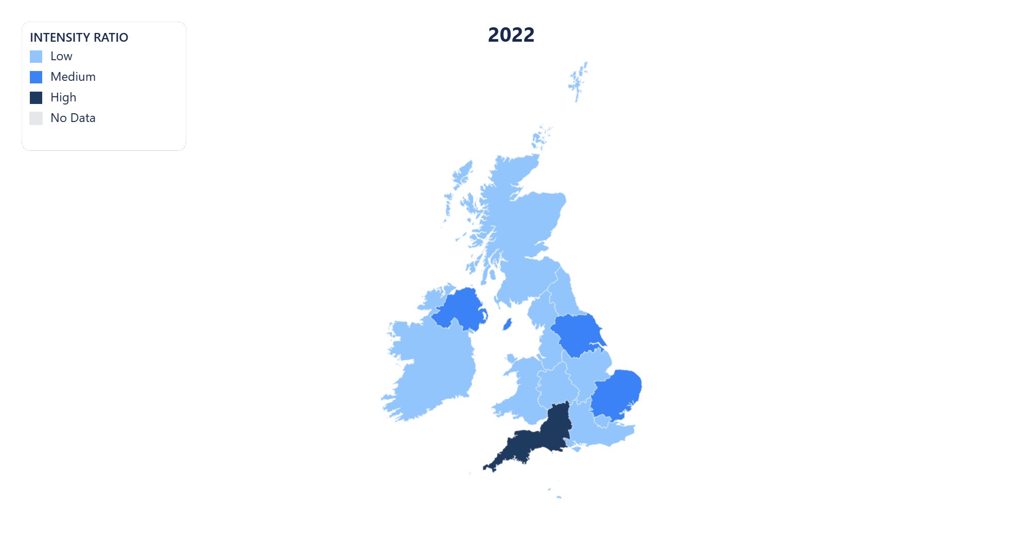
MP4 video export
Export your United Kingdom time-series map as an MP4 video. Perfect for presentations, reports, and social media posts where motion communicates change more clearly than static images.
Public share page
Share your United Kingdom choropleth map with a public link. Anyone with the URL can view the full interactive map — no account or login required.
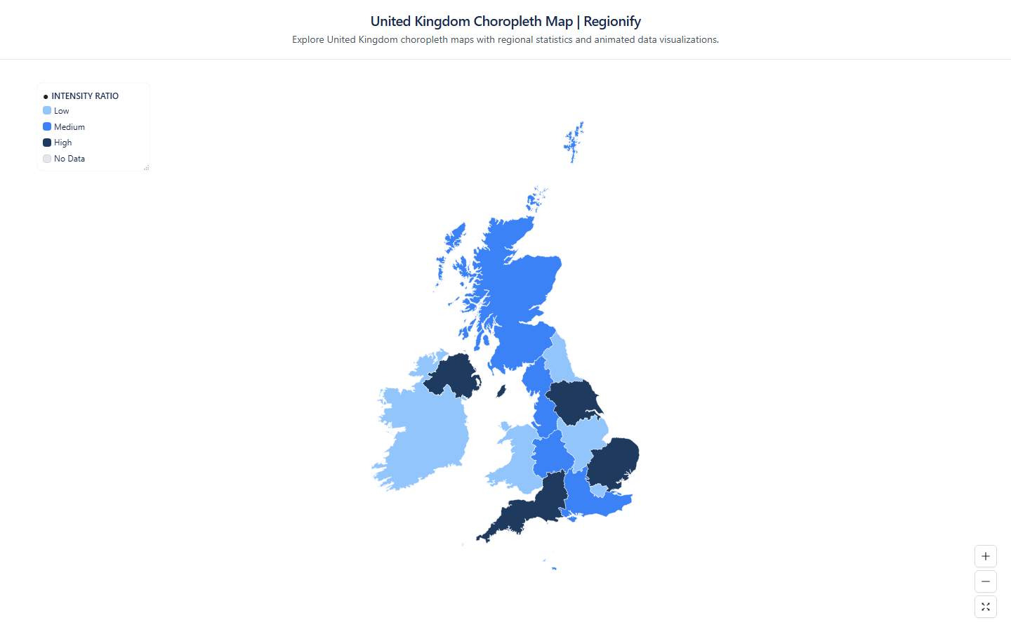
Embeddable iframe
Embed your United Kingdom choropleth map anywhere with a single line of HTML. The iframe stays live — viewers always see the latest version of your map, no re-publishing needed.
AI-powered data import for United Kingdom maps
No spreadsheet? No problem. Regionify's AI Agent turns a plain-text description or raw pasted data into a ready-to-visualize dataset in seconds.
AI Generator
Generate United Kingdom data from a prompt
Describe the dataset you need in plain English — for example "GDP per capita of United Kingdom's 16 countries in 2023" or "election results by countries" — and the AI generates a plausible, structured dataset that maps directly onto United Kingdom's administrative boundaries. Edit any values in the table view before saving.
- ✓ Works for population, GDP, health, election, and custom metrics
- ✓ Supports time-series prompts for animated maps
- ✓ Output pre-matched to United Kingdom's 16 countries
AI Parser
Clean and import messy United Kingdom data
Paste raw text, a copied Wikipedia table, or an unstructured CSV with regional figures for United Kingdom. The AI parser normalises region names, strips noise, resolves mismatched spelling across United Kingdom's countries, and outputs a clean id–label–value table ready to visualise.
- ✓ Handles inconsistent or misspelled countries names
- ✓ Auto-detects time columns for historical data
- ✓ Streams results in real time as AI processes
AI Agent is available on the Chronographer plan.
Countries of United Kingdom
- North East
- North West
- Yorkshire and the Humber
- East Midlands
- West Midlands
- East of England
- Greater London
- South East
- South West
- Wales
- Scotland
- Northern Ireland
- Guernsey
- Jersey
- Isle of Man
- Ireland
Build your own United Kingdom choropleth map — free
Upload any dataset, color United Kingdom's countries by any numeric metric, and export as PNG, SVG, GIF, or MP4. No design skills required — start in seconds, publish anywhere.